Discover the Skaftafell park on the ascent of the Kristinartindar (1126m) which will allow you to embrace one of the most beautiful views of Iceland.
Skaftafell National Park
Originally founded in 1967, the Skaftafell National Park, with an area of 4800km², is today attached to the Vatnajökull National Park so it borders the south-west end.
Easily accessible from Route 1 (4 hours from Reykjavik), the park offers great opportunities for outdoor activities:
- Multiple possibility of day hikes. The best known leads to the Svartifoss waterfall, but you have to love the crowd … Below we suggest a more engaging but absolutely superb hike!
- Glacier excursions: quite a few guide companies offer excursions lasting a few hours on the surrounding glaciers. It is physically accessible to the greatest number and it will allow you to discover beautiful glacial formations while learning lots of interesting things about glaciers. It is also an opportunity to, unfortunately, see the concrete impact of global warming.
The center of the park is located at the “Visitor Center” (64.016343, -16.966968). You will find useful information on hiking there as well as maps of the area. There is also a pleasant campsite, although sometimes a little overcrowded, at the foot of the trail head. Another solution for the night is the small and beautiful campsite in Svínafell a little further east on Route 1.
Ascent of Kristinartindar
If you are looking for which hike to do during your stay at Skaftafell, climbing Kristinartindar will undoubtedly offer you one of the most beautiful options. Far from the hustle and bustle of Svartifoss (through which we pass all the same), the path will enchant you all along and will offer you an exceptional panorama from the top.
For a distance of 17km and 1100 D +, the hike is physical, in particular the final part which takes place in sometimes bad terrain (slippery and stony), so be careful! It is a hike to avoid with too young children. There are also some slightly “gaseous” passages to advise against people prone to vertigo. Apart from that, the trail remains accessible.
A variant avoiding the summit and the difficult portion but still offering magnificent views, is possible – see below.
BE WELL EQUIPPED FOR THIS HIKING. Wear real hiking shoes and not just sneakers and be alert to the weather. Even if the weather is nice, take something to cover yourself. Similarly, do not neglect the amount of water to take because the climb makes you lose a lot and you do not cross a stream.
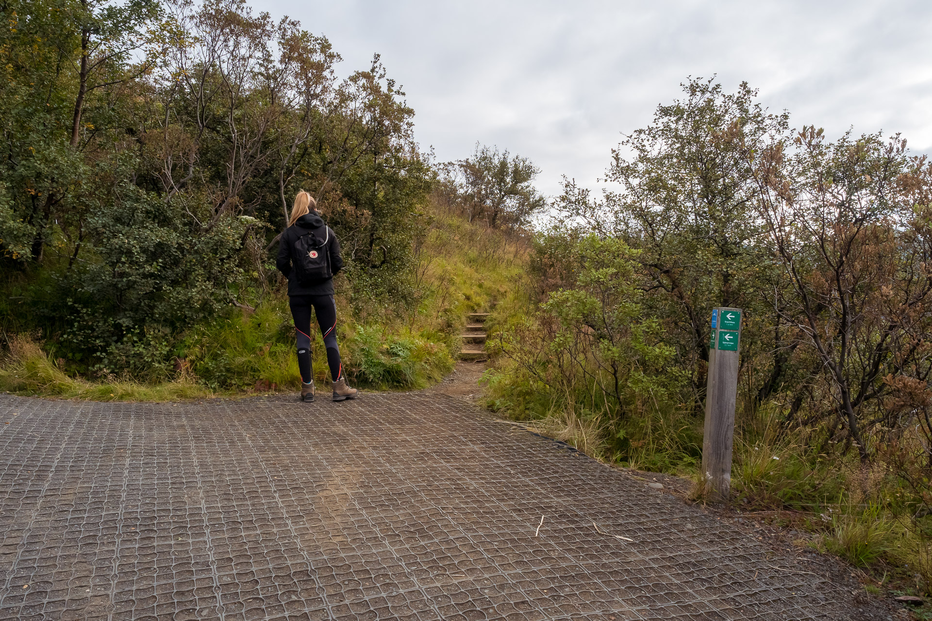
The trail starts at the campsite (same place as the one leading to Svartifoss). Follow the uphill path to the first intersection. From there turn on the right. Please note there is no clear indication of the fact that it leads to Kristinartindar and the trails may seem astonishing but that is fine.
The path then follows the ridge in a forest of small dense trees. We can see the glacier below between the branches. When we take the path it is 9:30 am and there is hardly anyone.
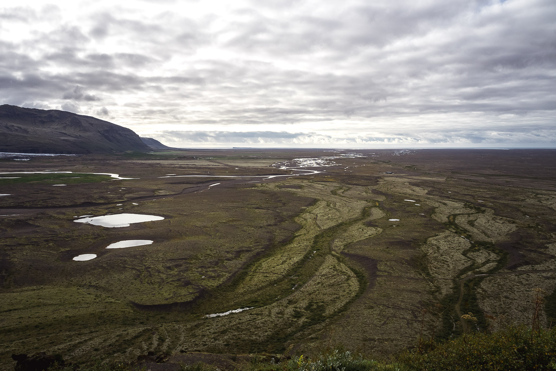
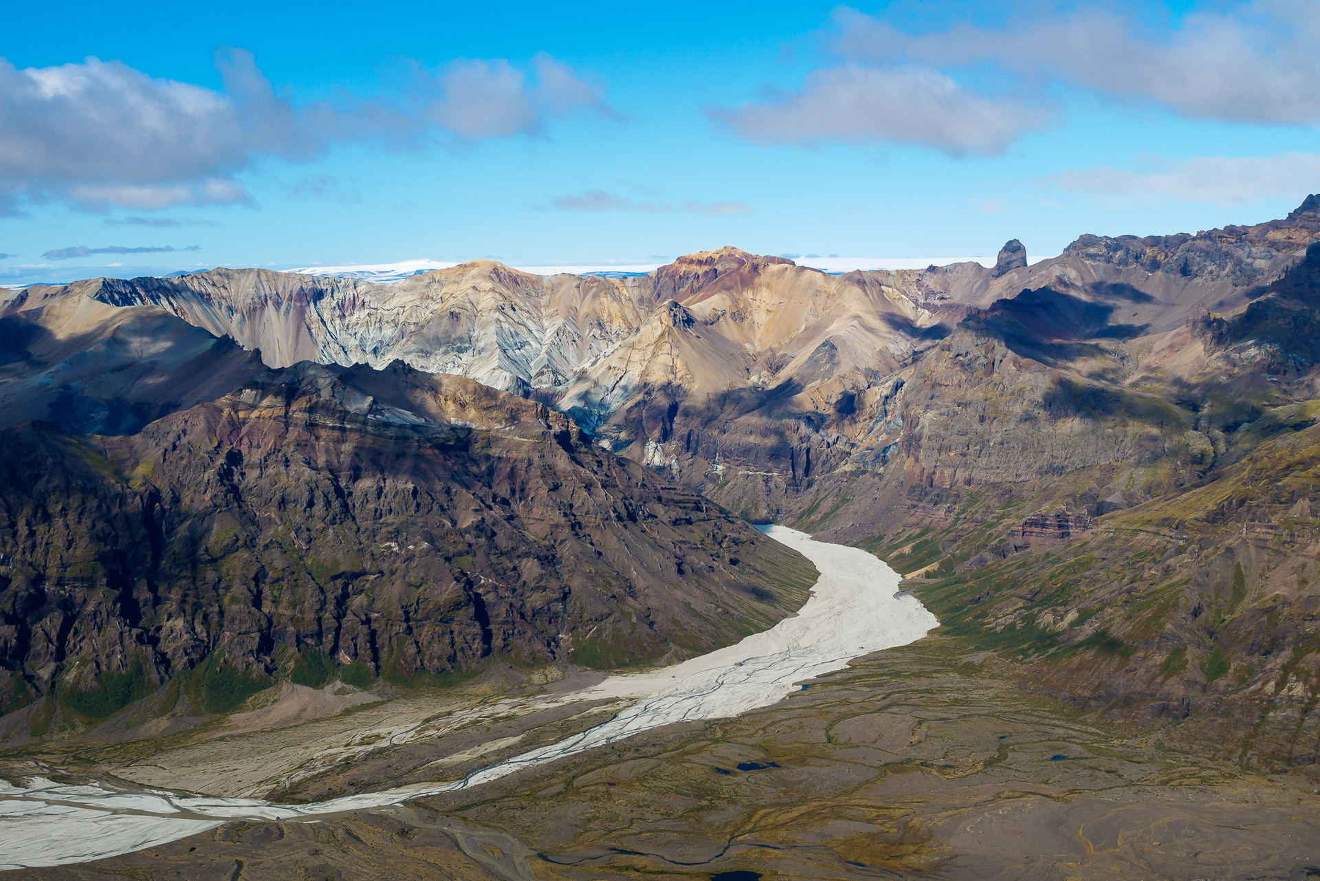
As the climb progresses, the view becomes clearer as the vegetation becomes more and more level with the altitude. We finally discover the view, especially on the Sandur side.
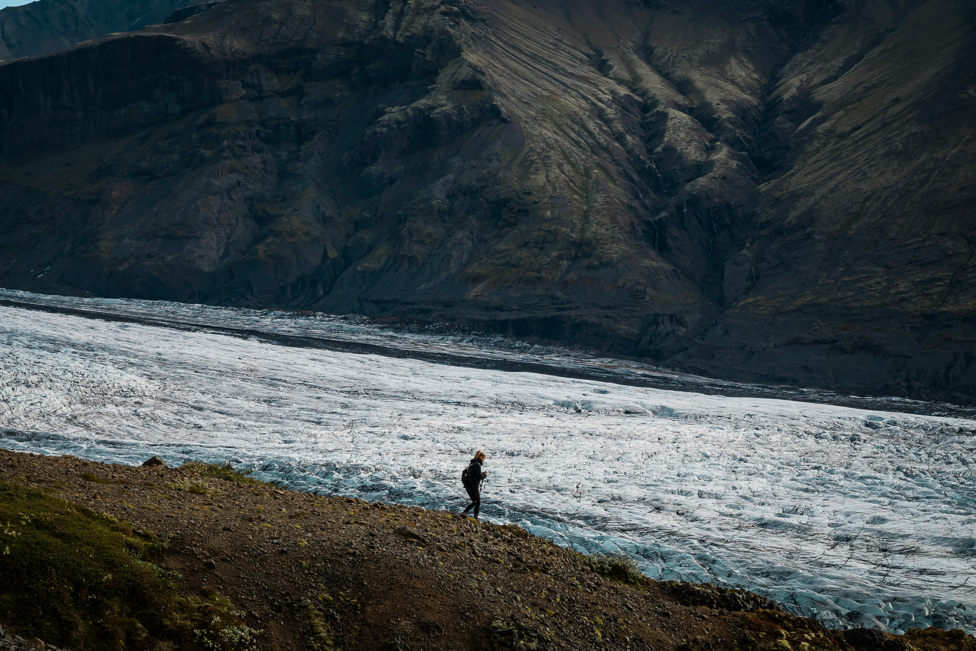
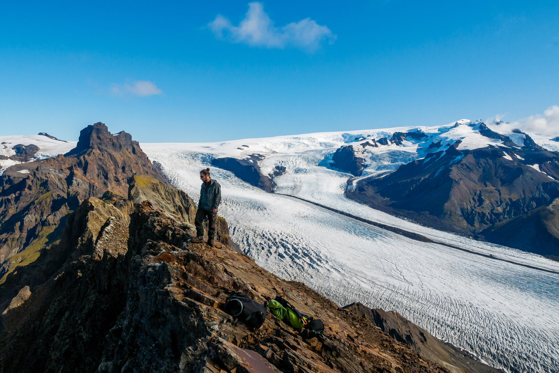
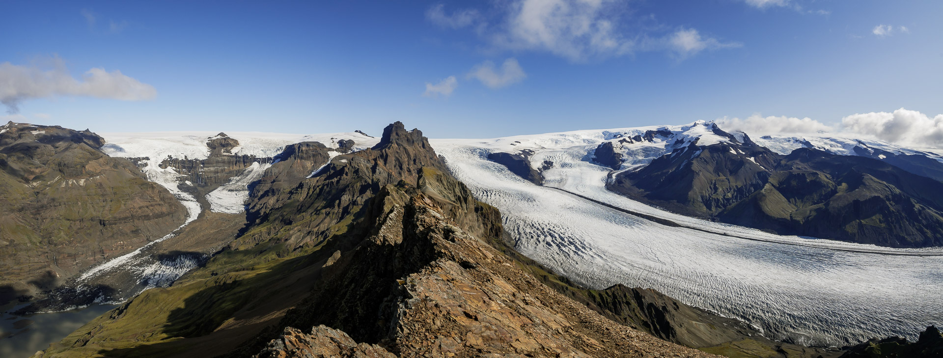
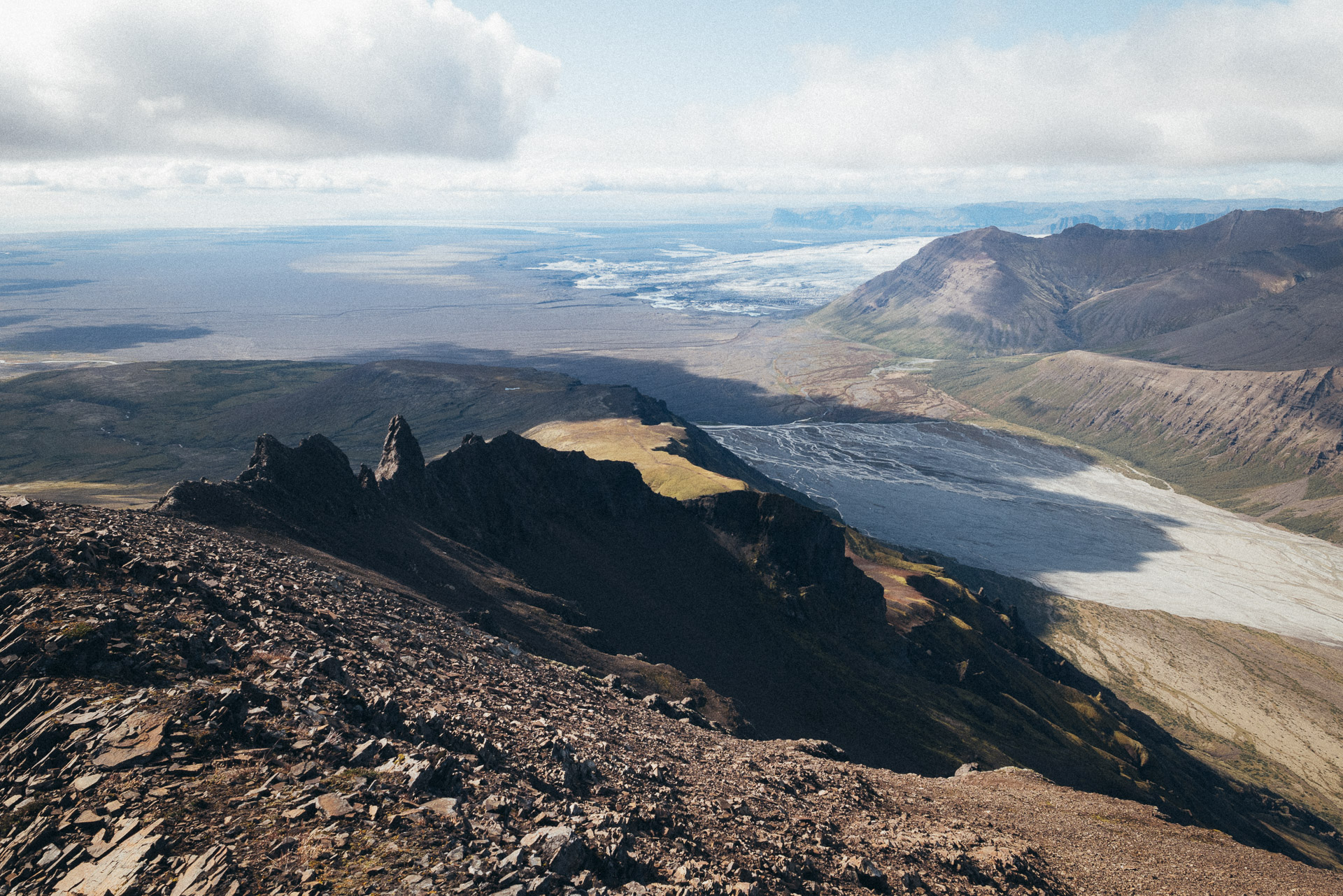
The rest of the climb is along the increasingly beautiful glacier. By overlooking it thus, we realize its gigantic size when it is only a language of Vatnajökull.
The trail climbs well but the slope is not excessive which makes it very hot without being particularly short of breath. We are very lucky today because the weather is fine. So we will have a view from up there!
After this long straight stretch along the glacier, the marked path suddenly turns to the left to go around (by the left) the large massif in front of you. If you want to reach the summit, find a path that goes straight down the slope and then continues on the right, it is clearly visible normally and there are some marks. If you don’t want to make the summit, follow the marked path on the left.
The path becomes more difficult now. Don’t hesitate to take a break now to breathe and have a drink. You are going to chain some very rough climbs in a rock that is falling apart a little. Be careful.
You will arrive after a strong climb at a shoulder marked by a large cairn. A second path joins yours (downhill path). For the summit, set off in the rocky path which climbs steeply in a zigzag. You don’t have much elevation left! Courage!
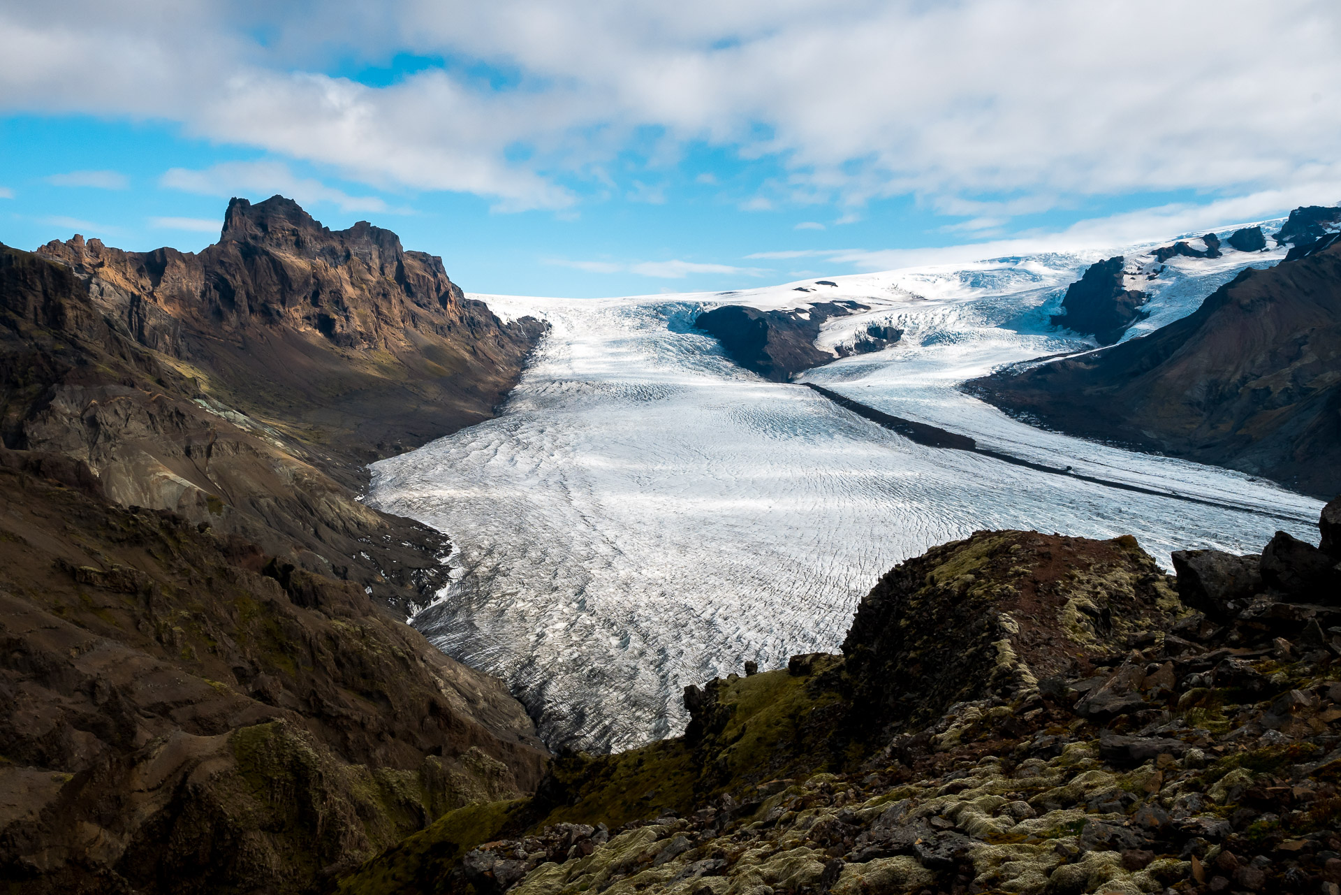
A few more meters and you are there! The summit is marvelous with a 360 ° view and in particular on the ridge which extends towards the North-East.
Be careful because here a fall would not forgive! We took advantage of this breathtaking landscape to take a picnic break especially since there was sun and little wind. We were few at the top first 6 and later just 4. It is unfortunately time to go down because you still have some way! To do this, take the same path as the climb to the big cairn below.
The descent can be impressive, take your time.
From there branch off to the second path which goes straight along the slope.
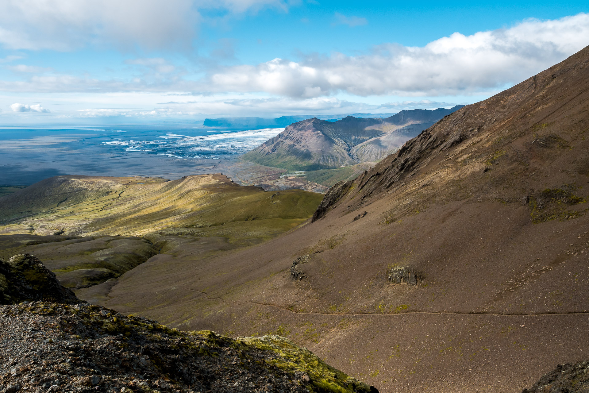
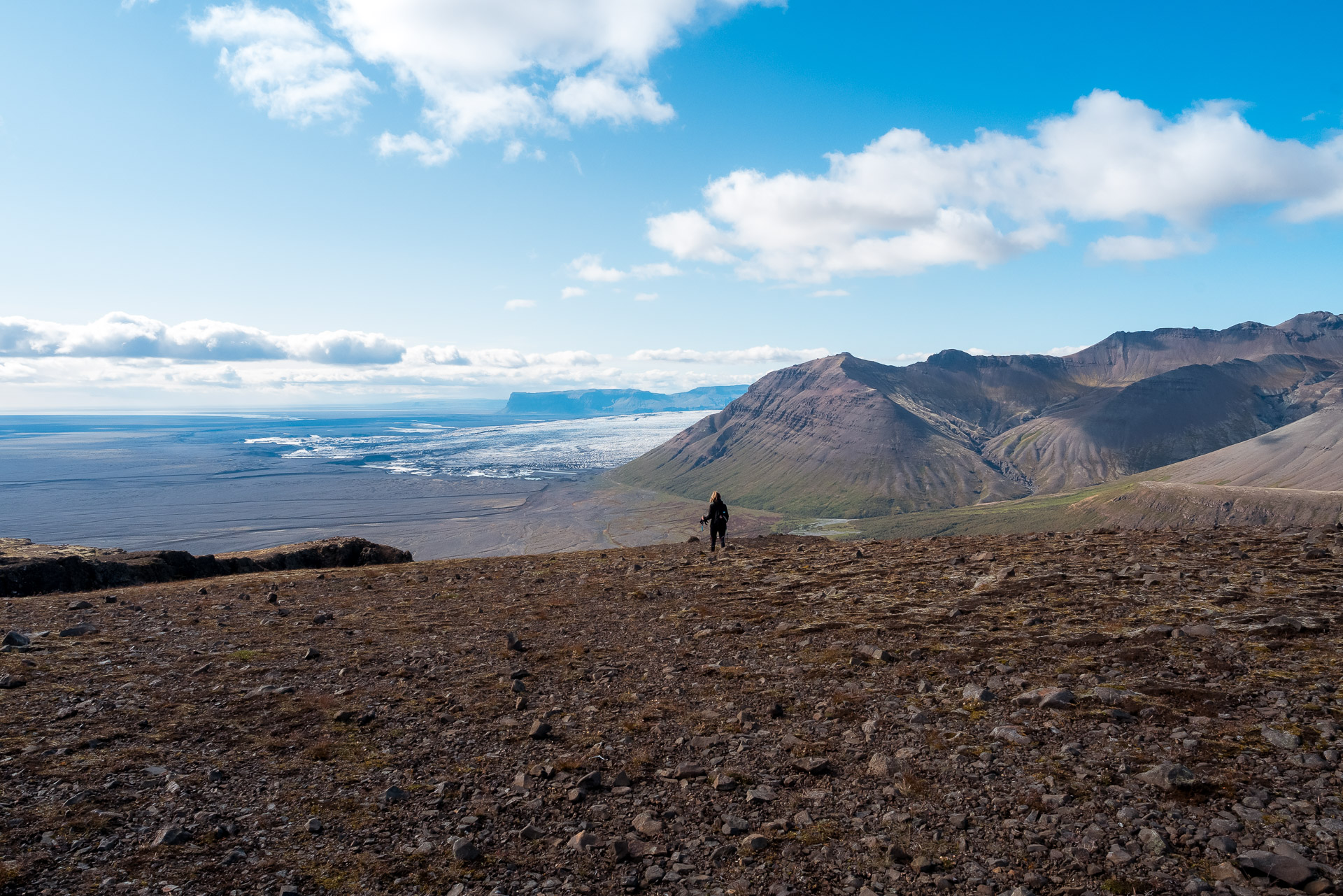
This portion can be tiring for the ankles, be careful. At the bottom of this long descent, you join the marked path which you will follow while continuing on your right. Further on you can admire the other side of the park.
All you have to do is follow the long descent that brings you back to the Visitor Center, taking the time to admire the landscapes.
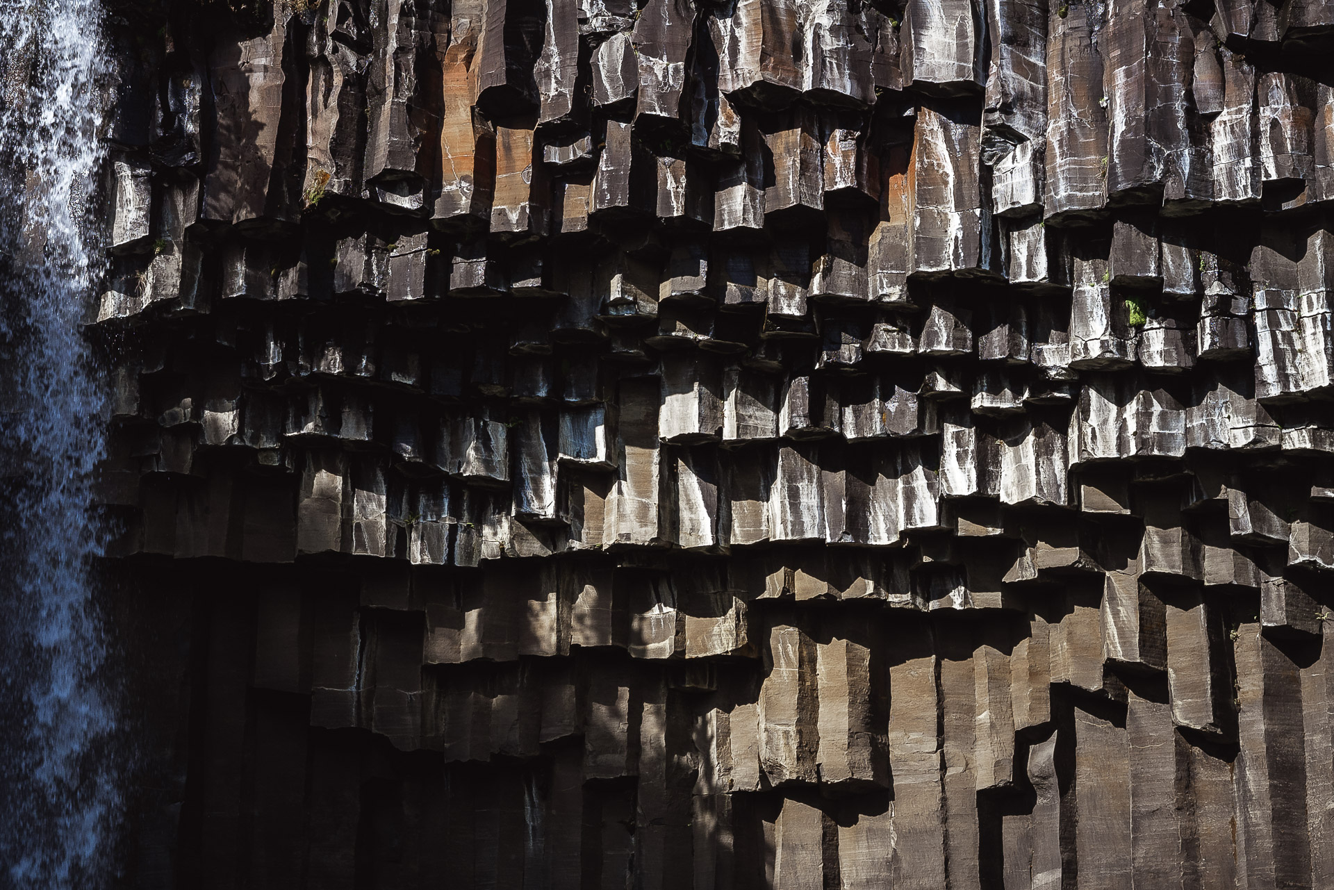
On the descent, after an observation table, follow the marked path on the left. He will take you to Svartifoss. In general the place is crowded but the waterfall is worth the detour.
A little more walking and you’re back to your starting point! Congratulations! We hope that this hike will inspire you because it offers some truly superb landscapes, among the most beautiful we saw during our stay. Even if you’re not at the top, the views up and down are worth it! And to celebrate this great walk, the Visitor Center offers a cafeteria with everything you need in drinks and cinnamon rolls!
Thank you for the detailed review! I have seen many times Svartifoss, so I just want to ask if the path you took climbing up was the same as Svartifoss trail or if you can avoid that🤔 Thank you again!!
You can avoid Svartifoss if I remember well. When you get there you can have a map at the tourist center normally to choose the right path.