4days
trekking
55km
walked
1100m
D+
4
fords
Laugavegur is certainly the best known and most popular trek in Iceland. This last point dissuaded me for a long time from exploring it, but Laugavegur is also the trek of many superlatives in terms of landscapes. You know what people say about those who do not change their mind … It would have been a shame not to discover this legendary path during our last trip to Iceland. 55km in an incredible setting to discover with us.
Laugavegur
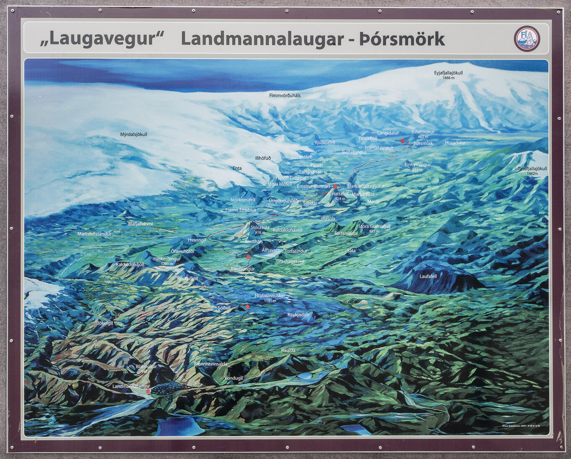
The itinerary
Spanning 55km in the south of Iceland between Landmannalaugar and Þórsmörk, Laugavegur, “The road to the hot springs”, allows you to discover some of the most beautiful Icelandic landscapes. The latter will be as varied as grandiose. Although the record is 4:39, the trek is generally covered in 3 or 4 days. The steps are as follows (direction North-> South):
- Landmannalaugar – Hrafntinnusker: 12km for 470m of D +
Hrafntinnusker – Álftavatn: 12km for 490 of D-
Álftavatn – Emstrur: 15km for 40m of D-
Emstrur – Þórsmörk: 15km for 300m of D-
The basic route can be extended by 22km to Skogar via the Fimmvörðuháls.
There are no major technical difficulties in terms of terrain except for river crossings (see below). The path is very well marked but you have to be careful in fog because the marks will quickly disappear.
Course direction
Laugavegur can be done from north to south or vice versa. In general, the north-south direction is preferred for various reasons:
- The wind is generally oriented N-> S in this region, it is therefore better to have it in the back than in the eyes especially when it raises clouds of sand.
- The trail generally descends in the direction N-> S
- As there are more people who the route in this direction you will cross a little less people.
Big highlights if you travel the trek in the south-> north direction, you will end in beauty at Landmannalaugar which is certainly the most beautiful landscape of the trek and you will be entitled to a bath in natural hot springs, ultimate pleasure after 55km of walking !
In fact, the distribution we found was 60/40 for N-> S against S-> N.
Difficulties
Weather
The Laugavegur does not present any difficulty in itself if it is not the few fords as we approach it below. The only real difficulty is related to the weather. Iceland, by its geographical location (close to the Arctic Circle and in the middle of the Atlantic), experiences very changeable weather which can be violent. Don’t get me wrong, a big sun can be replaced by a storm in a few minutes.
Find out as much as you can from shelters or if you have the network to know what the weather is coming or at least the trend. Iceland has an excellent reliable and well-made weather site: https://en.vedur.is/
The two main threats will be rain and wind. The latter can be very powerful and raised clouds of sand especially in the Alftavatn-Emstrur portion. Remember to protect your eyes! A little physiological fluid can be welcome in case of eye irritation.
For rain and especially if combined with wind, a long poncho seems to be one of the best ways to protect yourself. Gore-tex and other waterproof-breathable membranes very often end up allowing water to pass in the event of sustained showers (flow and duration). Protect your bag and its contents well also thanks to a bag (watch out for the wind!) And waterproof bags inside.
Fog is also a real danger because it will make the markings disappear if it is thick. You will find on the road a commemorative plaque of a hiker who died a few hundred meters from a refuge because he got lost due to a storm obscuring the markup! The danger is real! If you are lost staying where you are and waiting for a lull, do not try to go further this is how you put yourself in danger.
Even if you are in a group, tell someone outside of your route and the dates planned. He / she can give the alert if you are not back after a few days.
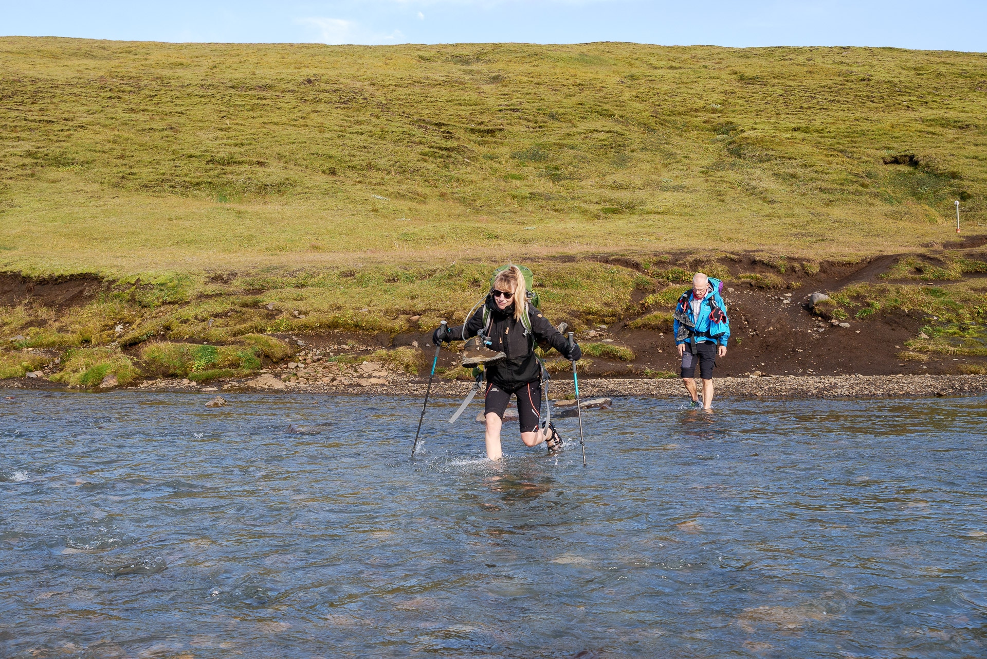
River crossings
There are four river crossings that you must ford, that is to say by crossing the rivers on foot. In addition to being a very unpleasant moment given that the water descends directly from the glaciers and does not exceed 5 ° C, this is a moment to be approached with caution because a fall could be problematic or even dangerous.
Here are some tips to minimize the risk:
- Cross where people cross: if the groups cross here it is because it is surely the best passage, more there will be more people which is a guarantee of security in case of glitch
- Organize the crossing well: store what must be protected from water, prepare a small towel if necessary, plan the trajectory of your crossing, detach the waist and chest belt from your backpack because in the event of a fall it must be able to get rid of it quickly.
- Provide suitable shoes: many people provide sandals or crocs for the crossing, this allows to protect from sharp rocks and improve grip (and can be used in the evening at the bivouac). For my part I did it barefoot, it works but you have to be careful with slippery rocks.
- When crossing and especially in case of strong current, stay facing the flow and move aside. Do not try to fight against the current but on the contrary to use it to help you. Walking sticks are very practical for improving balance.
- A ford crossing becomes dangerous when the water level exceeds the knee: if this is the case, be extremely careful and cross in a group if possible, holding on to each other.
- In general: do not tempt the devil and it is better to turn back to the holy path and except to take reckless risks.
General informations
Join the Laugavegur
The access points of the trek are as follows:
- Landmannalaugar: accessible by bus or 4×4 by the Landmannaleið road and the F208 – Beware of some fords to cross.
- Þórsmörk: accessible by bus and 4×4 by the F249 – Please note: many fords to cross and some really deep!
- Skogar: accessible by bus and by road 1
If you are on foot, you can see that access by bus is easy at the ends of the trek. We went through the Reykjavik Excursions company. The “Iceland On Your Own” pass allows a certain flexibility and lowers the price a little – Count 100 € / person round trip.
You will find the info at the following address: https://www.re.is/golden-circle-tours/
Another company that we encountered several times on site: https://trex.is/scheduled-bus/
Refuge or bivouac?
The Laugavegur offers the possibility of crossing it either entirely in a refuge or in a tent or a mix.
Shelters are a comfortable but very expensive choice! Count 130 € per night for two without the meal which is not offered. You will therefore have to bring your food even with this choice. However, the shelters include a kitchen that does not take meals-on board. You can also stock up on basics in some shelters which can be useful.
You will find a lot of additional information on the FI website:
Price: https://www.fi.is/en/mountain-huts/terms-and-conditions
Distribution of shelters: https://www.fi.is/en/mountain-huts/map
FAQs about Laugavegur shelters: https://www.fi.is/en/mountain-huts/faq
PLEASE NOTE: shelters must be booked in advance. We were lucky to find space the same day without a reservation, but it is rare. Some of the people we spoke to on site had booked several months in advance and had long been on the waiting list …
The bivouac sites near the refuges are chargeable (around 20 € per night) and quite variable in quality:
- Landmannalaugar: very stony and noisy because sometimes crowded. The common tent is nice.
- Hrafntinnusker: potentially very windy. Stone walls protect a little.
- Álftavatn: also windy, you can use the buildings to protect yourself from the wind
- Emstrur: pleasant even if the pitches are dense
- Þórsmörk: prefer Laugidalur which is very pleasant and offers beautiful views of the glaciers
You can also bivouac between the huts (except in the Landmannalaugar park) but the very sandy or rocky terrain is not always practical.
In terms of our experience, we had planned to bivouac near the shelters but the excruciating weather we had led us to spend two nights in the shelter.
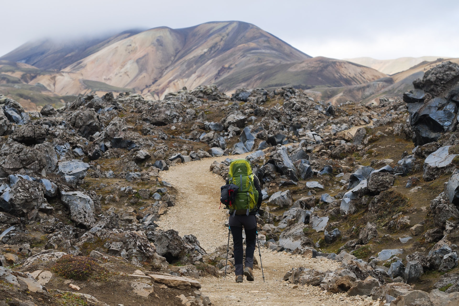
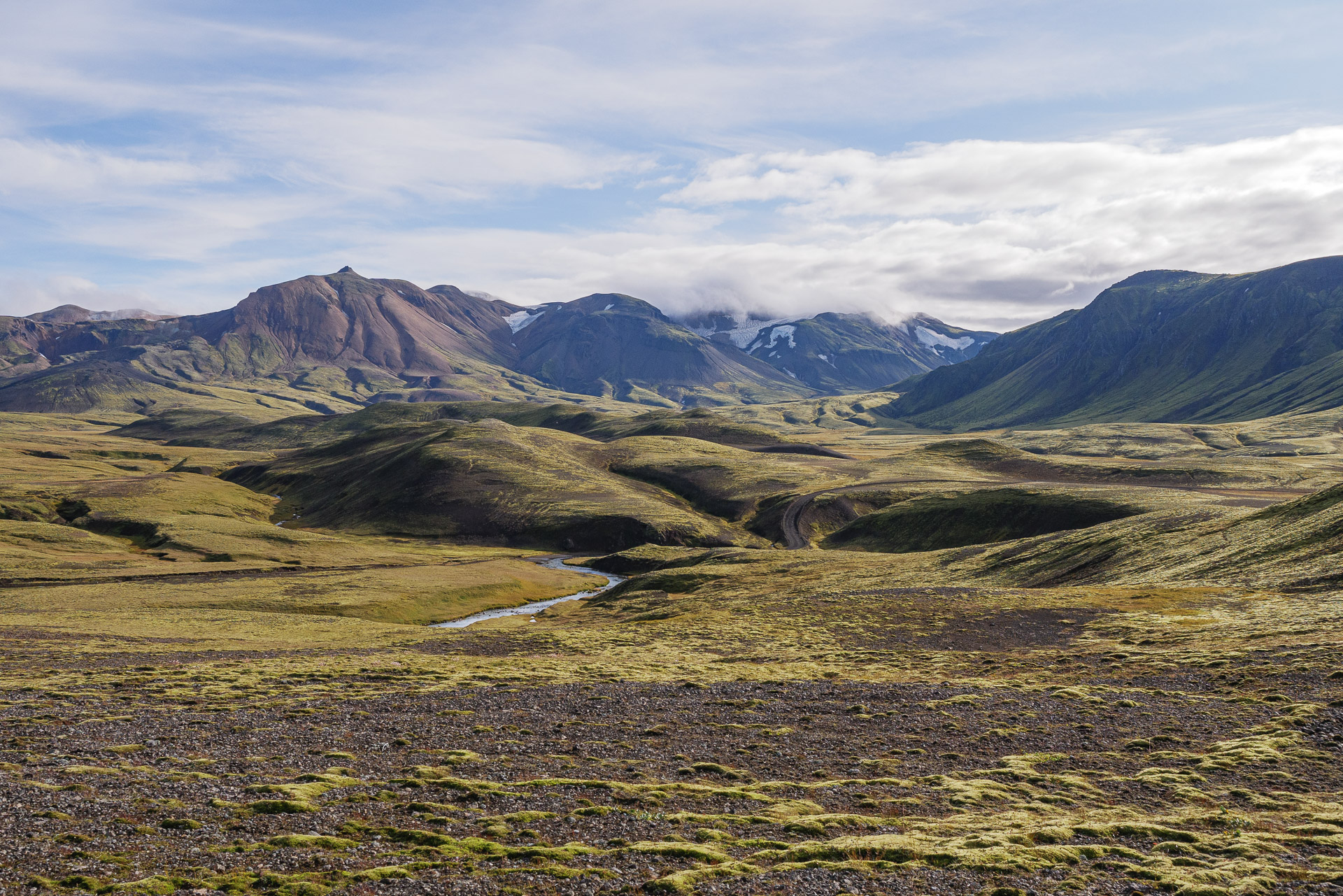
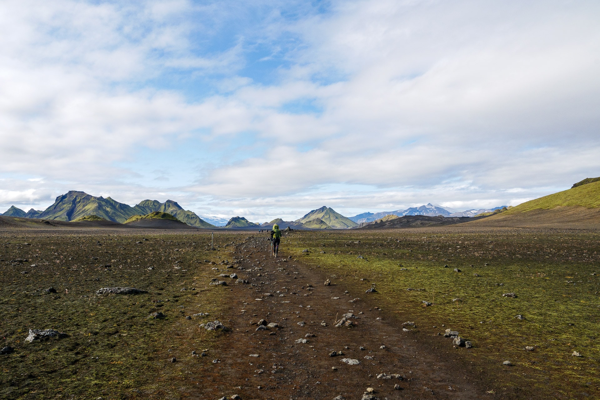
First day - From Landmannalaugar to Hrafntinnusker
August 18, 2019, after two days spent in the Landmannalaugar to discover this wonderful site, we begin our four days trek towards Þórsmörk.
Also discover the Landmannalaugar through a day hike
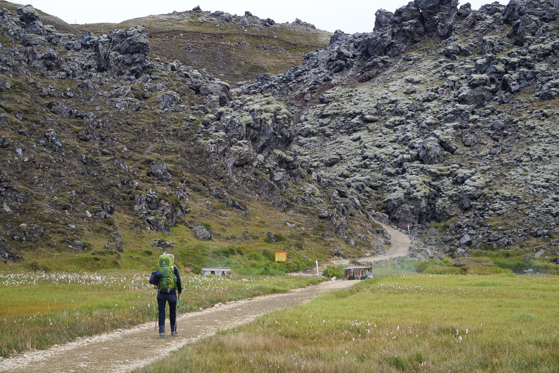
The beginning of the trail is behind the refuge of the Icelandic hiking association, the “Ferðafélag Íslands”. We start by crossing an old lava flow which presents pretty balsatic structures. The weather is fine for the moment and we don’t see anyone.
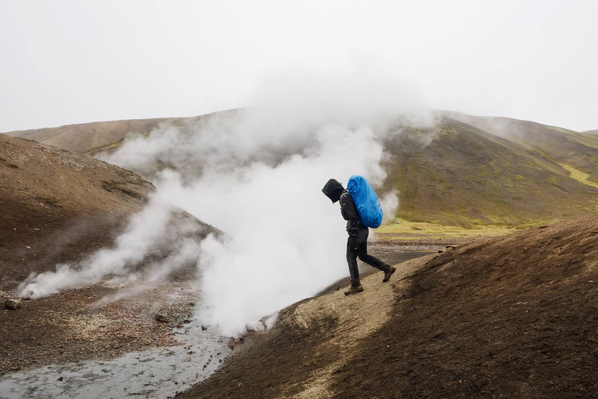
We quickly reach the fumarole on the heights of Landmannalaugar. This is followed by a short but intense climb which allows you to reach the top of the hill. The landscapes that await us always reveal themselves as rich in color!
Volcanic formations sometimes create strange shapes. We come across one evoking a dinosaur or dragon skeleton – which fits very well with the decor and the atmosphere elsewhere.
The path continues following the crest of the hills. The wind has risen since we passed the small pass. The temperature has dropped well, we are also a bit humid since there is also mist. Here, impossible to protect yourself from the wind because there are no trees or bushes; just rockery as far as the eye can see.
Fortunately, the path is well marked otherwise we would quickly get lost. Temperatures continue to drop and time to turn bad.
We manage to shelter as best we can in a trench enough to eat a little bit and put on big gloves and protect the bag from the drizzle.
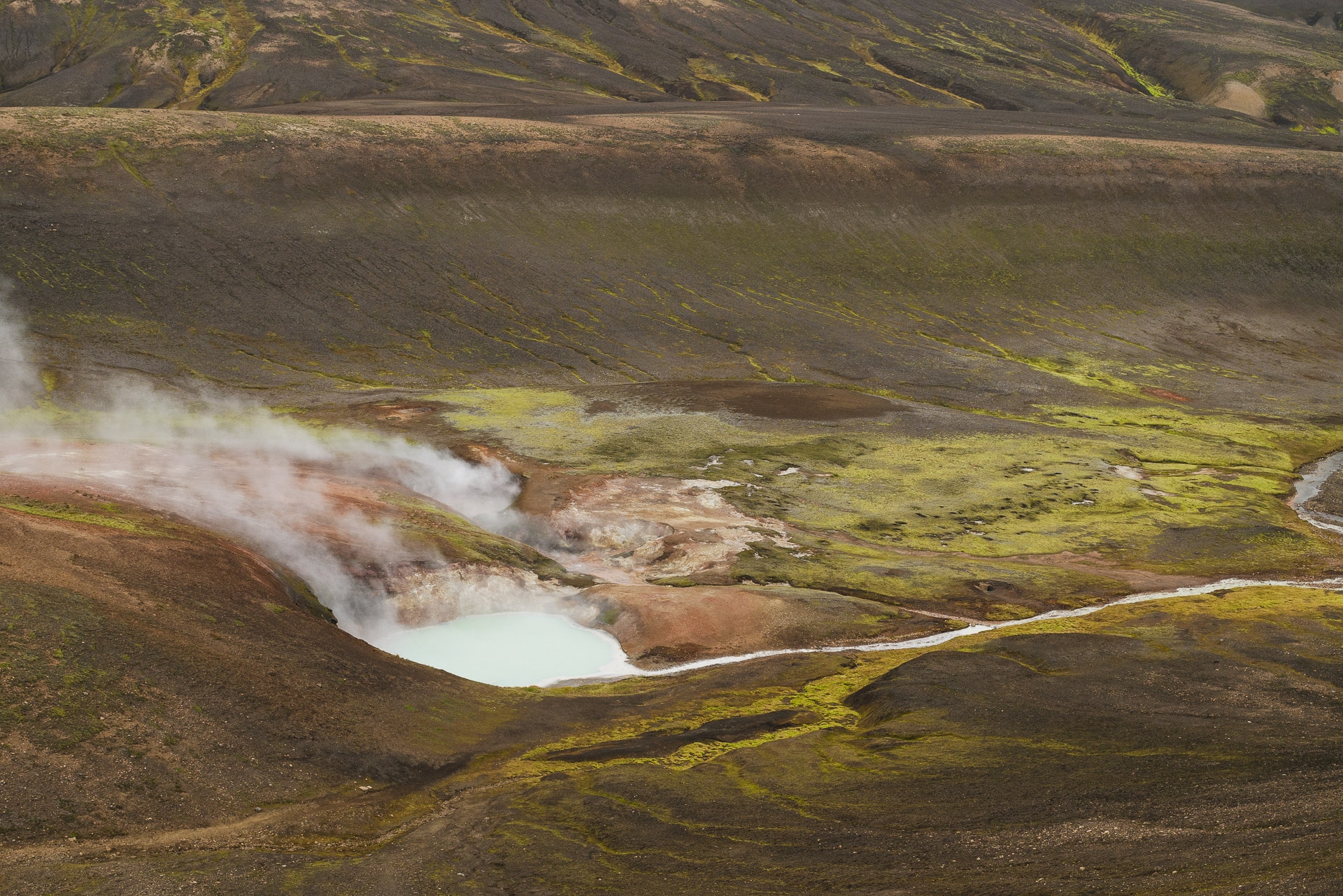
A little further we will come across small fumaroles just next to the path. It’s a chance to be able to see this kind of phenomenon so closely.
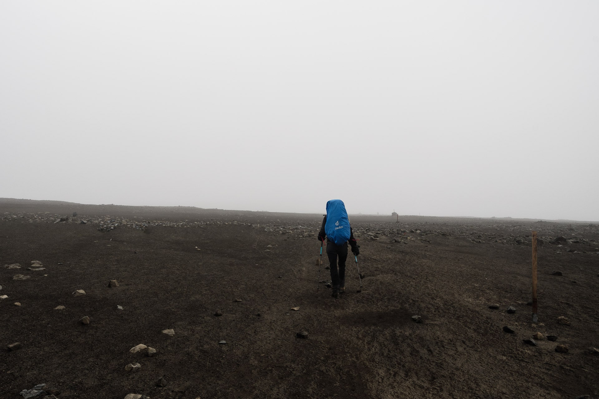
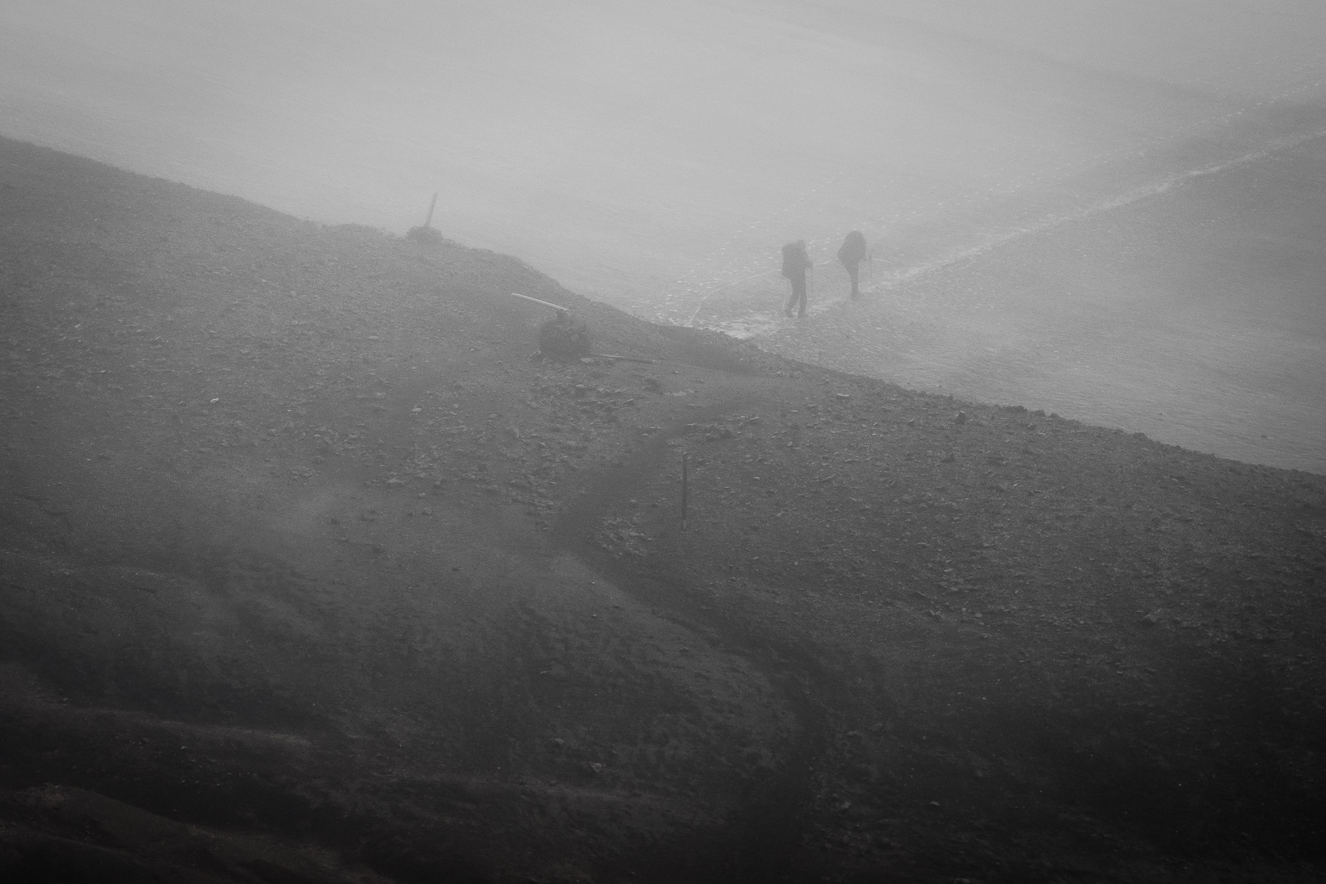
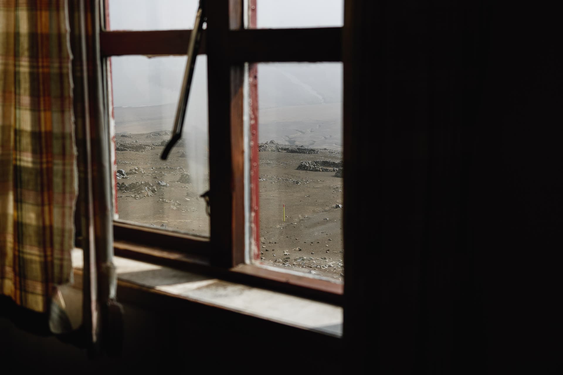
Quickly we arrive on a plateau which is lost endlessly in the fog. It is getting more and more stuffy. There are almost no more colors, we see life in black and white. Even if you don’t have the views you want, the atmosphere is great. You feel good in the heart of wild Iceland. We meet few people and that’s good because I was a little afraid of the crowd.
The few hikers we see, look more like shadows than real people.
A few more snowfields to cross and here we are with a view to the Hrafntinnusker refuge. The 12km will have been fast because we were not idle given the weather.
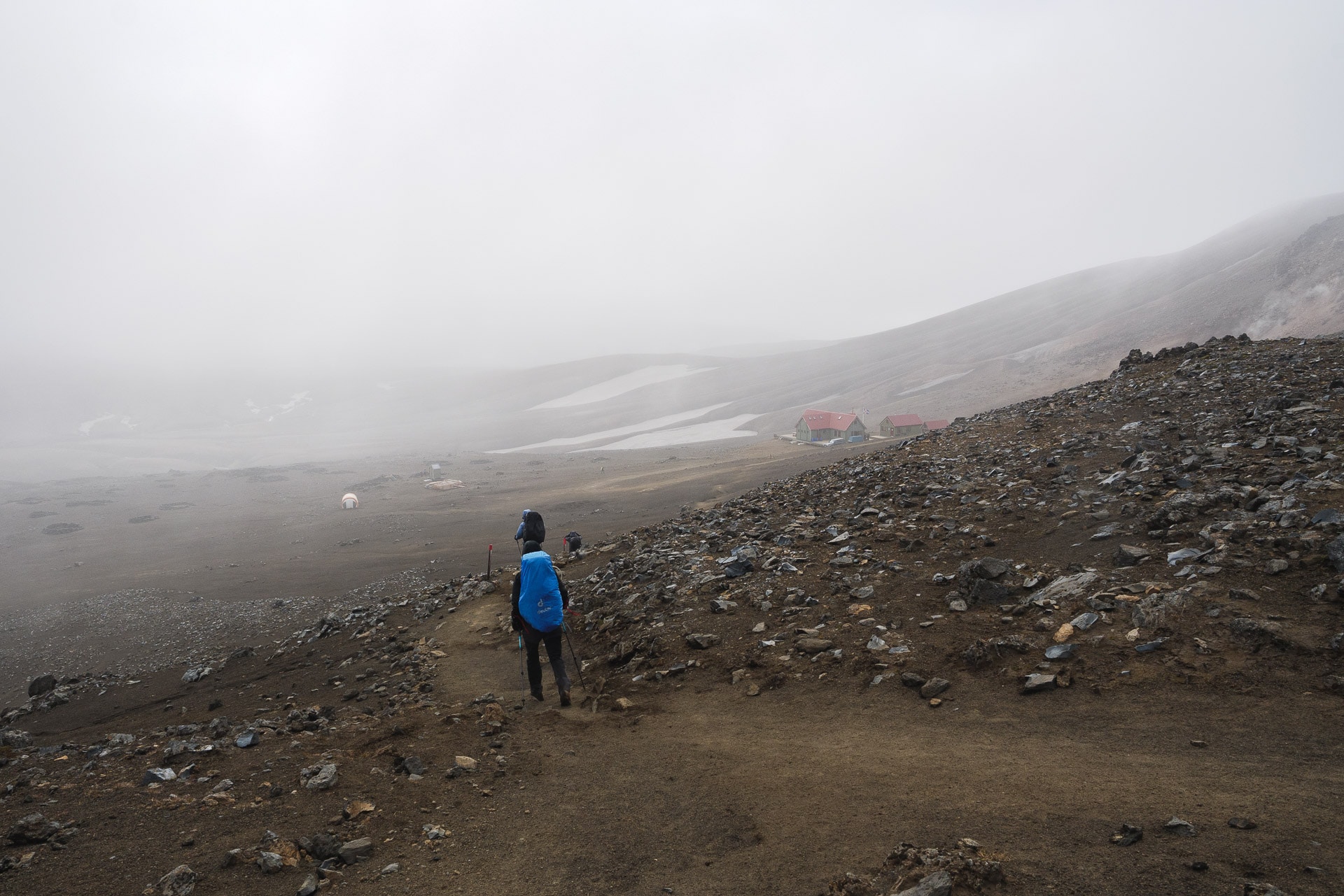
It also seems to be getting worse and worse, which is confirmed by the person at the reception of the refuge. The rain arrives and will force in the evening, the wind will keep him strong. Tomorrow’s weather looks horrible.
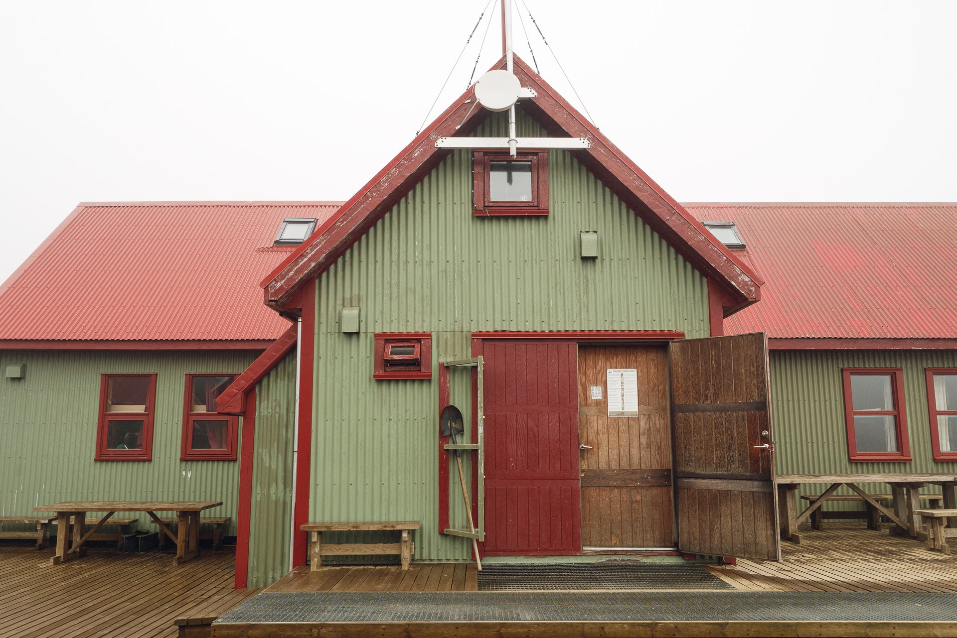
We had planned to bivouac but we change our minds. First of all, the bivouac area is not very attractive, while rocky and in the wind, the weather does not encourage you to stay outside. We are not there to perform but to enjoy walking. Luckily there are 2 places left! We take them even if the 130 € note hurts a little …
We are the first to arrive with a lovely retired Canadian couple. We sit on a double berth before we cook to warm up. The refuge is nice and clean. There are two large dormitories and a kitchen with all the necessary equipment.
The afternoon will be dedicated to observing the outdoors (especially small birds fighting against the wind), chatting with hikers who arrive drop by drop and resting.
Meal time will be hectic since everyone cooks almost at the same time but at least it warms the atmosphere.
We will sleep well tonight because, luckily, there are no snorers with us. It is in our interest to rest well because the day of tomorrow is going to be terrible …
Day 2 - From Hrafntinnusker to Álftavatn
This day will be remembered as one of the worst we have experienced hiking from a weather point of view … There will be no photo on this day of walking because we did not want to damage the appliances. Anyway we would have had monochrome white as a photo …
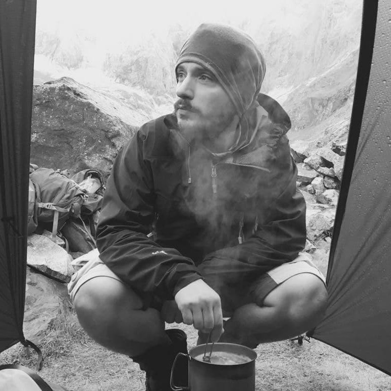
The awakening is almost collective around 7am. Everyone is watching the weather outside because it is supposed to get better in the morning but for now it is rain, fog and very strong wind. Nobody hurries. We make a rich breakfast in order to store calories.
9 am … The weather has not changed … The groups are starting to prepare. Motivated by this emulation, we also set off. Final adjustments outside. We directly took out the big artillery to protect us from the rain (poncho, rain pants for Hélène, …).
We attack! The wind comes to us from the rear left (big drop!) It is so strong that it bothers us to walk. Sometimes the gusts (in the 100kmh surely) deport us by a few steps … The whole thing is accompanied by an almost horizontal rain which only wets us on the left but which lashes the face. Landscapes, we only see the general shape. The path follows a succession of small hills.
Despite these particularly harsh conditions, we are living in a great moment because we are doing good things against bad luck and we are laughing at all this! We seek in our complicity the energy to move forward and it works! Fortunately for us, we have suitable equipment; we meet certain groups in canvas sneakers and without real protection against the rain, apart from comfort we can quickly border on danger …
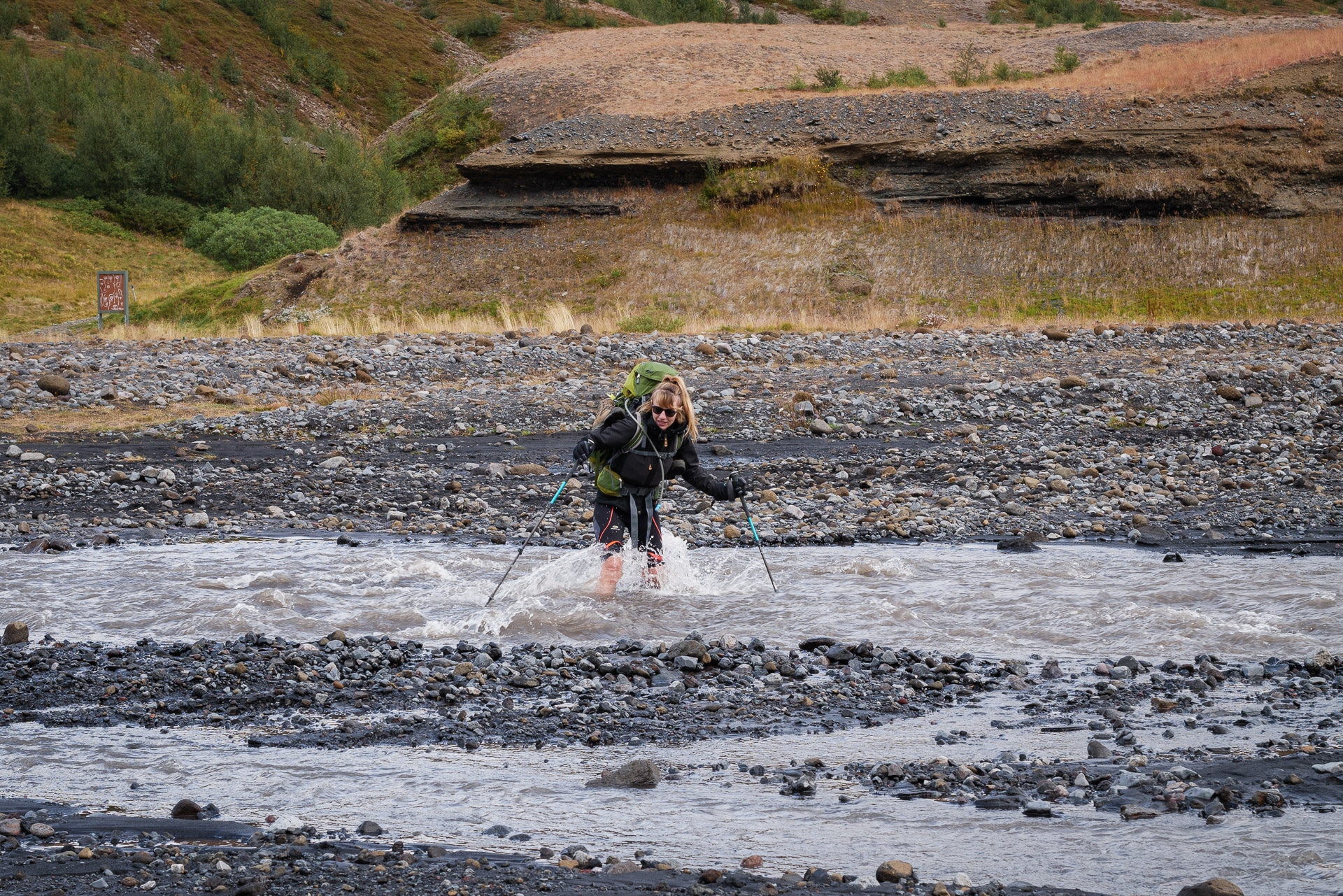
The kilometers pass under always equivalent conditions. At the end of this long plateau, we begin the descent which leads us to the real difficulty of the day: the first ford!
We join him quickly. It is not very wide, at most 8m but the flow is strong and the water level reaches the knees! The idea of crossing a river whose water is at 4 ° C is never cheerful but with this wind and the rain I admit that you have to look far to find motivation. The simplest and that is what we do, is to turn off the brain and go. I’ll go first. When you enter the water you have a feeling of cold but it’s okay, it is after 10 / 15s that the pain arrives, sharp and violent! When you get out of the water it goes in 30s but at the time it is really not pleasant. Hélène follows me, for her the pain is even worse I think but she overcomes the difficulty and arrives on the other side. There follows a little apocalypse moment because we have to get dressed in the rain and in the wind with the ponchos in the face, trying in vain to dry our feet … This first wading was epic for us. conditions and will remain in memory.
We only have a few kilometers to Álftavatn where we will resume the night in a refuge because we are still very wet after a day like this and it is no use playing “heroes”. The refuge will also be transformed into a giant clothes line because everyone arrives soaked (at different levels). We will spend the afternoon resting, warming up and above all chatting with Adin and Amélie, a very nice French couple that we will see again in Paris.
The weather will be a little milder at the end of the day, the wind will be just as strong but it will not rain any more. This will allow some stuff to dry outside in the wind.
What a day ! Too bad we couldn’t take pictures of the walk. Like another day like this during a previous Sarek trek, this one will remain in our memory like Mordor! We will sleep well tonight anyway. Tomorrow’s day promises to be better, because the sun must return.
Laugavegur is not difficult in itself but the weather is really the hard point. Plan ahead and go equipped!
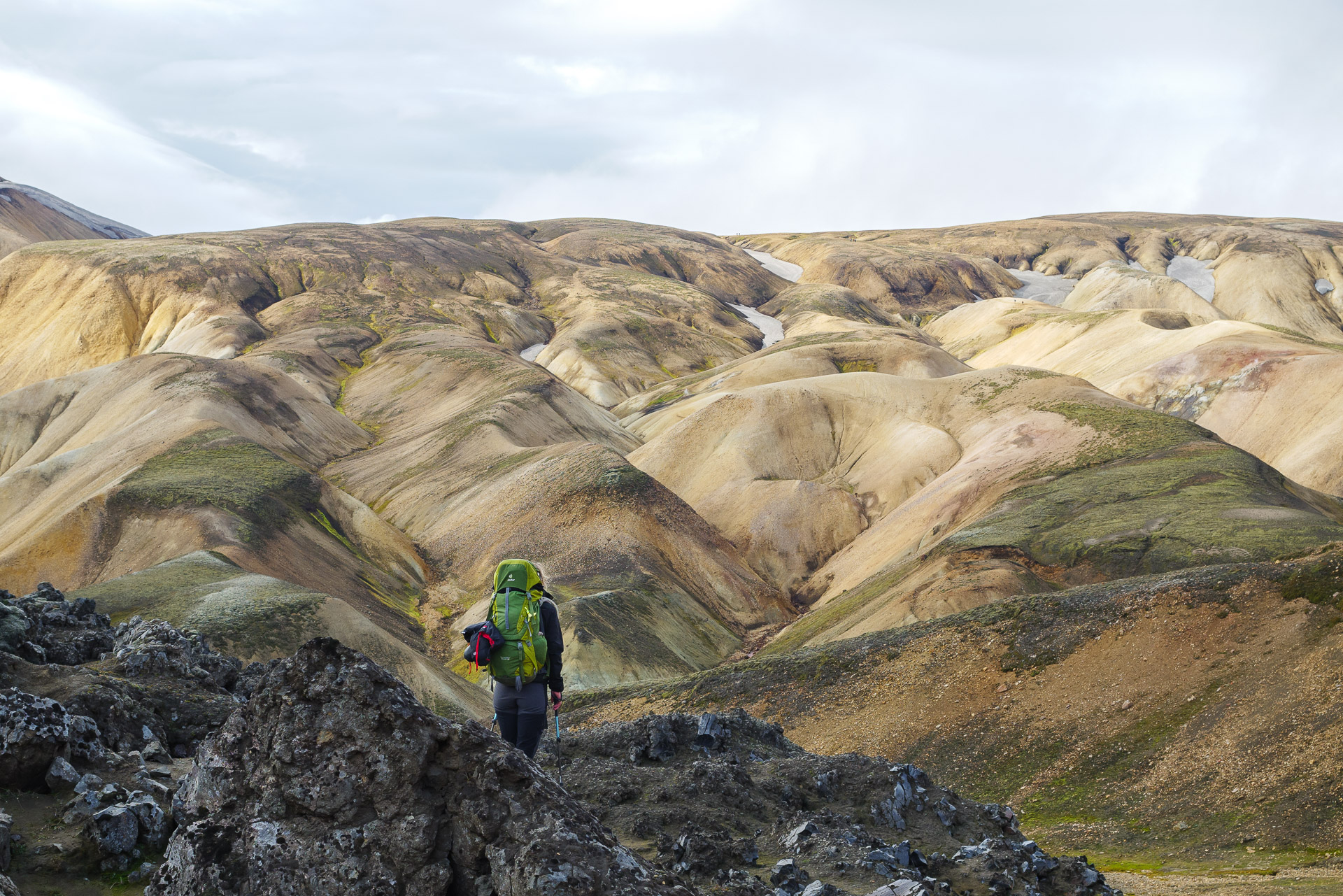
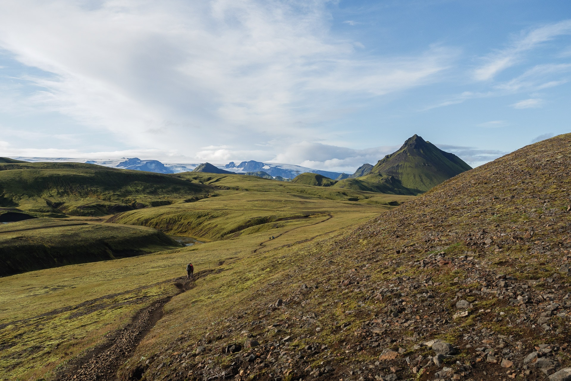
Day 3 - From Alftavatn to Emstrur
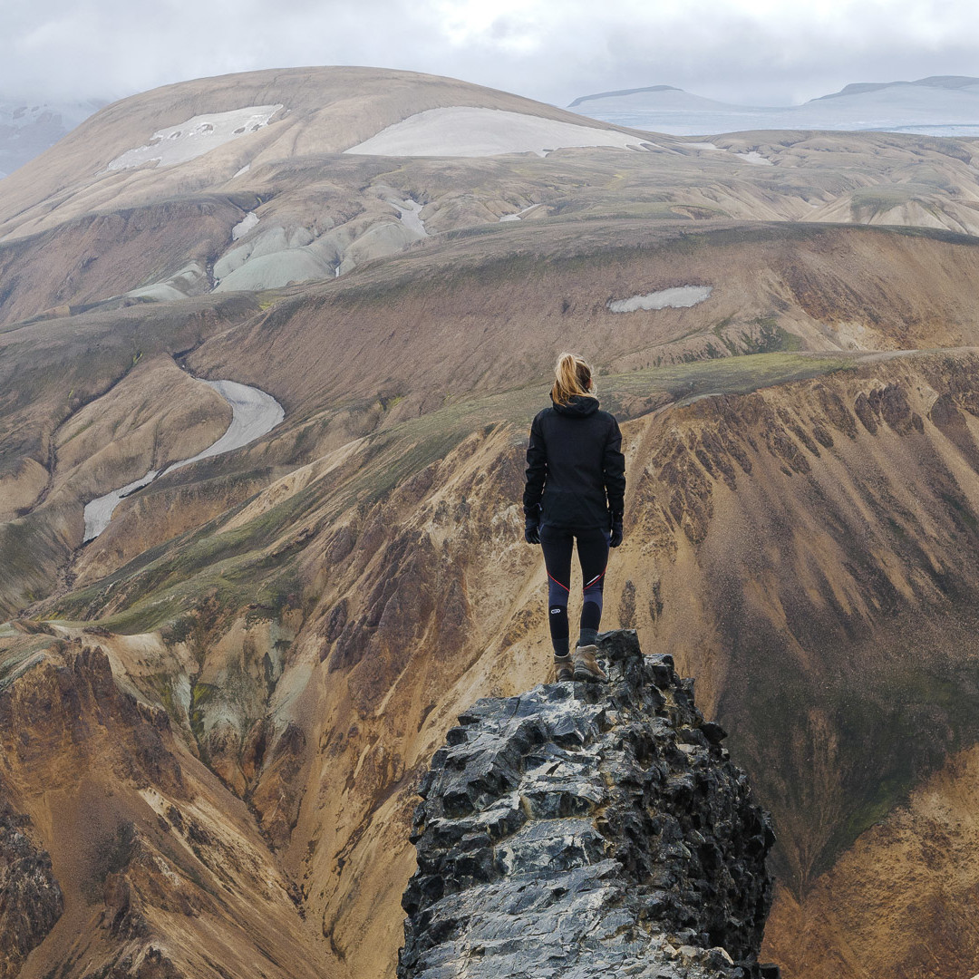
We had a good idea to choose the night in a refuge. We wake up rested and ready for a new day. The icing on the cake it is beautiful this morning!
The preparation is therefore done in a serene and relaxed atmosphere. Most of our things have even had time to dry out. Only the shoes are still wet.
We say see you soon at Amélie and Adin and we take the road towards Emstrur. What a pleasure to be able to enjoy the beauty of Laugavegur and its landscapes.
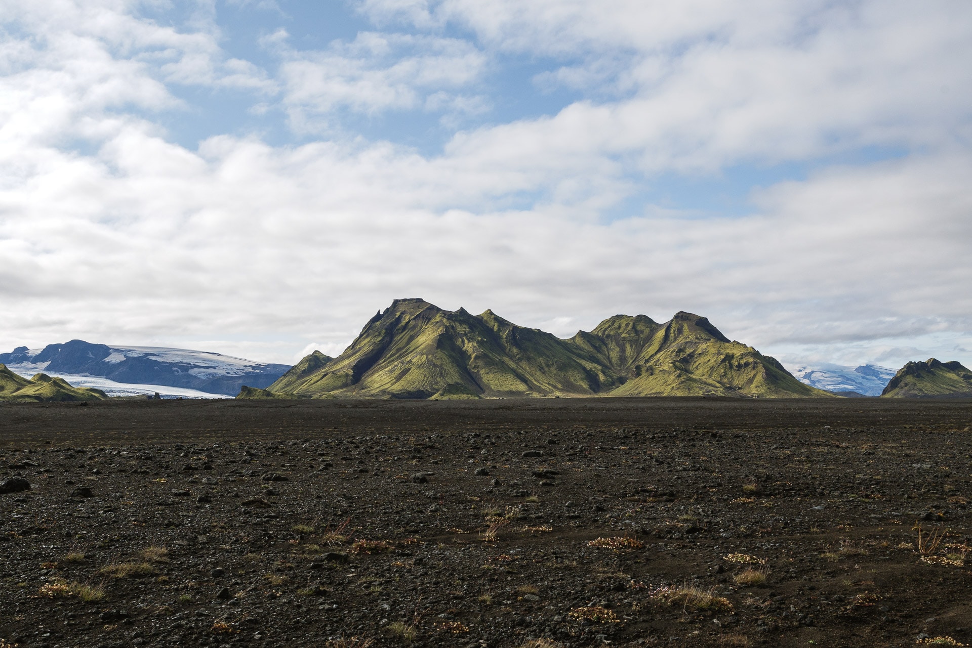
The huge Mýrdalsjökull glacier is visible in the distance. This mass of ice is already impressive but it is nothing next to the Vatnajökull …
The trail quickly leads to the first ford of the day. We approach the obstacle with much lightness that yesterday saw the sun. The river has a very different physiognomy: unlike that of the previous day, it is wide and relatively shallow. The crossing is nevertheless painful because the water is still as cold …
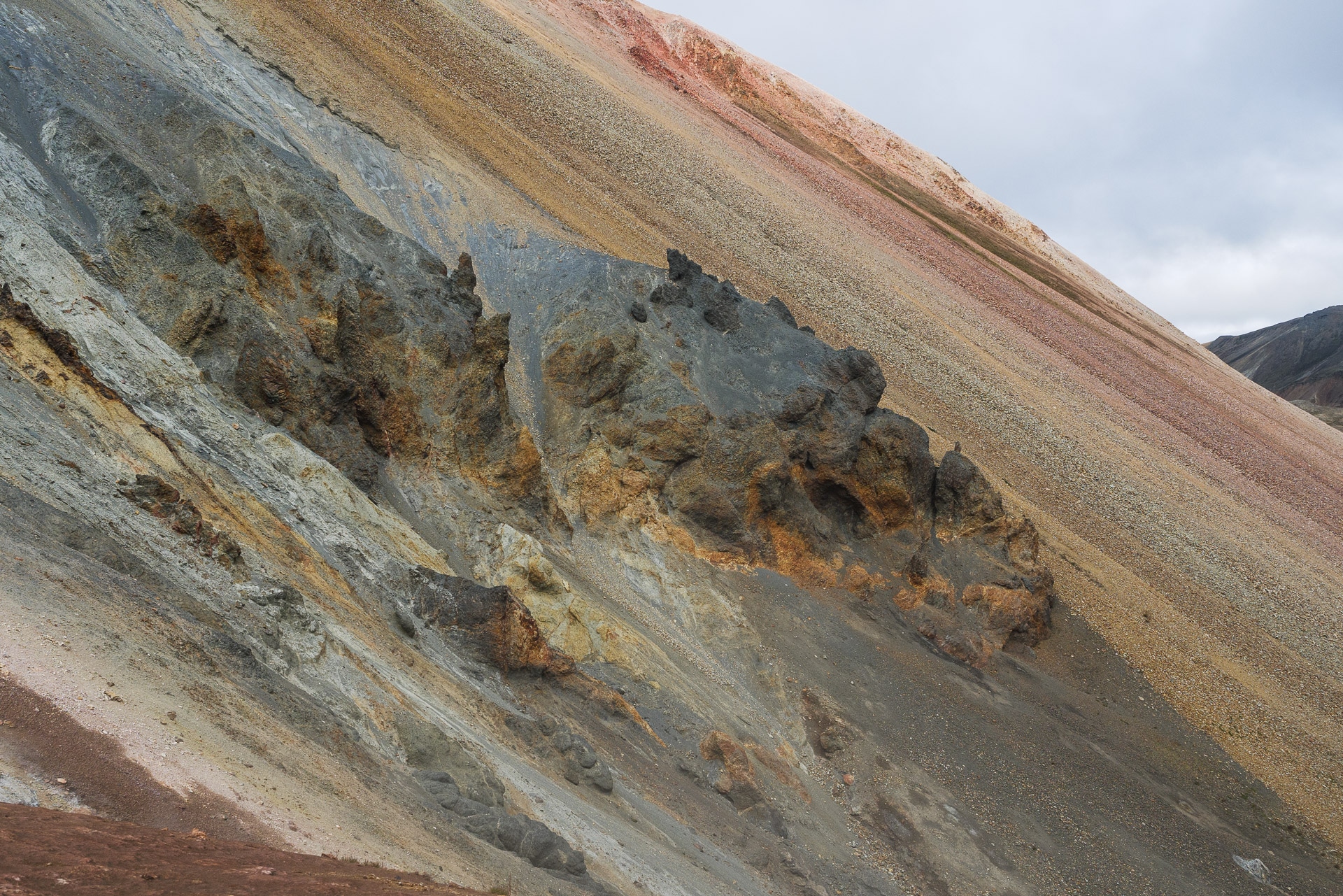
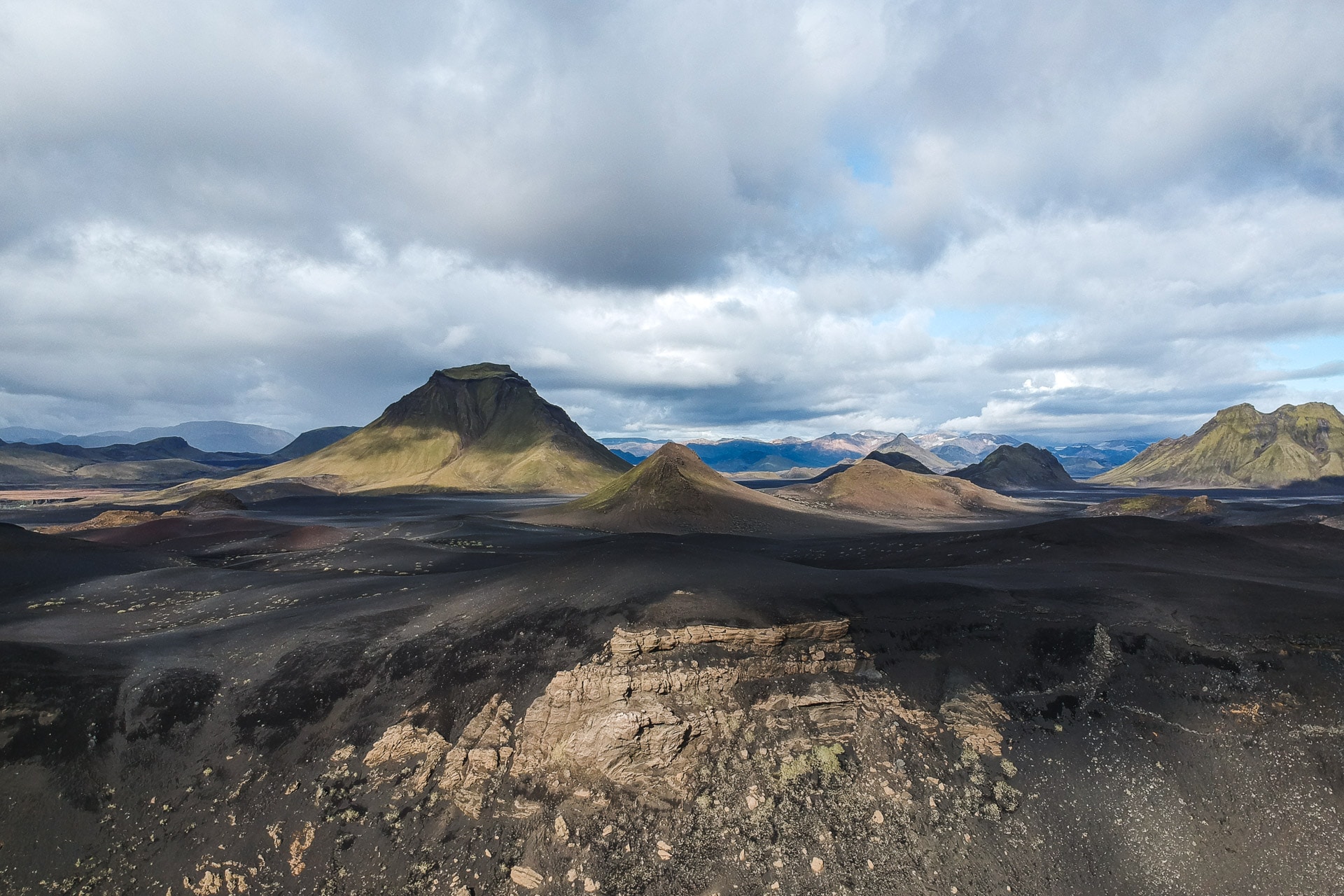
We continue our journey in a landscape which opens more and more. The soil is becoming increasingly black with ash and slag. The landscapes have another profile, just as beautiful.
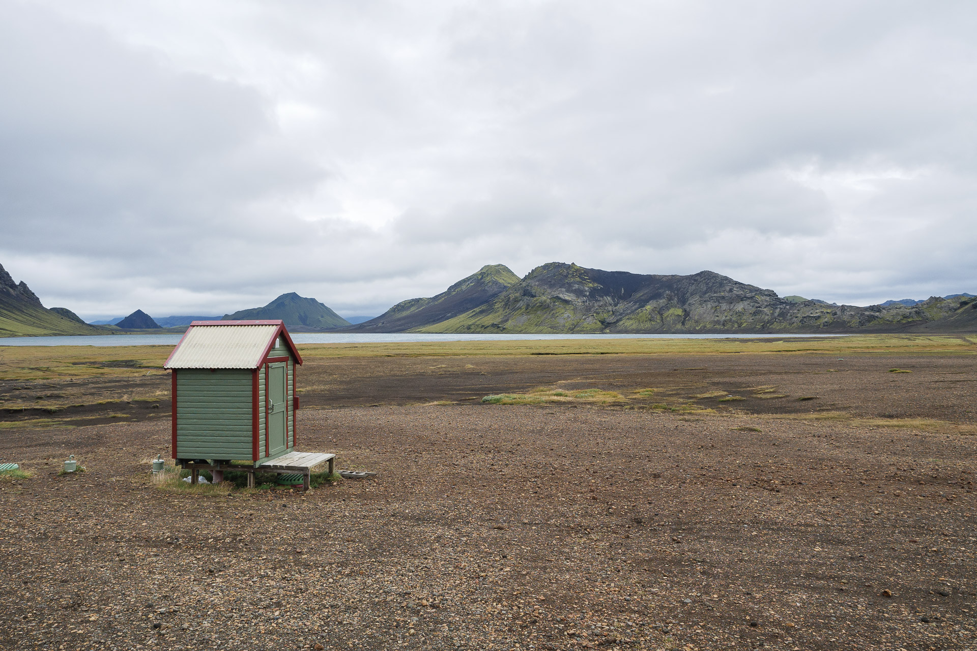
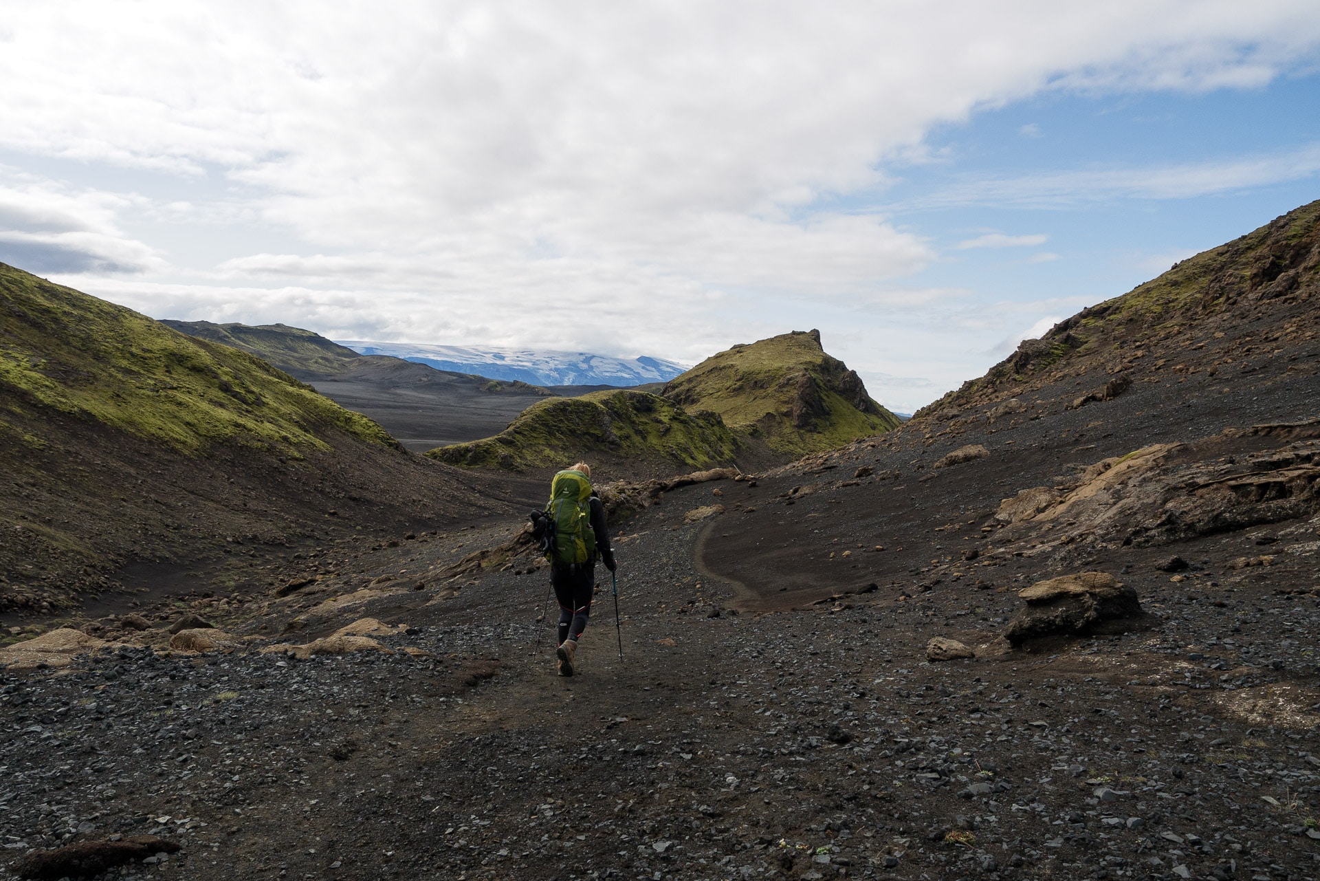
We pass by the site of Hvanngil, a small refuge which offers bivouac areas more pleasant than Alftavatn. The path then attacks an immense plain with a lunar landscape: just sand, flat, some plants struggling to survive and lots of space. It is a beautiful place.
Shortly before Hvanngil, a second ford awaits us. It is particularly wide but does not pose any major difficulty for us. We are getting used to it.
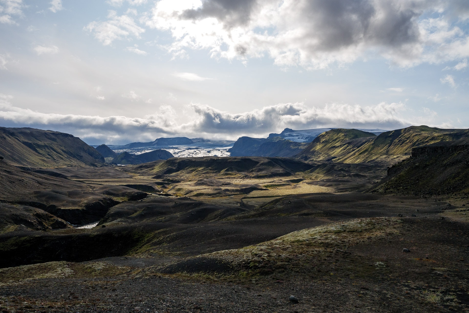
Although this portion of the Laugavegur is beautiful, it becomes monotonous at the end because it is really long … The exit from the plain is by a sort of “door” marked by rocky hills to the west. The path retains the same appearance but offers very beautiful views of the Eyjafjallajökull.
The path is no longer very long until Emstrur but the landscapes are still as beautiful. There are only shades of black and ocher, punctuated with green touches sometimes.
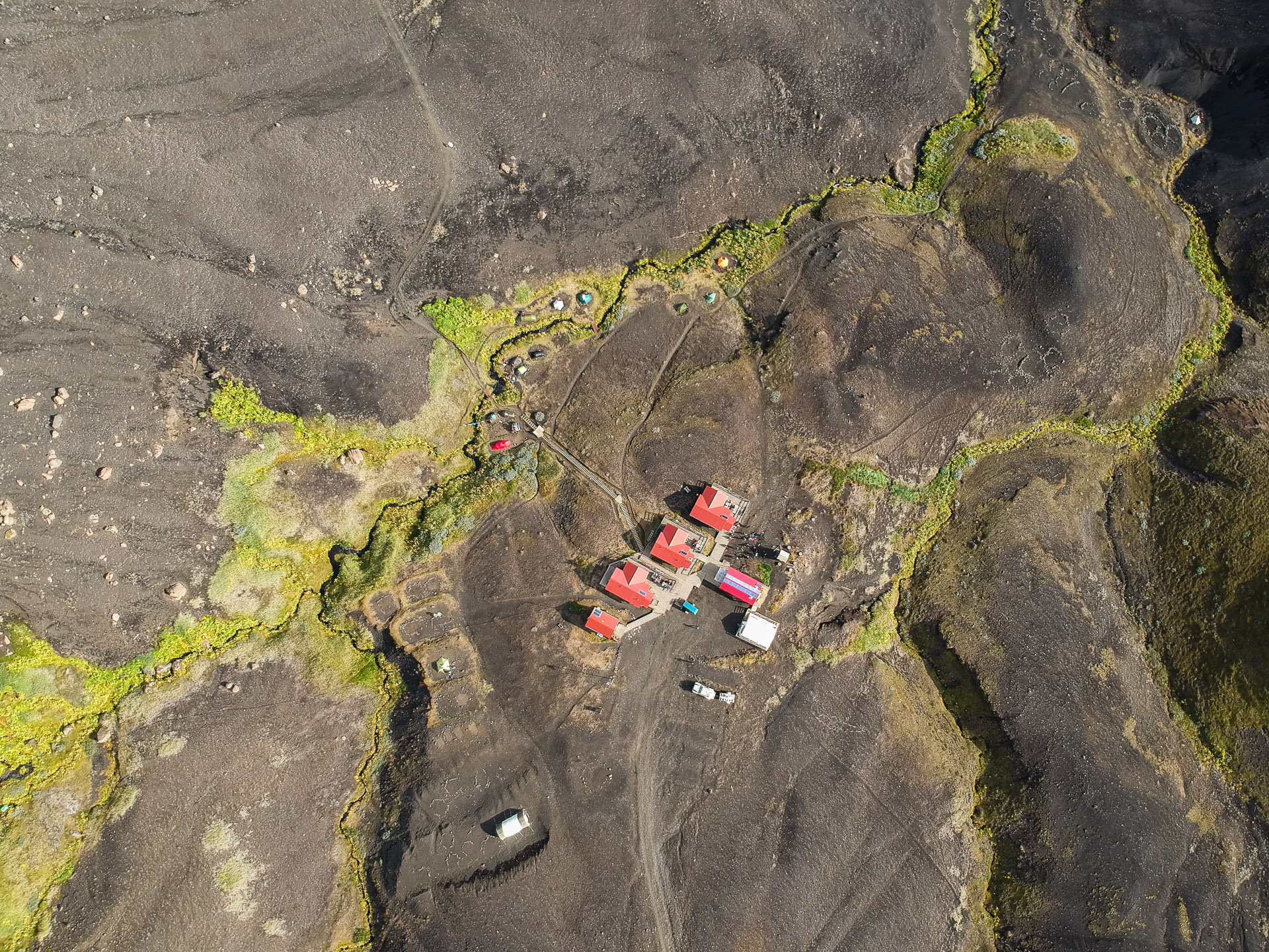
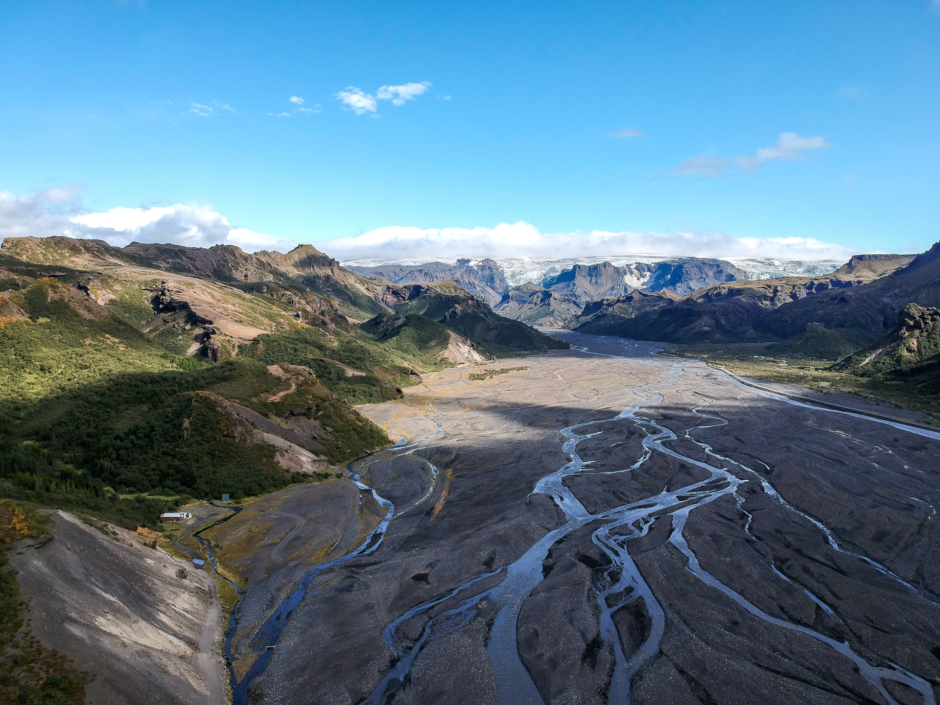
Emstrur is located in the hill and offers a beautiful view of the Mýrdalsjökull. There are some hard dwellings to spend the night but the site also offers bivouac areas which are rather pleasant although dense. As the weather is rather optimistic we will spend the night in a tent.
It is a pleasant site and the weather is nice and even good if you protect yourself from the wind.
I will take advantage of the end of the afternoon to fly the drone in order to take some aerial photos.
This day will have been superb as much by the landscapes as by the weather. We will still have a few drops in the evening but nothing bad. We are already attacking the last day tomorrow …
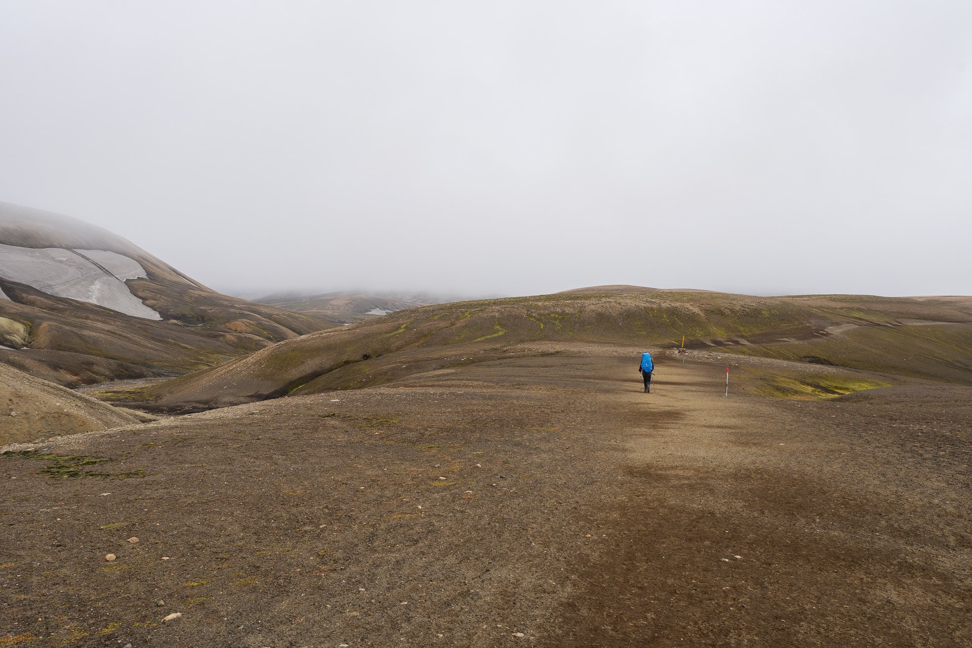
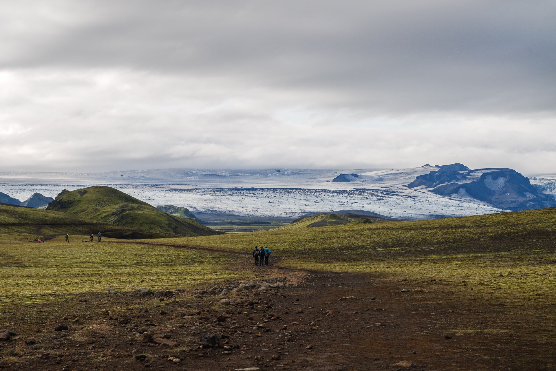
Day 4 - From Emstrur to Þórsmörk
Just 15 more kilometers and we will have reached our goal : Þórsmörk. We will start the day by reading the safety instructions in the event of a blowout as we enter the Katla area.
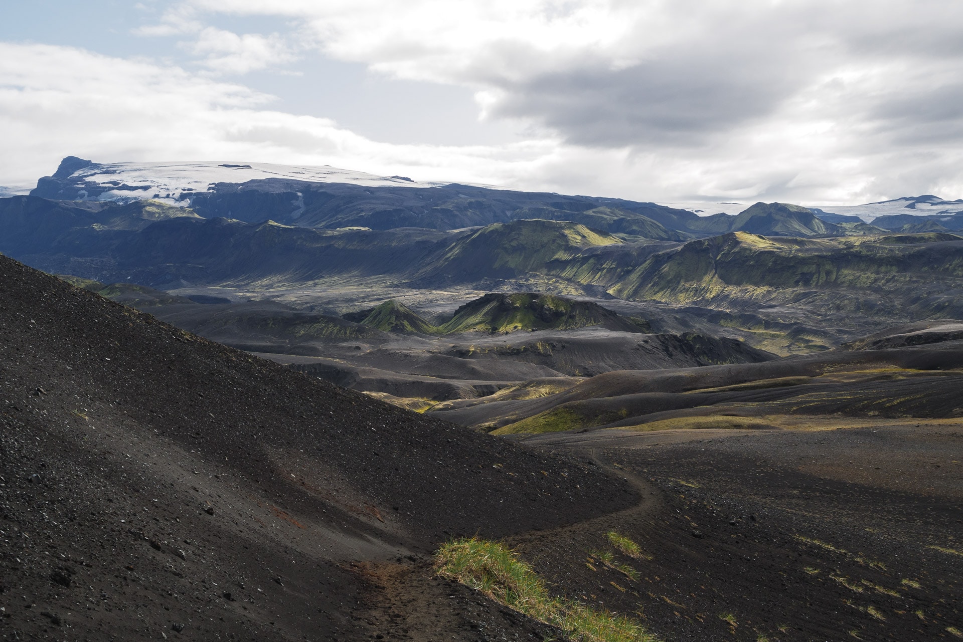
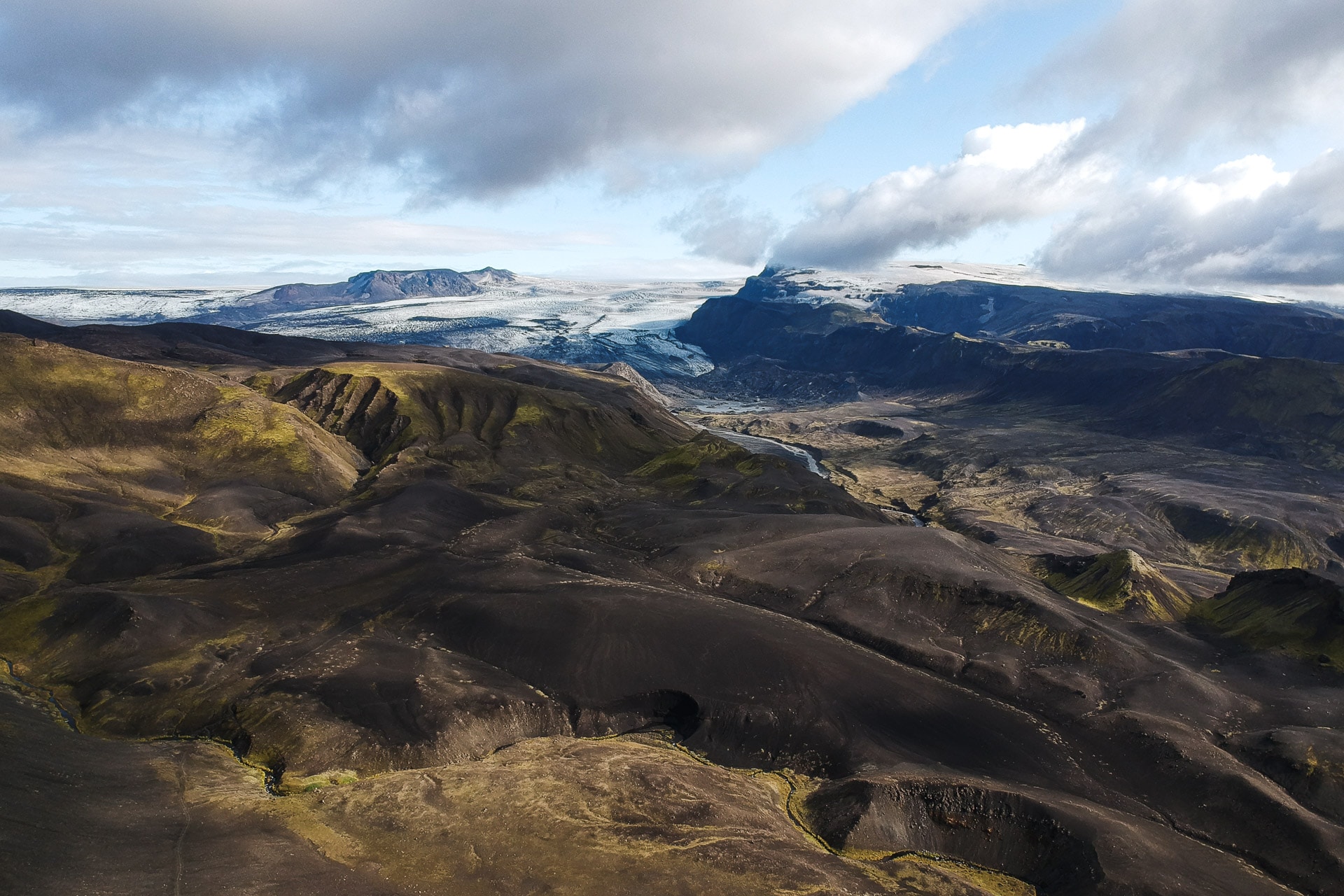
The Laugavegur, meanwhile, looks like what we could walk yesterday, that is to say a soil composed of dark sand and slag. We will first pass through a sort of valley carved out by the melting water of the glacier. This then takes us to the heights, which allows us to enjoy the view.
The terrain presents no difficulty. Just let yourself be carried away while admiring the landscapes. The Laugavegur will then gradually descend to the huge area where many glacial rivers meet. The landscape opens towards the west as you go, which allows you to guess the sea in the distance.
Without being ugly, it is not the most interesting portion of Laugavegur. Note however the gradual reappearance of trees.
The path then crosses a river thanks to a bridge over an impressive gorge before climbing on the top of the hill. From there we descend to join the 4th and last ford of the trek.
It is particularly wide and deep to the knees. It is done in 2 steps which allows to recover a little in the middle. Caution is advised as there is quite a bit of flow.
We are almost there ! The end of the path is really of little interest because it follows a kind of big track. Remarkable fact: we live in a forest which is particularly rare in Iceland!
Tonight we will sleep in Langidalur. I do not recommend Husadalur because the view is less pleasant. We will arrive at our destination in the early afternoon. It is a pretty, well-kept site, and above all it offers a marvelous view of Þórsmörk and the surrounding glaciers.
Here we are, the trek is finished. The afternoon will pass under a bright sun which will do us a lot of good. Everything will be enhanced by a small bottle of wine bought at a high price to celebrate!
There are beautiful hikes to do from Langidalur, including the ascent of Tindjöll.
We take the bus tomorrow towards Reykjavi and then continue our trip to Iceland.
Conclusions
Although it is a particularly well-known and popular trek, the Laugavegur nevertheless deserves the superlatives that we know; as much for its landscapes which are marvelous and changing from one day to another but also for its weather which will put your resistance to the test. This last point should not be overlooked. Even if some people have 4 days of good weather others can have 4 ugly days! Later during our stay, the Laugavegur was even closed due to the too difficult weather, that is to say!
If you hesitate for your next trip: go ahead, the Laugavegur will mark you and create lasting memories.