
Vercors crossing
3days
trekking
42km
walked
1660m
D+
10
Ibex
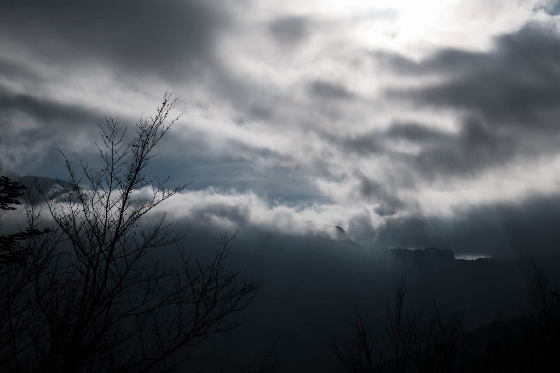
Finding a mountain hike for a few days in November is not always easy but the Vercors was the perfect place: isolation, landscapes, wildlife, altitude, everything you need to walk a few days away from the world.
The Vercors is a special place, limestone massif of the pre-Alps located close to Grenoble, it stands out for its isolation and the relative lack of water that reigns there. There is also a rich fauna easy to get close of. The massif is easily accessible by car or train, which makes transport logistics easier. I do not know why, the Vercors and its highlands have always had a reasoning a little mystical in me and it was a long time that I wanted to discover this place.
So we sealed the bags for three days at the end of October. The goal was simple: join Corrençon-en-Vercors from Chichilianne taking the time to savor the fall on the Hauts Plateaux. Here is the story of this beautiful autumn trek along the GR91.
Day 1 - From Paris to Mont Aiguille ("Mount Needle")
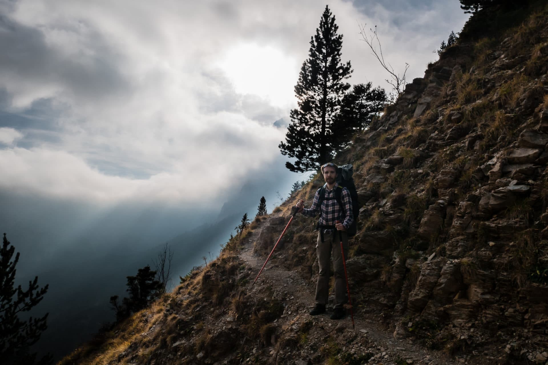
For this adventure, I will be accompanied by my friend Geoffroy, Jeff for the friends. It is at Gare de Lyon that we meet for an early start towards Grenoble. We will be there 3 hours later O magic of the French High Speed Train (TGV)!
For the next part we will take a TER which will deposit us at Clelles. The train station and the village are lost in the middle of nowhere, that’s it, we are there, we can start our trek!
It begins with a small disappointment, since Jeff forgot his camera memory card! I will be the reporter for the next few days.
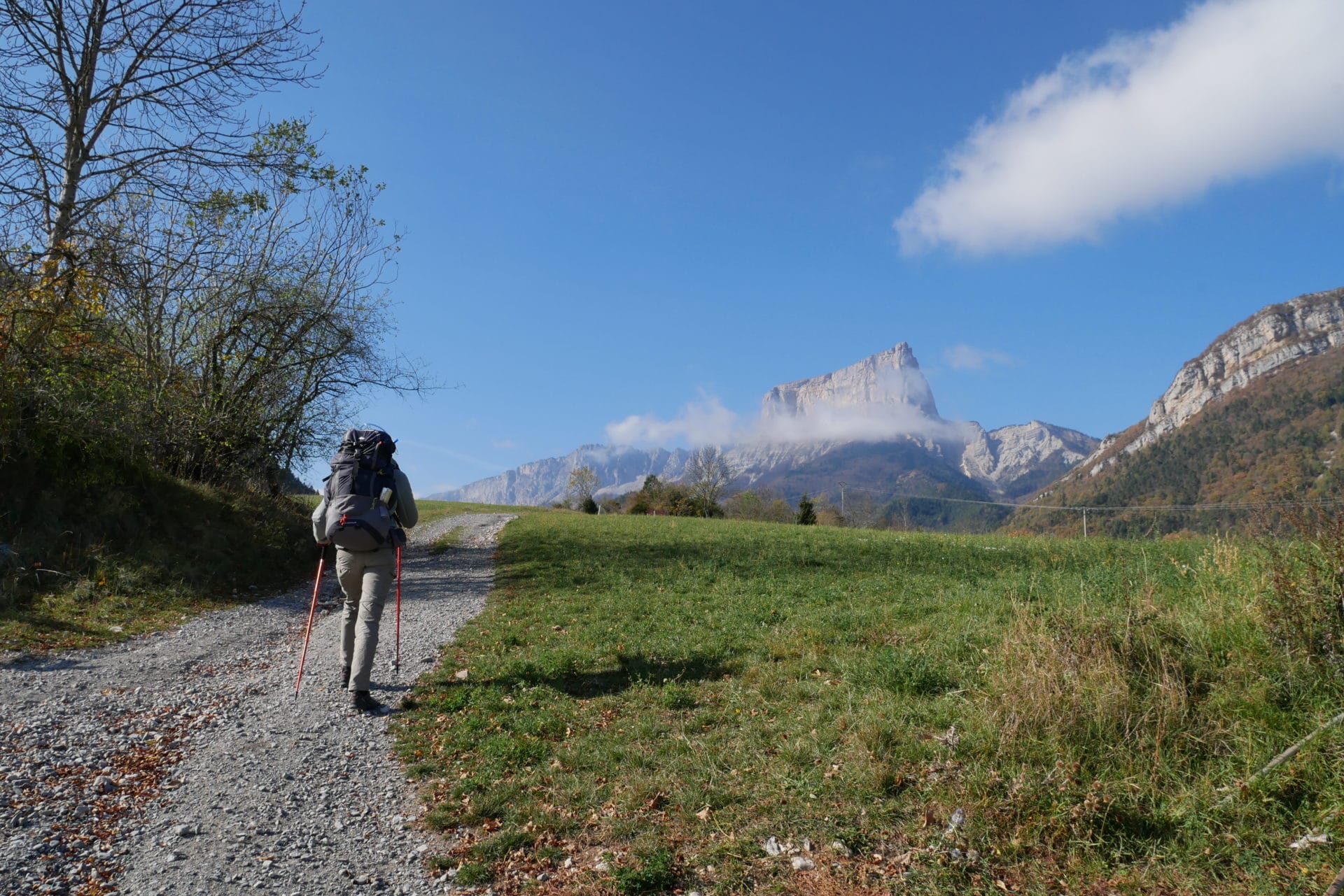
The first stage of the hike is to join Chichilianne and more specifically the Richardière, close to the Mont Aiguille. It is about 13h we still have a few hours before us before dark.
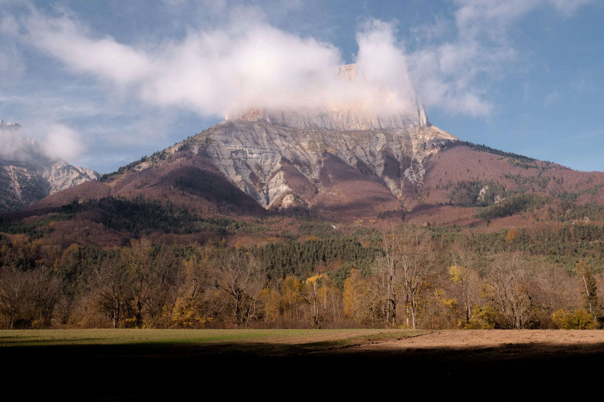
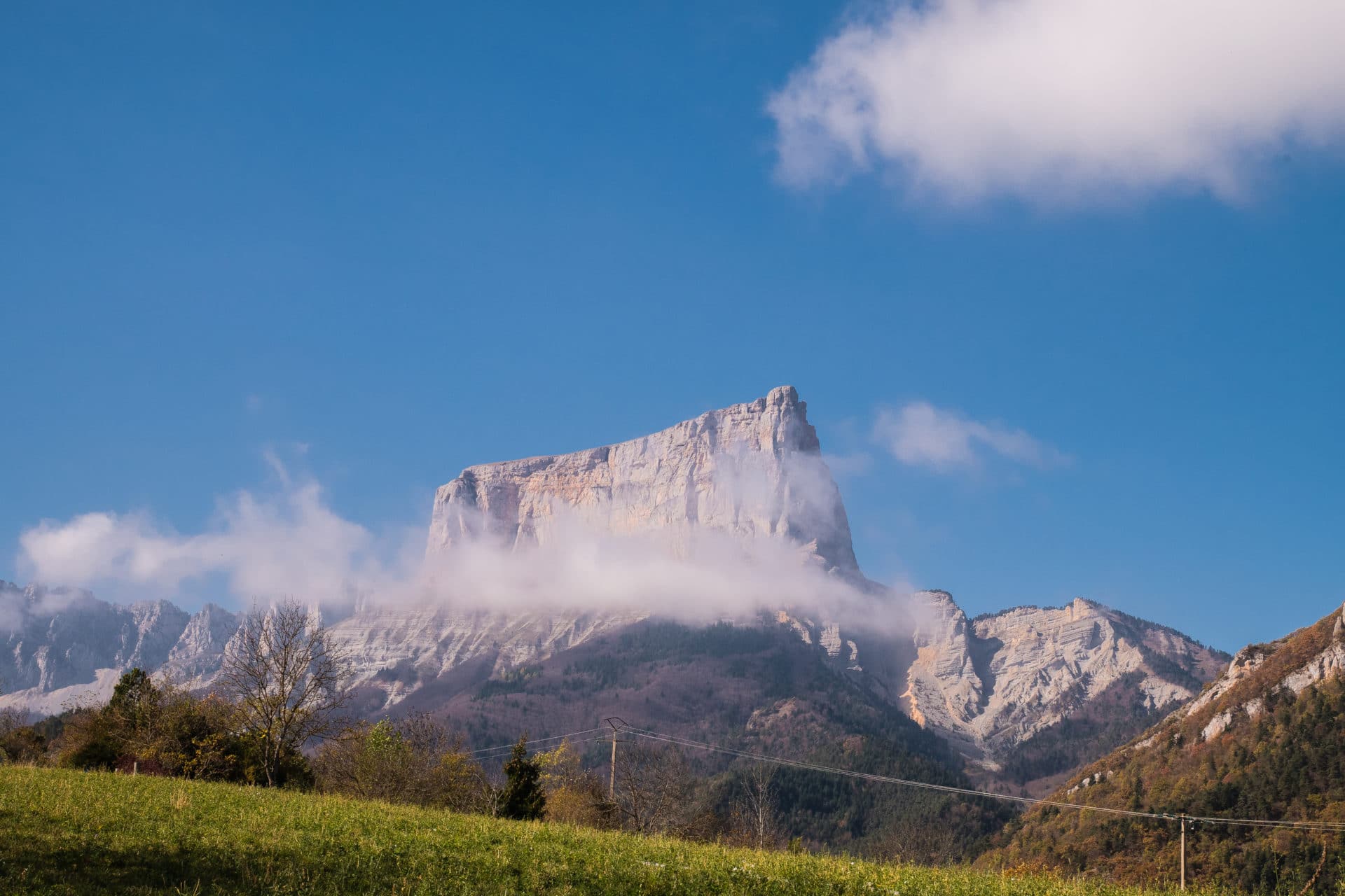
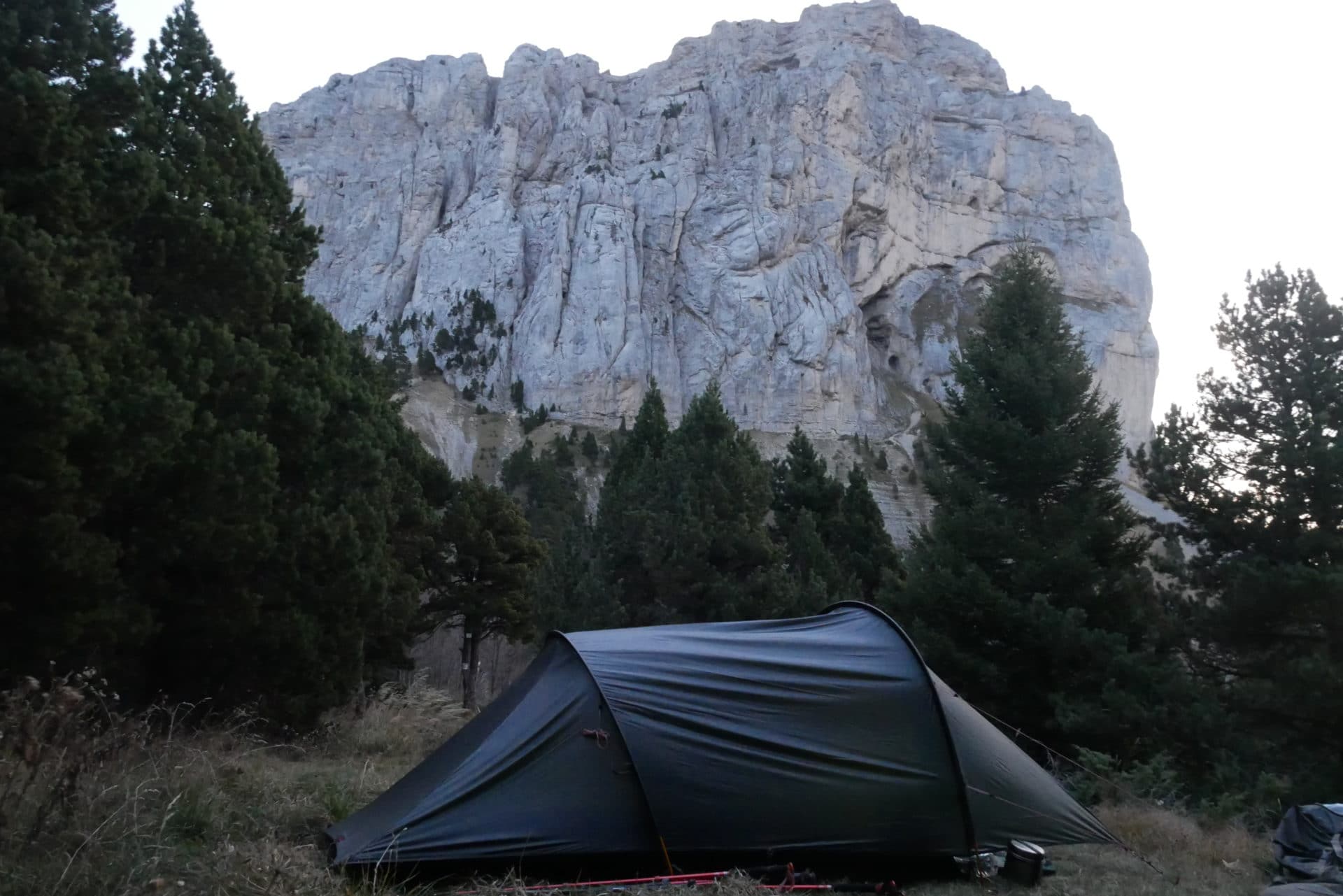
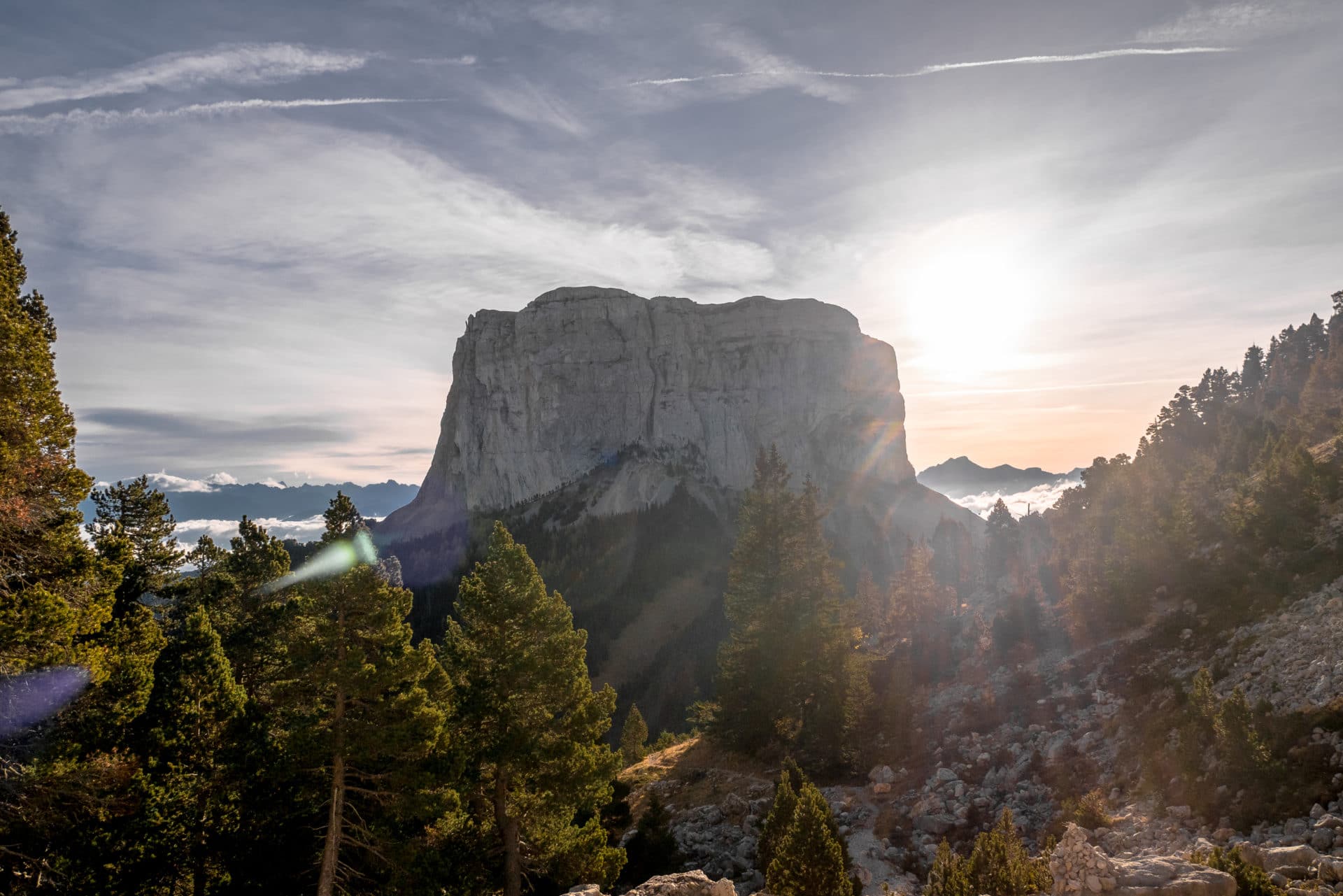
In the background of this first stage, the magnificent Mont Aiguille, rock prominence, alone, at 2087m. It is a historic place for mountaineering because it is the first “real” ascent made in 1492. It is also our goal of the day because we intend to bivouac towards the Col de l’Aupet.
The path is not difficult until the Richardière and relatively flat. We turn around the mountain that presents us different profiles.
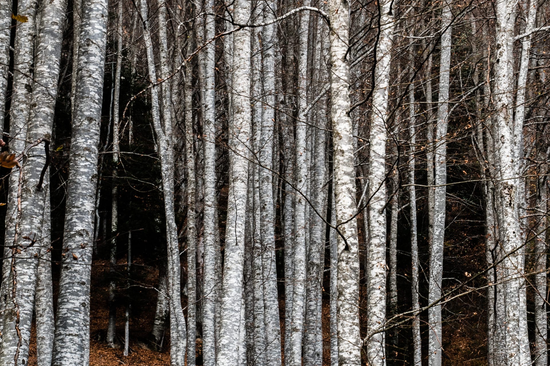
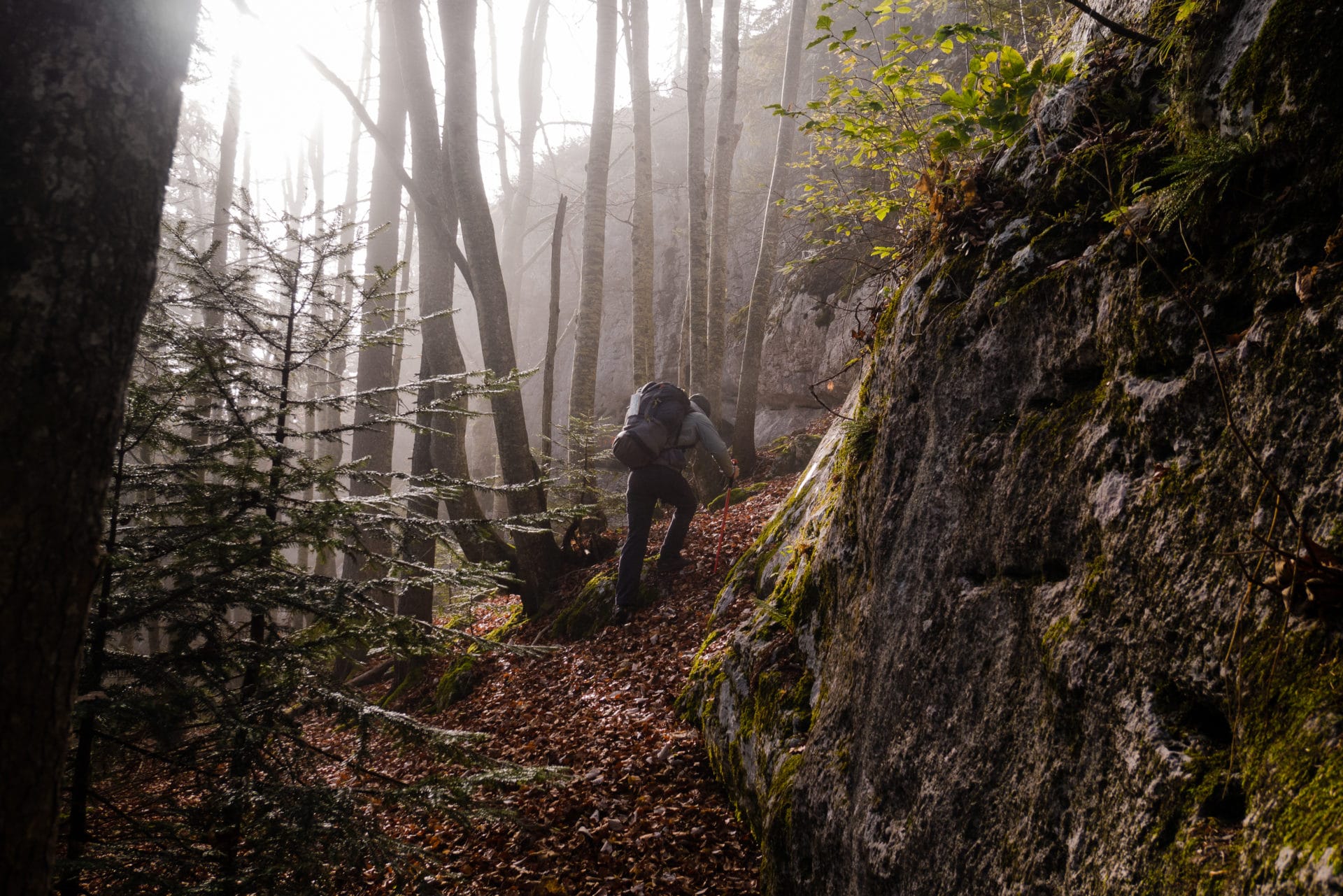
Once at the Richardière (1000m), we begin the climb through the forest of Chichilianne. We quickly gain altitude and for my part I struggle a little and I am short of breath. Jeff, he’s in the lead. It is getting late and the sun is falling.
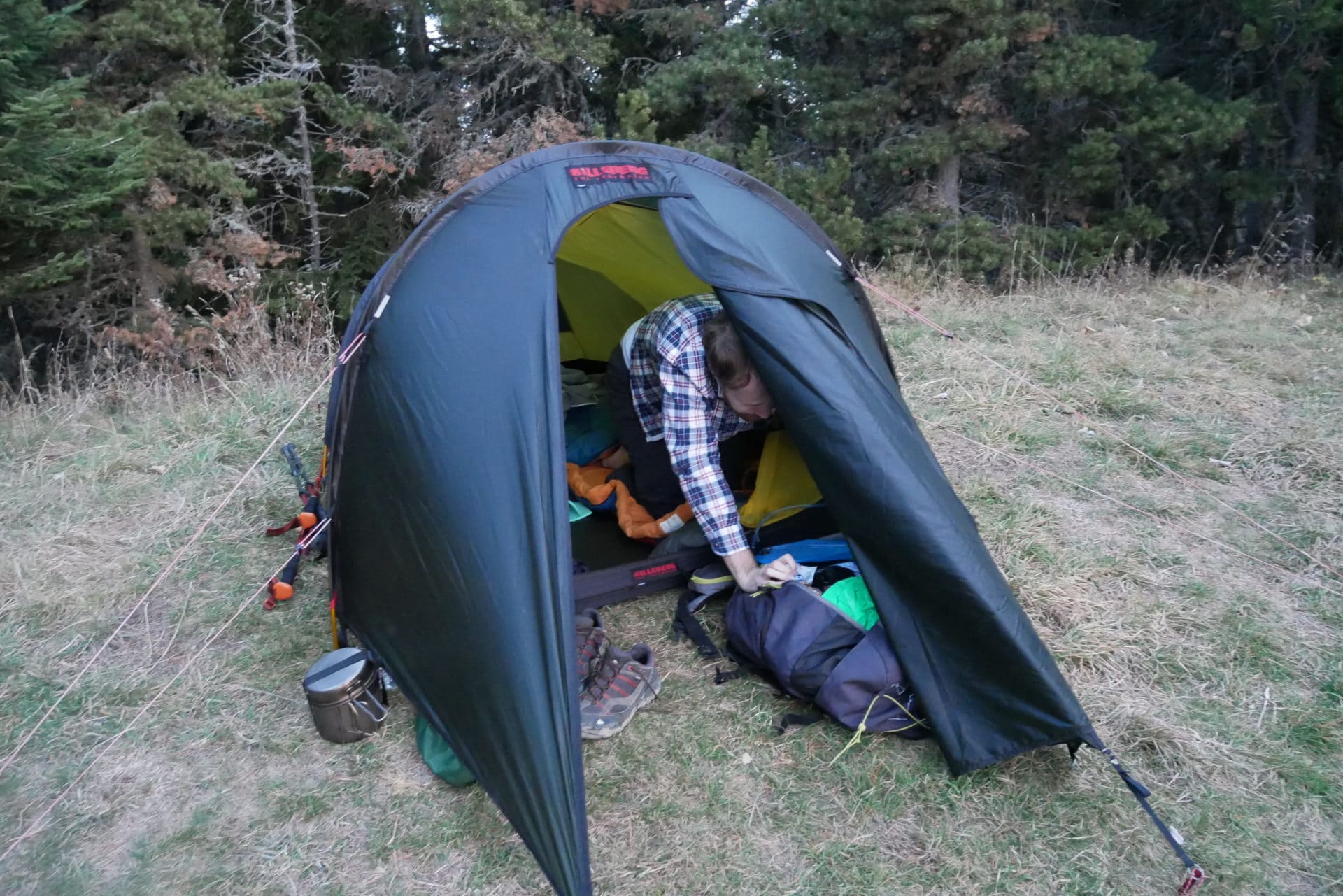
We arrive at the shoulder under Mont Aiguille around 4pm, for my part exhausted … We can not drink as we wish because there is no water there. We hope to find some tomorrow at the fountain of Bachassons. For the moment we install the camp which offers a beautiful view of the Mont Aiguille and the surrounding valley. As there is still light we leave to try to find water on the north side but nothing … we come back empty-handed.
The temperature falls quickly and the wind does not help! We will take refuge in our sleepingbag very early after a meal taken in a hurry! We have enough water for tonight but we need to find some tomorrow.
As often with the first days, the warm up was not easy but we are still happy to be here wrapped up in our sleeping bag.
Day 2 - From Mont Aiguille to the Playe's fountain
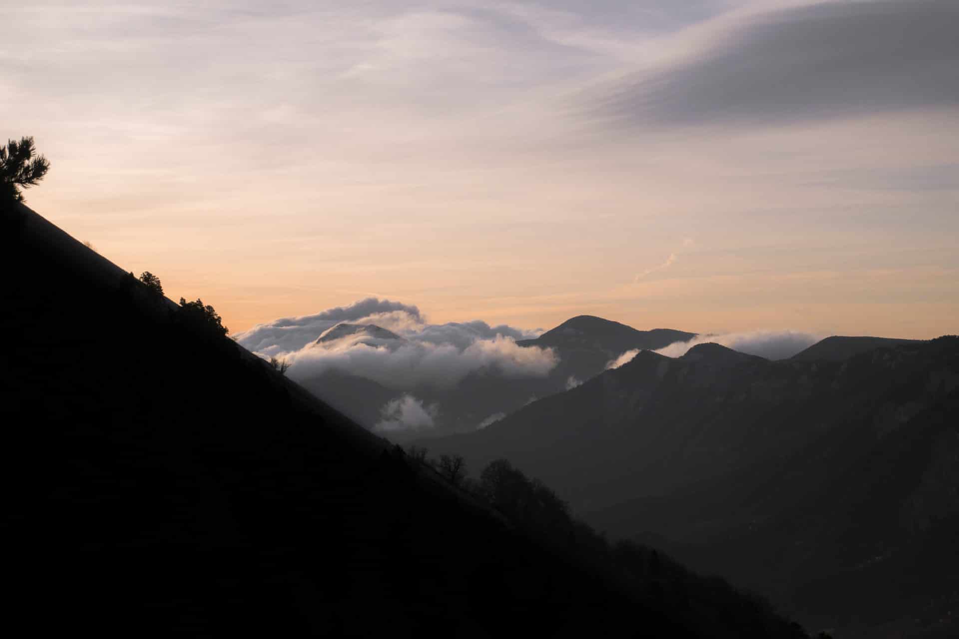
The night was not too cold, we had equipped ourselves knowingly. Dawn holds a glowing sunrise and the weather is sunny, all we need to attack the day the good way!
The breakfast has been light and fast because the lack of water does not allow us to make tea or coffee. So we resume the road fairly quickly once the camp folded.
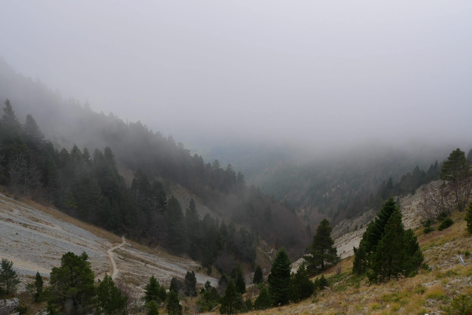
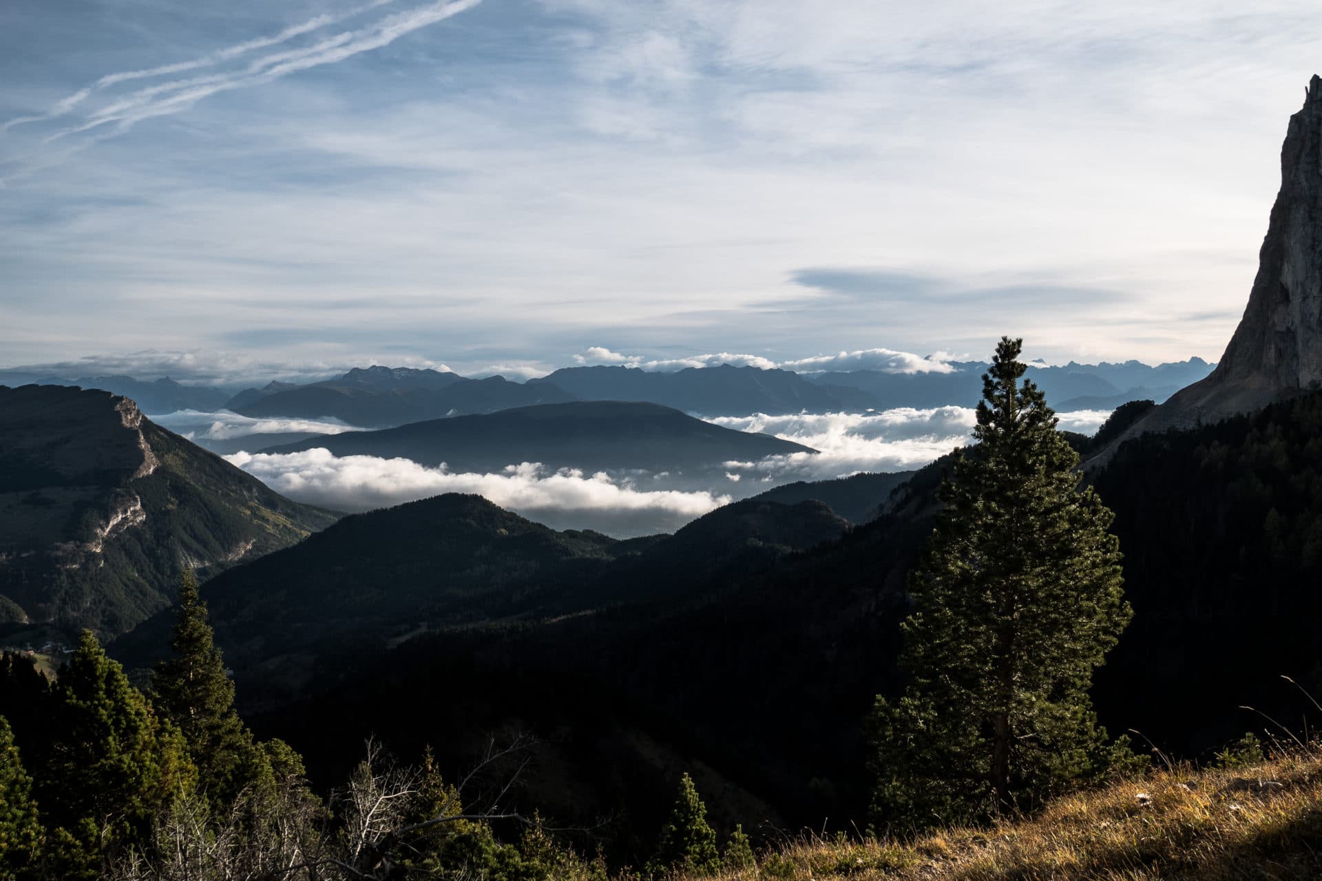
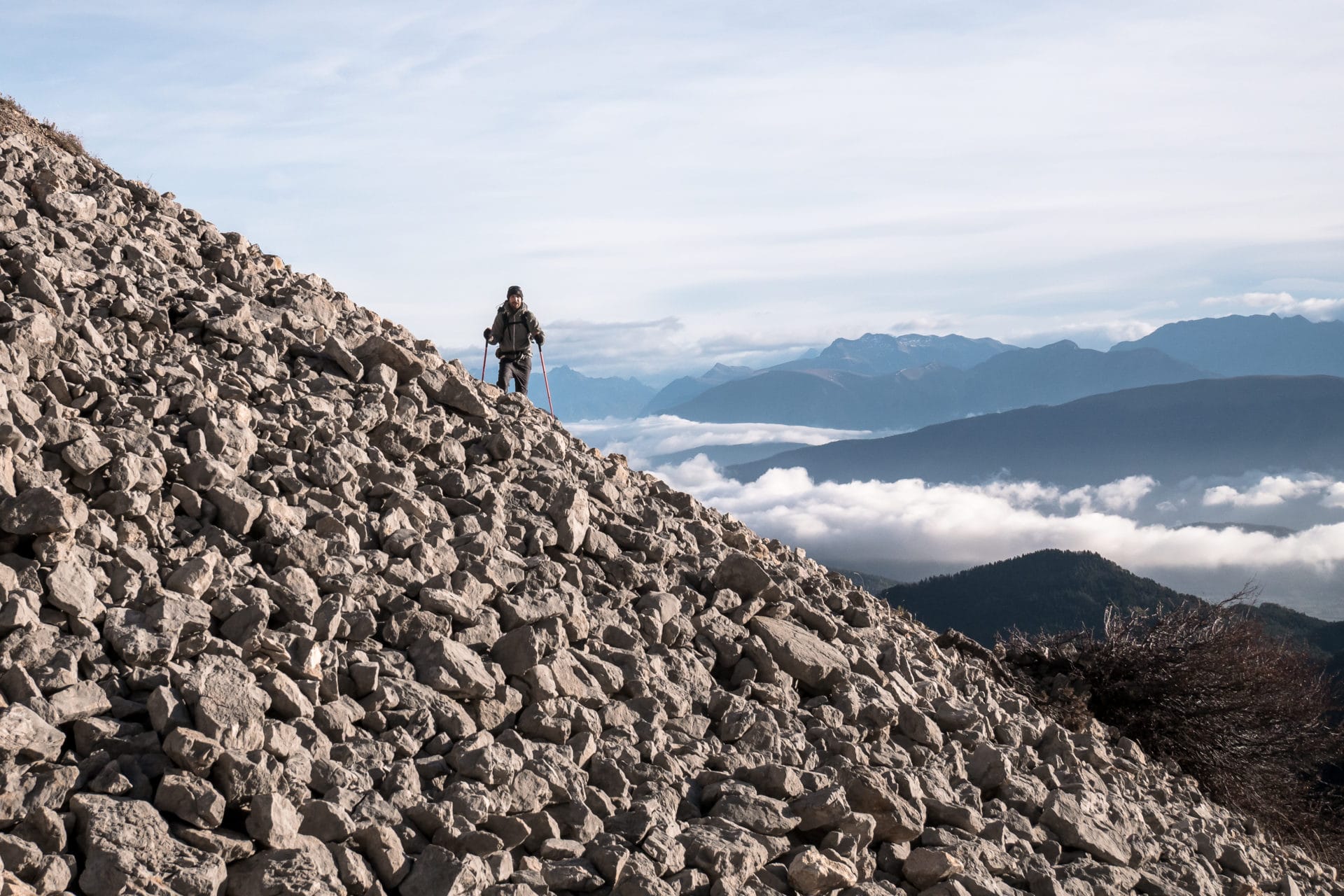
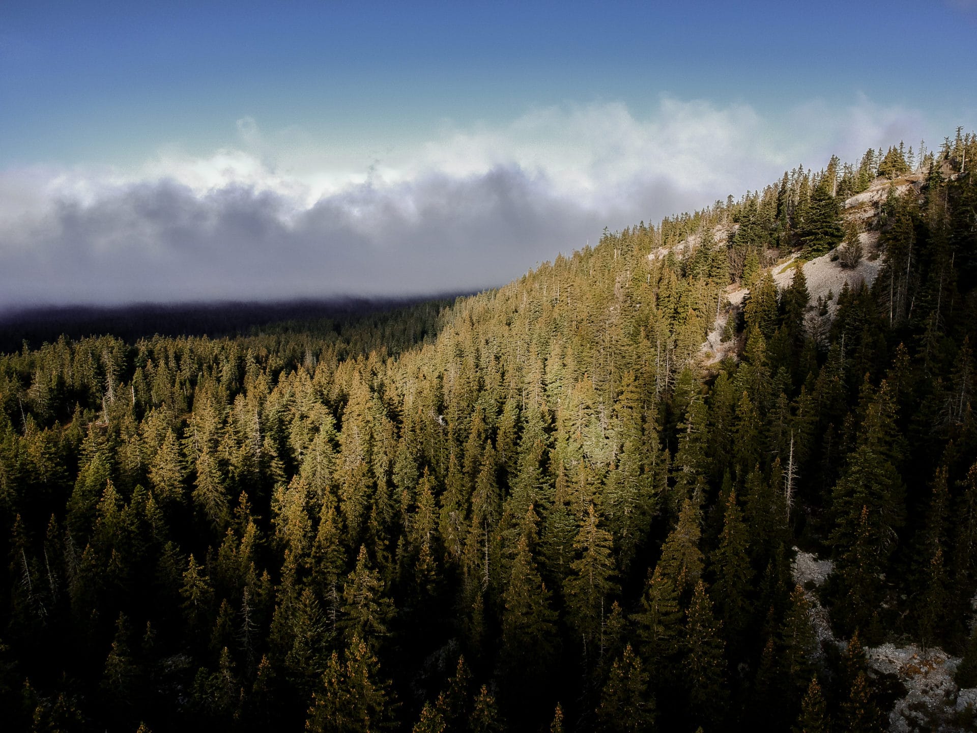
The first stage takes us to Pas de la Selle, which will be our gateway to the highlands. We leave the trees behind us in the climb which is therefore more and more mineral. The view to the pass is marvelous: down below the valley covered with morning mists and Mount Aiguille planted there in all its splendor.
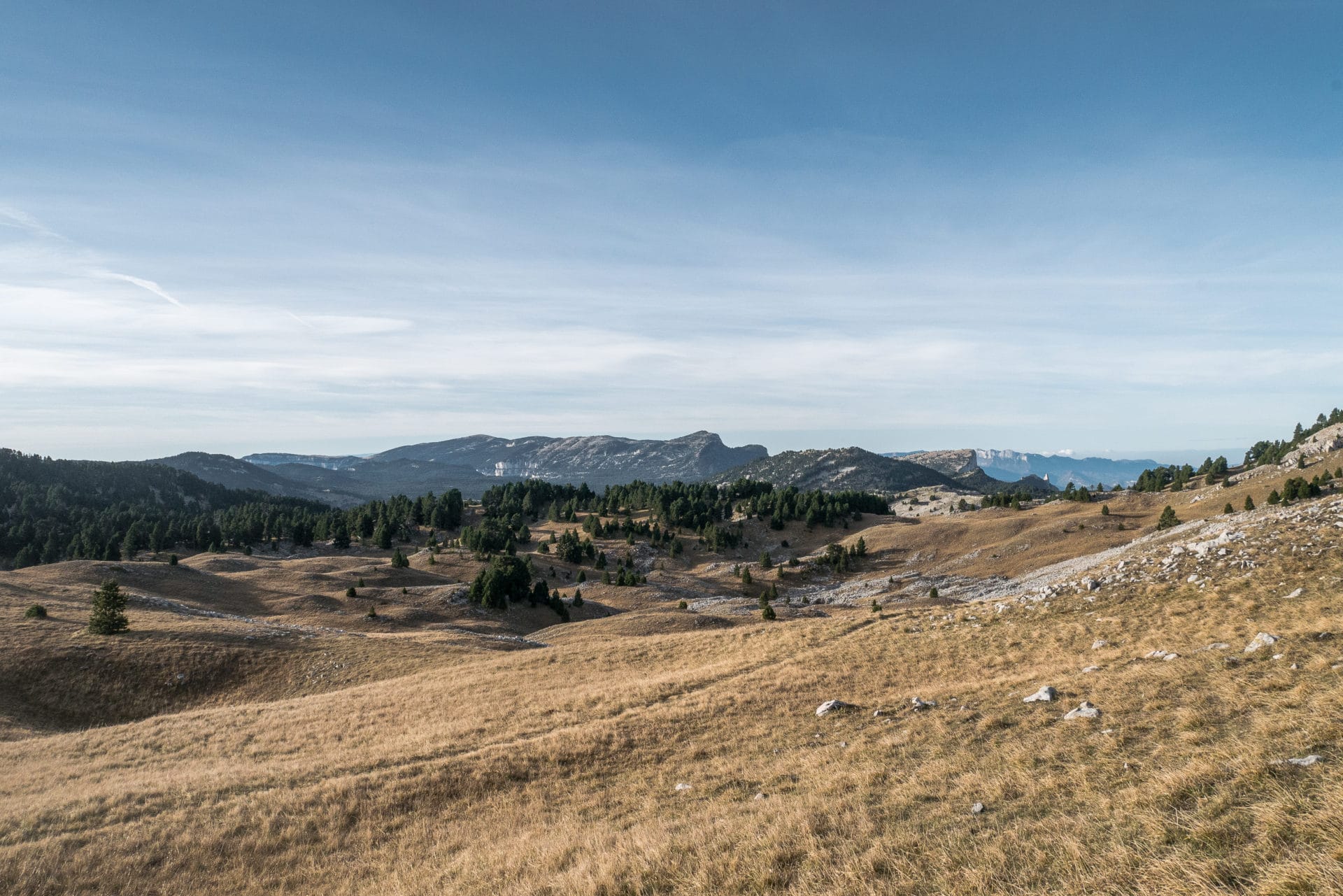
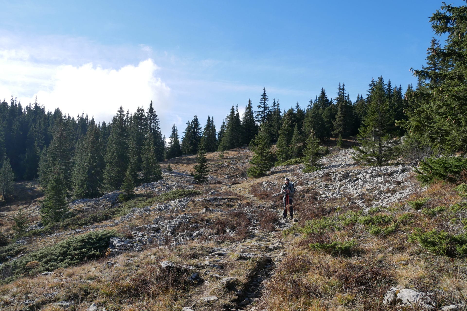
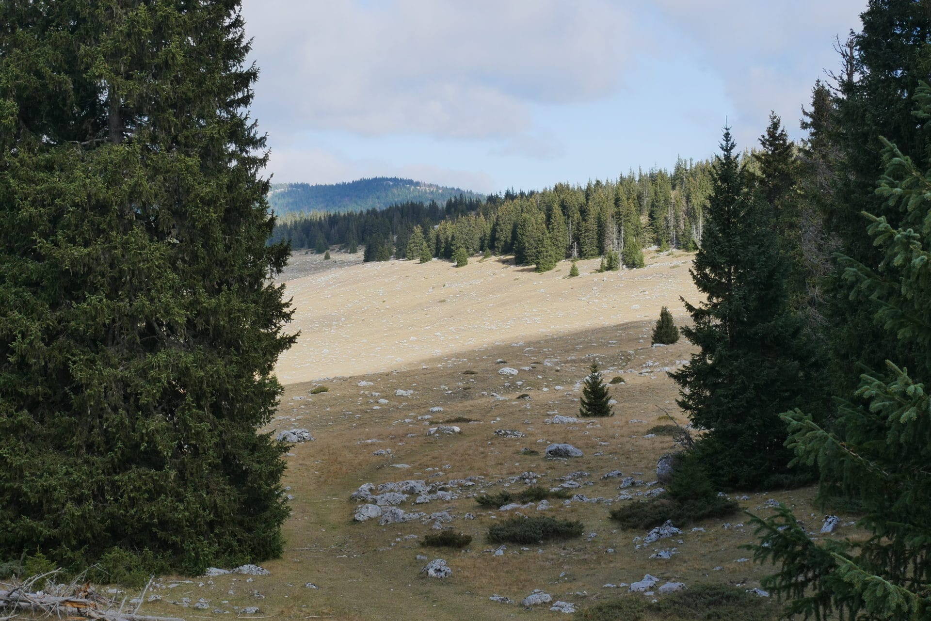
The arrival at the pass finally reveals the Highlands and it’s worth it! It’s like being in the Rohan of the Lord of the Rings: large heaths of short grass as far as the eye can see with a few trees here and there. It is very beautiful and there is nobody !
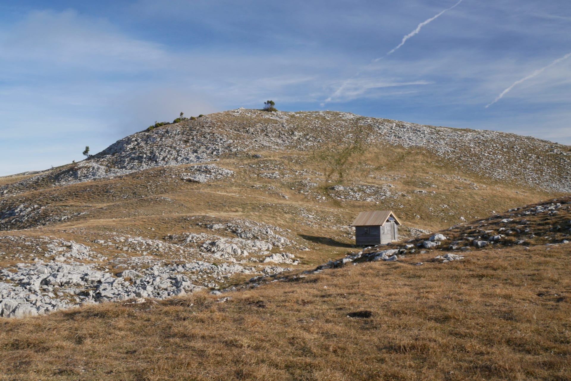
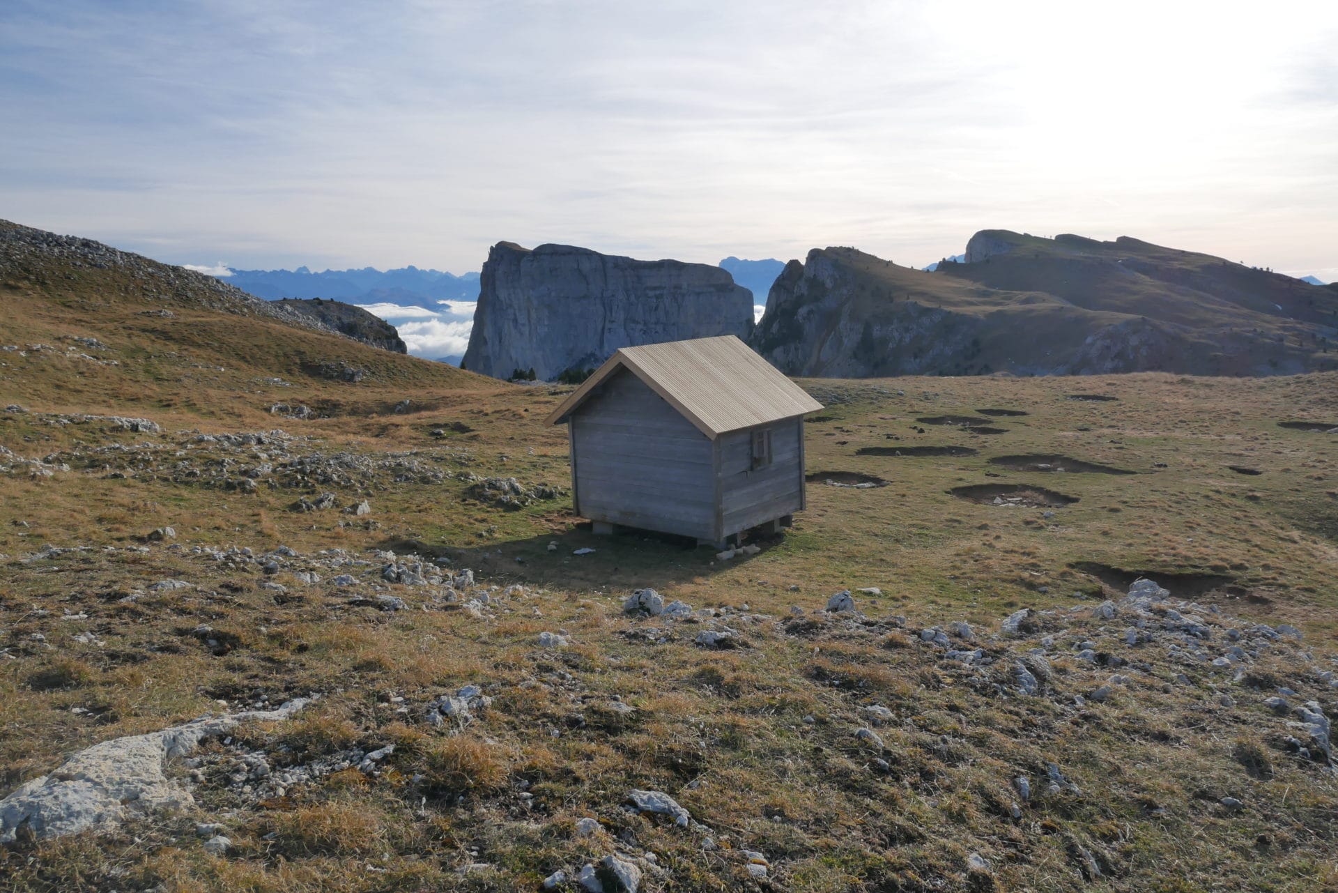
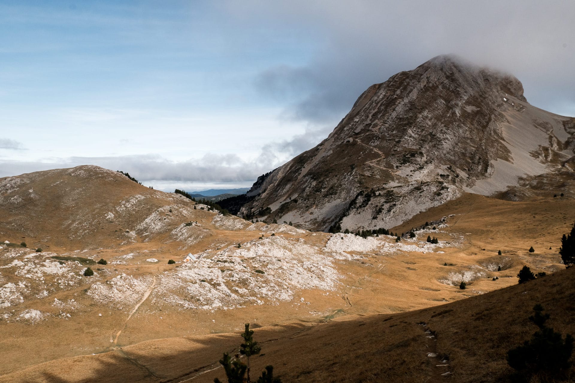
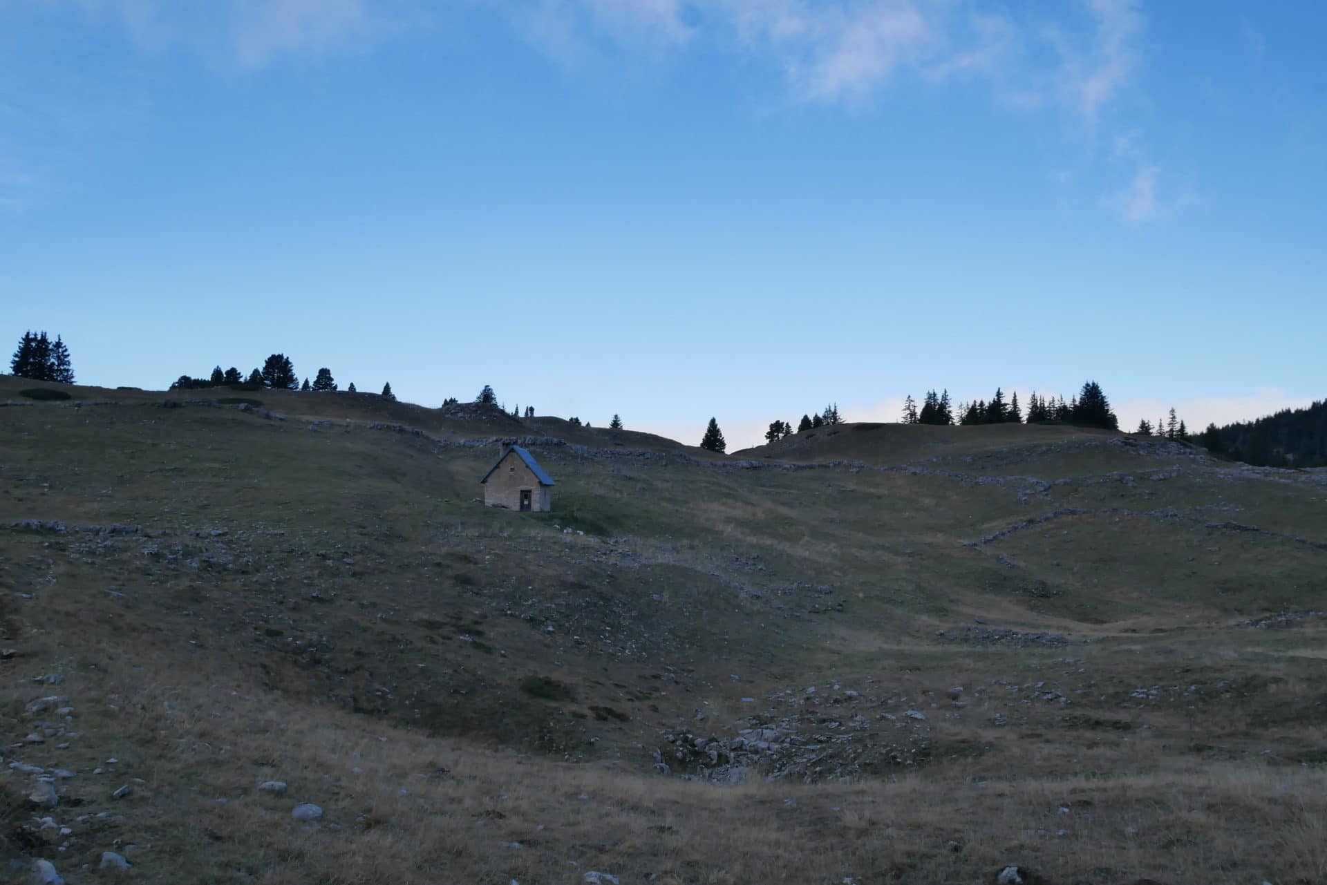
We then branch off to the north in search of the Bachasson fountain. On the road we cross a small hut lost in the land, there is a stop 2min.
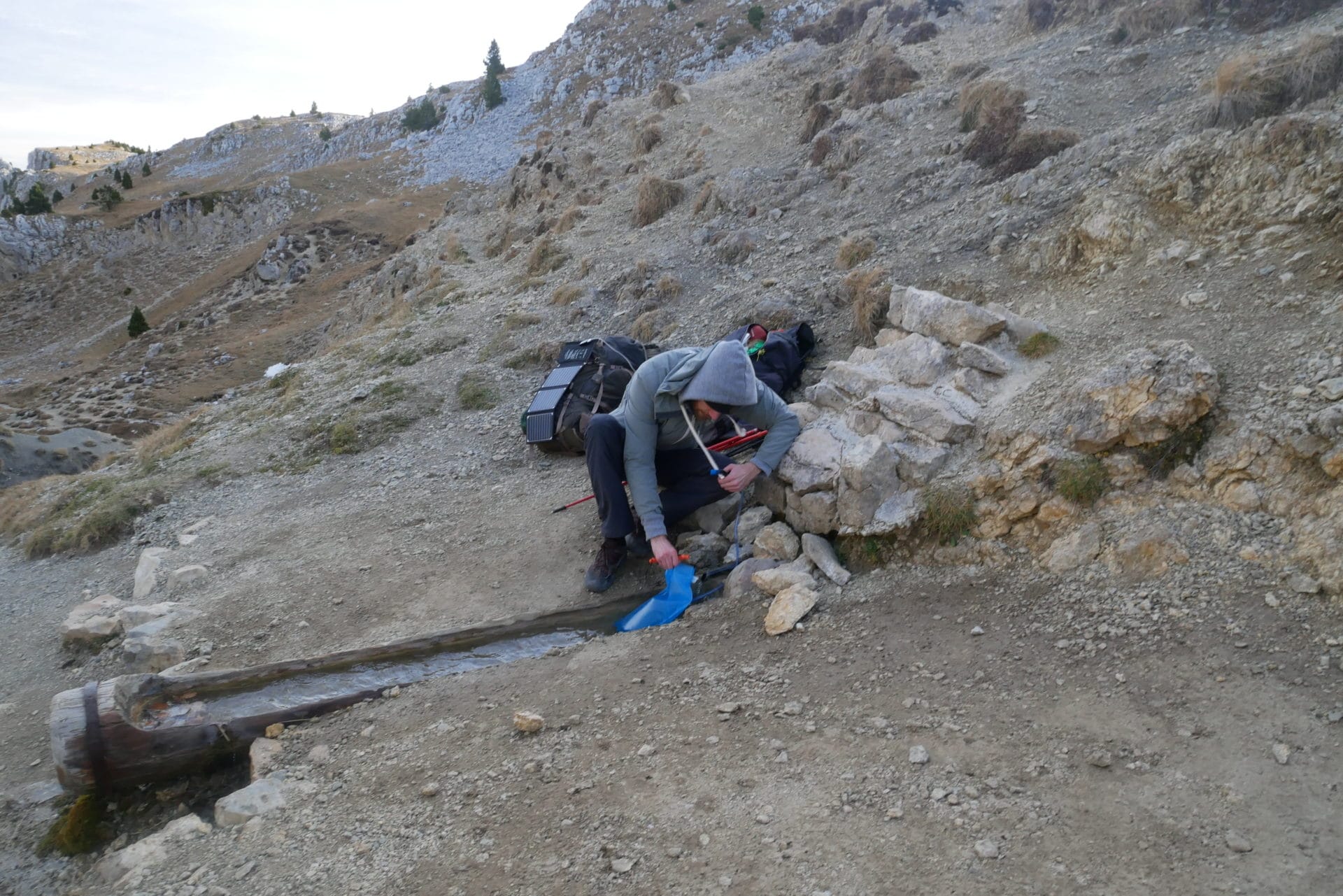
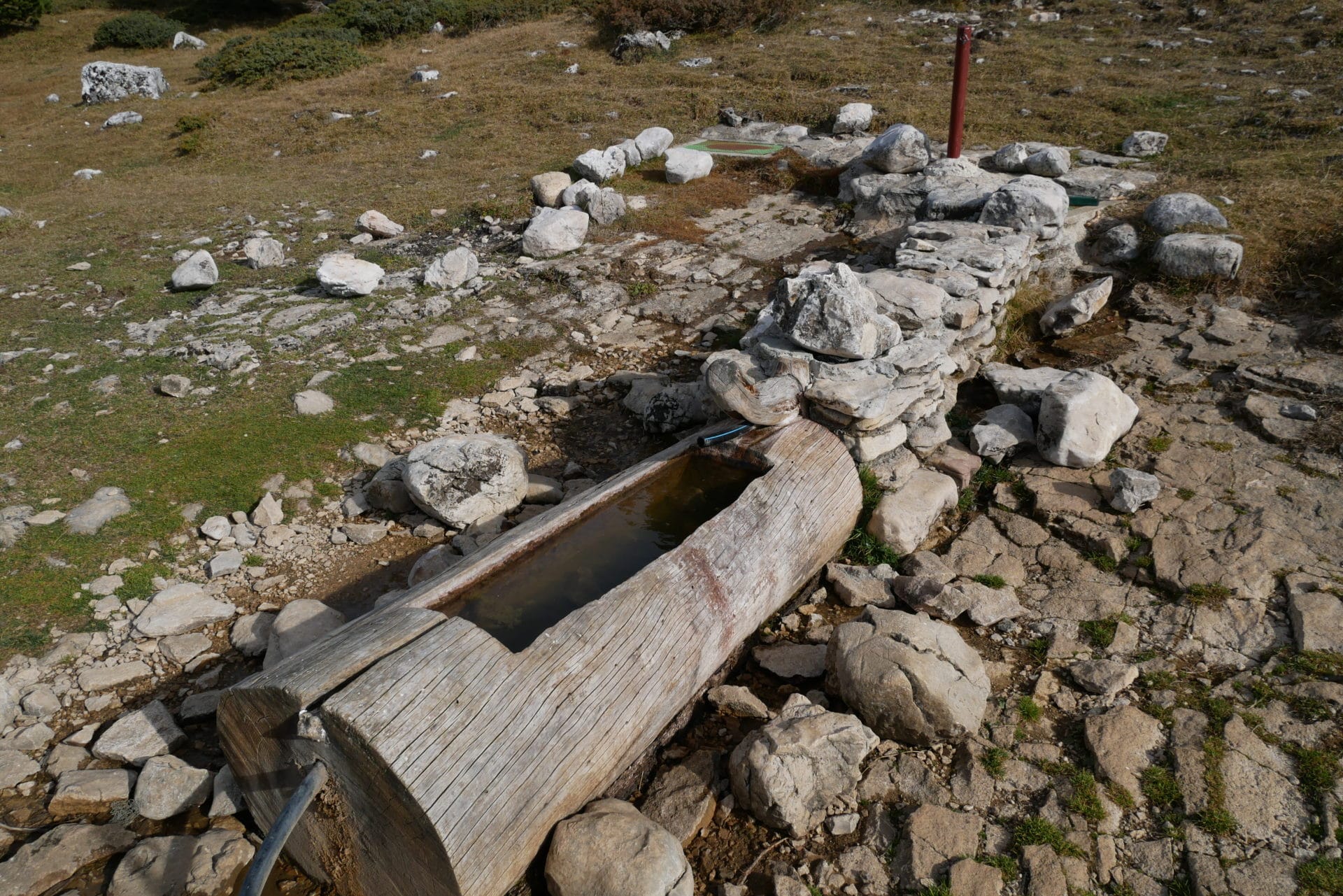
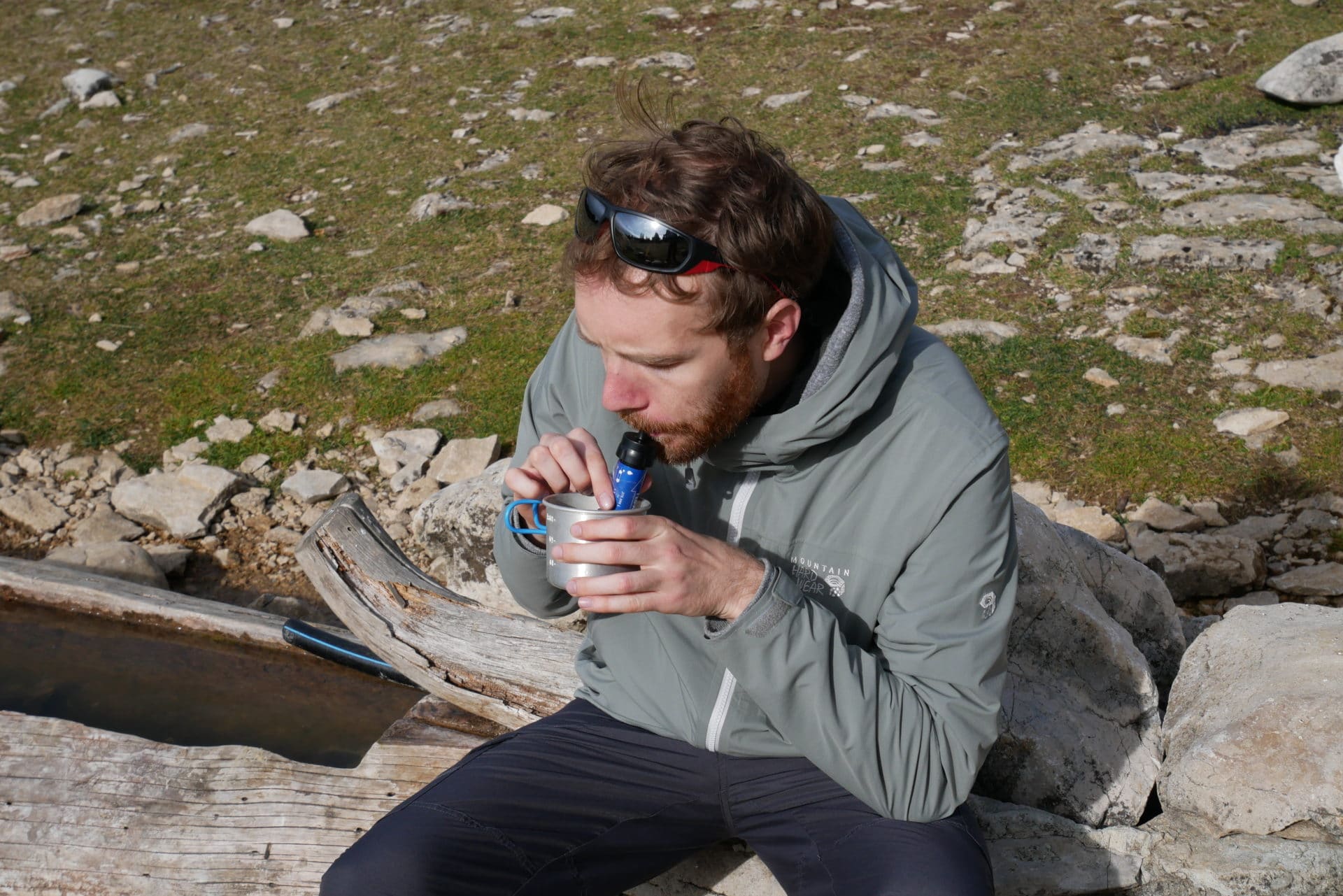
We are looking for the fountain that we will find a little further. It flows slowly but it flows, it’s already that! We fill our bottles thoroughly (3L / person).
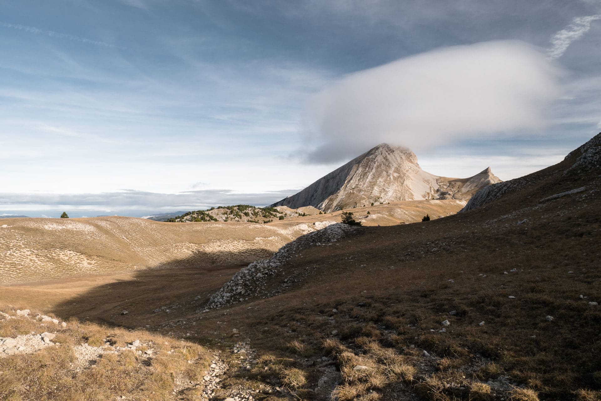
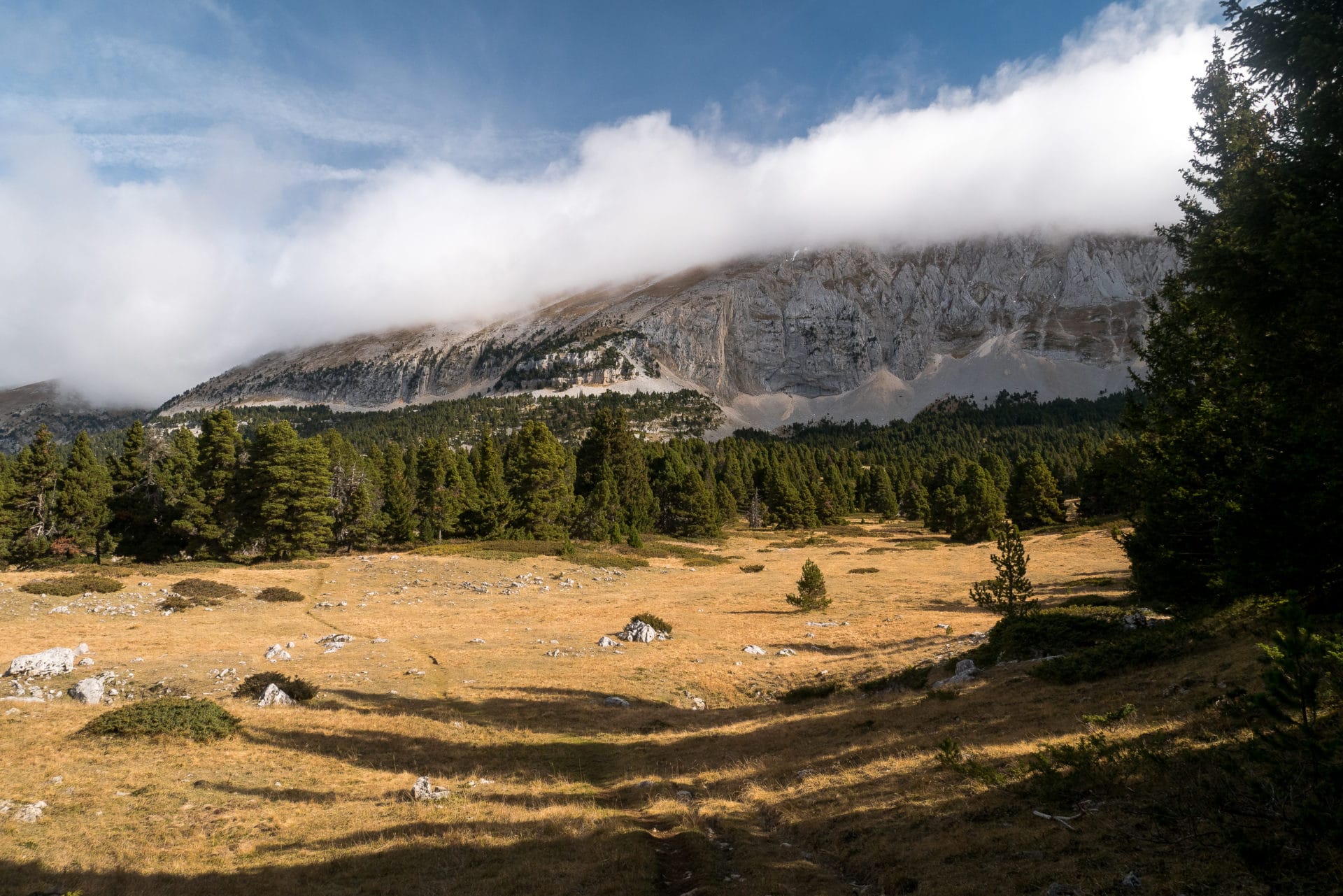
We take the road towards the Cabane des Aiguillettes for a coffee. It’s sunny but it’s very windy. The view is very beautiful with the Grand Veymont (2341m) in the background wearing a pretty cloudy hat.
We arrive quickly at the Cabane des Aiguillettes but it is already occupied by other hikers with whom we settle the time of a coffee.
The news are not good though: our companions inform us that many fountains are completely dry. Not good! So we take extra bottles that we fill with snow melted in the stove … We still hope to find some water on the road …
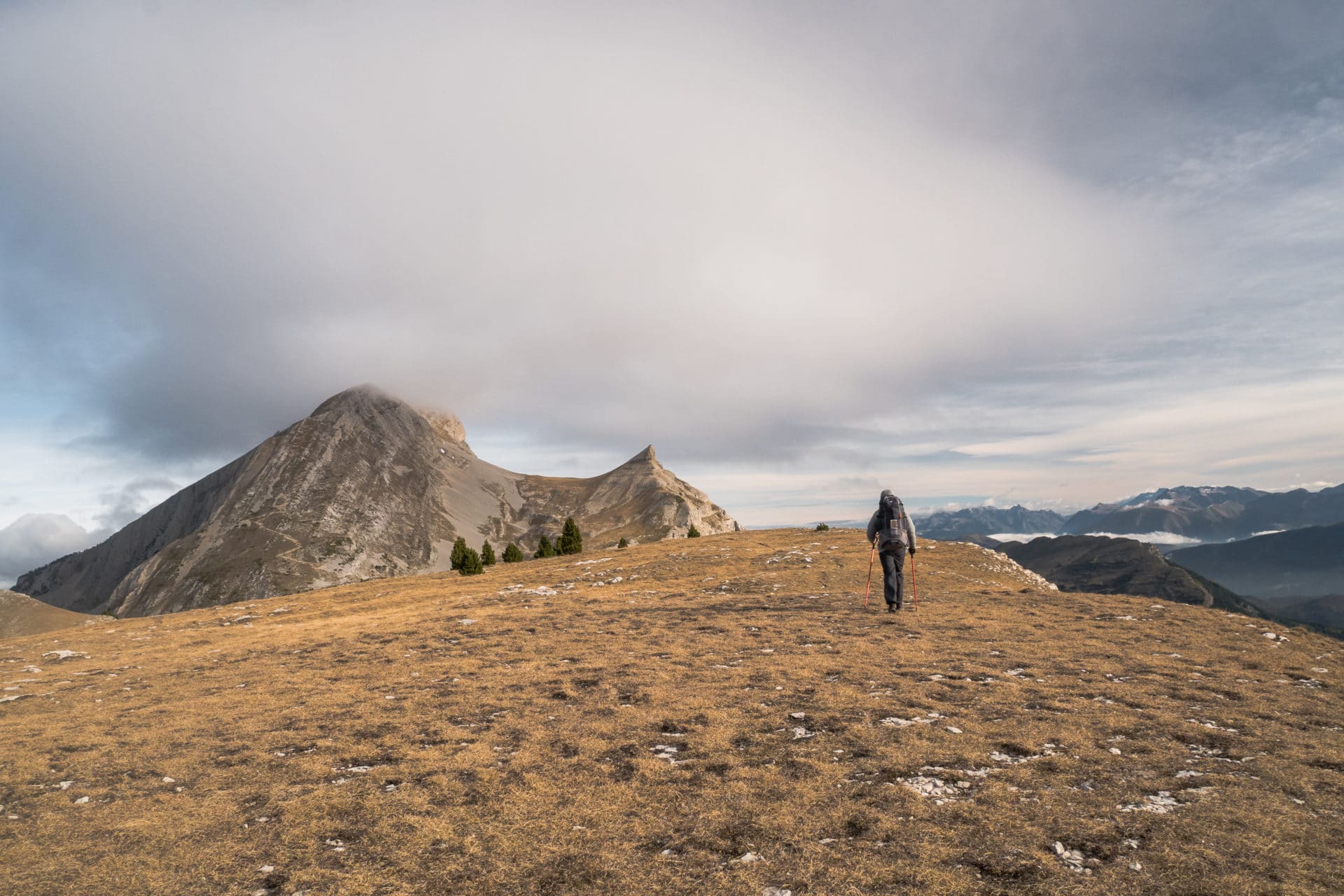
We leave after this short break a little “worried” about this water problem … we’ll see. Initially we wanted to climb up the Grand Veymont but as it is all hooded we decide to turn west and recover the GR91 earlier than expected.
We go through the Pas des Chattons (The Kittens Pass) where we expect a nice surprise! It is here that we expect a dozen ibex literally grazing on the way … We are approaching carefully so as not to scare them to the point of finding ourselves within 10m of them. It is even up to us to shift the path to pass because these gentlemen (there are only males) do not bother to move … We take the opportunity for some photos!
I had heard that the wildlife here was not very shy but at this point! As I said we are only males here, the females are higher with their young.
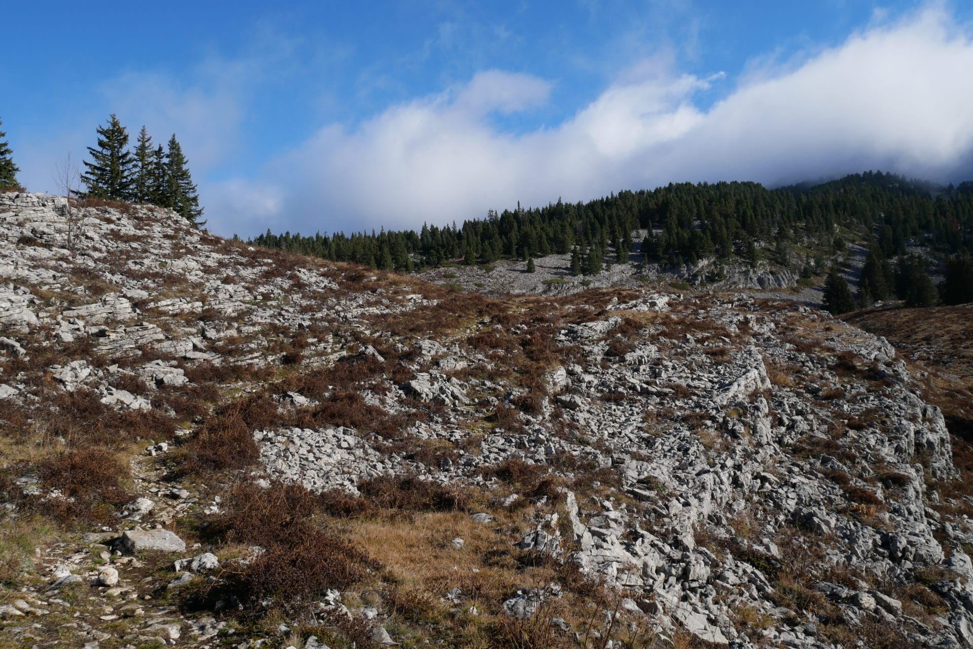
The landscape changes quickly after the Pas des Chattons. We are losing altitude, so the trees are coming back in numbers. Those are only conifers however, the conditions being always rough here in winter.
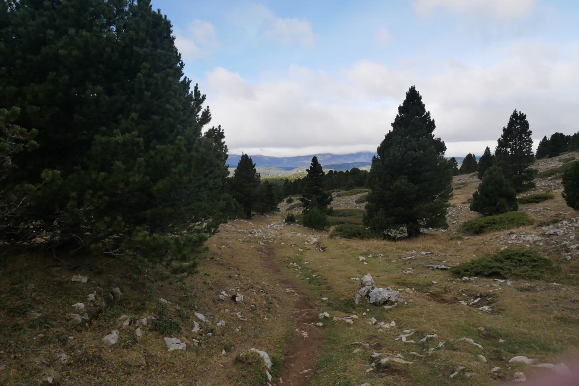
We will find, a little by chance, our first Scialet a little further. Scialets are kind of bottomless holes (at least in appearance) that are due to the very nature of the Vercors basement. Indeed it is mainly made of limestone and is therefore particularly prone to erosion by water. It is also this karstic subsoil that makes the Vercors an area so arid because the water disappears directly into the crevices of the ground. In any case do not fall in!
We reach the GR91 a little further north-east of the “Grande Cabane”. We will now follow GR passing through the Vercors from one side to the other. North direction.
We stop a little further just before the fountain of Serrons to have a break. The view is beautiful on the Grand Veymon.
We continue towards the fountain of Serrons. Even though we were told it was dry we made a 100m detour to see. And of course it does not run very well but it flows ! So we decided to fill all the bottles with good clean water (half was filled with melted snow and not very clean).
Well it takes 10min per bottle and we have 6 bottles to make … A long break in perspective, but it’s okay we are well there waiting in the sun.
9L later we resume our way with the sun in the back.
Landscapes oscillate between fairly rocky ground forest and open spaces where crossing bison would not be surprising. We move quickly, it’s pleasant. We have not met many people since we left the Aiguillettes cabin.
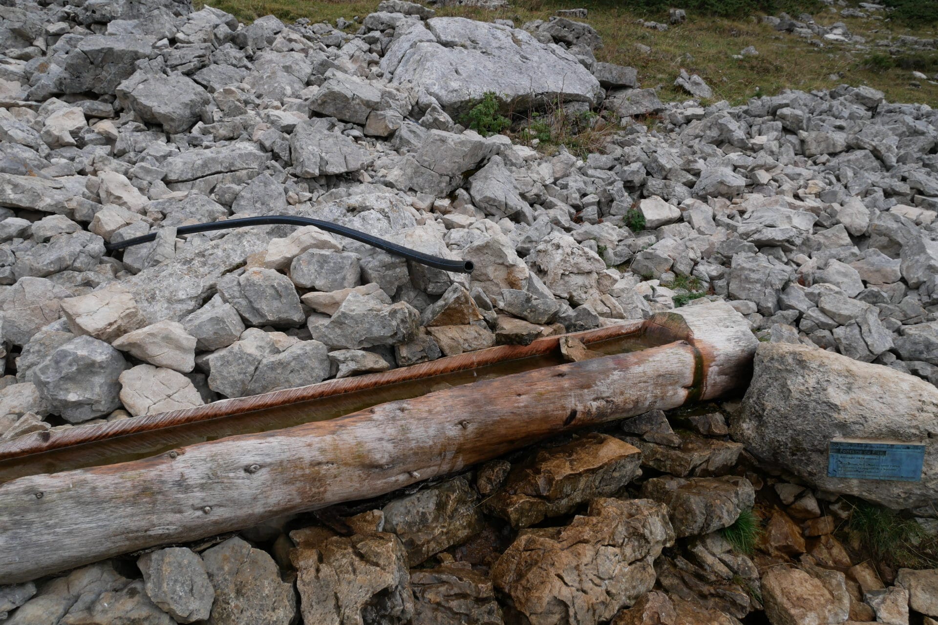
Further we cross the fountain of La Chaux which does not run almost (just a drop by drop). We recover some water that stagnates in the pipe to drink at the break.
We continue our road in the maquis for another 2km towards the fountain of Playe, we plan to bivouac nearby hoping to find enough water.
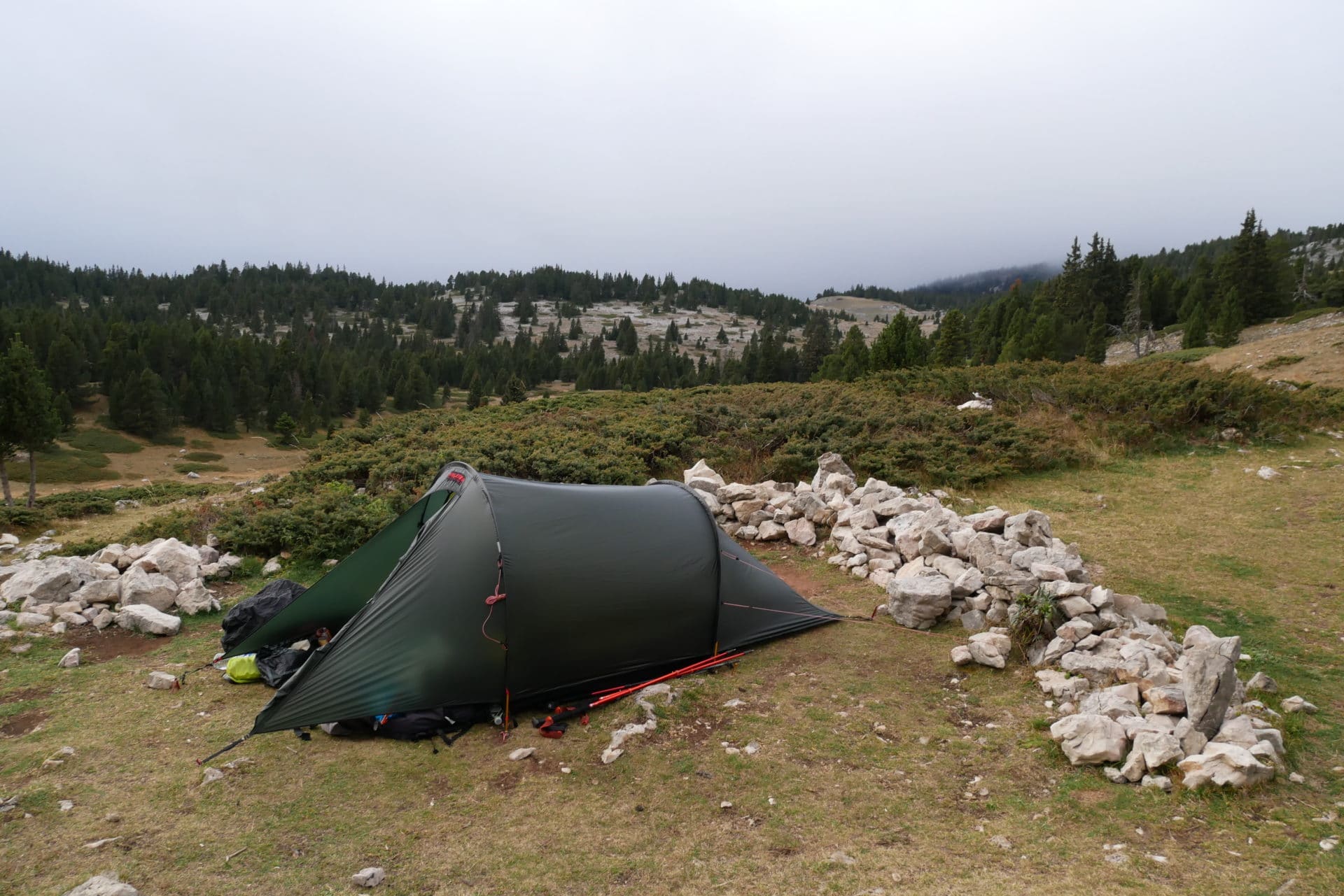
And we are lucky because the fountain still has an acceptable flow. So we will have enough water tonight to drink our thirst and cook. We set up the camp next door. The view is beautiful from here but the temperatures drop quickly with the twilight and it is windy again.
We will have a good meal rich in comparison with the day before but we will not linger outside because it is freezing tonight. Direction the sleeping bag at 6:30pm to fall asleep not long after. A nice day with a lot of diversity in terms of landscape and especially a real immersion in the wild Vercors.
Day 3 - From fountain of Playe to the Carrette's Cabin
Fresh night but no problem with our warm sleeping bags. The breakfast will be nicer than the day before because we have water. We also refuel the bottles before we leave because we will not cross other fountains and tonight we will be at the Carrette’s Cabin, so we need stock.
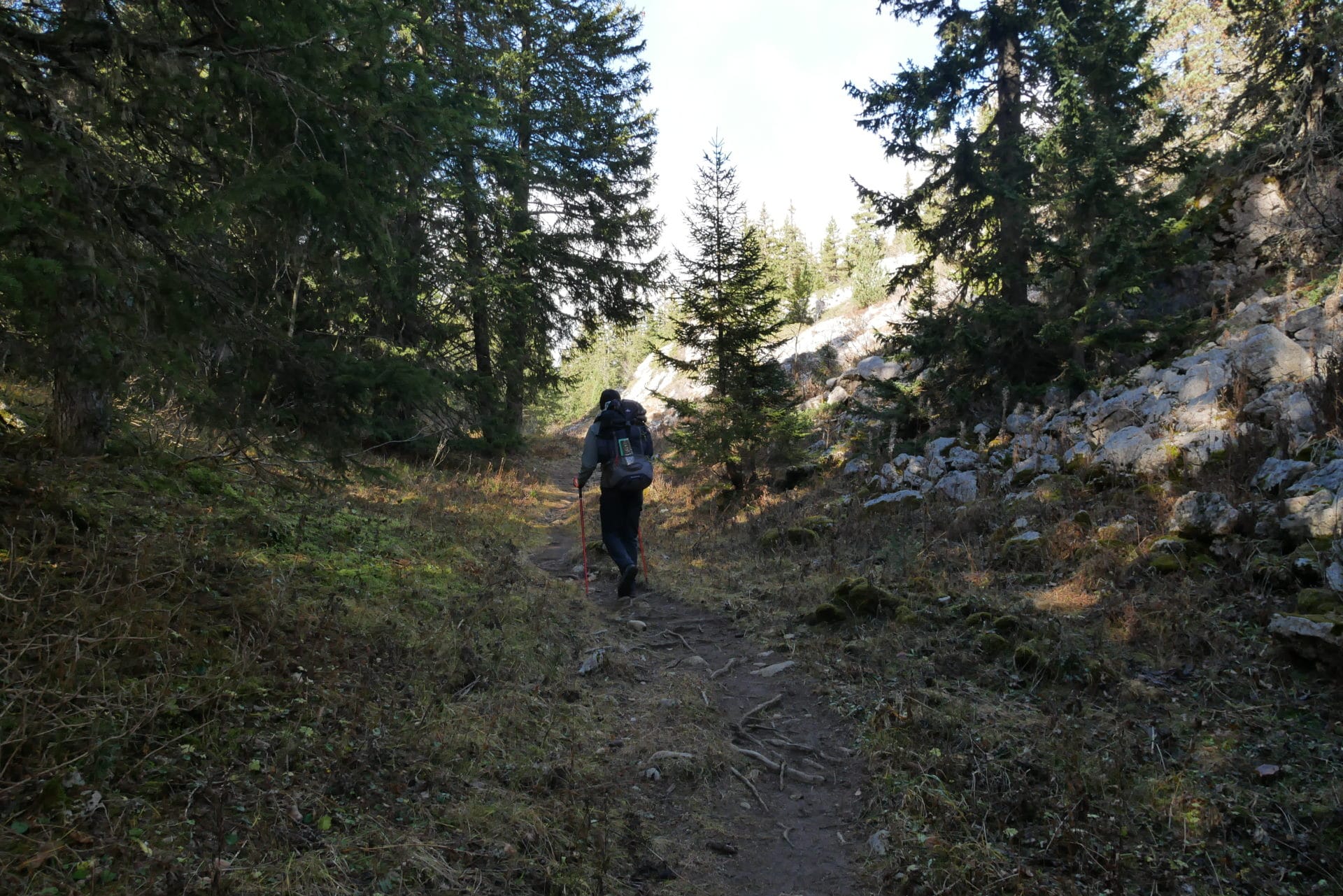
We take the road past the Cabin of the Jasse Play which exhales a good smell of fire passing by …
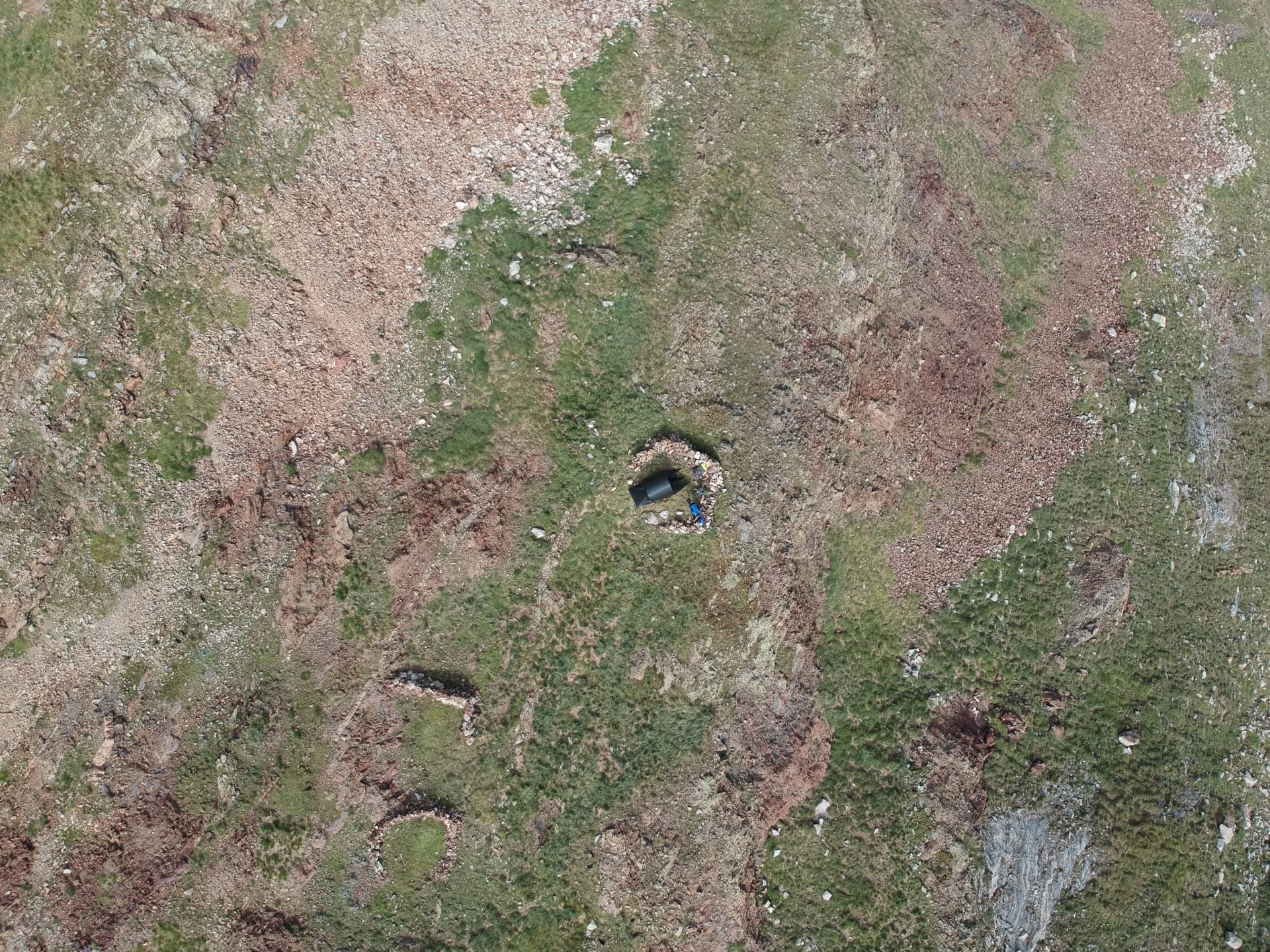
The path then continues through the forest and through small depressions. There is a pleasant maze of rocks and tree. A little further, not far from the Head of Cognaux, we overlook the forest and the rising sun offers a beautiful light. We take the opportunity to take a break and take aerial photos because we can finally fly the drone since the wind has fallen.
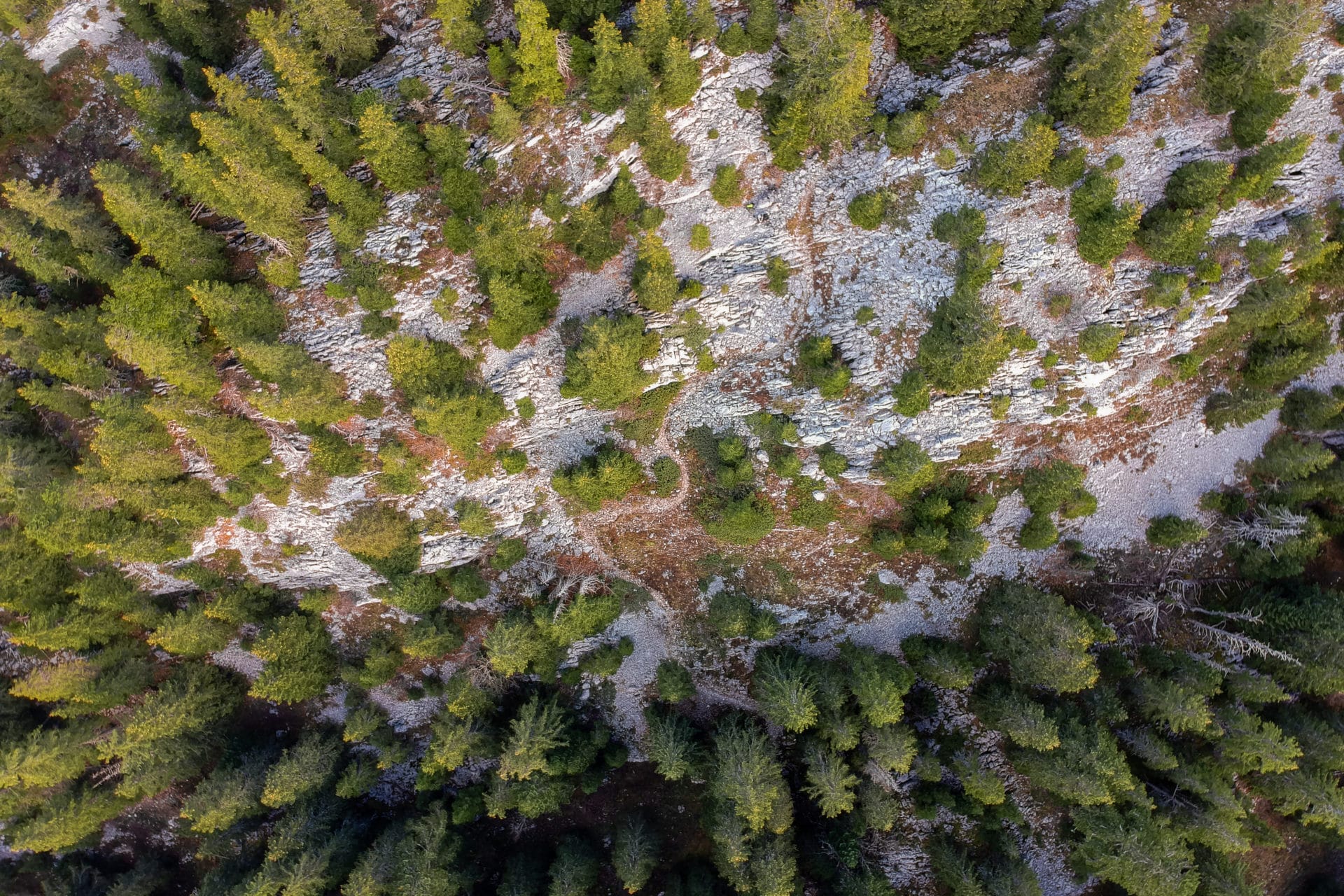
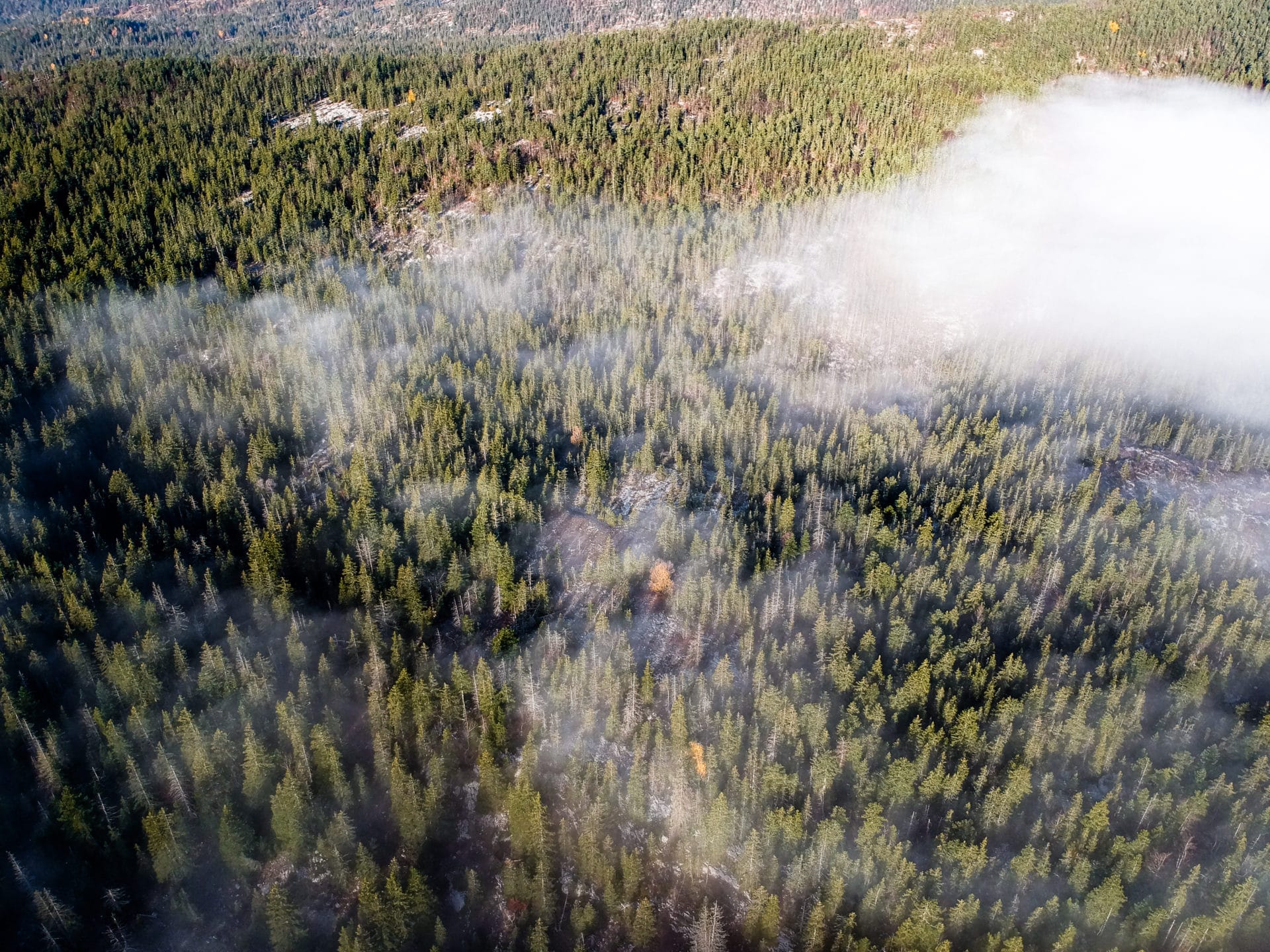
We continue our route along the GR91. The landscapes are so beautiful. The progression is fast since the day before we are on a flat downhill.
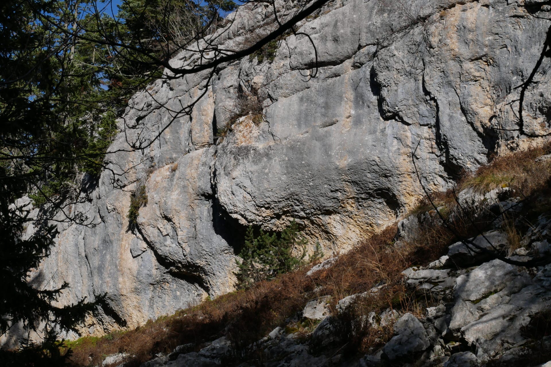
The GR91 then takes us through the Canyon of Erges. So it’s not the Grand Canyon either, but it’s original, the trail is steeped between two cliffs of about 20m high with sometimes some organic shapes.
Small meal break not far from the “Pot du Play” after crossing the canyon. We have lost a little altitude since this morning and it is felt by the presence of more and more numerous hardwoods.
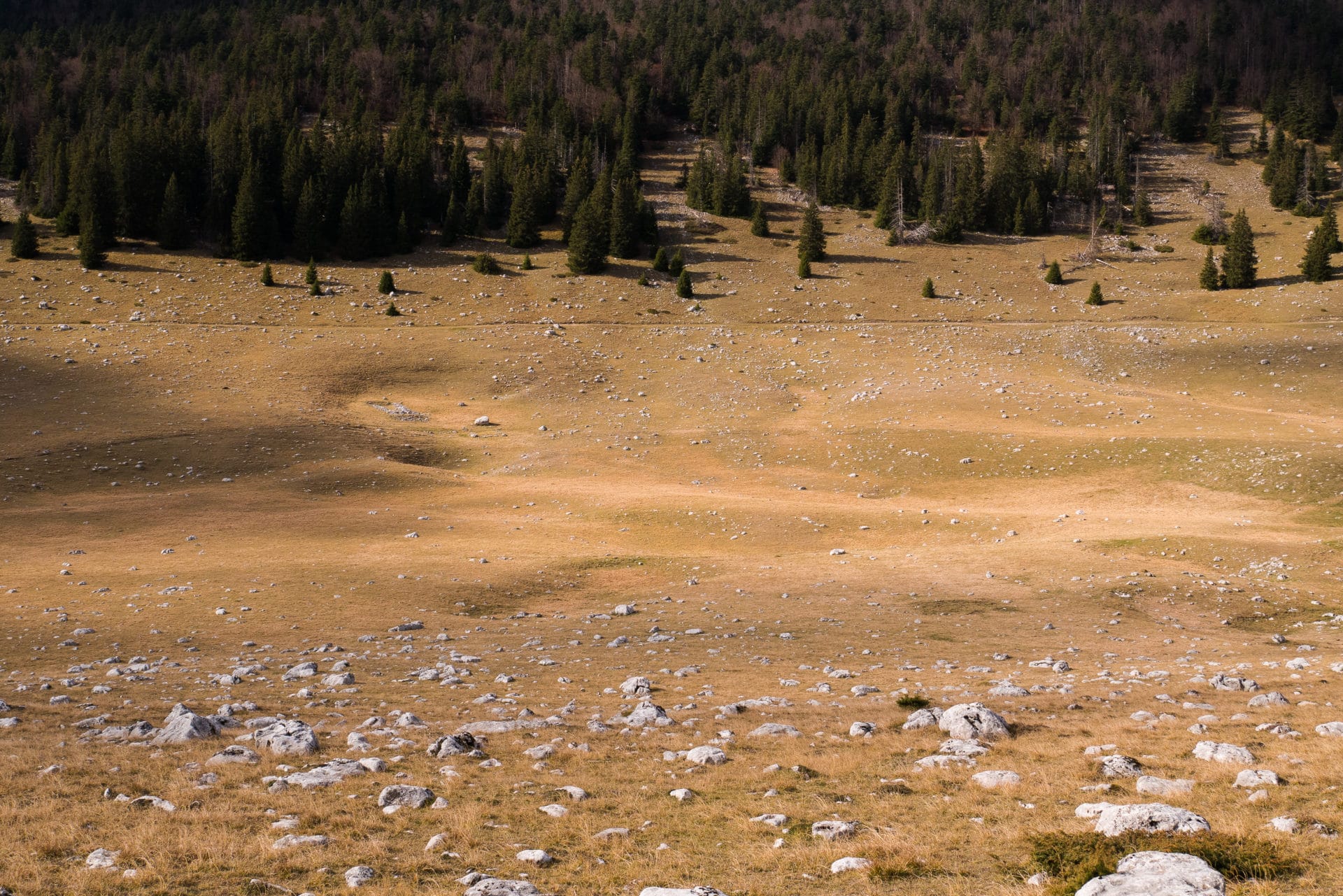
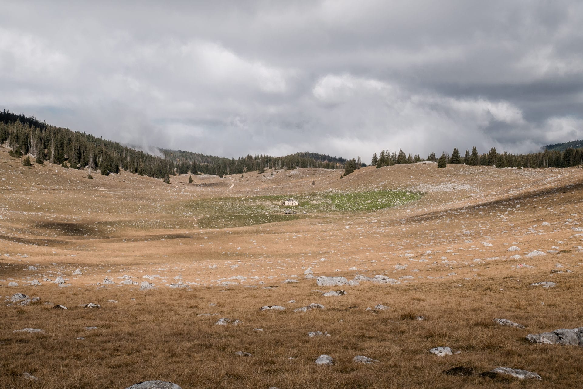
We then quickly reach the plain of Darbounouse. I find this place beautiful especially when we are there because the clouds created games of shadows on the ground, quite beautiful. It’s like being in the American Great Plains and we would not have been surprised to see a herd of bison grazing.
Photo shoot to immortalize the moment.
Back in the forest we do not have much distance to the Carrette Hut. The weather quickly turned gray and temperatures dropped in the process.
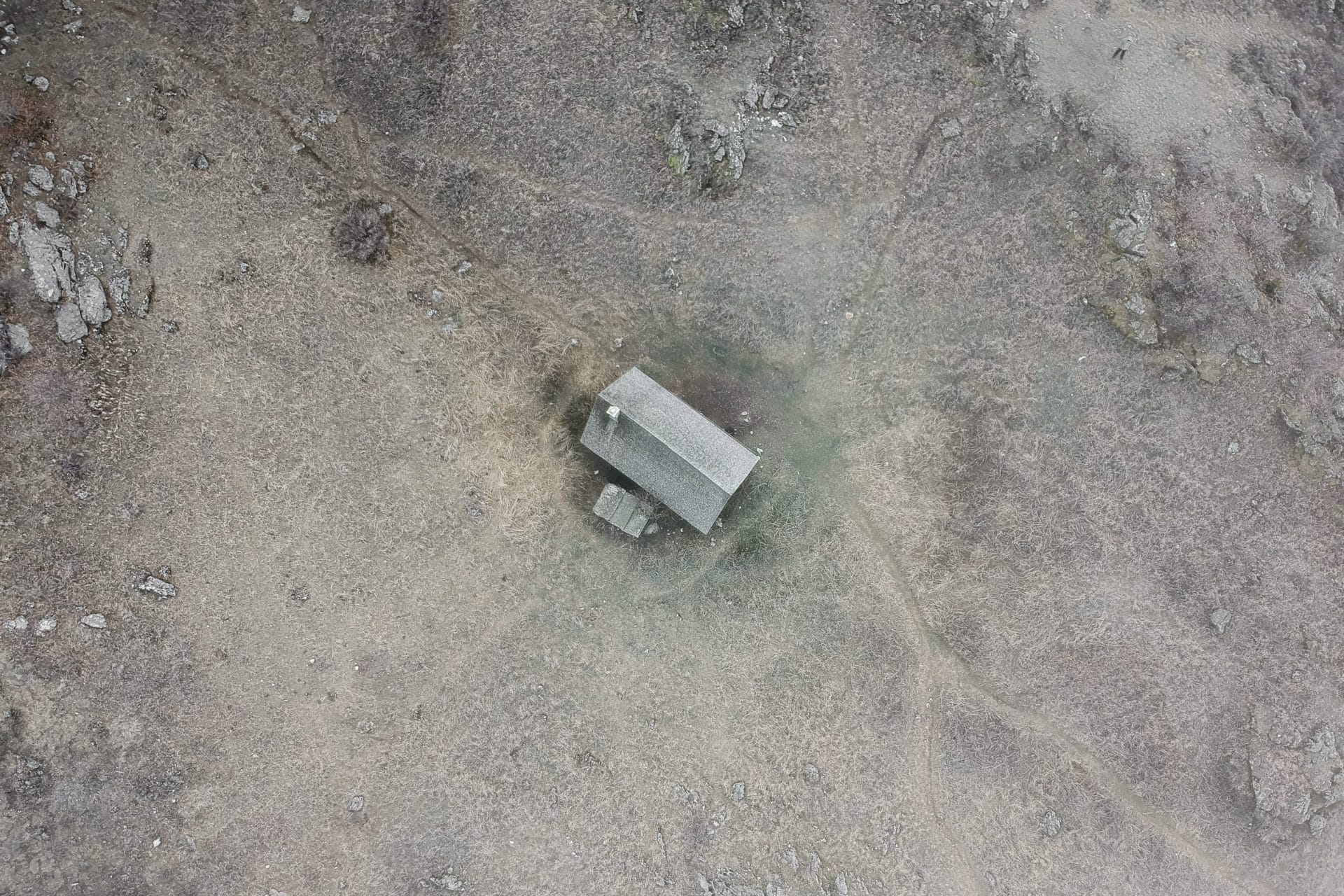
We arrive relatively early at the cabin which is nestled in a small depression east of the road. We could have continued to Corrençon but we wanted to enjoy this last night in the forest.
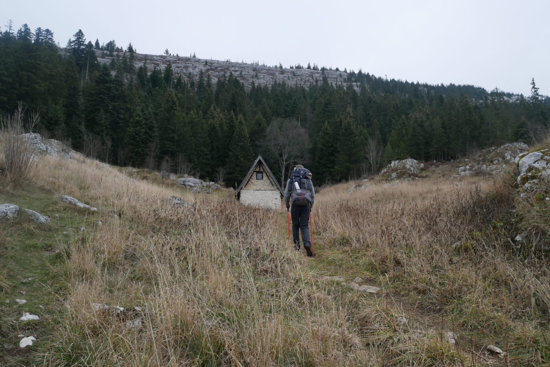
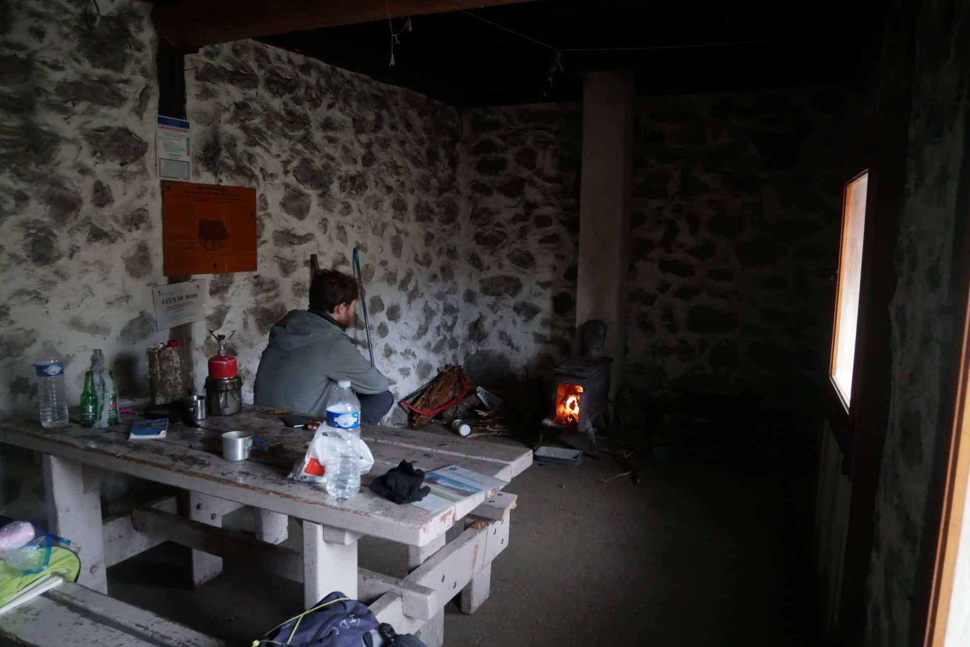
The cabin is already occupied by a mother, her daughter and a friend, we share a tea before they go back home.
Since there is a small stove, we will look in the surrounding woods if we can find some dead wood but the harvest is poor. This may help to gain some few degrees …
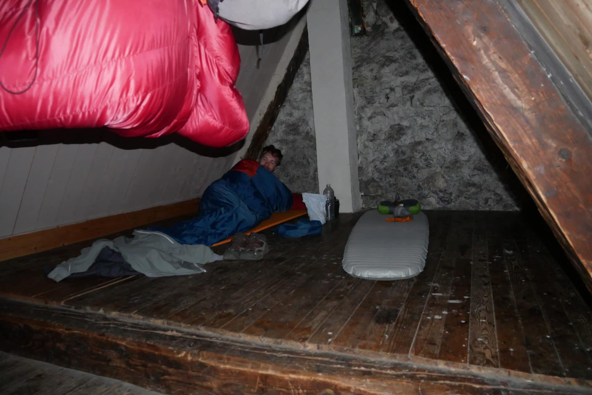
The hut could not be more simple: a rectangular hold with a stove in a corner and a table in the middle of the room, at the bottom a staircase leads to the floor, a simple wooden floor, intended to sleep. Without being clean is not too dirty either, it will be fine for tonight.
Our loneliness is quickly interrupted because two travelers arrive: a girl and her little brother who also come to spend the night here.
The hour passes quickly and we are already at the meal where we share our food. The stove heats very little and we are not unhappy to be 4 to warm the cabin a little.
Unfortunately, we will not stay at 4 because one of our acolytes did not feel good at the end of the meal and they made the choice to go back to their car because they felt the need to see a doctor quickly … Too bad and not nice for them because they came from far …
We are back alone. We enjoy the end of the evening calm and cold in the light of the candle! Bucolic!
Early sleeping, tomorrow return to civilization.
Day 4 - Arrival to Corrençon and back to Home
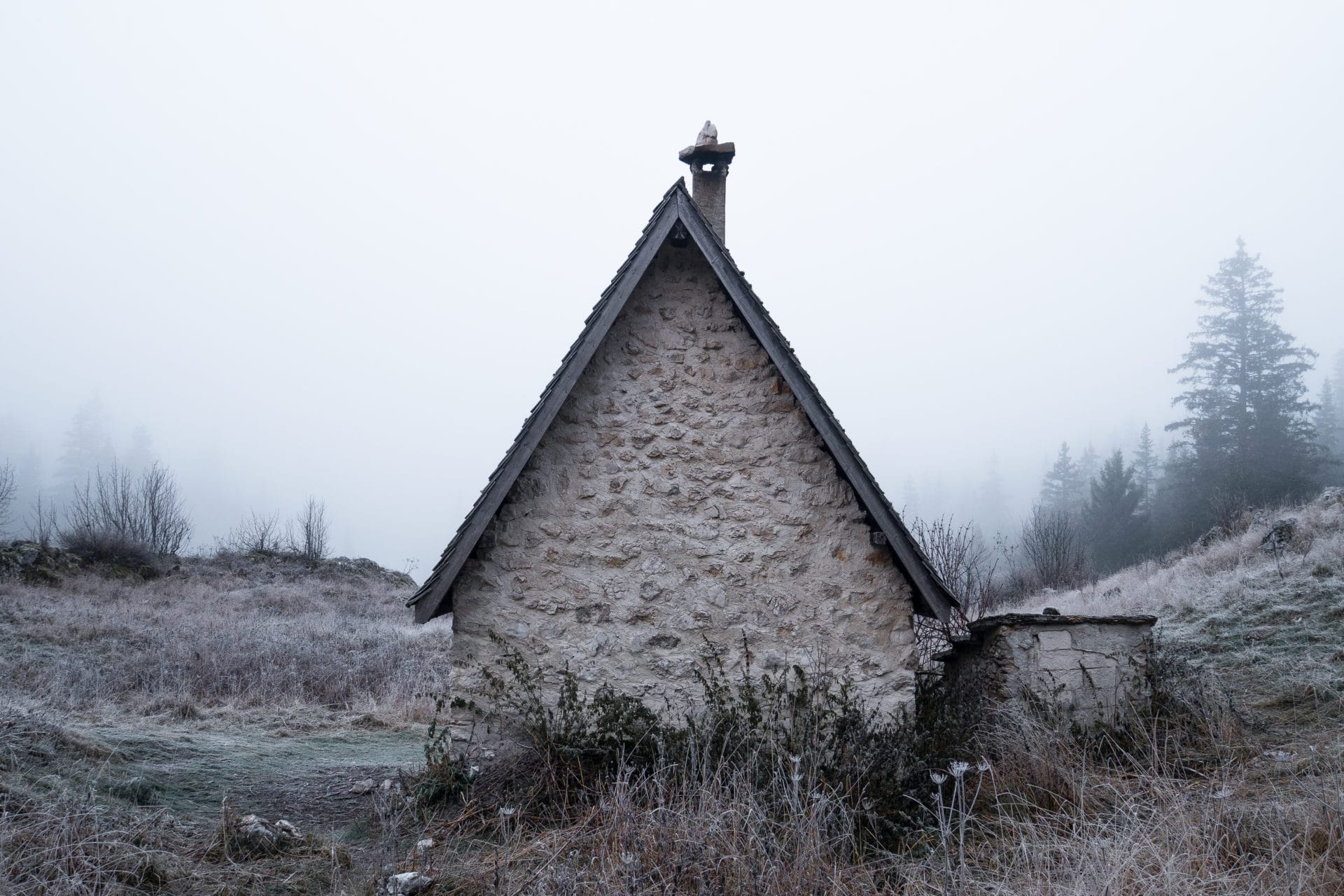
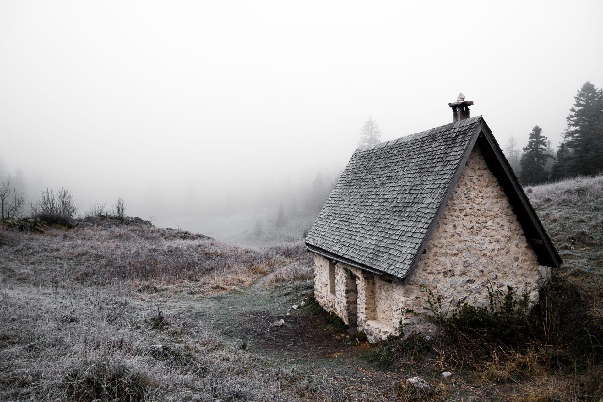
We did not sleep badly even though it must have been cold outside as evidenced by the beautiful frosty landscape that awakens us.
Let’s start the day with a photo session:
After breakfast, we continue to admire this morning show outside and in aerial view:
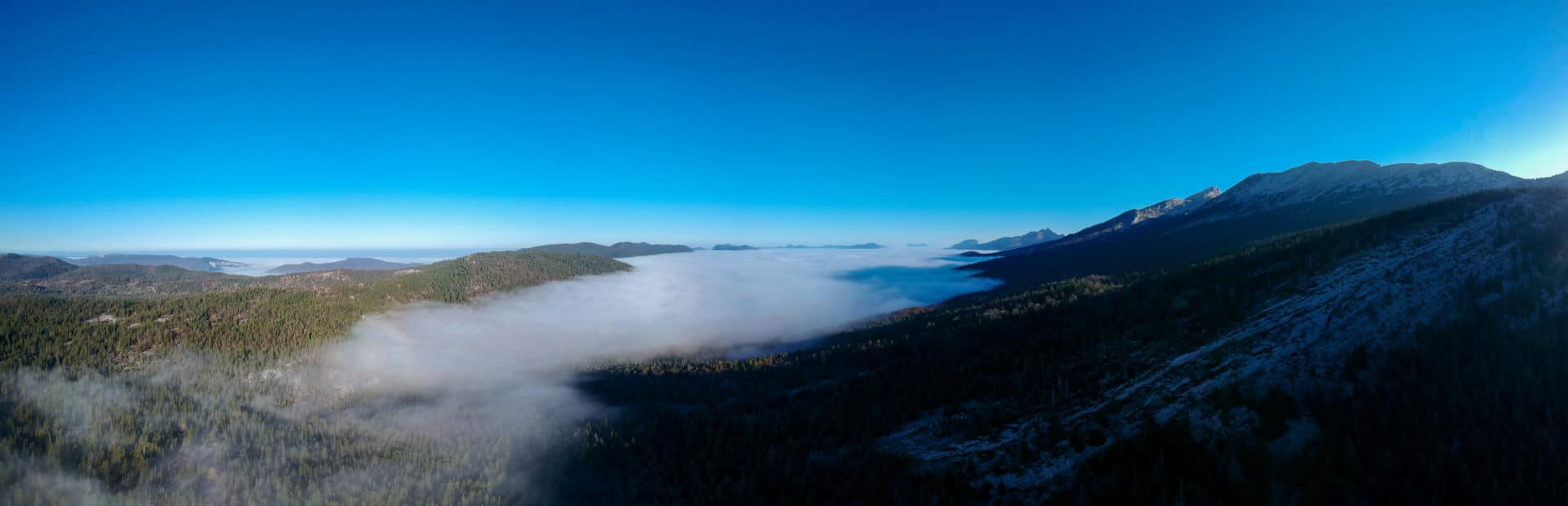
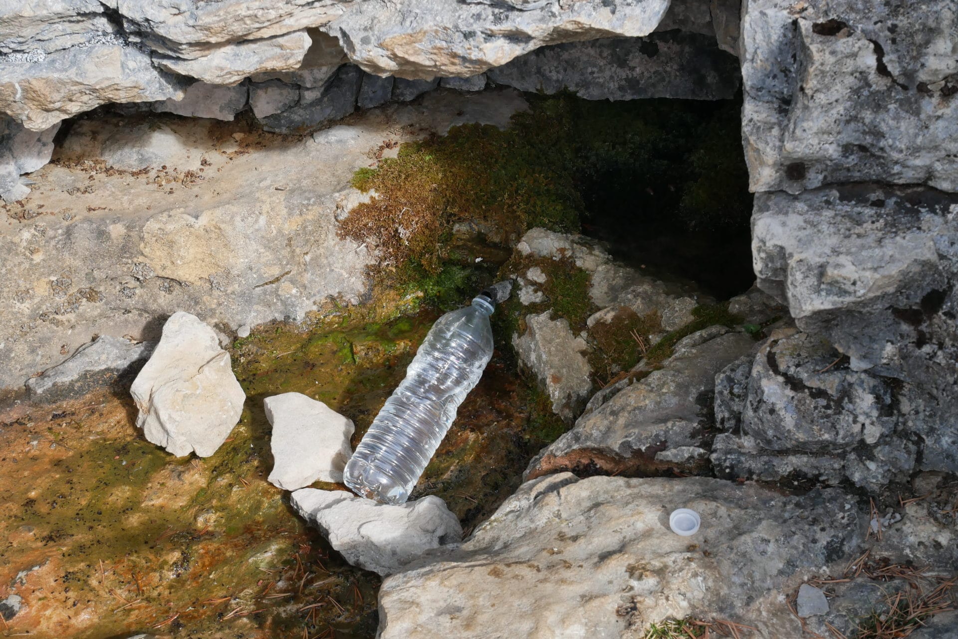
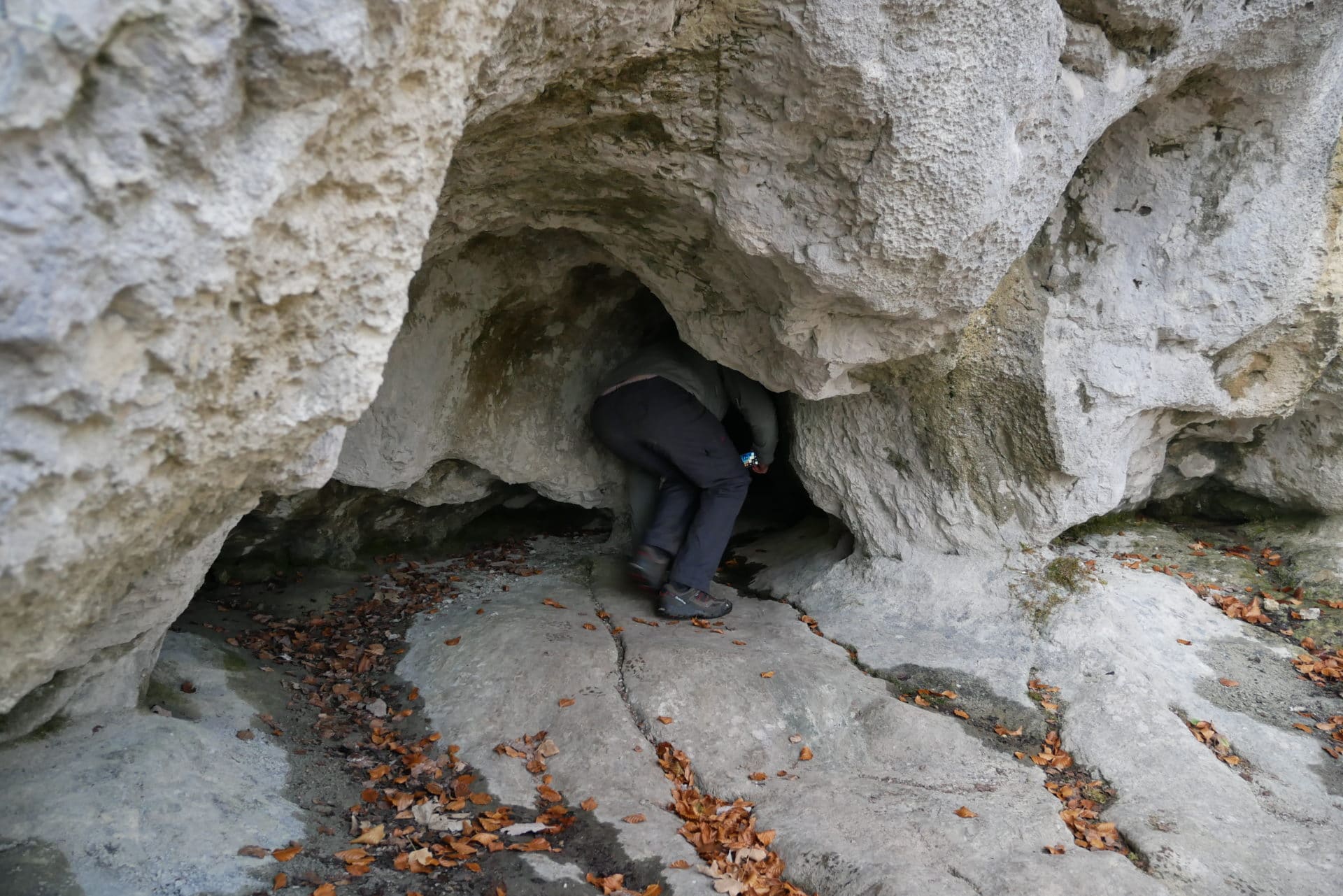
Past this contemplative moment, we fold the bags one last time, we then leave, to ward Corrençon-en-Vercors. But before that we make a small detour through a cave not far from the hut that houses a spring.
It is found after some hesitation. The place is quite nice and especially practical if you need water.
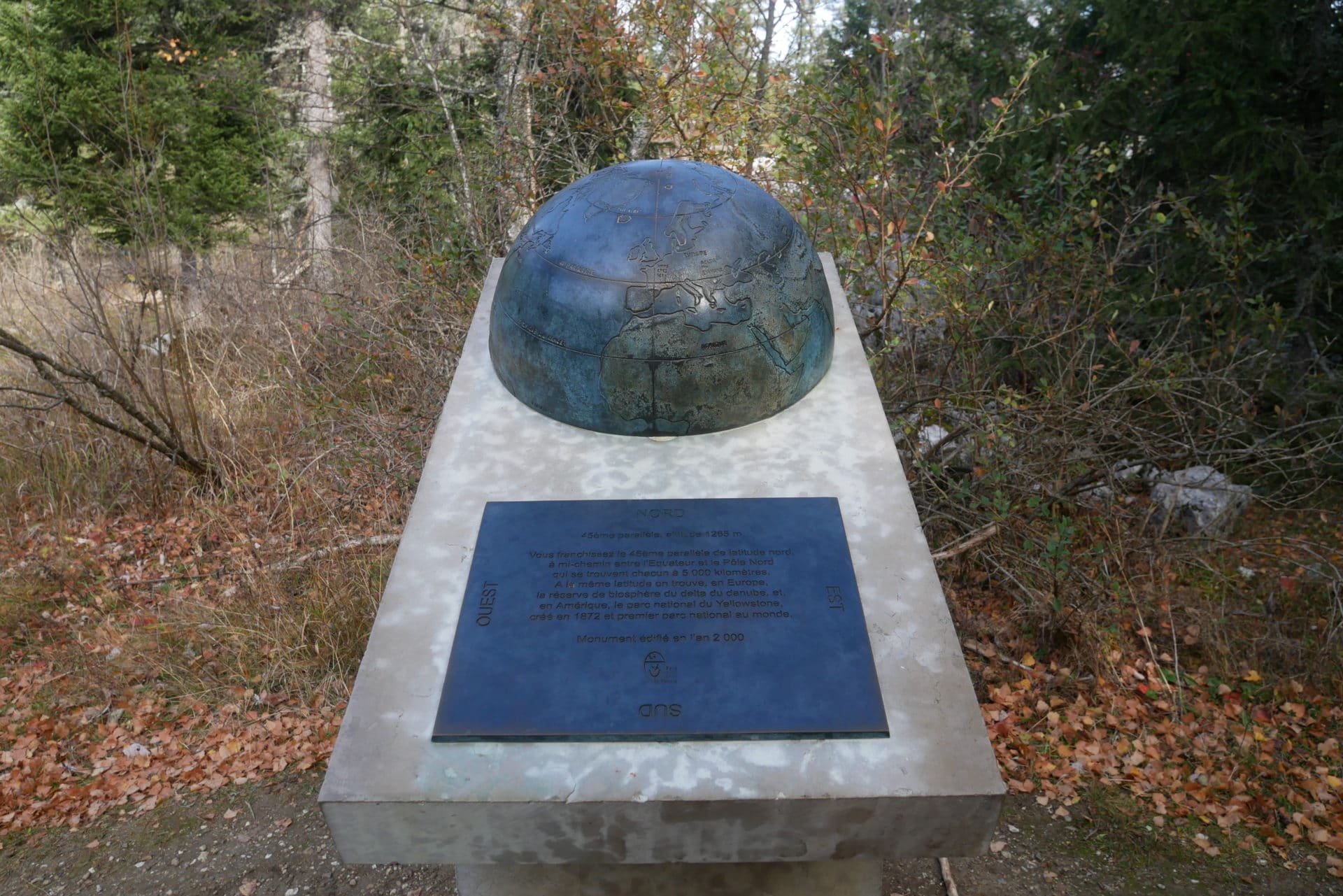
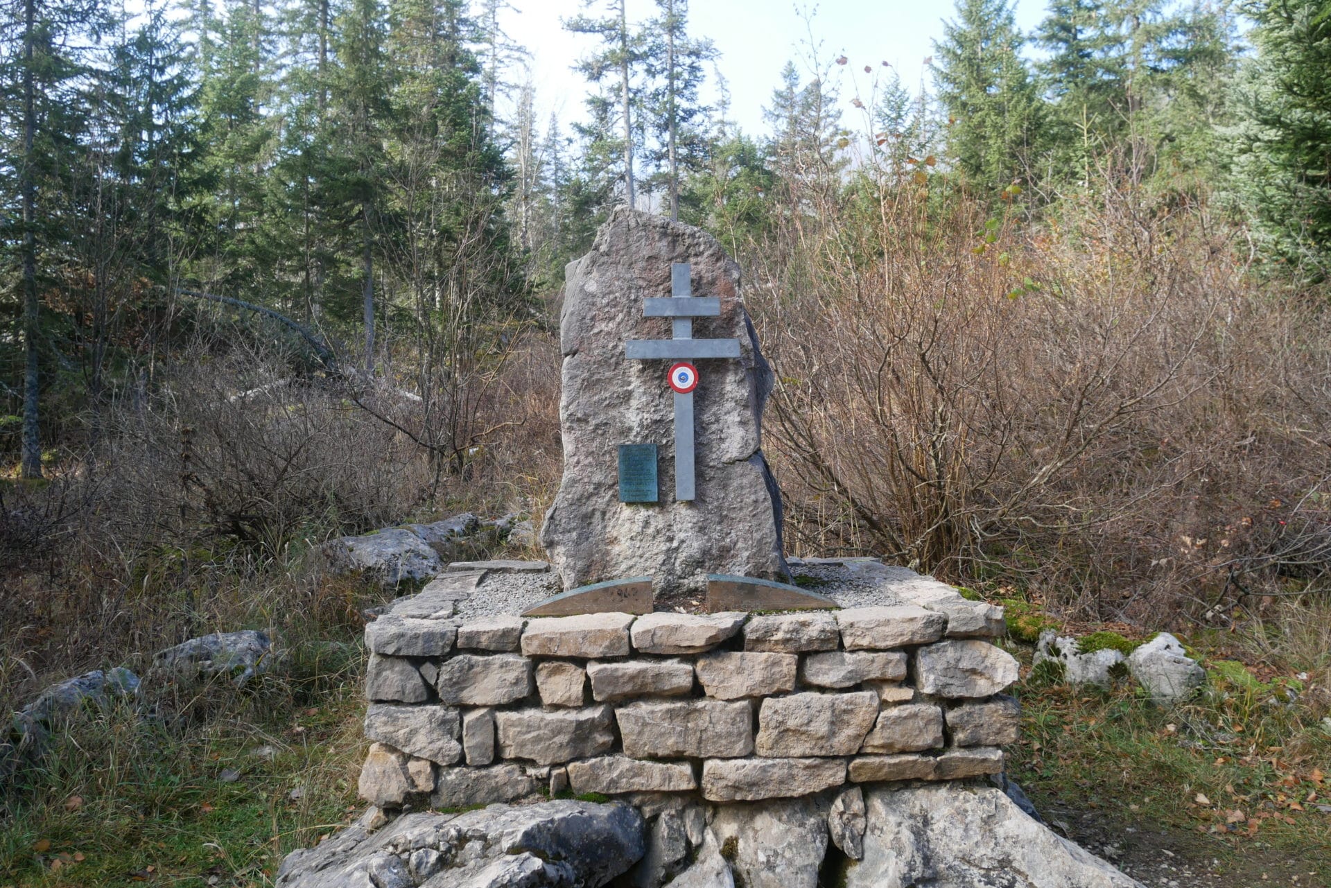
We then take the direction of the village. The path goes through a double place of interest : the 45th parallel mark that symbolizes this latitude and a monument to the memory of the Vercors guerrillas because the High Plateaux were a place of the Resistance during the Second World War.
The path that follows takes us back to civilization. It becomes almost drivable and meanders between golf and cross-country ski circuits … We arrive in Correçon-en-Vercors shortly thereafter.
Jeff will push to Villard-de-Lans on foot but I hitchhike on my side because I have a knee pain that has appeared since yesterday …
Villard, which is quite nice as a city, marks the end of the trip, a bus ride to Grenoble and train to Paris and here we are at home …
Conclusion
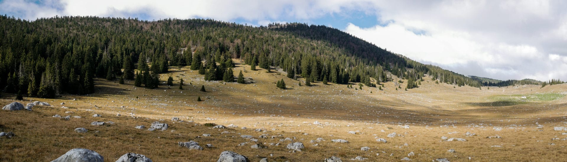
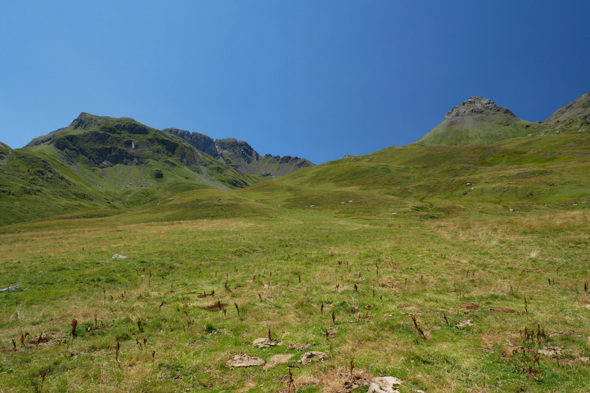
The Vercors will have kept its promises: what an extraordinary place! Only 1 hour drive from Grenoble and so isolated. There is really a feeling of end of the world here. I was particularly surprised by the variety of landscapes and their staging, in only 100m of altitude one passes from the grassy plain to the forest then to barren lands.
The hike itself is really nice and accessible. The only point of attention is the water, it is necessary to inquire a little in advance but there is this site to know the state of the fountains: Link.
I advise you to go discover this beautiful corner of France as well in summer, autumn or even in winter ski touring or snowshoeing.
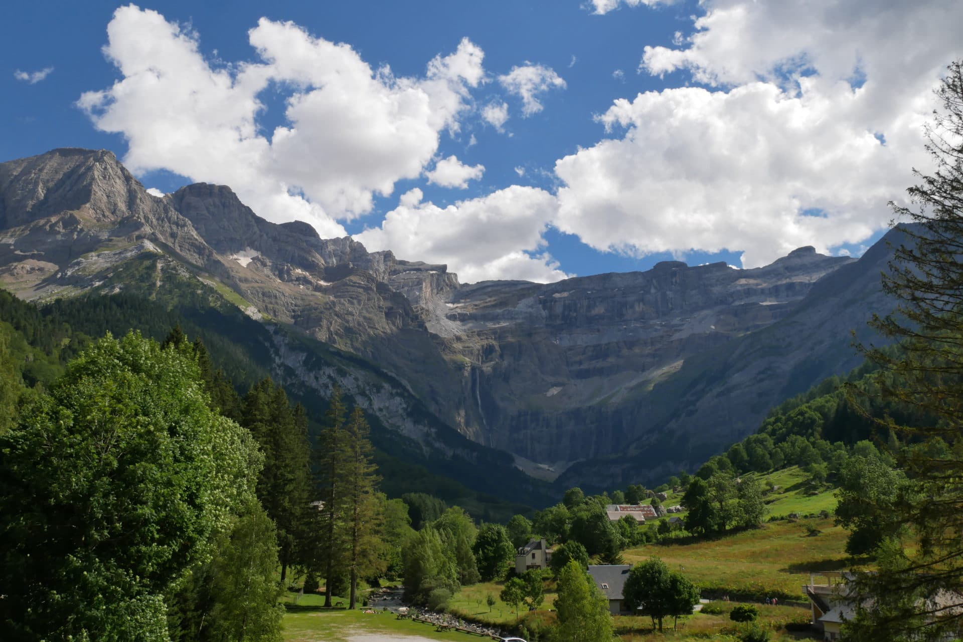
From Cauteret to Gavarnie - French Pyrénées
4days
trekking
40km
walked
2750m
D+
2days
raining...
It’s been a long time that we wanted to discover the Pyrénées and in particular the National Park (Link to the site of the Park). We took advantage of our summer holidays to hike four days from Cauteret to Gavarnie. A short trek between lakes, refuges and sumptuous passes.
Day 1 - from Cauteret to Lac d'Estom
We arrived the day before at Cauteret. The city is friendly and very active. It also has the advantage of being easily accessible by train (with bus at the end). Last restaurant and especially last night in a bed before starting 4 days in the mountains.
Note on the duration of the hike: we chose to go slow during this trek and enjoy the mountain. Some days, especially the third, are relatively short but it’s good not to have to run. The crossing must be feasible in 2 days I think by walking at a good pace.
So we are ready to go up to Estom Lake this morning. The weather is gray and it is not very warm. We reach the beginning of the path that is near the intersection of the Avenue du Mamelon Vert and Avenue Charles Thierry (GPS coordinates: 42 ° 53’17.7 “N 0 ° 06’58.2” W). The beginning of the path climbs above the city in the undergrowth. We are accompanied by some morning hikers.
The section to La Raillière (1050m) is not very interesting, we follow the road a little higher on a path “civilized”. The arrival at the thermal establishment immerses us in a real crowd. This is the starting area to the famous Gaube Lake. On our side we fork to the climb of Lake Estom, there are still a lot of people with us.
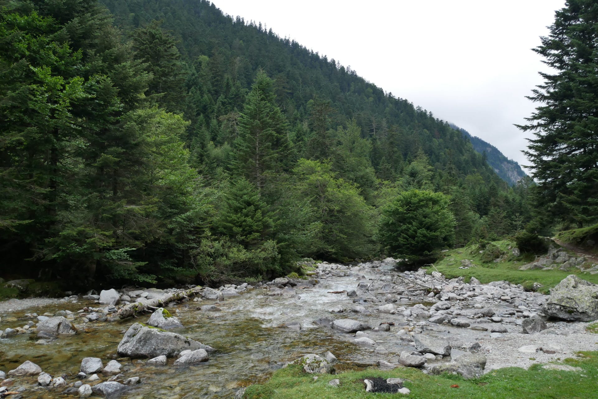
The vegetation changes little by little, there are now less hardwoods and more conifers. We follow the Gave de Lutour, the landscape is nicer now but the sky is more and more threatening …
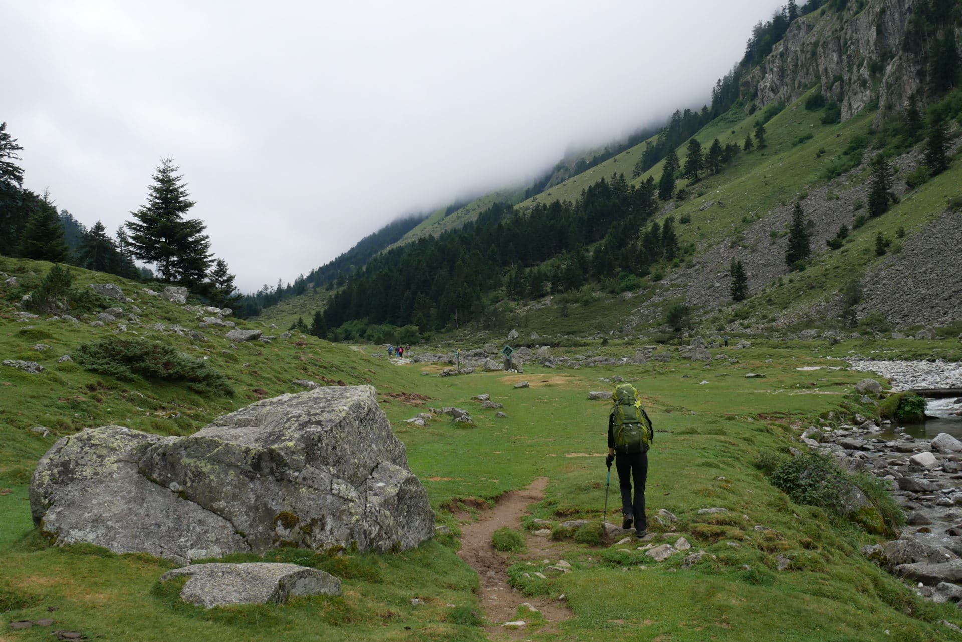
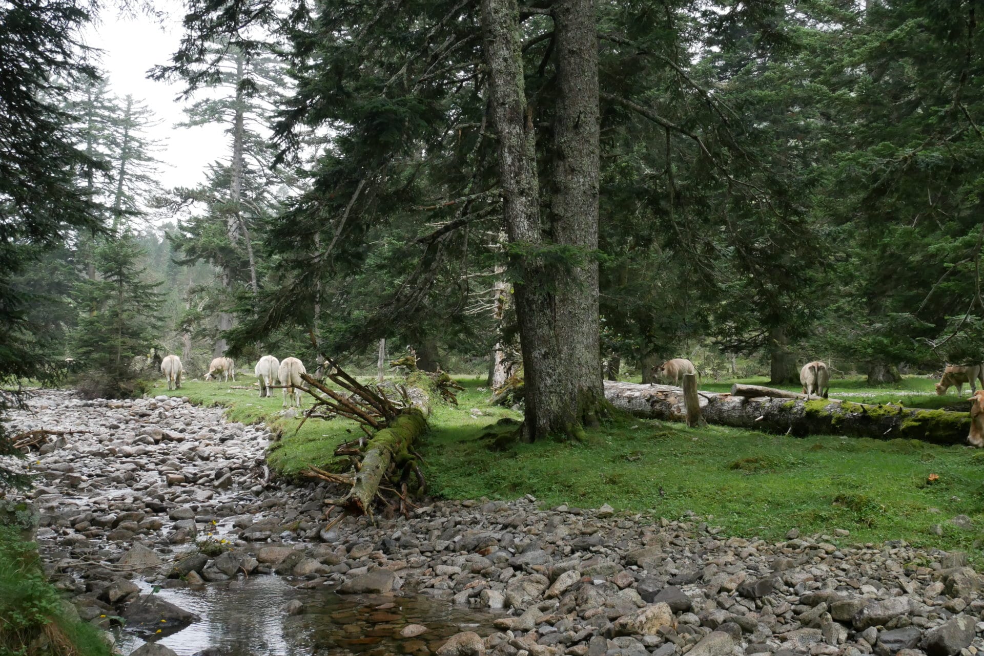
After some time we pass the Fruitière which marks the end of the road. We finally reach less “civilized” areas. We will stop a little further to have a snack next to the river and with a herd of cow for the animation. He still has a lot of people on the way.
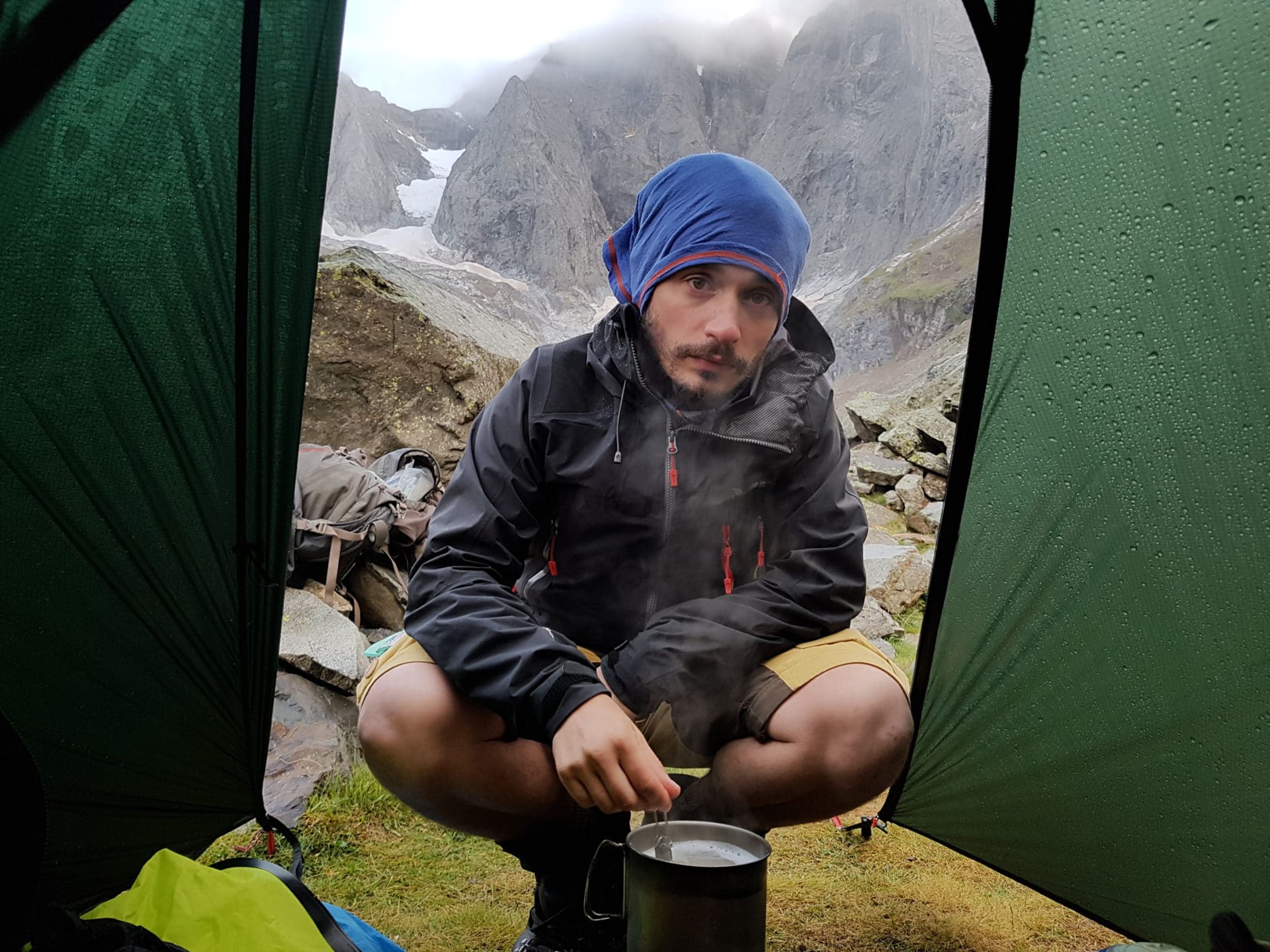
The end of the climb to the lake will be in the rain. This portion will be long, it’s our first day of walking for a long time, the bags weigh and the weather does not help. Under the sun the mountain must be beautiful but in this case it does not benefit too much.
We will take advantage of the small Refuge to warm up a bit with a tea. They are full tonight, so we will sleep under the tent. We pitch it a little under the refuge to be sheltered from the wind tonight. It’s not too bad even if it’s never fun to bivouac in the rain but it’s part of the game …
In the end, a good first day with the necessary elevation and weather conditions unfriendly … Hope that tomorrow will be better, we’ll see.
Day 2 - from Lac d'Estom to the Oulettes de Gaube passing by the Col d'Arraillé
A good cold and wet night as we like … The alarm clock is not very pleasant this morning and we would prefer to stay warm in the sleepingbag but we must go …
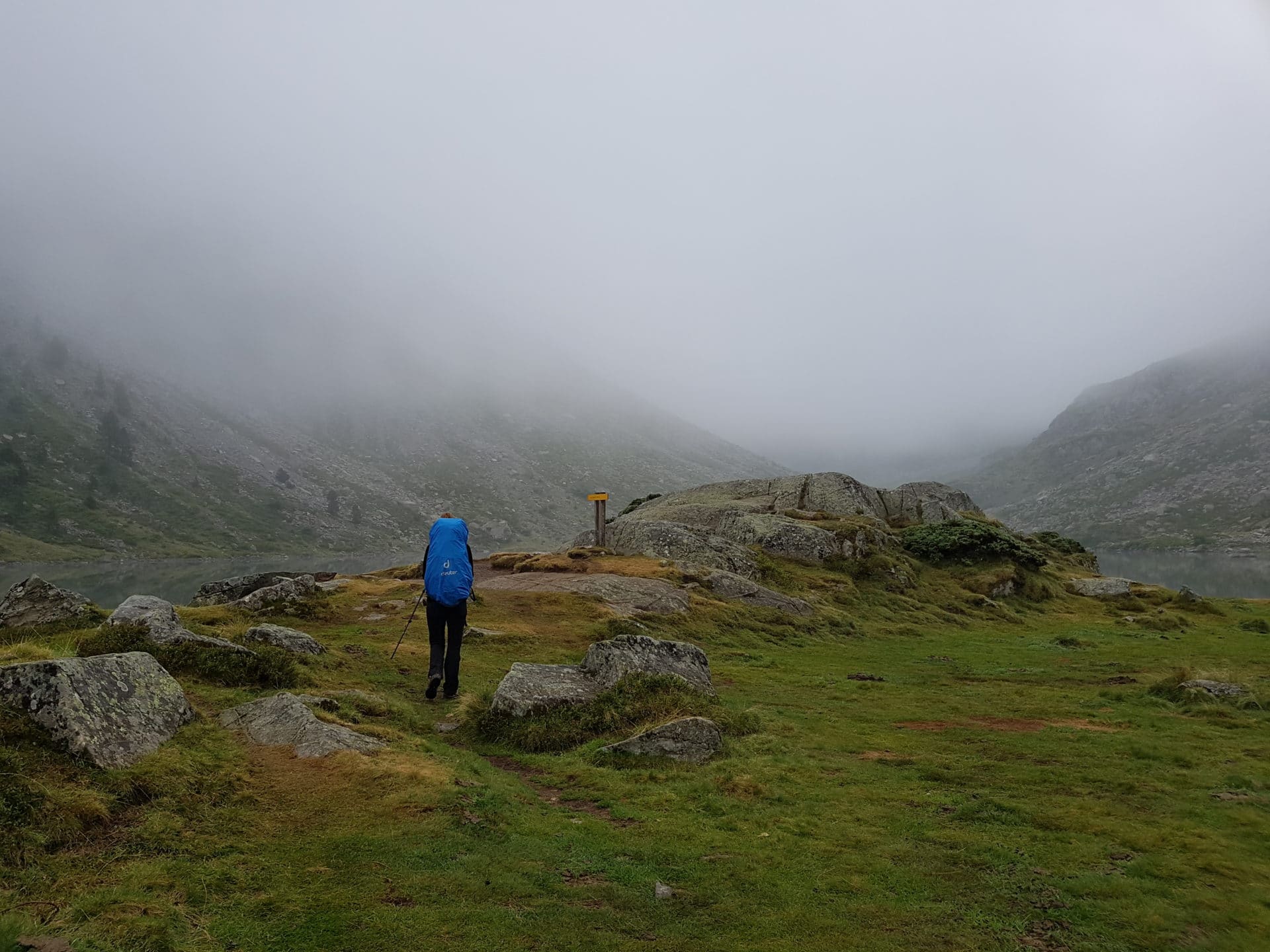
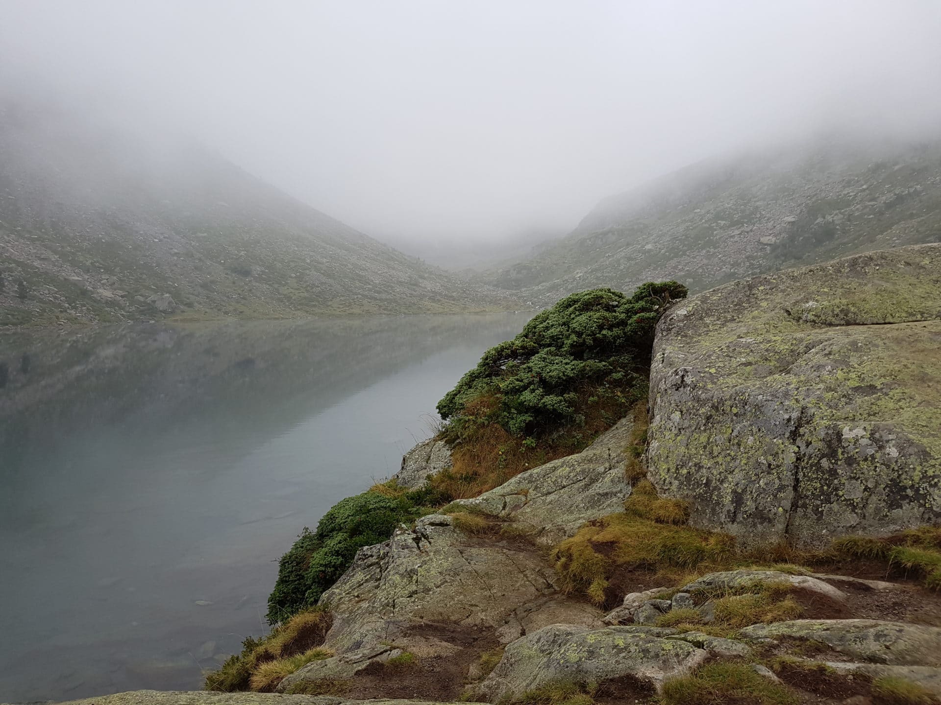
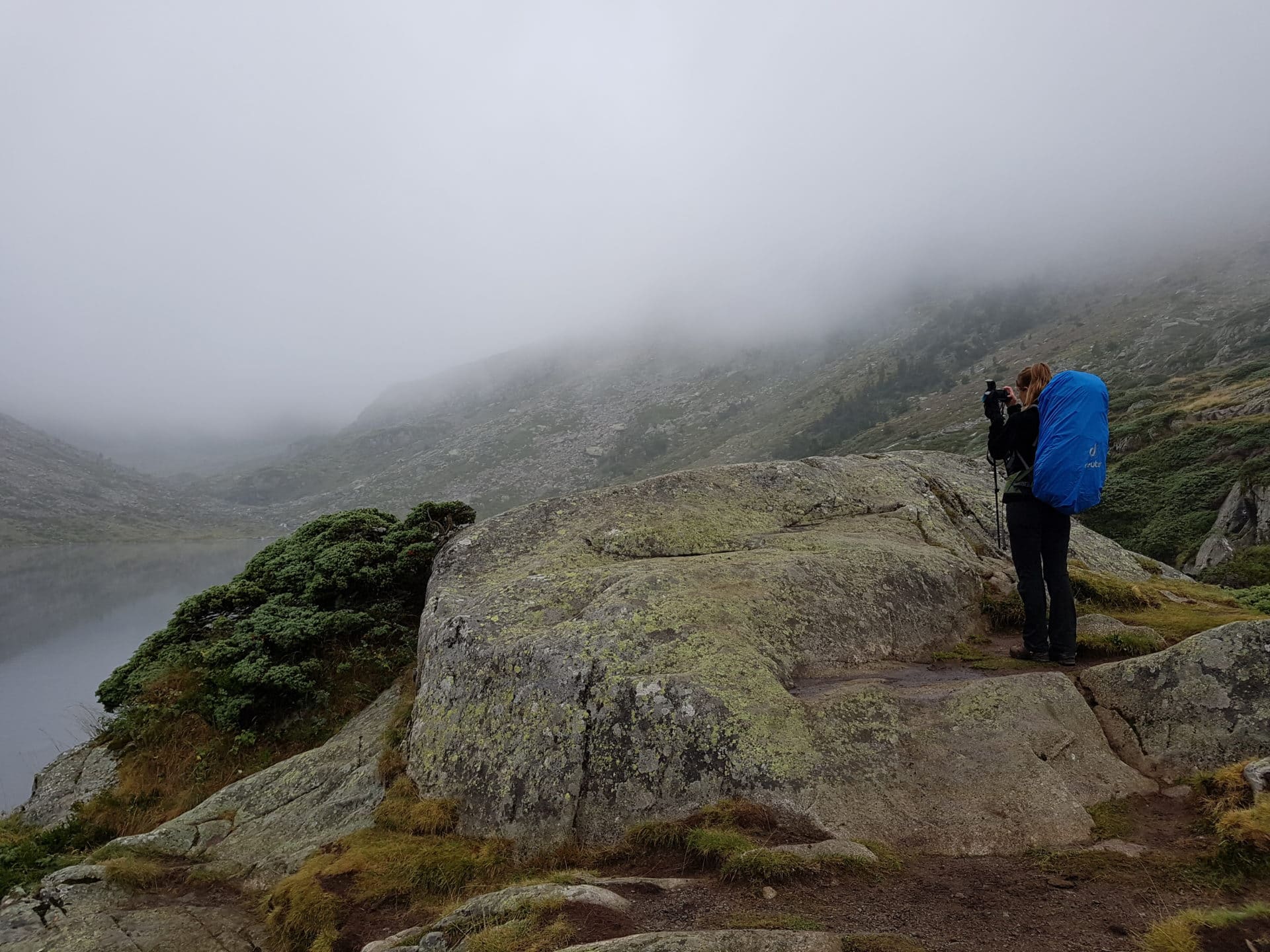
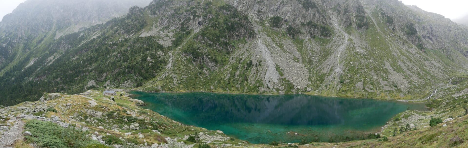
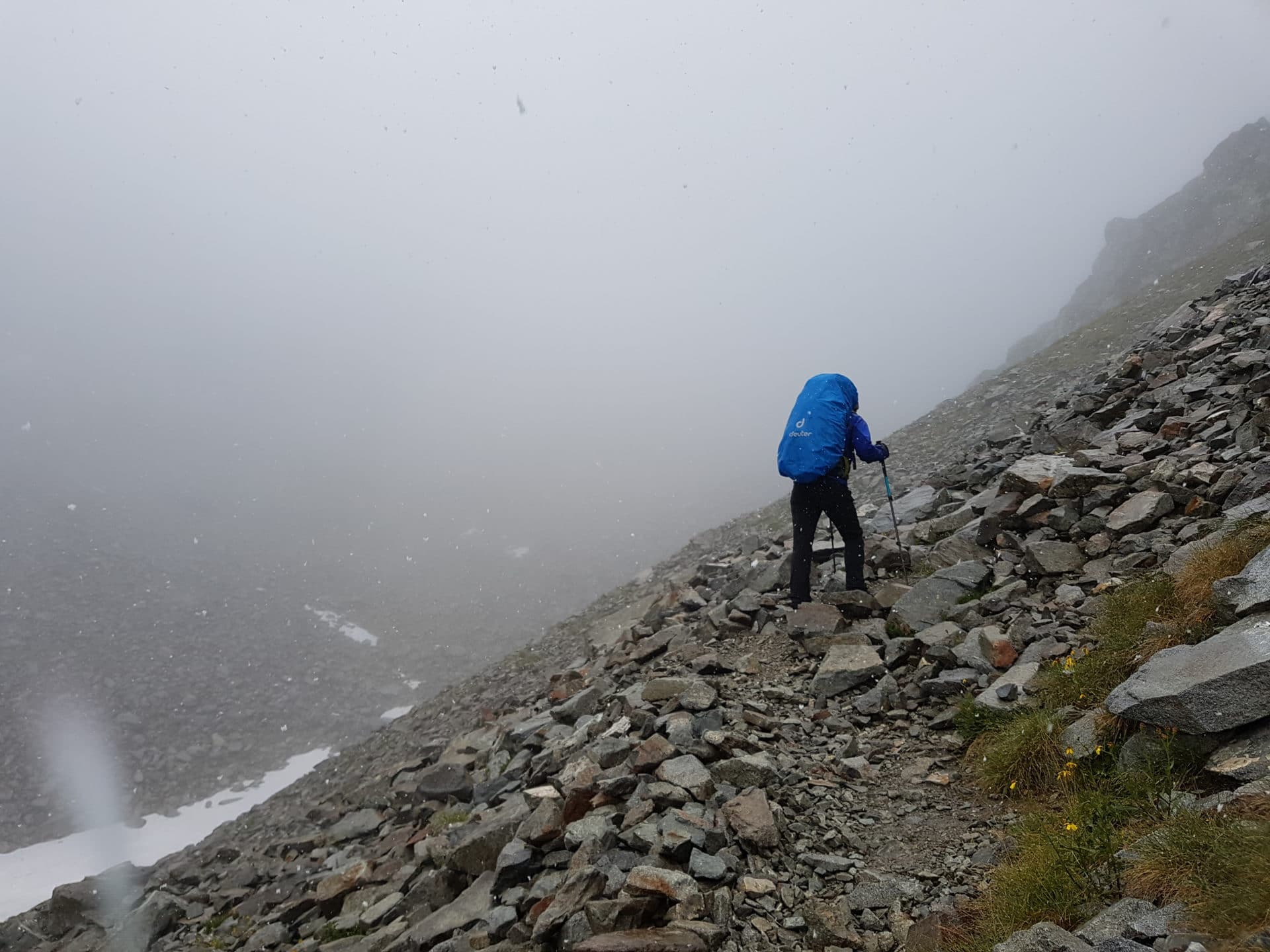
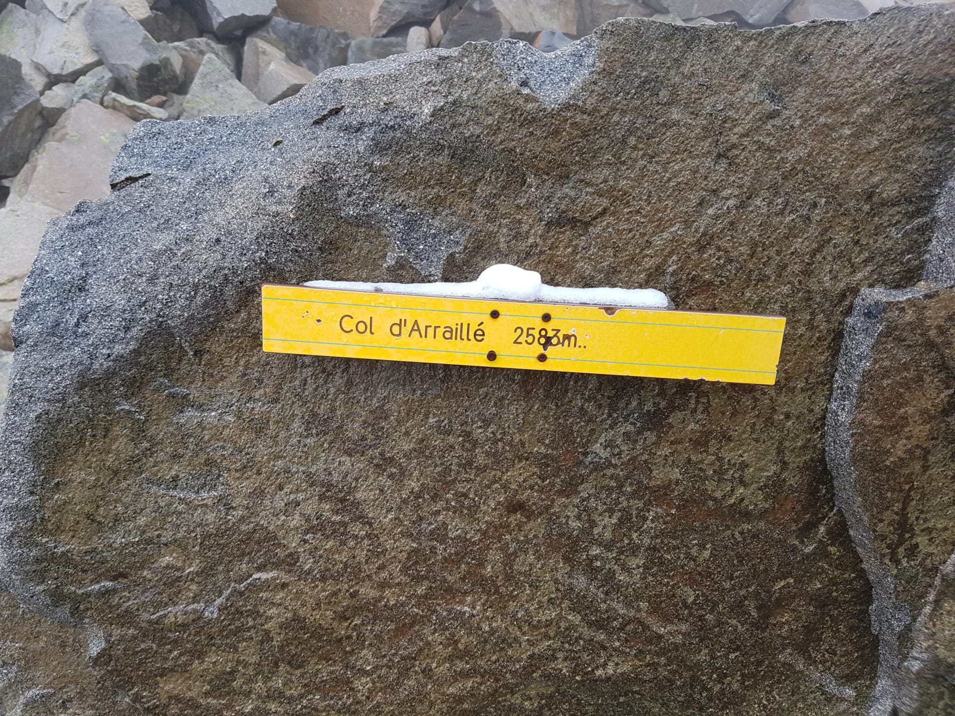
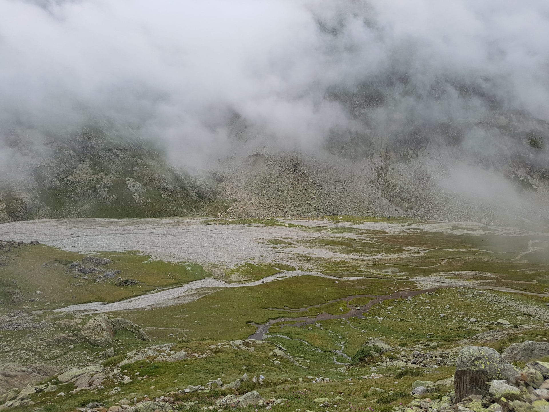
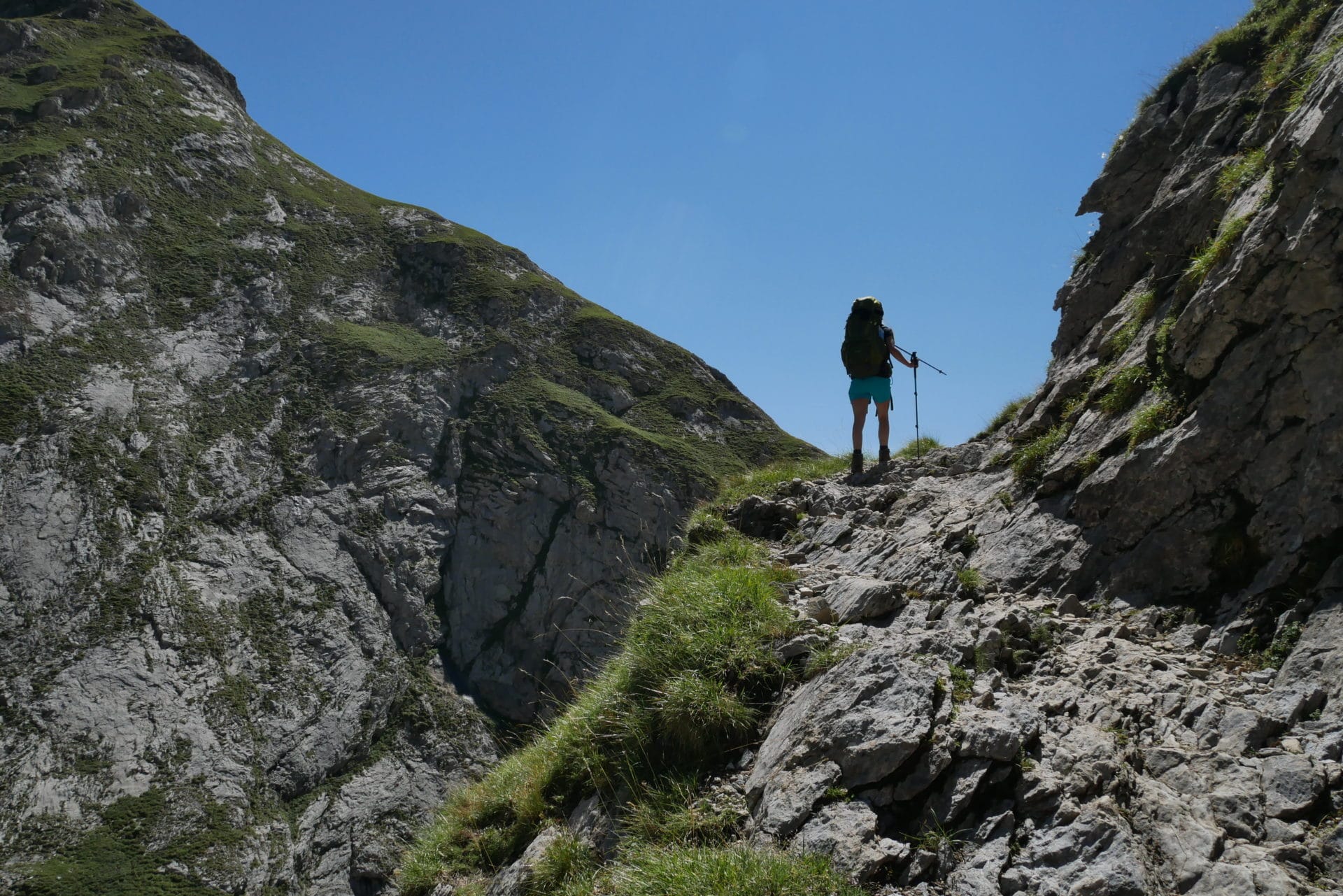
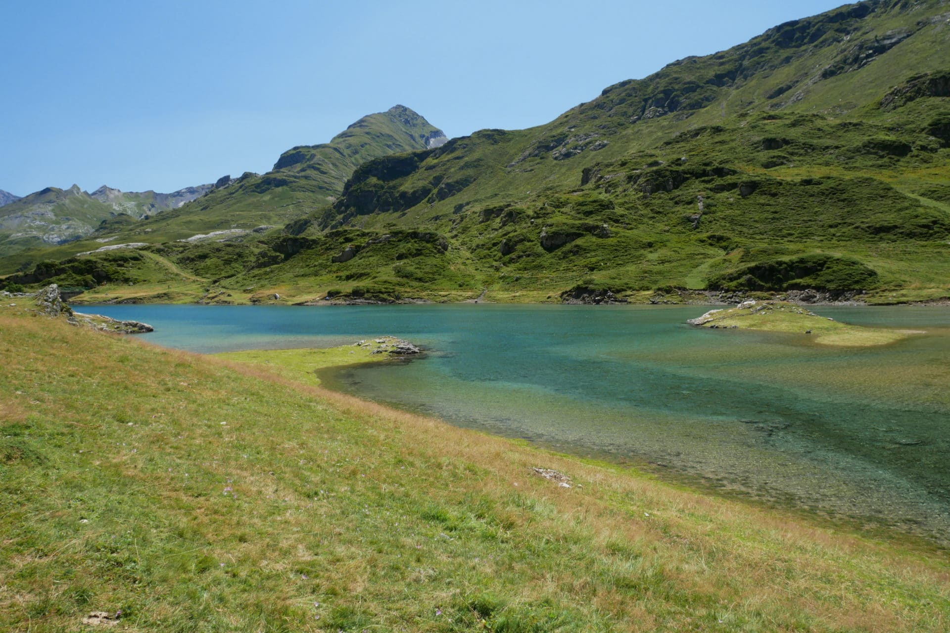
It is not raining for the moment but the sky is totally covered and gray. Once on our way we attack the climb to the Col d’Arraillé (2583m), the trail offers a beautiful view of the lake with green waters.
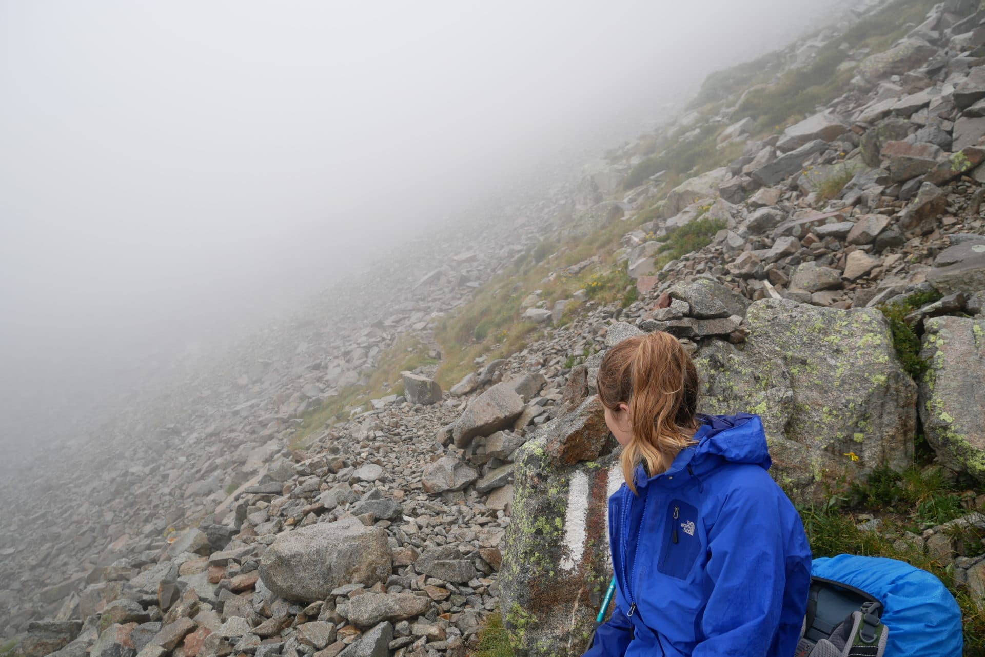
The weather is deteriorating as the temperatures drop, we quickly find ourselves in the fog and the few people we meet tell us that there is fresh snow in the pass … Quickly, we will be under our first snowflakes … The atmosphere is gloomy, we have not slept well, it is now really cold and it snows at least August … the Charm of the Mountain!
We finally arrive at the Col! The climb has seemed endless with this weather … It has a little bit of snow at the top but nothing nasty. Unfortunately, the fog closes us all the sight which must however be beautiful in good weather.
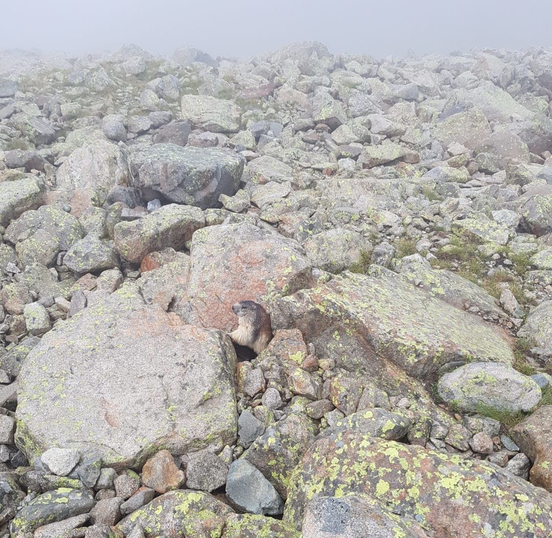
We begin the descent after a small meal break. We quickly lose altitude and this slope is a little more sheltered so we warm up a little. We are even entitled to our first rays of sun since our departure from Cauteret … The weather seems to want changed but it is shy for the moment. We are not the only ones enjoying a little warmth as evidenced by our meeting with a little fierce Marmot.
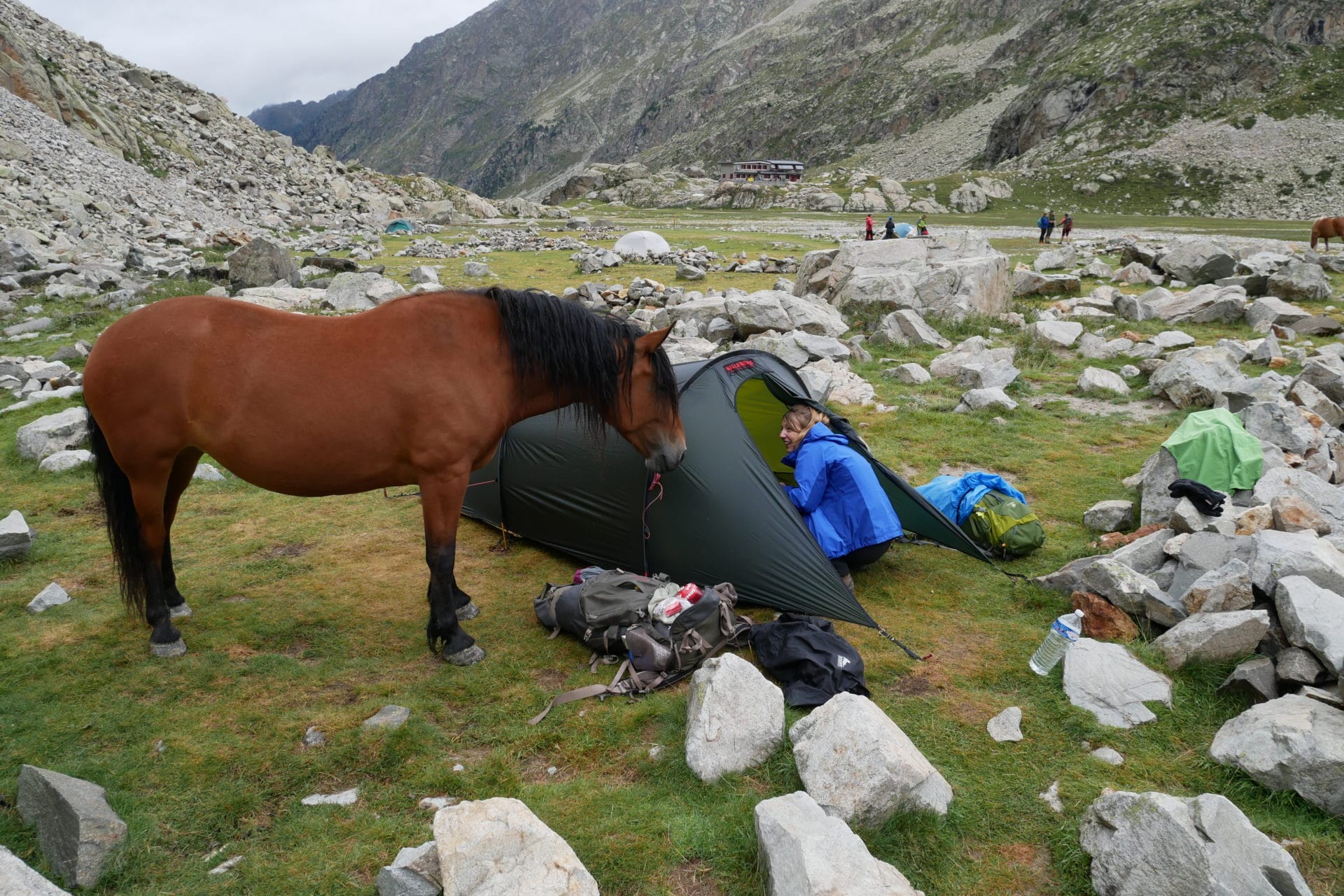
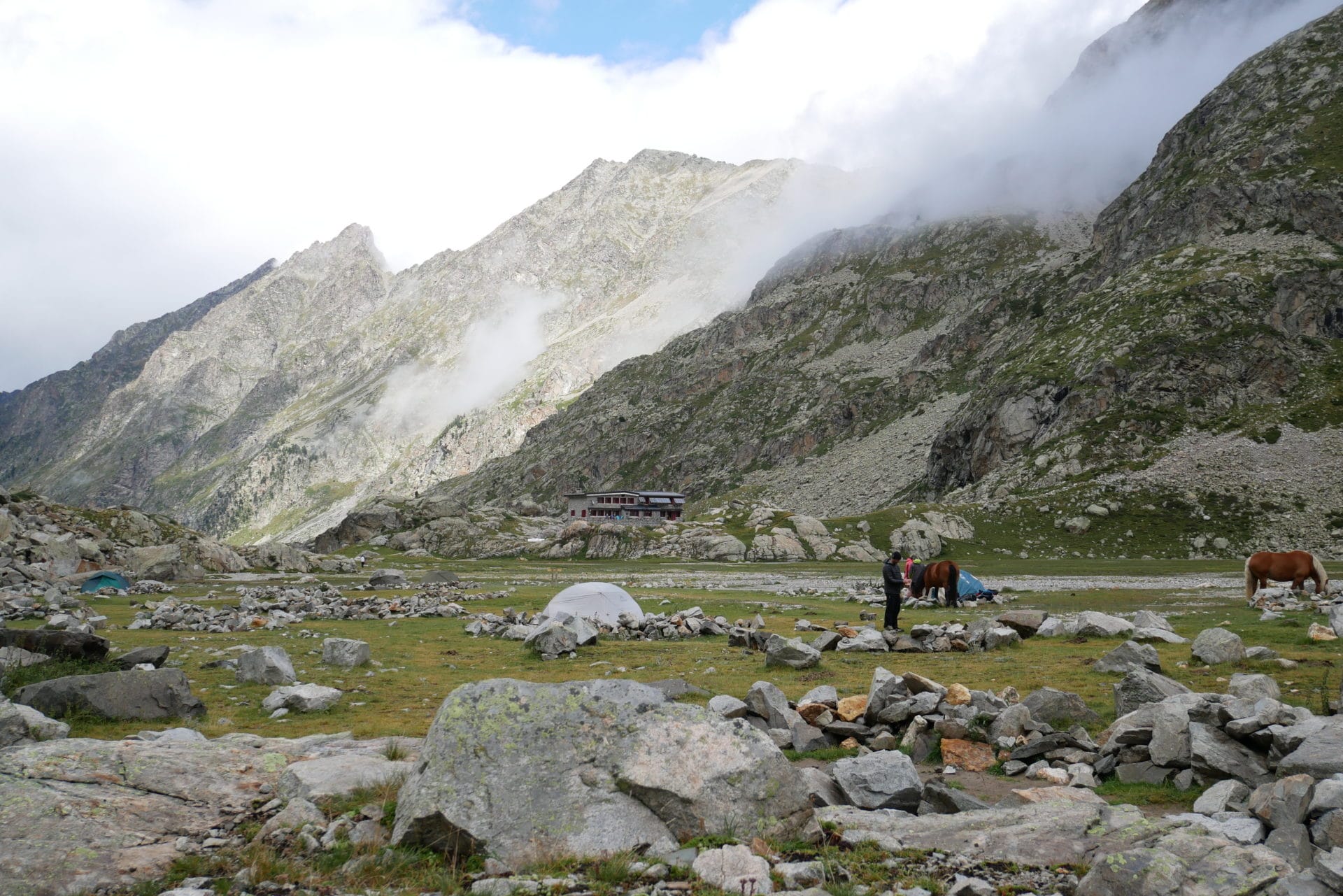
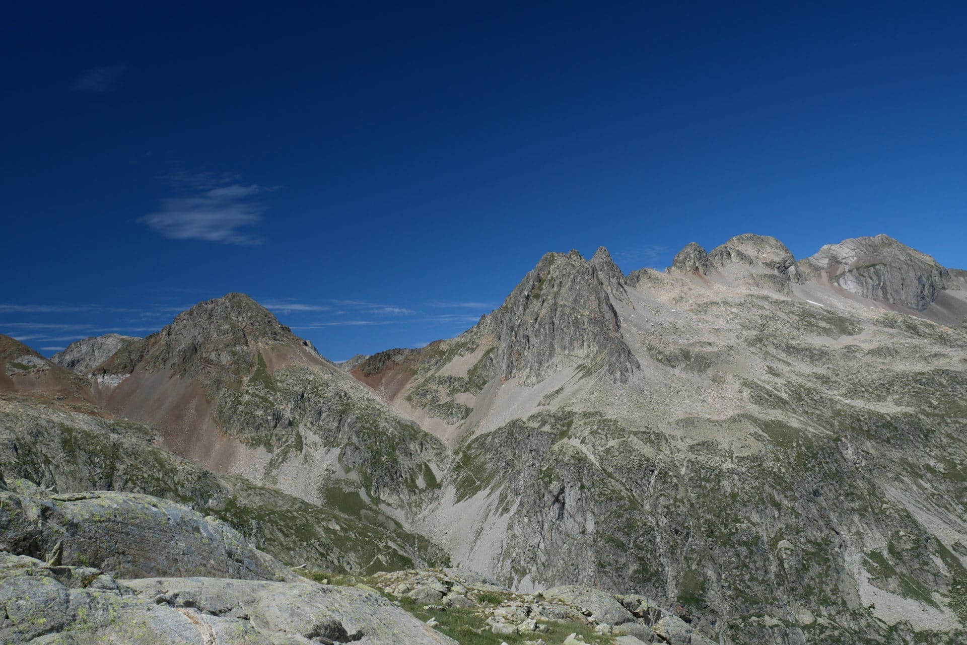
We will arrive quickly at the Refuge des Oulettes de Gaubes, it is a superb place! The Oulettes extend at the foot of the Vignemale in a kind of mini valley surrounded by high walls.
We will have a break at the shelter before going to pitch the tent in the spaces provided for this purpose west of Oulettes. There are not many people at the moment but there will be a lot of tents tonight.
Once the tent is up we have the visit of a curious who has understood that hikers are generous in apples or other treats!
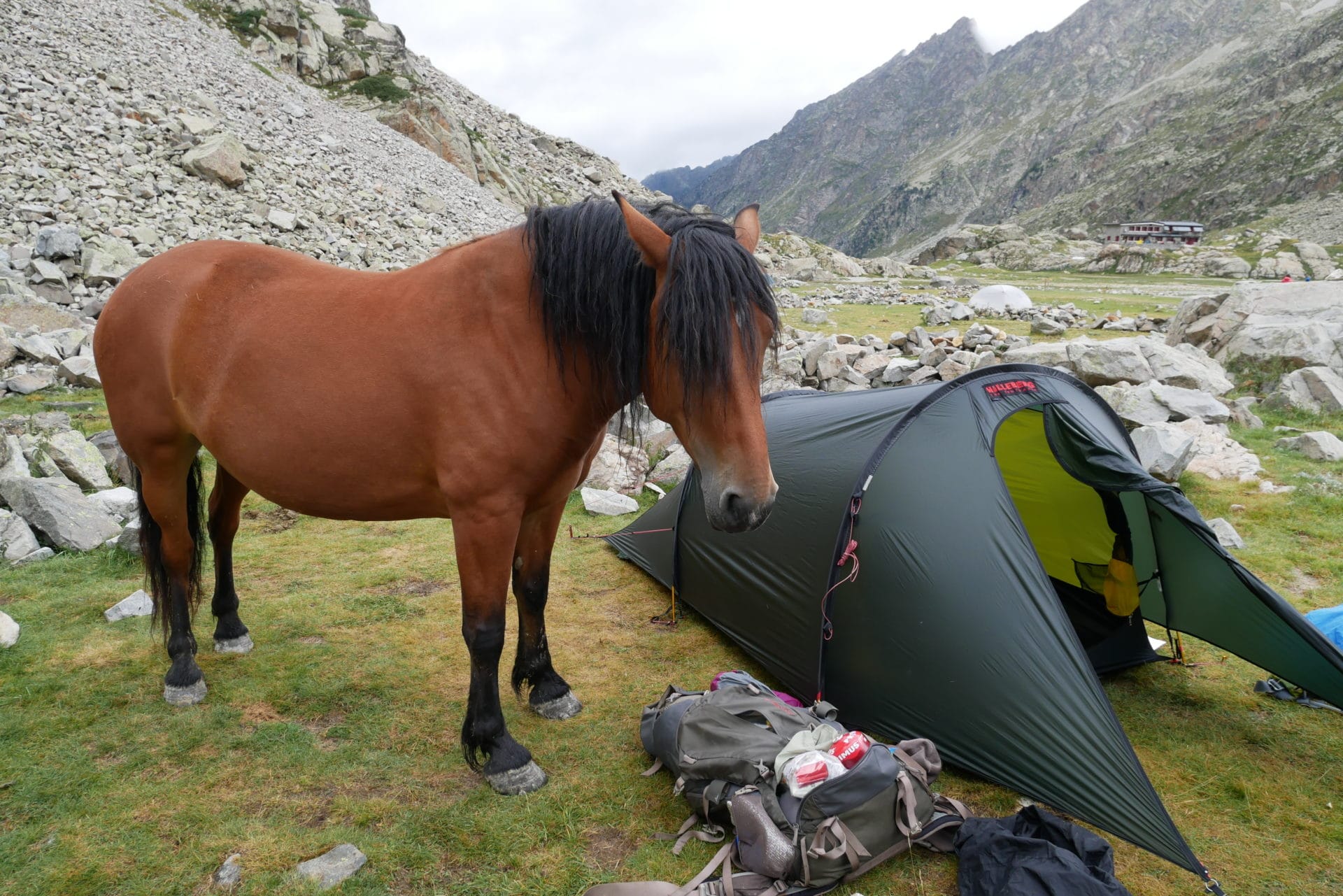
The weather at the end of the day will be changing with some sunny moments but especially the greyness and the rain. Temperatures have also dropped a lot tonight. So we are wrapped up in the tent hoping to spend a night not too cold.
Too bad the weather is so ugly today but we still had a good day of walking and the Oulettes are very beautiful. In the late evening, the face of Vignemale will play hide and seek with us, offering us beautiful images.
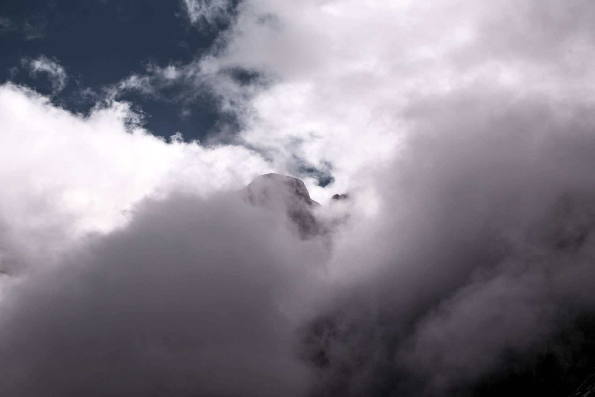
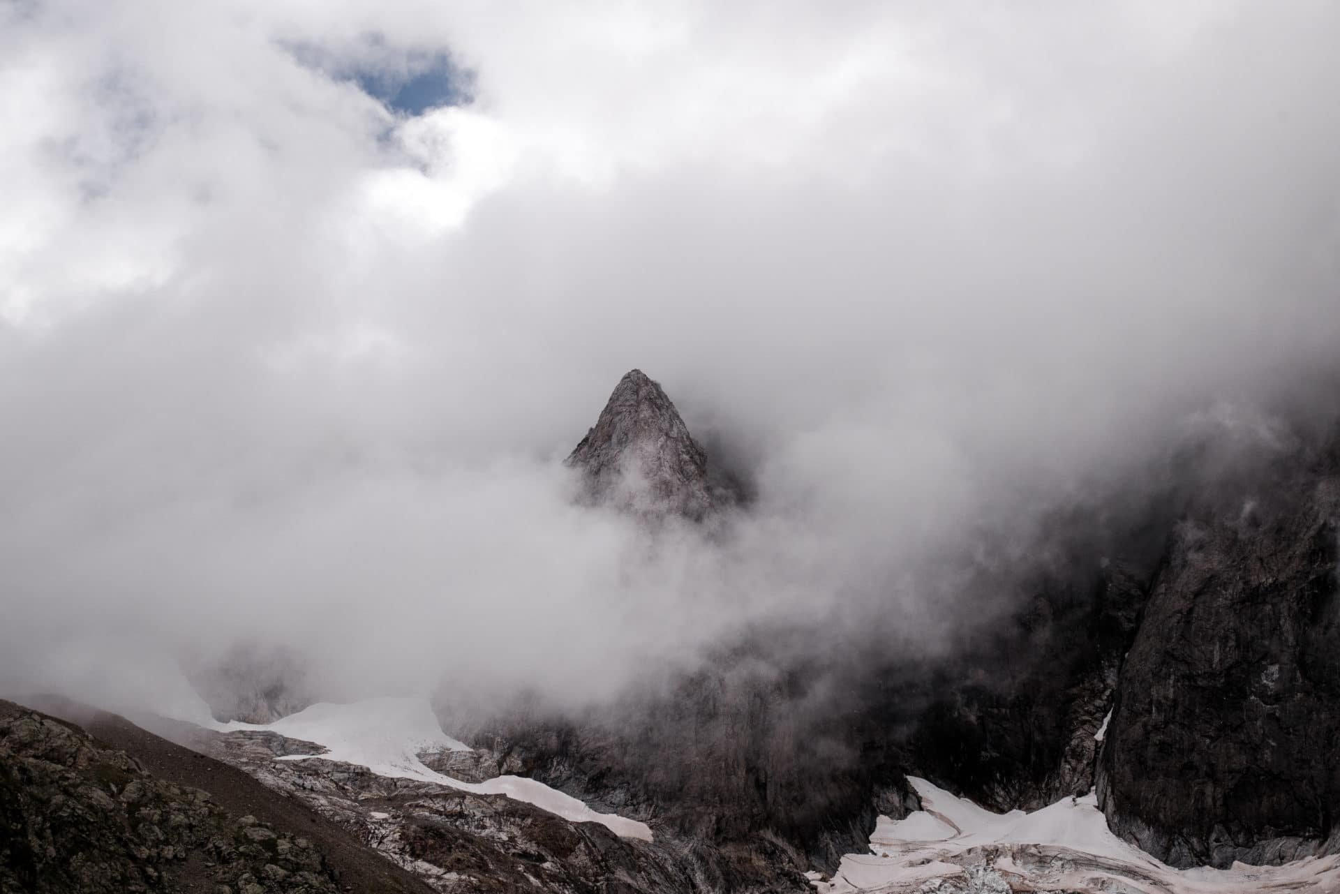
Day 3 - From the Oulettes de Gaube to the Refuge de Bayssellance
The night was difficult! It was very cold as evidenced by our tent all covered with ice this morning. I took for myself a summer sleeping bag (comfort 5-10 ° C) so I had to sleep with the jacket to gain comfort. Fortunately, Hélène had a good 0 ° C comfort sleepingbag.
It was cold but this morning, O happiness, it is very beautiful !!! Our first rays of sun after 2 days of bad weather what joy! The Oulettes de Gaube reveal all their beauty under the morning rays. The north face of Vignemale is superb. All this is good for the spirit.
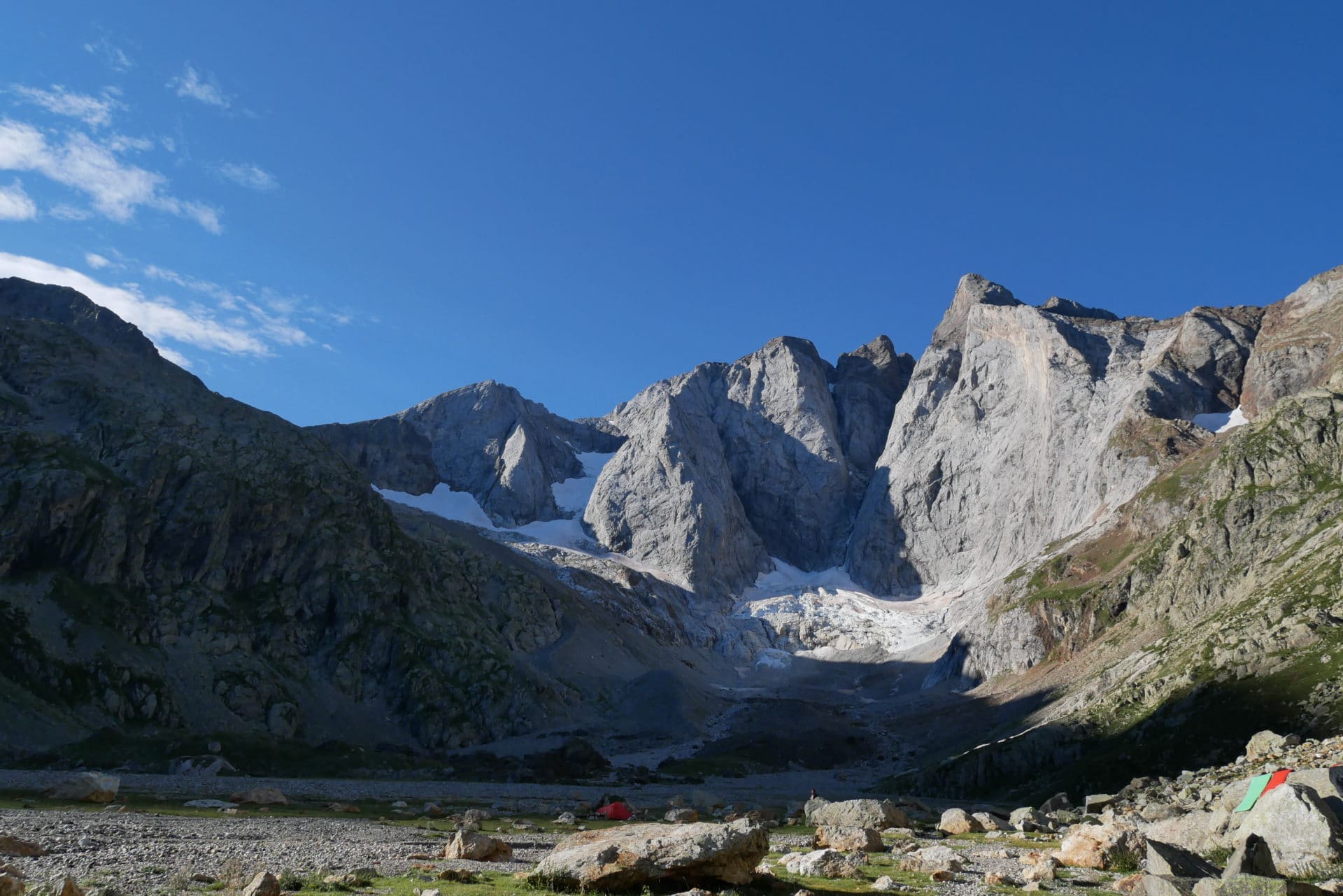
We take out all our things to dry them on a big rock. After 2 days of rain everything was wet. We continue with the breakfast that we share with another couple. We feel that this morning everyone takes their time to enjoy the weather.
We are not in a hurry to fold the camp and it is only at 11am that we take the road to the refuge Baysselance. It’s a short walking day in perspective but as I said in the introduction we wanted to enjoy the mountain and its beautiful landscapes.
First step, going back on our step and join the fork that we had taken under the pass of Arraillé. There are a few people on the way but it is ok. We often stop taking pictures because we finally see further than 200m! We discover below Lake Gaube and in front of us the beautiful red rocks of the mountains closing west of Oulettes.
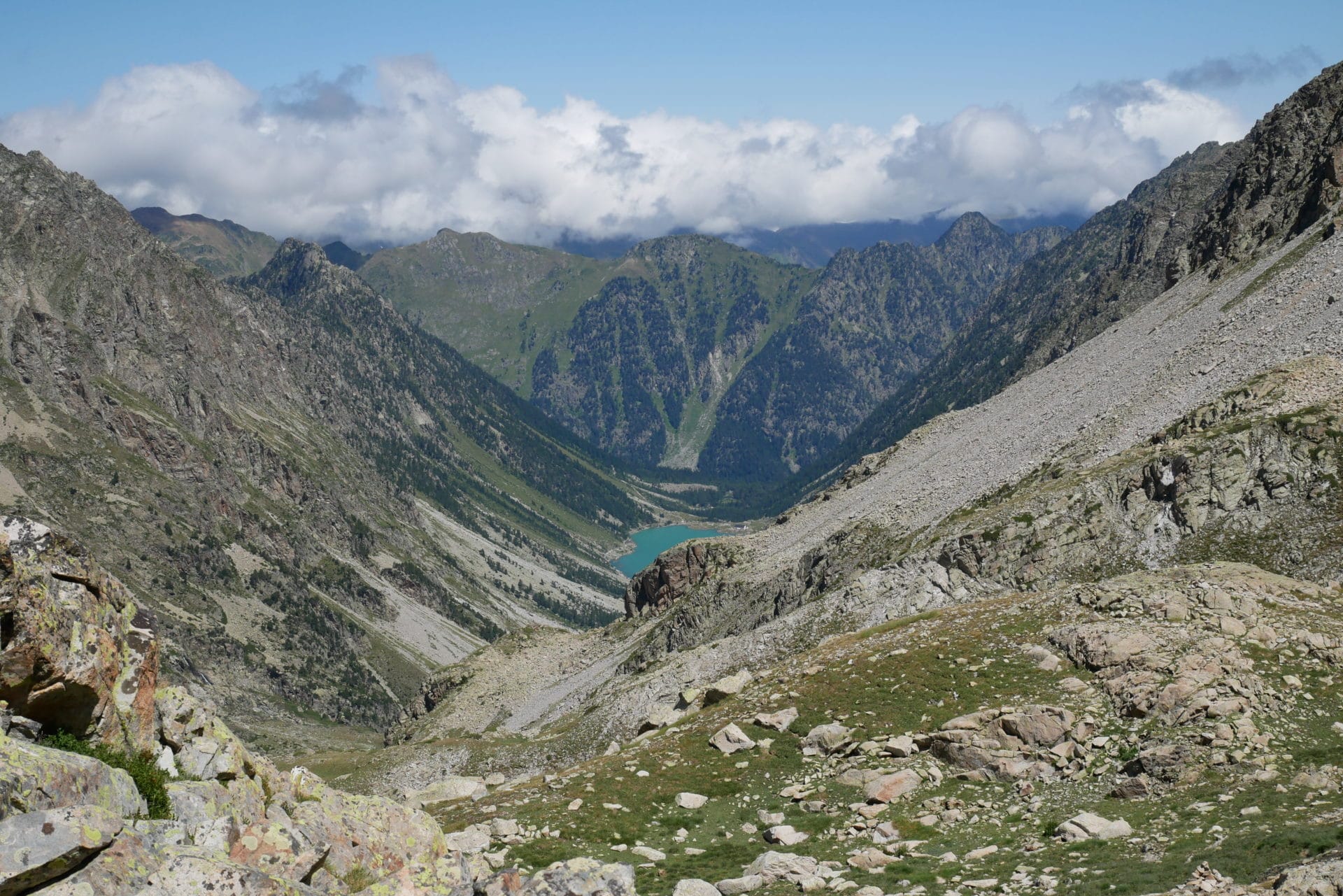
Once the bifurcation exceeded, the climb is steeper but the view of the Vignemale and the small glacier that resists somehow motivates well and moves us forward.
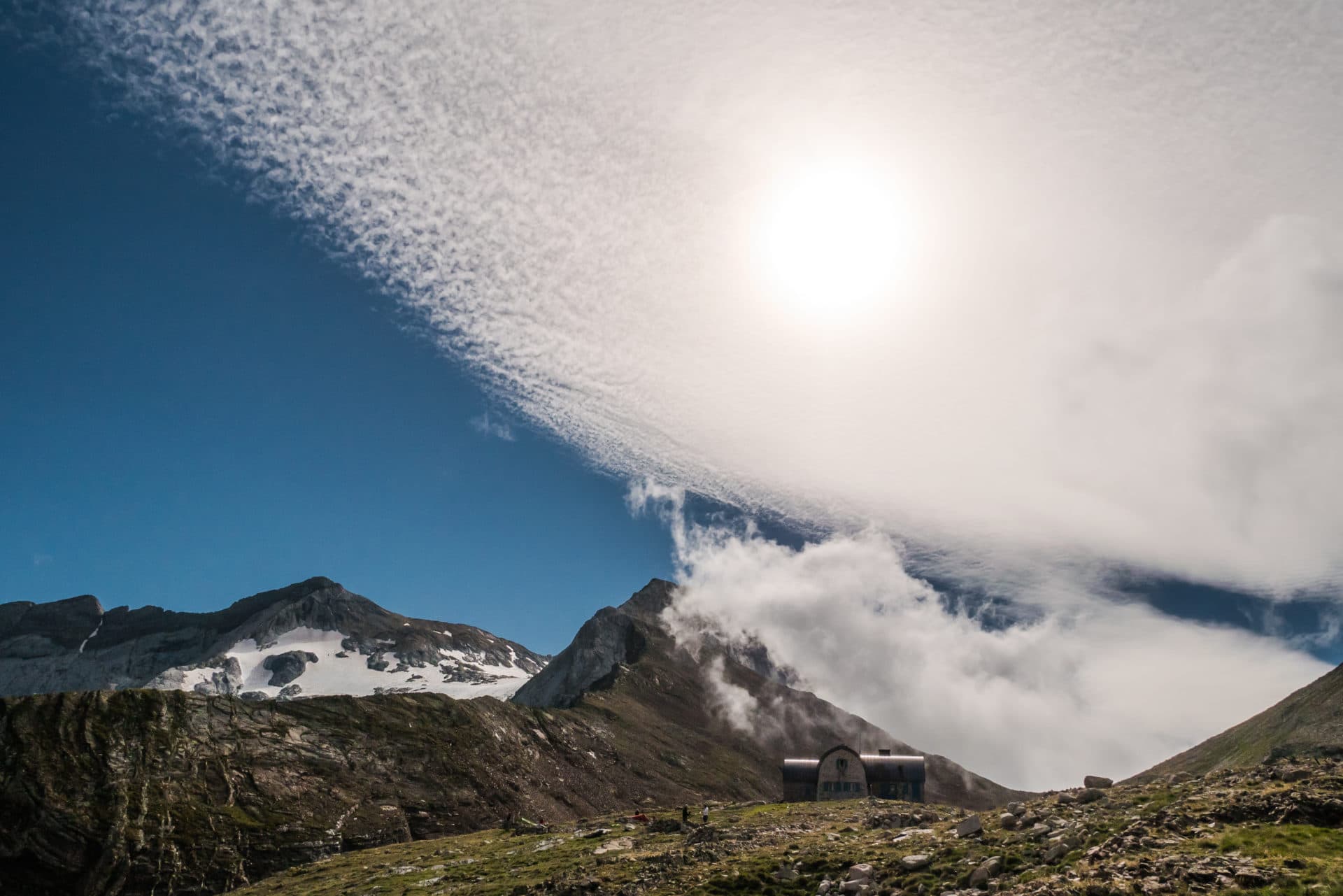
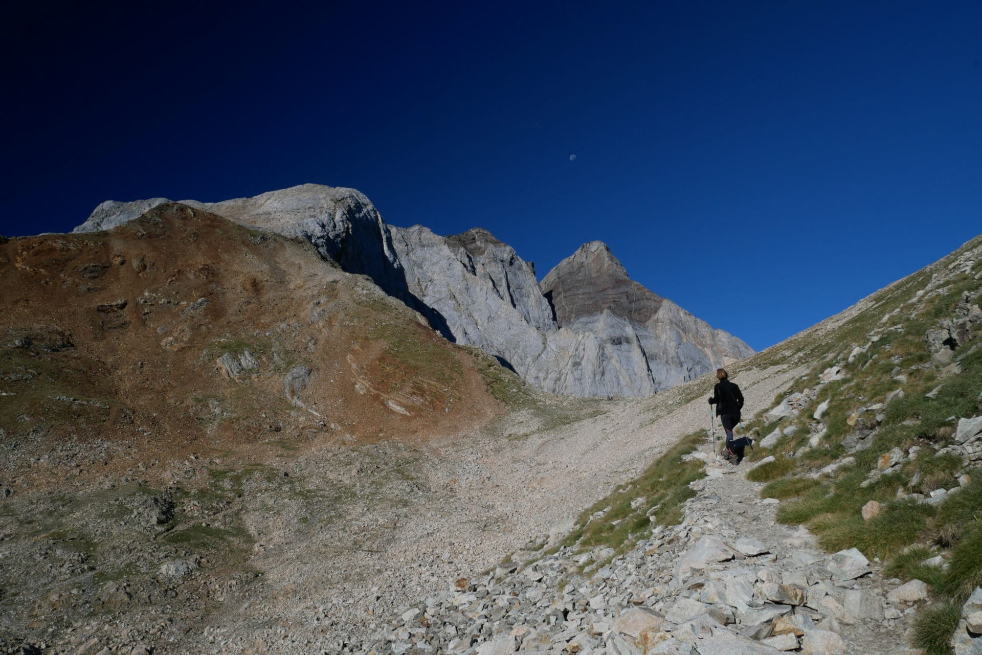
We will finally arrive quickly enough to Hourquette d’Oussoue (2734m) before descending to the refuge Baysselance (2651m). We discover a brand new view that now extends eastward with Gavarnie in the distance. The location of the refuge is superb.
We meet a lot of people who have made the way from the dam Oussoue to climb the Petit Vignemale and its 3032m.
Our arrival at the refuge will be accompanied by a good cheese omelette and a nice piece of pie! The shelter team is very nice.
We are in the early afternoon and we enjoy the sun.
We will eventually go up the tent a little away, near the cliff, on a promontory that offers us an absolutely wonderful view of the Mountain with, in the distance, the circus of Gavarnie.
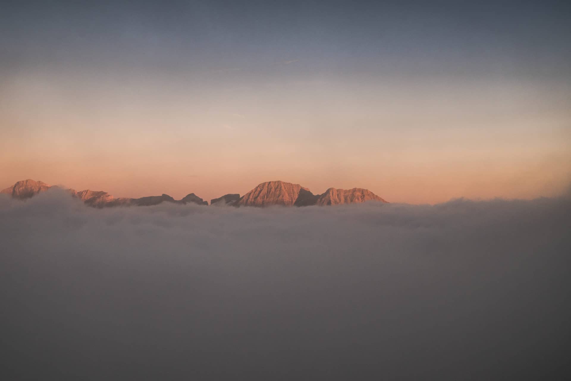
The evening will be magic. It will be a succession of changing lights, shadows, clouds of fabulous shapes. One of my most beautiful bivouac in terms of scenery and what happiness to finally have this weather!
We will fall asleep above a sea of glowing cloud.
Day 4 - Climbing of the Petit Vignemale and descent to Gavarnie
The night was cold but nothing really bad. The program of the day is charged: ascent of Petit Vignemale (3034m) and then long road to Gavarnie.
For the climb we will travel light: we leave the bags at the shelter to just take water and our cameras. The weather is beautiful, it’s perfect!
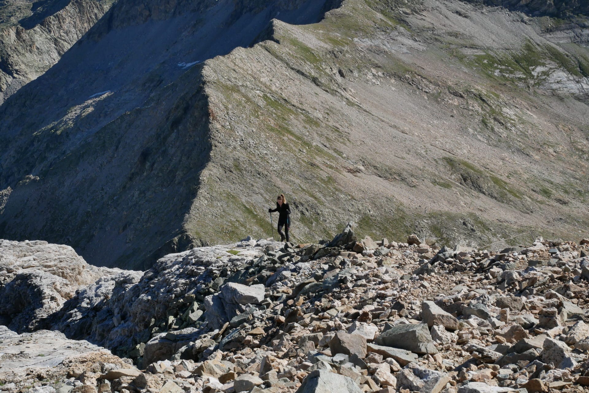
First step join the Hourquette d’Oussoue 100m above the refuge, it is quickly done. We then turn left to follow a set of rather clear trails towards the summit. It is early we are only two groups to climb for now.
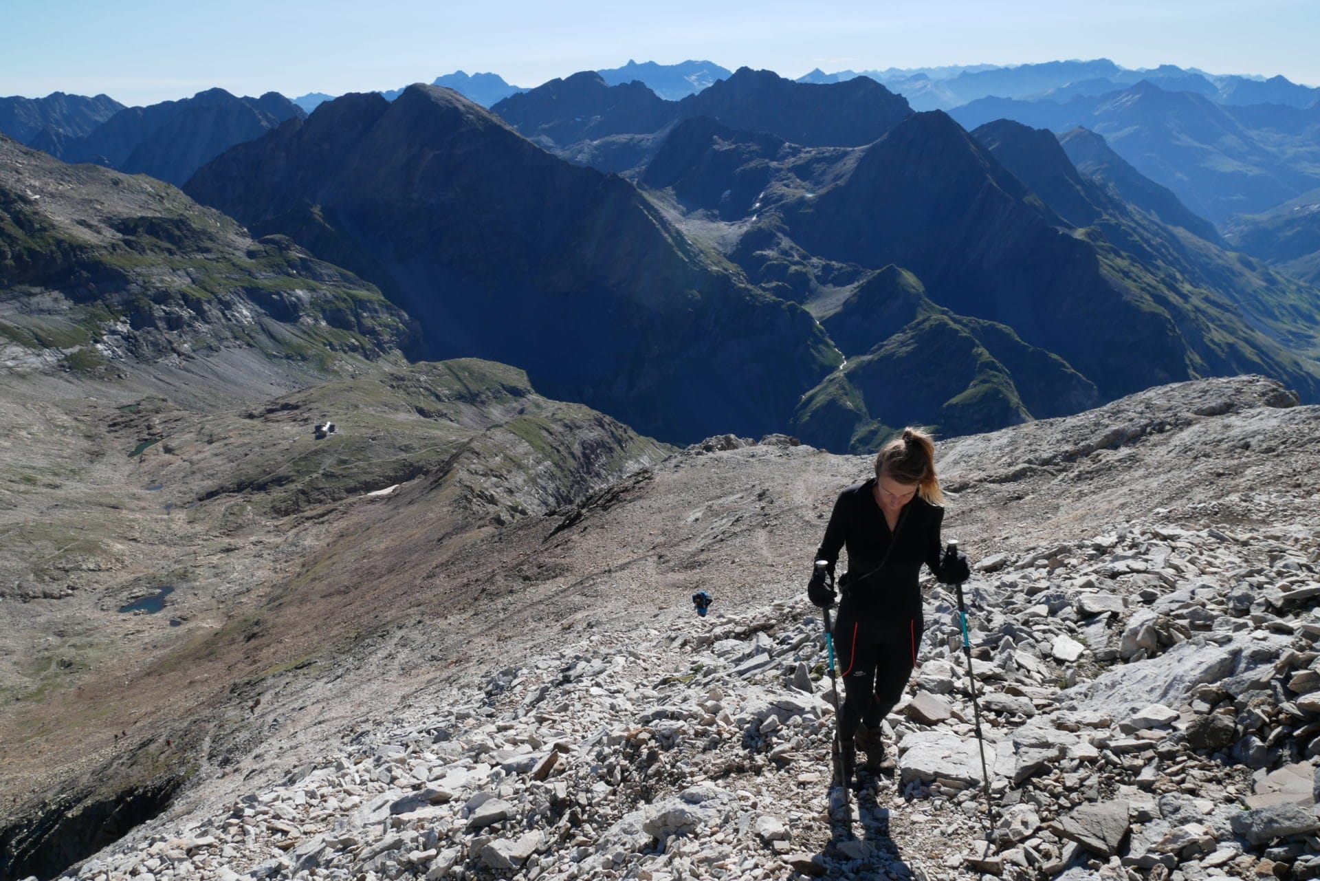
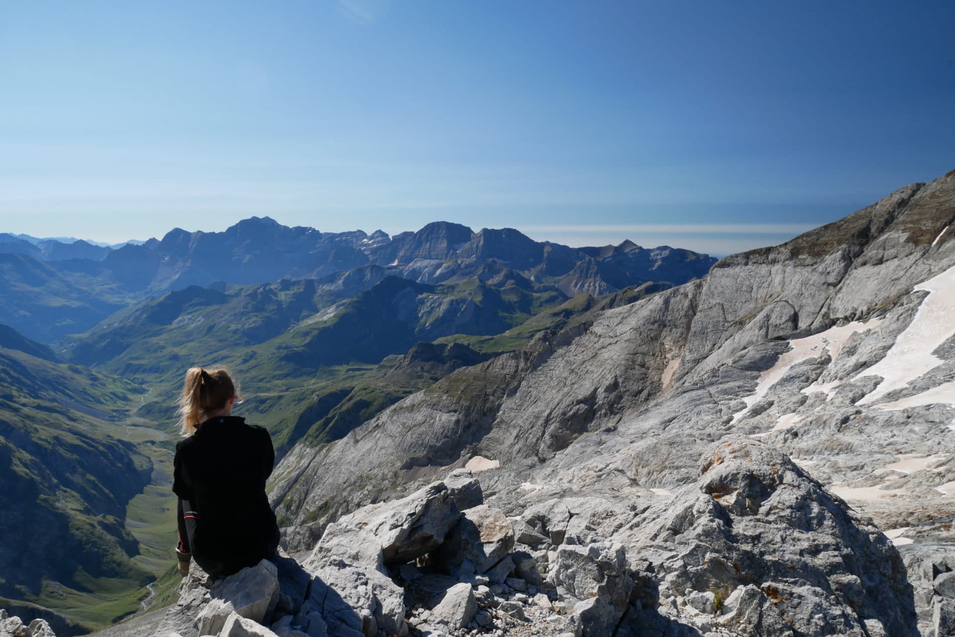
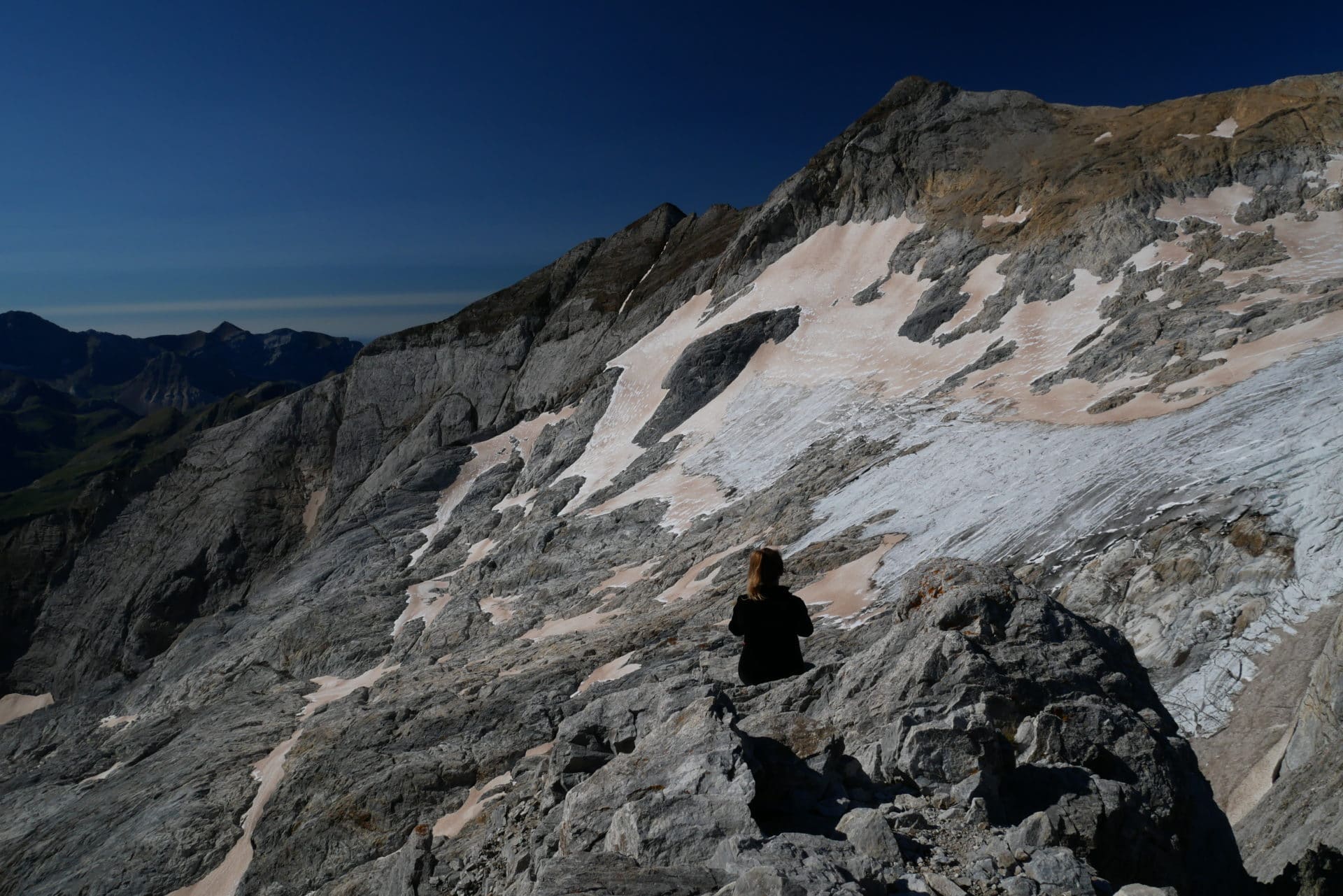
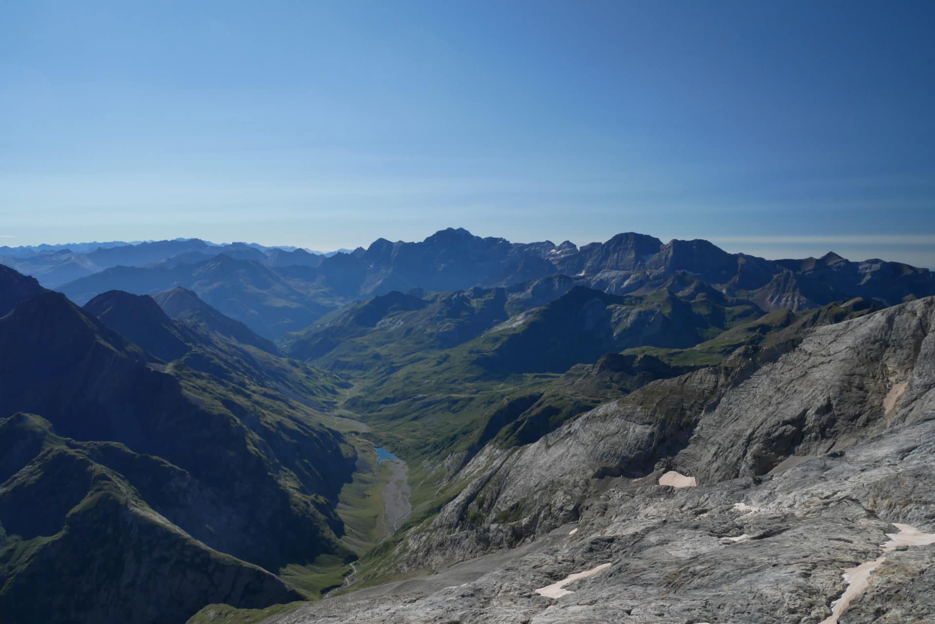
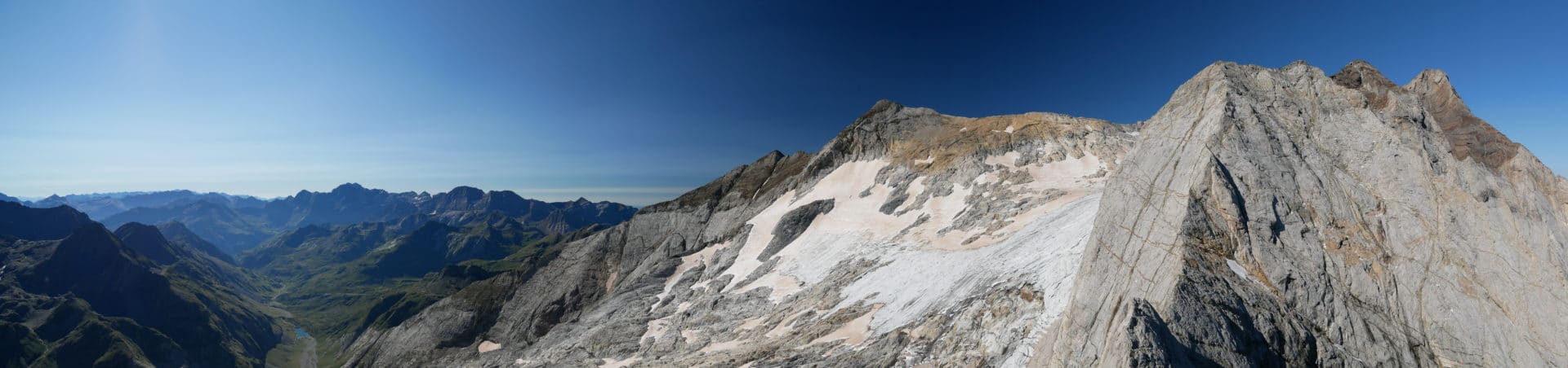
We will reach the summit in barely an hour. The view from here is absolutely beautiful! To the north, the Oulettes de Gaube, which extend under a vertiginous precipice, to the east the chain of the Pyrenees which continues as far as the eye can see. It’s sumptuous! We photograph, we observe, we take advantage of the moment especially that we are almost alone at this time.
Back to the refuge after this beautiful moment, there were already many more people in the climb. We stop for a coffee and we begin the long (!) descent to Gavarnie: 1200m D- and 15km …
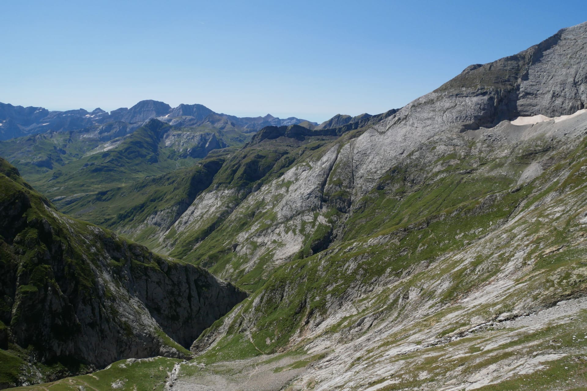
The beginning of the trail is rapidly losing altitude, it evolves in the canyon dug by the river. The landscapes are beautiful. There are some marmots to accompany us.
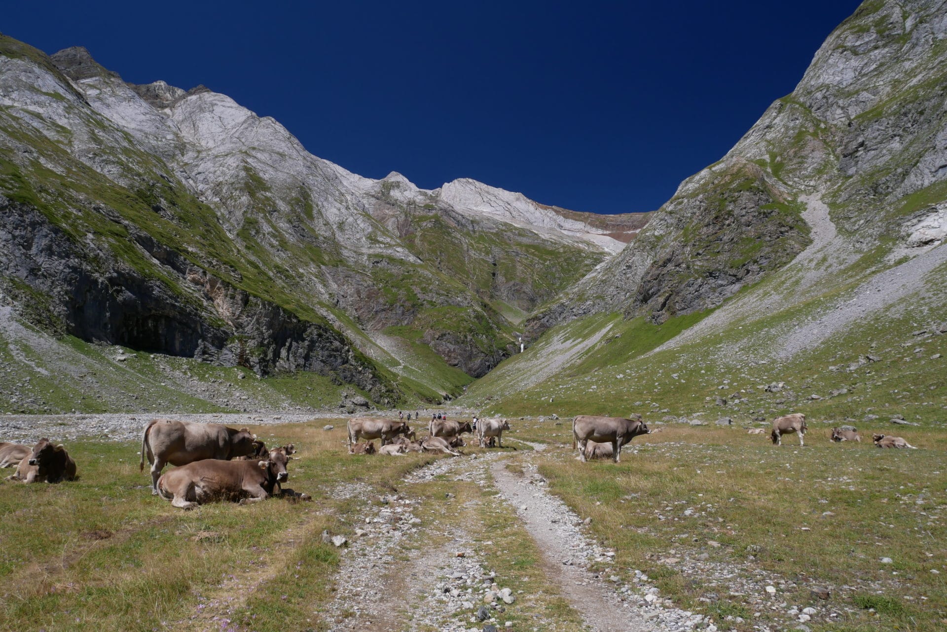
We will arrive quickly to Oulettes d’Oussoue and its dam. It is very hot now as we have lost a lot of altitude and the sun is hot. Short meal break and we hit the road again. We follow the GR10 at about 1800m. The landscapes have changed a lot. We left the high mountain for the pastures and there are many cows. We will also explain that these cows are all Spanish because an old Napoleonic treaty leaves summer access to our Iberian friends …
The end of the hike, even if the landscapes are beautiful, will be very long! Between the 1600m of cumulative descent, the horizontal distance and the temperatures, we will be happy to arrive in Gavarnie in the prospect of a good hot shower, a good bed and a restaurant!
Joy nuanced by the impressive crowd that the circus attracts. On the other hand all disappear after 6-7pm and the city becomes dead until the next day 8pm for a new human tide. However the circus is worth a visit because it’s impressive. We did not have time to do it but the hike to the breach Roland also looks great.
Conclusion
For a first time in the Pyrénées we were not disappointed ! Despite the first days of bad weather we still enjoyed the beautiful scenery on the second half of the trek. This crossing offers a good patchwork of possibilities that the Pyrénées reserves.
What is certain is that we will come back because we did not have much time and the list of hikes that make us want is long: the Breche de Roland, the Vire aux Fleurs, the Néouviel … to mention them.
We advise you to discover or rediscover this beautiful mountain range that extends all the same over 400km, there is plenty to do …