10days
trekking
176km
walked
12000m
D+
14passes
This is not the best-known GR but the GR54 has nothing to envy to the GR20 or the Tour du Mont Blanc. Technically, on the one hand, the numbers speak for themselves: a little less than 180km and about 13000m of elevation gain, 14 passes and an average altitude of 1800m. But from a scenic point of view either, the GR54 does not have to blush: we cross one of the most beautiful massif of the Alps, we go through all the mountain stages, we cross Chamois, Marmots and Vultures, .. and cherry on the cake, the path is much less crowded than other GR such as those mentioned above. In other words, the Tour de l’Oisans and Ecrins is beautiful and wild and hiking was a pleasure for 10 days.
The GR54 et the Ecrins National Park
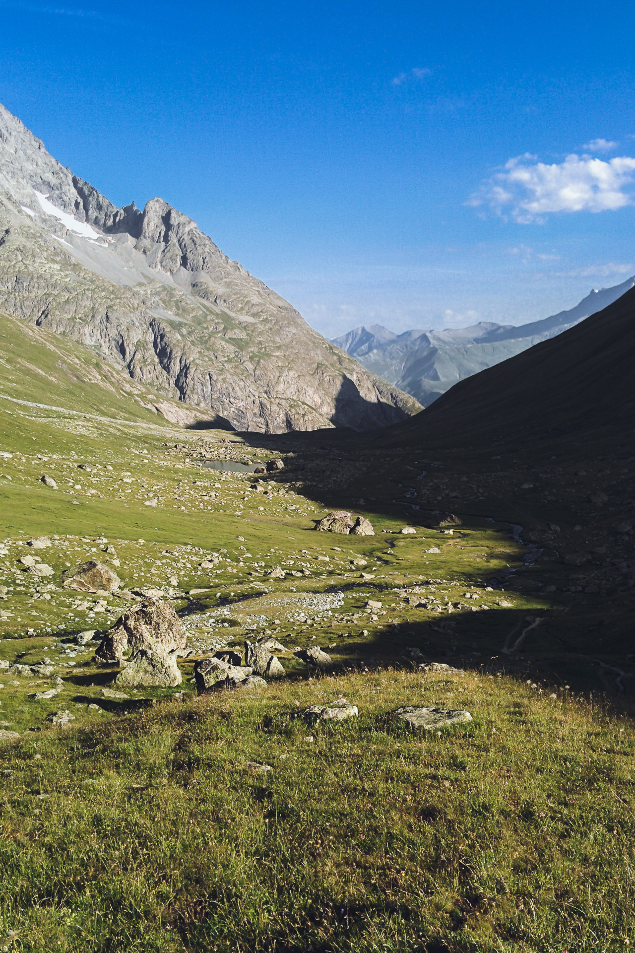
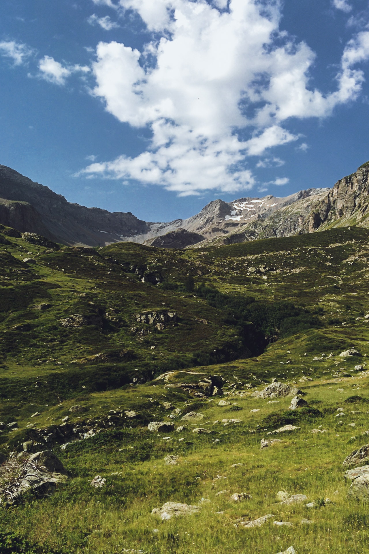
The Tour of Oisans and Ecrins is a loop that travels through these beautiful mountains in the heart of the Isere department. The diversity of landscapes, their beauty and wildness (especially for the southern part) make this GR one of the most beautiful. All days of walking are punctuated by the passage of at least one pass, by mountain lakes or majestic valleys. In terms of difficulties, the GR54 is not simple but remains accessible to the greatest number because it is quite possible to make each night in a shelter and therefore to travel light. For my part I chose the bivouac all along because this format offers the greatest freedom possible. Crossing villages or towns at least every other day also means you do not have to eat too much food or change menus.
We travel the GR54 largely in the Ecrins National Park. This area of protection of nature and mountain traditions is to be respected as a jewel. Fire is obviously prohibited as well as camping over several nights. However the bivouac is allowed between 8pm and 8am. The best way to know the rules to follow is to go to the park site what I recommend before departure: http://www.ecrins-parcnational.fr/
Day 1 : from Paris to the Ecrins
We are early July, it’s the day of departure! Finally ! As always before going on a hike (and on vacation …) the wait was long. But here we are ! I met with Quentin who should have accompanied me on all the GR54 but as we will see it will not be possible for him unfortunately. To make it to the Ecrins nothing easier: a little TGV to Grenoble and a little bus to Bourg d’Oisans where we will start the GR54.
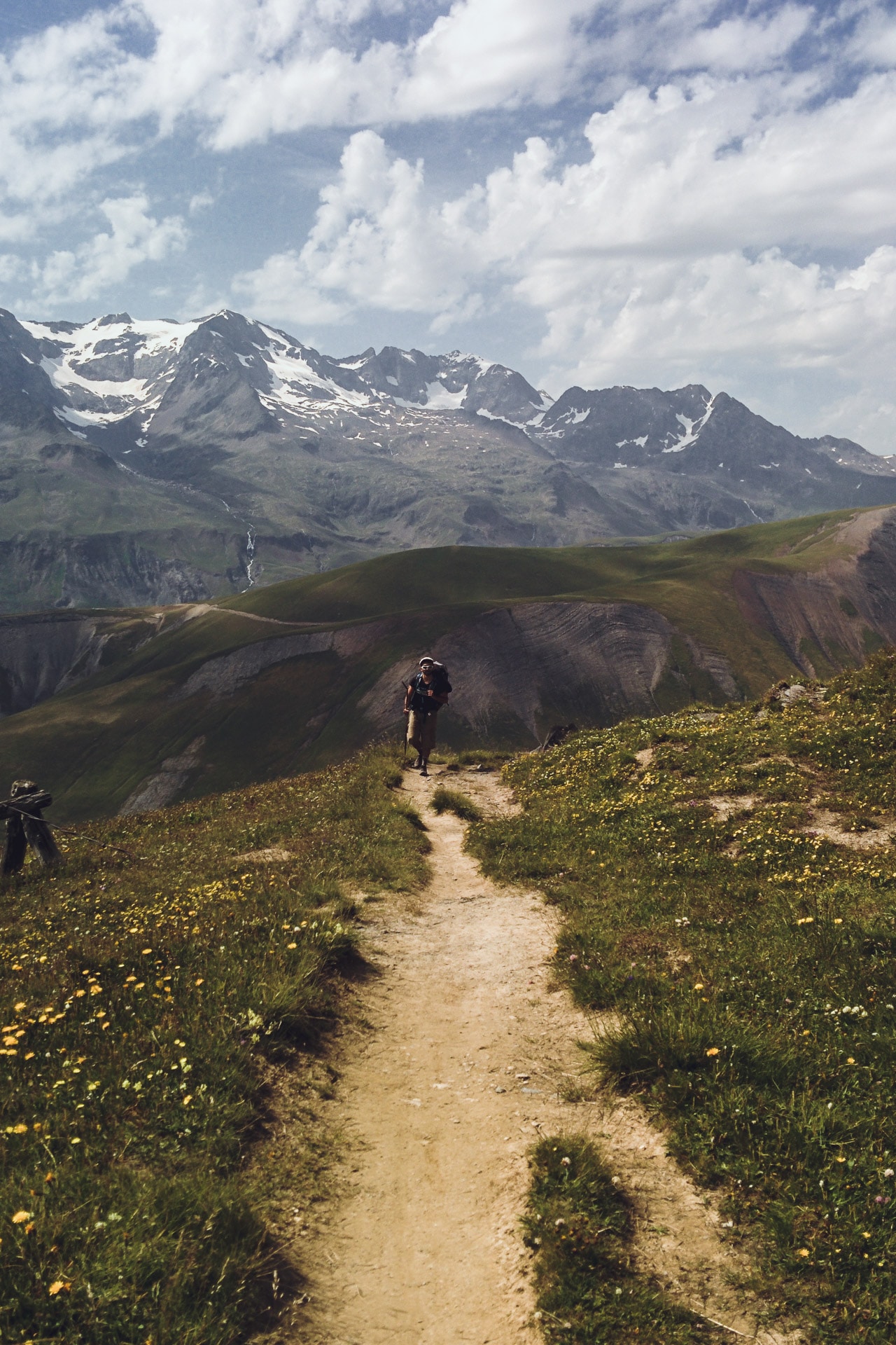
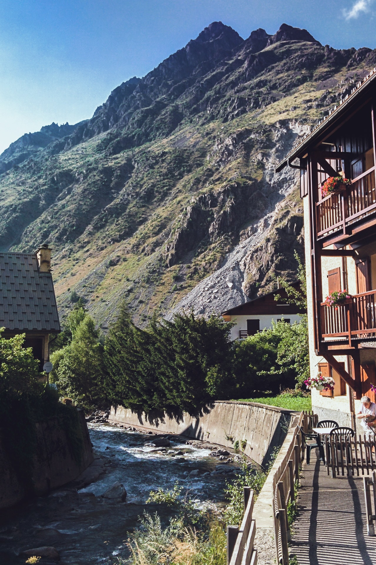
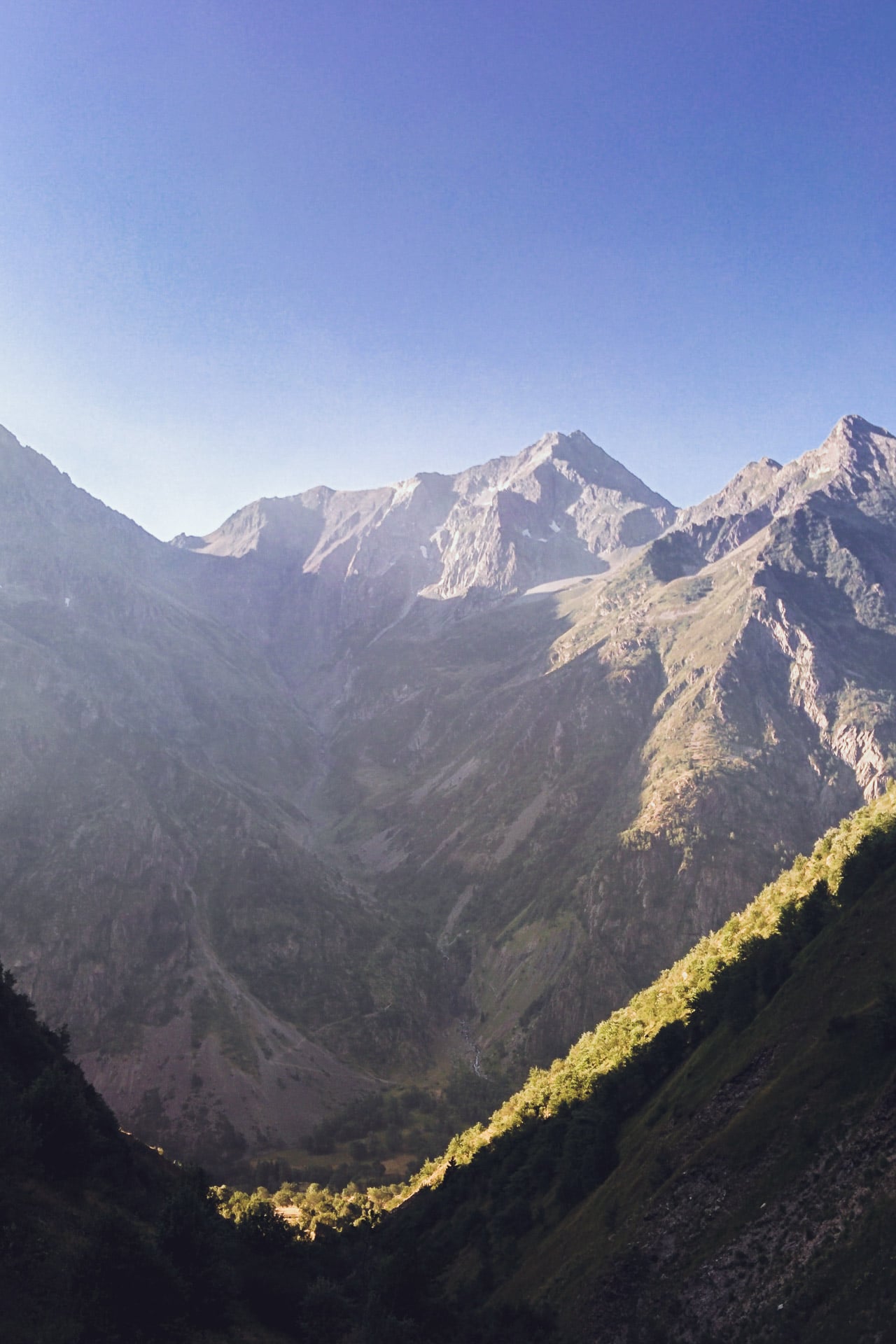
It only took us a morning to go from the city to the mountains. On site we complete our food supply with a little charge for the next days and noon. The “beginning” of the GR54 is easy to find, it is located behind the campsite Cascade and starts directly with a small climb in the rocks (be careful in case of rain it can be slippery I think). It is super sunny, even hot, and the weather forecast is good for the next few days …
We will stop on the heights of Bourg d’Oisans to nibble our lunch.
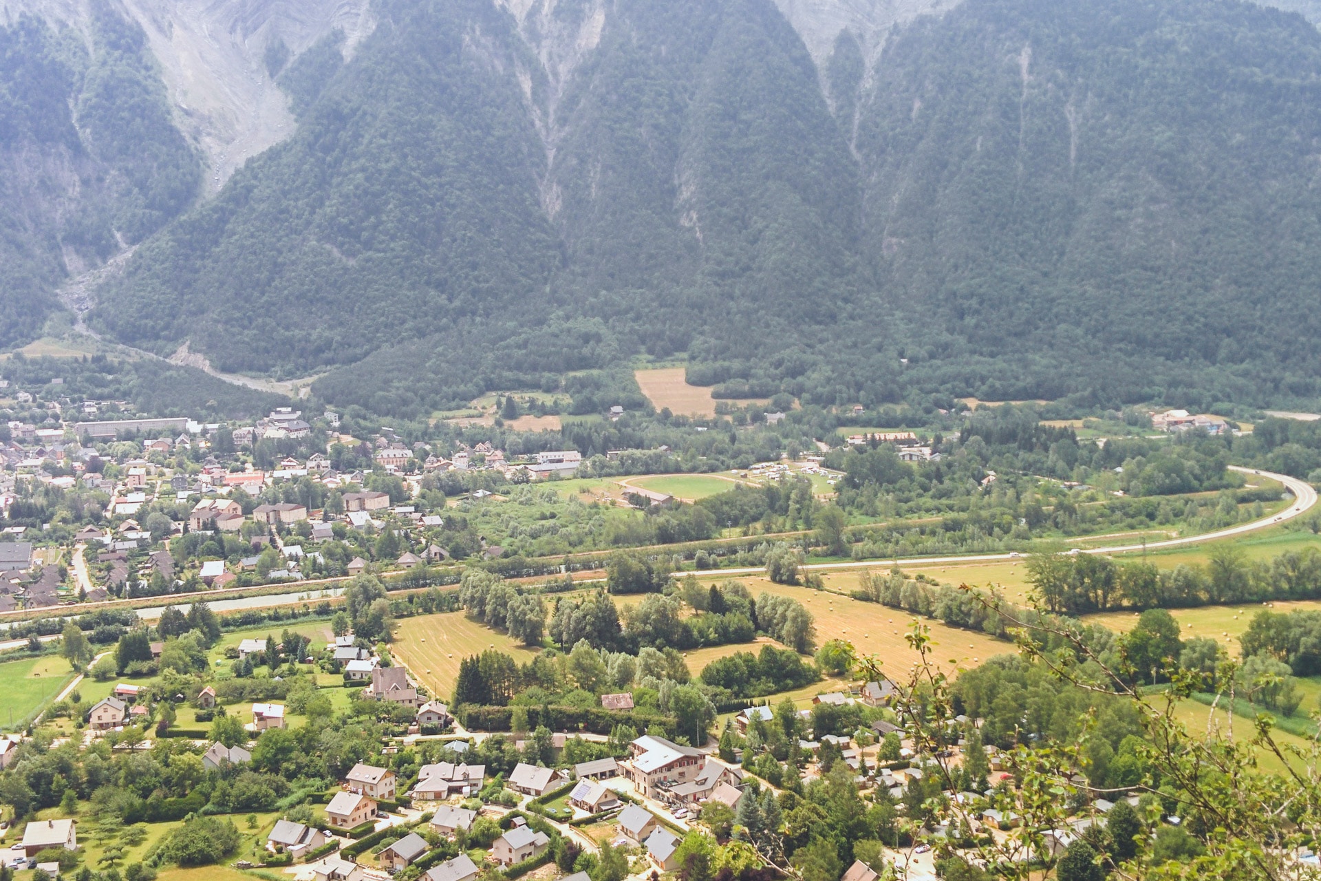
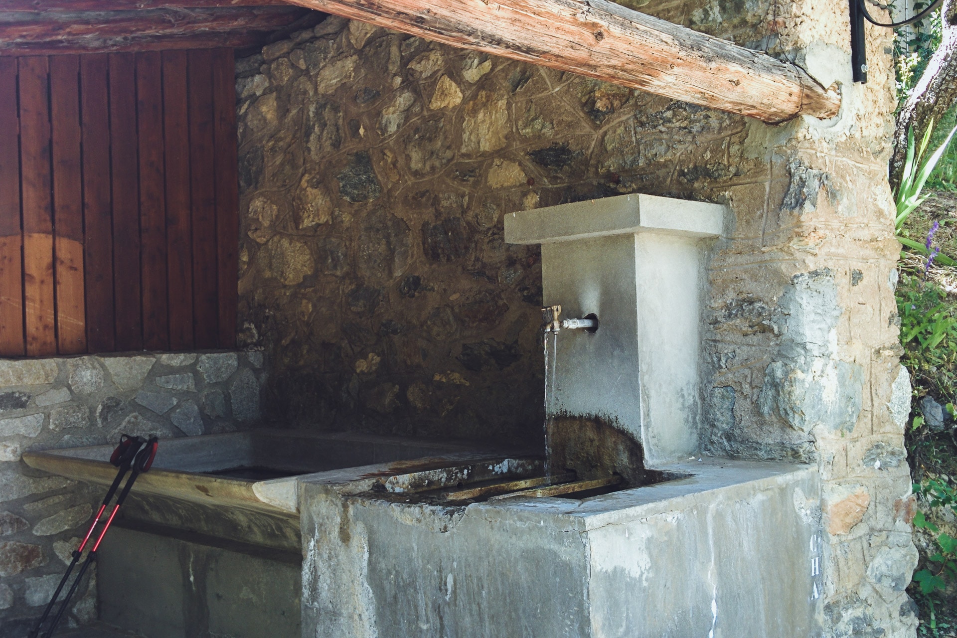
The path continues to climb then to finally arrive in the pretty hamlet of La Ville which we stop 2min enjoy the public fountain! The GR54 then continues alternating paths and tarred passages while passing through small typical mountain villages. Once again we take advantage of the fountains that we find in almost every one of them. It is very very hot and the flies are numerous and very annoying!
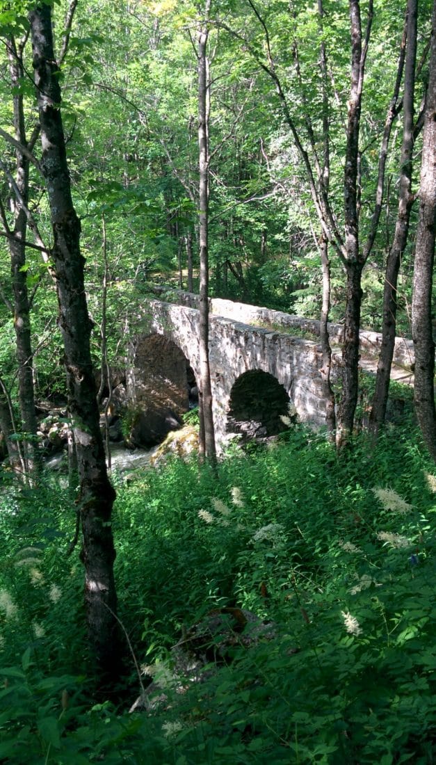
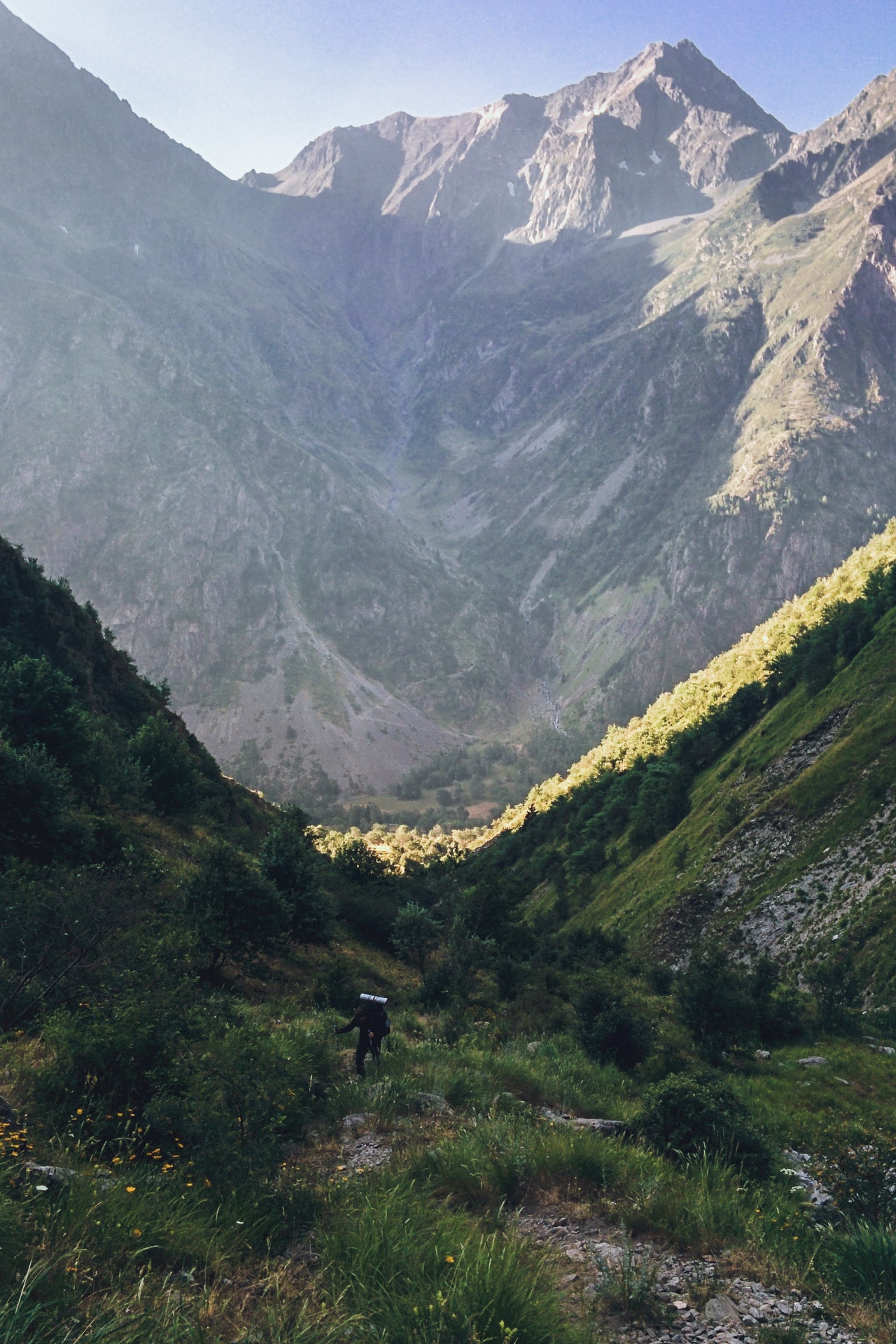
The path goes down once the village of Rosay pass. We reach the torrent of Sarenne at the level of a beautiful Roman stone bridge. We are now under cover of the forest so it is better but there are always so many flies it is tiring. We had planned to sleep in this area but the topology does not allow us to do so and the flies push us to move forward, moreover it is still early then so much to save time.
So we run along the torrent on a lot of distance, a little cool drink break at a refreshment bar and we continue.
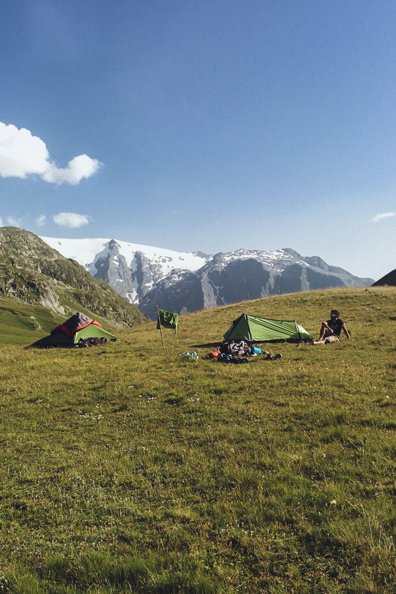
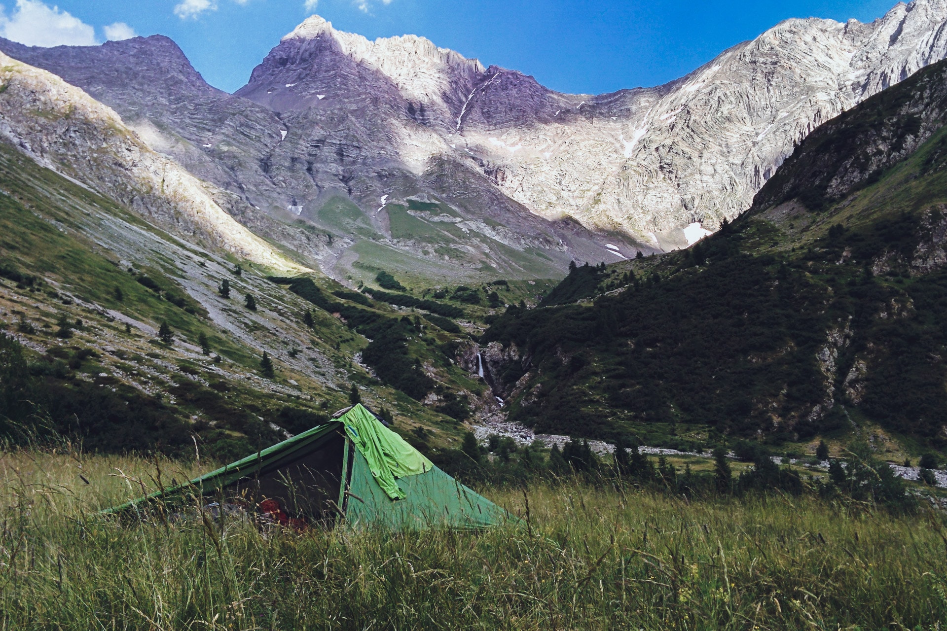
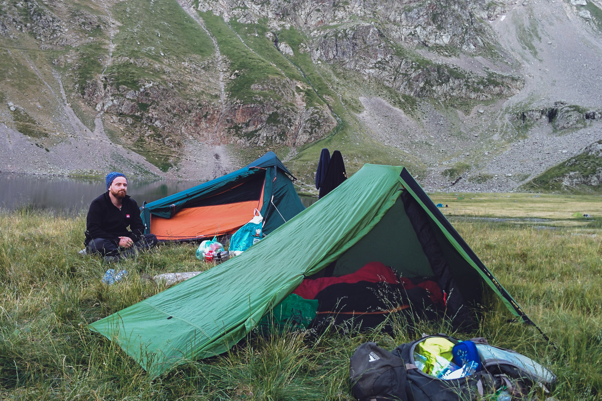
We will find our location for the night a little further, a large expanse of fairly flat grass and not too far from the Sarenne. Flies are a little less present. It’s time to take our little evening meal after a long first day (between the ride and the walk) and we’ll go to bed early.
Day 2 : from The Sarenne Pass to the Highland of Emparis
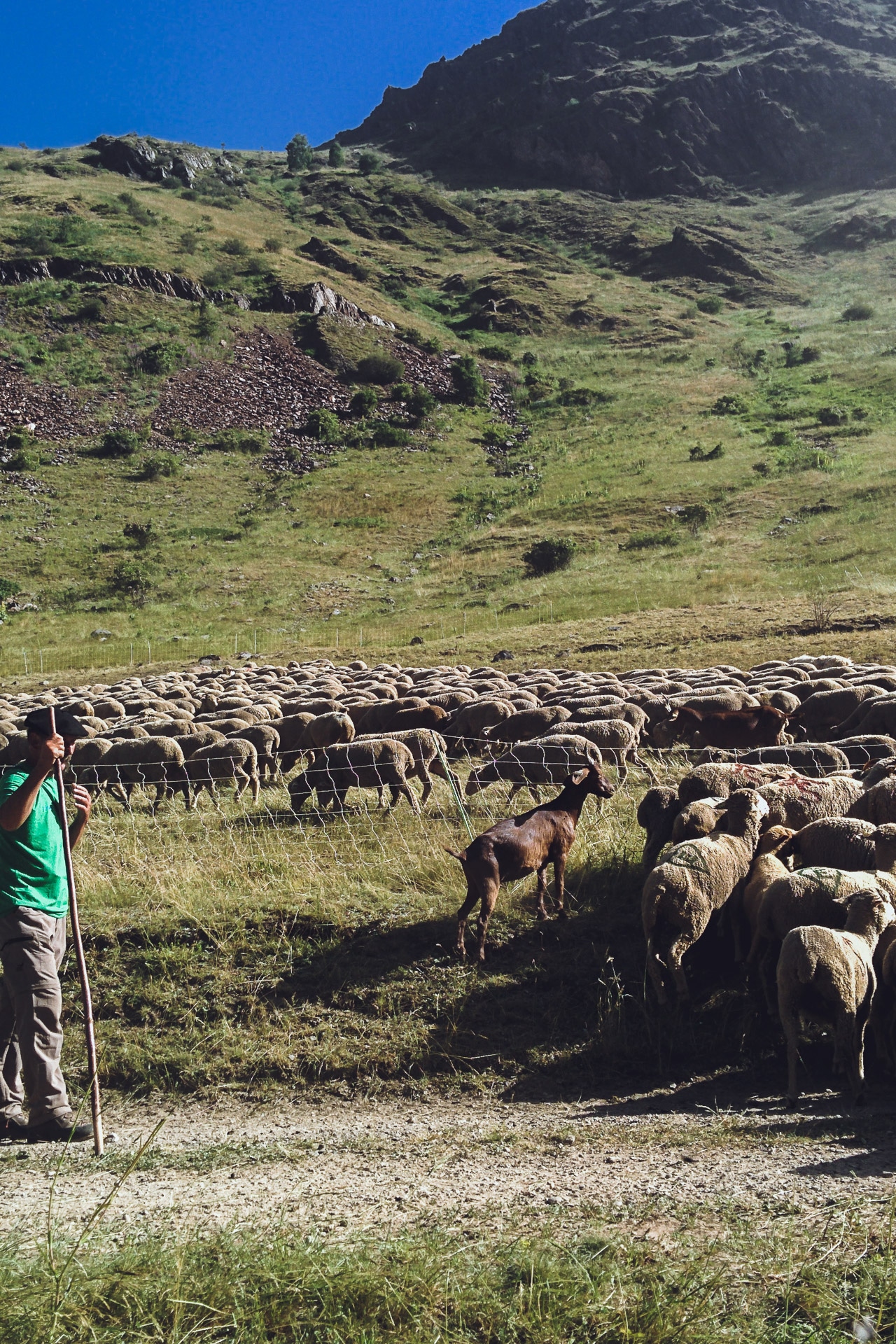
The second day begins gloriously invaded by flies. We therefore quickly leave the bivouac towards the Col de Sarenne (1999m). On the way we meet a shepherd who drives his sheep in a inclosure. Continuing to advance two “patous” come out of nowhere and come to me, one in front of the other behind. Fortunately the shepherd calms them …
“Patous” are shepherd dogs raised from a very young age in the flock. They think they are “sheep” and will do everything to protect them. So be careful when approaching an unguarded flock because the dog can be aggressive unfortunately. Hikers’ attacks are recorded every year.
The climb to the pass does not really charm because it follows a road. There are many cyclists. We take a break at the shelter to have a drink.
We then begin the descent to Clavans-Les-Bas. It’s already very hot and Quentin is starting to have his feet bad because of his shoes. He has big blisters on each foot and it hurts with every step … It’s not a good sign.
We take our lunch break at the beginning of the road that goes up to Besse. It gets hotter and the flies are a sore. Once in Besse we attack a climb of 700m vertical drop. Normally it would go well but there with the overwhelming temperature it’s really hard! Quentin has more and more pain in his feet …
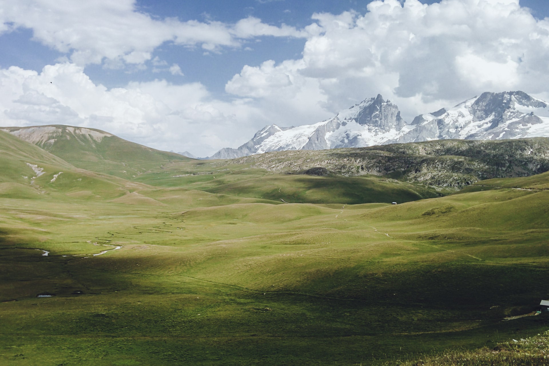
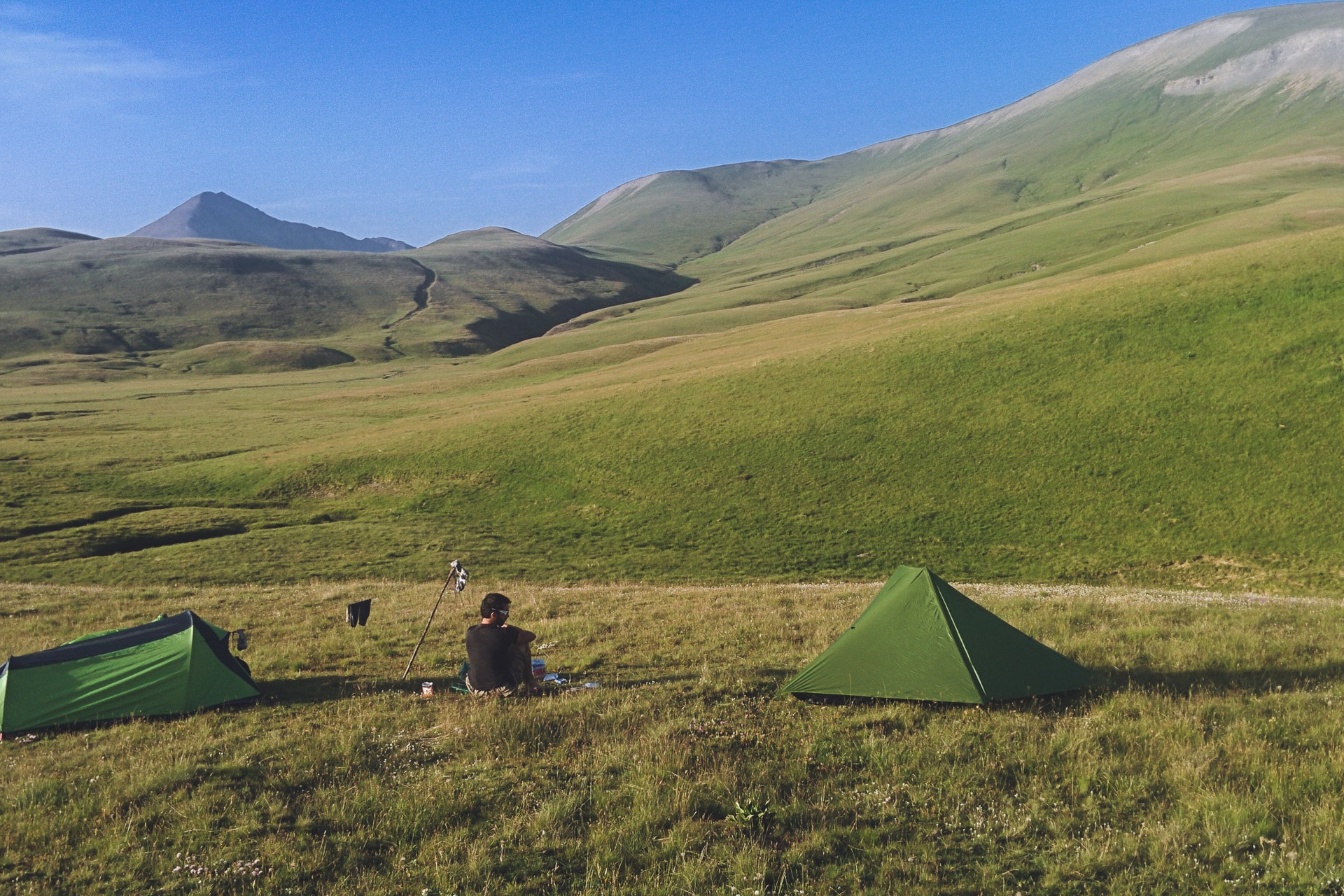
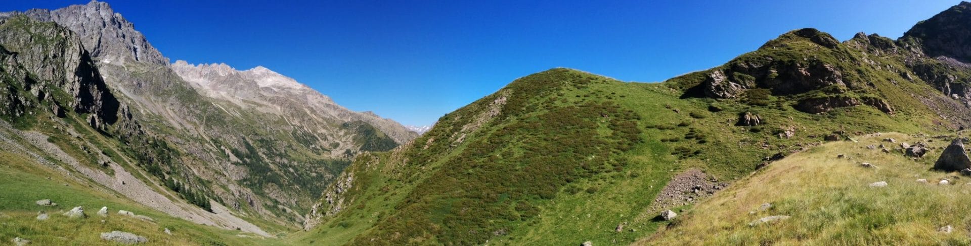
On the other hand once at the top of the show is sublime: in front of us spreads the Plateau of Emparis, immense green meadow which is not without reminding the Great American Plains in a certain way, except that no bisons here but marmots.
I motivate Quentin to go a little further to bivouac next to a water point. His feet really hurt it worries me for the next day …
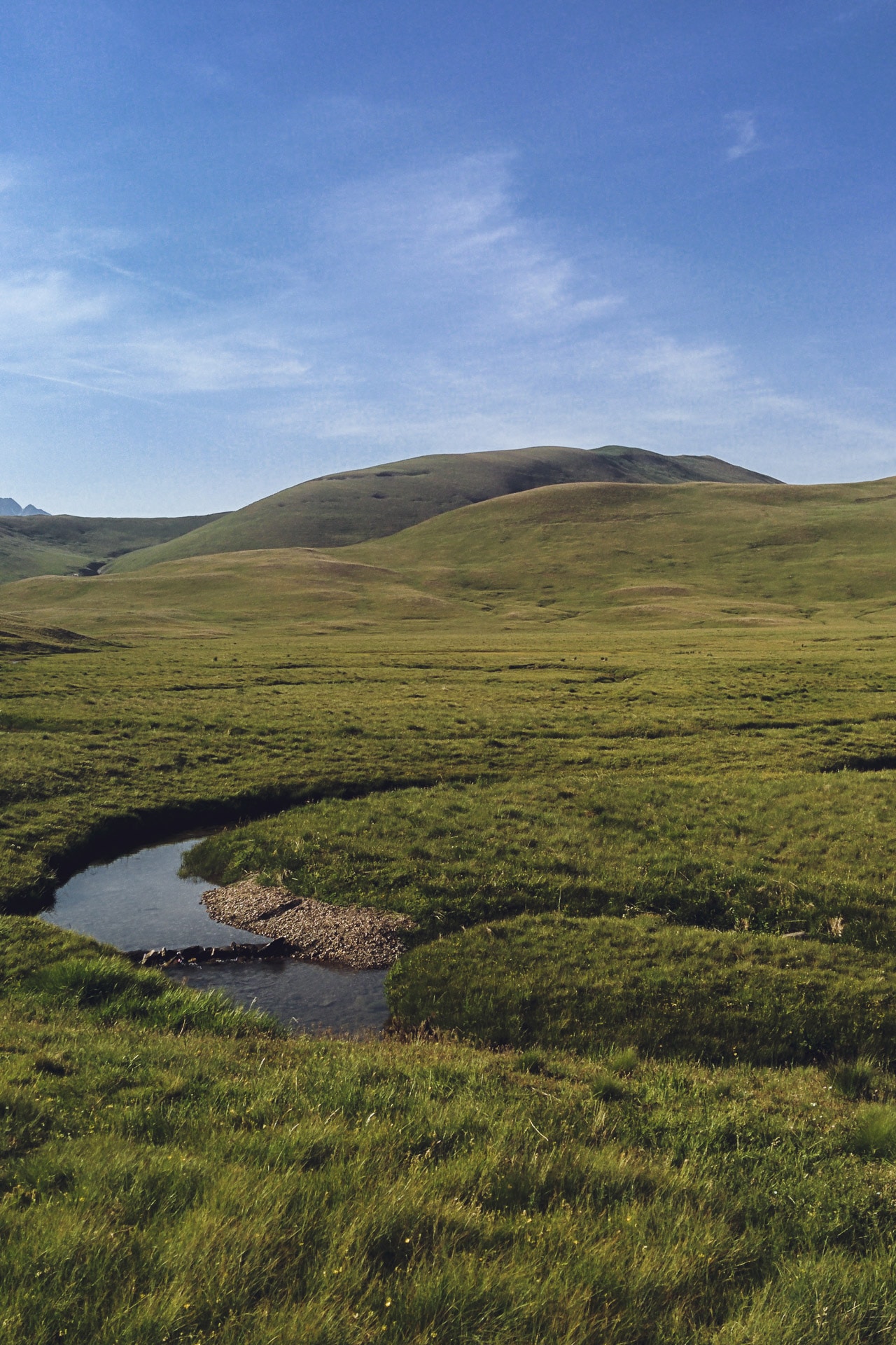
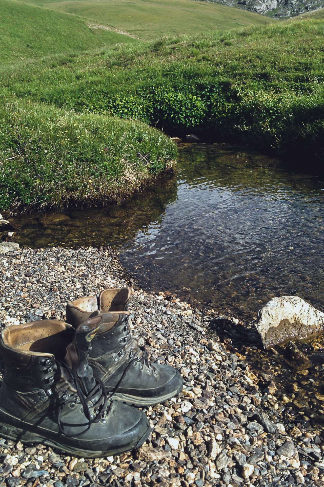
Our location for the night is very beautiful. It is slightly overhanging so we saw all over the plateau. Right next to the camp, the “Rif du Coin” allows us to cool off and wash our belongings …
The evening ends with a well-deserved freeze-dried fondue and an army of flies to wish us good night …
Day 3 : from the Plateau d'Emparis to the Lake of the Star (Lac de l'Etoile)
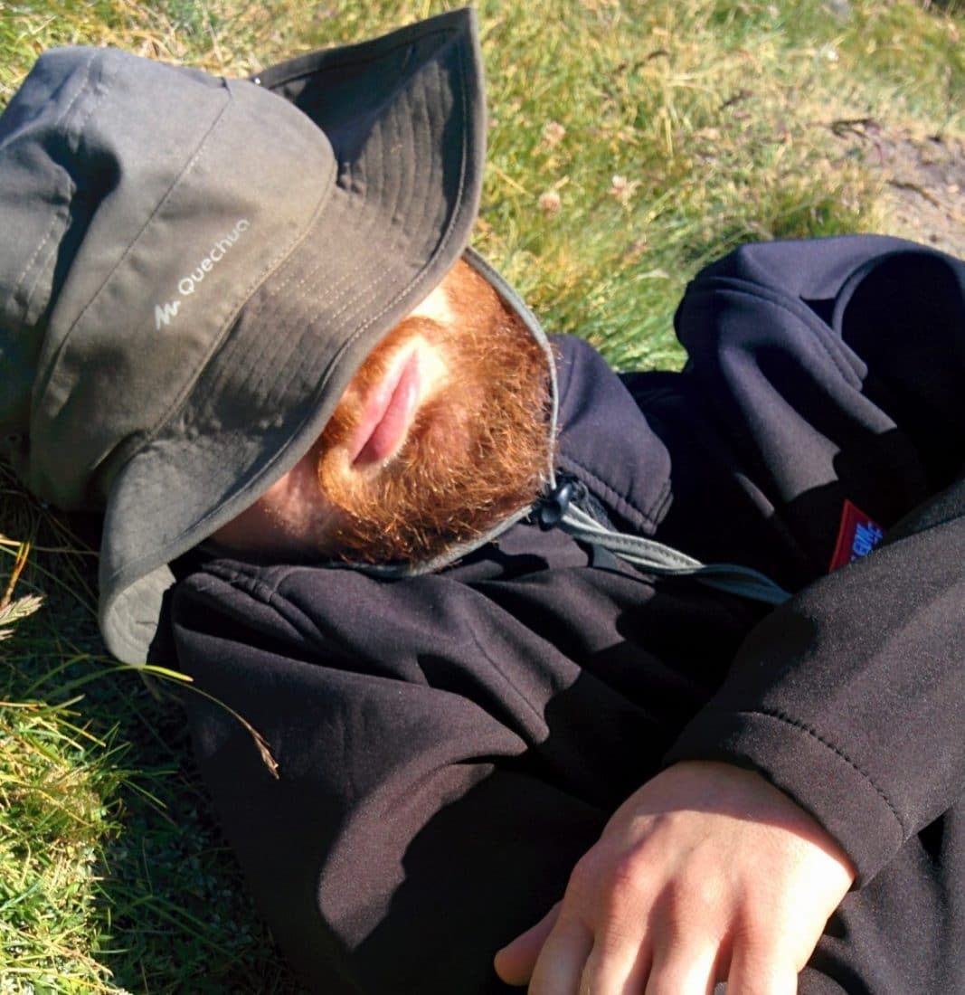
The day begins with bad news: Quentin decides to stop the GR given the state of his feet and the pain he feels at each step … He will go down to La Grave and continue hitchhiking until at a train station. I will continue without him.
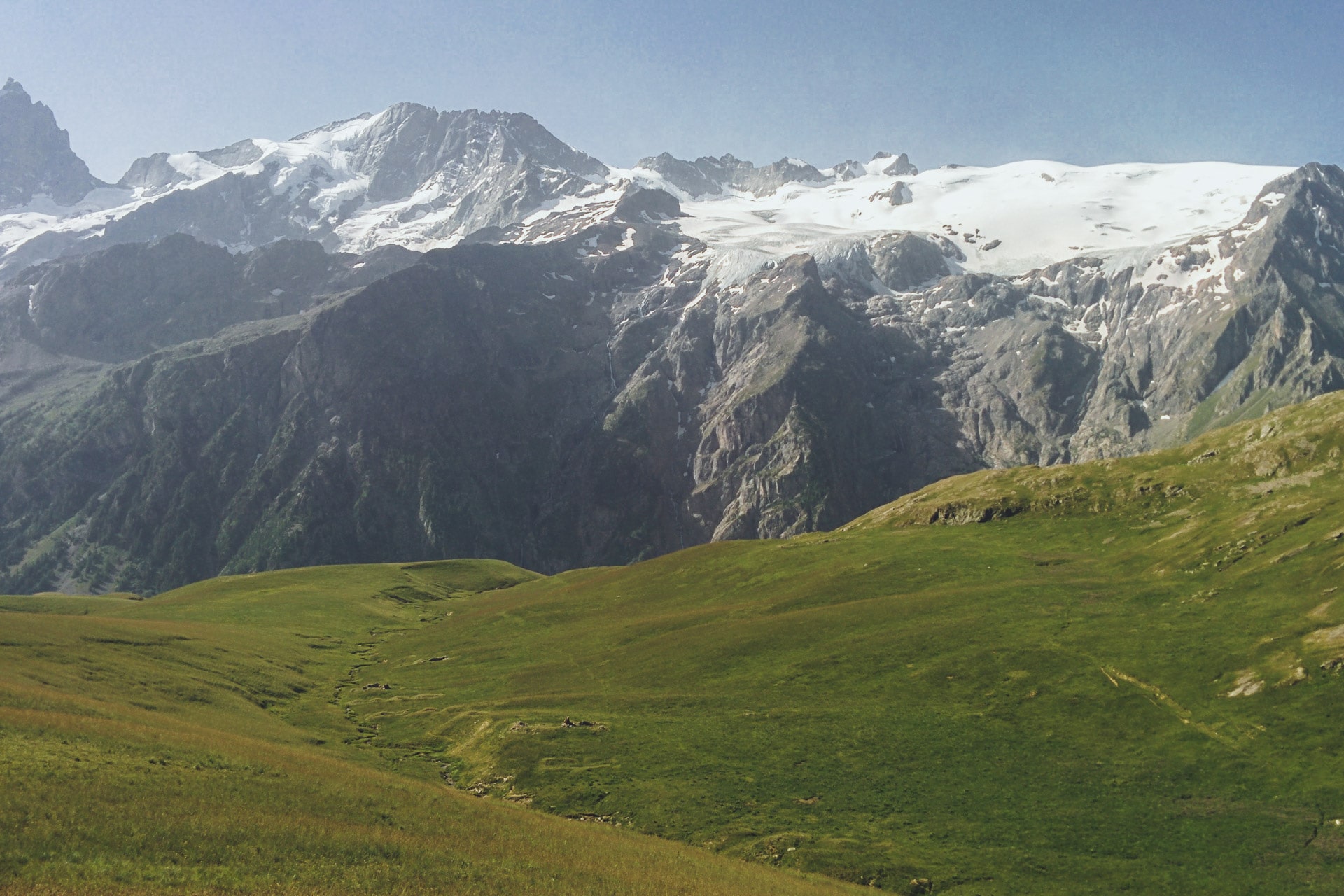
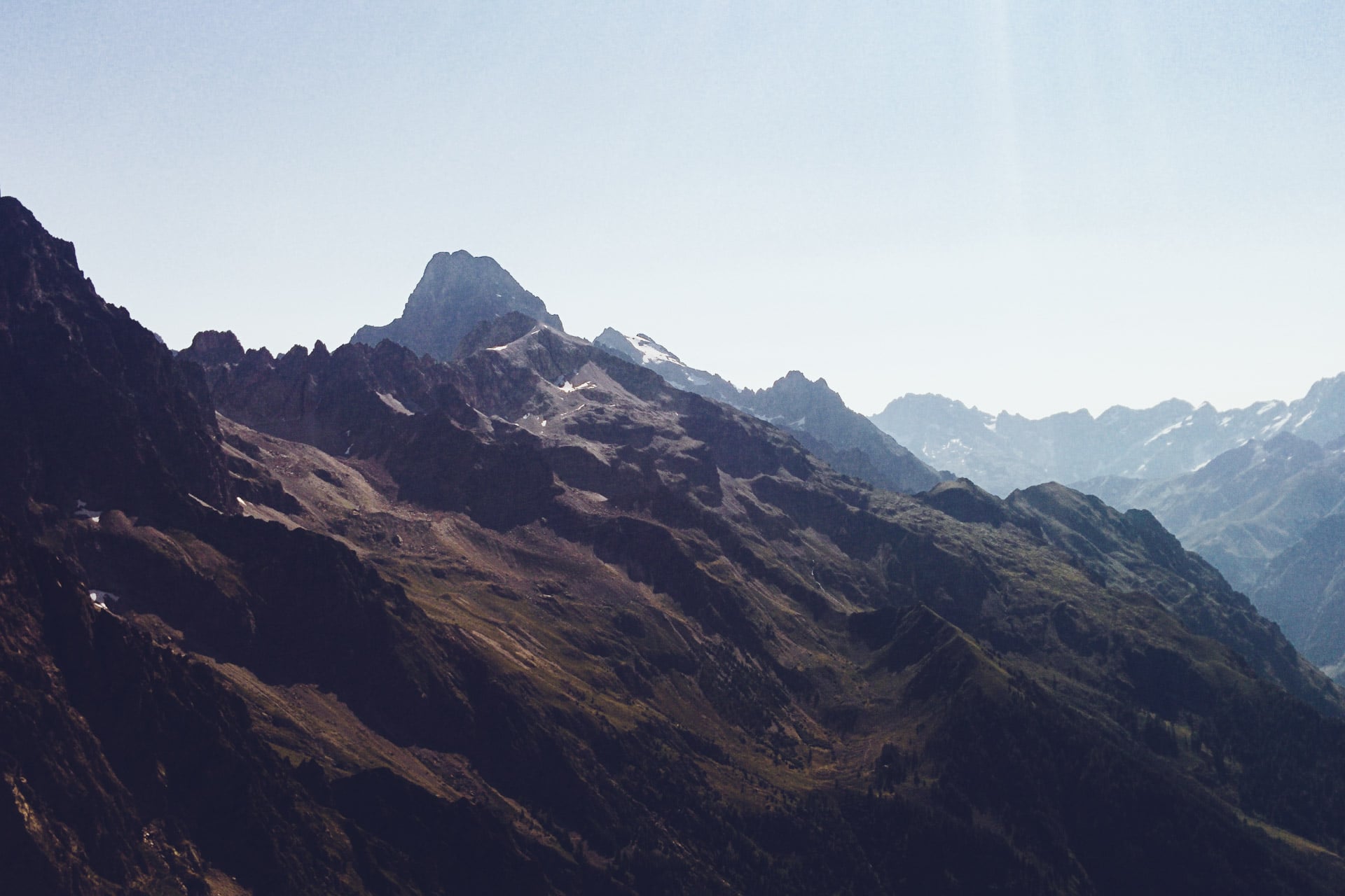
We are once again hunted by flies this morning. The climb to Col du Souchet (2365m) does not present difficulties and is quickly done. From the top, the massif of the Meije is revealed, beautiful and impressive.
The descent to the Grave is pretty especially thanks to the Meije (3983m) in the opposite side of the valley. The GR54 also passes through some pretty village like Chazelet or Les Terrasses. La Grave is also pretty but more animated already.
After the lunch break, Quentin stays there and I continue, sad moment … I wish he could continue but according to the state of his feet is better for him. I will continue alone but it does not matter it will give another dimension to the GR.
Let’s go to Villar-d’Arêne and further Pont d’Arsine. The path is flat and easy by cons it is a stifling heat … I stop almost every hour to drink 1L of water … I’m soaked …
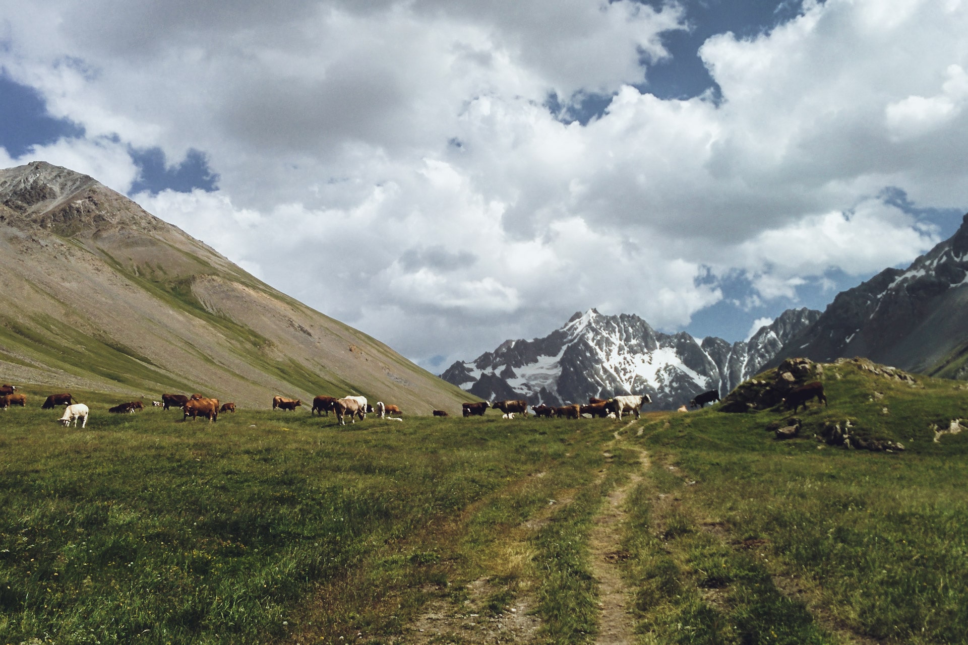
But I cover ground and I quickly find myself climbing the path that leads to the Refuge de l’Alpe de Villar-d’Arene. I am greeted by a herd of cows.
To finish this long day, during which I did a lot of kilometers I’m looking for a corner for my bivouac evening (after taking a small beer at the shelter …).
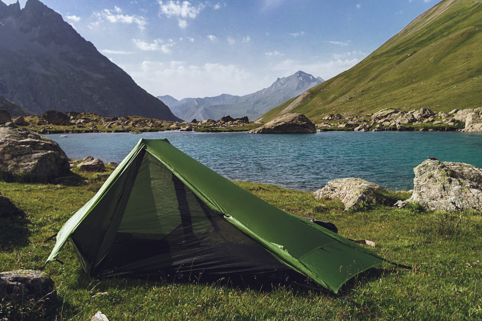
My choice will be on the Lac de l’Etoile because it is a little hidden from the path and especially because the location is superb! A hell of a day that ends and especially a hot day! I will have drunk almost 7L!
Day 4 : from Lac de l'Etoile to Vallouise
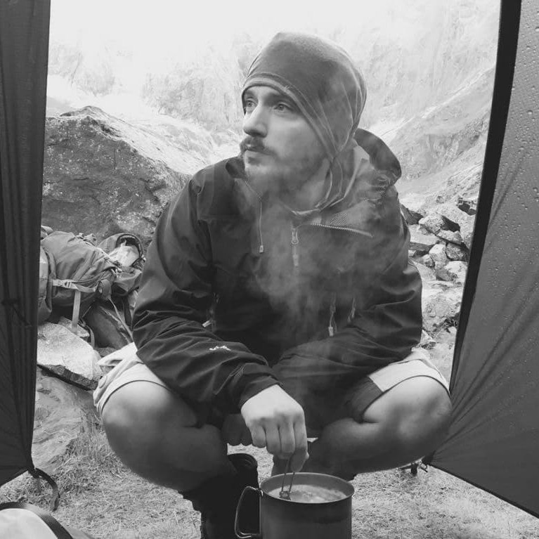
I survived my first night alone … The most disturbing in the mountains at night is the silence that reigns not the noise around.
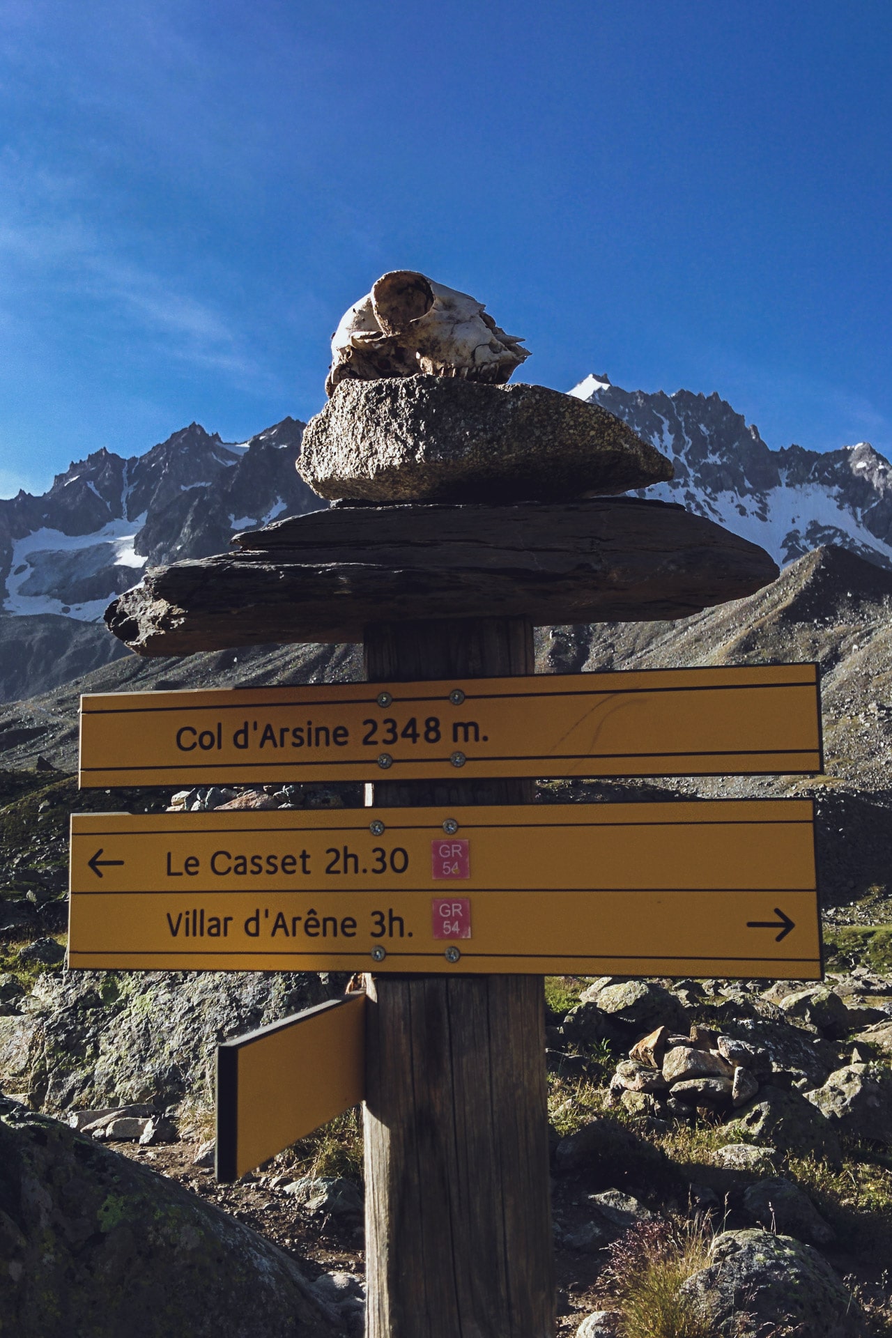
I fold my bag after a quick breakfast and I leave towards the pass of Arsine (2348m). At the pass there are a lot of marmots but the photos are not good….
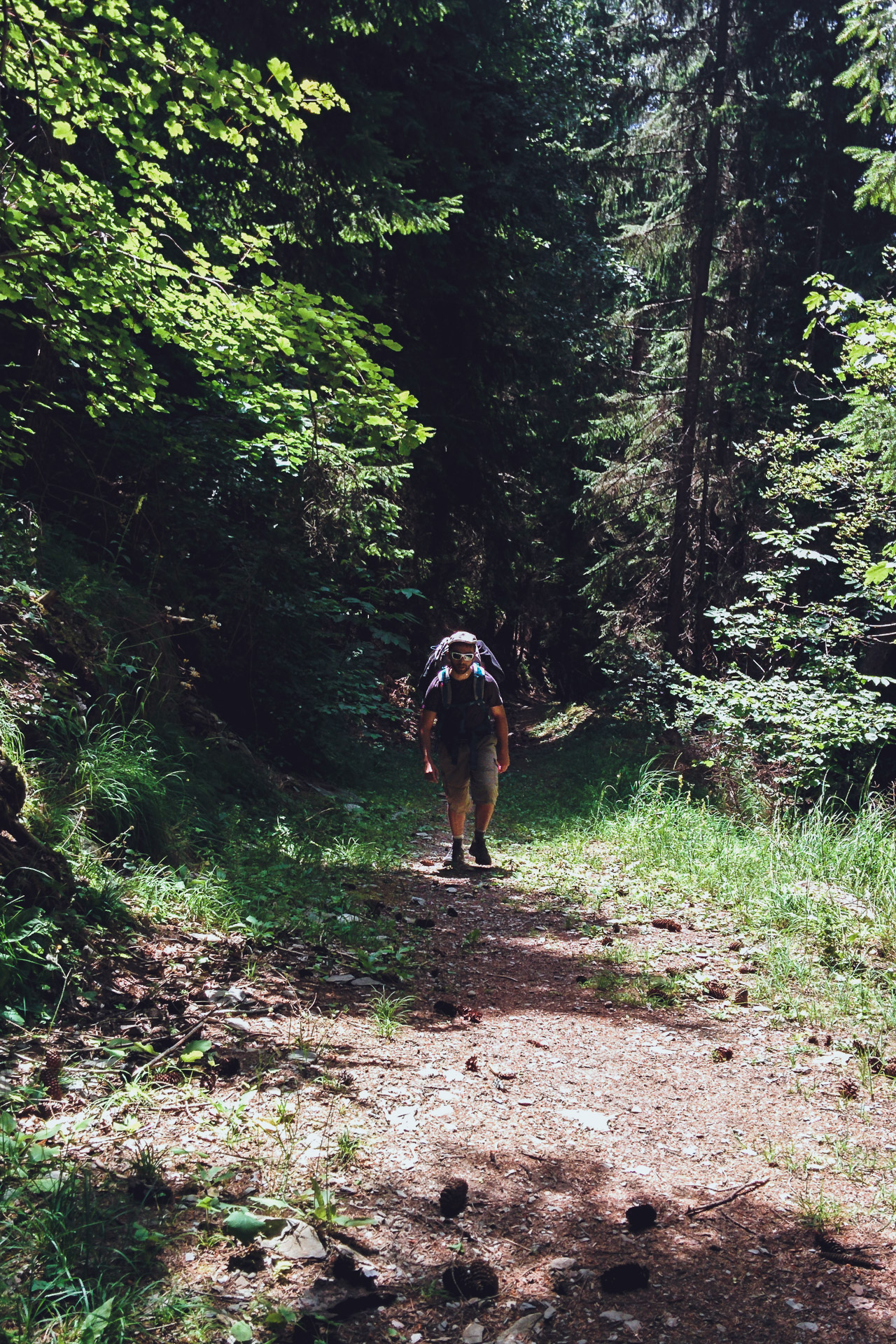
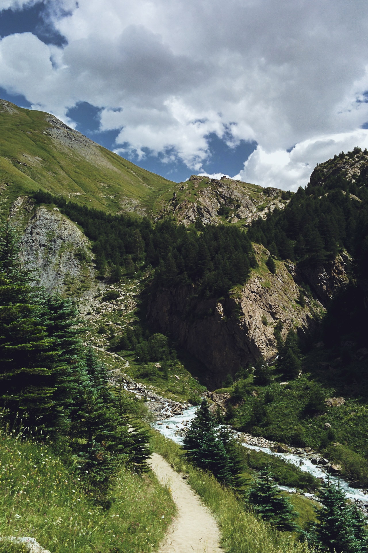
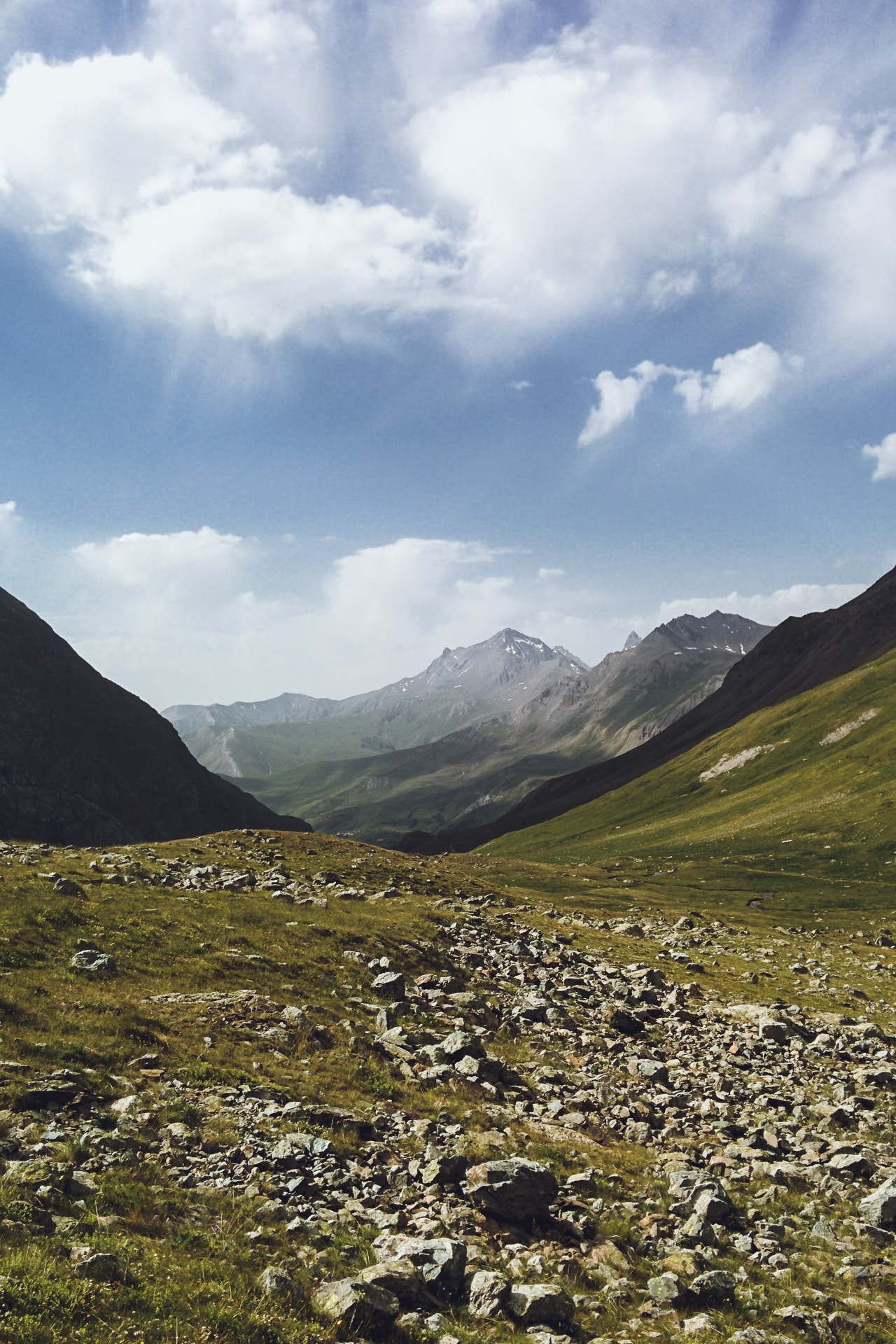
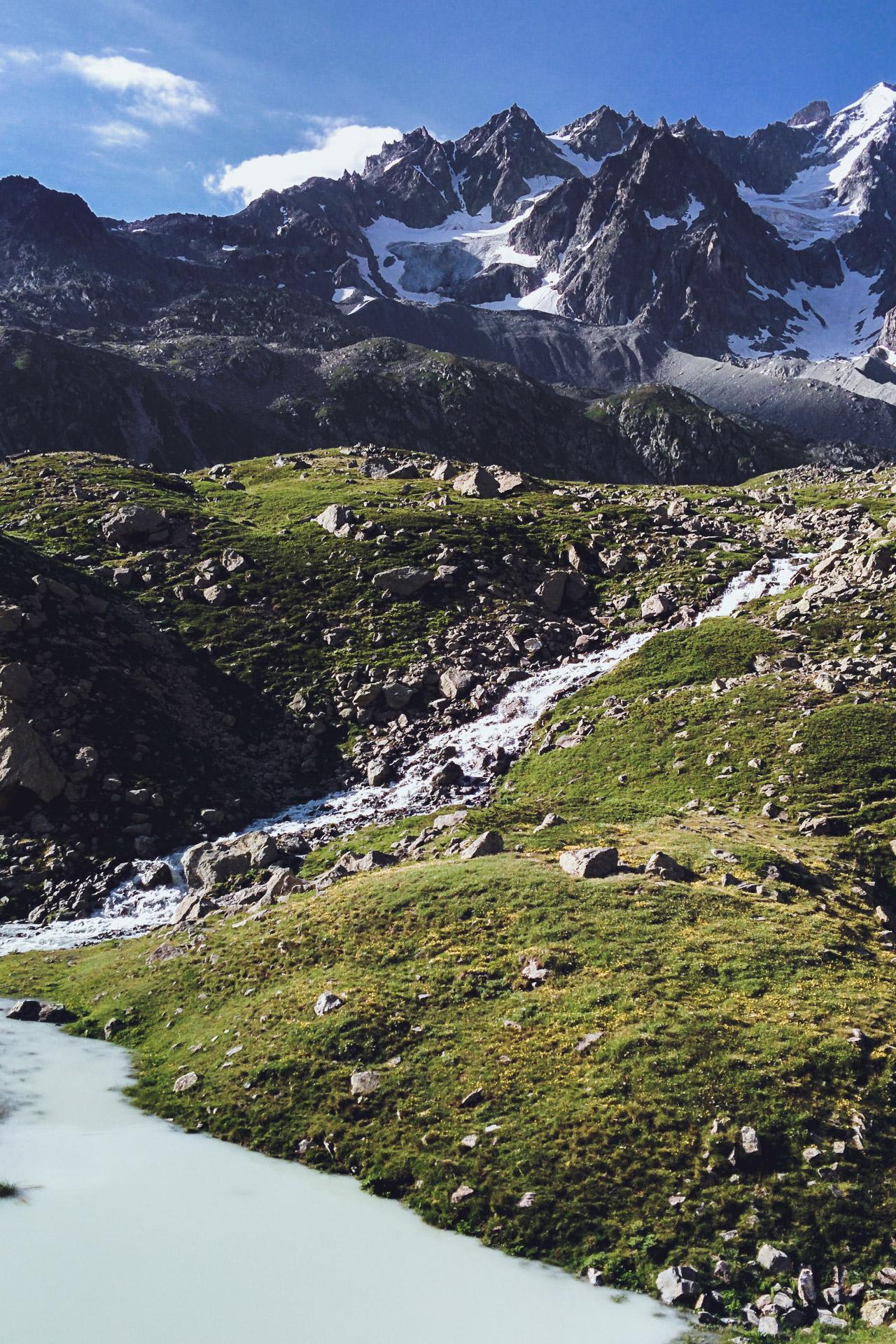
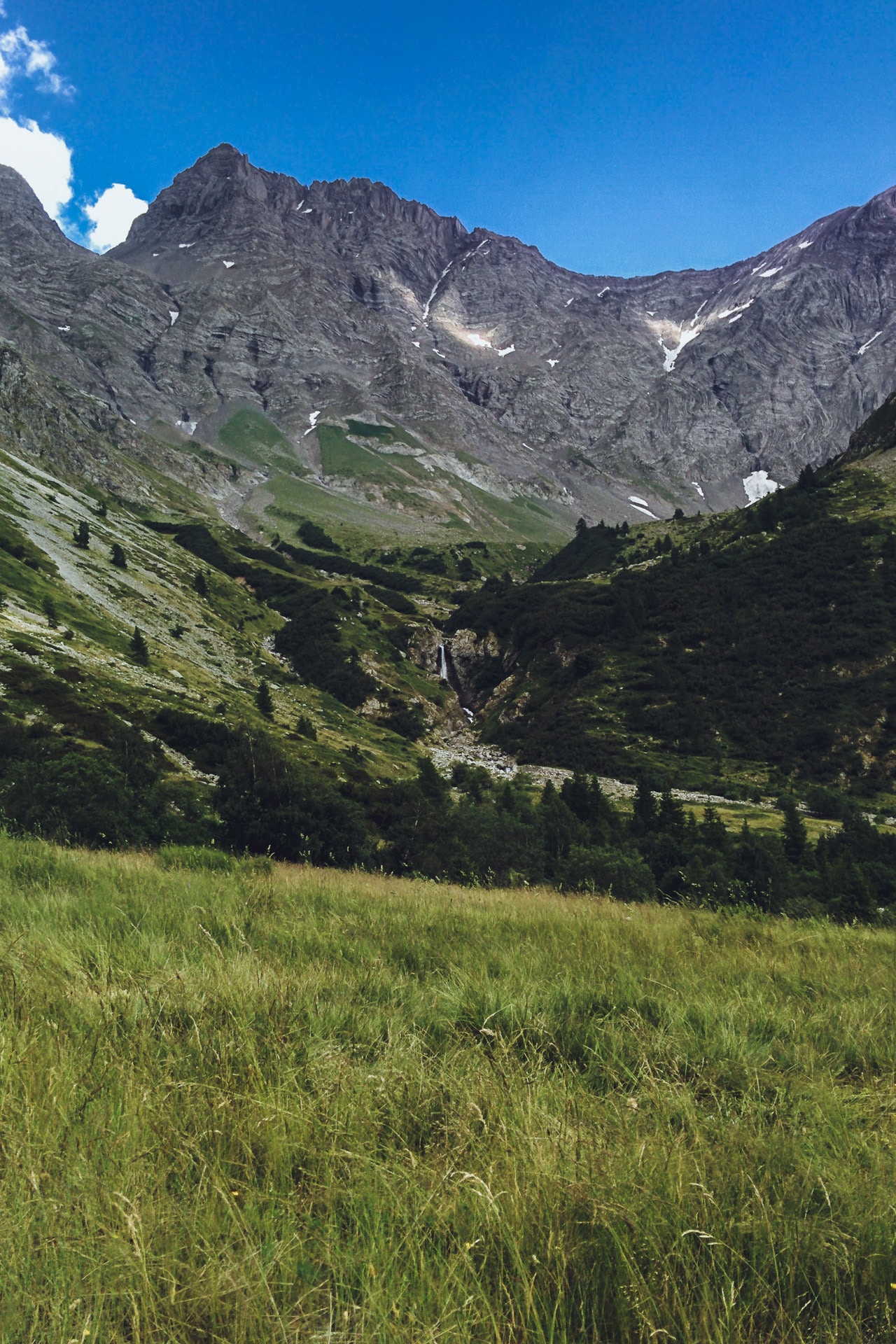
I then begin the descent. I follow the stream of Petit Tabuc which is growing while the altitude decreasing. The mineral setting gives way to coniferous forests. It is a beautiful landscape, it is still cool enough to enjoy and as the days before I do not meet anyone …
The path then continues to Le Casset and Le Monêtier-les-Bains. I start to meet hikers who go up to the pass. The trail begins to “civilize”, there are cyclists and more and more people. Everything has a less charm now …
After a break in Monêtier, I start the climb to the Col de l’Eychauda (2425m). The beginning of the ascent is great in the shade under the cover of the forest. I meet some deer who also seek the freshness of the undergrowth. The climb is done following the Torrent de la Selle, it’s nice.
By cons, around 2177m, we land on a chairlift area and installation of winter sports … it breaks the whole atmosphere. The path is stony and dusty, everything is “controlled”, artificial. This is the way to the pass, which has a retention lake for artificial snow.
I continue in the Ravine of Neyzets, fortunately the view is nicer here.
The 600m descent to Chambrian hurts your knees especially if you count the 800m of D- after the Arsine pass … To top it off I’m entitled to a bleeding nose abundant probably due to heat, altitude and dehydration.
I decide to continue to Vallouise for tonight to spend a night at the camping to have a good shower. The problem is that Vallouise is not very close and the road to go is only tar.
So I’m going to do a little bit of hitch-hiking to save my little knees … A Dutch couple will take me after a few minutes and, lucky enough, they are staying at the campsite where I wanted to go!
They deposit me in front of the reception, great. After settling my tent I have a real shower, the first since the start! Then I spend a little time with “Vinz” another hiker who is doing the GR54. It is a former bar manager in Paris who has dropped everything and who is doing hikes since. We discuss all this around a little well deserved pastis after this long day again very hot.
Day 5 : from Vallouise to the Refuge du Prè de la Chaumette.
I slept less well this night than previous … Obviously in a campsite it is noisier in the evening than at 2300m altitude ..
Today’s agenda : passage of the Col de l’Aulp Martin, culminating point of the GR54 with its 2761m. This gives a difference in altitude of 1100 from the parking of Entre les Aygues followed by a descent of 900m. A sporty day but after four full days I’m starting to get fit.
As I just said I will start the day at Entre les Aygues because it is only tar since Vallouise. So I can get hitchhiking for these 8km.
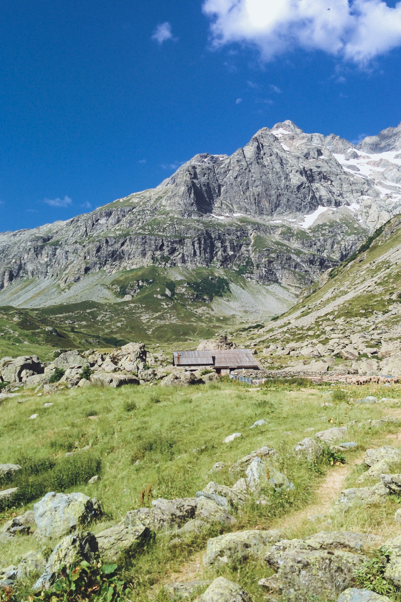
The beginning of the path is very beautiful. We walk in the valley with the beautiful Torrent de la Selle next. After a few kilometers we arrive at the Jas Lacroix Hut where the shepherd is resting and where I recharge with water. The site is charming.
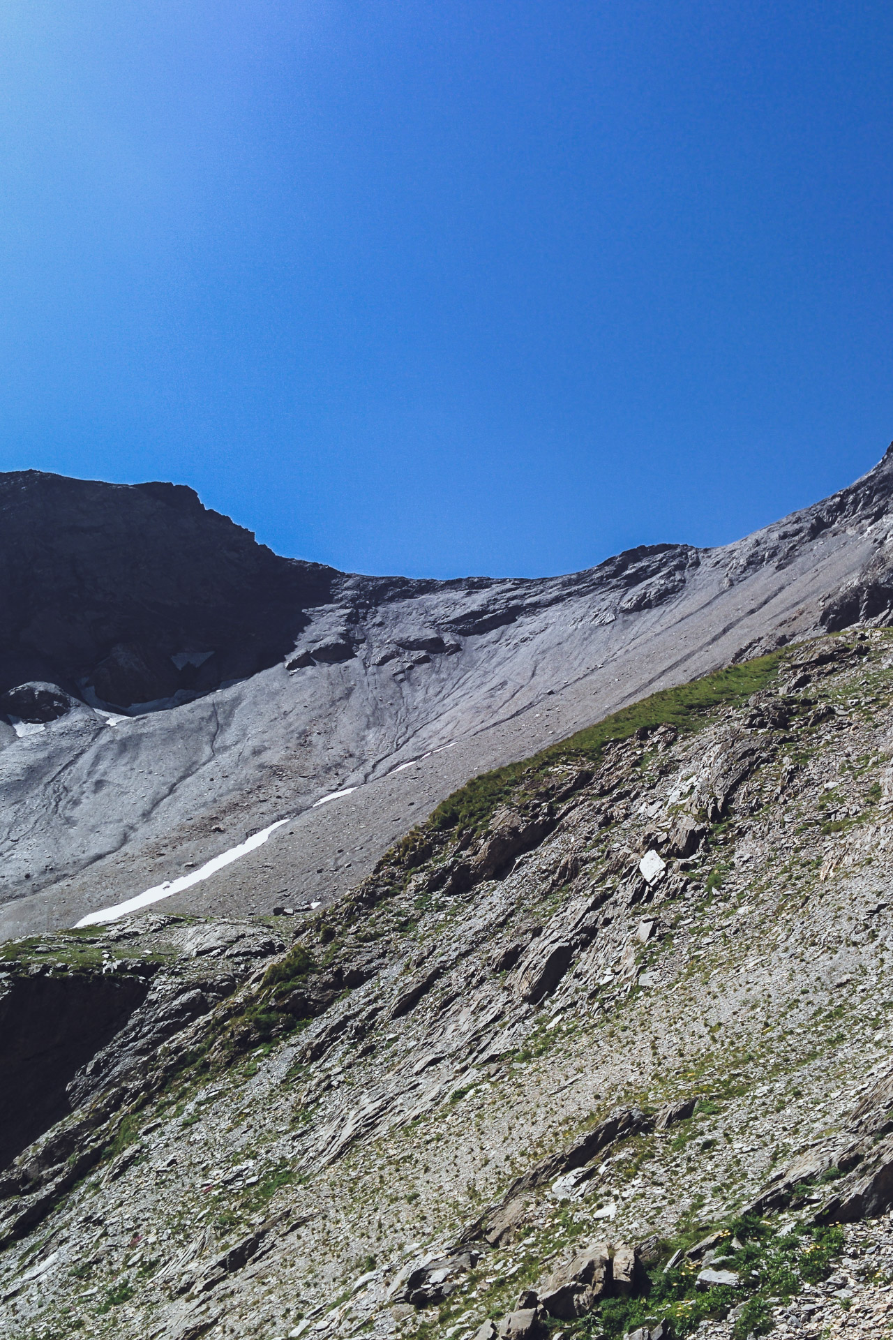
The GR54 changes quickly after the hut. The environment becomes more and more mineral. The 700m of D + above the cabin are not easy especially in this heat.
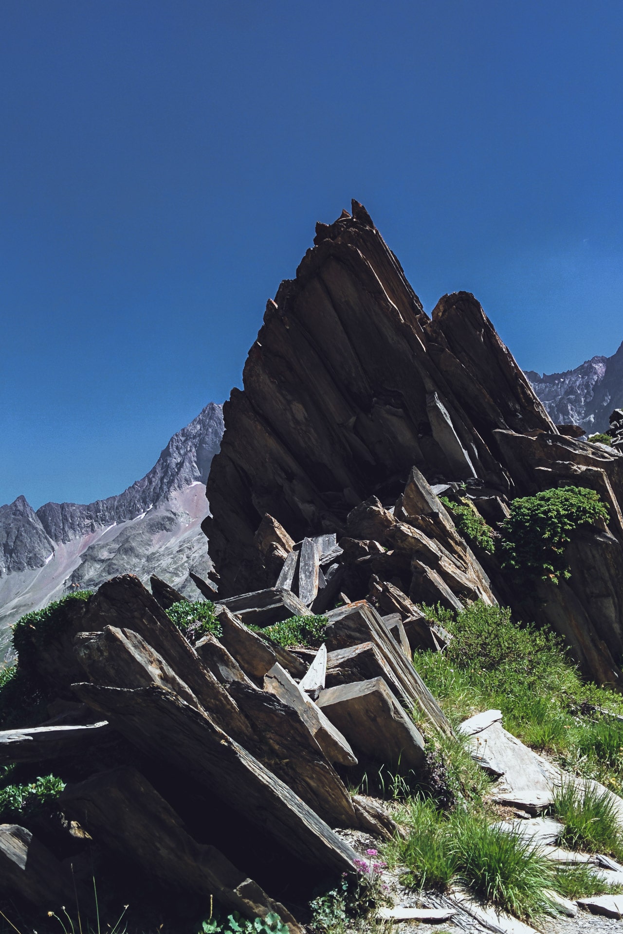
The end of the climb is carried out in a 100% mineral environment. I think the rock is Gneiss, those are kind of very friable stacked slates. You have to be a little careful if there are people above. I also think that in case of rain the path must be quite slippery, so be careful.
In any case I finally arrive at the top, very nice view. I meet a couple who makes the GR54 with whom we chatter a little.
The path then crosses to the Pas de la Cavale (2735m). Then you have to start the descent to the Refuge. The view is beautiful. There are many sheep that hide behind rocks so as not to suffer too much from the heat.
I quickly loose altitude and I am relatively early at the Refuge of the Pré de la Chaumette (1790m). As I have time, I eat a good omelette, a piece of pie and a beer, great luxury! I spend a good part of the afternoon talking with the guardian. It’s always interesting to talk to the guardians of refuge, they have lots of things to teach us.
Later in the afternoon, the couple from earlier also arrives at the shelter. We will then look for a place to bivouac. The bivouac is allowed next to the shelter but in a specific area, just ask the guard to indicate it to you in case of doubt. Unfortunately the terrain is not very flat and especially very grassy (tall grass) it is not the most practical. In the evening Vinz finally arrives with his huge backpack which must be filled to more than 20kg.
End of the day always with flies and a good night sleep …
Day 6 : from Pré de la Chaumette to the Chapelle-en-Valgaudémar
One again a long day in perspective: three passes to do and quite a few miles to the village!
I begin early but the couple of the day is already gone! The beginning of the path is done quickly without difficulty. Despite the drop, I’m gaining altitude quickly. In the climb I catch up with the couple who is enjoying.
After the pass, a steep descent starts and it is made of this rock very slippery, so be careful especially if it rains!
A bit of flat and then the Col de Gouiran (2597m) that goes easily.
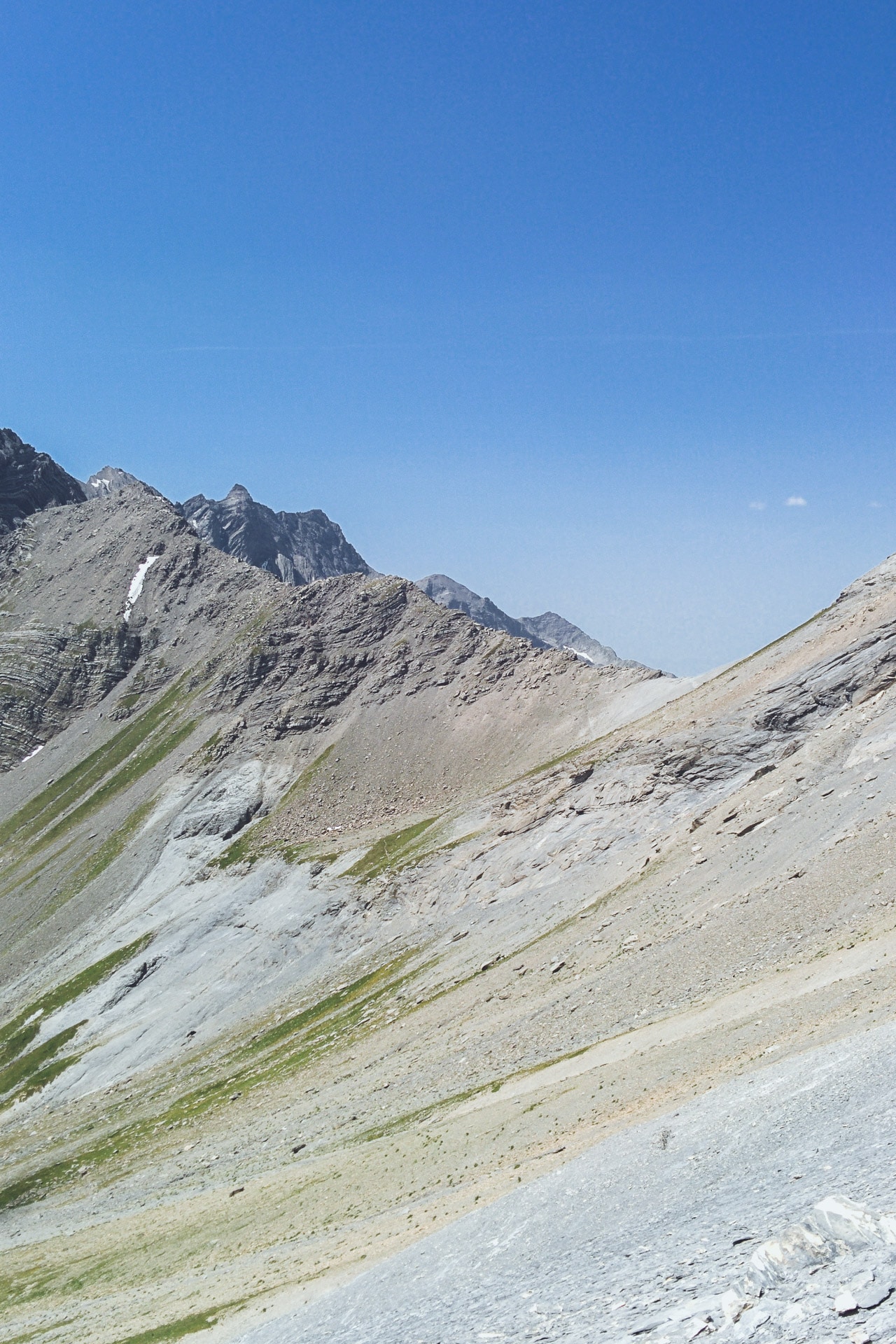
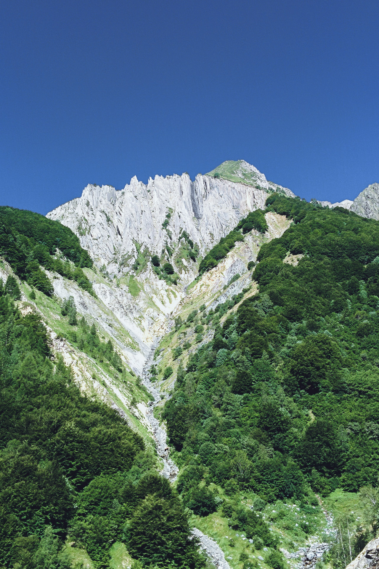
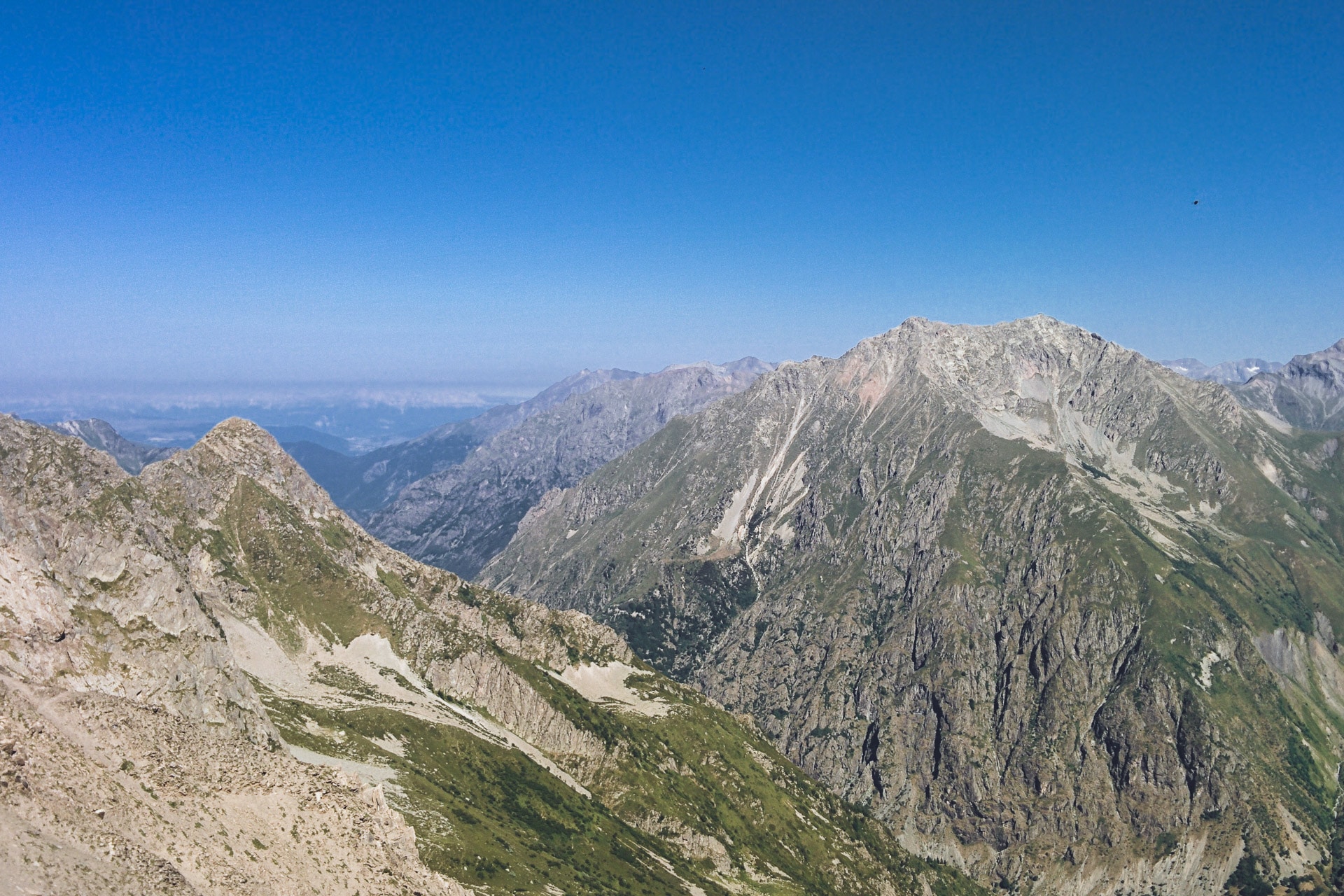
The physiognomy of the terrain has changed a lot in recent days, we are in the southern part of the GR54 which is much more “mountain” in terms of “minerality” and atmosphere. All this part will be my favorite until the Muzelle.
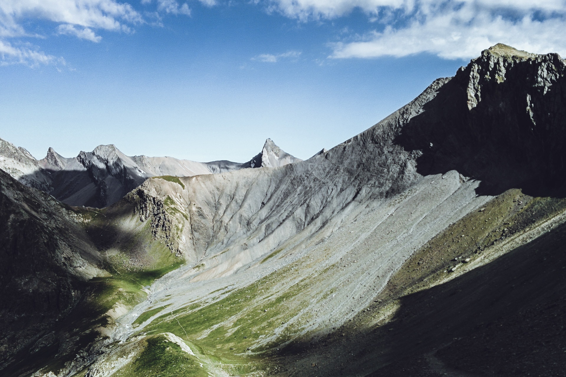
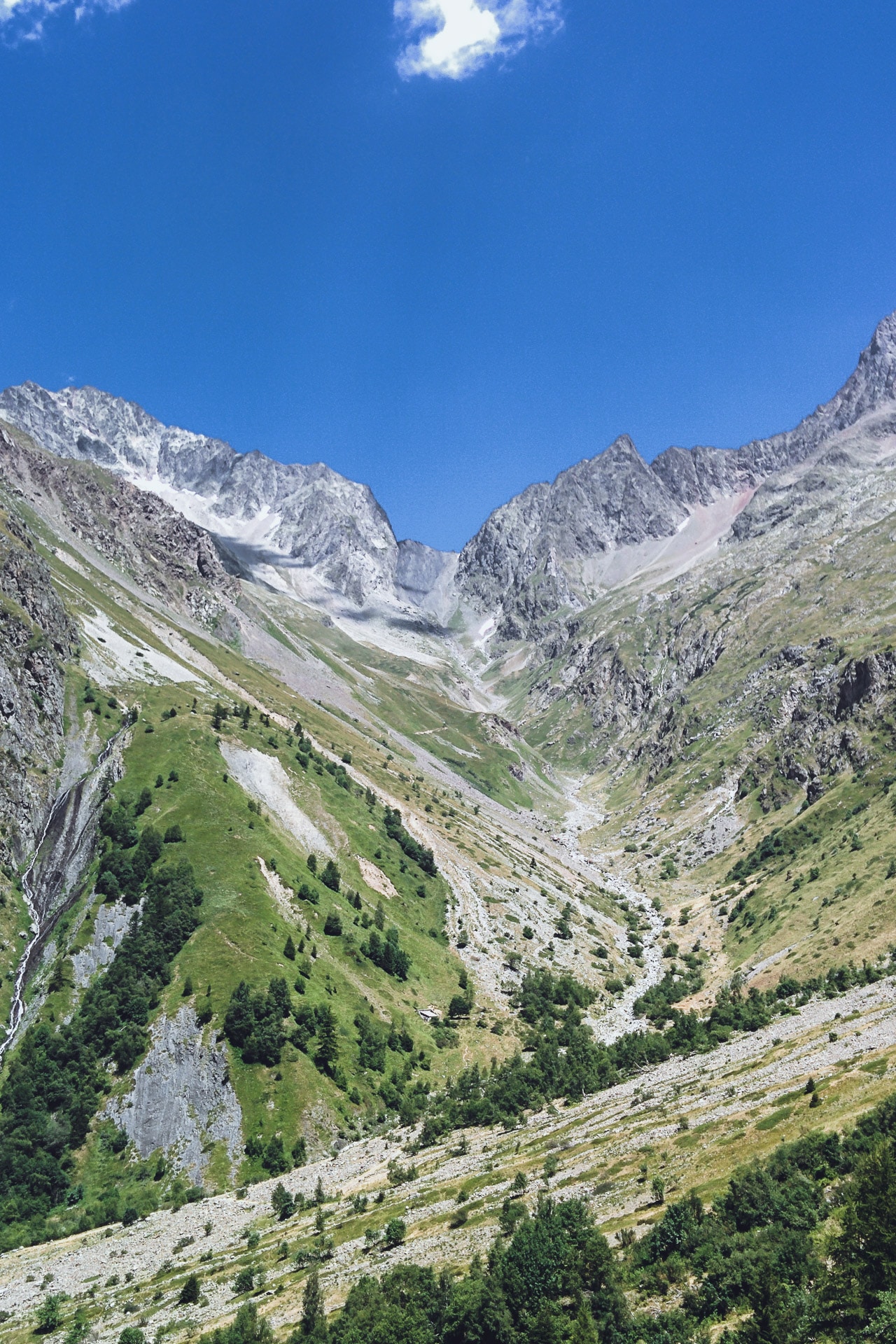
Once the Pass of Gouiran done, one follows the “Vallon Plat” until the Col de Vallonpierre (2607m). Unfortunately too much taken by the way to go I forgot to make photos here but it is one of the most beautiful scenery of the Ecrins that I have seen (you will have to go by yourself…). The view on the west face of Sirac (3441m) is striking and impressive!
The descent to the refuge of Vallonpierre (2271m) allows you to enjoy the show. The site of the refuge itself is beautiful with the lake and the surrounding rocky chaos, again I zap the photos (…).
I have an “omelette break” at the refuge before continuing my journey.
I think there is a very beautiful hike to do on 2 days starting from the bottom of the valley and then connecting the refuge of Vallonpierre followed by the one Chabournéou
Then follows the very long descent to the Chapel Valgaudémar, 1100m below. On my side it goes well until Refuge du Clot but then the long kilometers of flat break my knees. In addition to that it is always hot … The end of the road is along the fields is less fun. I am always surprised to see how in a few hours we go from the high mountains to the valley. The advantage of walking is to live the transition smoothly.
Finally arrived at the Chapelle en Valgaudémar, I take a place at the municipal campsite which is very good in terms of quality / price ratio. Once settle, let’s go to the shower that will be sooo good! I take advantage of the late afternoon to redo shopping and go for a walk in the village which is very pretty.
At the end of the day I meet Vinz who also stays at the campsite for the night by coincidence. So we have a little beer together to finish the evening.
Day 7 : From the Chapelle en Valgaudémar to the Col de la Vaurze.
Tomorrow, my friend Ben must join me in the village of Desert-en-Valjouffrey, the concern is that it is not far at all. So I will have to do a short way today and tomorrow.
For the moment, I’m packing up and I’m going to Villar-Loubière. The path is laid out and is not interesting. Villar is a typical and charming mountain village. It is from here that the real climb begins with the first stage of the Refuge des Souffles (1968m). I take my time but the 900m of D + are done well and in a beautiful setting.
The location of the refuge is very nice, slightly wooded. I take the time to eat one end and rest as it is still early.
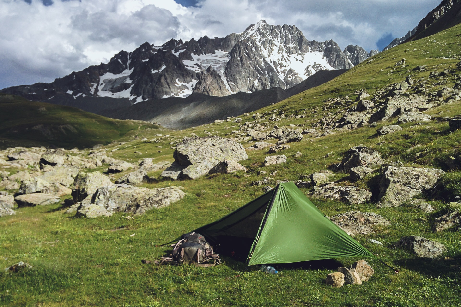
After this long break I take the road to the pass. After talking with the guardian I decided to sleep in the Perinon Ravine around 2050m. The only “worry” is that there is no water in the corner so I refuel at the refuge, I carry 4L for tonight and tomorrow morning. It may seem like a lot but considering the heat it is limited …
The path is pretty to the bivouac. It turns in the valley floor at a nearly constant altitude.
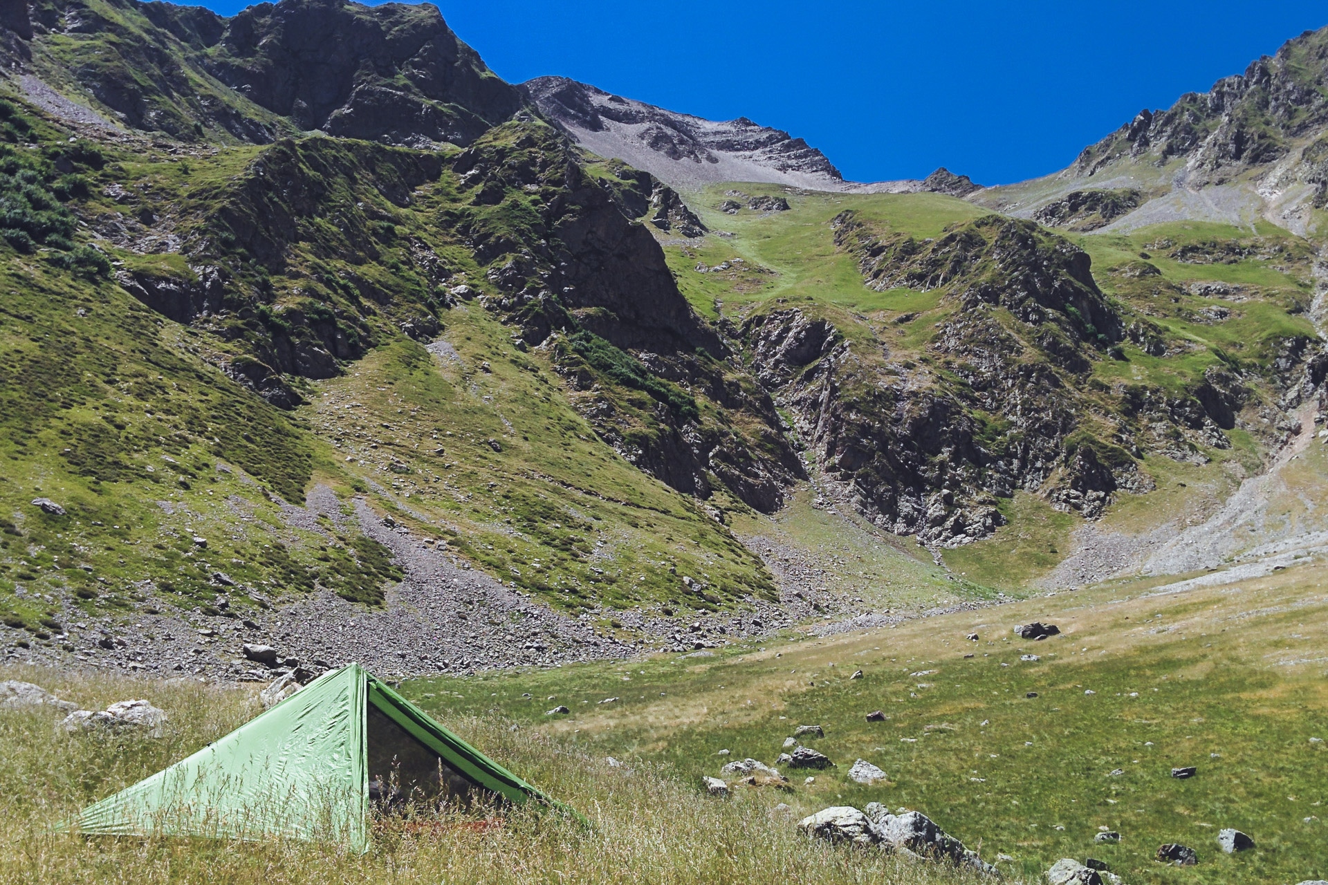
So I arrive quickly at my location for the night. I settle on the small hill south of the ravine. It’s a nice site, again there is nobody. On the other hand flies and horseflies have not forgotten to be there … No wonder since a flock of sheep graze in the corner. I hope there is no patou …
It is early so I have all my afternoon but not much to do. I turn around. I tried the nap in the tent but the sun is at the zenith and it is too hot …
The afternoon thus passes, slowly. In the early evening I visited by the herd of sheep that literally goes on my bivouac. So I play the shepherd so that they do not damage my tent and praying that there is no patou. I am impressed by the number of sheep injured, sometimes badly …
So ends the evening. Quietly … I feel good.
Day 8 : from the Col de Vaurze to the Désert en Valjouffrey
A short day in perspective: I pass the pass, I go down to the Desert and I’m waiting for Benjamin …
I start “late” by taking my time.
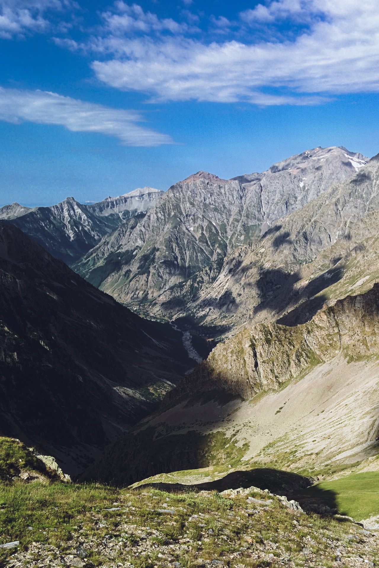
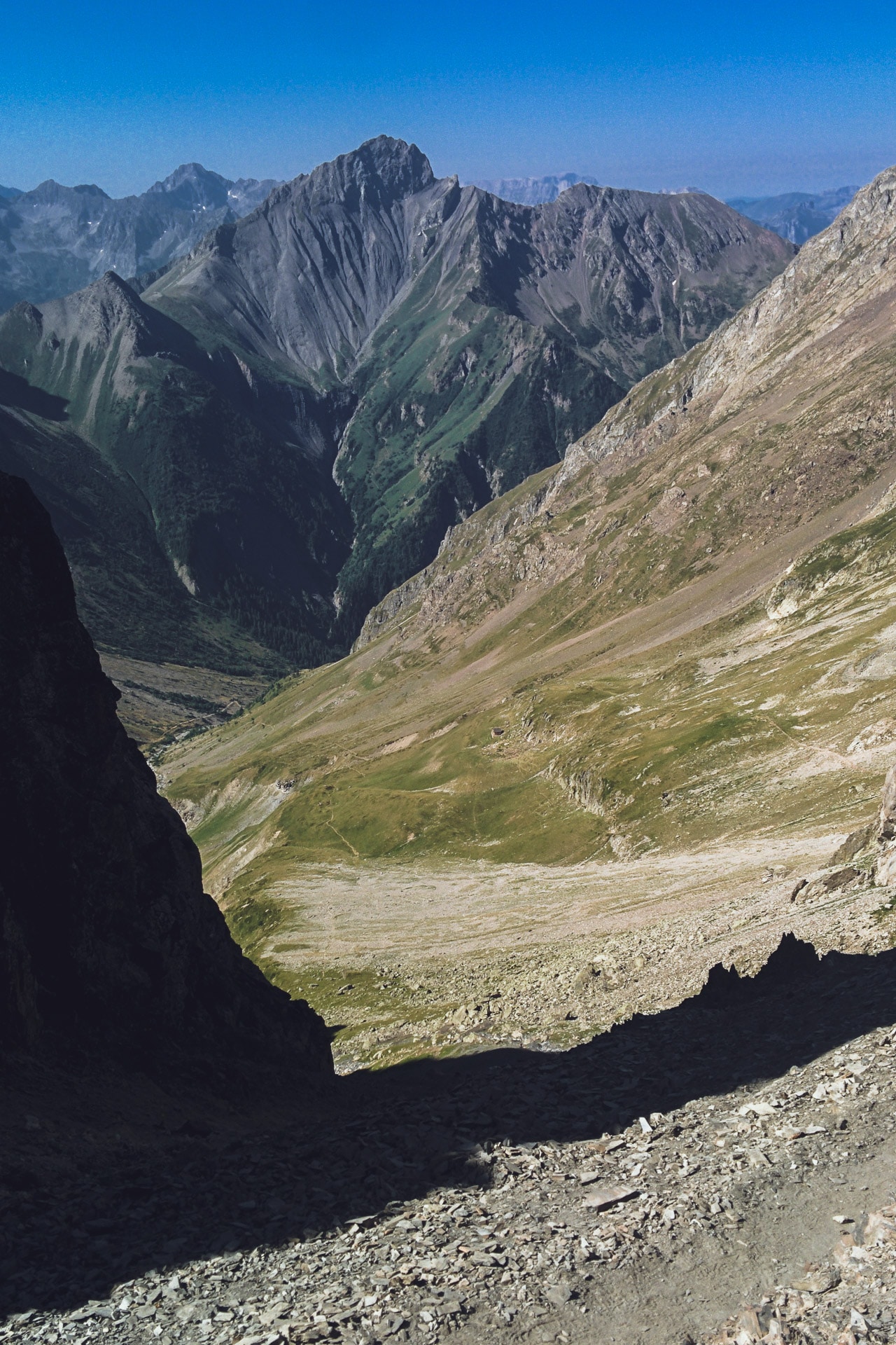
The climb to the pass is nice and not too difficult. From above the view is very beautiful, we can see the Desert in Valjouffrey far below, 1200m lower.
After a few minutes enjoying the view, I attack the long descent. In itself there is nothing really complicated but the many stones make the way a little dangerous. Shortly after arriving at the Desert, I witnessed a hoist in this way. I will learn later that it was a lady who took in the thigh a rock launched at full speed: report a fractured femur … The rock must have been “released” by a sheep upstream. All this to say be careful in this long descent. During mine I saw an impressive number of sheep with broken legs.
Still, here I am arrived at the small village. It has an air of end of the world, I like it. It is very typical. I do not have many news from Benjamin, I do not really know what time he will be there because there have been changes of trains and unfortunately the network is not good here.
In the meantime I settle at the bar “Les Ecrins” to have a drink and recharge the phone.
Time passes and still no news … I decided to go for a ride to find the evening bivouac. There is not much like a nice location and close to the village. However, I spot a corner north of the village towards Côte Belle.
I go back to the bar and I finally manage to catch a few network that allows me to receive an update from Benjamin: there was a big problem with the trains and he is not sure to find a bus to come here today in the Desert … Ouch … Anyway I have nothing to do but waiting for him. So I stay at the bar and finally I spend a lot of time talking with the manager who is of Corsican origin.
It is finally in the early evening that Benjamin arrives, carried from Entraigues to the Desert in the bucket of a van …
For the end of the evening we land at the corner I spotted, we eat quickly harassed by mosquitoes and hop to sleep.
Day 9 : from the Désert-en-Valjouffrey to Valsenestre
It is slightly wet this morning at the bottom of the valley, so we take off quickly from the camp. The first step of the day is to climb Côte Belle (2290m). The path begins gently sloping but quickly it stiffens. For my part it’s not bad as it’s been nine days that I walk but Ben struggles a little since it’s his first day and that his bag weighs heavily! But we go on. Anyway it’s useless to hurry we have the whole day ahead.
The “summit” will still be quickly reached and we give ourselves a good little break up. We meet a mother and her daughter that we’ll meet again in the Muzelle and two friends with whom we will spend the late afternoon.
The view from the top is nice; to the north we can see the Muzelle Pass, which is impressive from here.
We then go down to Valsenestre. At the top of this section we find some interesting rock formations that could be reminiscent of sculptures.
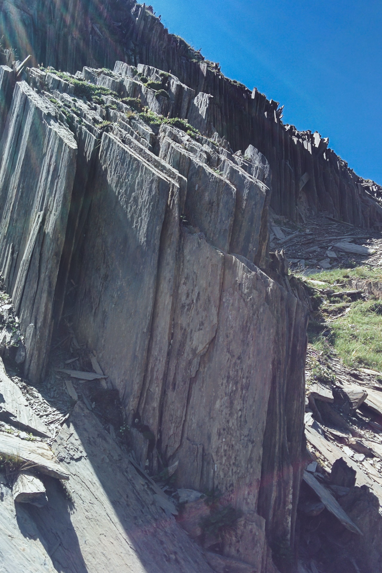
The rest of the descent is done in the scrub. It’s long and rather monotonous after a while … Not to mention the heat still present.
Arrived in the bottom of the valley we head to the village but we will stop before near the river to bathe a bit and wash our stuff.
It is still relatively early. So we kill time as we can at a picnic table. First of all, we are joined by the Cote Belle friends (a guy and a girl). We end the evening quietly with them.
For the bivouac no choice. There is a mandatory space and we will respect the rule. By cons there is not even a water point or any development whatsoever.
Tomorrow last day of real walk and last pass to pass …
Day 10 : from Valsenestre to the Lake of La Muzelle
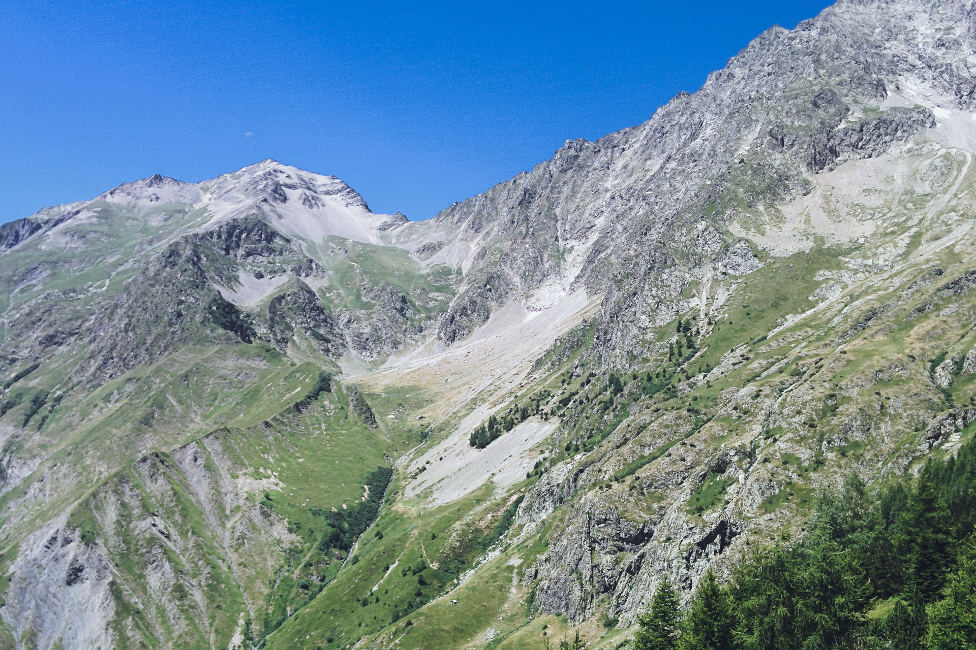
We leave early to climb to the pass in the fresh morning. We reach the GR54 where we had left it, a little higher. 1100m to climb with a final that is deemed a bit dangerous.
The beginning slowly climbs up to the level of the Ramu Hut (about 2100m on the GR). After, it gets steeper and the laces are linked to the top. It is slippery rock but it feels comfortable. Viewed from below the pass is impressive. We ride each at his own pace. I’ll get to the top first followed by Ben a few minutes later.
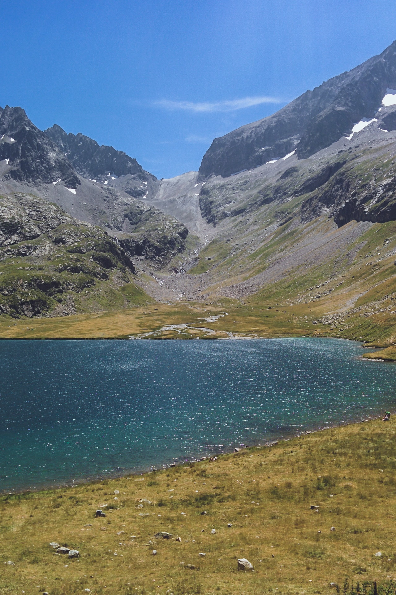
The view of Col de la Muzelle (2613m) is fantastic ! Front extends the lake nestled between the cliffs and overlooked the Roche de la Muzelle (3465m).
The descent to Lake Muzelle (2099m) is good even if you have to be careful with your ankles because there are many pebbles.
Arrived at the bottom we go directly to the refuge to savor a well deserved beer once again! It is early so we are also eating and we enjoy the moment. We meet again the mother and daughter of Côte Belle and the two of the day before.
We will join a place for the bivouac not too late because unlike the previous time I came here there are a lot of people since the lake is easily accessible from the valley. ..
But you will find some nice places around with a beautiful view of the lake. Last bivouac, last night in the mountains …
Last day : descent and going back home
That’s the last day. Tonight we’ll be in Paris …
We fold everything one last time and we start the descent along the Creek Piss. It is a pretty way well in the shade and embellished by the tumultuous waves of the torrent. We cross a lot of people who spend the day at the lake.
Once at the bottom, we quickly reach Bourg d’Oisans by hitchhiking to avoid a long, flat part and manage to catch an earlier train.
The loop is complete and the GR54 finished!
Pouf! Here we are back in Paris in a few hours while this morning we were still at 2000m in a superb setting. End of this adventure, prepare the next ….
Conclusions
It’s not going to be very original but I loved this GR. As I said in the preamble it has nothing to envy the GR20 or the Tour du Mont Blanc I think. On the contrary, the fact that there are few people still improves the experience.
The Ecrins are definitely one of the most beautiful mountains in the Alps, I really advise you to go discover it. Many of the GR54 stages can be done on a day (round trip) it’s worth it!
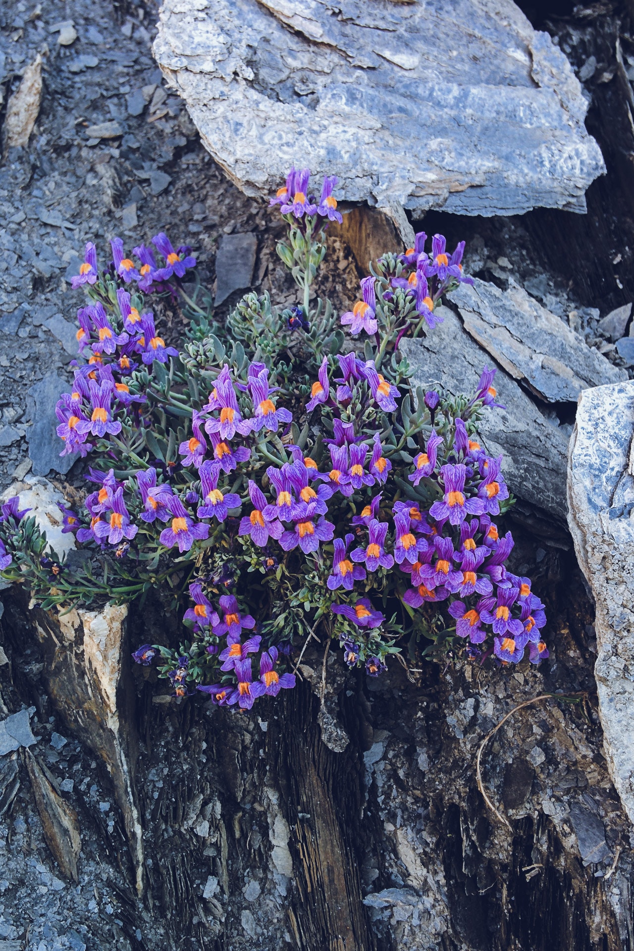
In addition to landscapes there are Chamois, Ibex, birds of prey and of course Marmots.
Like all GR, the GR54 is perfectly marked so no worries of mapping. We cross every day a refuge so you can do it without tent.
Walking alone was also interesting but it was a shame that Quentin had to stop so early…
Anyway this hike was amazing and I strongly suggest you to do it !
Quelques infos utiles :
- Pour la préparation du GR54, je vous conseille l'excellent TopoGuide de la FFRandonnée : Topo Guide
- Toujours utiles le numéro du PGHM des Hautes-Alpes : 04 92 22 22 22
- Site du Parc National des Ecrins : http://www.ecrins-parcnational.fr/
Hello, thank you for the great trip report. I have a couple questions. Do you have a gpx file you can send me? It looks like there is one on the desktop version of your page but the map does not show up on my phone. Also can you tell me where to find all the bivouac areas ahead of time so that we can plan our days? Is there a specific website or map that shows them? We plan on camping the whole hike. Thanks!
Hi Ryan, I can email you the gpx. Just contact me with the “Contact” page please. Concerning the bivouac, you can usually set your tent next to the refuge (just ask to the guardian). Otherwise if you just stay for a night you can put your tent anywhere you want.
Hi there, thanks for the report and the pictures, it was great to read and it helps a lot with getting an idea about the route. I am planning to hike a part of the GR54 in July, I will only have 5 or 6 days. I will start in Bourg d’Oisans, but I am doubting whether I should start walking clockwise (North) or counter clockwise (South). From your report, I get the sense that South may be a more attractive option. What do you think? Thanks in advance for your advice.
Hi Laura,
I agree with you. South is more attractive in my opinion (wilder). In 5/6 days you can walk more than half of the trek so enough to enjoy the wonderful landscape of Les Ecrins 🙂
Hi,
We are planning to hike this GR starting next week, so your report ist really useful. Thanks! But could you tell me what you did for water? How much did you carry, and were there often places to refill? Did you filter water from streams?
And do you have advice on how not to excite the Patous? Or should we just hope there is a shepherd nearby … 😛
Thanks again 🙂
Hi Christopher, Water is easy to find along the GR (when I hiked it a least) : there are fountains in the villages, stream along the path, water at the shelters. I was carrying around 1 or 2L of water depending of how far I was from a village. Uselly I had a pill of “micropur” to clear the water.
About the Patou, you can cross some : don’t panic, just try not to cross a herd of sheep. If they spot you, they will come barking and making you going back, just do it calmly. Don’t have “agressive” behaviour. Do not run either. Speak to them calmly saying they are “good dog doing good work” (it works I tried it in Queyras 😀 ). To be honest, it’s very impressive but if you follow ‘logical’ behaviour everything will be good.
Some advices in French : https://www.chartreuse-tourisme.com/destination/le-blog/patous-et-chiens-de-protection-nos-conseils-aux-randonneurs/
Have fun, GR54 is wonderful
Hi,
What kind of sleeping setup would you recommend? We planned on doing the gr54 next year end of july and we’re not sure how cold it could get during the night. Do you by chance know/remember the temperature during the night?
Hi Daniel,
Usually, I take a +5°C to +10°C sleeping bag if I go in the moutains during summer. It’s a bit warm but it’s better if there are very cold conditions as I can happen.
Thanks for your report, especially about the bivouacs. Very helpful in planning my own trek.