3days
hiking
18km
walked
1800m
D+
2lakes
We were looking for a hike of a few days with the possibility of bivouac and in particular near lakes. I already knew the Ecrins National Park and more particularly the Bérarde. I have wanted to go back for some time. It is therefore by searching in this massif that we found these two lakes: the Muzelle perched at 2105m overlooked by the Roche de la Muzelle (3465m) and the Lauvitel located at 1530m, surrounded by impressive walls. It was decided: we will spend a few days in autonomy between these lakes between June 18 and 22, 2015.
The Ecrins National Park is a French National Park located in the Alps near Grenoble and extending largely over the Massif des Ecrins. It was created in March 27, 1973.
Covering an area of 918km², the park culminates at the top of the Barre des Ecrins at 4102m.
For more information: http://www.ecrins-parcnational.fr/le-parc-national
First day - Ascent to Lac de la Muzelle (2105m)
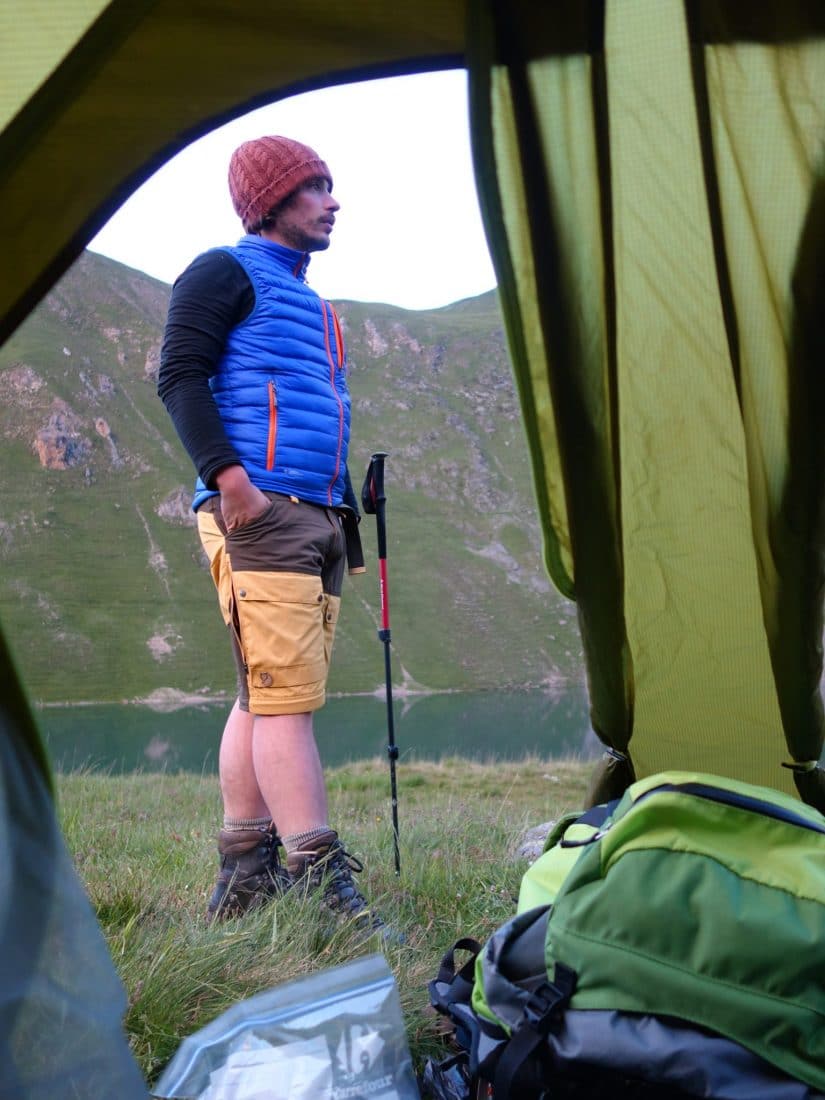
We arrived the day before in the Massif des Ecrins. We spent the night at the charming Plan du Lac gîte between Vénosc and St Christophe en Oisans.
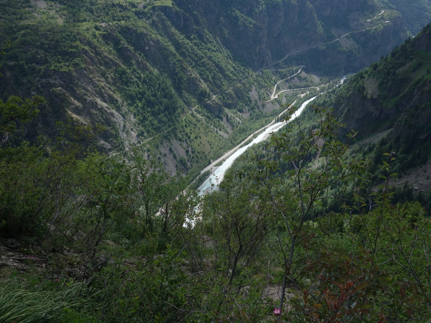
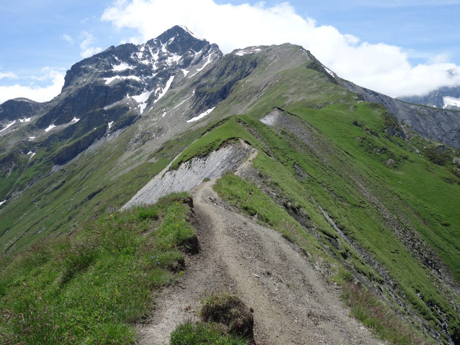
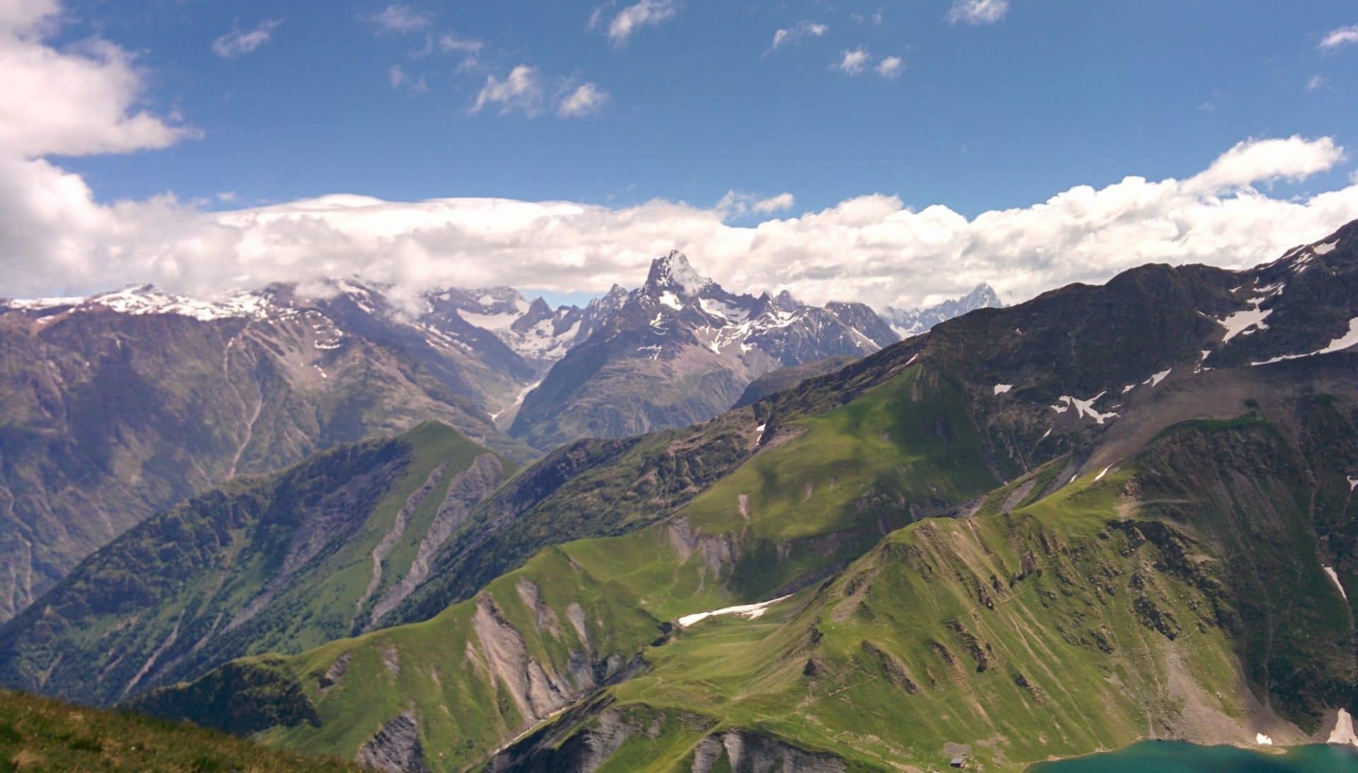
The ascent to Lake Muzelle is generally made from Bourd d’Arud following a portion of the GR54 (also find our Tour des Ecrins and Oisans along the GR54 – Link). We decided not to follow the usual path and past by the Cîme du Pied de Barry. This little-used path (we will meet absolutely no one until arriving at the Muzelle refuge) starts behind the Plan du Lac gîte, not far from the Pisse waterfall and climbs up to 2637m at Cime du Pied of Barry before going back down on the Muzelle. It offers superb views of the Ecrins and offers a passage over a pretty wide ridge which remains aerial.
We left the cottage without rushing around 8:45 am. The day starts very quickly because we meet a chamois right next to the waterfall. The weather is good and the forecasts are good. Everything comes together for a great day.
The hike begins directly on a steep slope which leads us to Lanchatra, a tiny hilltop village, little or not inhabited. Once above the village the slope remains steep but the view over the valley becomes clear. By cons we begin to be invaded by flies. This will remain a constant throughout this day and on the following (slightly attenuated): dozens of flies that turn around your head and a lot of horseflies …
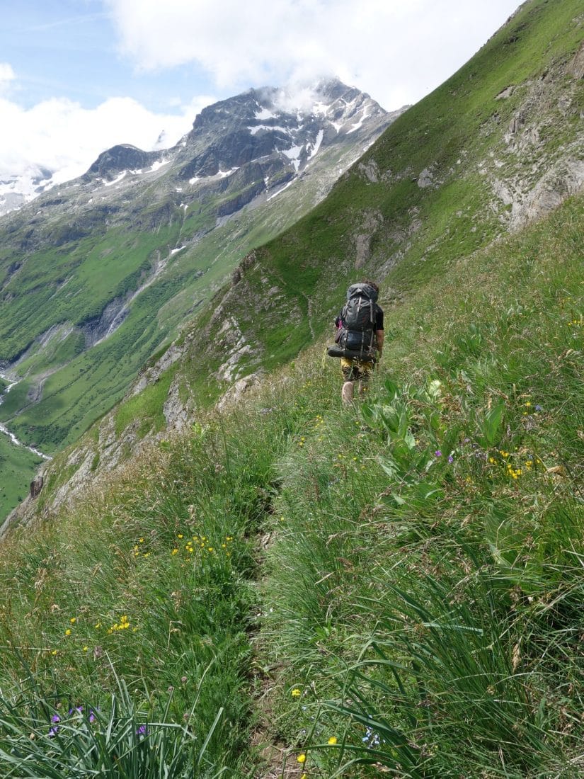
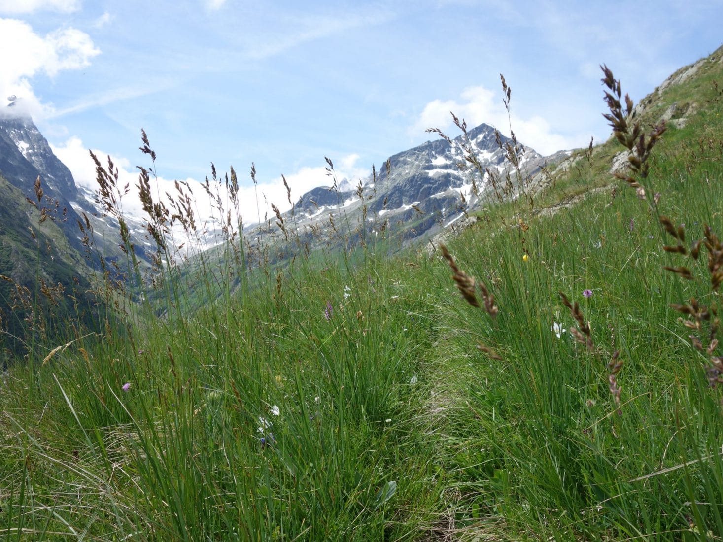
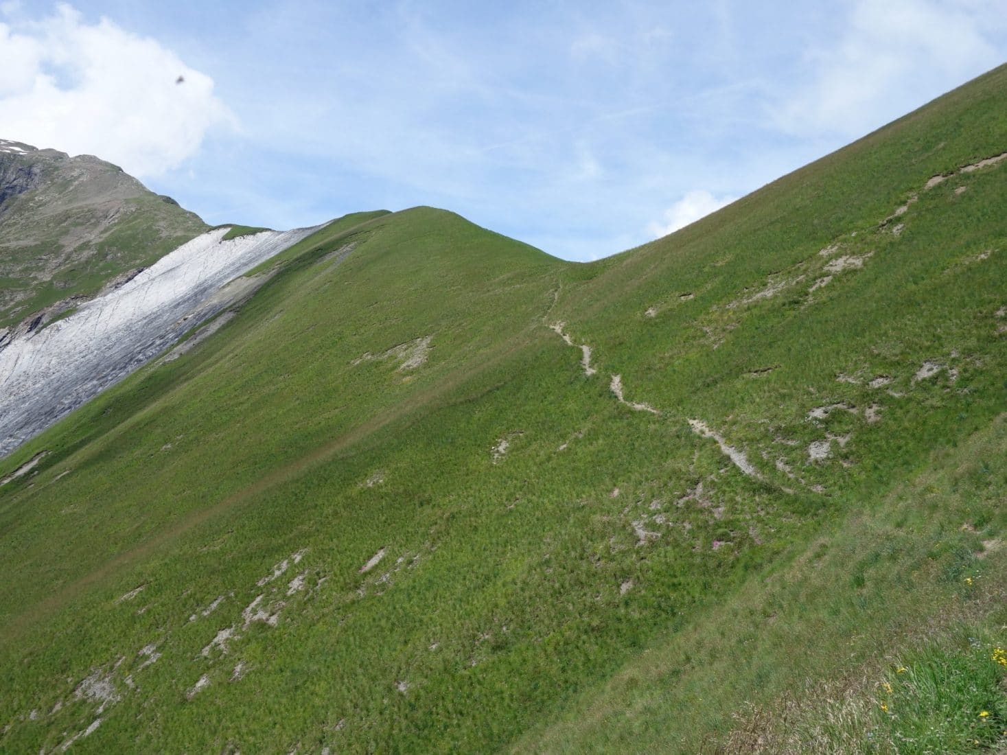
This part of the path becomes even steeper, you have to use your hands a lot. The evolution is almost vertical because after almost one or two hours of walking you are still in sight of the lodging below. After a good elevation (600m?), The path begins to follow the ridge. We are in full alpine stage while in bloom in June.
Possible variant: a variant to consider is “climbing” the summit of the Bell (2328m)
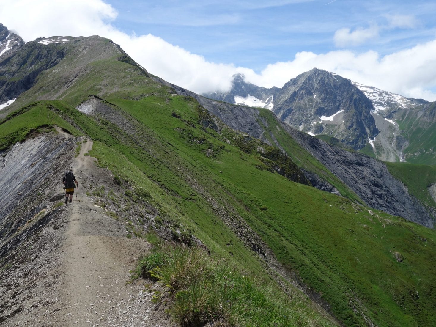
After the Col de la Clôche we land for lunch. Attacks by flies spoil the moment a bit and I get bitten by a horsefly … We leave in the direction of the famous ridge; it is a very beautiful passage which does not present a risk if you pay attention but which gives a beautiful aerial impression. We have already been leaving for 2-3 hours, we have and we will not meet anyone, we are in the heart of the Ecrins, … everything is fine.
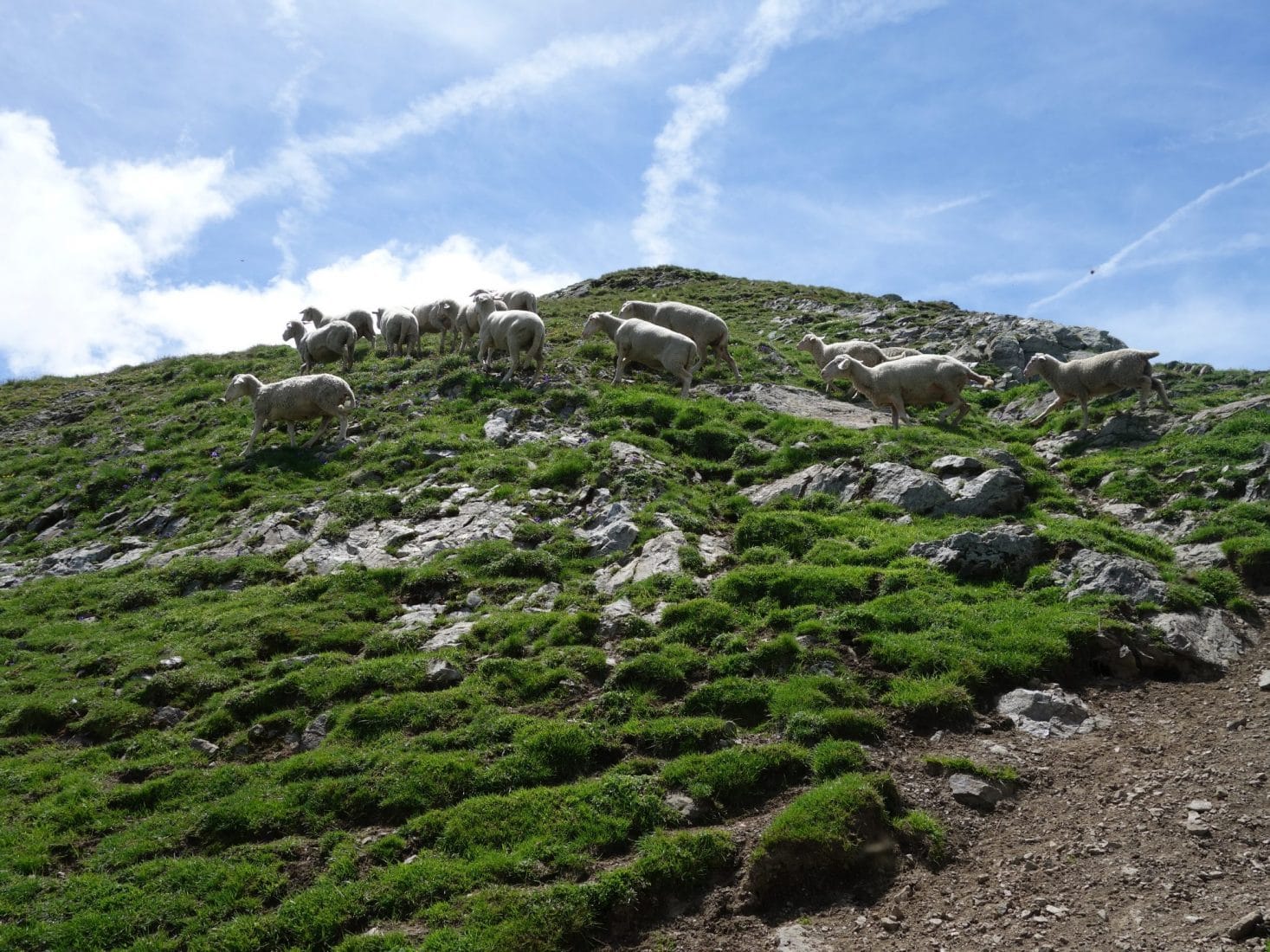
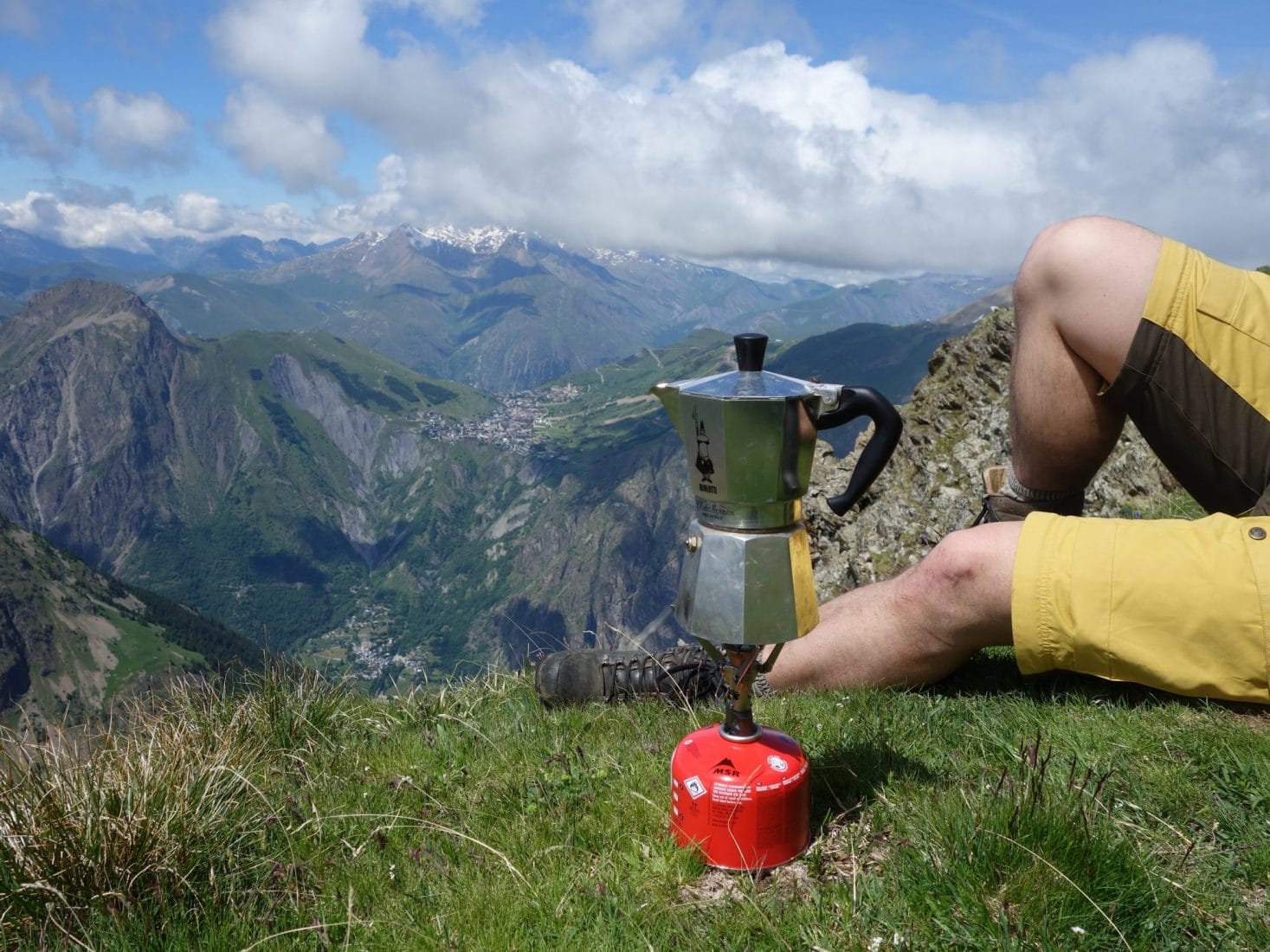
The climb resume again after this beautiful passage. We will meet a small flock of sheep grazing peacefully and happily for us not guarded by a dog. We finally arrive below the Cîme du Pied de Barry. The path almost disappears here and branches off to the right (towards the ONO) to attack a relatively steep descent with no visible trace. We will take advantage of the view just before this part by having a coffee (we had the Mocca …) facing the Massif.
The descent although tiring because it evolves in a fairly chaotic grassy terrain also offers us a spectacle of spring flowers and marmots. We join the path below, not far from what seems to be a ruin (an old sheepfold may be) to go to the refuge which is not very far away. On the way we pass not far from one of the last bogs of the Ecrins, extremely fragile environments. It is only there, after almost that we meet people and not just anyone: the refuge keeper and a person from the team who goes up to open for the weekend.
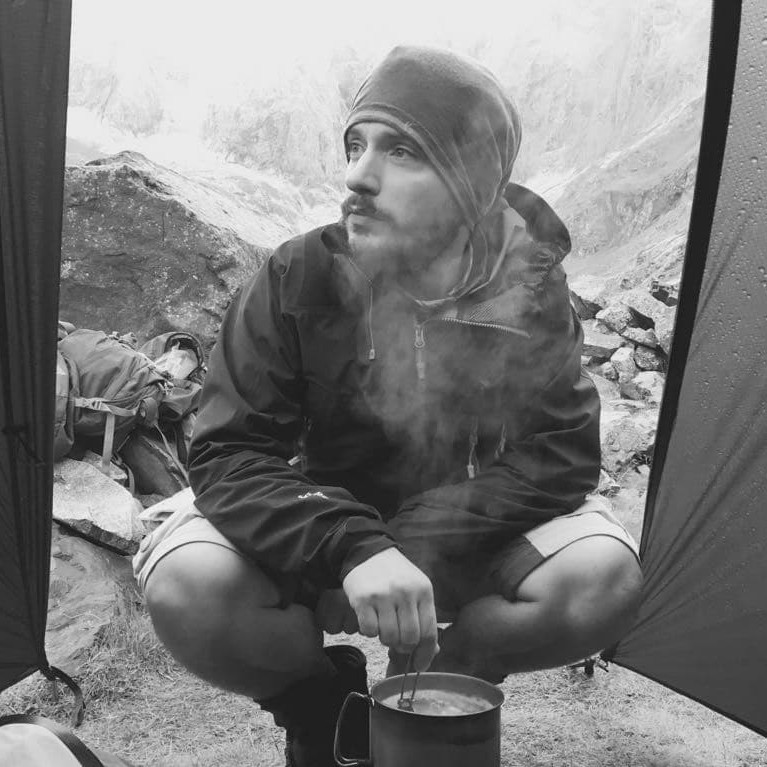
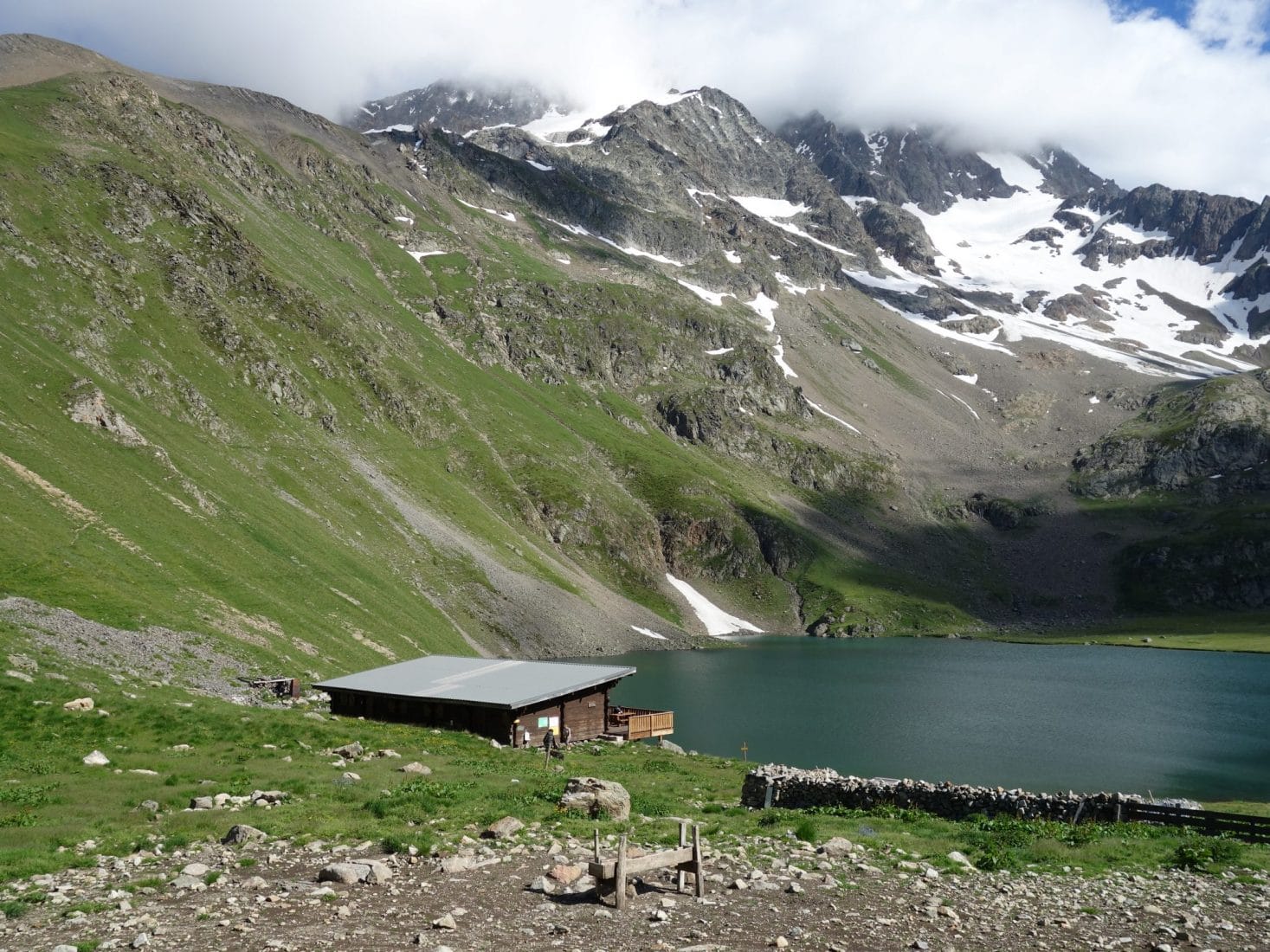
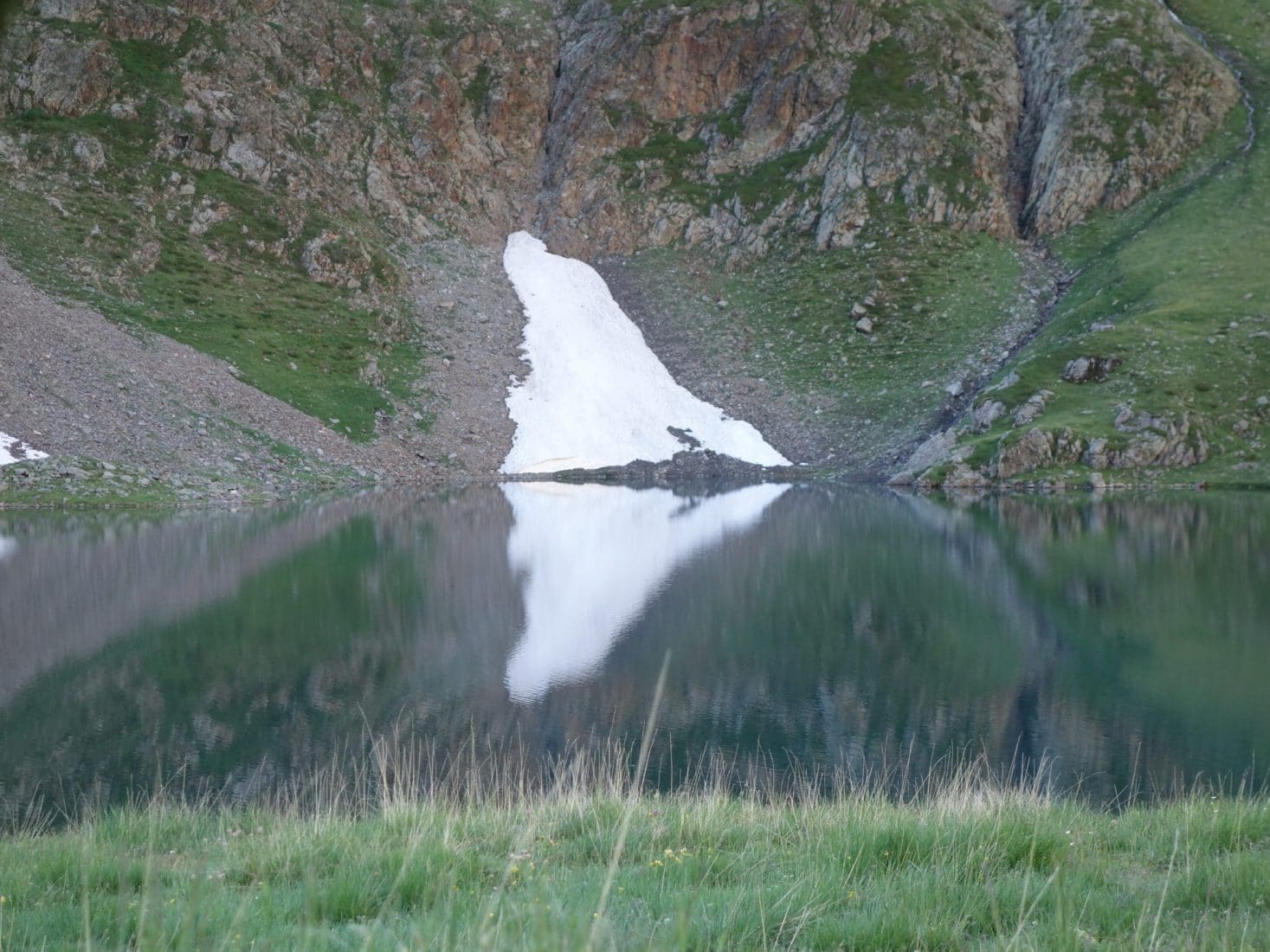
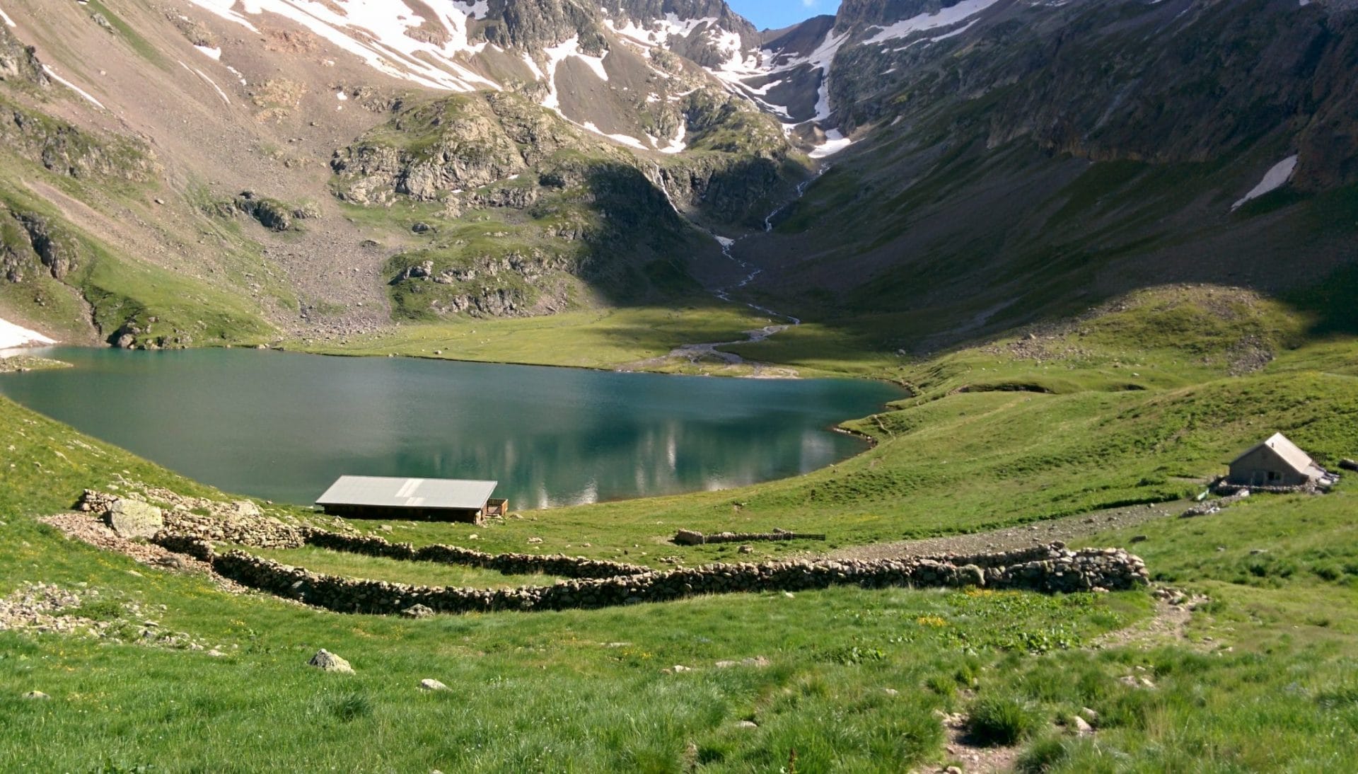
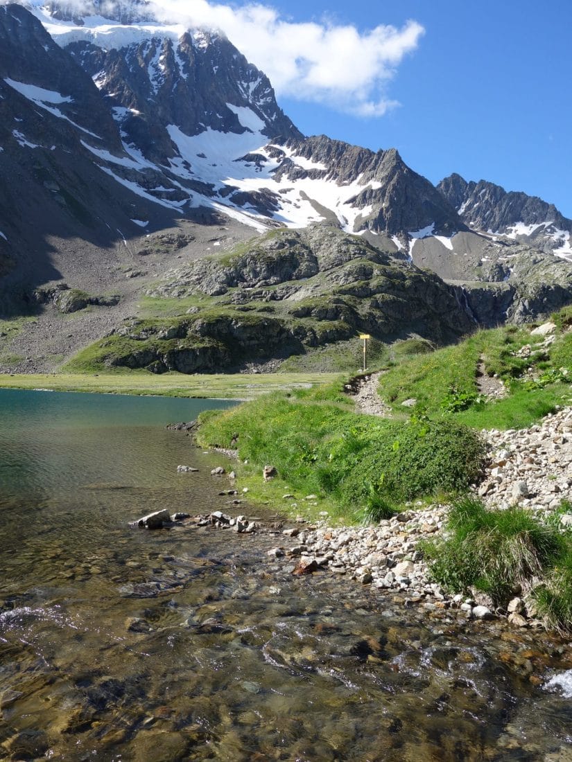
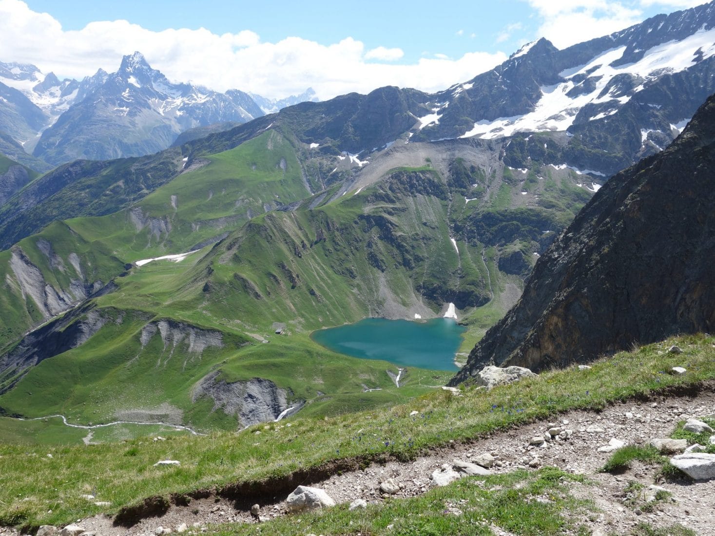
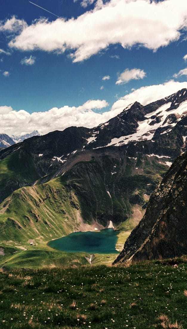
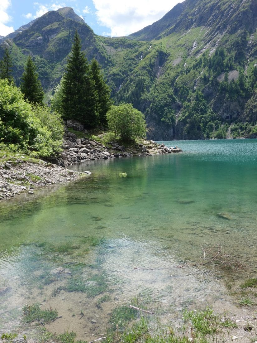
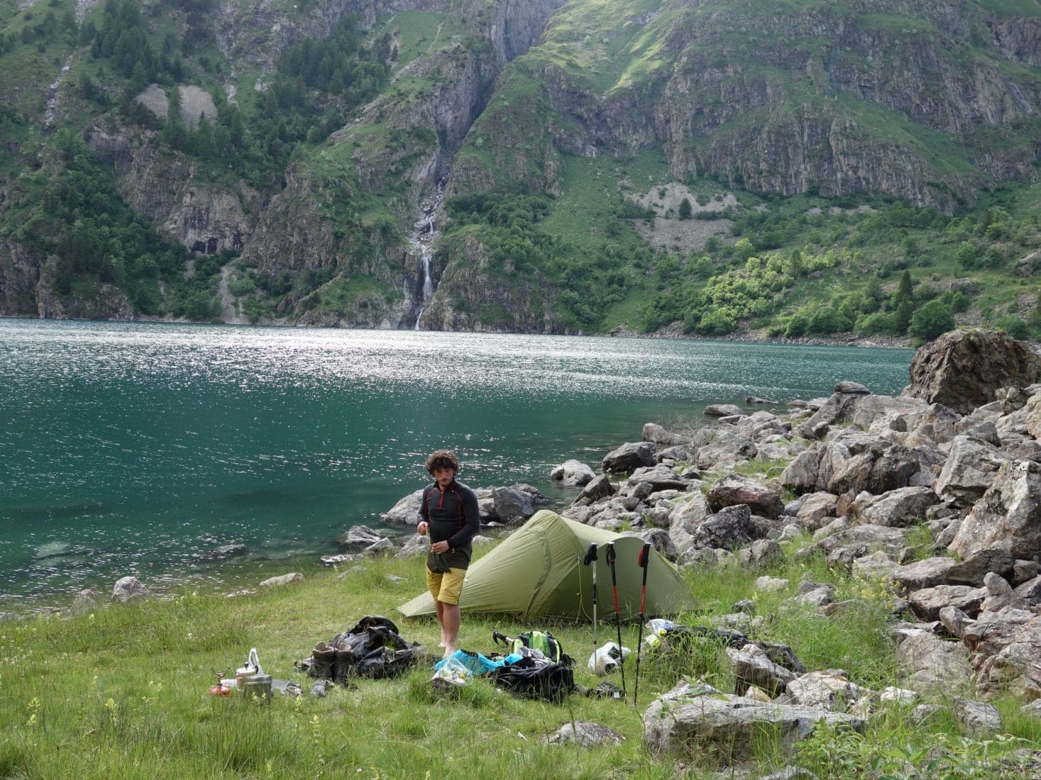
The arrival on the refuge and the lake of Muzelle is superb. The landscape reveals a large circus closed at the bottom by the impressive Col de la Muzelle. The Lake is nestled at the bottom of the depression. Since we are early in the season, many snow patches are present on the surrounding walls and are reflected on the surface of the lake. After a refreshing break at the refuge, taking advantage of the babysitter’s present, we will put the bivouac slightly above the lake near the spillway. The view is superb, the weather is nice and we will only have met the babysitter, her teammate and a guy who does the GR54 and with whom we will eat in the evening. We will not go to bed late after the 1500m of D + that we have just completed.
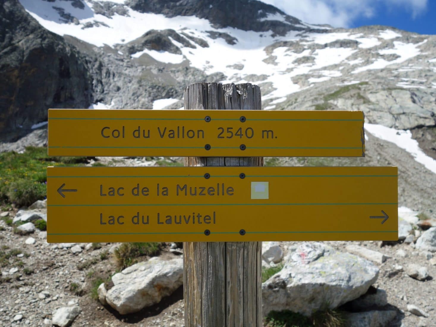
Day 2 - From Muzelle to Lauvitel
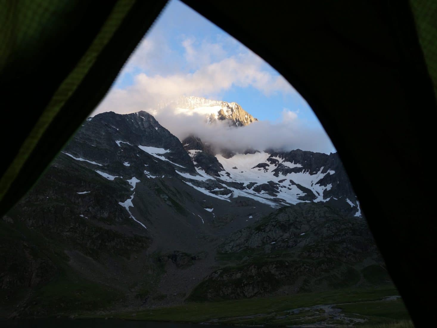
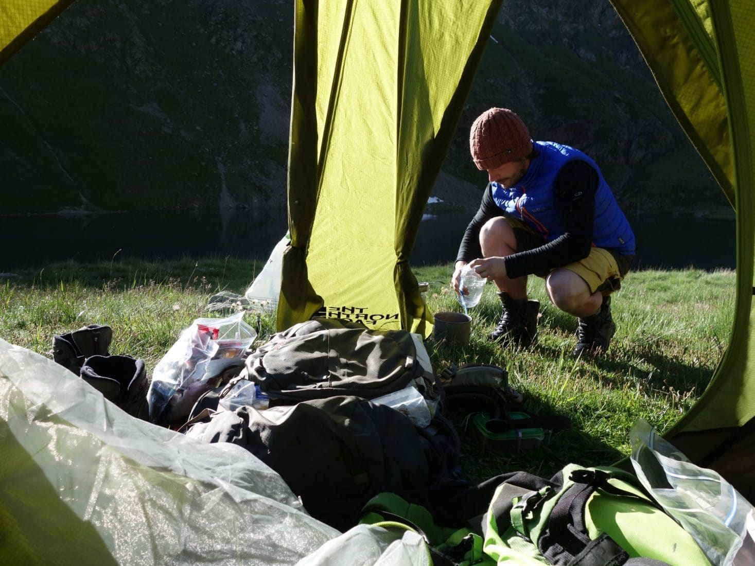
It was relatively cold last night since the tent was frozen in the morning but we slept well in our cozy sleeping bag. As the program of the day is not very busy we take our time in the morning while waiting for the sun to come warm the tent.
Breakfast will be quickly swallowed and we put the camp away before leaving in the direction of Lac du Lauvitel.
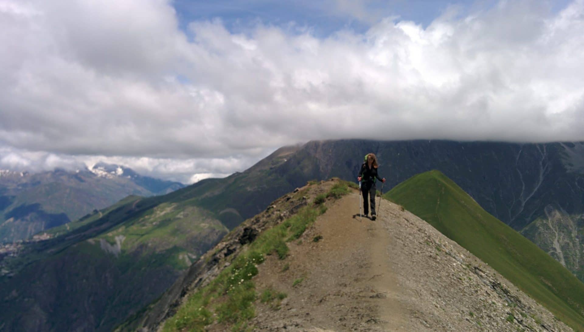
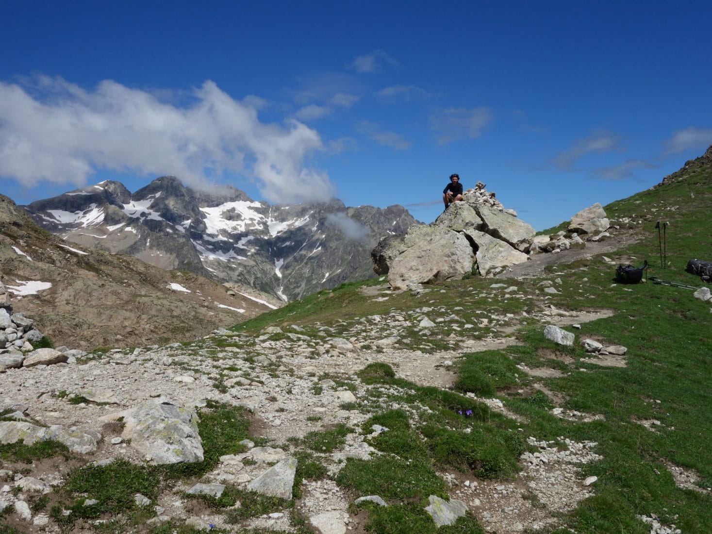
We will pass by the Col du Vallon (2540m) to reach the Lac du Lauvitel. But before that we stop 5min to find a Geocache placed under a rock not far from the path.
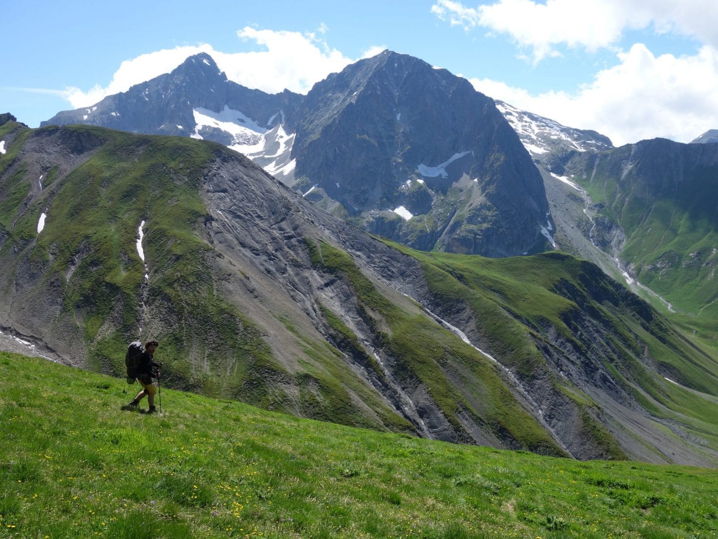
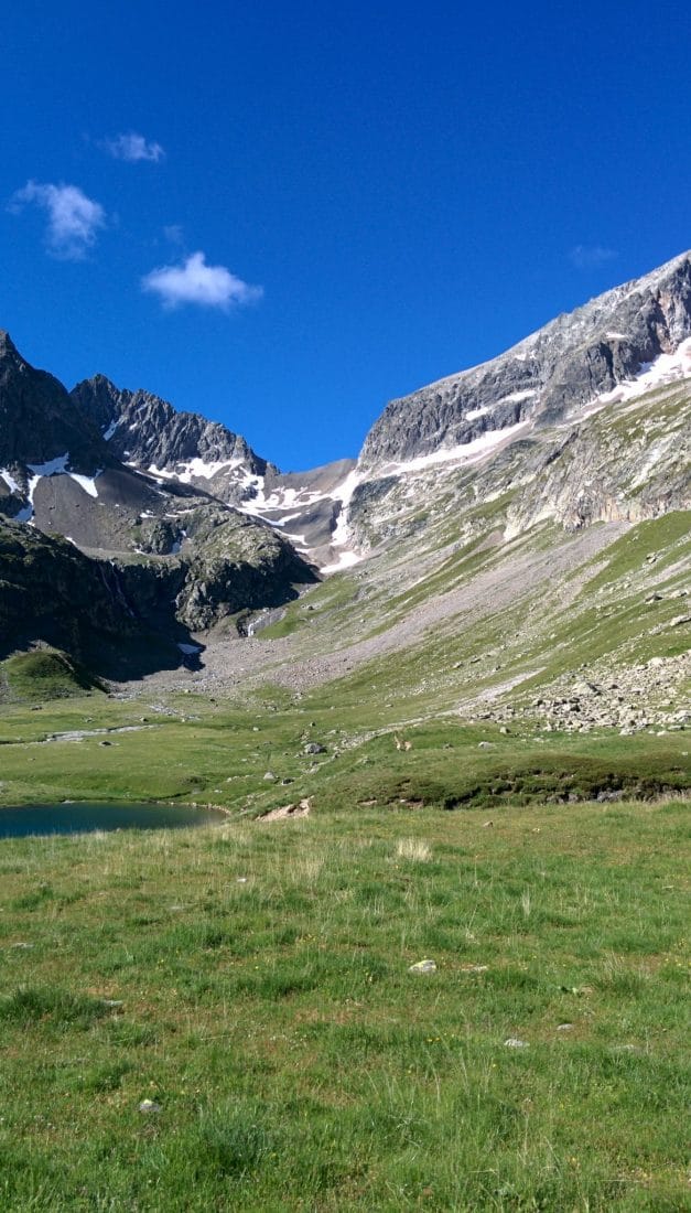
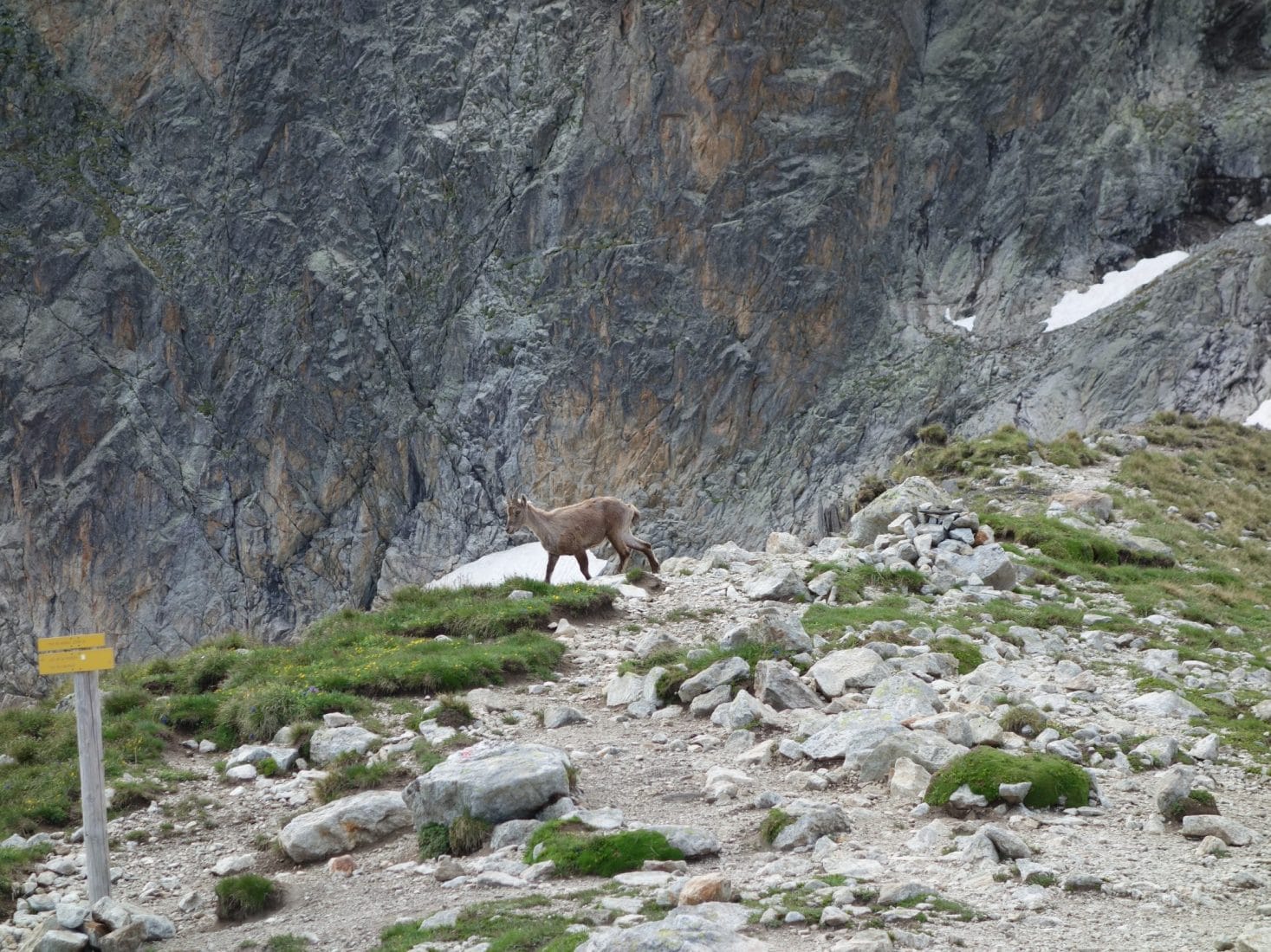
The ascent follows a path that zigzags up to the pass. The view is absolutely superb on the Lac de la Muzelle below. We are lucky because it is under a bright sun that we will still be walking today. The climb does not pose any particular difficulty, in particular thanks to the well-stepped path. Arrived at the pass we land for a bite to eat and above all to admire the landscape. An ibex even gives us the pleasure of passing right by while taking our time. There is nobody…
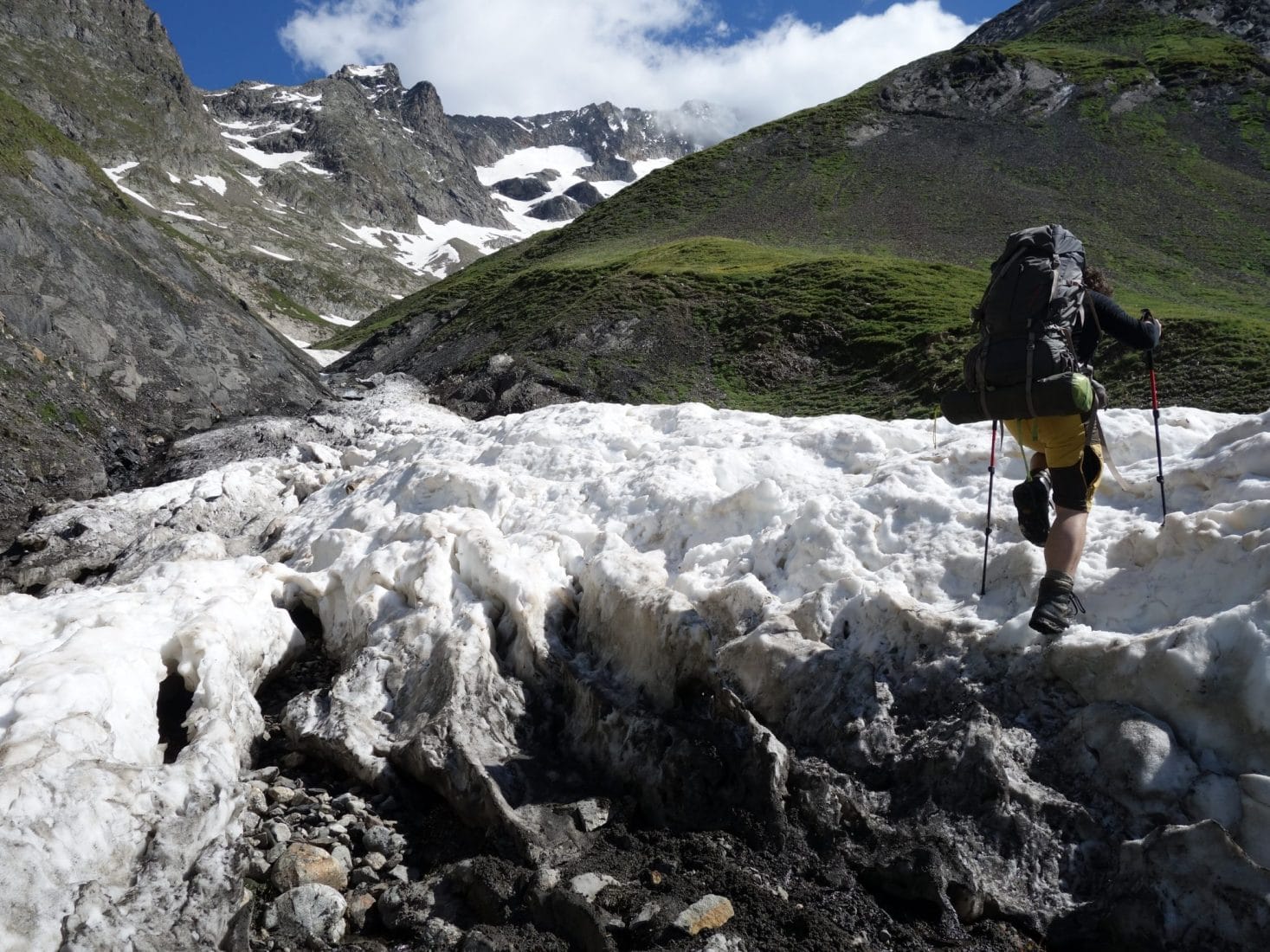
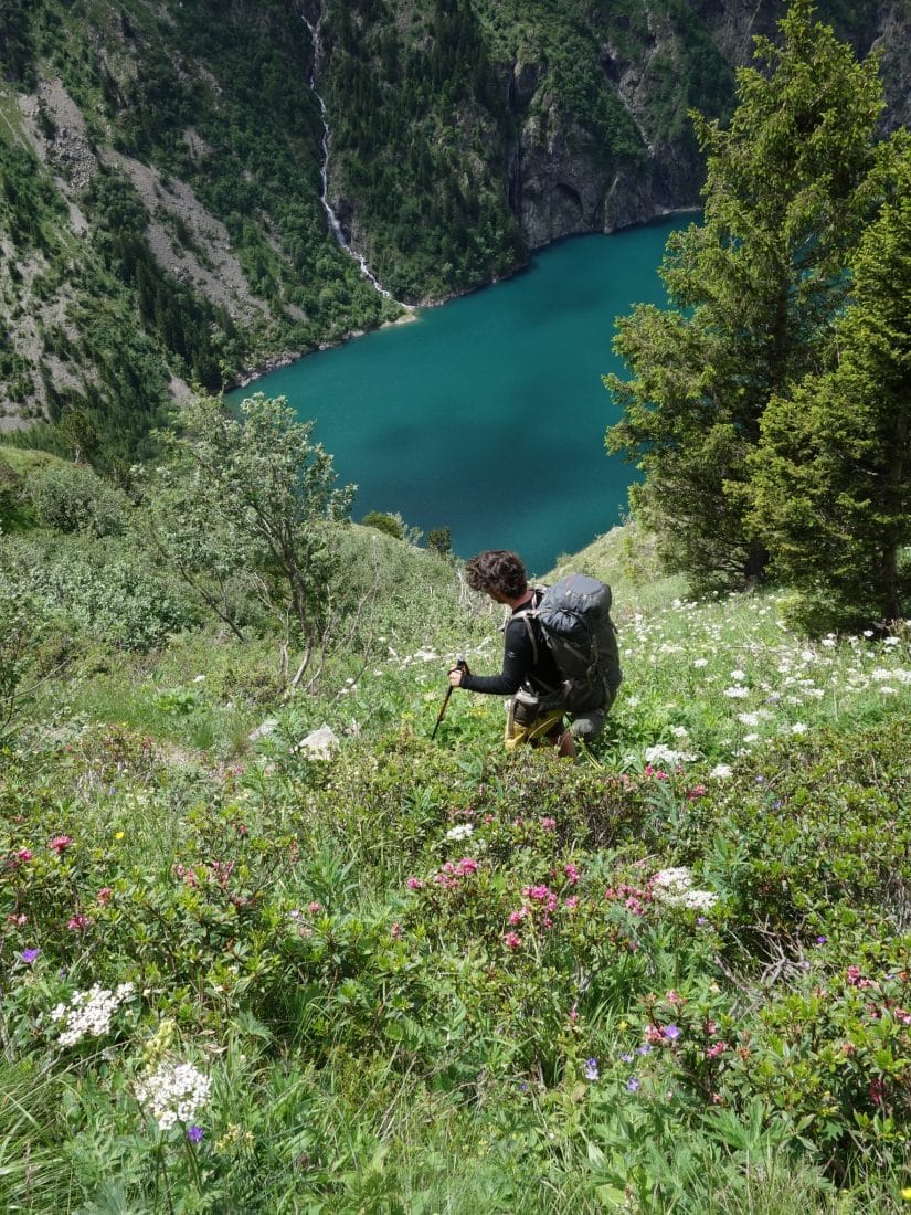
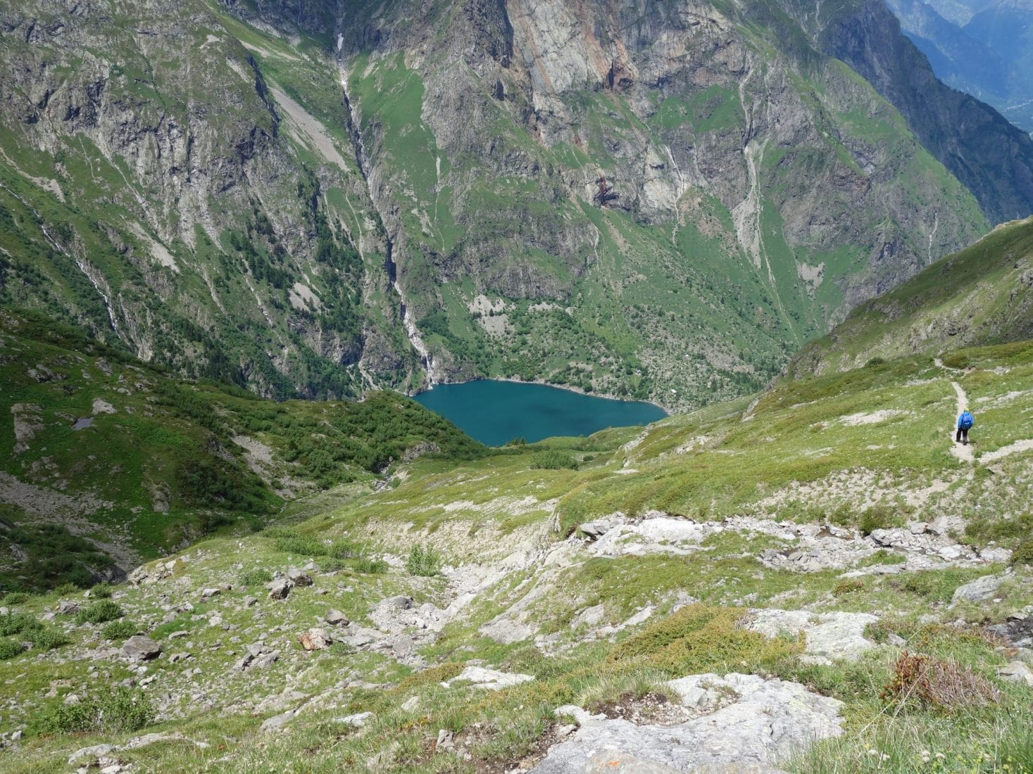
We begin, after this break, the long descent to Lake Lauvitel. More than 1000m of D-. Fortunately the path is good and the view is beautiful, it follows the Embernard stream for almost the entire descent. The Lake is quickly revealed below us and we see it approach gradually, slowly. The lower part of the trail passes through a freshly collapsed area. We had also postponed the stay because security works were underway in the previous weeks and the path was prohibited. But this day we pass without a hitch.
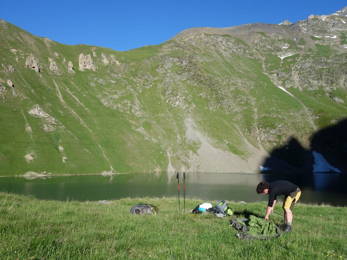
We finally arrive at the Lake. There are a few people because the way to go up there from the valley is simple and fast. There is a large expanse of grass with two tents already and a few chalets on the other side of the lake. The Lake is very beautiful, it is nestled between large cliffs except on the west side where it opens onto a valley which is an integral reserve. Only downside, an electric line that passes over the lake but which does not spoil the beauty of the place either.
We don’t want to be too close to the other campers, so we leave on the left towards a rocky chaos because we think we will find a site for the tent behind it if we believe the map. We actually find a space right next to the lake and back to the rock well hidden from other people who may be on the grassy part. We put up the tent quickly then we take advantage of the place and its serenity.
We will end the evening with a good hot meal and admire the sunset over the mountain.
Day 3 - Descent and return
The night will have been good and less cold than the day before since we were much lower. The alarm clock is done in the shade but the place is still as beautiful. We have breakfast without rushing because the program of the day only involves going back down to La Danchère before returning to the Plan du Lac to take the car and go home.
The descent is nice, it follows the Selle stream which turns into the Lauvitel stream below. We meet a few people who are climbing.
Here we are, downstairs … After 2 big days upstairs, alone, the blocked view of the valleys is strange. In order to speed up the return (we have the road then to return) we decide to hitchhike. I don’t think there has ever been a more efficient stop, barely the thumb was lifted when two guys in a van stopped and dropped us off at the lodging for the first day.
This three-day getaway was a breath of fresh air. The Ecrins are magnificent and are less popular than other parts of the Alps. Nature is strong and present there. This tour is recommended for all those who want to discover the mountain and spend two nights in bivouac. We can facilitate it by going up to La Muzelle from Bourd d’Arud.
Some info:
- IGN map: IGN TOP 25 3336 ET (1 / 25000e)
- Muzelle refuge site: Link