8days
trekking
130km
walked
10000m
D+
10
mountain goats
It’s been a long time I wished to walk along the Belledonne Mountain Range. The creation of the GR738 was a perfect time to do it and to discover this beautiful but unknown place of the French Alps.
In France the “GR – Grandes Randonnées” are some long hiking paths managed by the French Hiking Association. This are awesome paths to discover the French mountains, country or even seaside.
Follow me along this 8 days on this difficult hiking path wild and lonely, only 4h away from Paris.
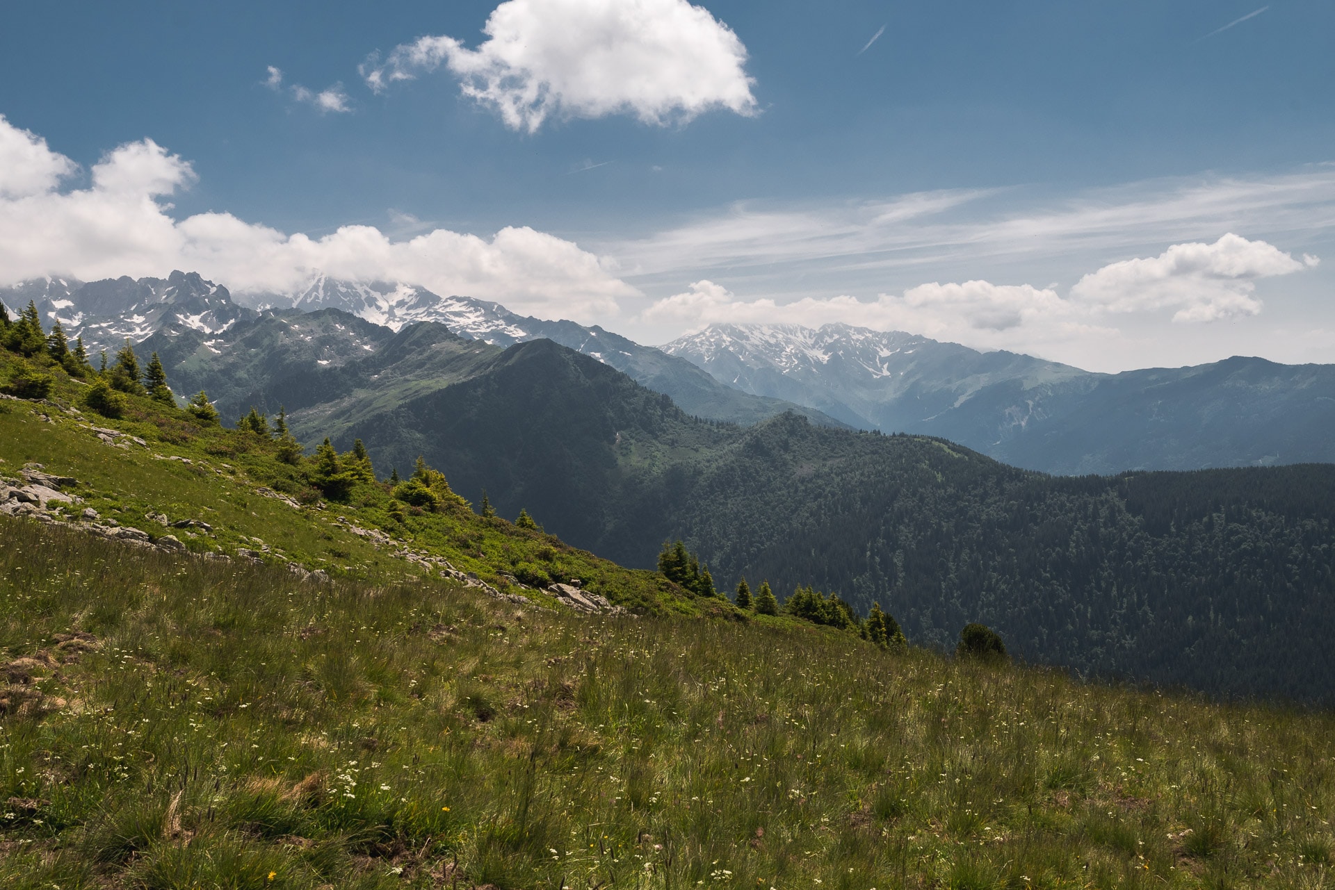
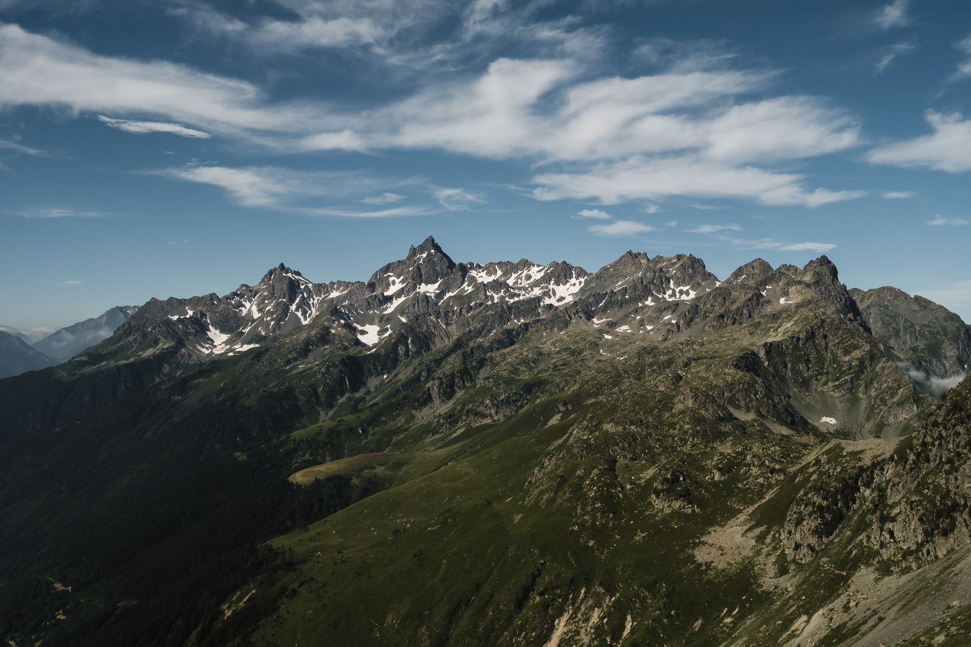
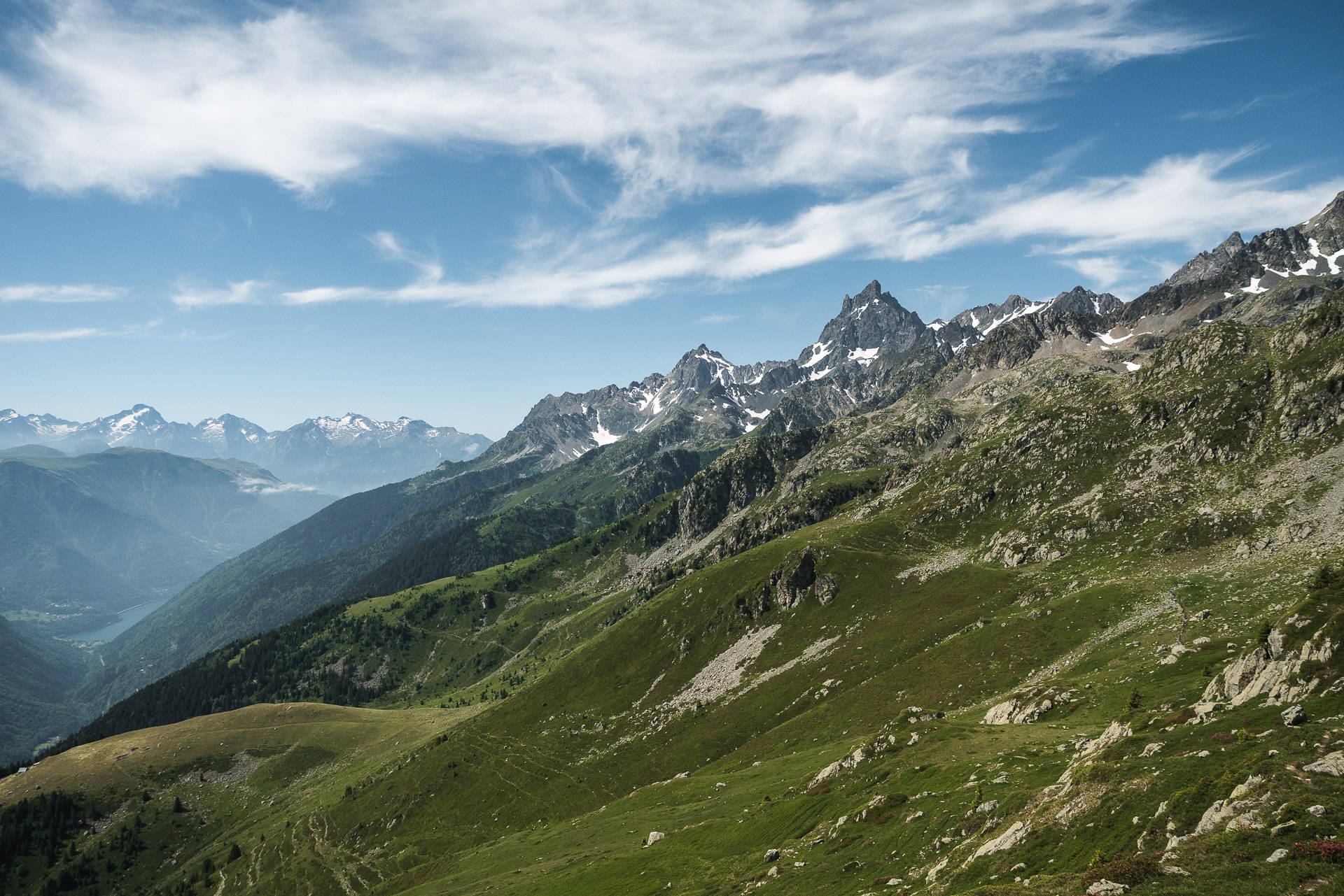
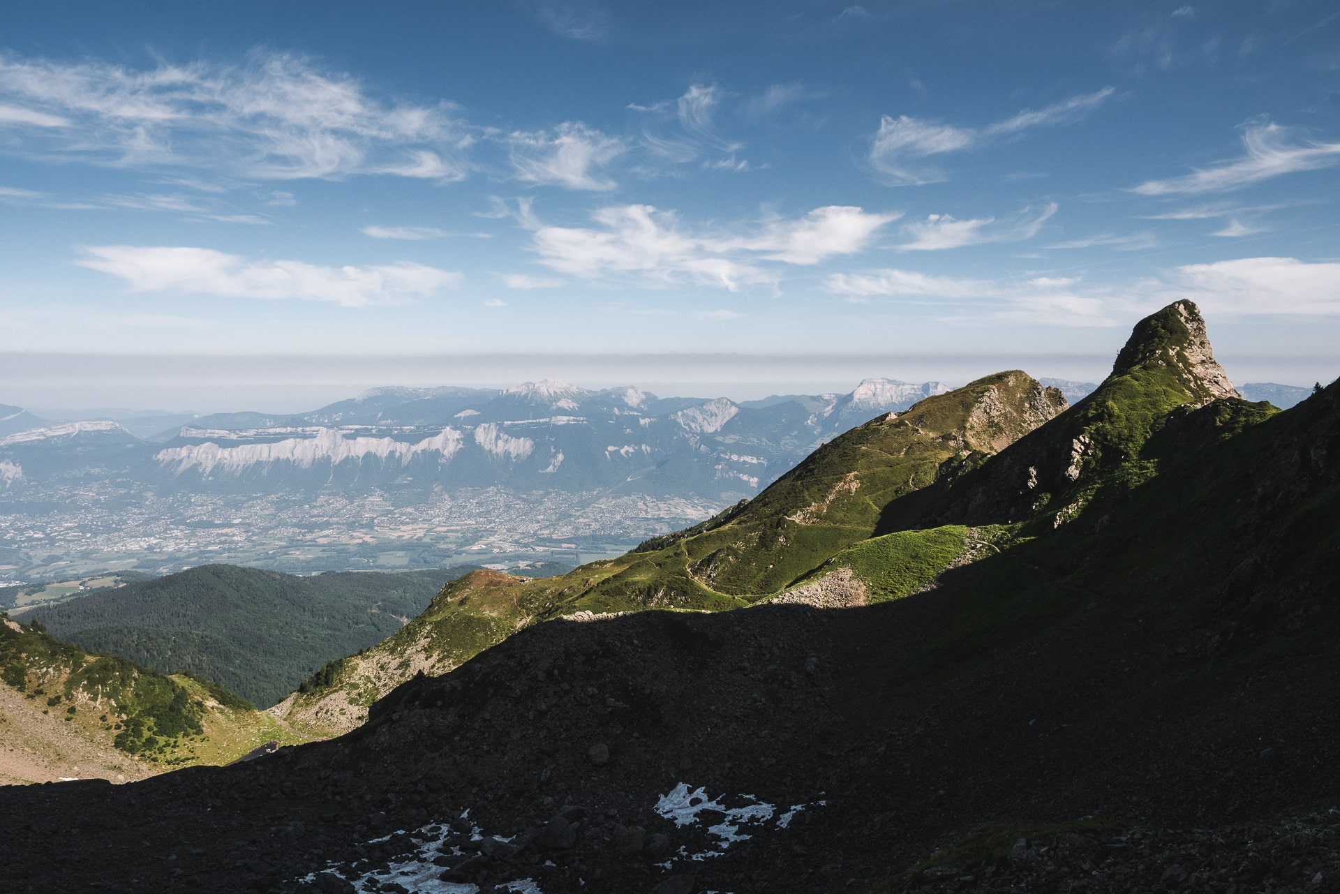
Belledonne and the GR738
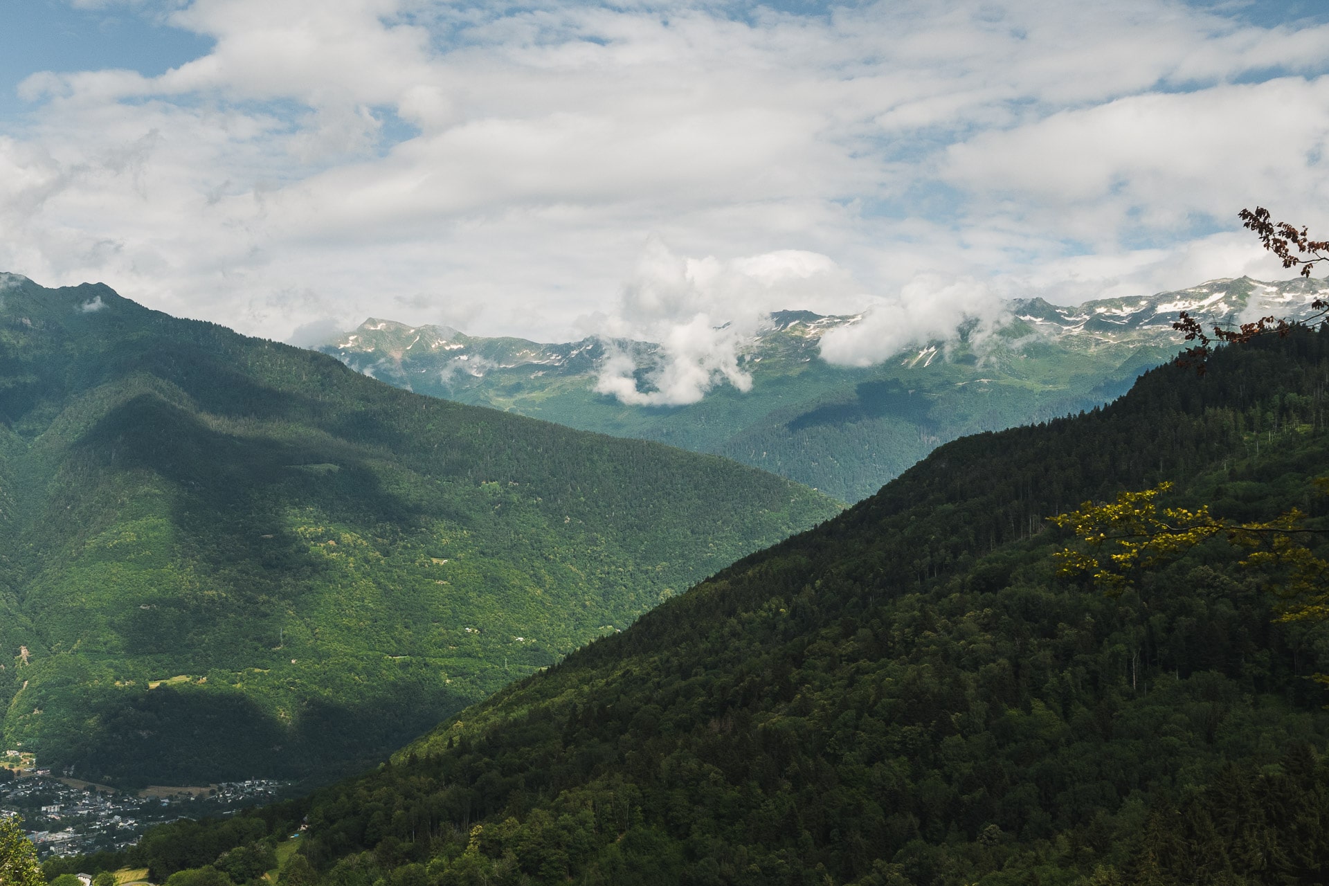
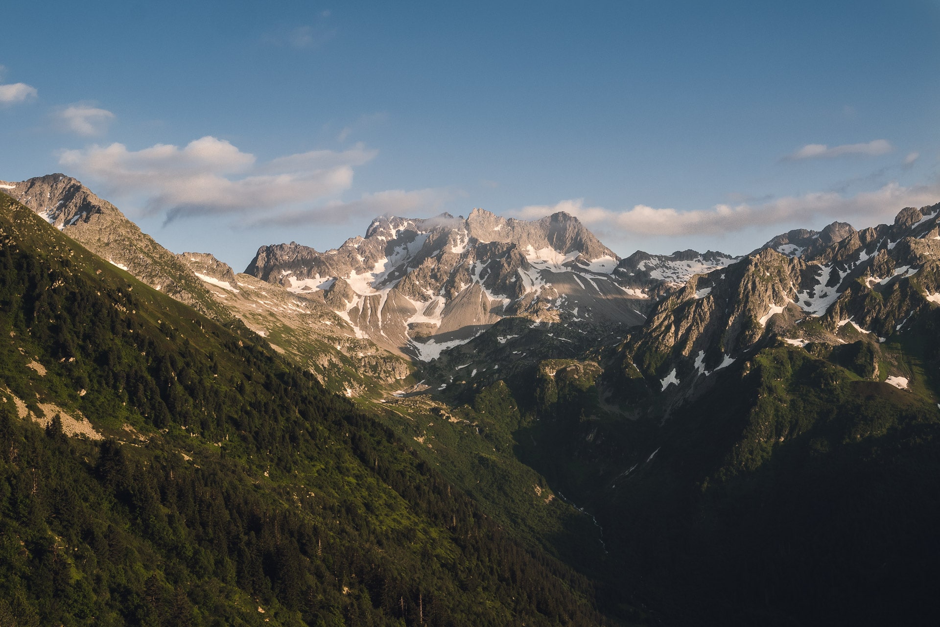
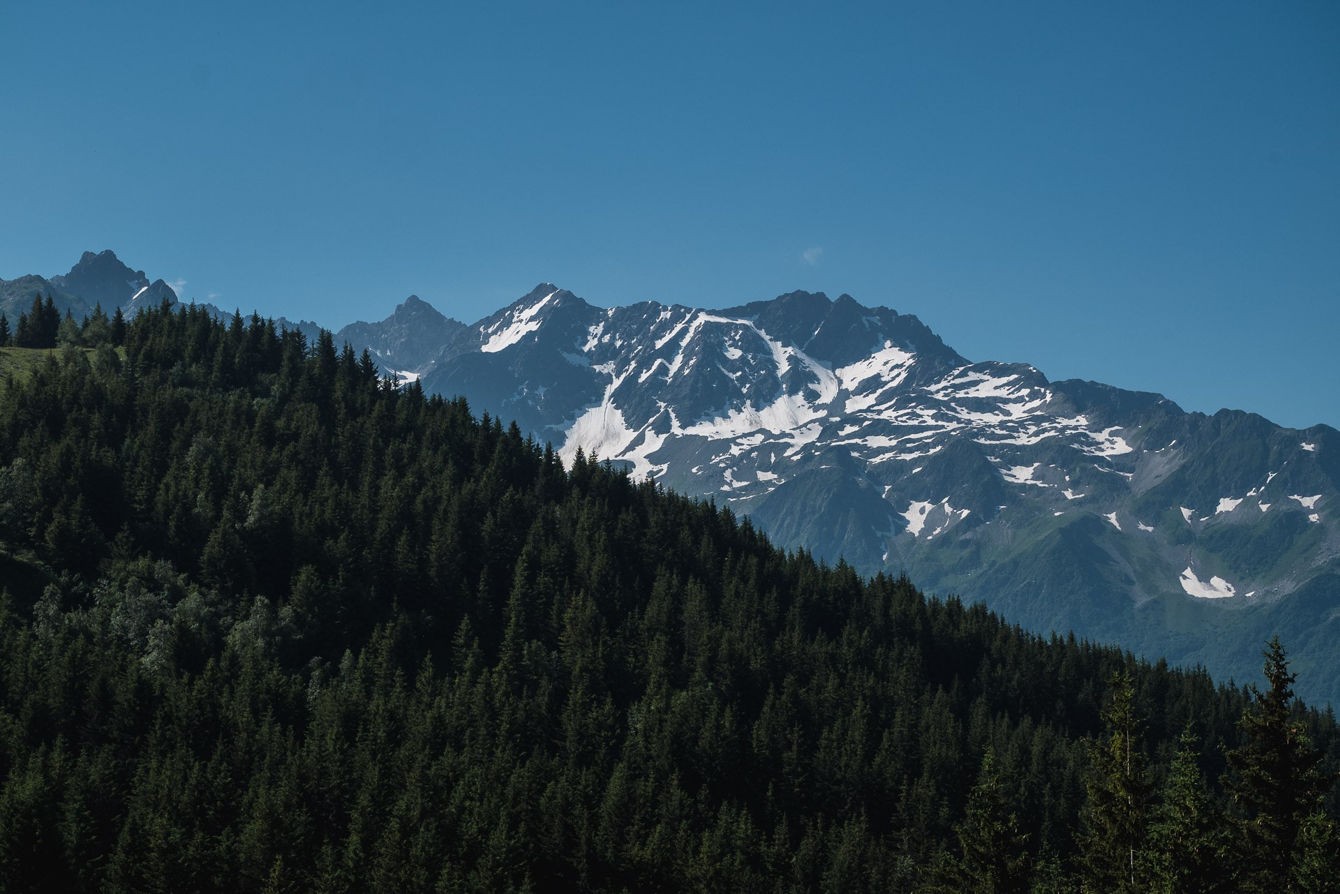
Belledonne extends from Chambery to Grenoble. The mountain range is 60km long and 10km wide. Its highest point is the “Grand Pic de Belledonne” at 2977m. It is one of the last mountain range not being a natural park but some projects are being leaded this way. Less know than the Ecrins, the Vanoise or the Vercors, Belledonne offers a large choice of interesting hikes in marvelous landscapes, all of this far from the crowd. It is easily reachable by car but also by train.
Belledonne is a place of pastoralism so you will cross herds of sheep guarded by sherped dogs called Patou. The fauna is rich, you will meet Ibexes, mountains goats and the wolf is also there especially in the nord side.
Patou : this dogs are raised to guard and protect the sheeps. This are defense dogs so they will not let anyone coming near the herd even a hiker. So beware approaching a herd because several people are bitten every years.
How to behave meeting a Patou :
- Do not cross a herd of sheeps, always go around or pass it keeping your distance.
- The Patou, when it spots you, will come running towards you and barking loudly to “mark” his territory. He will then smell you and evaluate the threat you represent. Talk to him gently, without shouting, stop the time he “scans” you or continue to walk quietly, have a calm attitude to put him in confidence. He will accompany you as you move away from the herd.
- Do not run or be threatening of any kind. Do not brand a walking stick for example. Any action that can be interpreted by the dog as aggression could lead to aggressive behavior.
- If you have a dog with you, do not take it in your arms
The trails that make up the GR738 are not from yesterday, they were known as the “Shepherds Trail” before, but the official status of GR dates from 2017 with an official opening in the summer of 2018. When I traveled the GR (July 2018), the section between the “Col de la Vache” and the “Brèche de la Roche Fendue” was not yet marked GR (but there is a markup consisting of a yellow line and / or blue points) but this should be finalized in 2018. With these 130km long and 10 000m of elevation gain, the GR738 is positioned as a long and difficult mountain range crossing like the GR54 or the famous GR20. One of the specificities of the GR that marked me is the few village that we cross. If you want to go independently, you will have to provide food for almost the entire hike. If you do not want to carry heavy laods, it is also possible to go from shelter to shelter.
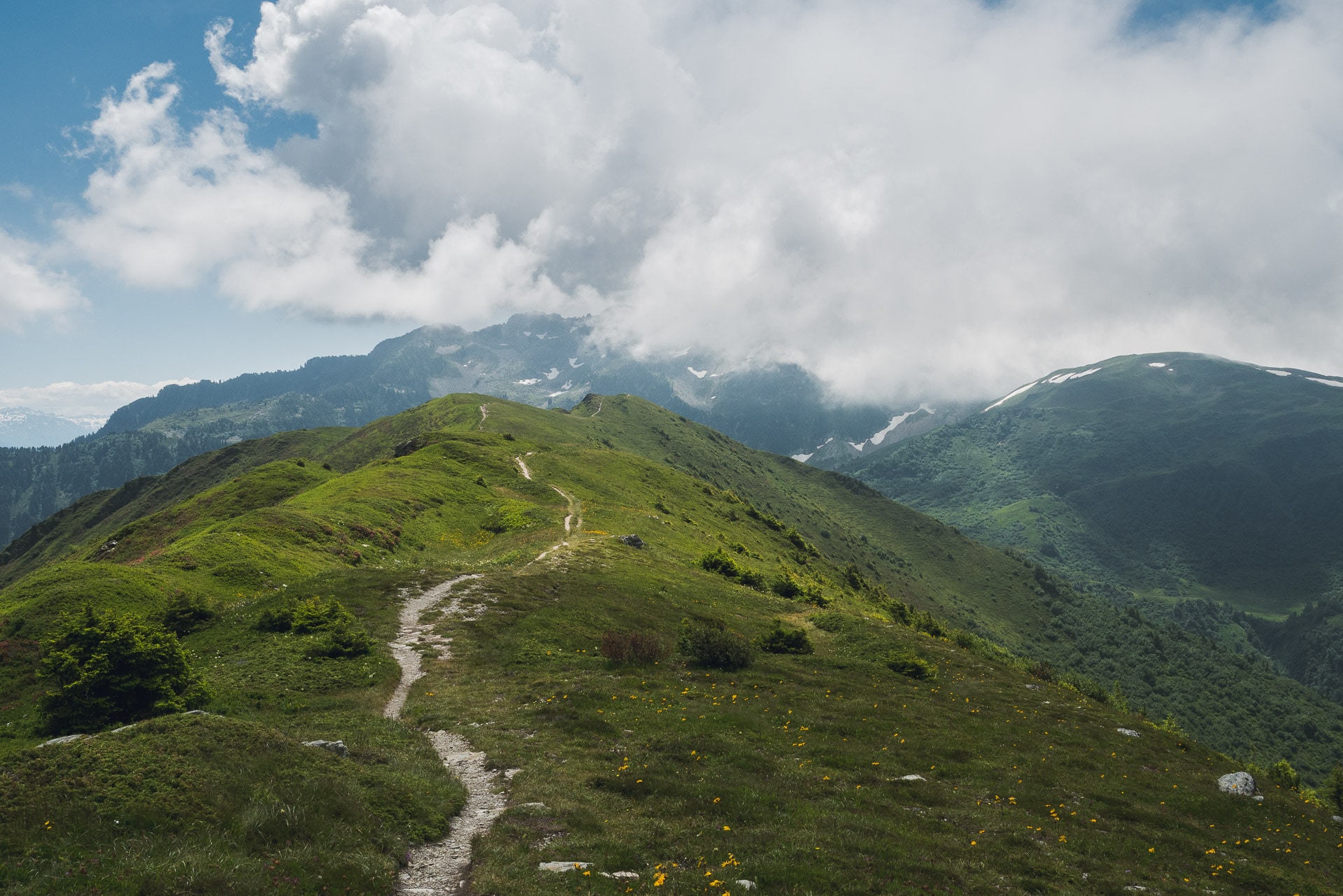
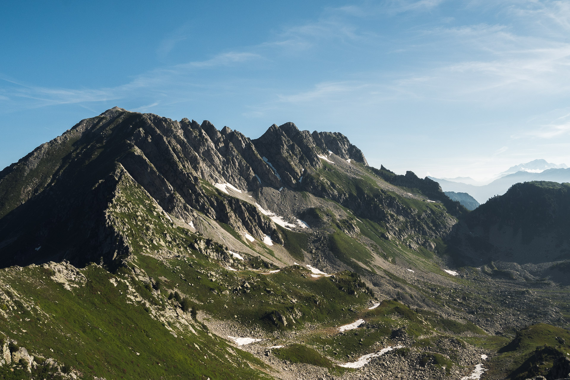
As I said before, Belledonne is not crowded and wild, so you will hike meeting few people especially in the most remote parts. For having traveled, the GR738 is a beautiful trek, quite physically demanding but rewarding in terms of landscapes especially on the Seven Laux – La Pra section.
Day 1 - Departure from Paris and first kilometers
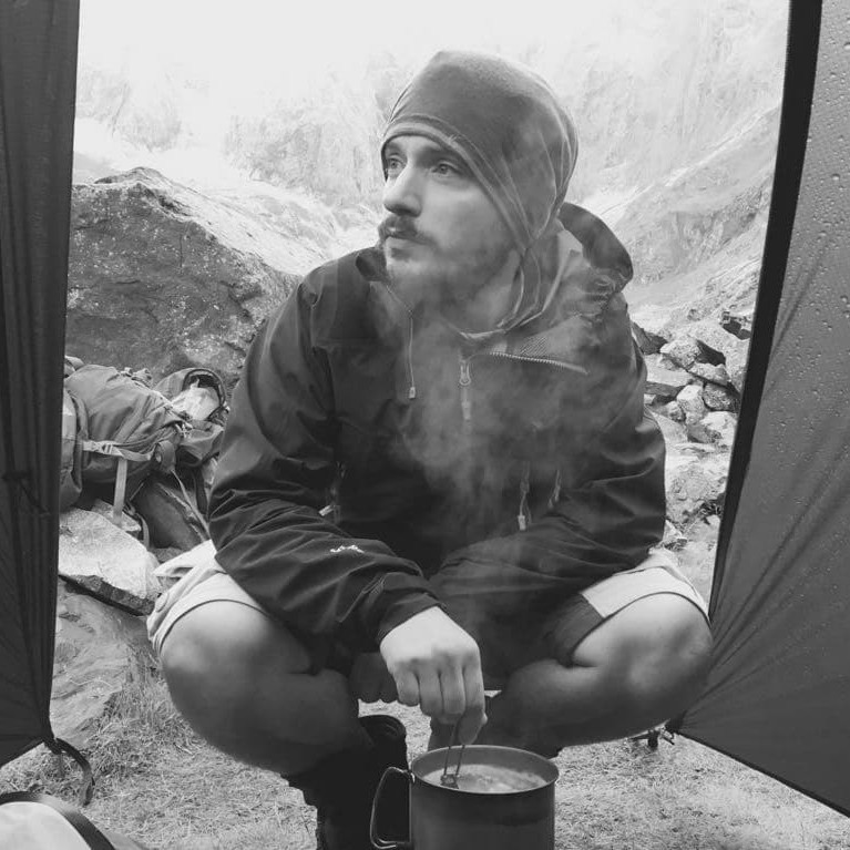
We are July the 06, 2018 at Gare de Lyon, let’s go for 8 days of hiking along the GR738. I will be solo for this trek because I had to do it with my brother but his holidays have been canceled unfortunately … This is the first big hike of the year and I didn’t train a lot recently (…), we will see how it goes physically knowing that the backpack is particularly heavy because I have 8 days of food with me since I want to be completely autonomous.
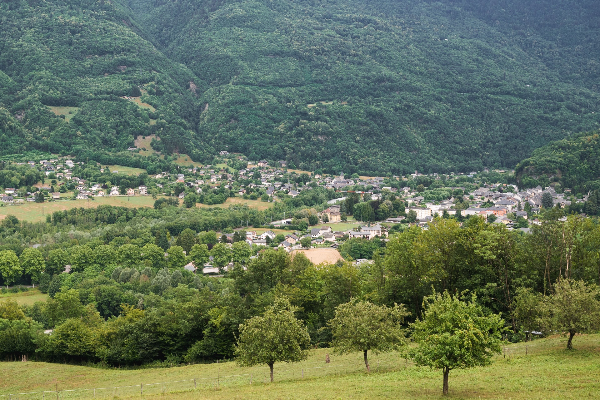
Direction Aiguebelle to join the beginning of the GR738. The trip is fast because the village is 30 minutes from Chambery that is reached in 3 hours from Paris by TGV.
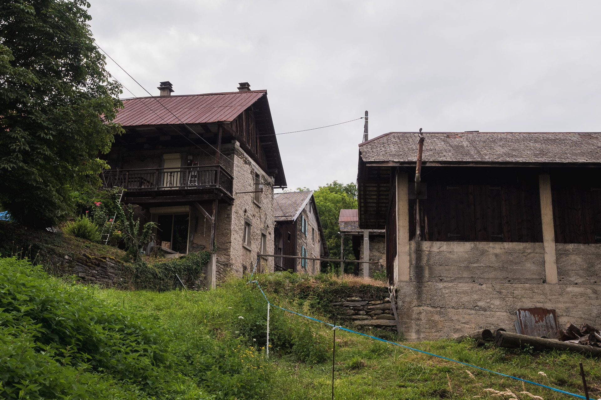
So here I am at the beginning of the 130km that separate me from Vizille, the end of the GR. To find the beginning of the path, join the main street of the village towards the NW. The first red and white marks that will accompany you for a few days are located at the junction of the road that climbs towards the Planay (it’s a pity that there is no small sign marking the beginning of the trail, whatever something a little solemn).
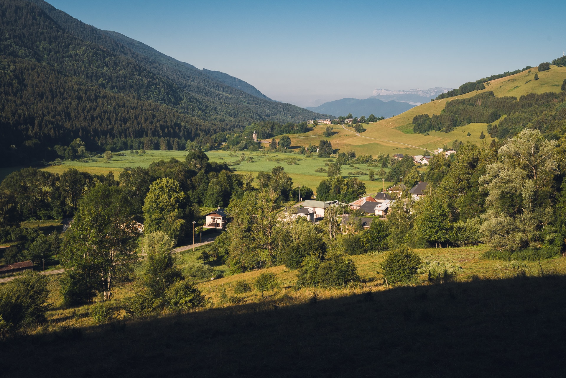
So let’s say it right away, I do not like the first days of walking, in general it’s difficult (the time to launch the machine), it’s not beautiful in terms of landscape and I always make a mistake of navigation. And you know what … I got the winning trio this time! The climb over Aiguebelle is not very pretty and I will be accompanied by flies and horseflies. The bag is heavy, I’m not “warm” and the fatigue of the trip makes it hard on this first day. To top it off, I’ll go in wrong a direction at Les Bugnons adding 2 or 3 useless km!
I choose to keep the location name in French so that it is easier to find them on the map.
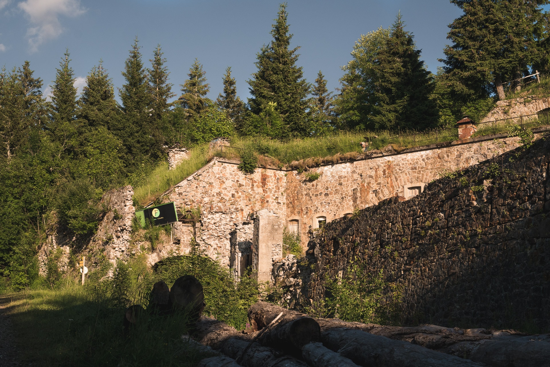
The goal today was to go up to Fort Montgilbert and camp there. I arrive at 7pm, exhausted (…) and harassed by mosquitoes – a hell! No adequate surface to put the tent, I decided to push further in the hope of finding a better place.
In the end, I will stay next to a forest track and I will spend the evening in the tent because mosquitoes made the outside unbearable … This is a typical first day! I hope it will be better tomorrow. For the moment sleeping, it is necessary to recover for the continuation.
Day 2 - From Fort Montgilbert to Refuge de la Perrière
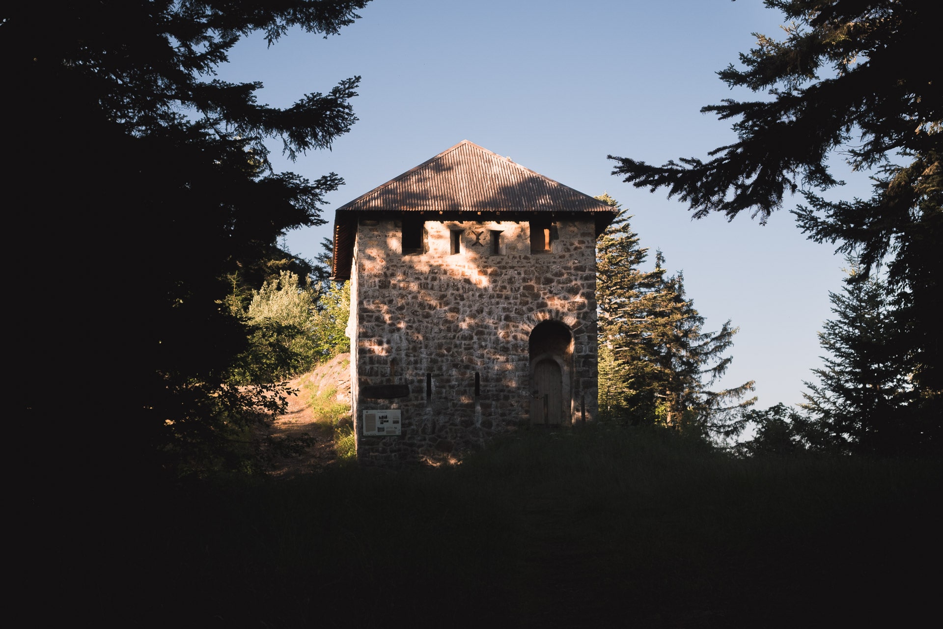
Early wake up and fast packaging. It’s a long day waiting for me: 17km and 1700m of climbing ! Few hundred meters away from my camp I cross an old tower with a place that would have been perfect to put the tent … Too bad!
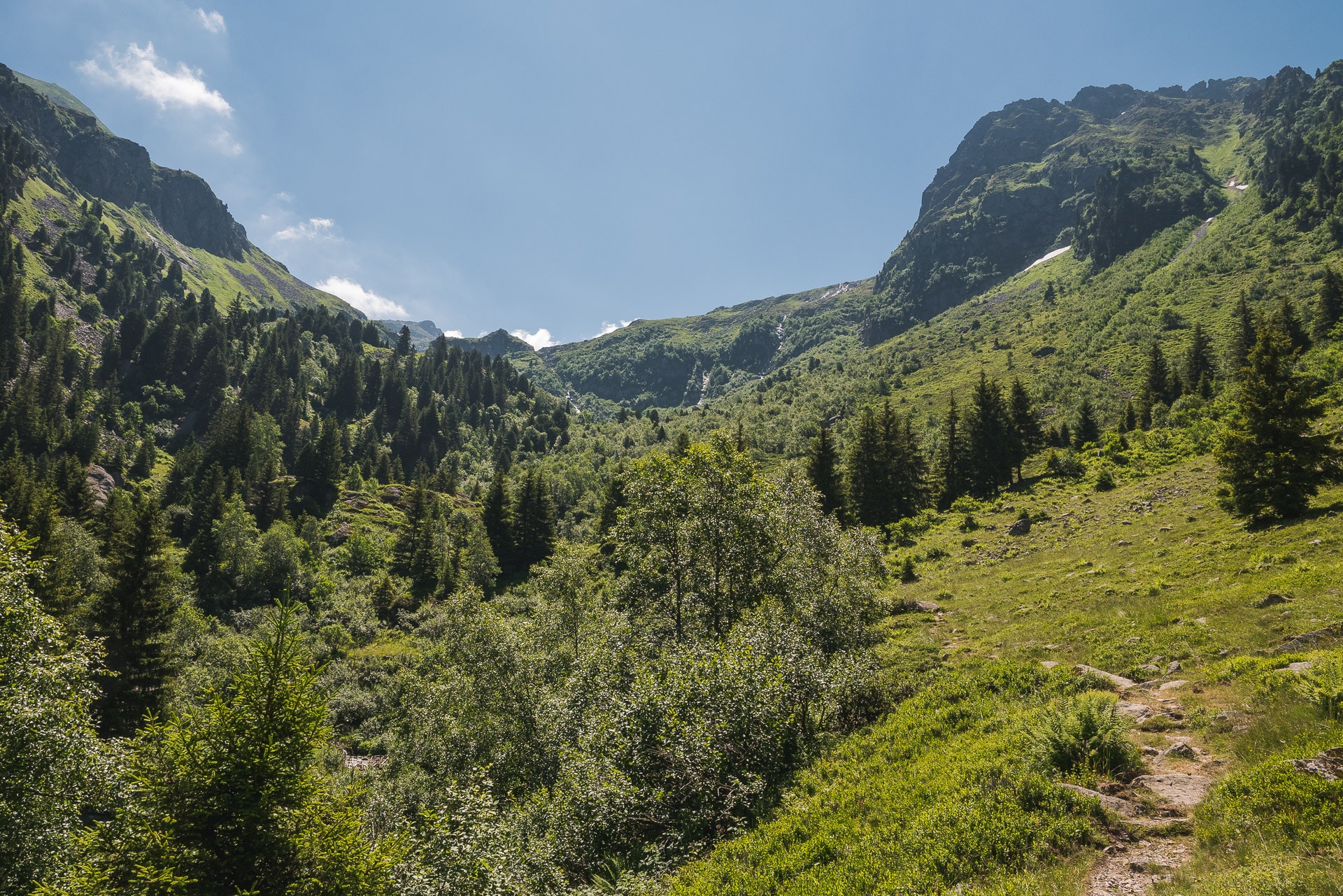
The trail then goes down to a small village called Les Granges, I meet briefliy a mountain goat in the descent in the undergrowth. In the village, the GR738 passes on the other side of the valley, in the shade, to go up towards Col du Champet.
The climb for the pass is long, I physically in pain and tired. I pay for the lack of training this year. Fortunately the trail oes under the foret cover.
Arrived at the pass I give myself a little break, time to nibble. Trees begin to be rare at this altitude (~ 1800m); the surrounding mountains show themselves, the landscape has already changed and is more beautiful.
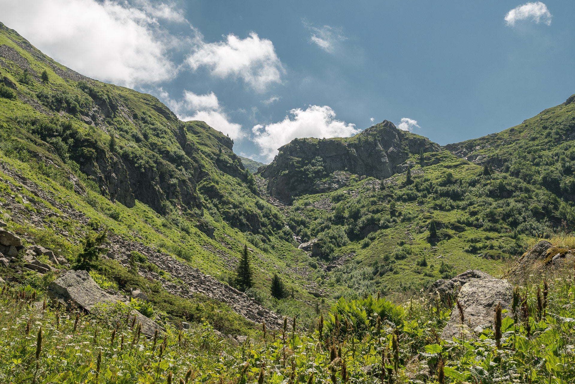
The GR738 then leads to the summit of the Grand Chat (1992m) and runs along the ridge to Frog Lake – LAc des Grenouilles. It is a nice passage but I have a little trouble to enjoy because I have more water for some time and it is very hot. Unfortunately the place is dry …
Fortunately, I cross the little “lake of frogs” that allows me to drink a little even if it is not deep and the water a little muddy (thank you straw filter …). On the other hand on this one there I show some stupidity given that a few meters lower (but hide at the sight from the lake) is the refuge of Arbarétan to which there is water …
Bakc on the trail after this short refreshing break. Next key passage, the Col de la Perche (1988m) that I quickly join. You must then descend relatively low before climbing the Col de la Perrière (1979m). On the way we cross the spring of Gargoton which is full of charm and which allows me especially to drink to my thirst and refuel. I give myself a good break before attacking the 300/400 m climb.
The ascent to the pass is not complex in itself but I’m really getting tired today. I can not wait to get to the shelter of La Perrière and breathe a little.
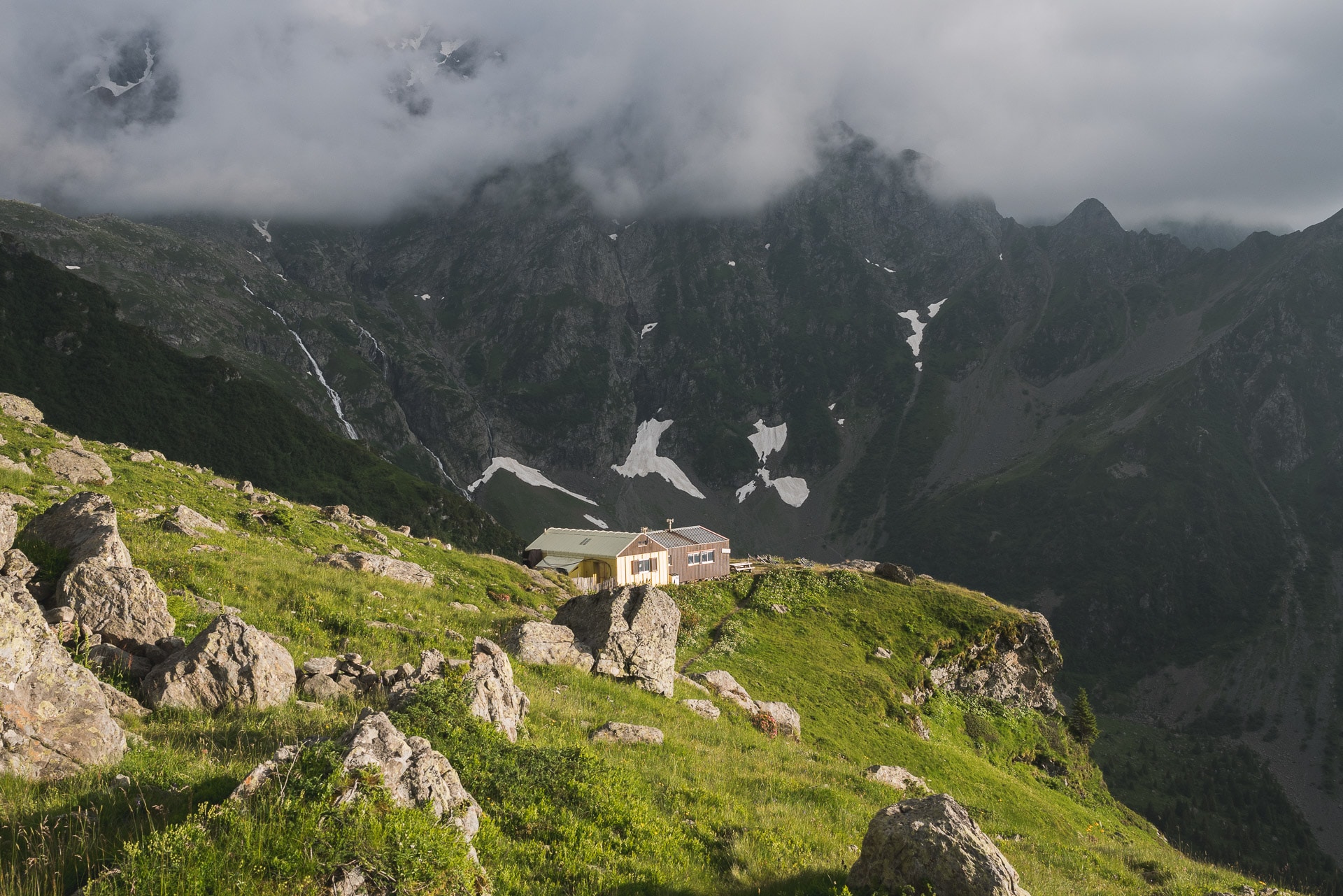
The latter is located not far from the pass slightly below. It is a pretty cabin with about fifteen beds. The building has been entirely renovated by the association “Tous à poêle” in 2018. Although not guarded, the refuge of the Perrière offers a good comfort. It is also popular with locals because it can be reached from Val Pelouse in 50min walking. Since we are Saturday, quite a lot of families have come with their children and the shelter will be full tonight. For my part I will put my tent outside to sleep in peace.
I’m happy to arrive because I’m exhausted. It is not too late, so I have time to enjoy the place and the atmosphere. It will follow a pleasant evening animated by children’s games and the friendly atmosphere. The sunset is beautiful.
From here I see my goal tomorrow, the Col de Claran (1956m) which is only 4km in staight line but which will require a good ride again.
My feeling is shared tonight because although the place is nice and there is a pleasant atmosphere, the GR738 has not particularly impressed me with its landscapes. On the other hand physically I’m suffering and I hope that the next days will be better. For now let’s have a good night’s sleep.
Day 3 - From Refuge de la Perrière to Refuge de la Pierre du Carre
The night was good even though I wake up with my legs and my back stiff . I am the only one awake, it is dawn, the atmosphere is soothing. The “camp” is quickly folded and I start on my way to Refuge des Férices.
This stage of the GR738 begins with a nice climb to the Col de la Frèche (2183m) enough to warm you up in the morning!
The terrain has changed since yesterday. It’s wilder, more rocky, I prefer it. Once at the pass, the path goes from combe in combe to cliff side down nicely towards the Ferices. This portion is very beautiful, very wild but be careful the path can be steep (especially downhill). Be careful especially if you are hiking with children.
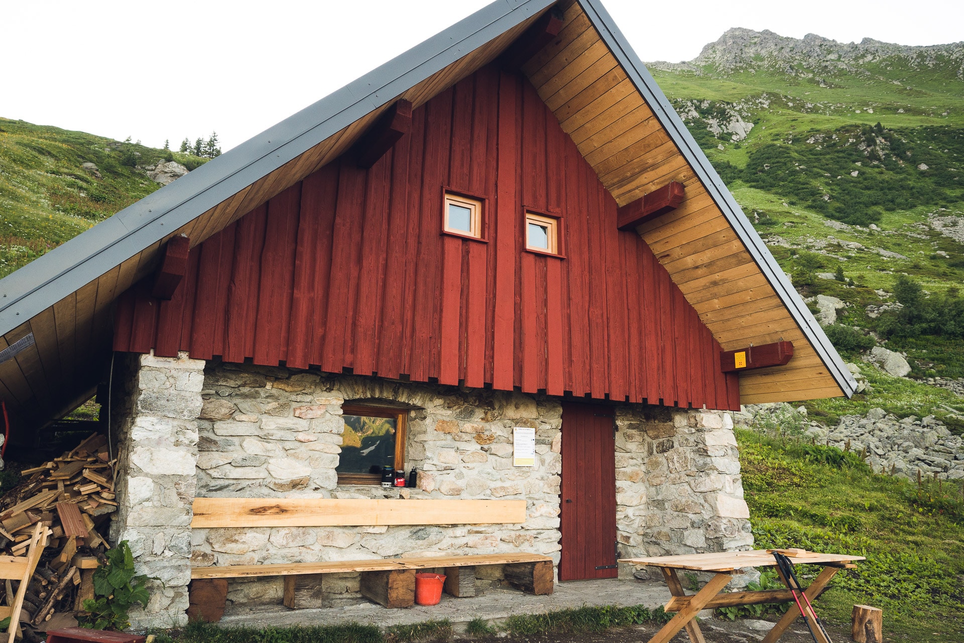
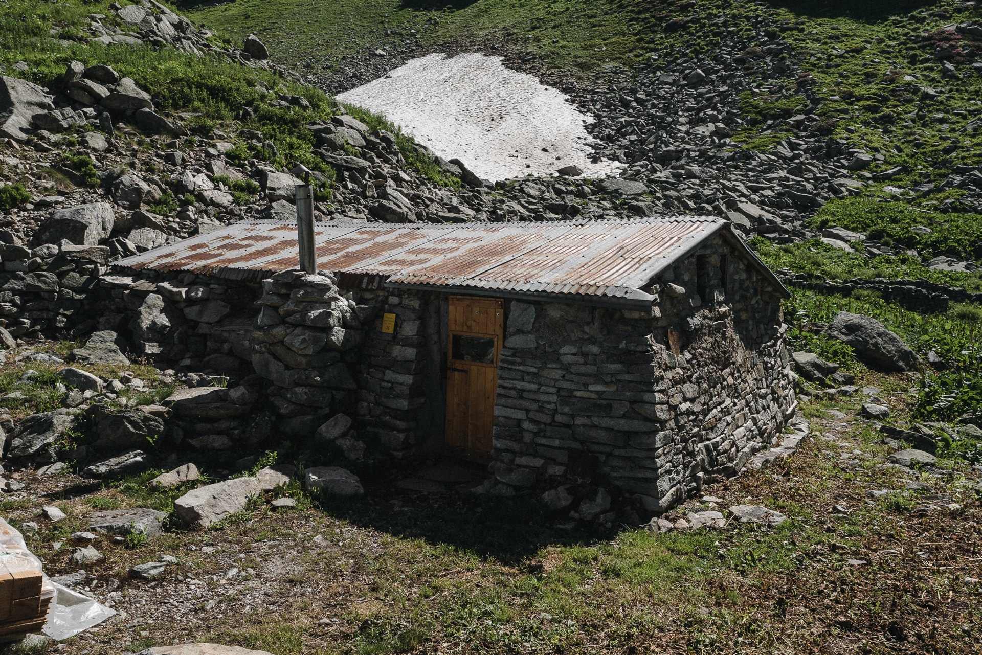
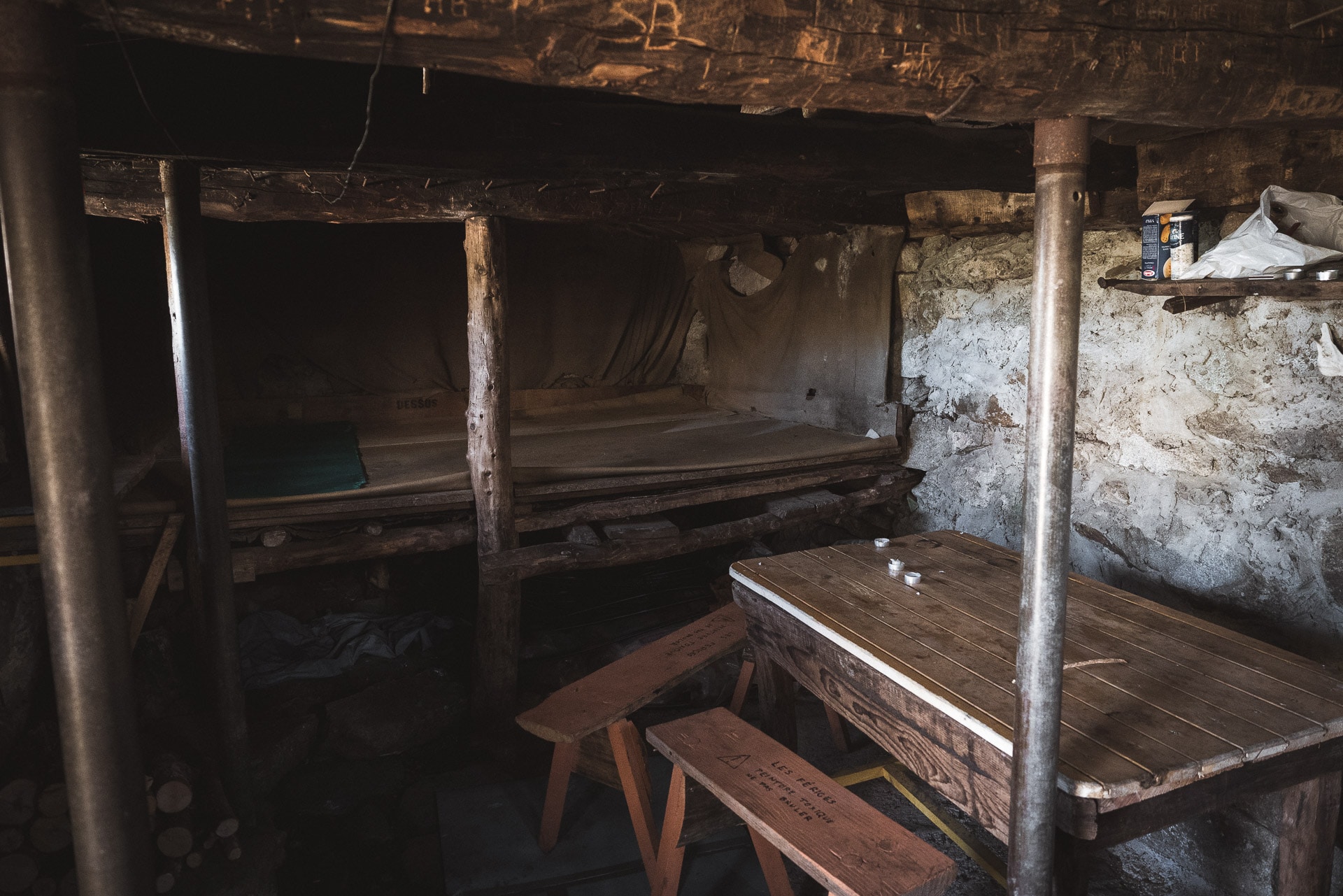
I reach the little rustic Refuge des Férices which is a simple stone hut with just enough installation inside. I think this place has a lot of charm and the place it is in is really beautiful.
I give myself a long break before heading to the Chalet de Pré Nouveau some 400m below.
The knees are painful in the descent and the fatigue of the last days is there. This portion unlike the previous one has little charm … I will cross in this descent the only other people of my 8 days having traveled the GR738 in full …
Lunch break at the cabin (which is closed) before beginning the ascent to the Claran.
Again this portion is not very pretty because it evolves in dense vegetation and very wet. It is only at the approach of the Claran refuge (1828m) that the landscape opens again. In any case, the climb is long and difficult for me …
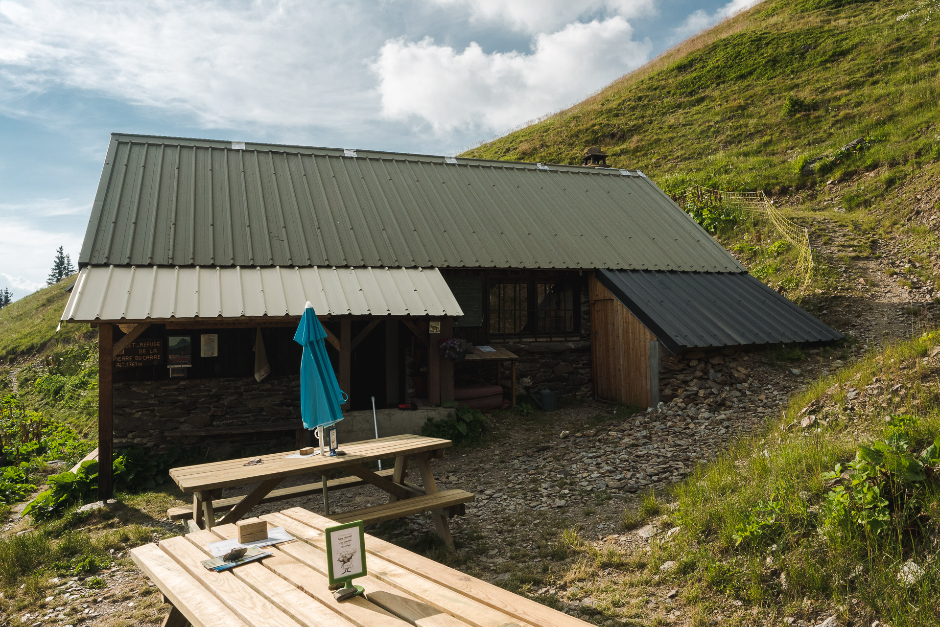
The final climb to the finish collar will tire me even though the view is beautiful. Behind the shelter of the Pierre du Carre is revealed with him the idea of a good cold beer. By cons it seems much closer than it is in reality and the descent is a torture for my knees.
I finally reach the refuge, exhausted once again … There are few people and I will quickly find myself alone with the guards. I eat a good portion of blueberry pie with a well deserved beer, best moment of the day. Once again and as often, the view of the refuge is beautiful.
I will spend a lot of time talking to the caretaker and his wife who are very hospitable. If you pass in the area, I really advise you to spend a night or just some time to eat because there is a pleasant atmosphere of “family refuge” that sometimes gets lost with large establishments.
There are a few pitches above the refuge to set up the tent. They offer a nice view of the valley.
I go to bed early because I need to recover. I’m getting worried for the future and I hope I’m going to hold physically. Walking alone does not help because I have no one to motivate me when I’m tired. The group provides a nice energy.
I fall asleep tonight, lulled by the “scare to wolf” (blank shots of gas cannon) of the shepherd who is a little higher on the mountain.
Day 4 - From Refuge de la Pierre du Carre to Chalet du Léat
Fourth day … my little rituals are well-honed and I get up again early and I fold the camp quickly. The day begins with a long descent … I do not like descents, especially at the beginning of the day.
This one is particularly ugly and not pleasant because the morning dew has soaked everything and it skids. It breaks my spirits and already that I began to tell myself that I will not be able to finish the GR738, this descent undermines me a little more.
Consequence: arrived at the T-fork when the trail joins a forest track, I seriously ask myself whether I continue GR738 or not. It is a scene that would be very cinematographic with the following cornelian choice: to the left the GR, to the right the return home punctuated by a failure. I call my girlfriend to the rescue who finds the words to motivate me and convinces me to continue.
Direction the left and the motivation to finish this GR738 !!
The path follows the forest trail for a good distance. It is not very pretty but at least the ground is good and in the shade. Arrived at the Praillet 1700m, the trail begins a gentle descent through the pastures towards the Aup Bernard that I reach quickly.
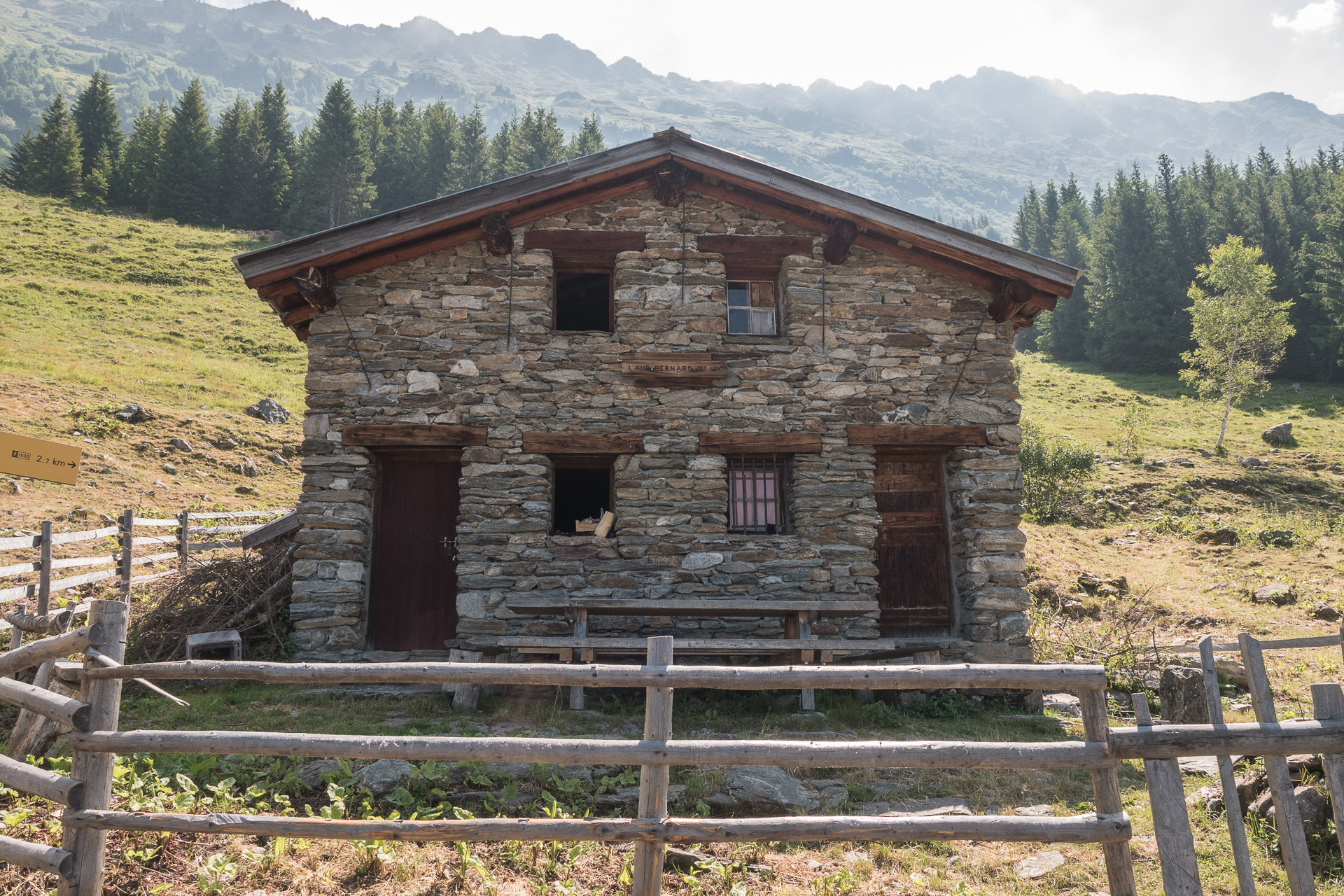
After the Aup Bernard and a rehydration break, another descent towards the Bourgeat Noir awaits me. There is not much to say about this portion again, except that once walks under the trees which is both pleasant because we are in the shade but from a landscape point of view I prefer big open spaces.
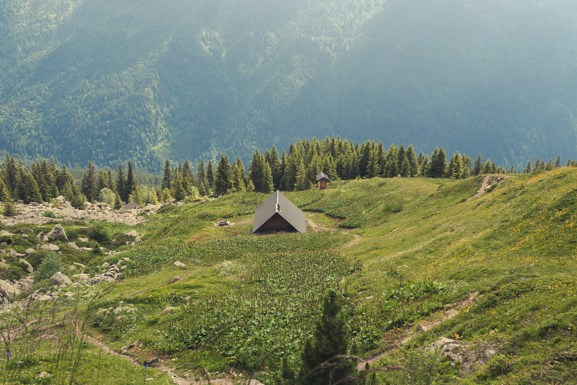
Arrived at the village, the GR738 rises normally towards Refuge of the Oule but I will have to double my stage tomorrow to hold my planning, so I make the choice to take a direct route towards the chalet of Léat and thus to gain a little time for tomorrow.
The path in question evolves in the forest (fortunately because it is very hot) but climbs very very strong! I have the chance to meet a mom and her daughter who are hiking to the day between the Léat and Oule and I go up with them, it’s more motivating and it allows to chat.
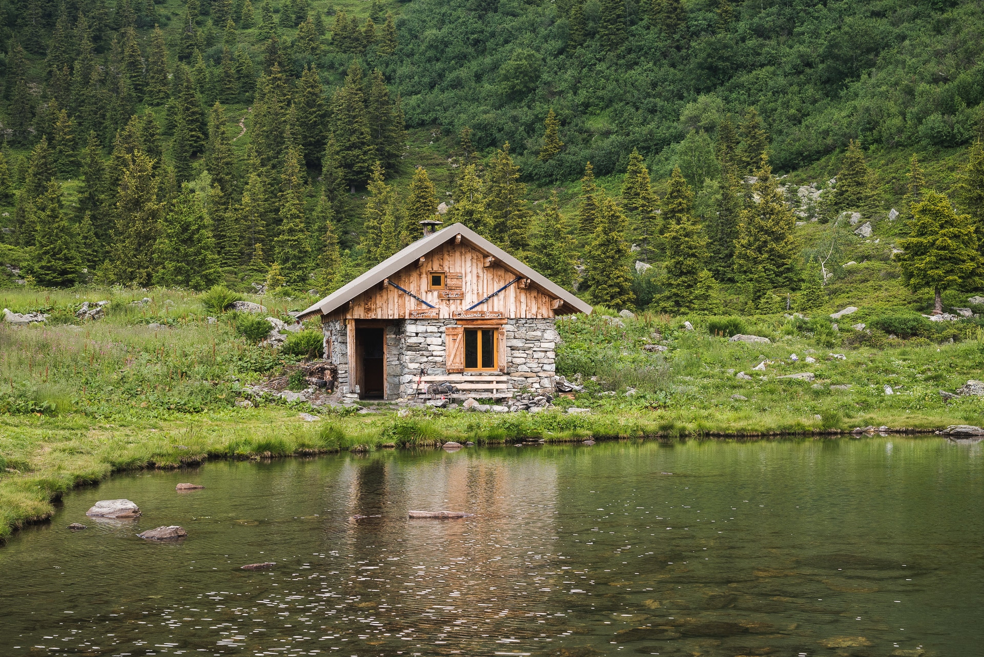
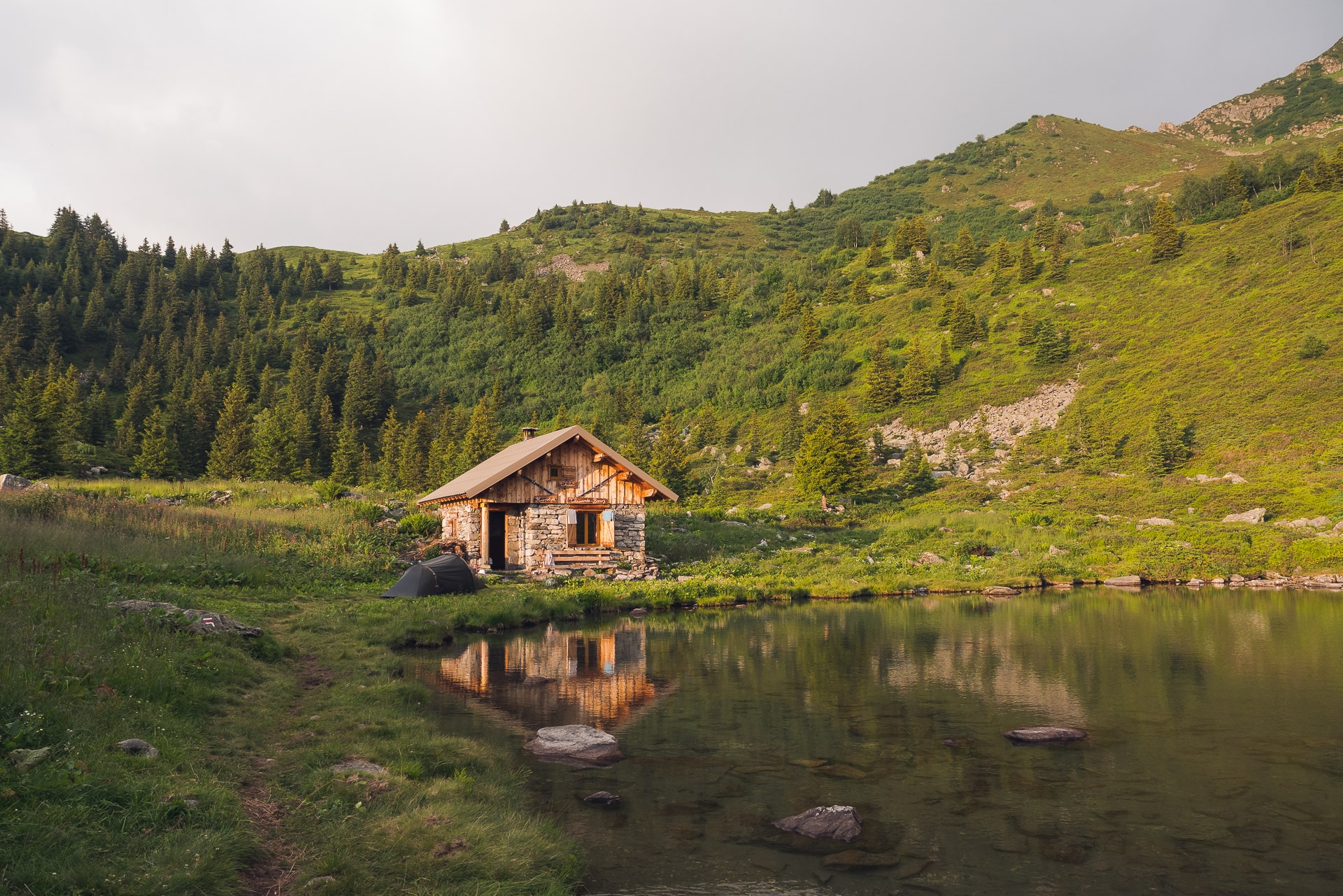
I am very happy to arrive at the chalet which is nestled right next to the pretty Lac du Léat in a small depression. It is a beautiful place and the cottage is very well maintained.
We share a little mint tea with my two climbing friends before they get on their way again. Soon a pair of walkers arrived to spend the night at the shelter as well. We will be joined a little later by a group of fifties’ very nice. In the end it’s a nice evening that I spend. The surroundings of the chalet are really pretty especially in the orange light of the evening.
I put my tent right next to the shelter. Tomorrow, direction the Sept Laux, for, I think, a new approach of the GR738 because it will be a much more “mountain” and rocky environment.
Day 5 - From Chalet du Léat to the Sept Laux
I did well to sleep in my tent and not in the shelter because there was snorers! I even heard them from outside!
Long day in perspective because today I double a stage (even if the stage until La Martinette is not very long) and tonight I’ll be at the Sept Laux.
To change, the day begins with a descent without great interest towards the bottom of the valley, from there you go towards La Martinette.
Then begins the long climb of 1100m to the Seven Laux. It is early so I have plenty of time to climb this drop and I go quietly at my own pace.
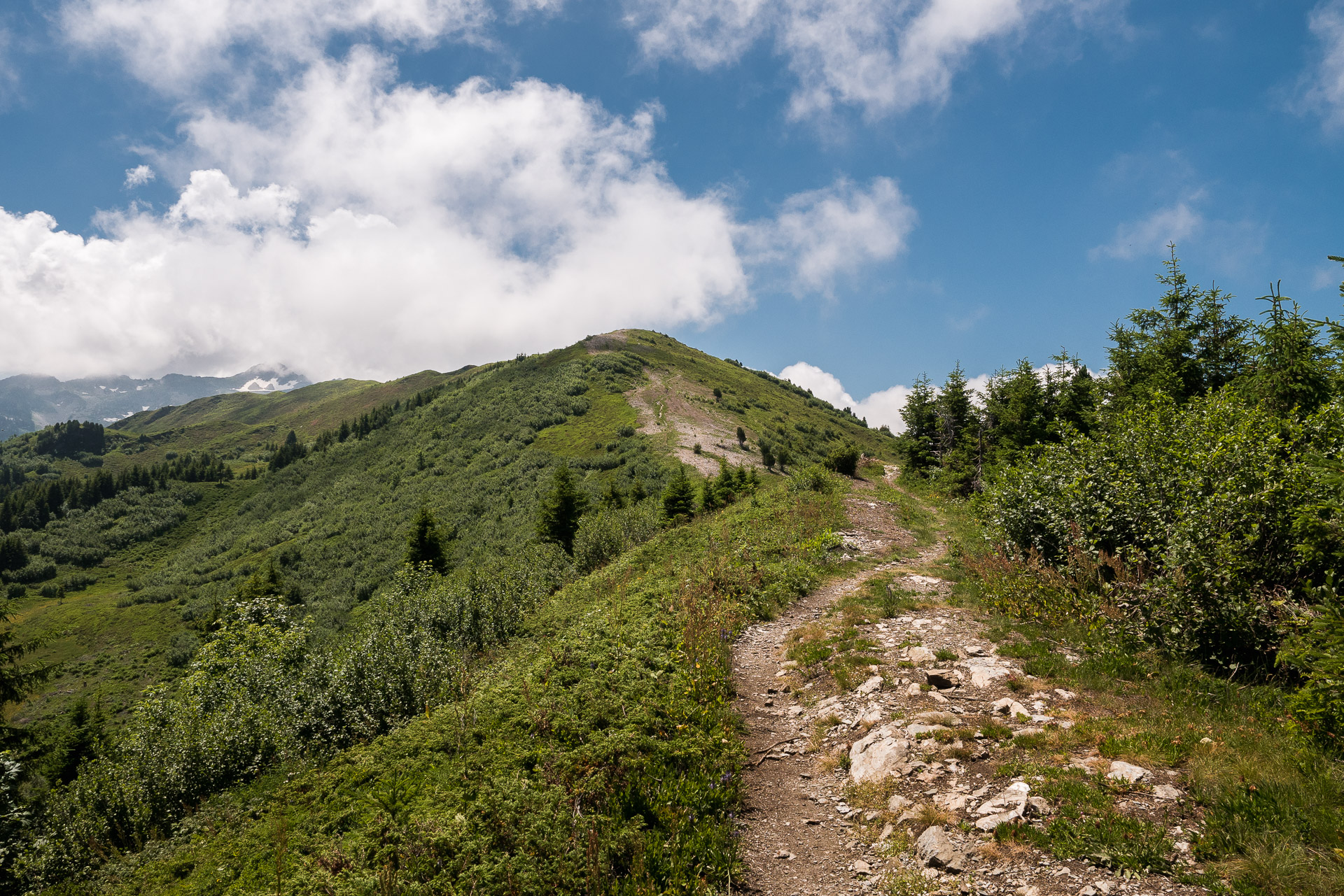
From what I’ve been told, prefer the GR738 trail rather than the one that passes by the “Cul de la Vieille” (translation : the old woman’s ass 🙂 ) because this passage requires to use your hands which is not ideal with the bag . The climb is beautiful and wild, we go between the scree and on nice trails gradually taking the height. There is nobody again and it is sunny.
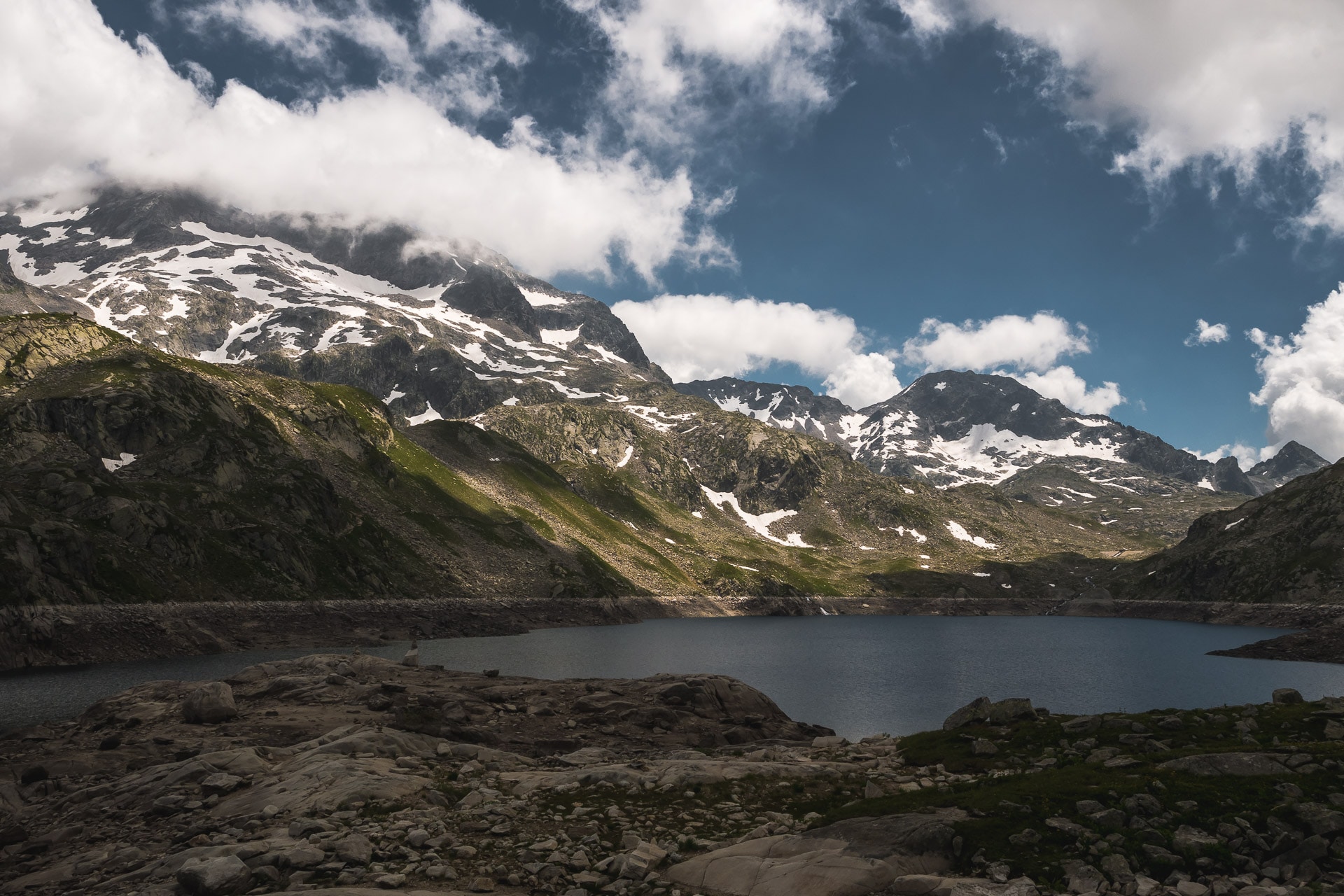
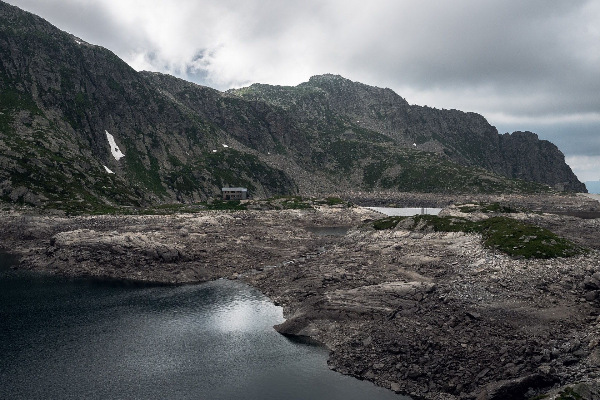
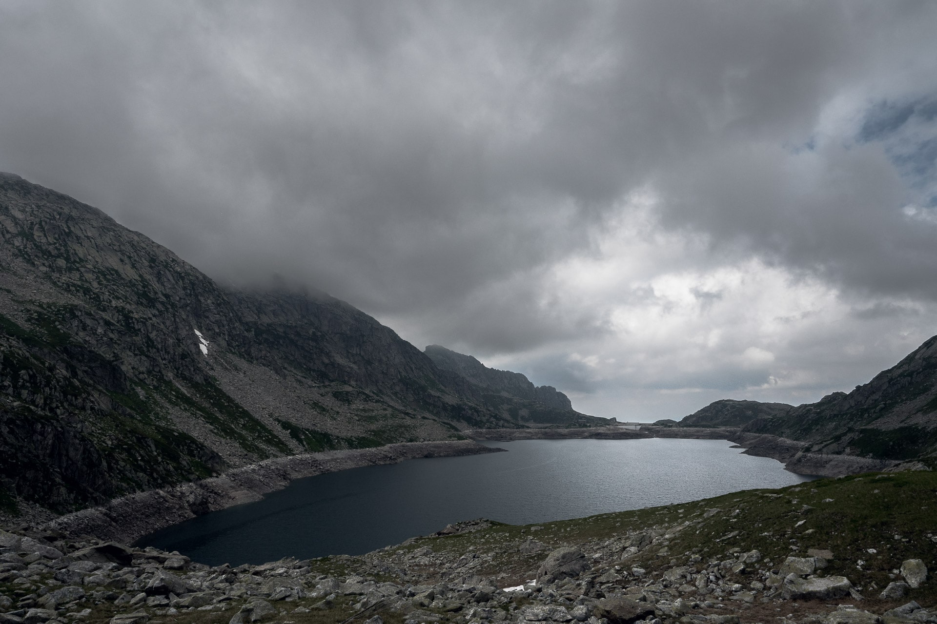
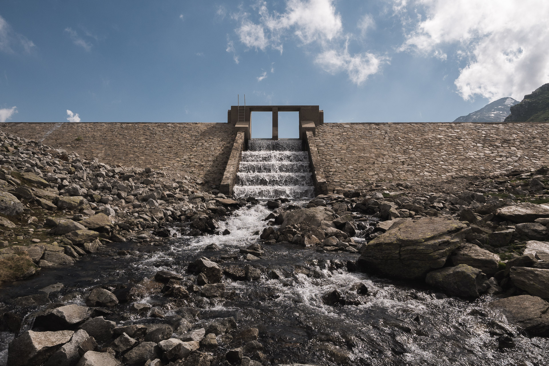
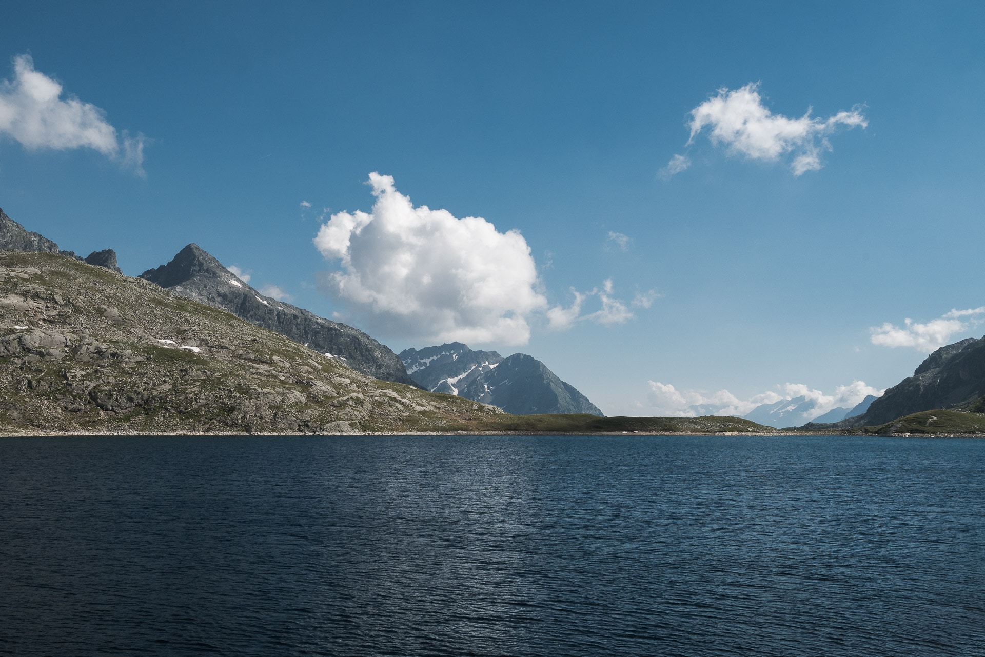
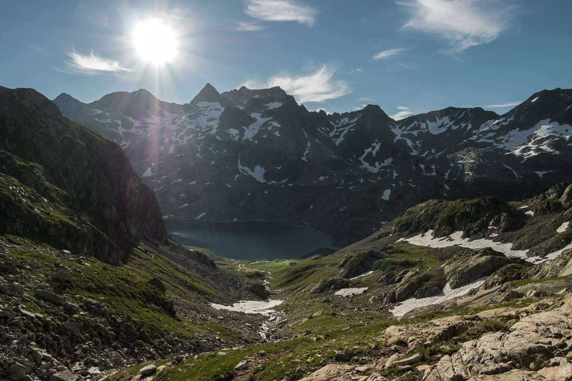
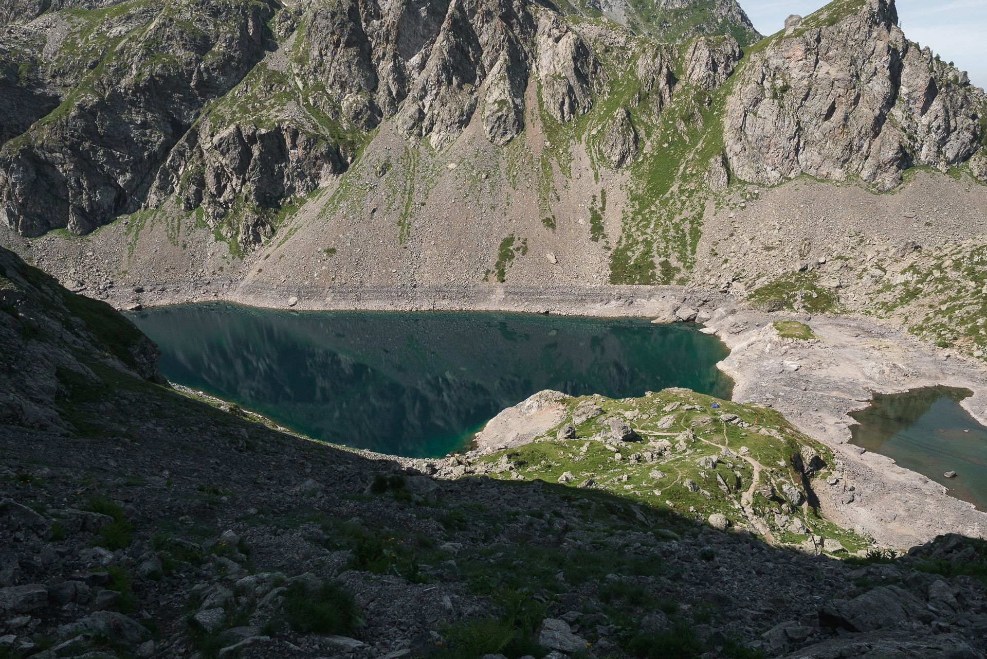
Once at the Lac Noir, you are almost there. Another 10min and finally the Refuge des Sept Laux is revealed on a small piece of rock between the lakes. The Sept Laux are a huge hydropower complex created by EDF (French Electical compagny)(I imagine that there must still be lakes initially). There are many lakes larger or smaller that communicate together. At this time the lakes are low as can be seen in the photos but it’s nice all the same, especially in the direction of the south.
I sit on the terrace of the refuge to eat a good omelette. I chat a little with the hikers present and I enjoy the satisfaction of having climb these 1100m especially that I feel much better physically, so I am confident to finish the GR738.
It is whe planning the next few days that I realize my mistake: I have not counted the stages well and I miss a day. Currently I miss my train !! So I’ll have to double another stage … By analyzing a little bit the map and the rest of the stages, I decide to try to double tomorrow’s stage, ie to walk to Jean Collet rather than to stop at the Habert d’Aiguebelle. It’s going to be a long day but it’s feasible. By cons to win a little time tomorrow, I take my bag and I push to the sheepfold of Cos under the Col de la Vache to set my camp.
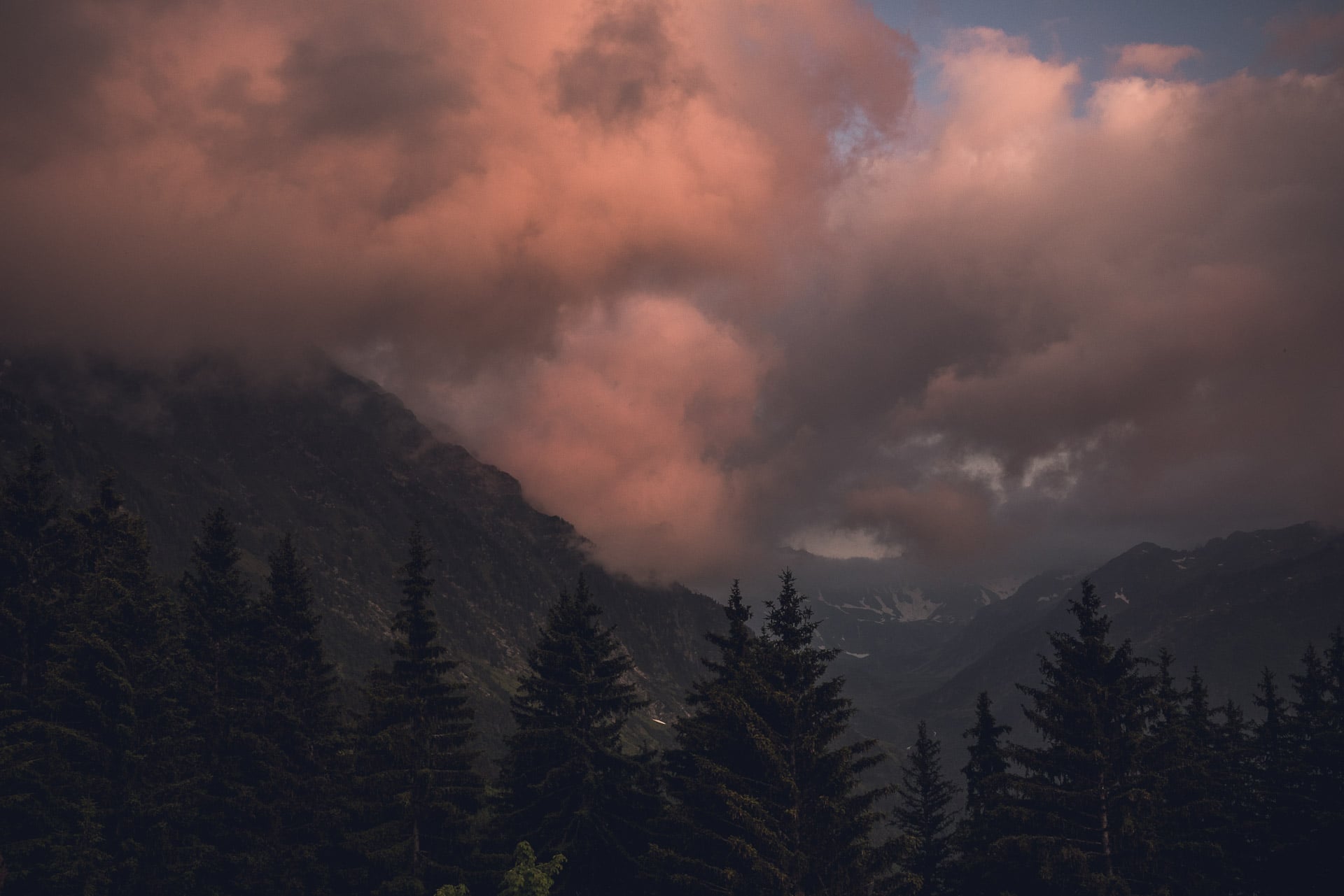
The path between the refuge and the sheepfold is really beautiful especially with the light plays due to the clouds of the late afternoon.
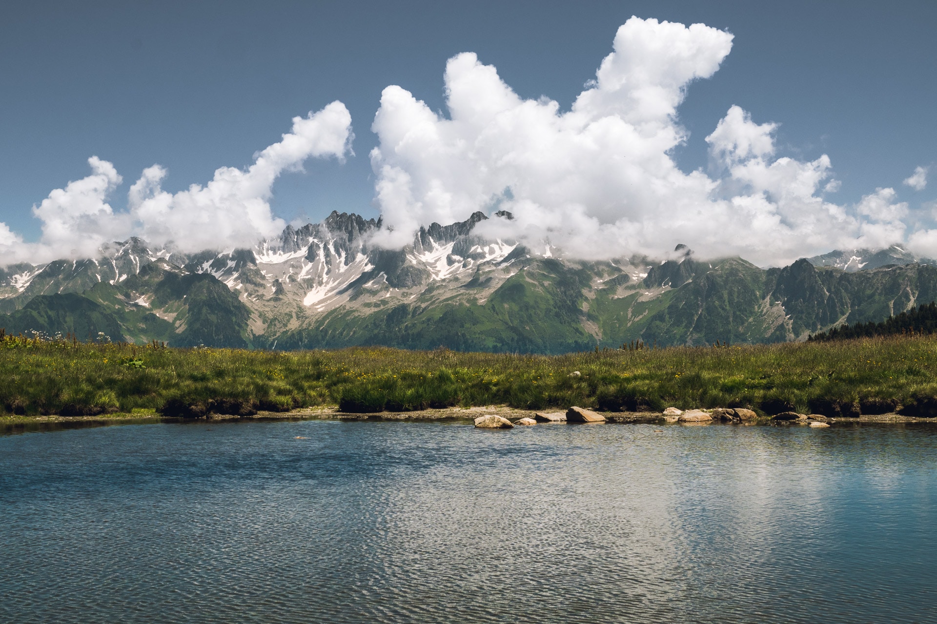
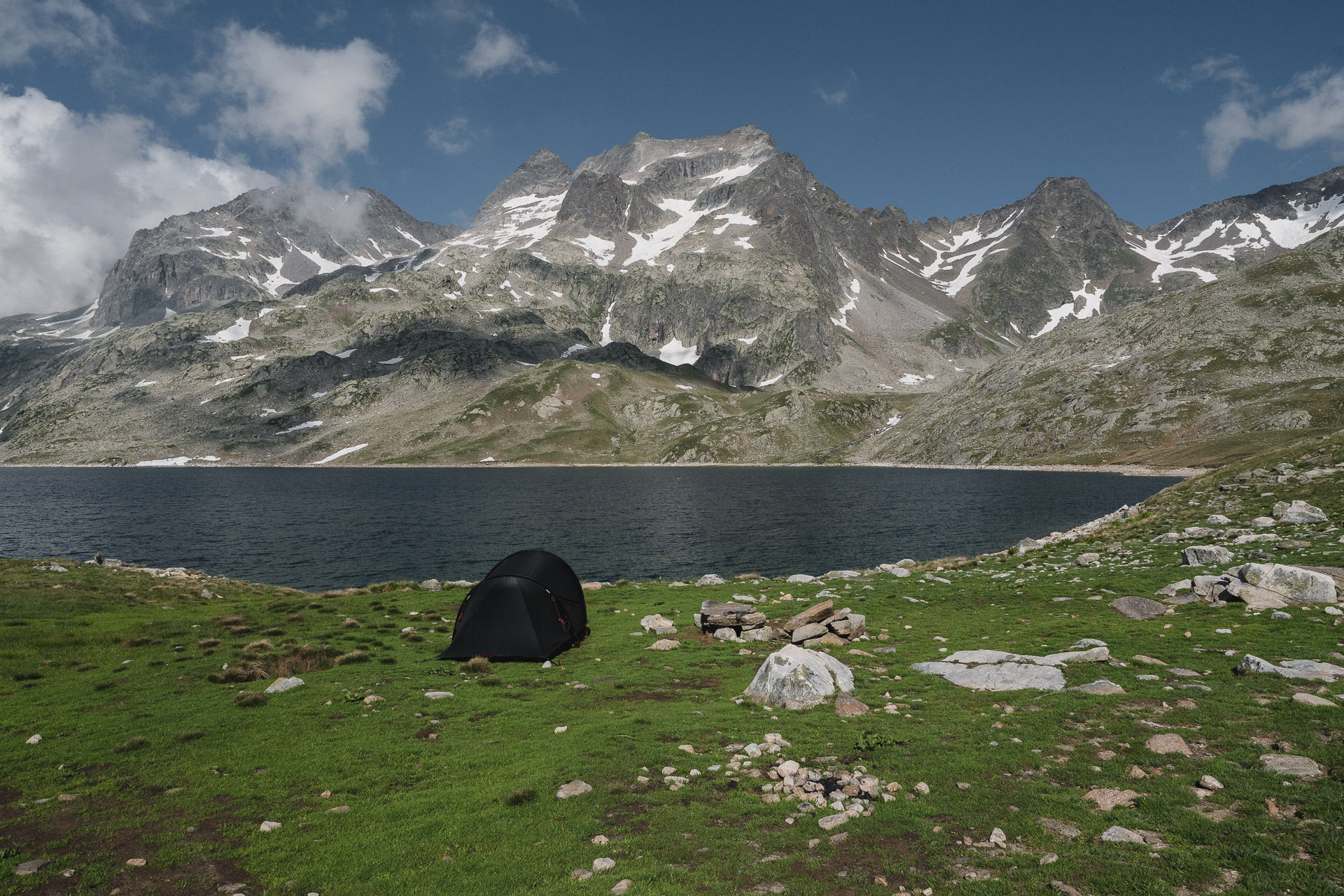
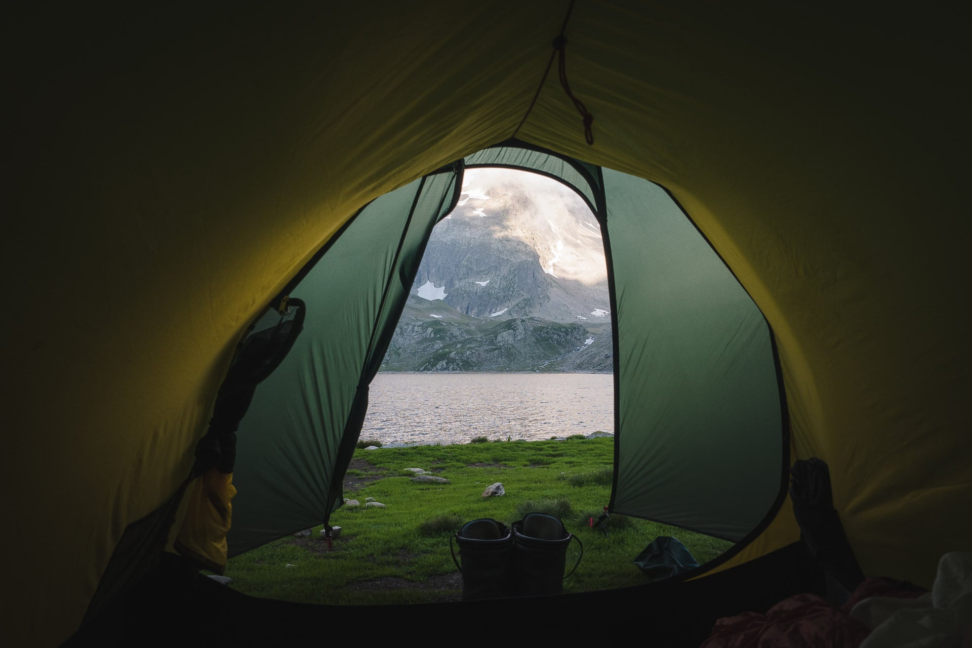
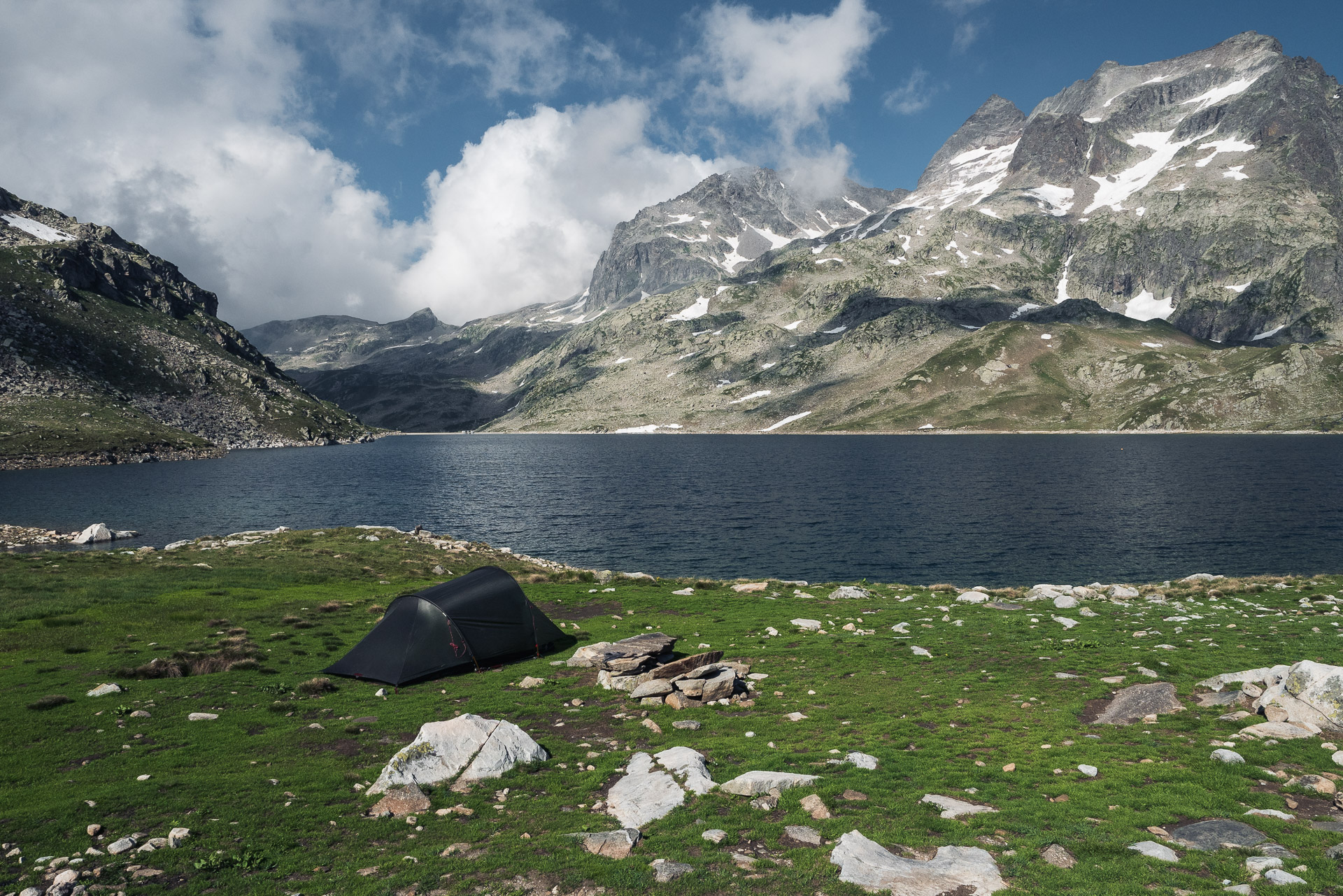
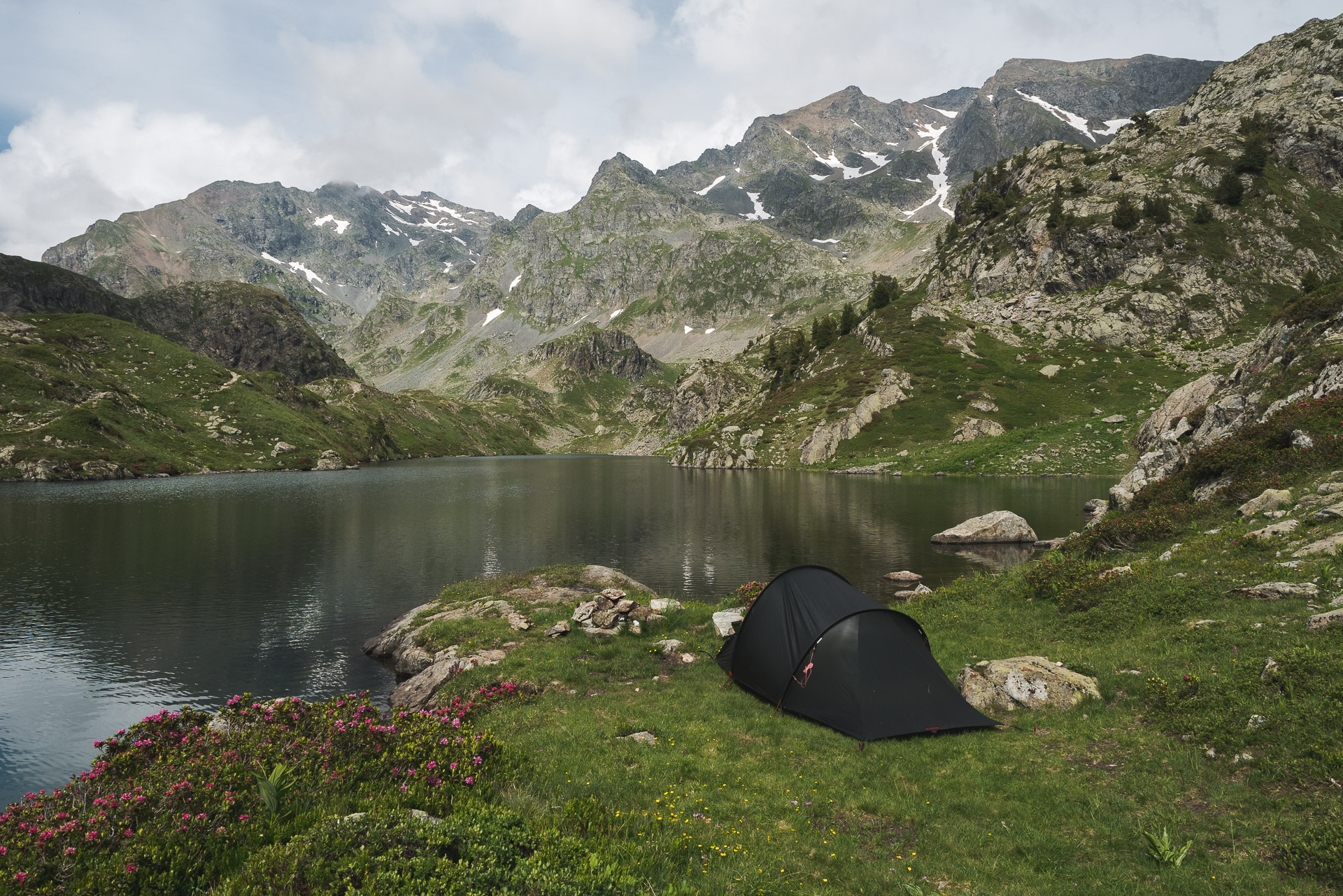
The surroundings of Lac du Cos are beautiful and offer dreamy camping pitches ! I set the tent not far from the sheepfold which is not occupied for the moment. I have all the view of the lake and the Pyramid (2912m) in the background. It’s a nice moment, serene and lonely again.
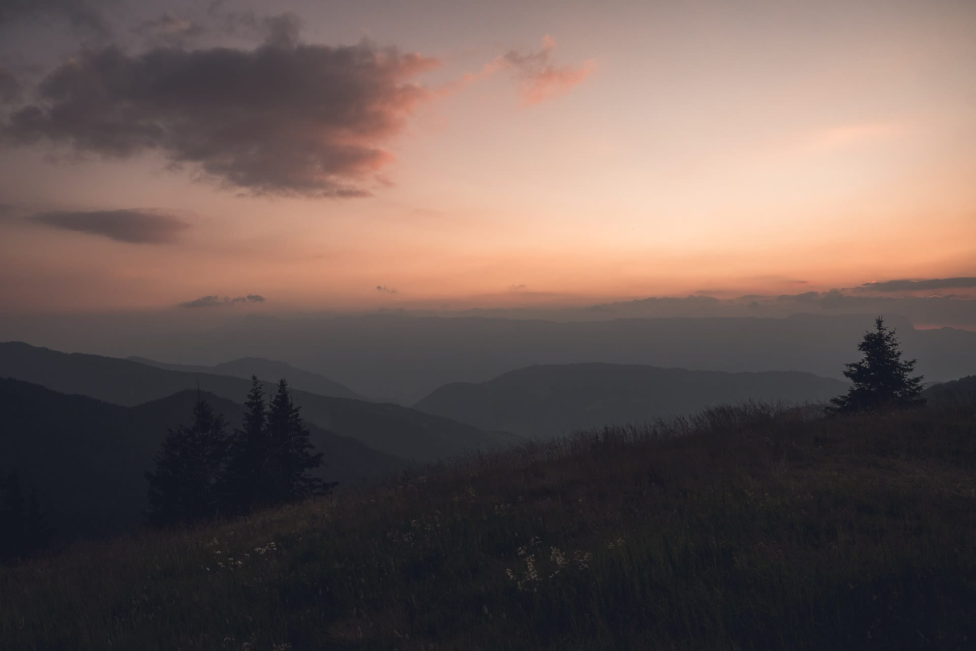
In the evening I will have the visit from few ibex on the heights behind the tent. The colors on the surrounding mountains are very beautiful and it is not cold. It’s really a beautiful bivouac, certainly the most beautiful of my GR!
Day 6 - From Lac du Cos to Refuge Jean Collet
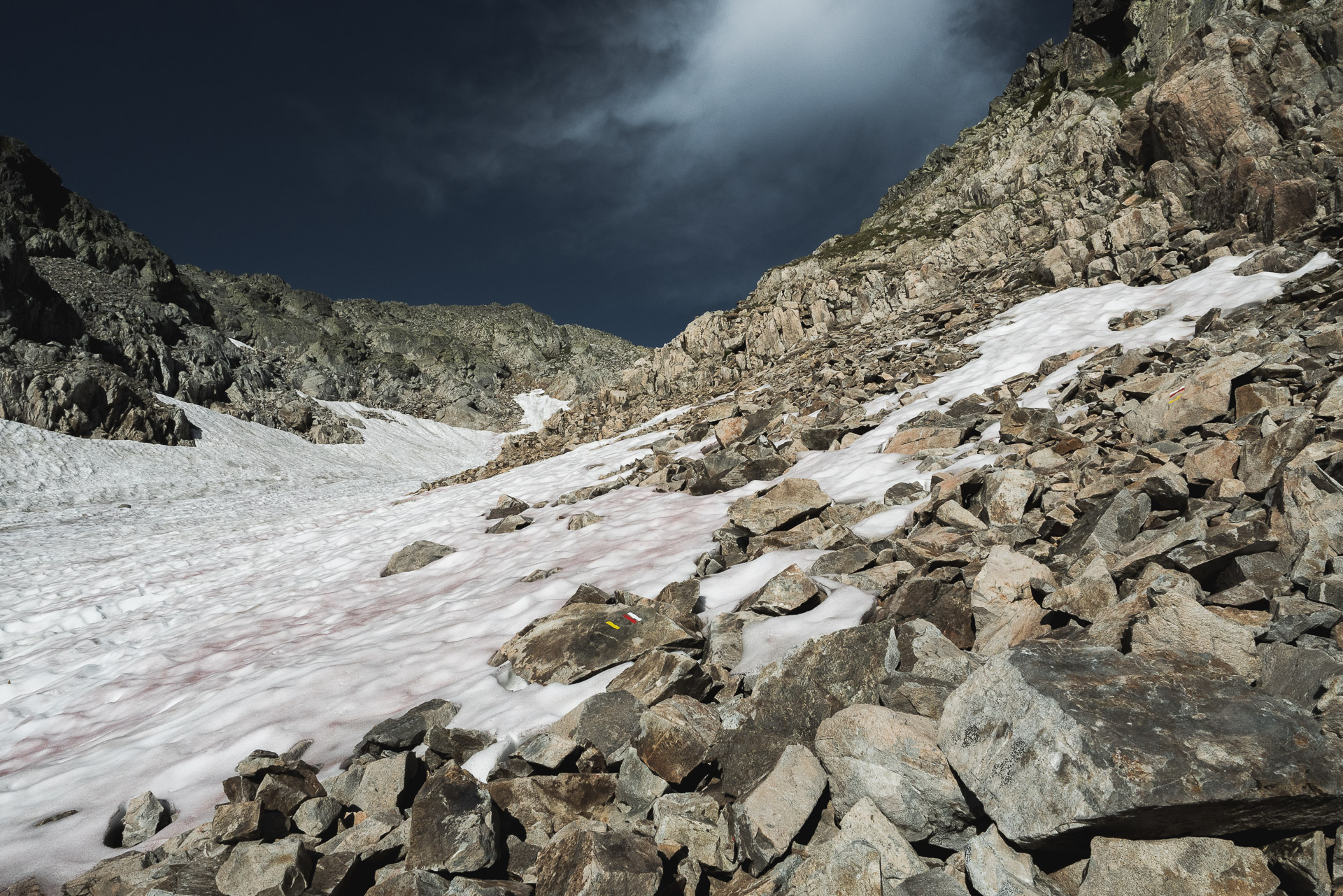
Well, it’s a long day waiting for me! I have to double my stage and join the refuge Jean Collet. The first problem is that in front of me there is the Col de la Vache and it is still under snow. Indeed, the precipitation has been exceptional this winter and the snow is still present. I know it is manageable because I met groups that had succeeded but during late afternoon every time. I begin early in the morning, I hope that the nocturnal refreezing was limited …
So I start the climb in the rock for the moment. Behind the view is beautiful with the morning sun and the lake below.
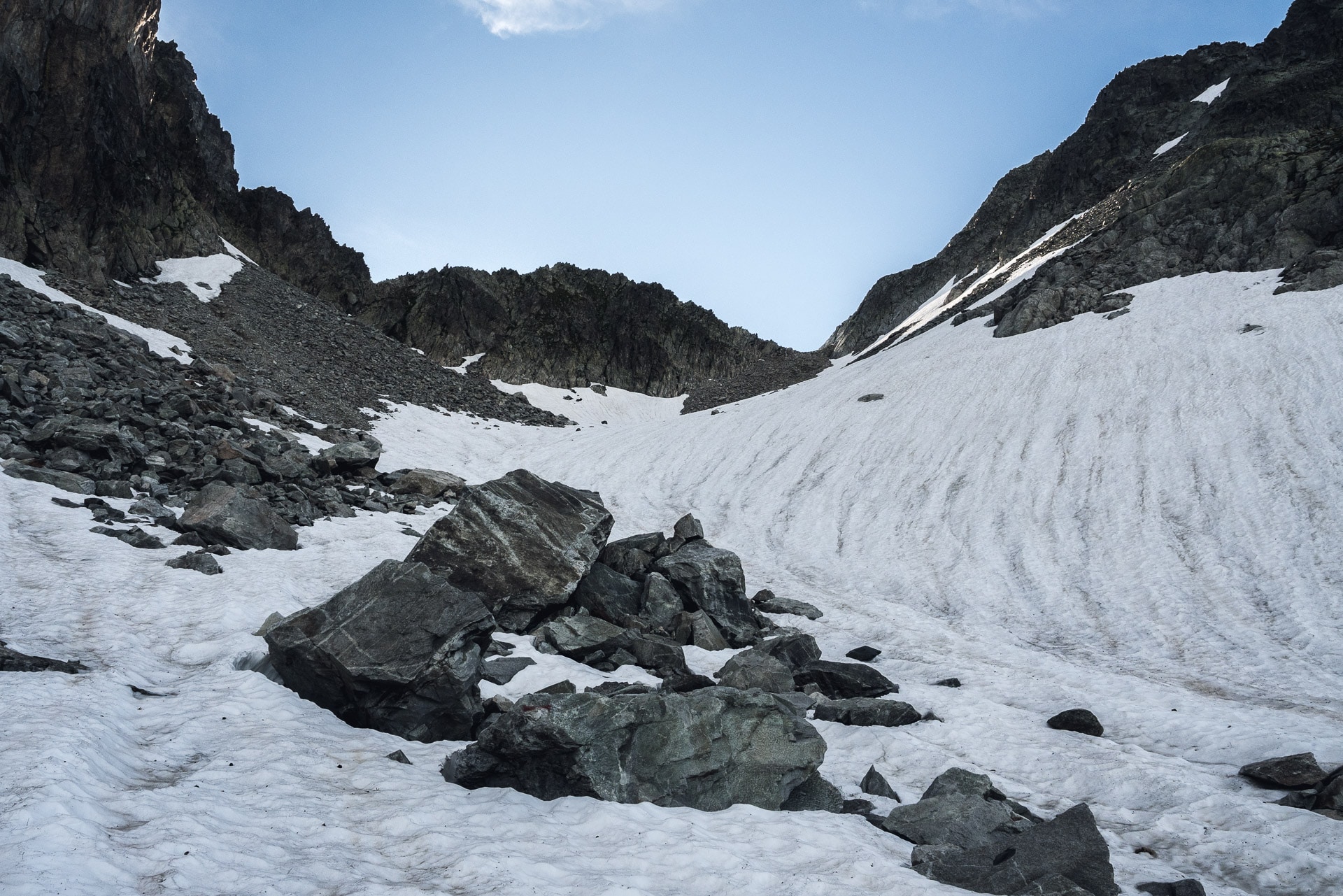
I quickly join the snow. I think that from 2300-2400m everything is all white. Fortunately the surroundings of the snow field are ok to get through. Not being equipped with crampons, I prefer to spend in the rockery and avoid a slide … For the climb it is easy and it is even more “playful” because I use my hands a little in some passages.
I quickly arrive at the pass in the end. On the other side no surprise: the snow on 200m of descent… except that this snow is totally frozen and so it is a long slope of ice which presents itself to me ! Ouch !! I am not equipped for. So I have 3 choices: either I turn around and I go elsewhere (but where?), Or I wait for the sun turns and warms the collar but in this case goodbye doubling the stage today, or I try to go down the slope by sliding me on the butt …
I choose the 3rd option because I want to move forward. I’ll be honest, in hindsight, this idea was not very clever because being alone, the risk was quite high … But hey, here I am slowly sliding on the buttocks braking with the walking sticks as much to say that the equilibrium is precarious and that I am cold at the buttocks! Besides I begin an uncontrolled slipping and I can stop only with a depression in the ice a little lower … I get away without much damage if it is a nice hand injury but it could have been much worse.
The descent will take a good hour in the end and a good stress!
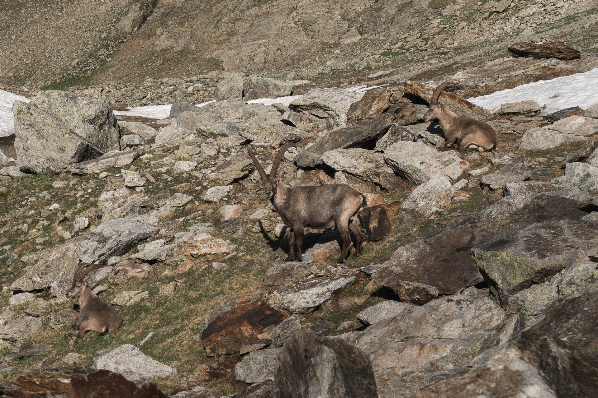
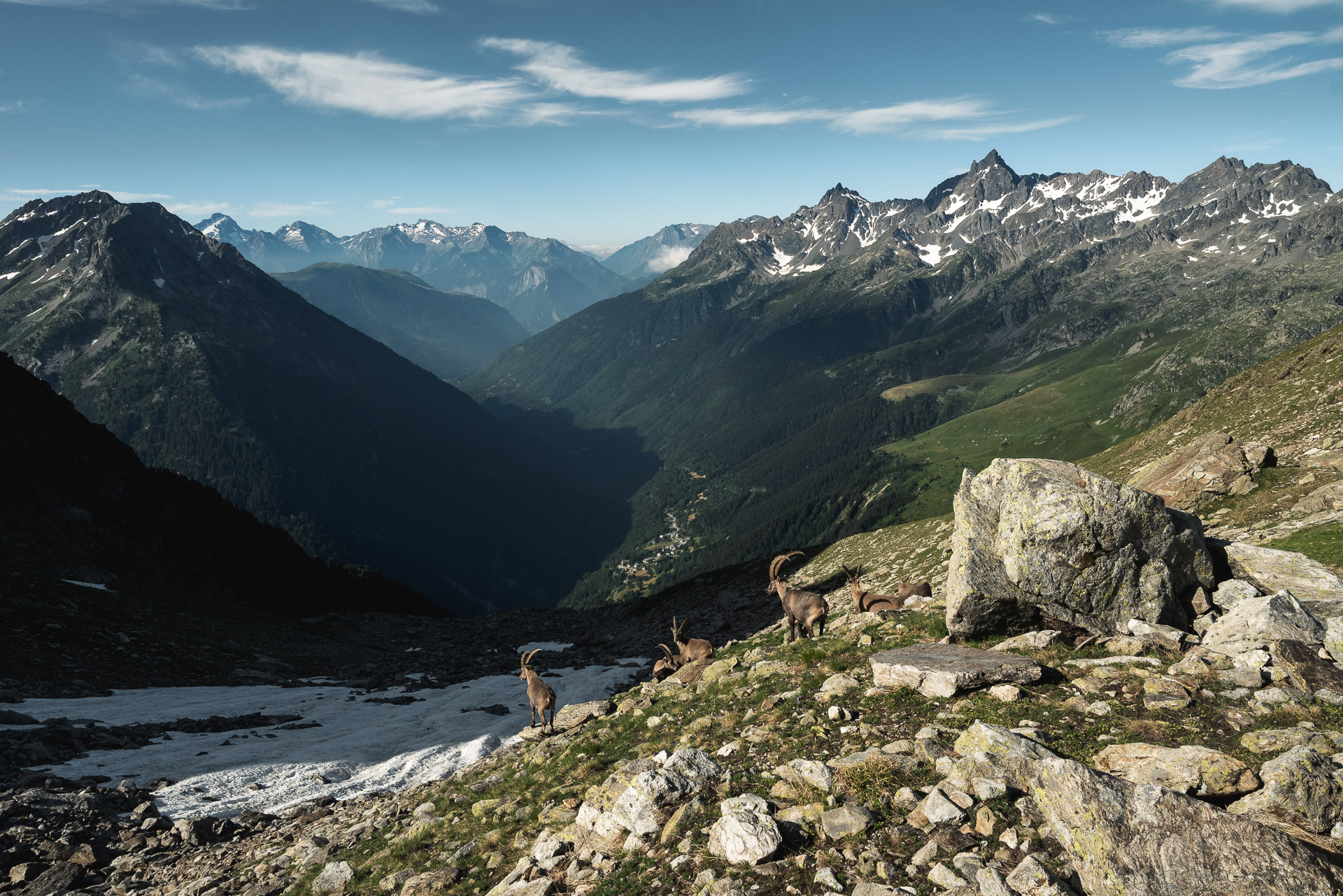
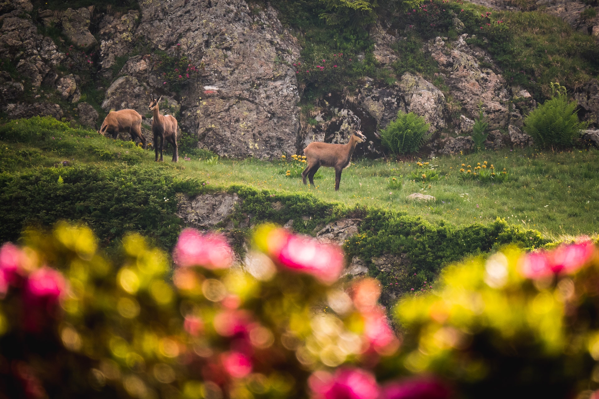
Fortunately, and to make me forget this misadventure, some ibex are waiting for me downstairs and scarcely scorn to shift to let me pass. I realize some beautiful pictures, I like this kind of meeting with the local fauna (a priori their presence here in the morning is common).
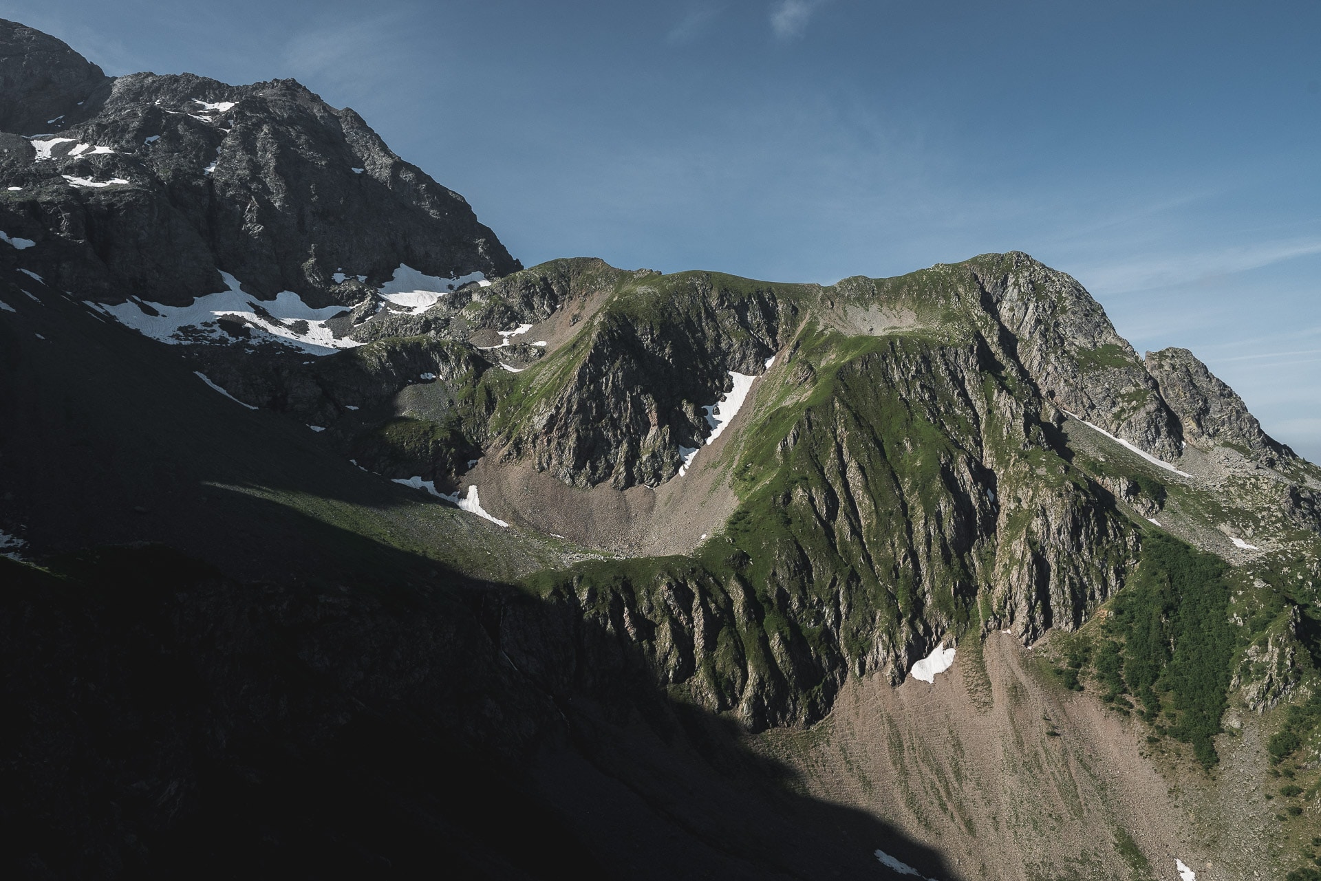
I take the trail towards Pas de la Coche after disinfecting my hand. We can see the path snaking away. The passage of the Col de la Vache really symbolizes a change in the landscapes, given that the sequel to the GR738 will be in a much more rocky, more wild.
When I walked the GR738 in July 2018, the trail was not marked “GR” from the Col de la Vache to the Brèche de Roche Fendue. There are other markings including yellow lines and / or blue dots. The GR tag should be completed by the fall of 2018.
The landscapes are very beautiful on this portion.
I quickly reach the Pas de la Coche, which normally symbolizes the end of the stage of the day. It is still early so I have plenty of time to join Jean Collet.
For now I head towards the Brèche de la Roche Fendue (2480m). The path is very wild and does not even appear on the IGN map (which is rare). Enjoy the small spring that gives birth to the Creek of the Great Mountain to refill the source water as good as fresh.
The climb to the Brèche is done in the scree all along. It is a good climb, long enough in the end especially that it is very hot.
The passage of the breach is beautiful because it is really a small opening in the surrounding cliffs.
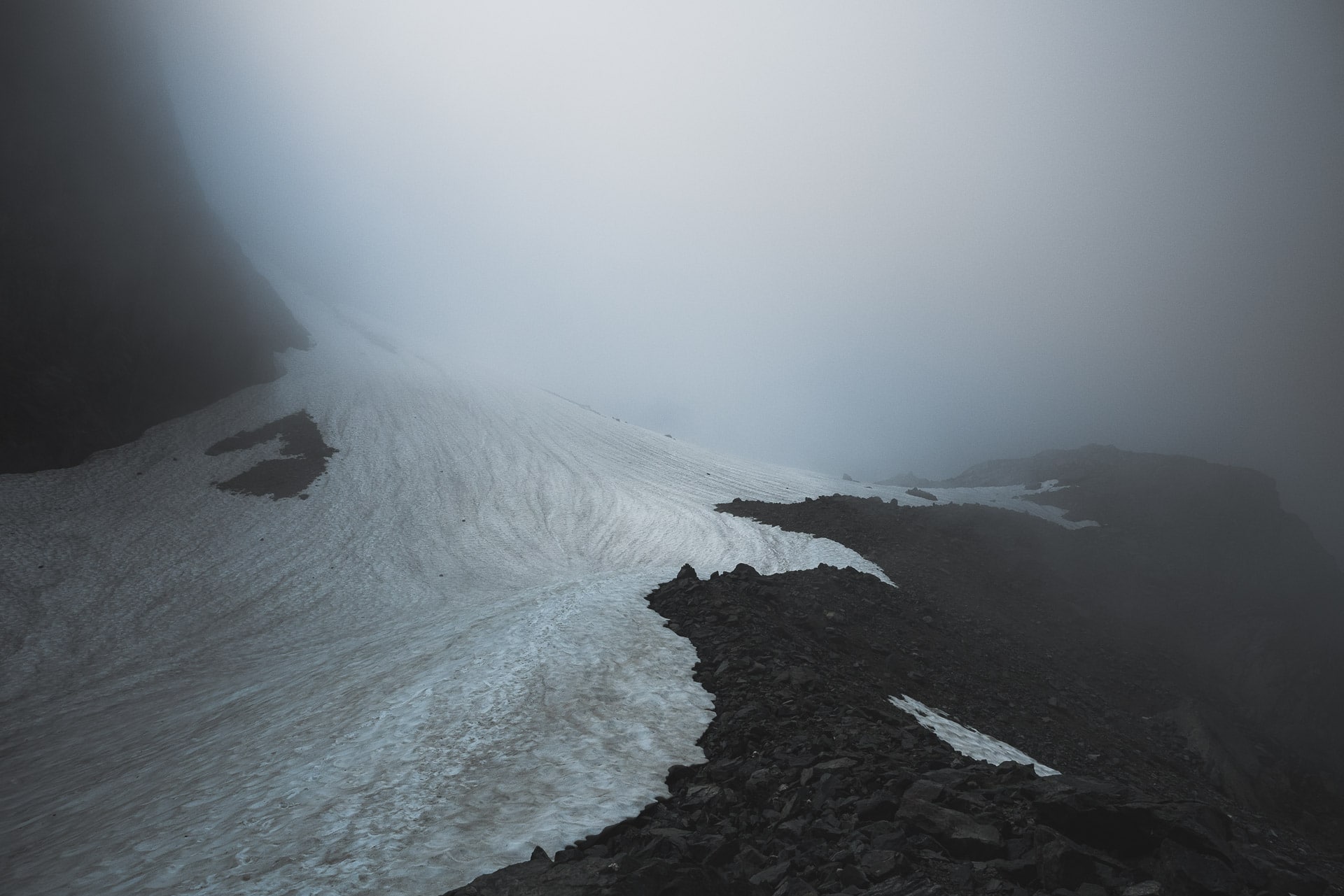
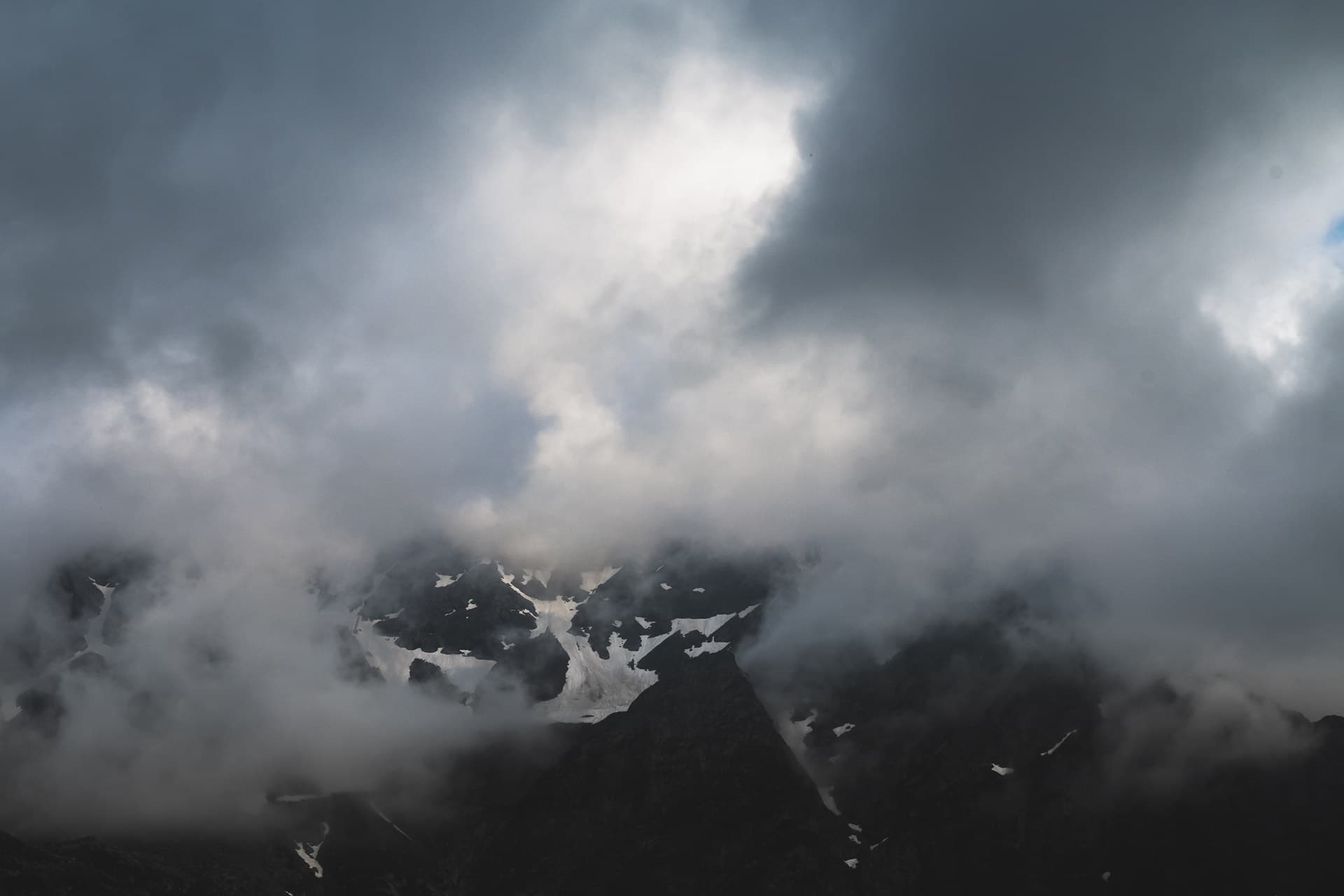
As for the passage of the Col de la Mine de Fer and the whole descent to Jean Collet, I do not have many pictures to present to you because, behind the Brèche de Roche Fendue, I was in the clouds all along . This creates a nice atmosphere but it is more difficult to appreciate the surrounding landscapes.
The Col de la Mine de Fer and the descent to the Refuge Jean Collet do not present any particular difficulty.
I reach the refuge in the afternoon. I did a good job, I’m happy. I therefore offer myself a small craft beer as a reward.
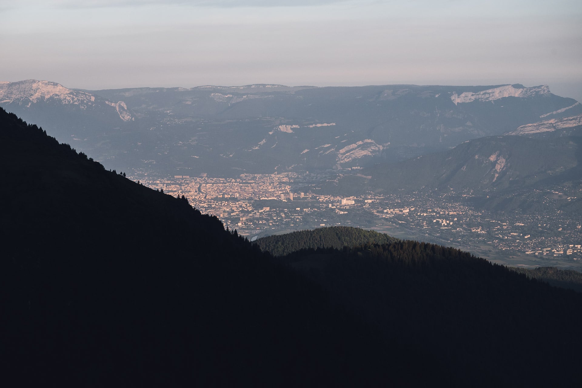
End of the day pretty classic. I will spend a lot of time talking to the guardians and a hiker at the shelter. I will then install my tent a little above because there are some places planned for the bivouac. The place offers a beautiful view of the valley and Grenoble 1700m further down. Seeing Grenoble is also the symbol of the near end of the GR. Another 2 steps and I will have finished. In any case, this day is the most beautiful of the GR738 in terms of landscapes in my opinion.
Day 7 - From Refuge Jean Collet to Refuge de la Pra
It’s go again ! This stage represents the last real stage of the GR since the last will be just dedicated to the descent on Chamrousse.
For now the first part of the day begins with the descent to the Habert du Mousset, which is quickly realized.
We then enter the heart of the subject with the climb on Col de la Sitre (~ 2160m). It is a nice climb quite steep but that does not present a major technical difficulty. You just have to take your time.
I admit a certain apprehension to pass this pass because I know that there are sheeps guarded by a patou behind and that some hikers have already had “nice” contacts with this good doggie …
Fortunately for me the flock is lower and down to the lake of the Grande Sitre, so I will avoid a bad meeting.
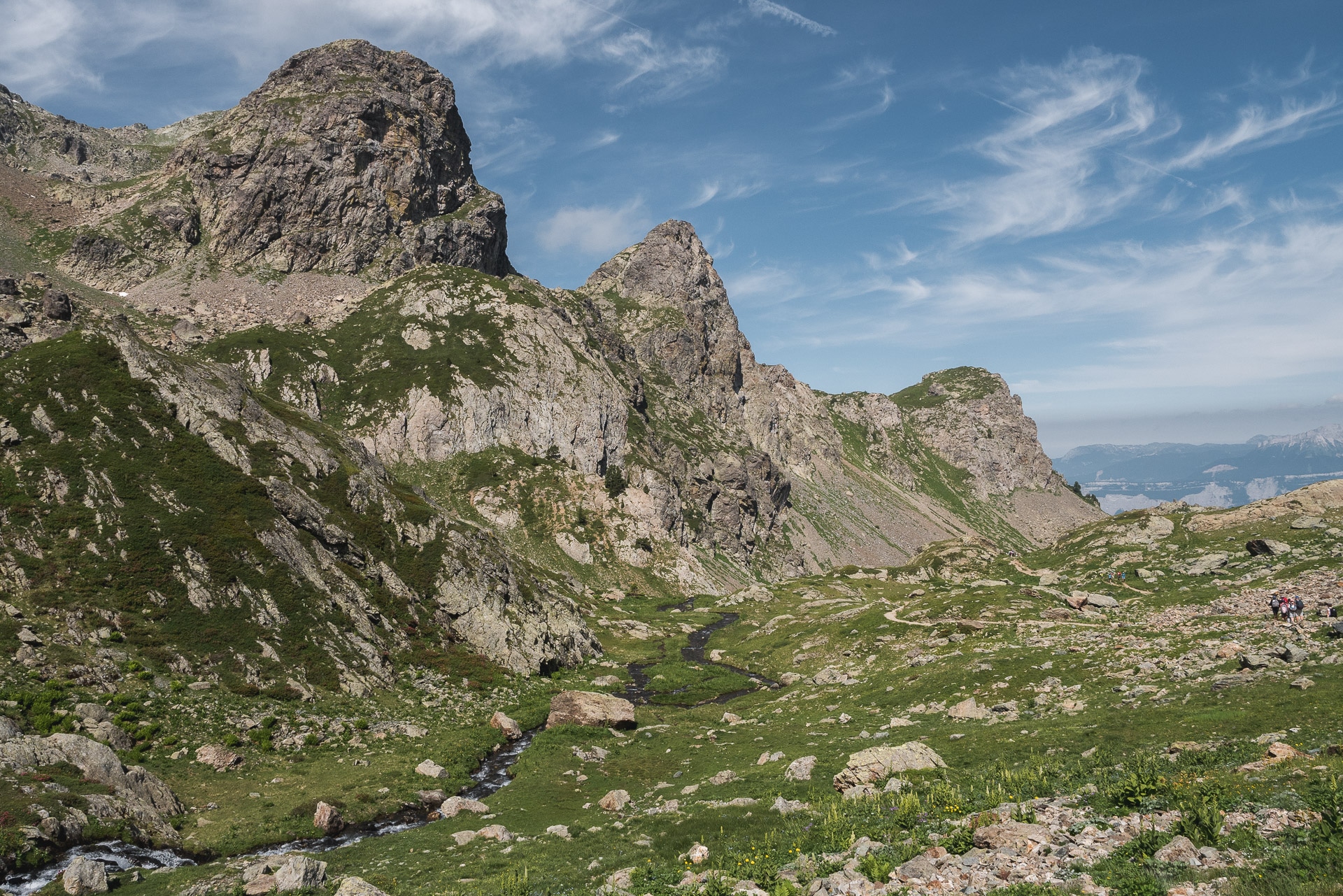
We have a beautiful view from the pass with the small lake below and the whole area to the Col du Loup. This is the next step that I reach quickly.
From there begins the long descent to Lac du Crozet. The lake is beautiful and it must be a good spot for the bivouac. On the other hand there are some people since we are near Pré Raymond or Pré du Mollard.
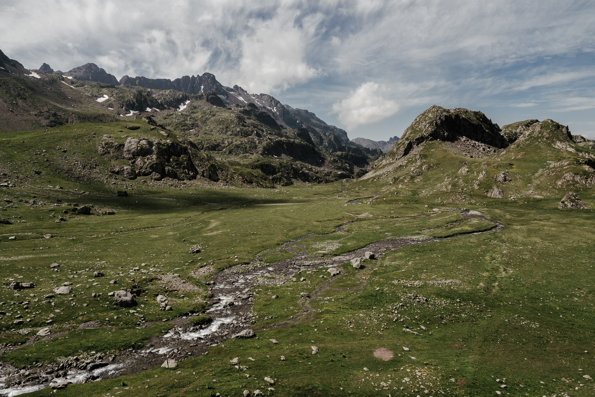
From the Crozet, you bifurcate on the left towards the Col de la Pra. All this portion has a lot of charm because there are many small streams that crisscross the valley.
Passing the pass is a formality and I reach the refuge 5min later. It is a “big” refuge, with two buildings facing the beautiful landscape that stretches between Le Galeteau and the cliffs of the Jasse Bralard peaks. I love these great alpine slopes traversed by pretty streams.
So I move to the terrace of the refuge to eat with a beer admiring the landscape. It is early I will have plenty of time to rest, enjoy the moment and chat with people.
Warning: the bivouac is now prohibited in the direct area of the refuge, following a municipal bylaw. Indeed the tourist affluence has greatly degraded the area, not to mention the people who tear trees for campfires. Link to the refuge site and the order.
By talking with the guardians, they tell me that hikers saw the Wolf yesterday a few meters from their bivouac! It is unexpected but I would like to live the same thing tonight!
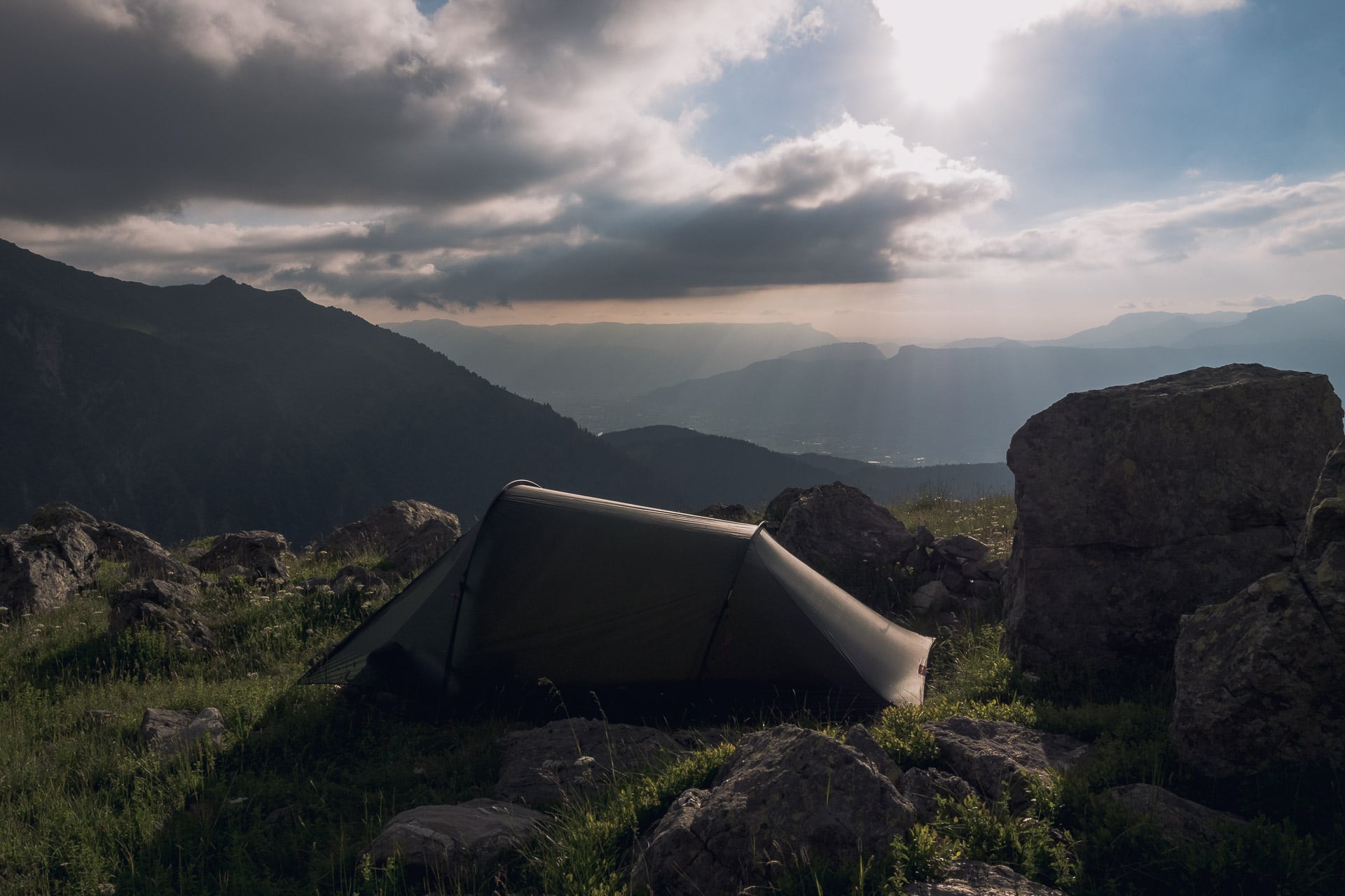
After this long pause of several hours I’m back on the trail towards Lake Longet to get out of the no-bivouac area. I get a nice little place at the SW end of the lake, right at the water’s edge.
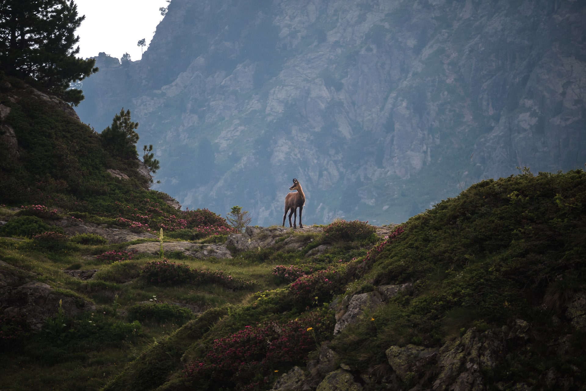
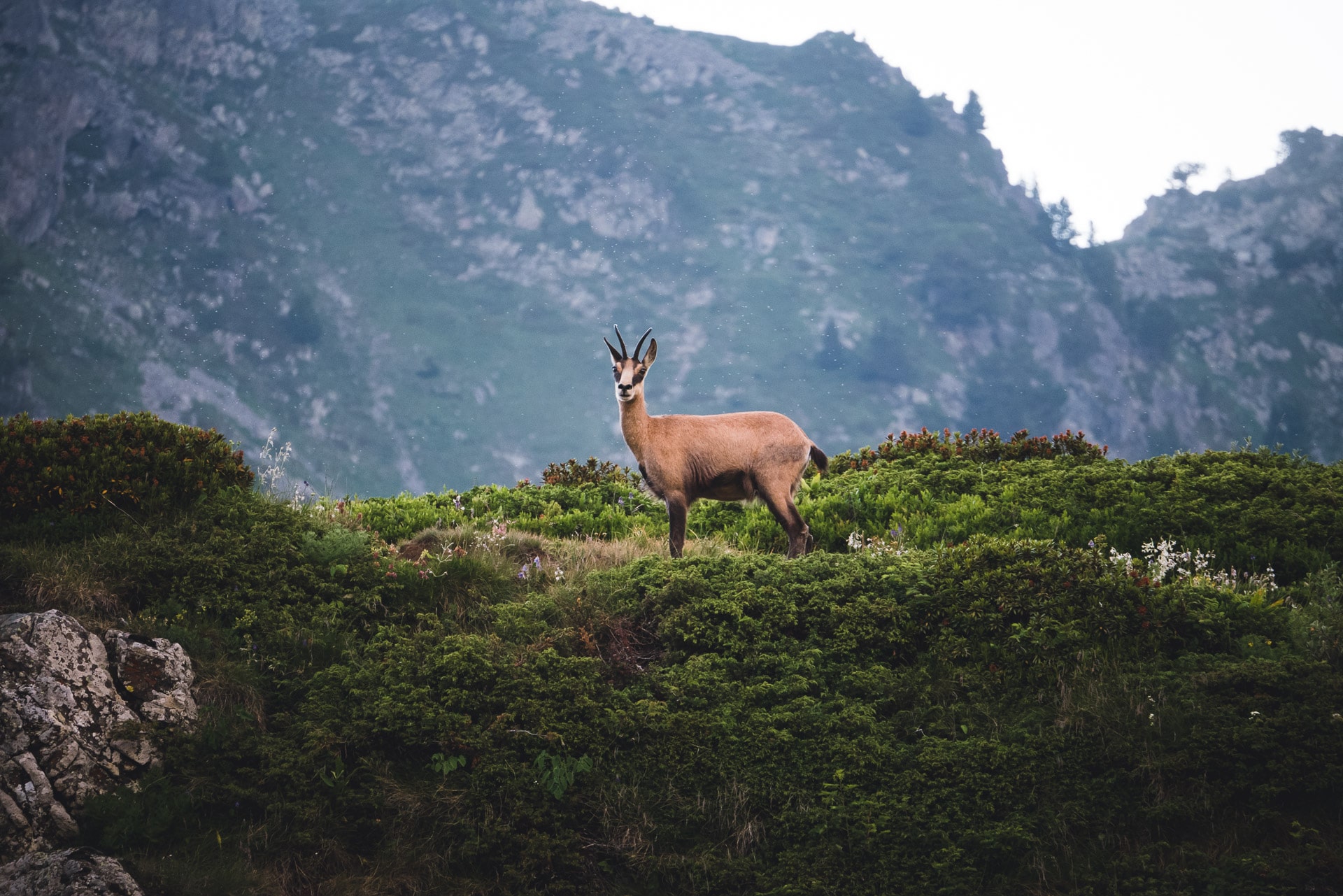
No wolf tonight but the nice visit of a group of chamois near the camp. A beautiful moment to sign my last bivouac along the GR738.
Day 8 - Back home
Last awakening, last storage and last departure of the bivouac. I only have 3 hours until Chamrousse before returning to the tumult city. My camera was out of battery, so I can not show you the pretty Robert Lakes. This would have been the only nice landscape of this stage because the rest (especially after the lakes) is not very beautiful compared to the last days. The end in particular is done by the ski slopes …
I thought that Chamrousse would be an authentic mountain village but it is not. It is a resort 100% dedicated to skiing without much charm. I will wait for the bus to Grenoble to the terrace of a restaurant. Direction to the train station and return to Paris … That concludes these 8 days.
The most attentive will have noticed that I did not realize the last stage which consists of a long descent towards Vizille. I did not see any interest in this section and it was confirmed to me by a group of hikers.
Conclusions
Well above all, I was surprised by this GR738. I was expecting something easier and I must admit that it made me doubt myself ! Well, my physical training was not at the top, far from it, but still it’s technical. One of the key points of this difficulty lies in the fact that if you want to achieve it in complete autonomy you have to take all the food with you … The bag weighs quite heavy at first. On the other hand you can realize it from refuge to refuge which limits this difficulty. The first days are also quite demanding in terms of altitude. Well, it must still nuance because I realized in 8 days what is expected in 10 and I think I could have reached Chamrousse directly the same day as the Pra. If I get there, you can do it too.
In terms of landscape there is really a contrast between a very “forest” start, nice but no more and the portion after the Sept Laux which is very beautiful and very wild. This whole area really deserves to be known. In addition one meet really few people (at least in the beginning of July) and it is appreciable to enjoy the mountain.
The layout of the last born of the GR family (in 2018) allows you to discover this beautiful and little known Belledonne mountain range and I am happy to have realized it. If you are looking for a beautiful alpine trek far from the classical routes I really recommend the GR738 which will not fail to emulate the next years.
Feel free to share your experience of this route in the comments!