Kristinartindar - Hiking in the Skaftafell
Discover the Skaftafell park on the ascent of the Kristinartindar (1126m) which will allow you to embrace one of the most beautiful views of Iceland.
Skaftafell National Park
Originally founded in 1967, the Skaftafell National Park, with an area of 4800km², is today attached to the Vatnajökull National Park so it borders the south-west end.
Easily accessible from Route 1 (4 hours from Reykjavik), the park offers great opportunities for outdoor activities:
- Multiple possibility of day hikes. The best known leads to the Svartifoss waterfall, but you have to love the crowd … Below we suggest a more engaging but absolutely superb hike!
- Glacier excursions: quite a few guide companies offer excursions lasting a few hours on the surrounding glaciers. It is physically accessible to the greatest number and it will allow you to discover beautiful glacial formations while learning lots of interesting things about glaciers. It is also an opportunity to, unfortunately, see the concrete impact of global warming.
The center of the park is located at the “Visitor Center” (64.016343, -16.966968). You will find useful information on hiking there as well as maps of the area. There is also a pleasant campsite, although sometimes a little overcrowded, at the foot of the trail head. Another solution for the night is the small and beautiful campsite in Svínafell a little further east on Route 1.
Ascent of Kristinartindar
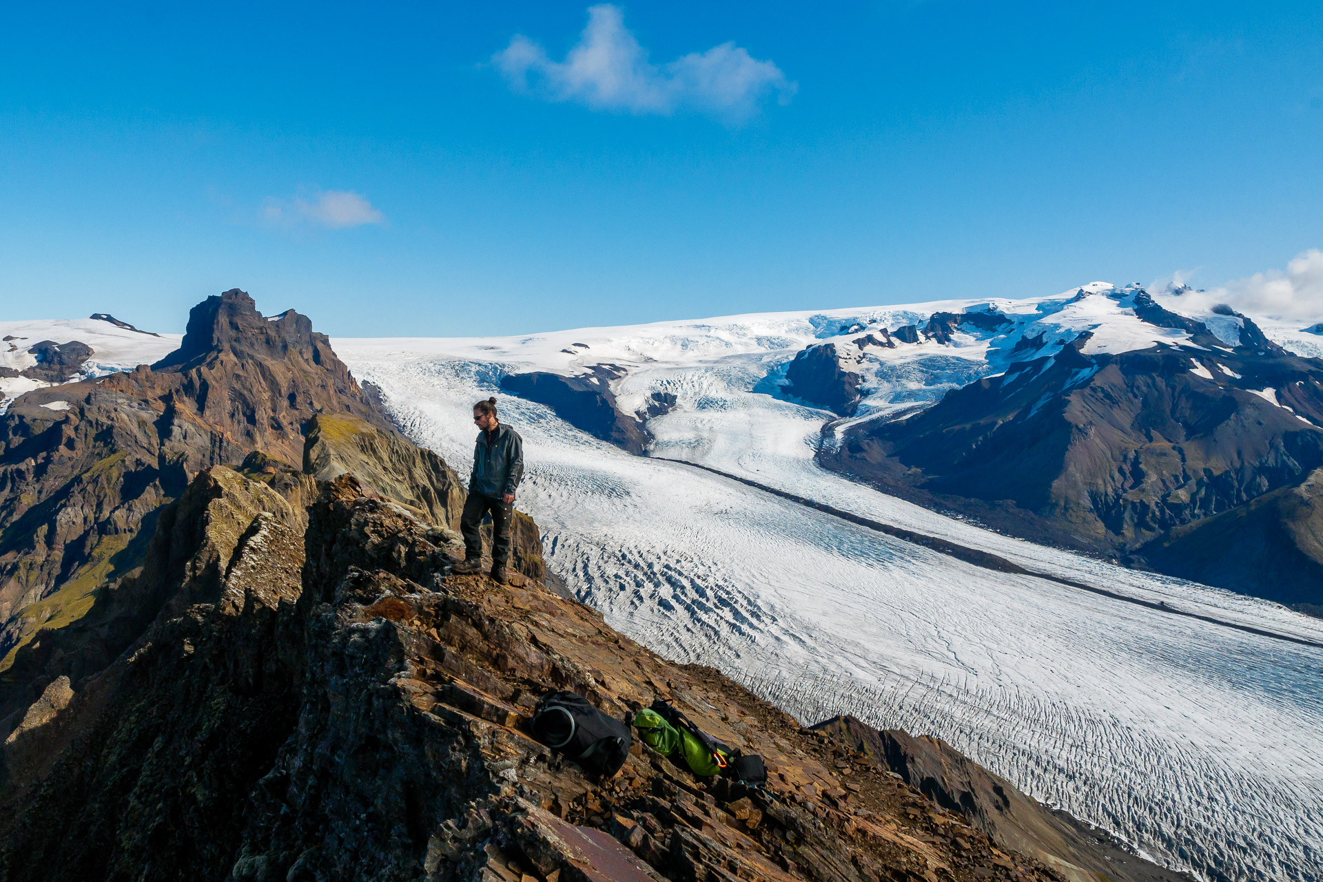
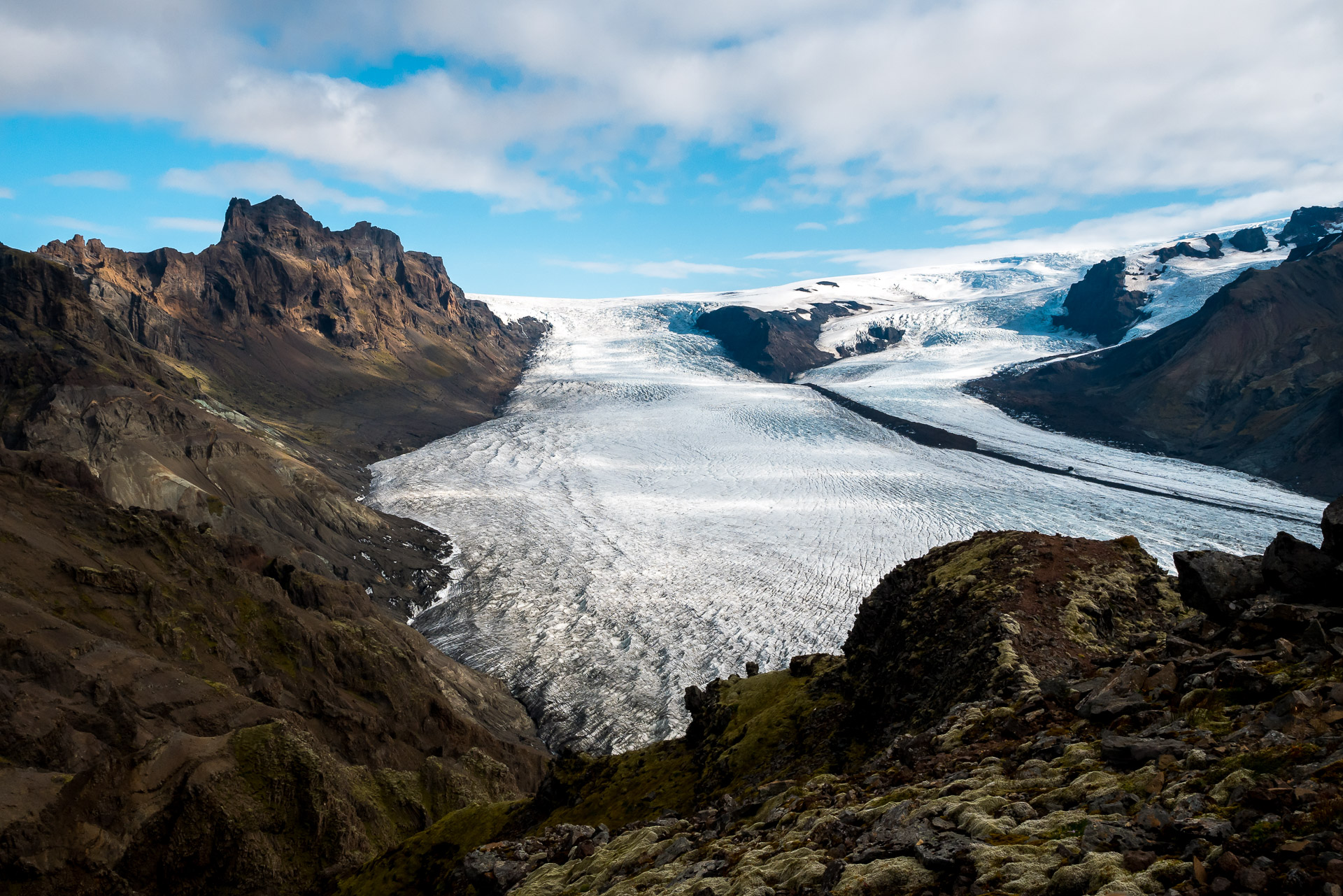
If you are looking for which hike to do during your stay at Skaftafell, climbing Kristinartindar will undoubtedly offer you one of the most beautiful options. Far from the hustle and bustle of Svartifoss (through which we pass all the same), the path will enchant you all along and will offer you an exceptional panorama from the top.
For a distance of 17km and 1100 D +, the hike is physical, in particular the final part which takes place in sometimes bad terrain (slippery and stony), so be careful! It is a hike to avoid with too young children. There are also some slightly “gaseous” passages to advise against people prone to vertigo. Apart from that, the trail remains accessible.
A variant avoiding the summit and the difficult portion but still offering magnificent views, is possible – see below.
BE WELL EQUIPPED FOR THIS HIKING. Wear real hiking shoes and not just sneakers and be alert to the weather. Even if the weather is nice, take something to cover yourself. Similarly, do not neglect the amount of water to take because the climb makes you lose a lot and you do not cross a stream.
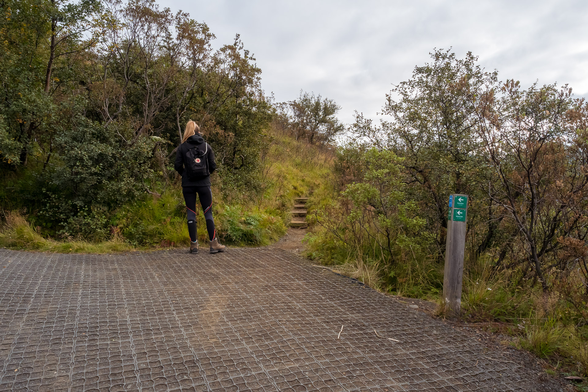
The trail starts at the campsite (same place as the one leading to Svartifoss). Follow the uphill path to the first intersection. From there turn on the right. Please note there is no clear indication of the fact that it leads to Kristinartindar and the trails may seem astonishing but that is fine.
The path then follows the ridge in a forest of small dense trees. We can see the glacier below between the branches. When we take the path it is 9:30 am and there is hardly anyone.
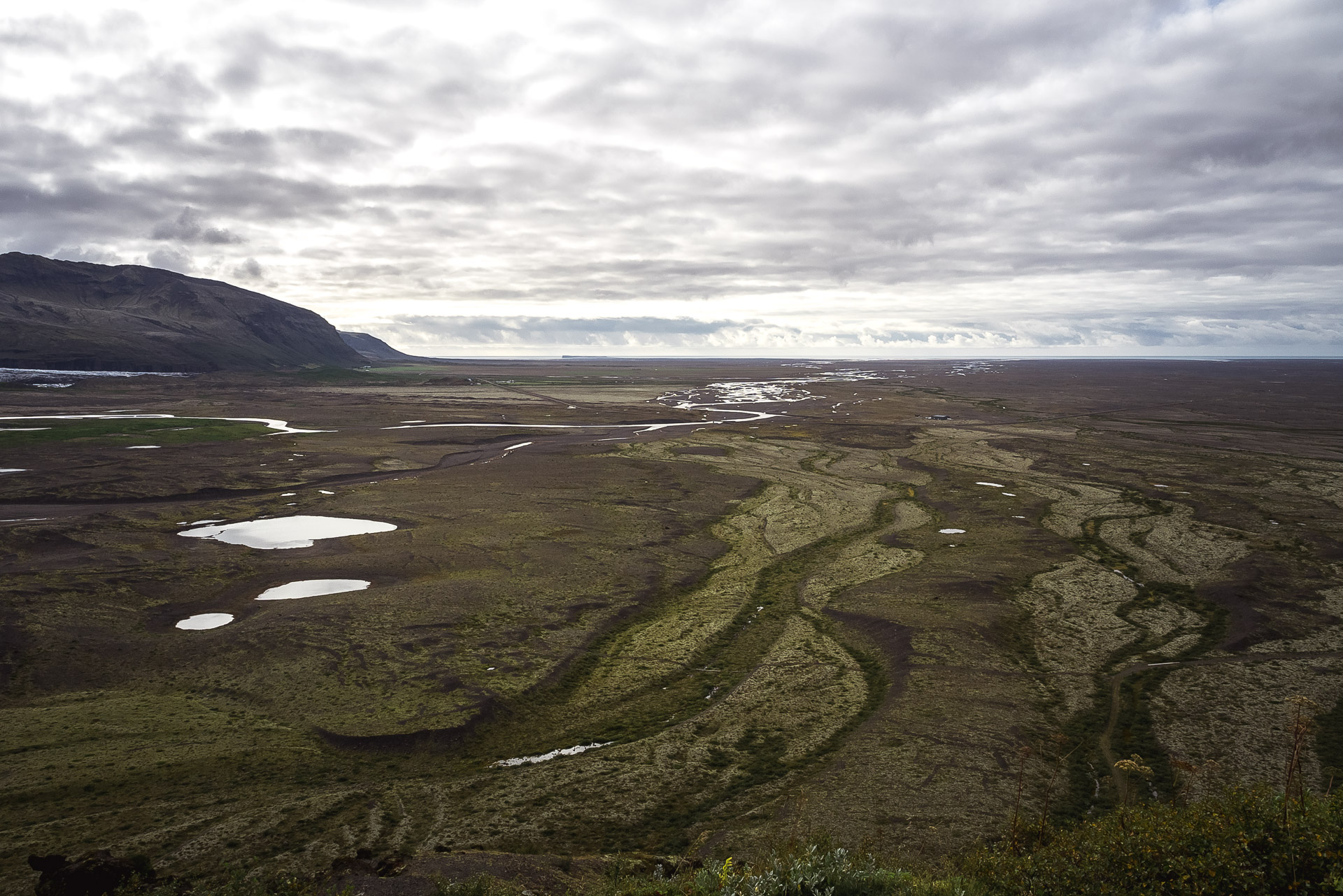
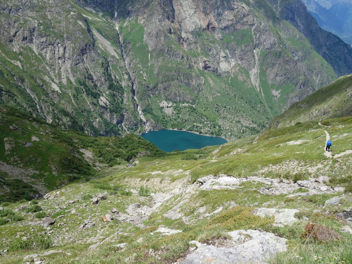
As the climb progresses, the view becomes clearer as the vegetation becomes more and more level with the altitude. We finally discover the view, especially on the Sandur side.
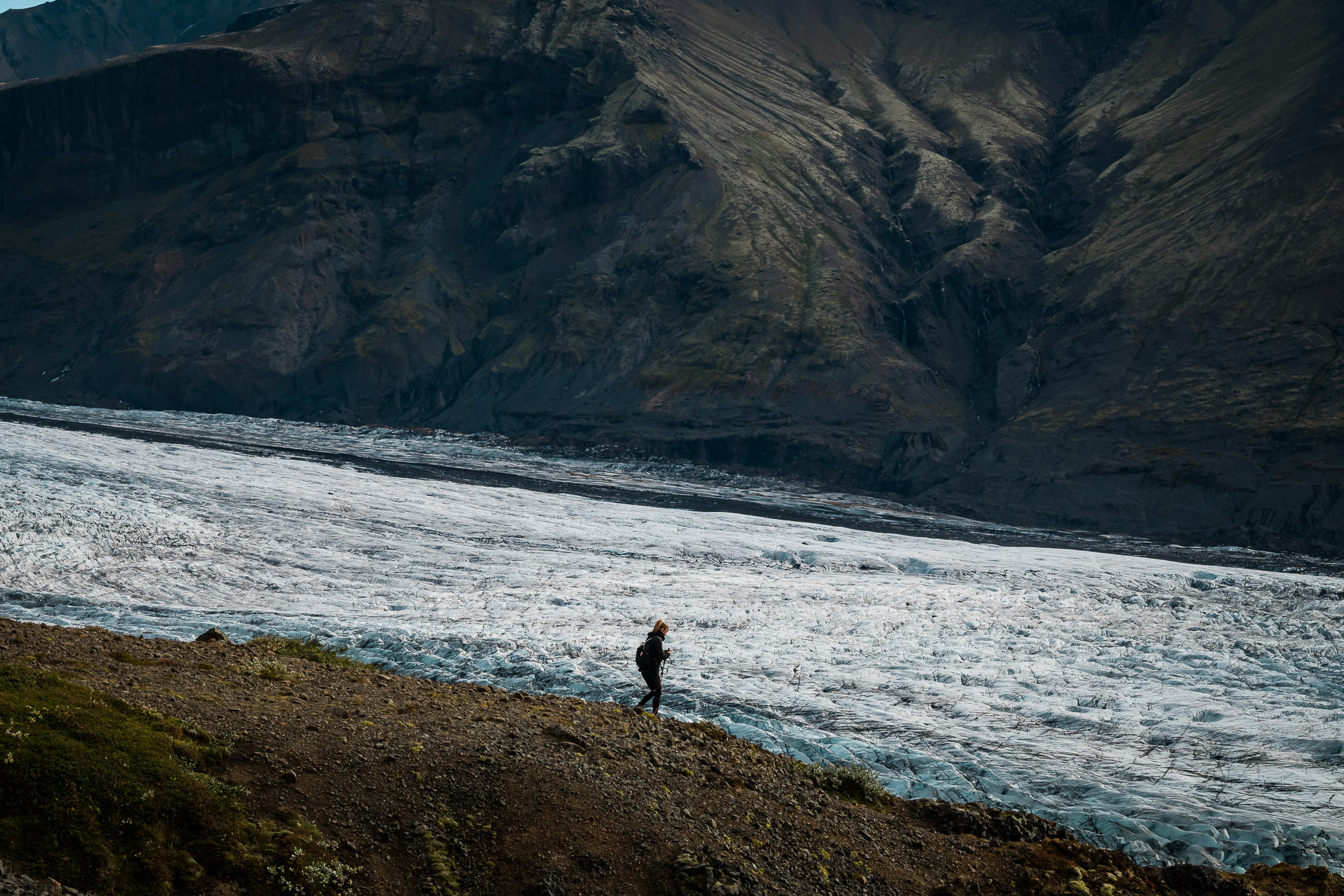
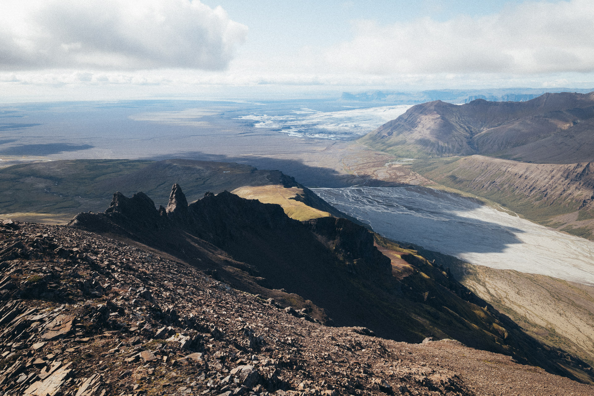
The rest of the climb is along the increasingly beautiful glacier. By overlooking it thus, we realize its gigantic size when it is only a language of Vatnajökull.
The trail climbs well but the slope is not excessive which makes it very hot without being particularly short of breath. We are very lucky today because the weather is fine. So we will have a view from up there!
After this long straight stretch along the glacier, the marked path suddenly turns to the left to go around (by the left) the large massif in front of you. If you want to reach the summit, find a path that goes straight down the slope and then continues on the right, it is clearly visible normally and there are some marks. If you don’t want to make the summit, follow the marked path on the left.
The path becomes more difficult now. Don’t hesitate to take a break now to breathe and have a drink. You are going to chain some very rough climbs in a rock that is falling apart a little. Be careful.
You will arrive after a strong climb at a shoulder marked by a large cairn. A second path joins yours (downhill path). For the summit, set off in the rocky path which climbs steeply in a zigzag. You don’t have much elevation left! Courage!
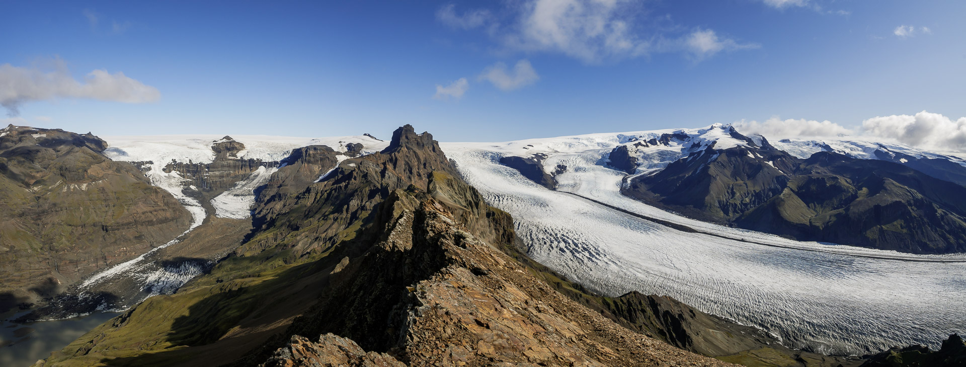
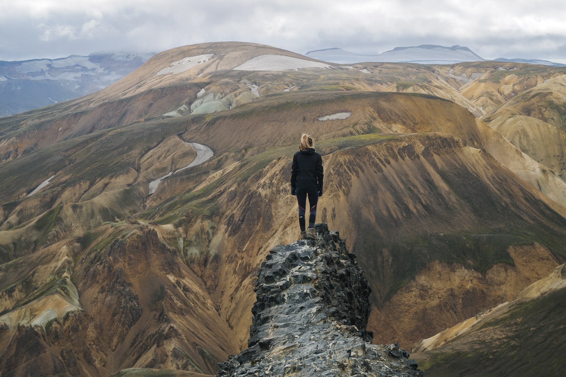
A few more meters and you are there! The summit is marvelous with a 360 ° view and in particular on the ridge which extends towards the North-East.
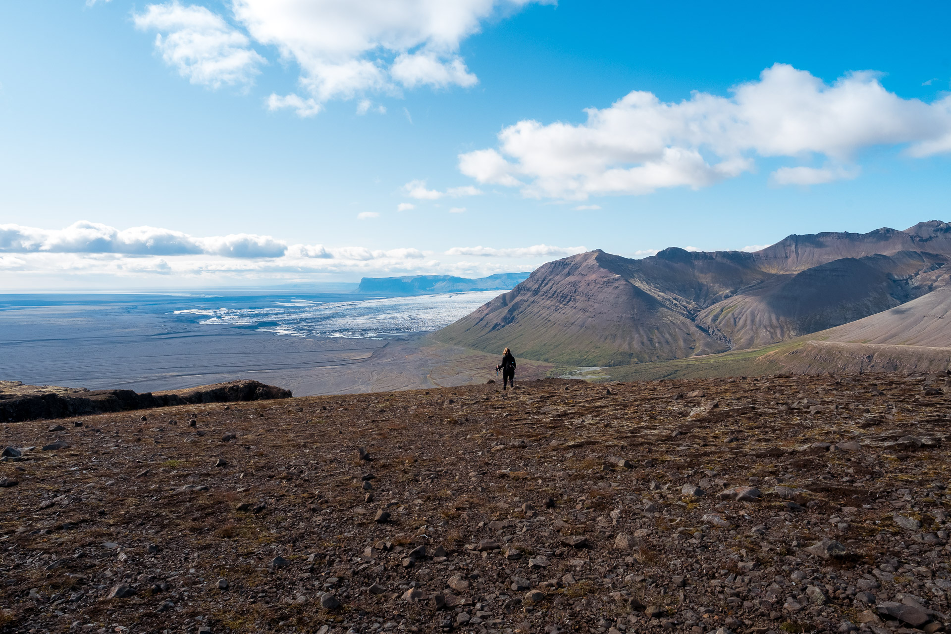
Be careful because here a fall would not forgive! We took advantage of this breathtaking landscape to take a picnic break especially since there was sun and little wind. We were few at the top first 6 and later just 4. It is unfortunately time to go down because you still have some way! To do this, take the same path as the climb to the big cairn below.
The descent can be impressive, take your time.
From there branch off to the second path which goes straight along the slope.
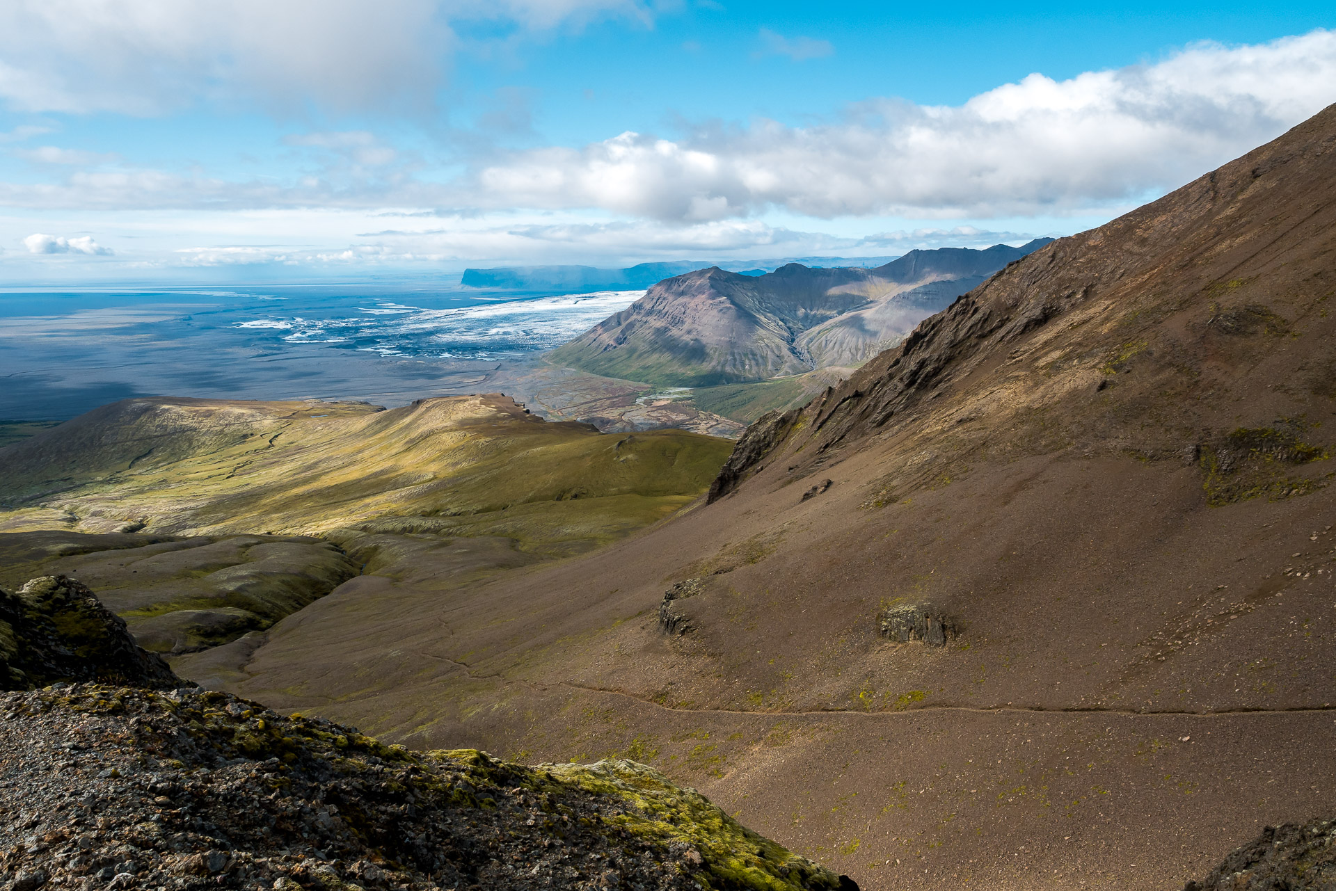
This portion can be tiring for the ankles, be careful. At the bottom of this long descent, you join the marked path which you will follow while continuing on your right. Further on you can admire the other side of the park.
All you have to do is follow the long descent that brings you back to the Visitor Center, taking the time to admire the landscapes.
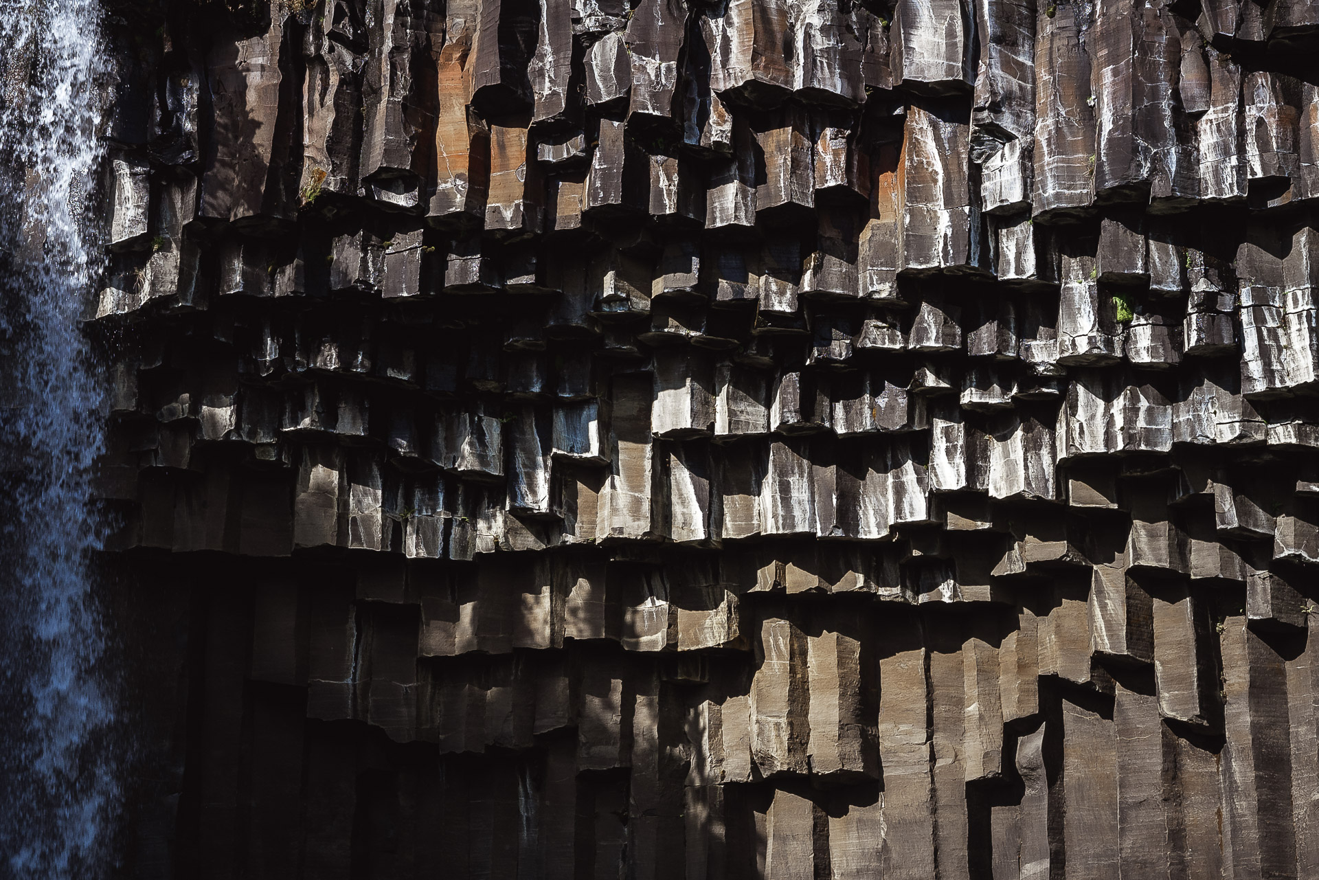
On the descent, after an observation table, follow the marked path on the left. He will take you to Svartifoss. In general the place is crowded but the waterfall is worth the detour.
A little more walking and you’re back to your starting point! Congratulations! We hope that this hike will inspire you because it offers some truly superb landscapes, among the most beautiful we saw during our stay. Even if you’re not at the top, the views up and down are worth it! And to celebrate this great walk, the Visitor Center offers a cafeteria with everything you need in drinks and cinnamon rolls!
Landmannalaugar - Icelandic Highlands
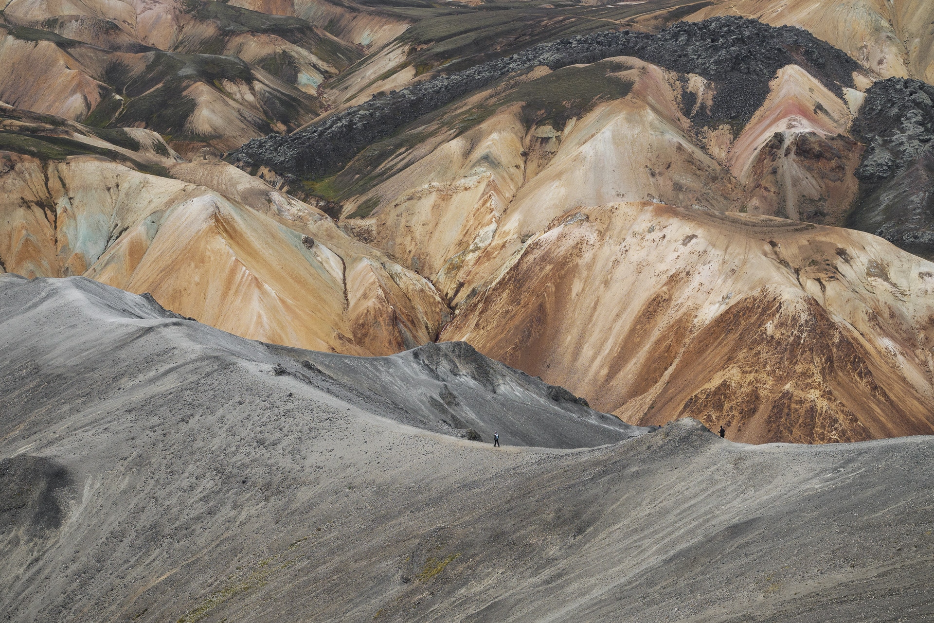
The Landmannalaugar is a massif located in the Icelandic highlands. The site is particularly known and renowned for its colors which are due to the volcanism very present in the region but also for its natural hot springs. Departure or arrival of the famous Laugavegur, the Landmannalaugar deserves to stop there to explore and discover it.
Landmannalaugar
Geology
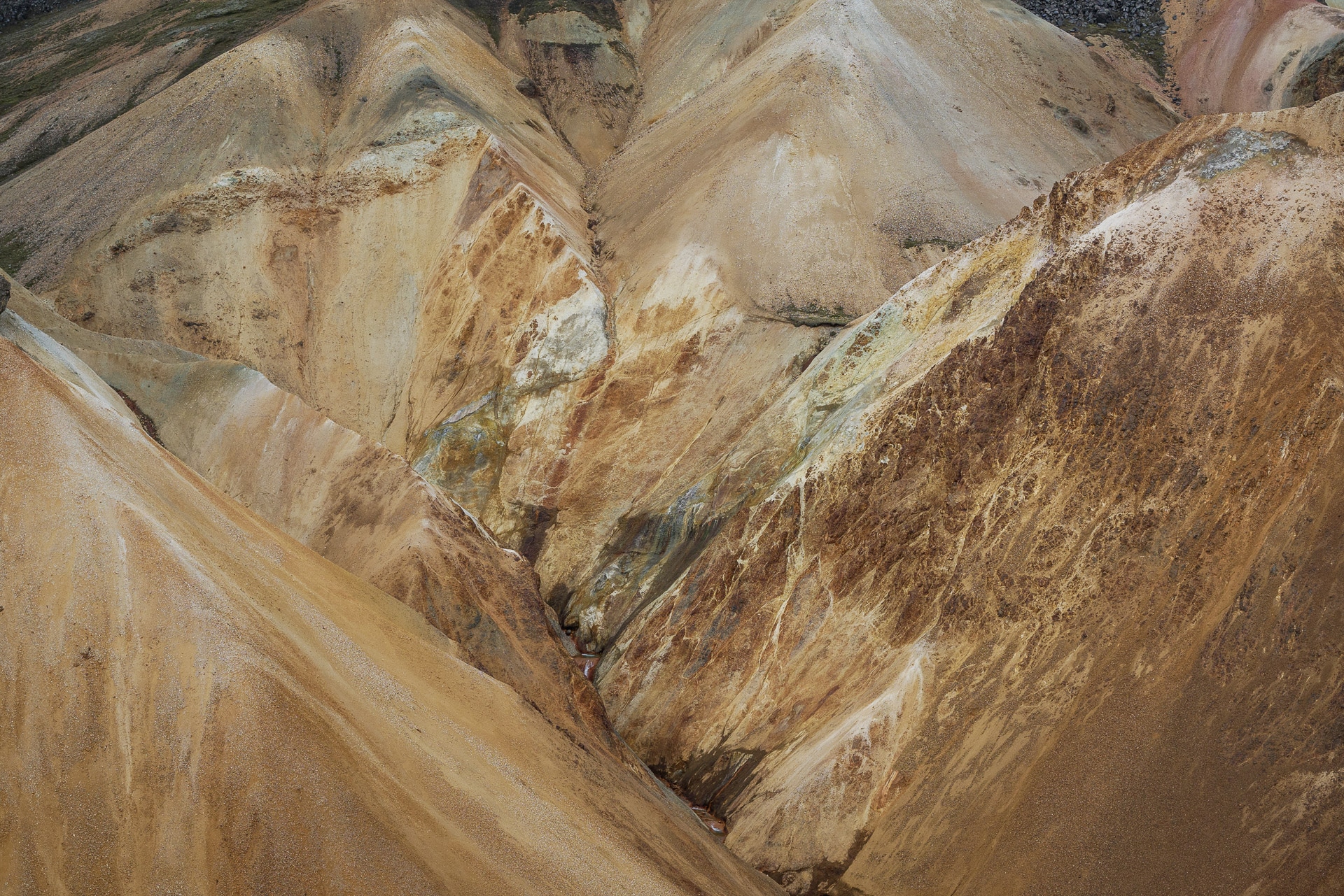
The extraordinary colors of Landmannalaugar are due to the iron contained in the rhyolite, the main rock of the site. Indeed, the lava formed under an ice cap which allowed an interaction between the rock and the melt water. We are talking about rhyolithic tuff here.
You will also come across a lot of obsidian, volcanic glass. This rock is beautiful when wet.
Join the Landmannalaugar
The landmannalaugar is accessible by a good post on which you will still have to cross at least two fords. Access is therefore reserved for the 4×4. To access the site follow the F225 then 224 from Route 26.
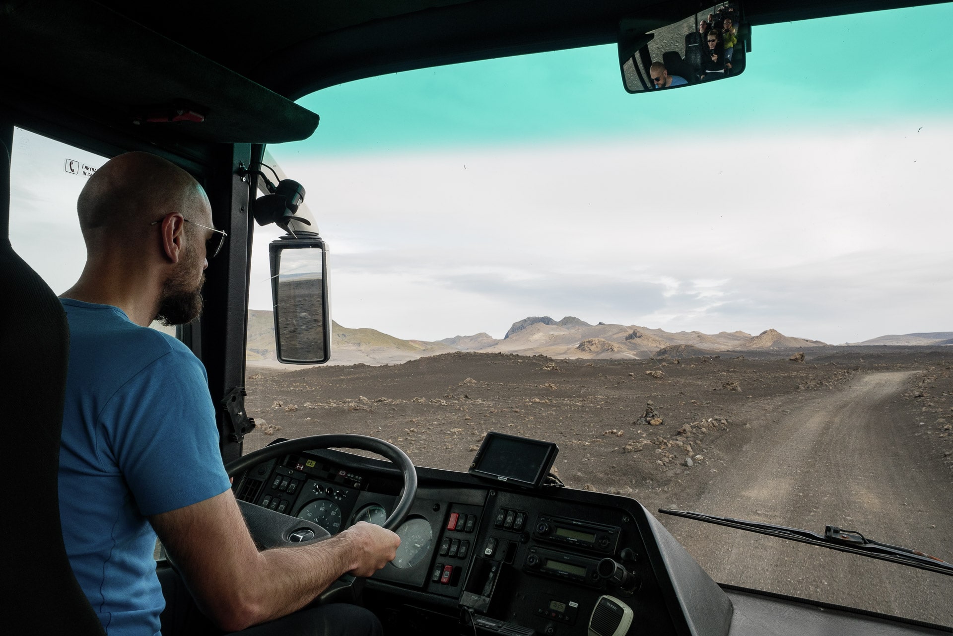
The site is also accessible by several bus services. We opted for Reykjavík Excursion because the buses leave from the center of the capital and offer timetables that suit us. If you want more information: https://www.re.is/golden-circle-tours/
This trip is the first we did on an F-road and is really beautiful. Try to take a seat at the front by bus if you want to enjoy the view.
What to do at Landmannalaugar?
The Landmannalaugar is one of the extremities of the famous Laugavegur that we had the chance to visit. But you can also radiate for the day from the camp for beautiful day hikes as we present below.
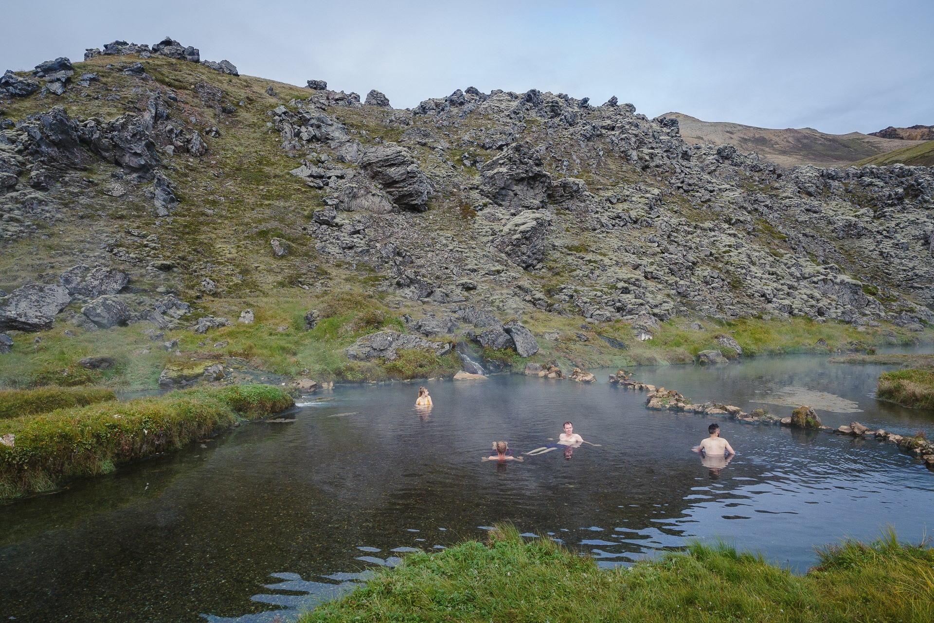
The Landmannalaugar is also known for its hot springs. It is a mandatory stop if you come here. The source a little behind the tumult of the parking lot is superb. The temperature should be around 40 ° C but is flexible because cold and hot currents meet in the main pool, allowing you to find the location that suits you best. The bottom is in fine gravel which makes the water very clear. A structure allows you to store your belongings while swimming. The only downside and not the least: the world! In the afternoon when the buses arrived, it’s crazy! We therefore advise you to go there in the evening or even better in the morning! We were lucky to be only three in the basin on our way around 9am. Real happiness especially after a cool night.
Practical information
Or sleep ? Many solutions :
- The refuge of “FI”, the Icelandic hiking association. The night is at 9000ISK. I advise you to book well in advance given the crowds … More info: https://www.fi.is/en/mountain-huts/all-mountain-huts/view/landmannalaugar
- In a tent: there is a large bivouac area. Do not imagine the beautiful wild and comfortable bivouac: the ground is rocky and the land is located too close to the parking lot. We also found the site noisy even in the middle of the night … It will cost you ISIS 1000 per night per person …
Food
On site you can buy some basic products such as freeze-dried or gas. All at a price of gold, of course, but it remains practical just in case.
Discover the Landmannalaugar - Ascent of Bláhnúkur (945m)
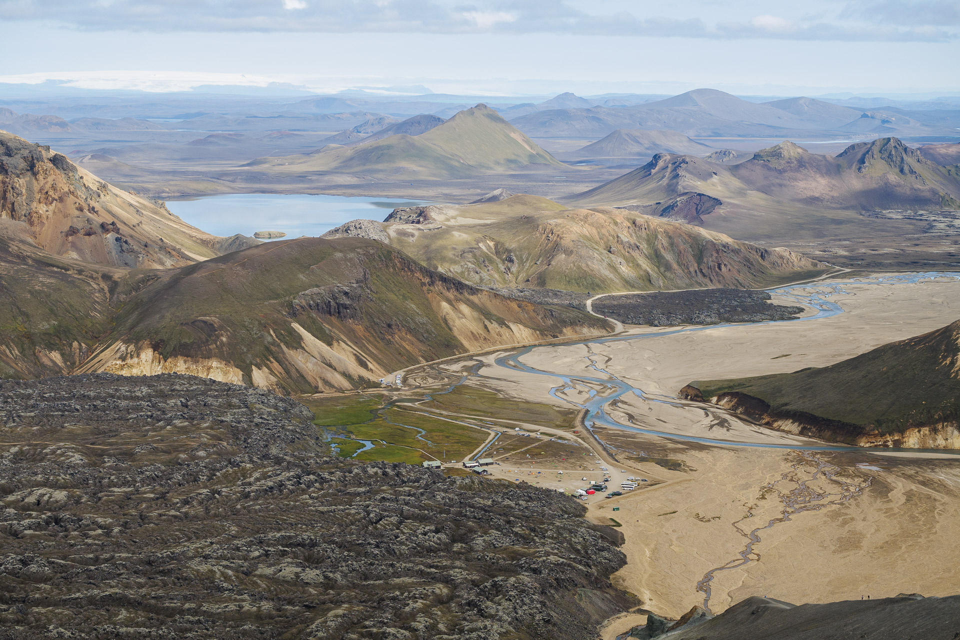
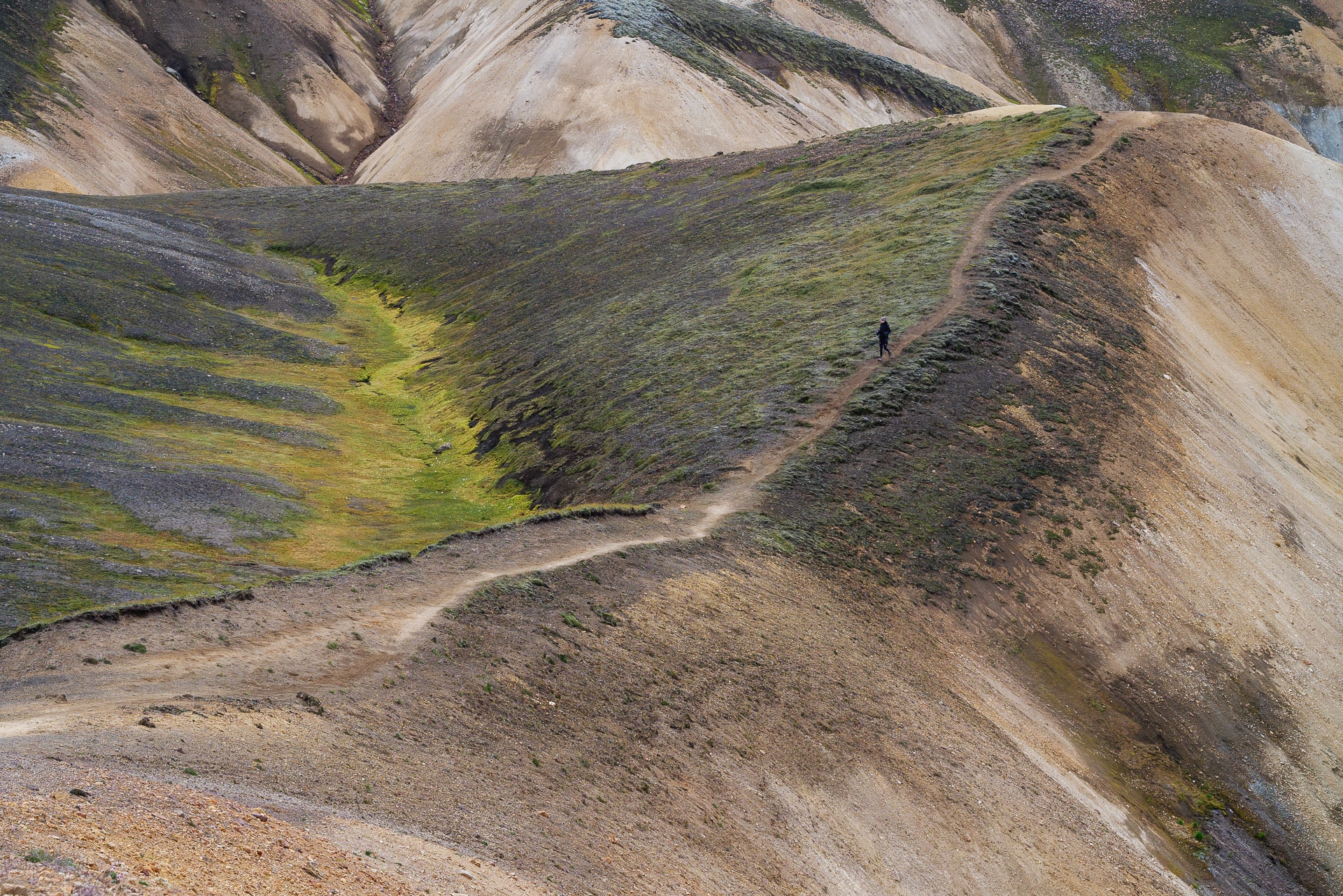
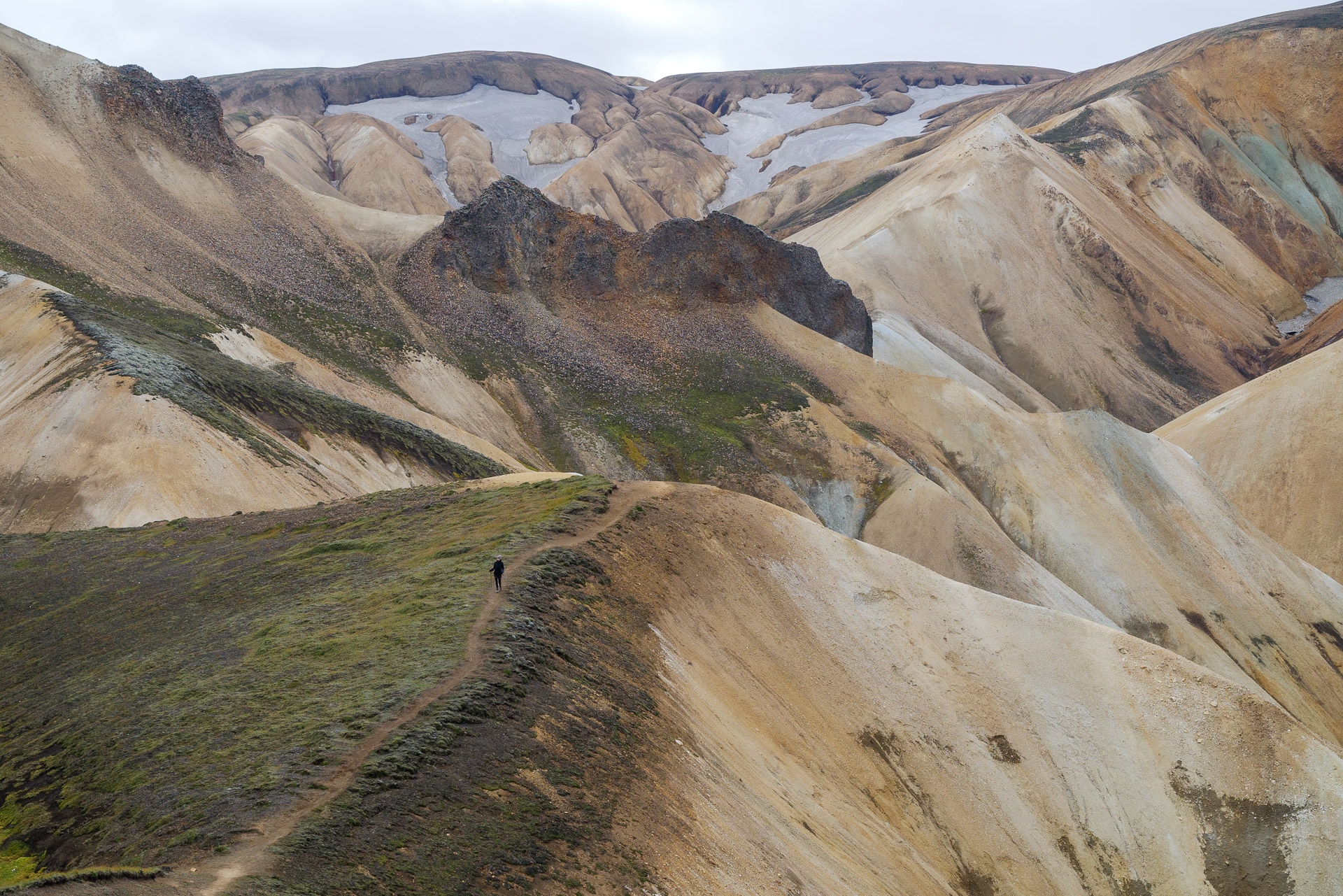
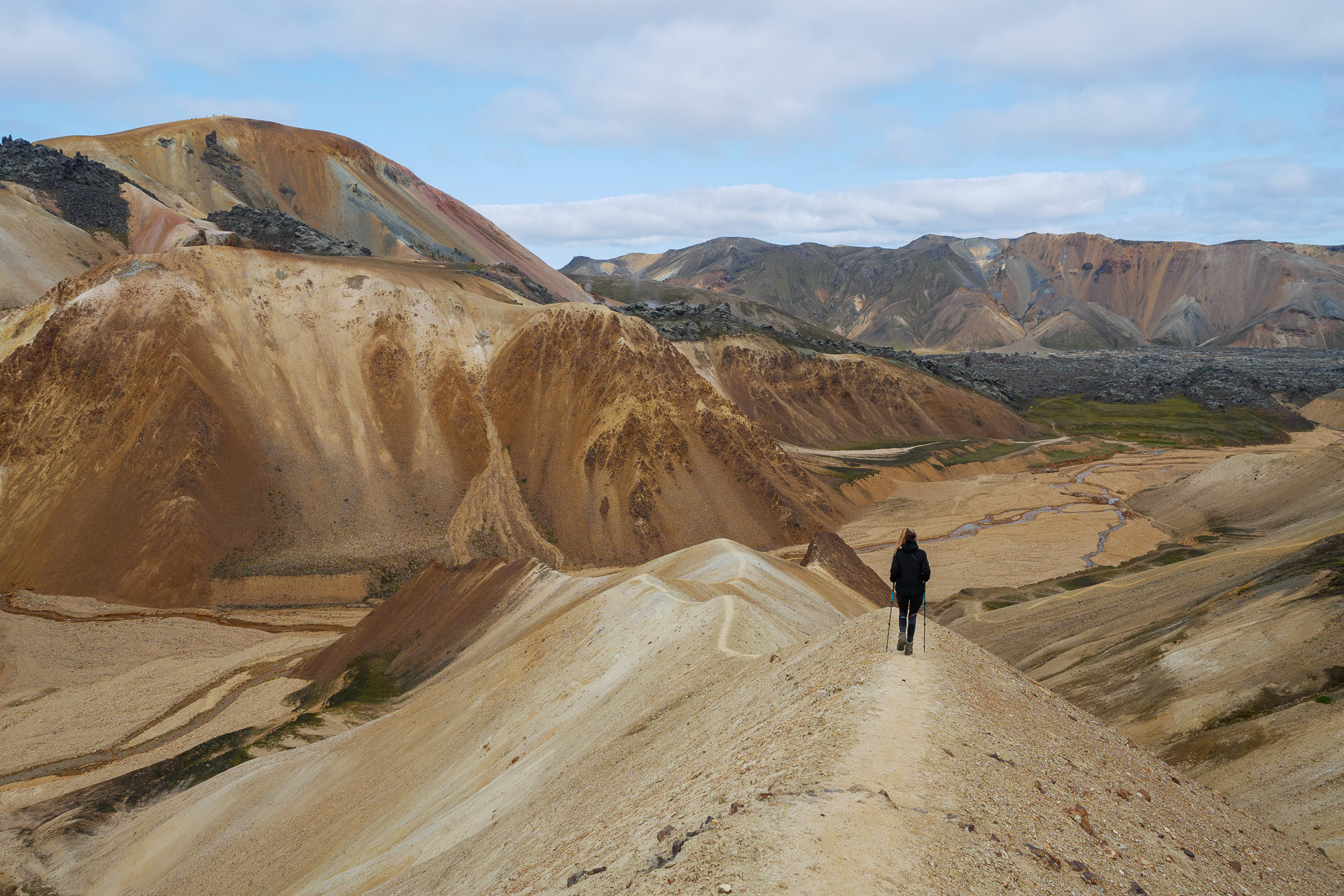
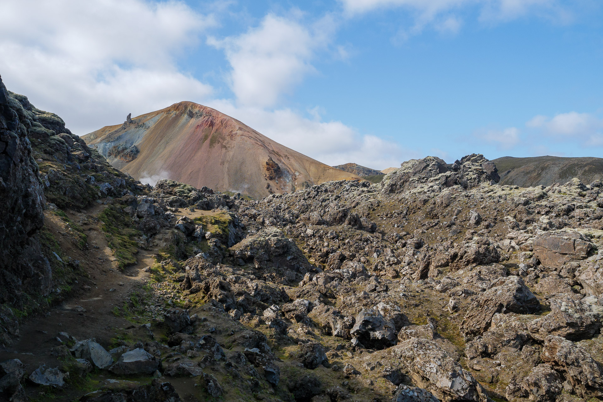
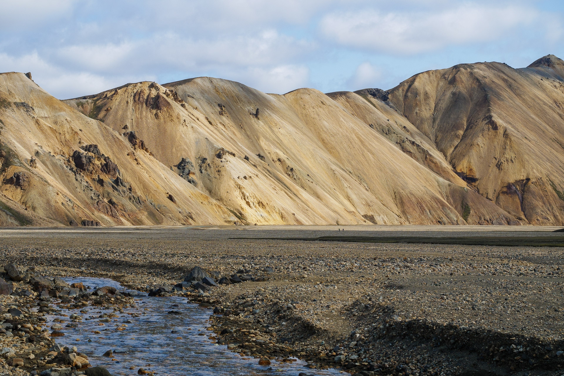
The Landmannalaugar offers many hiking possibilities. We offer here an itinerary accessible to the greatest number which allows you to discover the richness of the site over a short half-day, enough to give you time to enjoy the hot springs afterwards. This takes you to the top of Bláhnúkur at 945m which allows you to admire the surrounding landscape. You will then discover the richness of the colors and structures of the Landmannalaugar before going to a fumarole area. The return is through a petrified lava field. This will give you a complete overview of what the Landmannalaugar can offer you.
ID card :
Distance: 6.5km
Duration: about 3h15min
Positive elevation: 350m
The route is accessible below:
The start of the hike is at the end of the parking lot to the south. In front of you, after a small portion in an old river bed, stands a mountain in greenish rock (the rhyolite) on which you can clearly see a path going up in a zigzag. Continue slightly to the left (100m) to find the start of the path which joins the ridge on the right.
We can see it in the photo below:
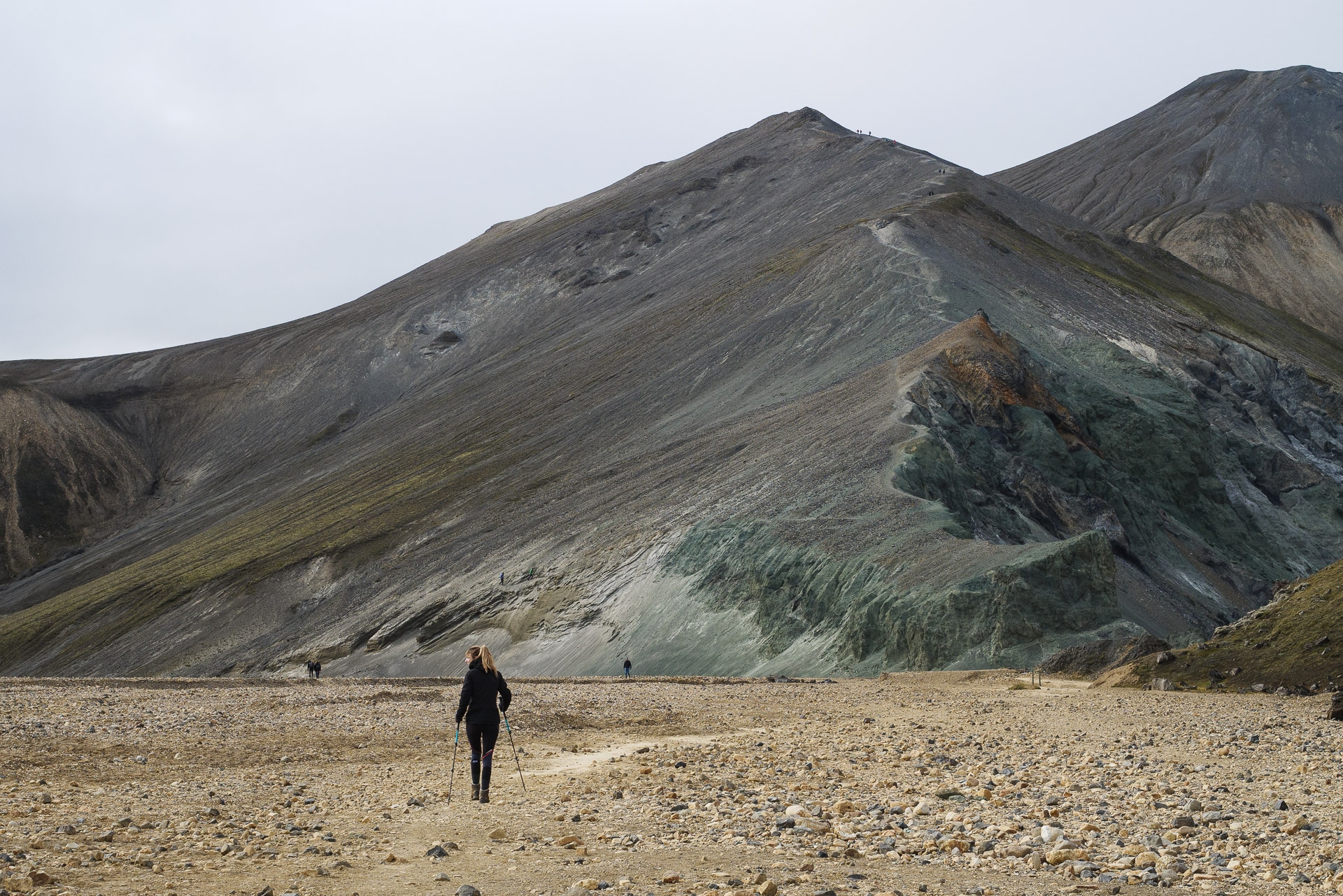
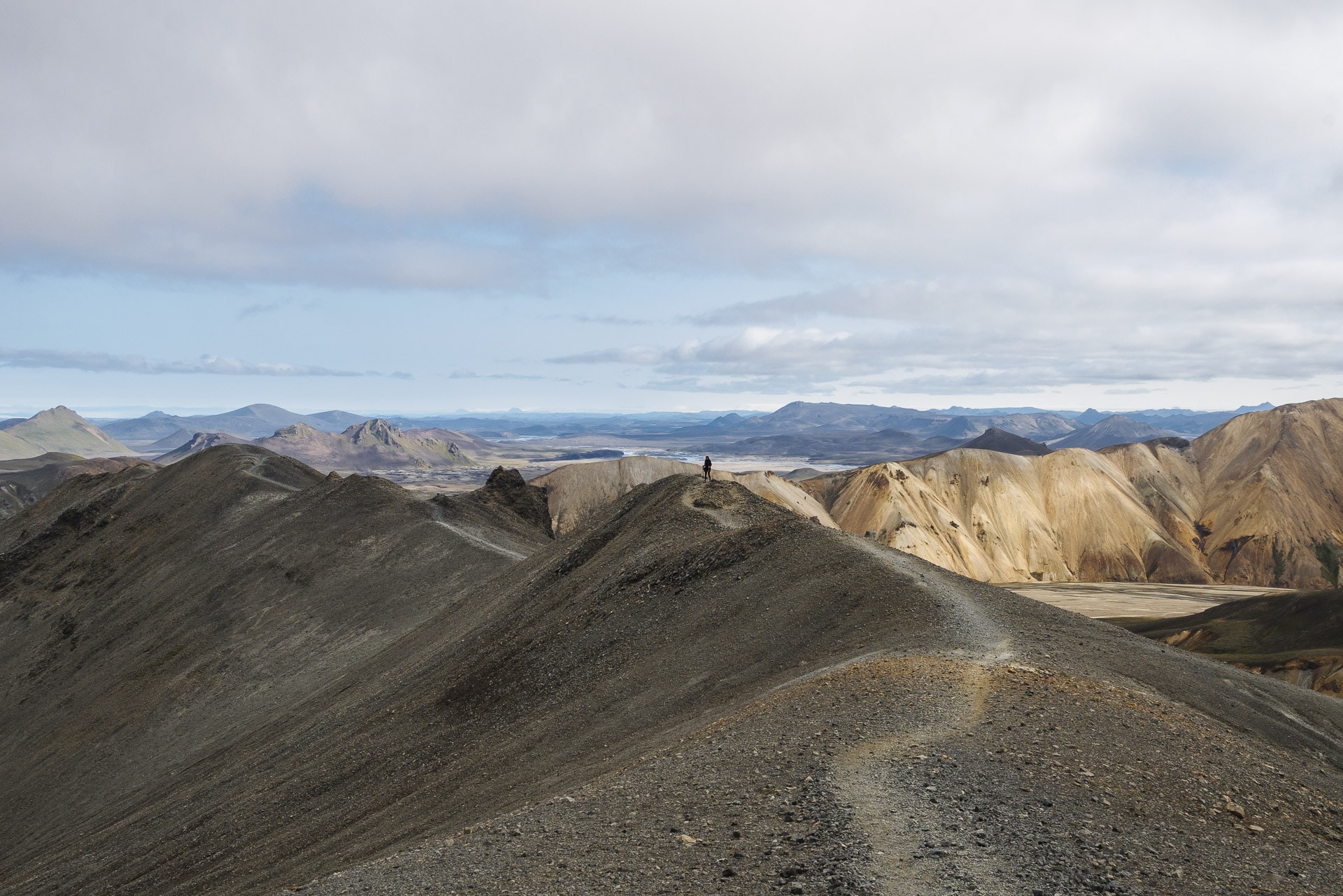
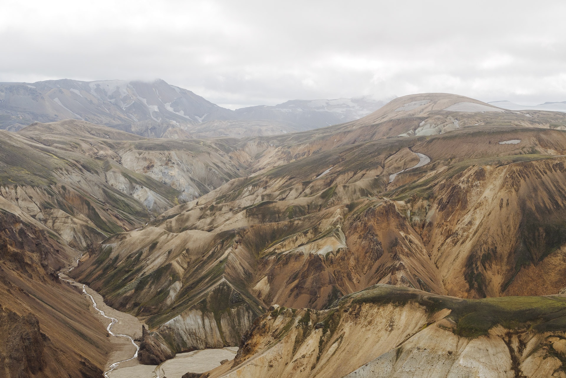
You “just” have to follow the path to the summit. Just be careful with the ground which is not always very stable (sand and slag) and which must be slippery if it rains. The climb is quite steep but take your time it is done quickly. The climb offers more and more beautiful views, enough to keep you motivated!
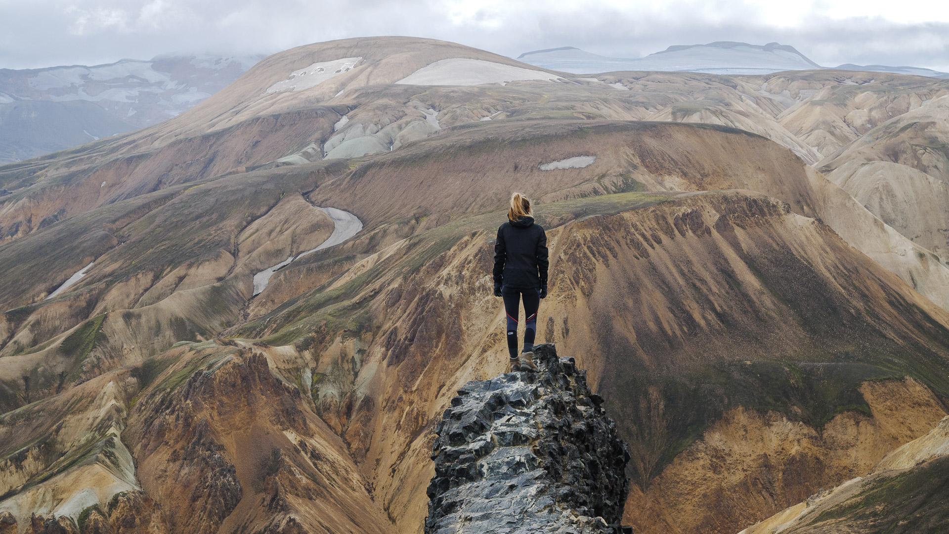
Here you are at the top! The view is breathtaking! When we did it was gray but it does not spoil the colors which remain fantastic.
You can then start the descent following the ridge direction SW.
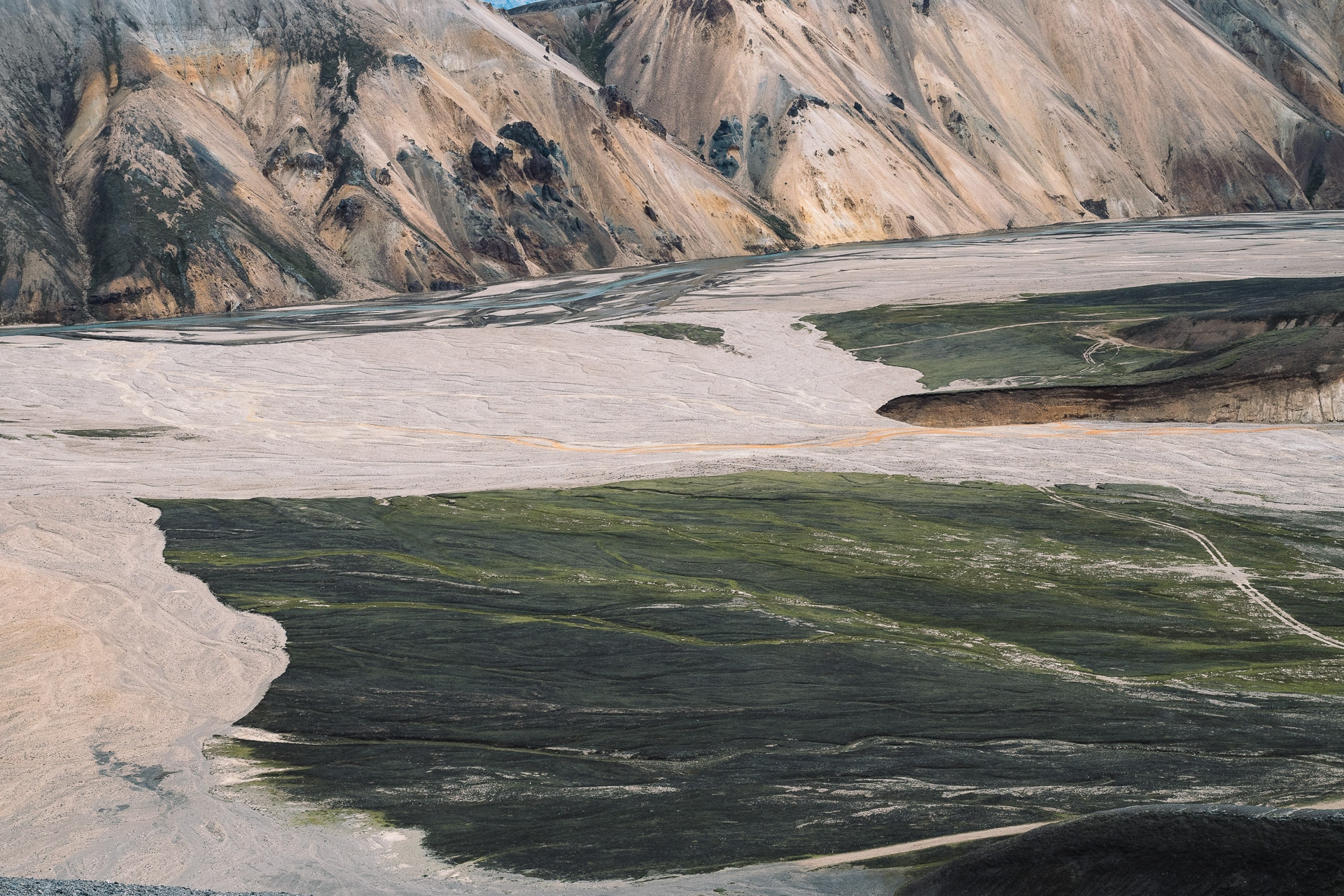
You will come to a flatter part, here turn right (northbound) in a kind of gorge. The trail is beautiful here as well as the surrounding colors!
Follow the path (be careful, some portions can be slippery). Then join the marked path towards the fumaroles slightly on the heights. From there several solutions: you can descend by Laugavegur, you can also follow the ascent of Brennisteinsalda (881m) or, like us, turn around and continue in the lava fields.
The trail continues along the small Brennisteinsöldukvisl river before returning to the starting level.
You just have to go back to camp before going to relax in the hot springs! We took 3h20min to complete this journey without hurrying and taking a lot of pictures.
There is another route, the “Skalli”, which is 15km long and makes a long loop from the south. This path also offers extraordinary views of rocks with superb hues. Attention the topo indicates that it is a painful path in case of bad weather. To make it go south and follow the chubby hats wearing blue.
Between La Muzelle and Lauvitel
3days
hiking
18km
walked
1800m
D+
2lakes
We were looking for a hike of a few days with the possibility of bivouac and in particular near lakes. I already knew the Ecrins National Park and more particularly the Bérarde. I have wanted to go back for some time. It is therefore by searching in this massif that we found these two lakes: the Muzelle perched at 2105m overlooked by the Roche de la Muzelle (3465m) and the Lauvitel located at 1530m, surrounded by impressive walls. It was decided: we will spend a few days in autonomy between these lakes between June 18 and 22, 2015.
The Ecrins National Park is a French National Park located in the Alps near Grenoble and extending largely over the Massif des Ecrins. It was created in March 27, 1973.
Covering an area of 918km², the park culminates at the top of the Barre des Ecrins at 4102m.
For more information: http://www.ecrins-parcnational.fr/le-parc-national
First day - Ascent to Lac de la Muzelle (2105m)
We arrived the day before in the Massif des Ecrins. We spent the night at the charming Plan du Lac gîte between Vénosc and St Christophe en Oisans.
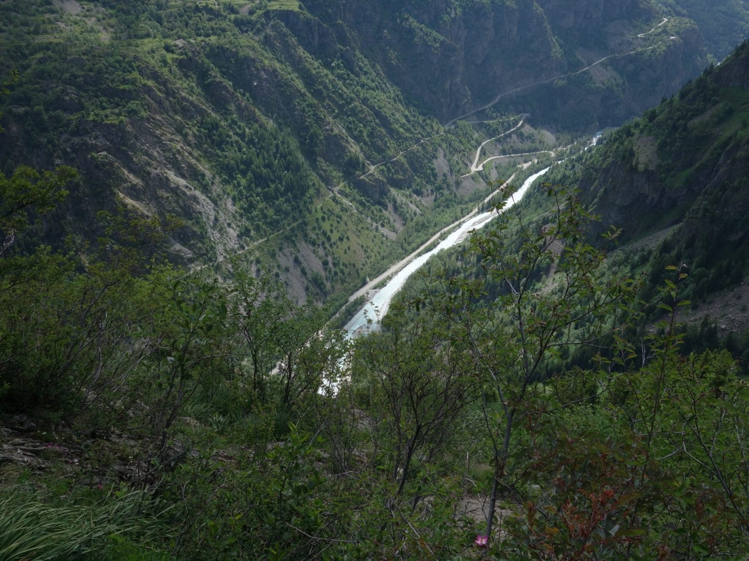
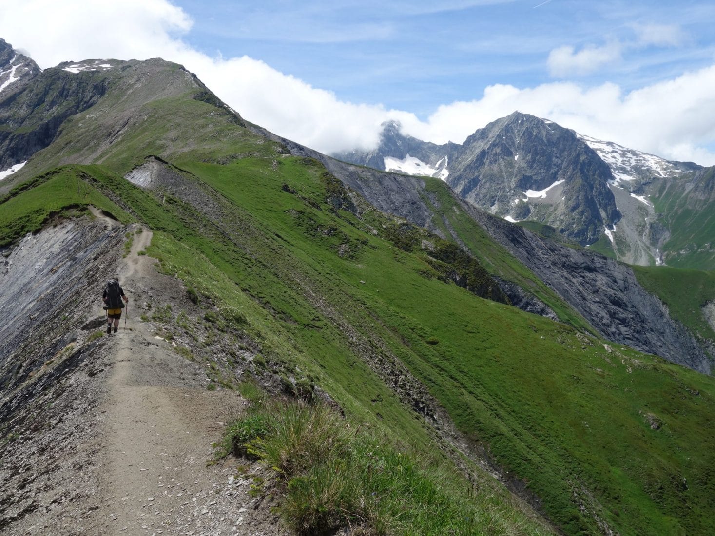
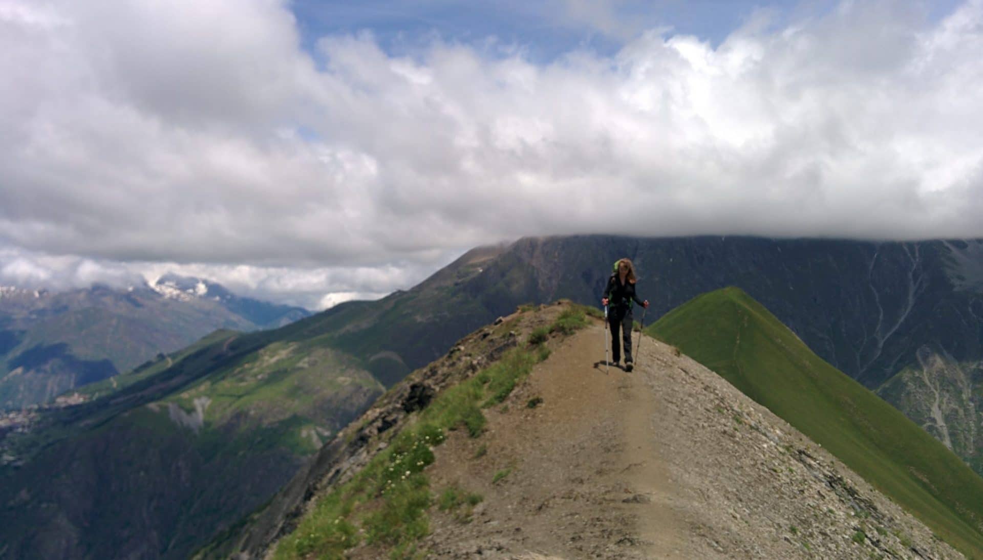
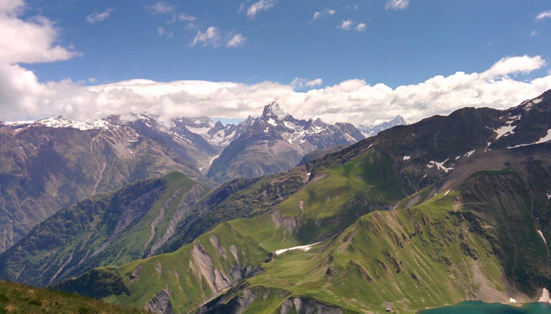
The ascent to Lake Muzelle is generally made from Bourd d’Arud following a portion of the GR54 (also find our Tour des Ecrins and Oisans along the GR54 – Link). We decided not to follow the usual path and past by the Cîme du Pied de Barry. This little-used path (we will meet absolutely no one until arriving at the Muzelle refuge) starts behind the Plan du Lac gîte, not far from the Pisse waterfall and climbs up to 2637m at Cime du Pied of Barry before going back down on the Muzelle. It offers superb views of the Ecrins and offers a passage over a pretty wide ridge which remains aerial.
We left the cottage without rushing around 8:45 am. The day starts very quickly because we meet a chamois right next to the waterfall. The weather is good and the forecasts are good. Everything comes together for a great day.
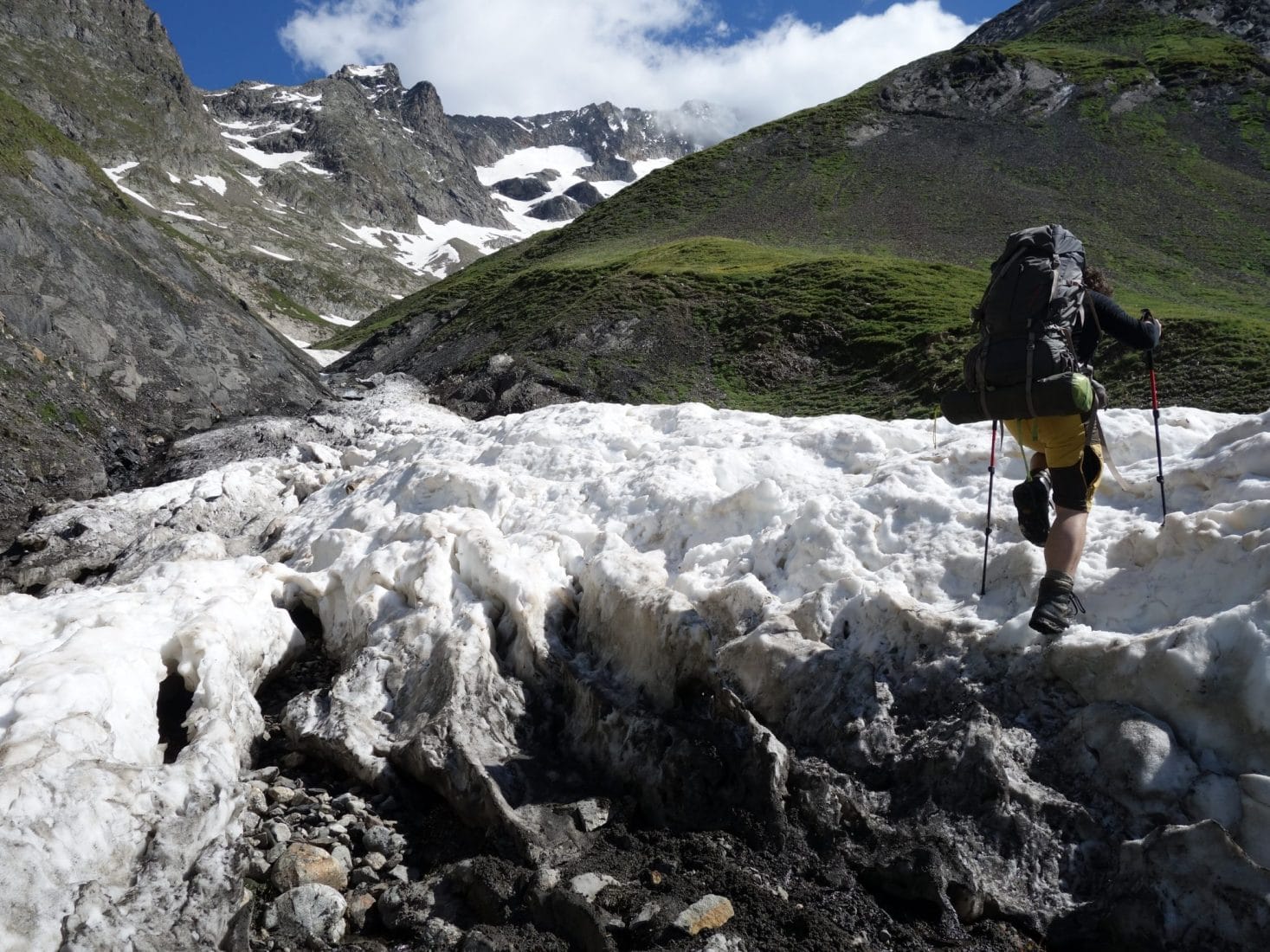
The hike begins directly on a steep slope which leads us to Lanchatra, a tiny hilltop village, little or not inhabited. Once above the village the slope remains steep but the view over the valley becomes clear. By cons we begin to be invaded by flies. This will remain a constant throughout this day and on the following (slightly attenuated): dozens of flies that turn around your head and a lot of horseflies …
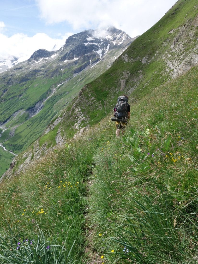
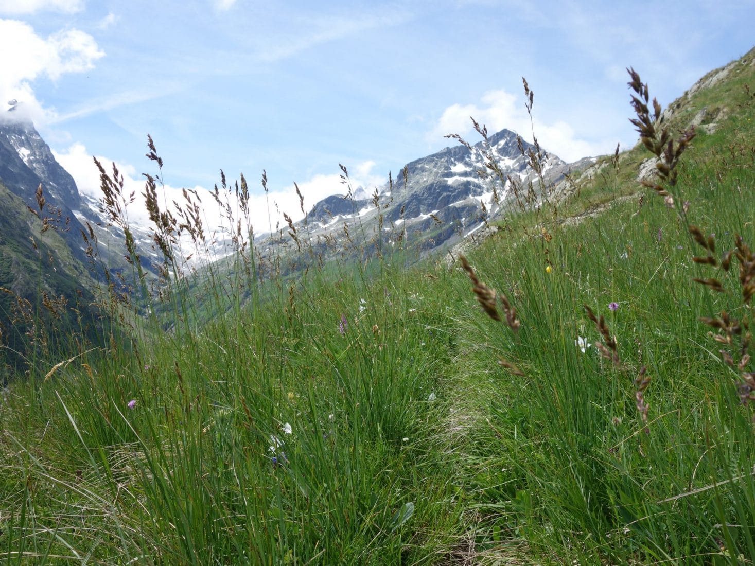
This part of the path becomes even steeper, you have to use your hands a lot. The evolution is almost vertical because after almost one or two hours of walking you are still in sight of the lodging below. After a good elevation (600m?), The path begins to follow the ridge. We are in full alpine stage while in bloom in June.
Possible variant: a variant to consider is “climbing” the summit of the Bell (2328m)
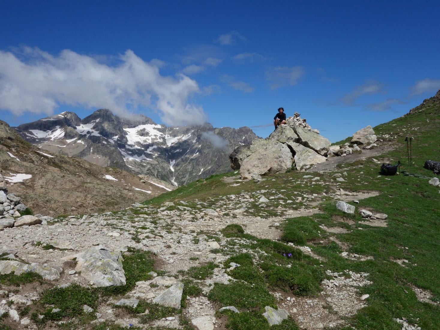
After the Col de la Clôche we land for lunch. Attacks by flies spoil the moment a bit and I get bitten by a horsefly … We leave in the direction of the famous ridge; it is a very beautiful passage which does not present a risk if you pay attention but which gives a beautiful aerial impression. We have already been leaving for 2-3 hours, we have and we will not meet anyone, we are in the heart of the Ecrins, … everything is fine.
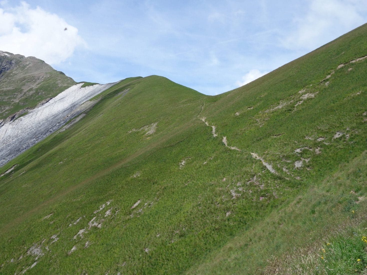
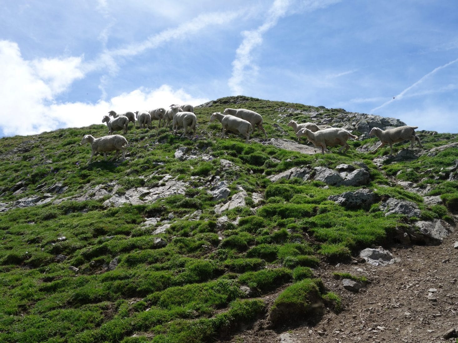
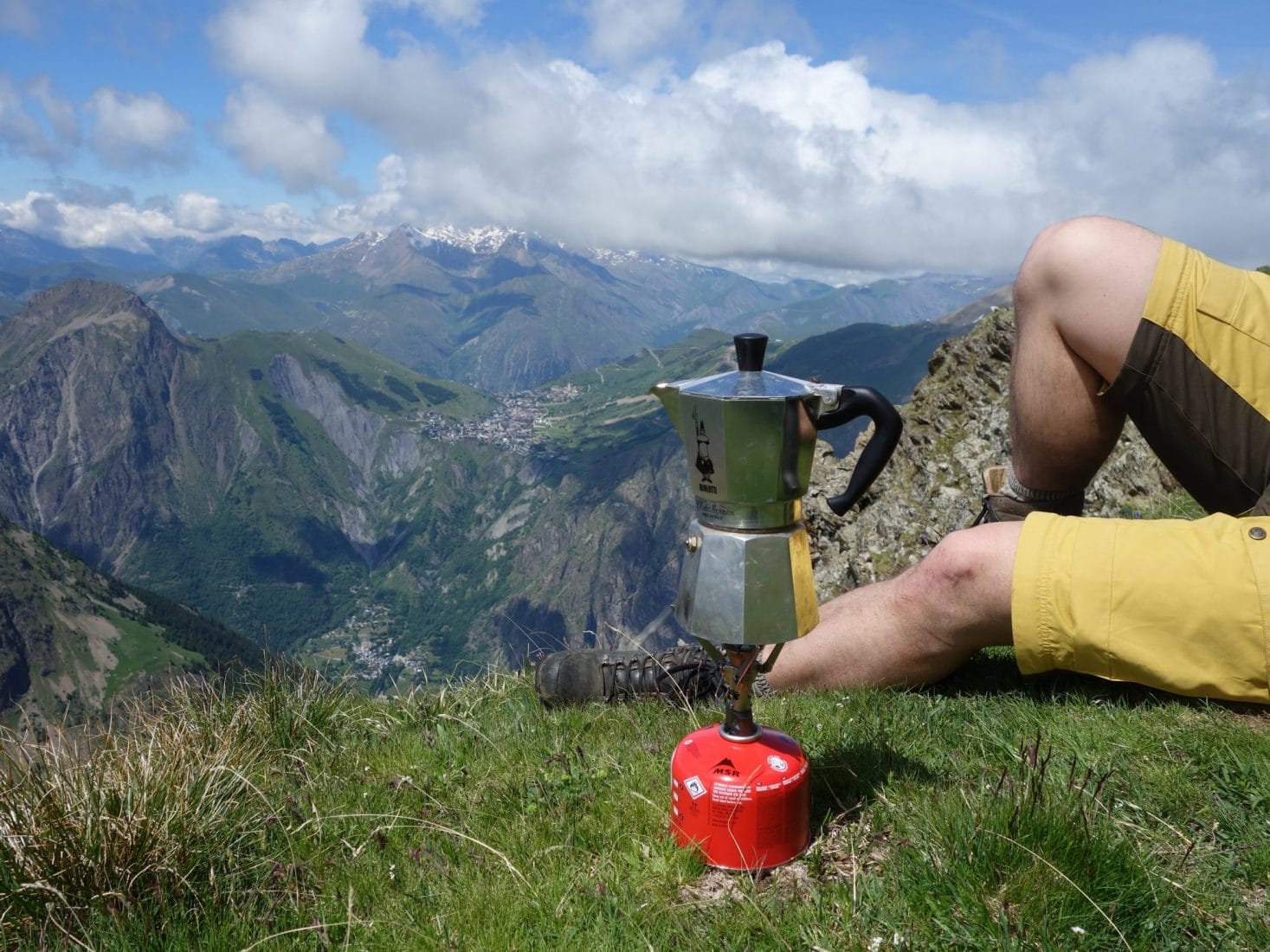
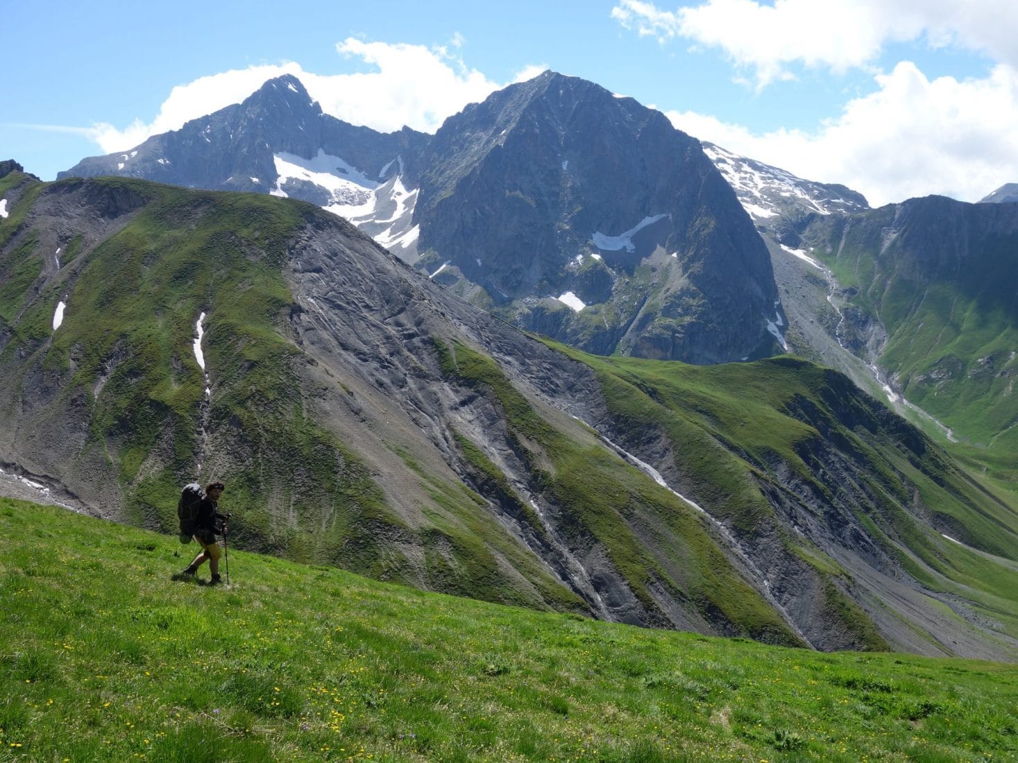
The climb resume again after this beautiful passage. We will meet a small flock of sheep grazing peacefully and happily for us not guarded by a dog. We finally arrive below the Cîme du Pied de Barry. The path almost disappears here and branches off to the right (towards the ONO) to attack a relatively steep descent with no visible trace. We will take advantage of the view just before this part by having a coffee (we had the Mocca …) facing the Massif.
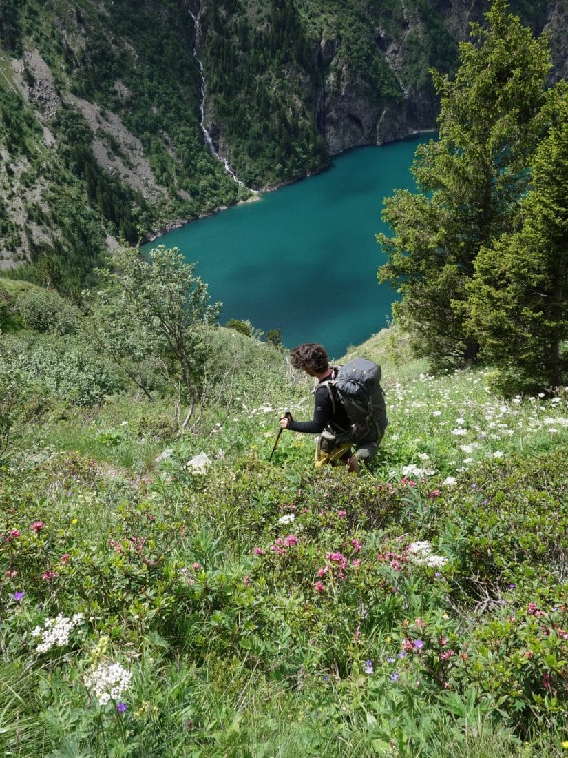
The descent although tiring because it evolves in a fairly chaotic grassy terrain also offers us a spectacle of spring flowers and marmots. We join the path below, not far from what seems to be a ruin (an old sheepfold may be) to go to the refuge which is not very far away. On the way we pass not far from one of the last bogs of the Ecrins, extremely fragile environments. It is only there, after almost that we meet people and not just anyone: the refuge keeper and a person from the team who goes up to open for the weekend.
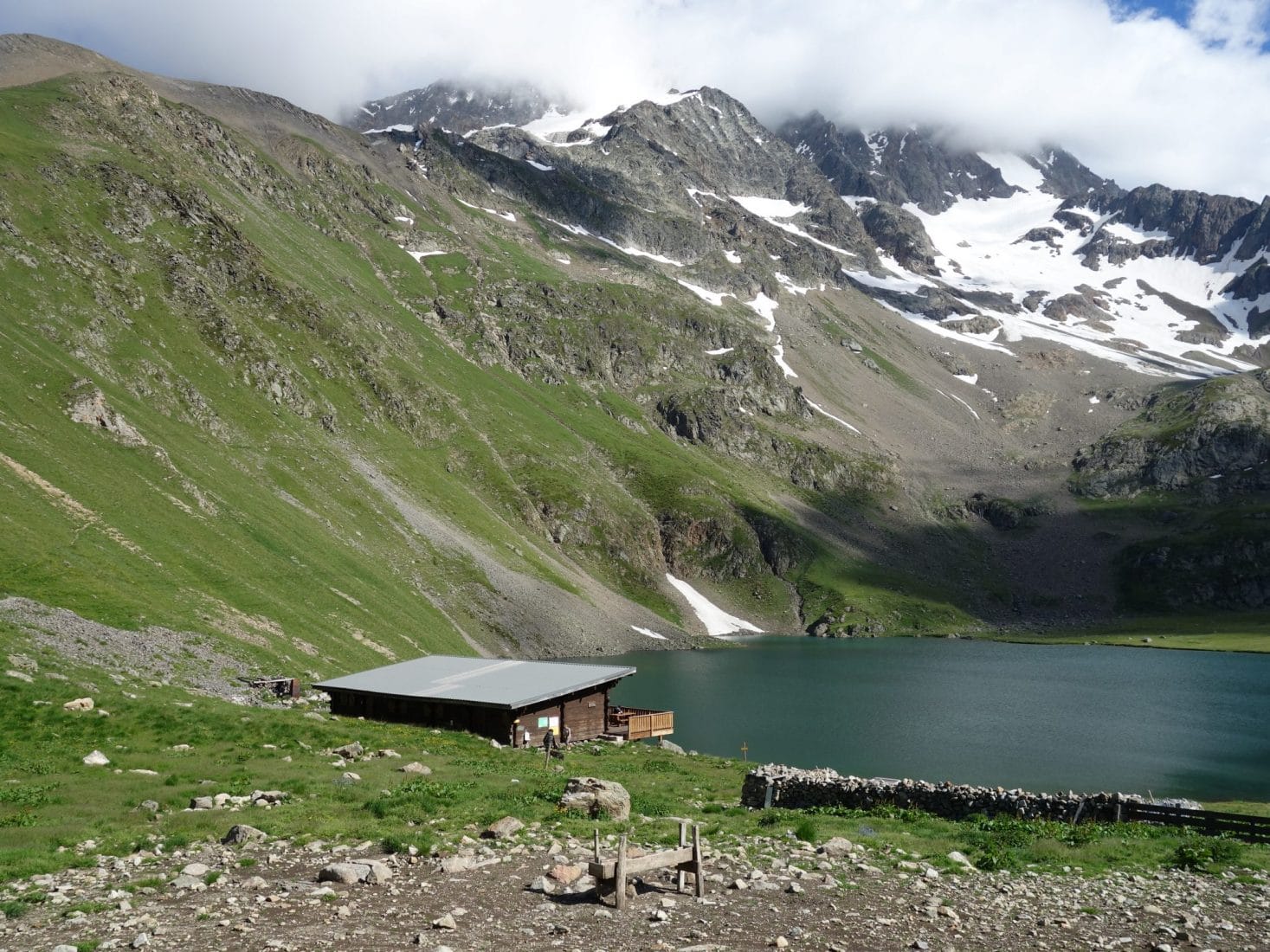
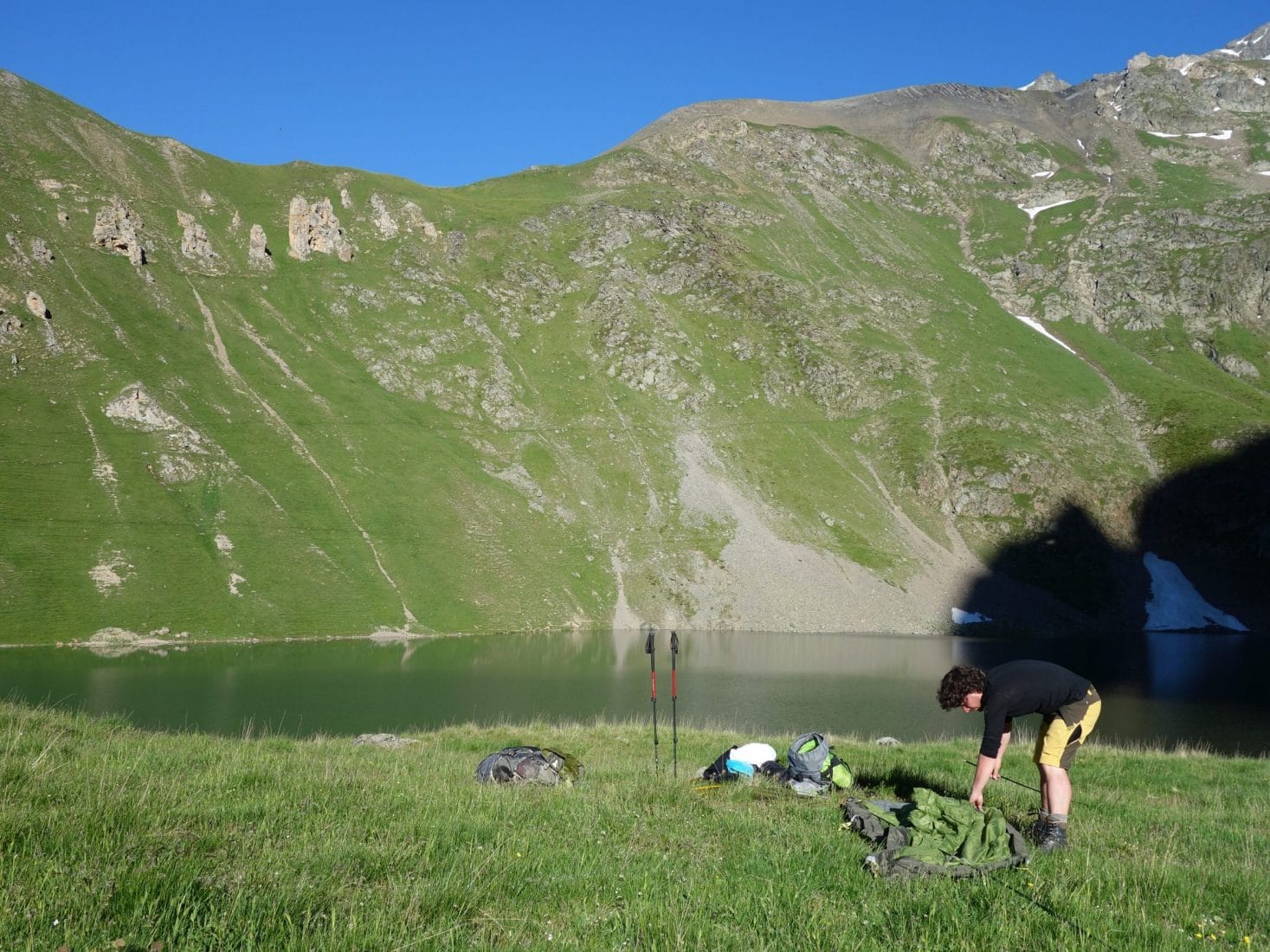
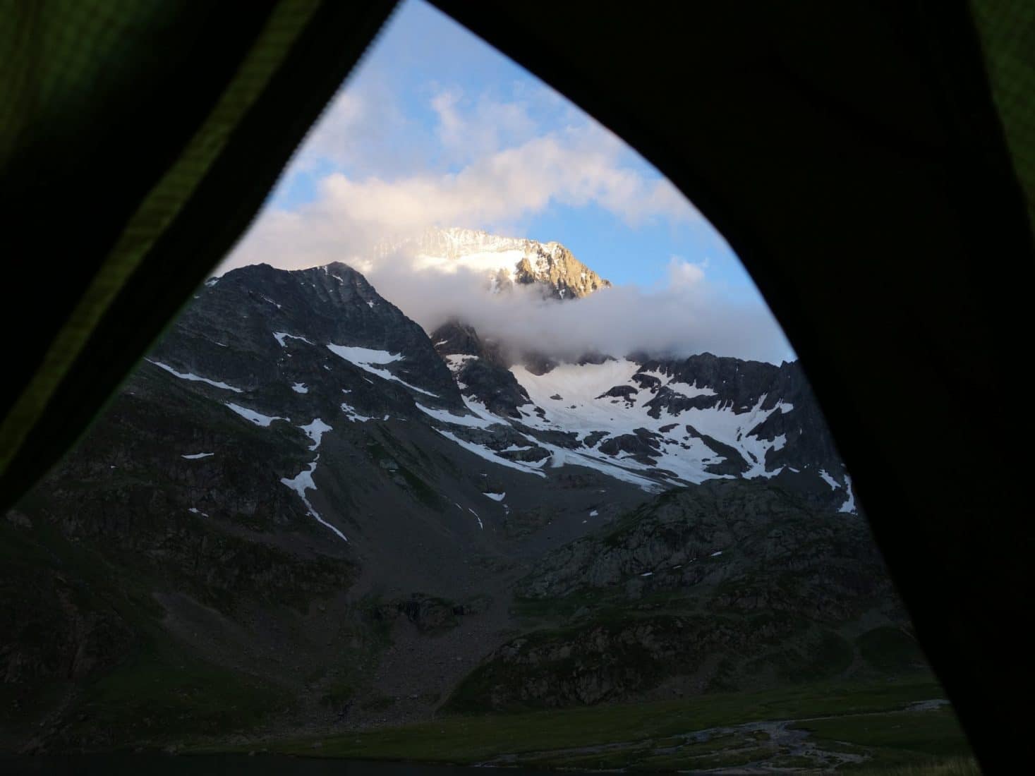
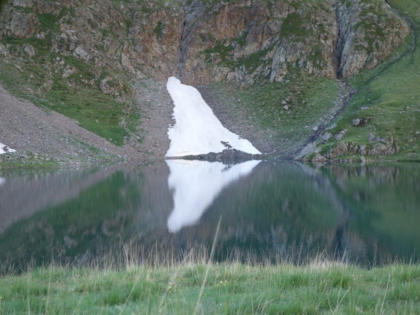
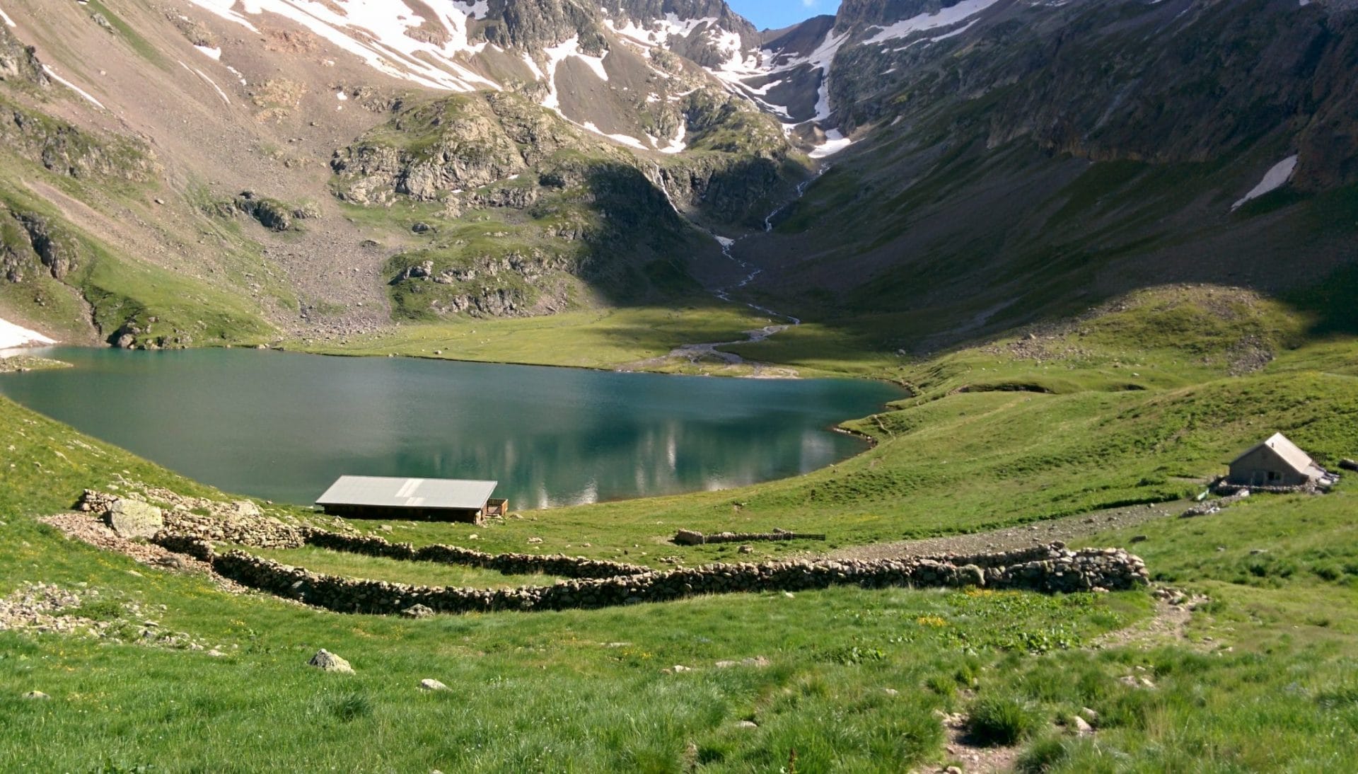
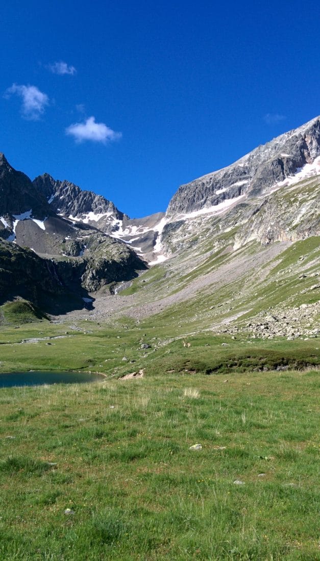
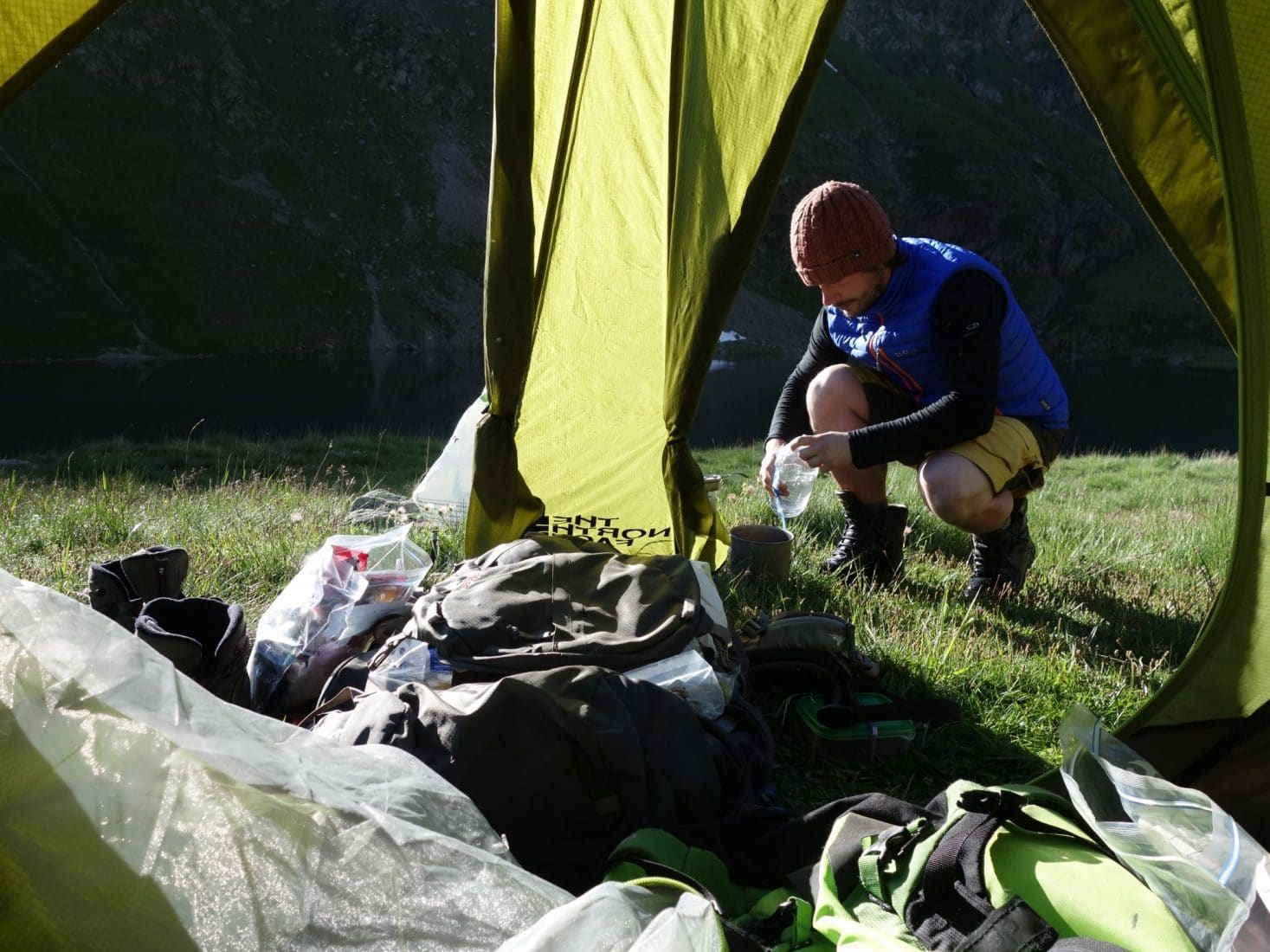
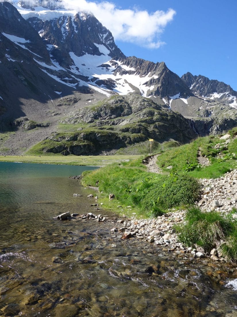
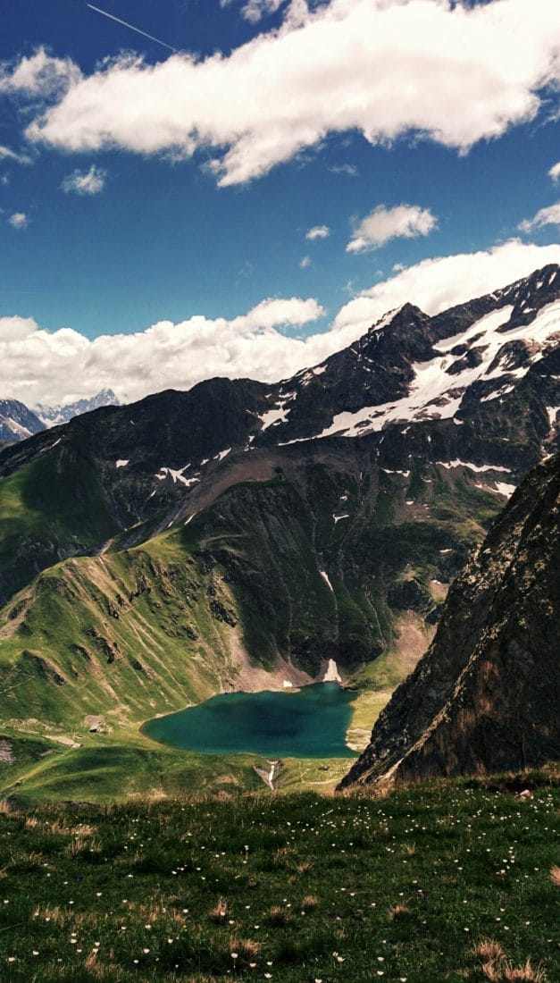
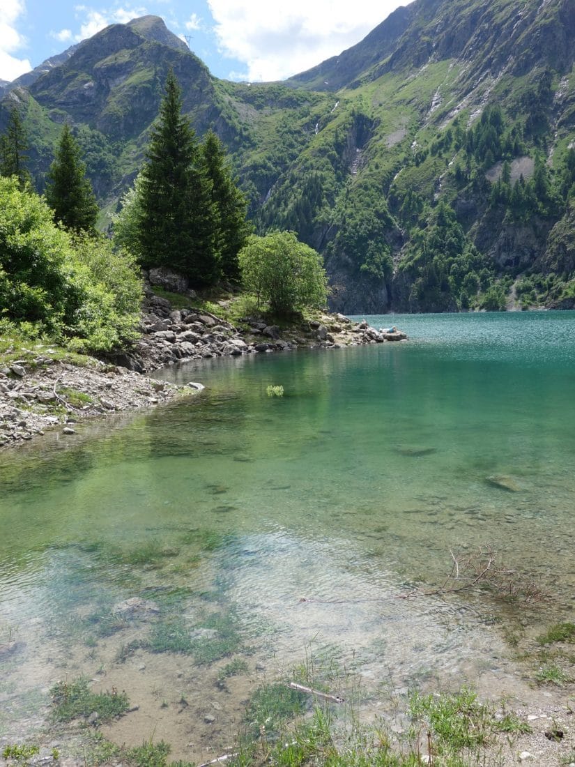
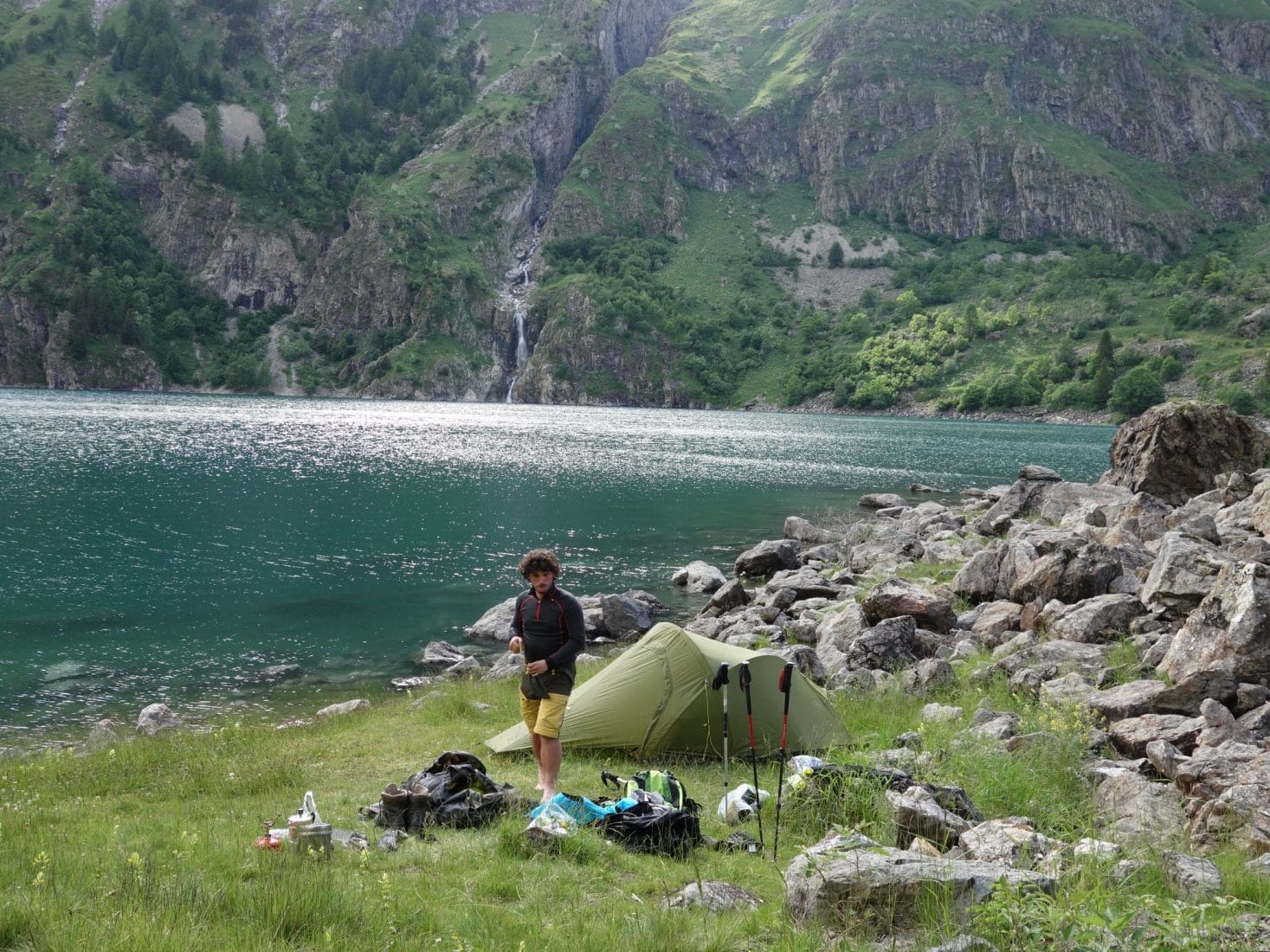
The arrival on the refuge and the lake of Muzelle is superb. The landscape reveals a large circus closed at the bottom by the impressive Col de la Muzelle. The Lake is nestled at the bottom of the depression. Since we are early in the season, many snow patches are present on the surrounding walls and are reflected on the surface of the lake. After a refreshing break at the refuge, taking advantage of the babysitter’s present, we will put the bivouac slightly above the lake near the spillway. The view is superb, the weather is nice and we will only have met the babysitter, her teammate and a guy who does the GR54 and with whom we will eat in the evening. We will not go to bed late after the 1500m of D + that we have just completed.
Day 2 - From Muzelle to Lauvitel
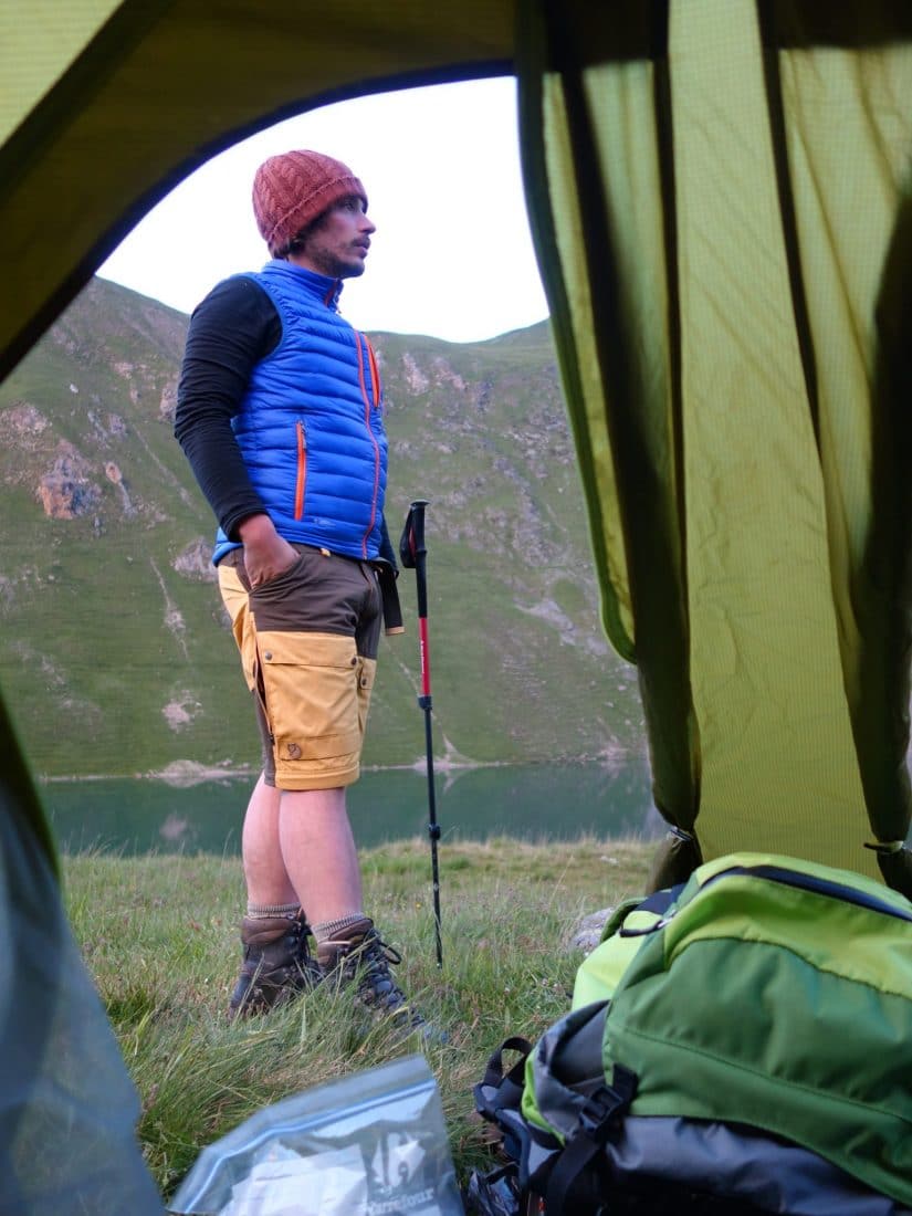
It was relatively cold last night since the tent was frozen in the morning but we slept well in our cozy sleeping bag. As the program of the day is not very busy we take our time in the morning while waiting for the sun to come warm the tent.
Breakfast will be quickly swallowed and we put the camp away before leaving in the direction of Lac du Lauvitel.
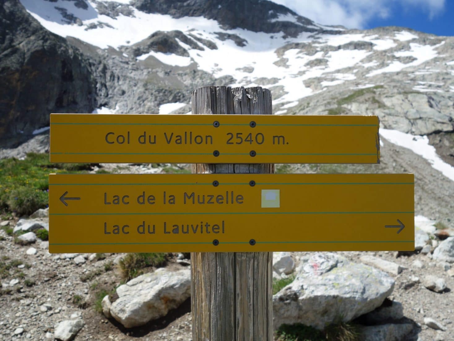
We will pass by the Col du Vallon (2540m) to reach the Lac du Lauvitel. But before that we stop 5min to find a Geocache placed under a rock not far from the path.
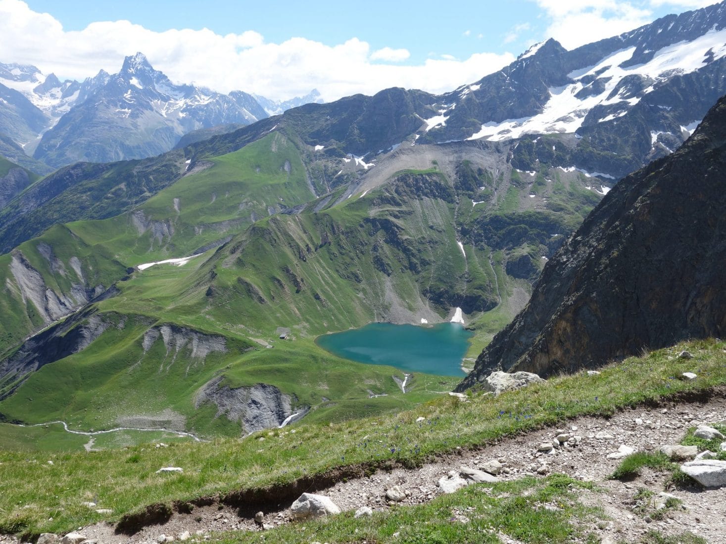
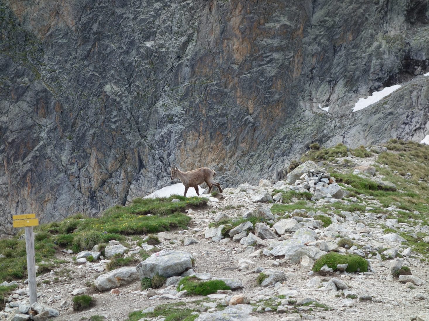
The ascent follows a path that zigzags up to the pass. The view is absolutely superb on the Lac de la Muzelle below. We are lucky because it is under a bright sun that we will still be walking today. The climb does not pose any particular difficulty, in particular thanks to the well-stepped path. Arrived at the pass we land for a bite to eat and above all to admire the landscape. An ibex even gives us the pleasure of passing right by while taking our time. There is nobody…
We begin, after this break, the long descent to Lake Lauvitel. More than 1000m of D-. Fortunately the path is good and the view is beautiful, it follows the Embernard stream for almost the entire descent. The Lake is quickly revealed below us and we see it approach gradually, slowly. The lower part of the trail passes through a freshly collapsed area. We had also postponed the stay because security works were underway in the previous weeks and the path was prohibited. But this day we pass without a hitch.
We finally arrive at the Lake. There are a few people because the way to go up there from the valley is simple and fast. There is a large expanse of grass with two tents already and a few chalets on the other side of the lake. The Lake is very beautiful, it is nestled between large cliffs except on the west side where it opens onto a valley which is an integral reserve. Only downside, an electric line that passes over the lake but which does not spoil the beauty of the place either.
We don’t want to be too close to the other campers, so we leave on the left towards a rocky chaos because we think we will find a site for the tent behind it if we believe the map. We actually find a space right next to the lake and back to the rock well hidden from other people who may be on the grassy part. We put up the tent quickly then we take advantage of the place and its serenity.
We will end the evening with a good hot meal and admire the sunset over the mountain.
Day 3 - Descent and return
The night will have been good and less cold than the day before since we were much lower. The alarm clock is done in the shade but the place is still as beautiful. We have breakfast without rushing because the program of the day only involves going back down to La Danchère before returning to the Plan du Lac to take the car and go home.
The descent is nice, it follows the Selle stream which turns into the Lauvitel stream below. We meet a few people who are climbing.
Here we are, downstairs … After 2 big days upstairs, alone, the blocked view of the valleys is strange. In order to speed up the return (we have the road then to return) we decide to hitchhike. I don’t think there has ever been a more efficient stop, barely the thumb was lifted when two guys in a van stopped and dropped us off at the lodging for the first day.
This three-day getaway was a breath of fresh air. The Ecrins are magnificent and are less popular than other parts of the Alps. Nature is strong and present there. This tour is recommended for all those who want to discover the mountain and spend two nights in bivouac. We can facilitate it by going up to La Muzelle from Bourd d’Arud.
Some info:
- IGN map: IGN TOP 25 3336 ET (1 / 25000e)
- Muzelle refuge site: Link