Annapurna Trek
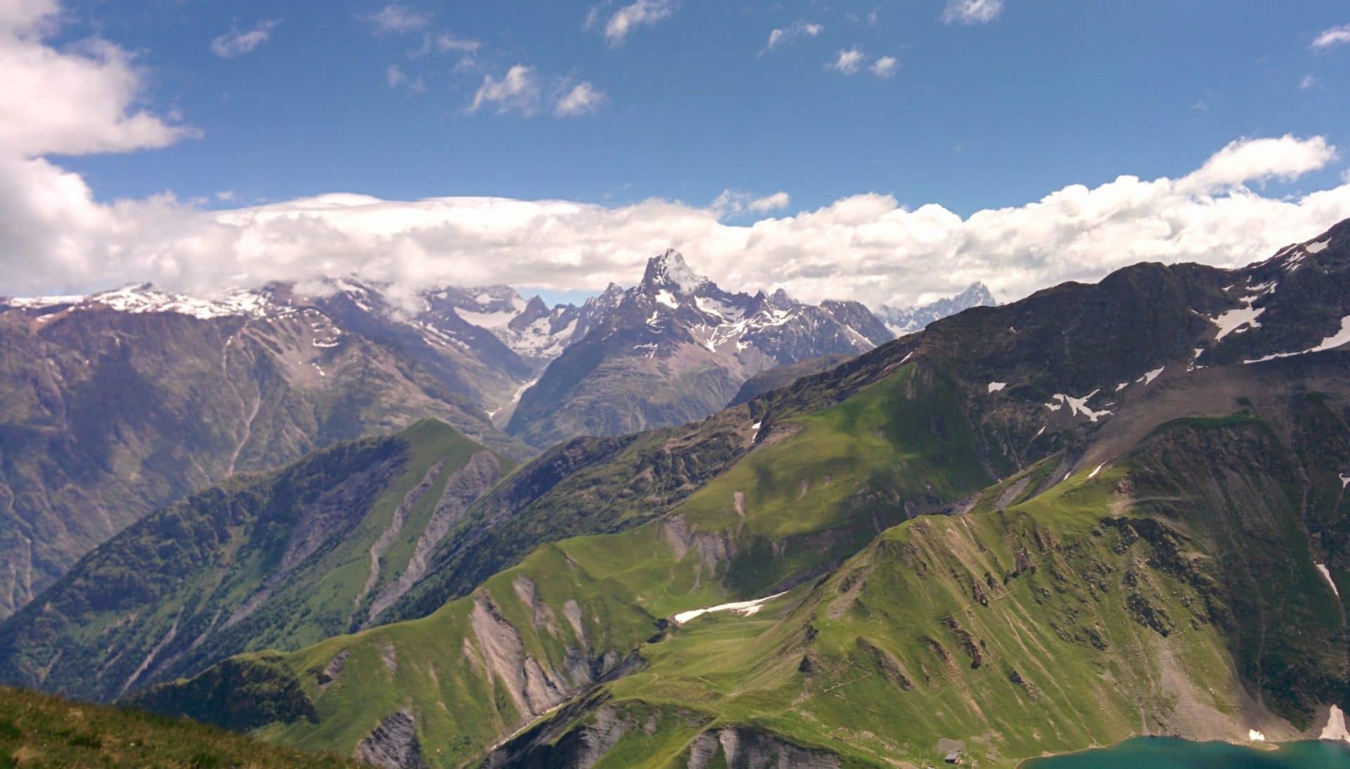
Nepal is a country which in itself embodies the very essence of hiking, adventure. Nestled between India and China, Nepal stretches along the Himalayan range. Eight of the fourteen summits of more than 8000m are located there in particular the most known, Everest (8848m) but also Annapurna (8091m). Annupurna is nestled in the heart of its eponymous massif; there are six main peaks, all over 7000m. It is around this massif that the Trek of the Annapurna Tour is carried out.
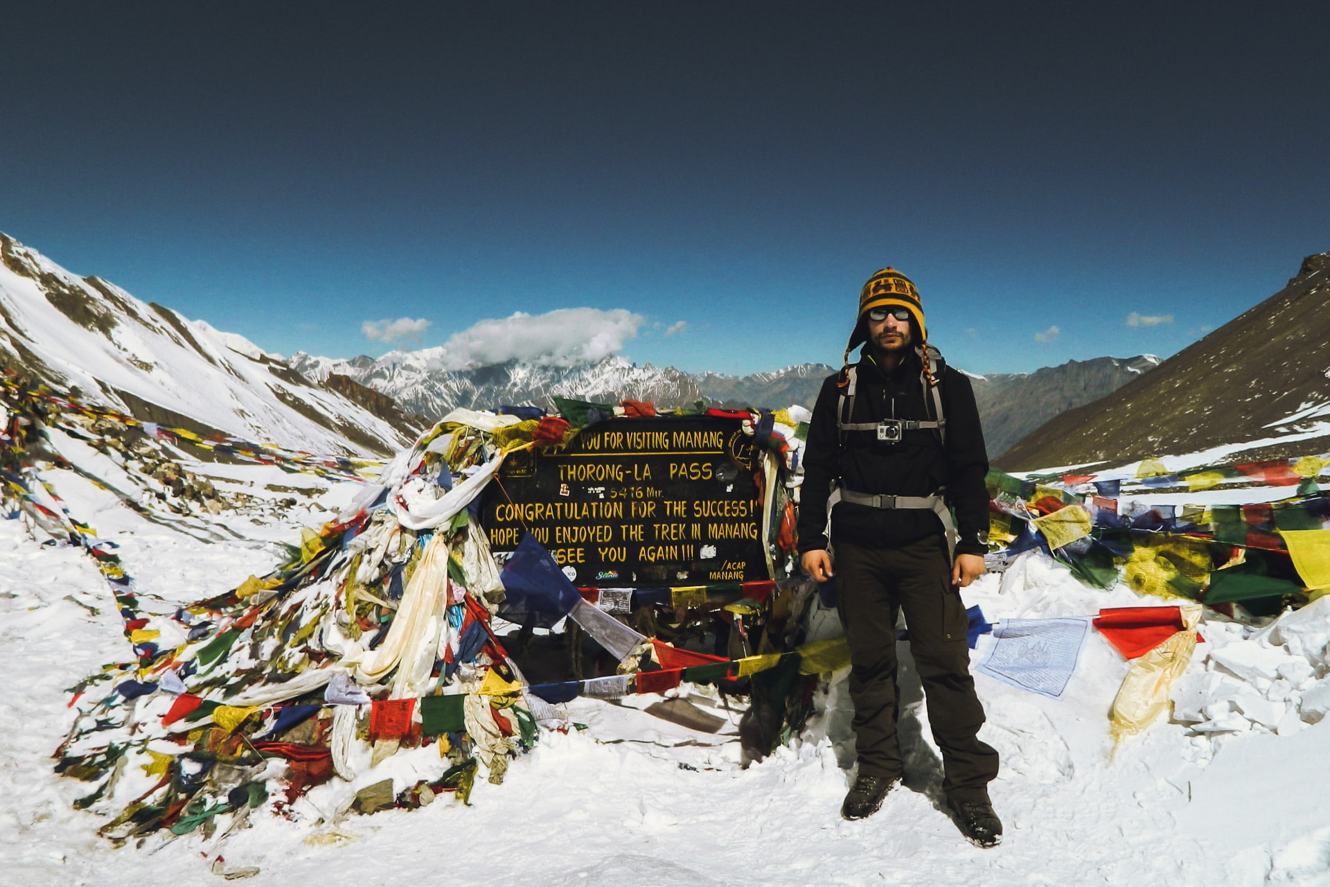
Lasting 10/12 days (for the full tour), the trek evolves between 900m and 5416m with the passage of the famous Thorong pass. It is a must for anyone who loves hiking and the great outdoors. We go from the rice fields to the high Himalayan peaks, taking the time to discover the country.
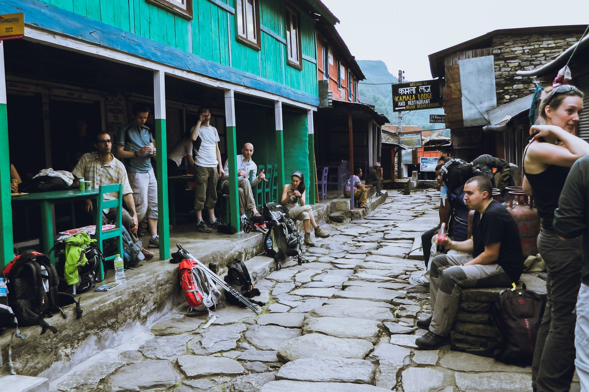
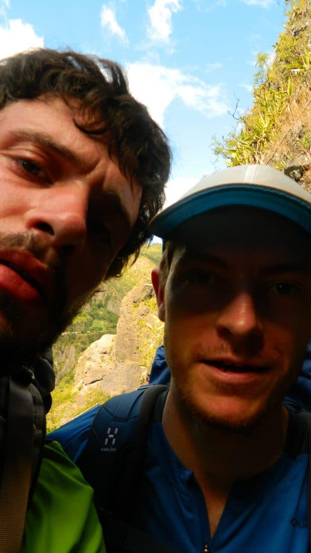
This trek is the first that I realized, in 2012. Unfortunately at the time I did not keep the notebooks which I use today to keep track of impressions, memories accumulated on the way, this return will be a light story mainly based on photos taken during the trip. In addition at the time I wanted to discover “serenely” this practice and not have to complicate my life to organize everything (which is a shame in hindsight), so I had gone through an organization for this trek but it did not in no way distorts the landscapes and the experience.
Kathmandu
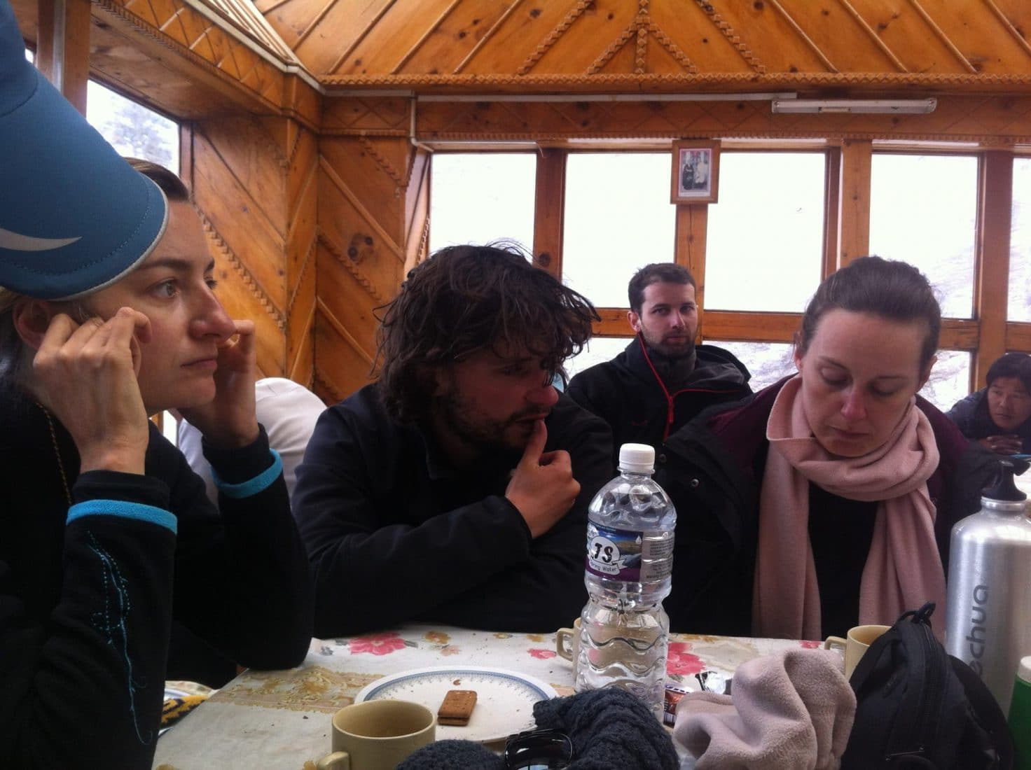
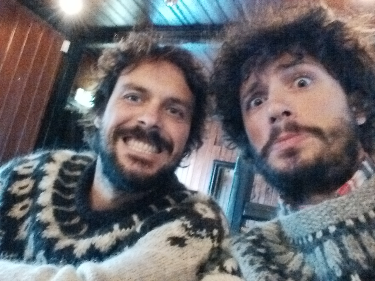
Kathmandu is the obligatory passage for the start of the trip. The city is regularly served by air from India or the Emirates. We went through Abu Dhabi on our side for a relatively long trip (6 hours stopover) but it was an opportunity to discover the other members of the group.
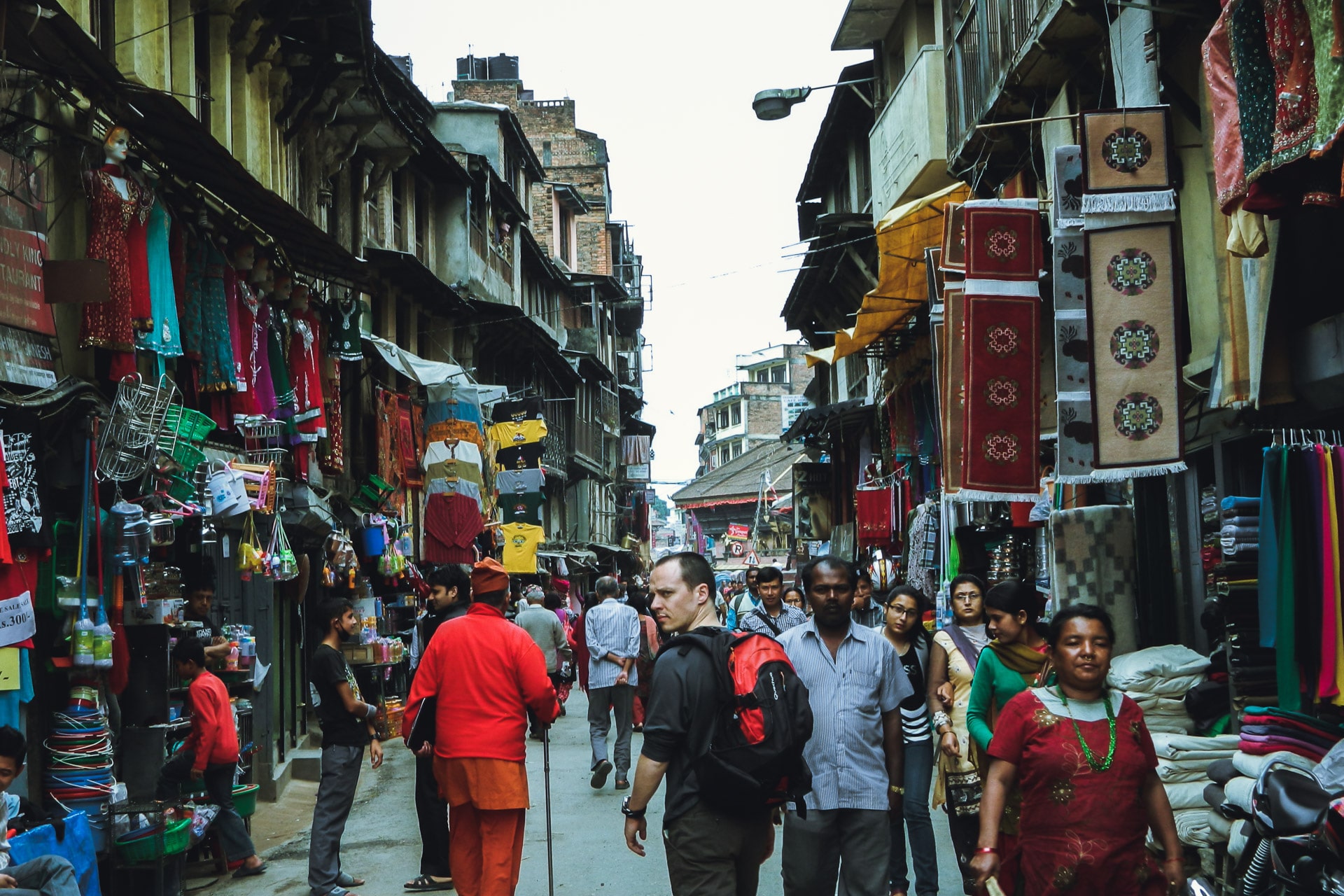
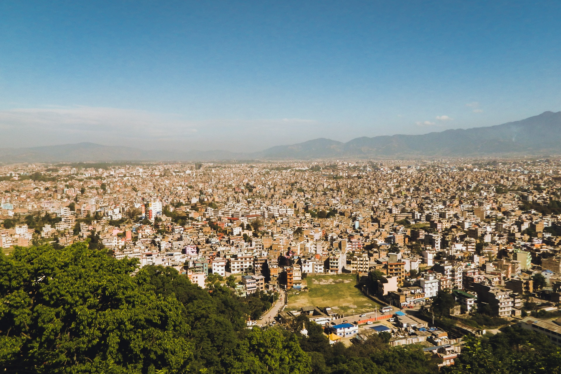
Kathmandu is a city steeped in the imagination, especially with the hippie movement in the 60s. Today it is a strong city of more than 800,000 inhabitants. The experience in town is complete in terms of sensation: sight, hearing, smell, everything is stimulated. Kathmandu is a real anthill.
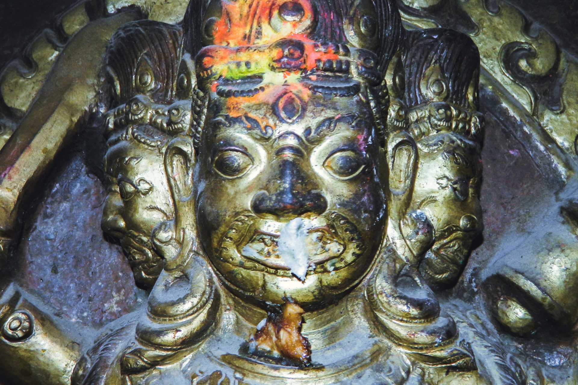
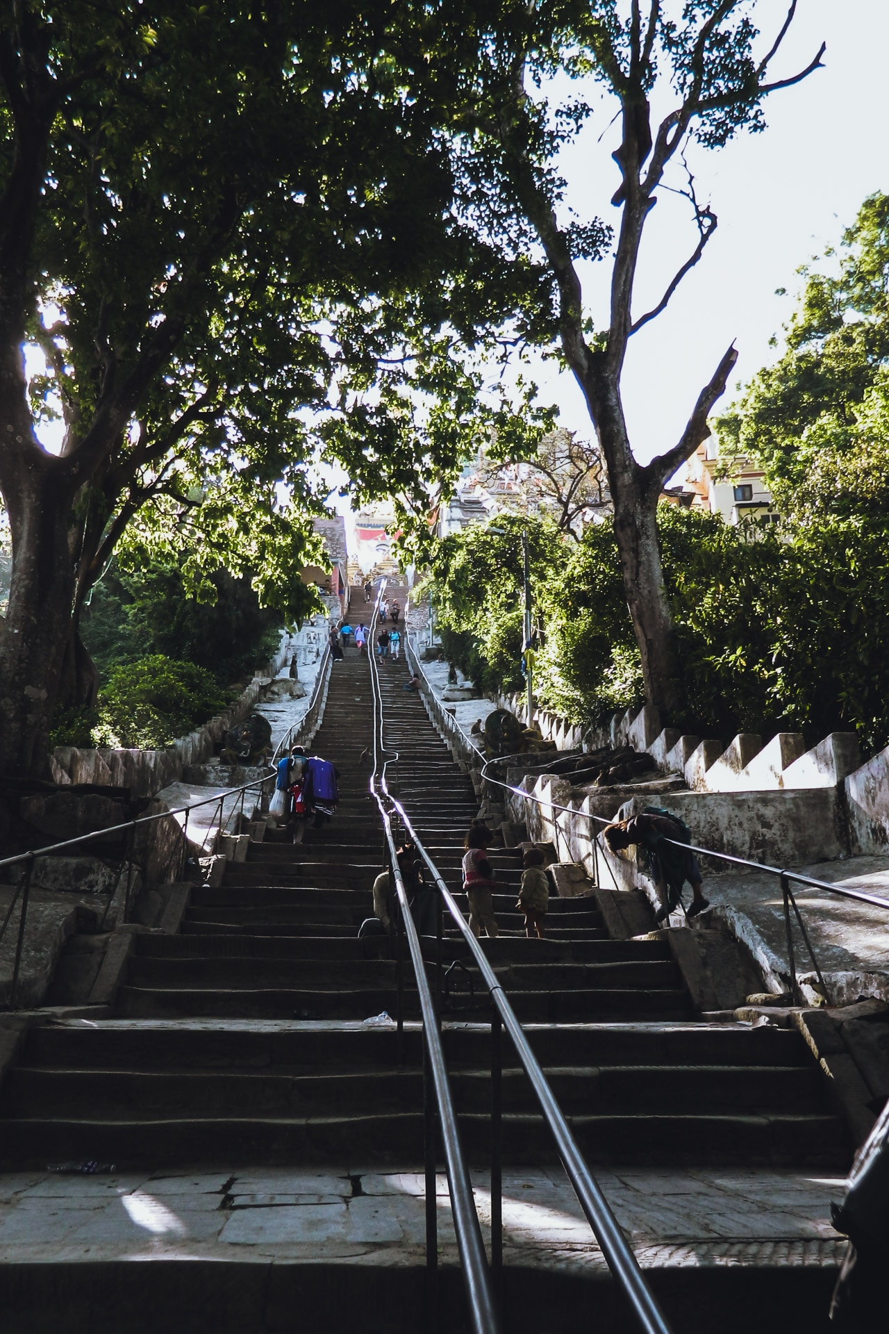
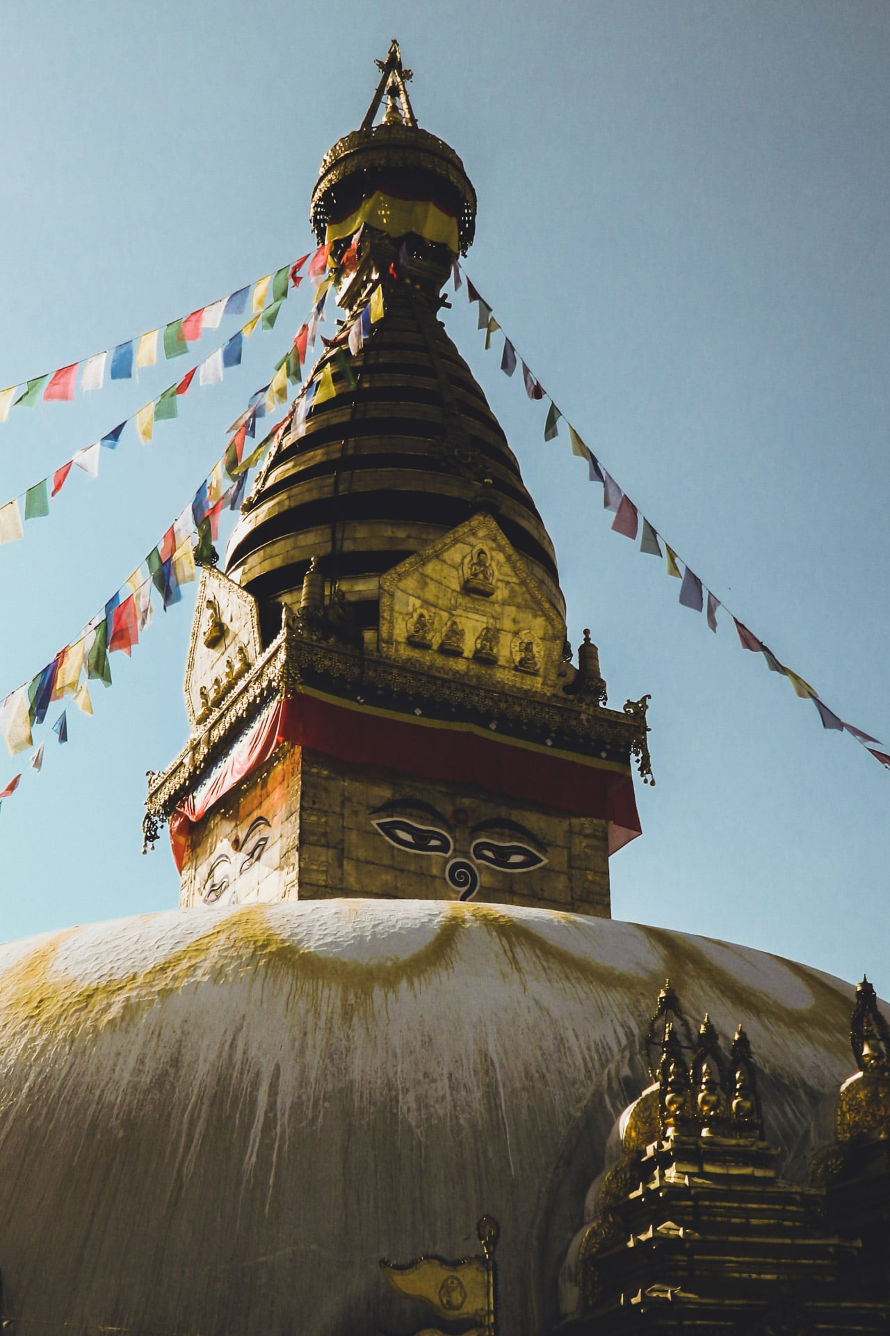
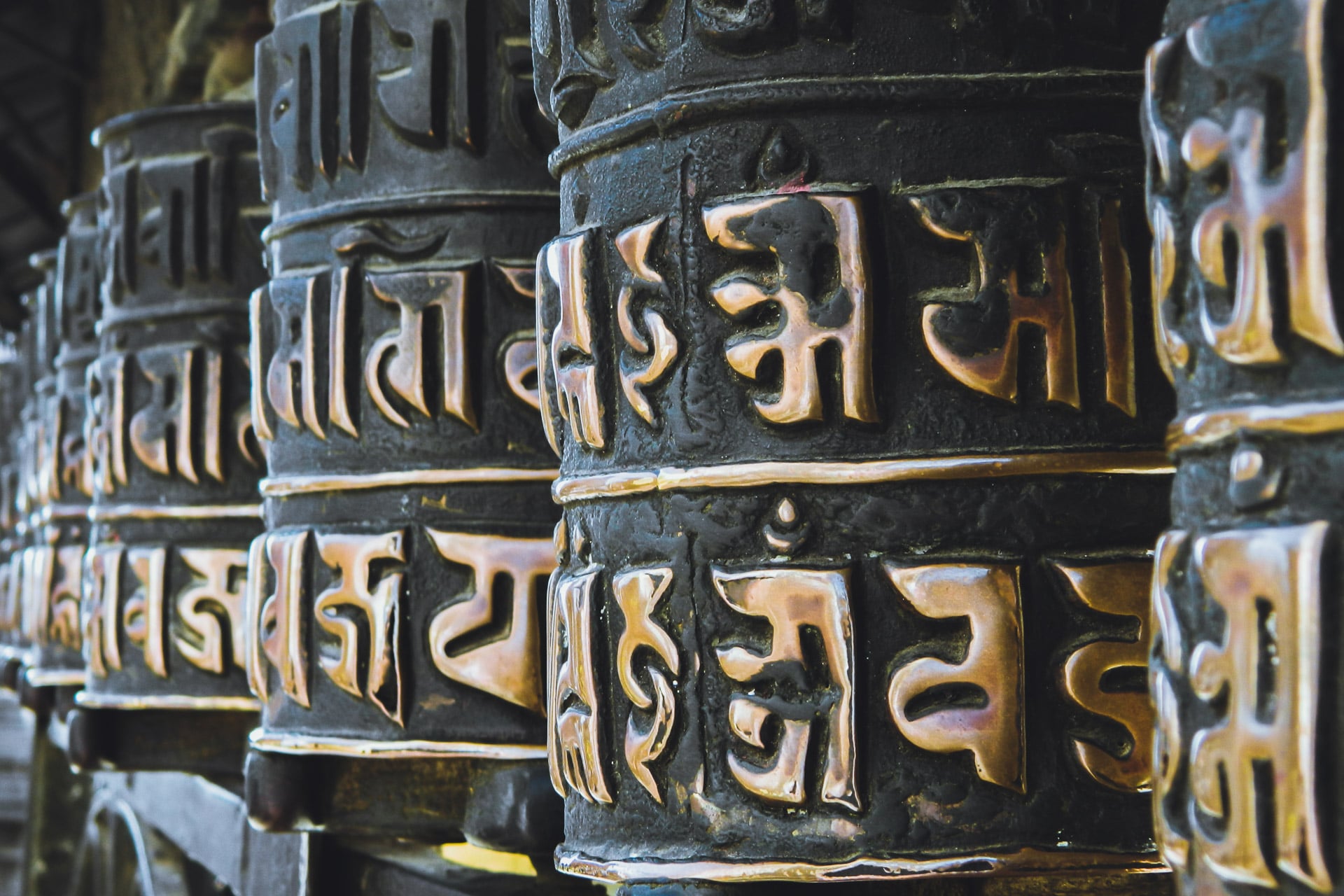
The city is rich in monuments, religious in particular, and in history. Note in particular Durbar Square and Swayambunath which were unfortunately partially destroyed during the earthquake of 2015.
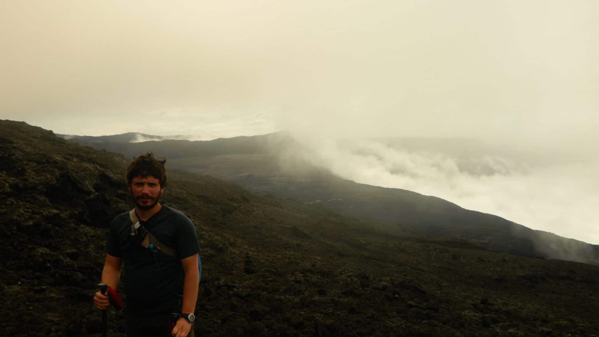
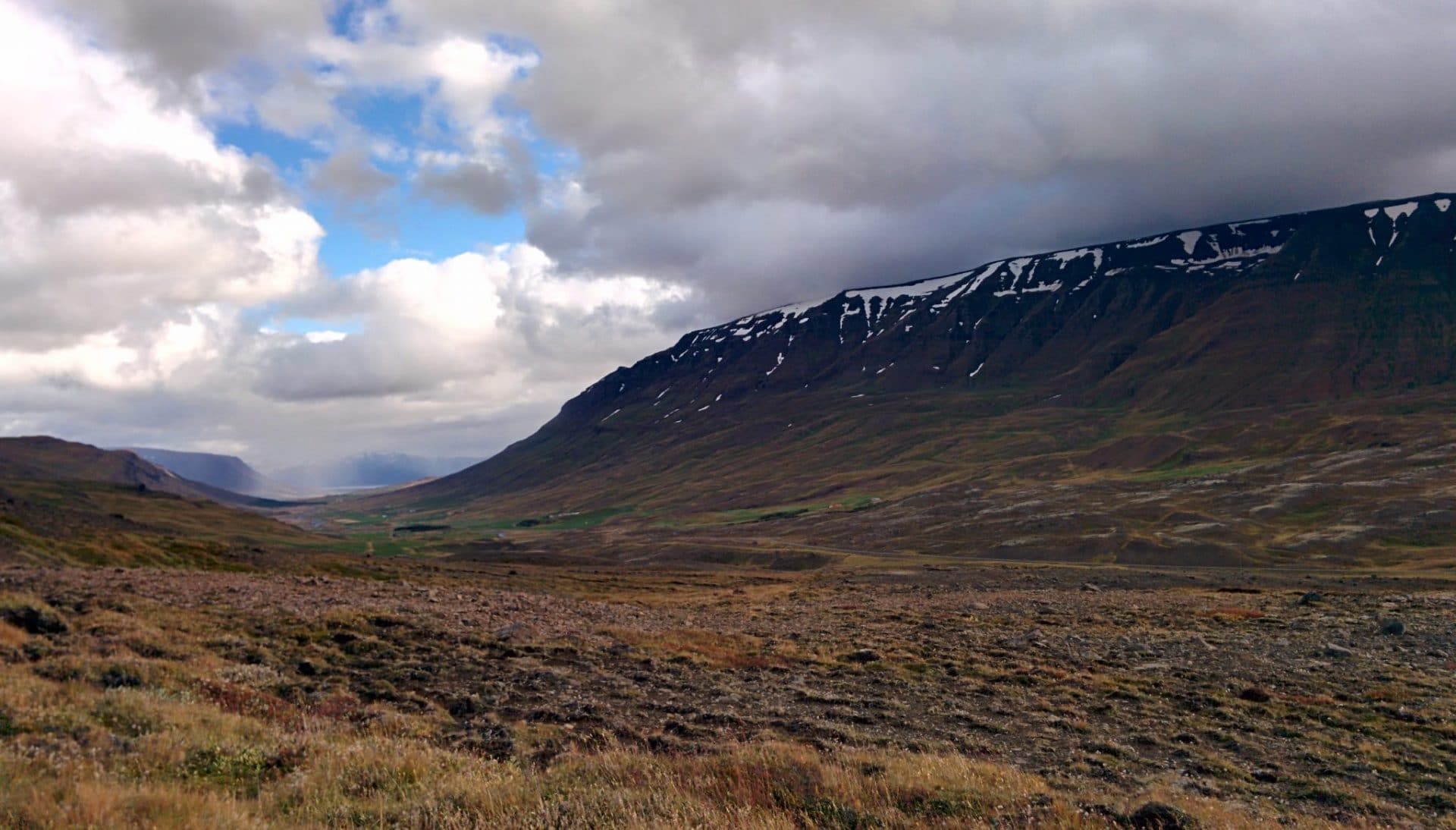
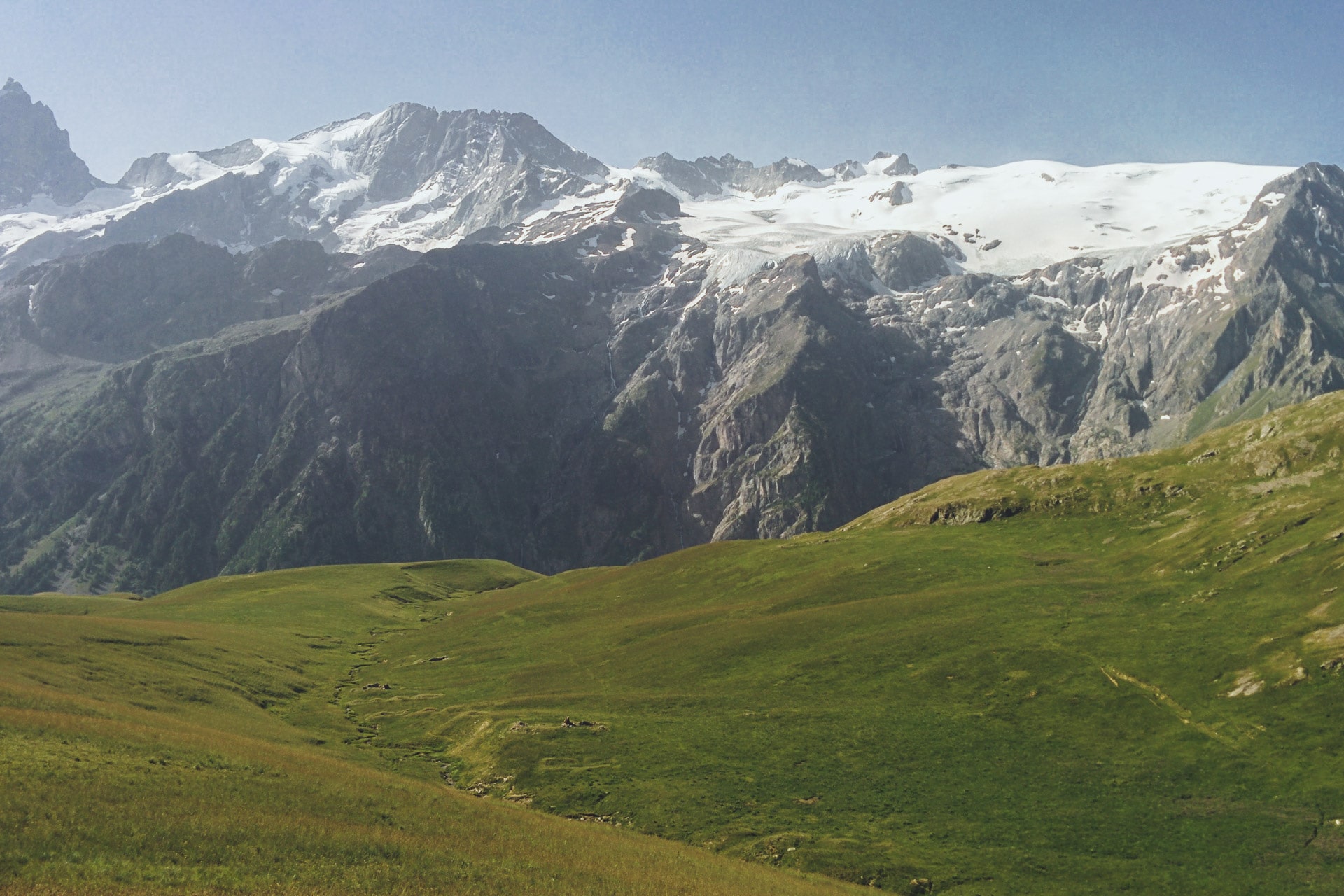
First Part of the Trek: The Low Altitudes
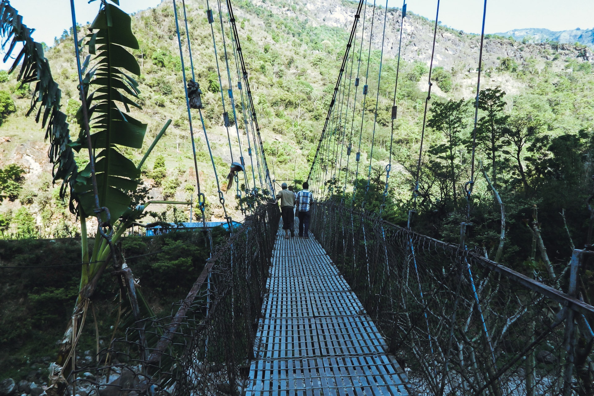
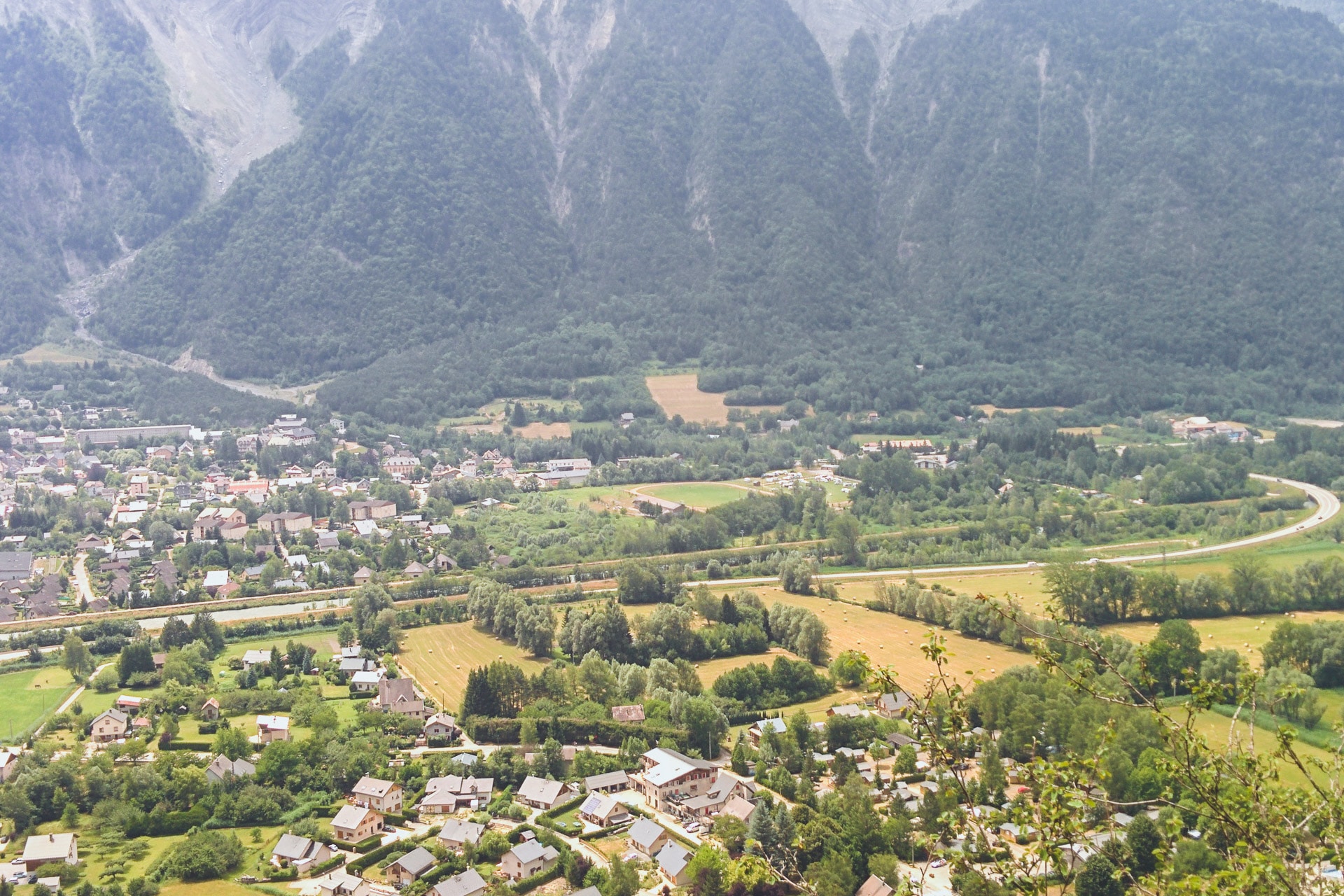
The start of the Annapurna Tour trek is towards Besisahar. Six hours of bus on mountain roads with Nepalese driving style … an experience in itself.
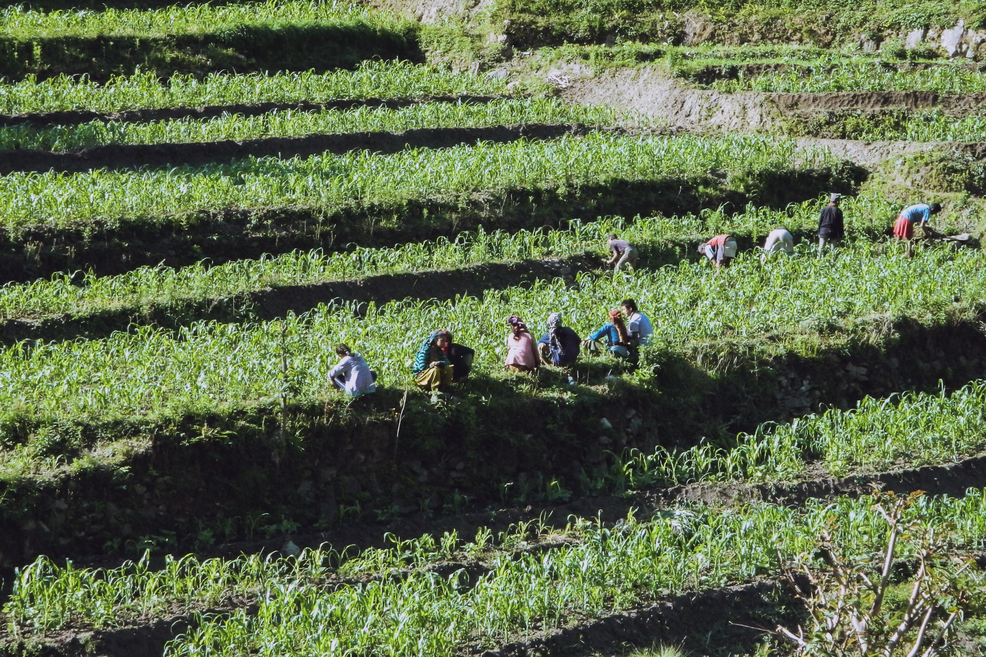
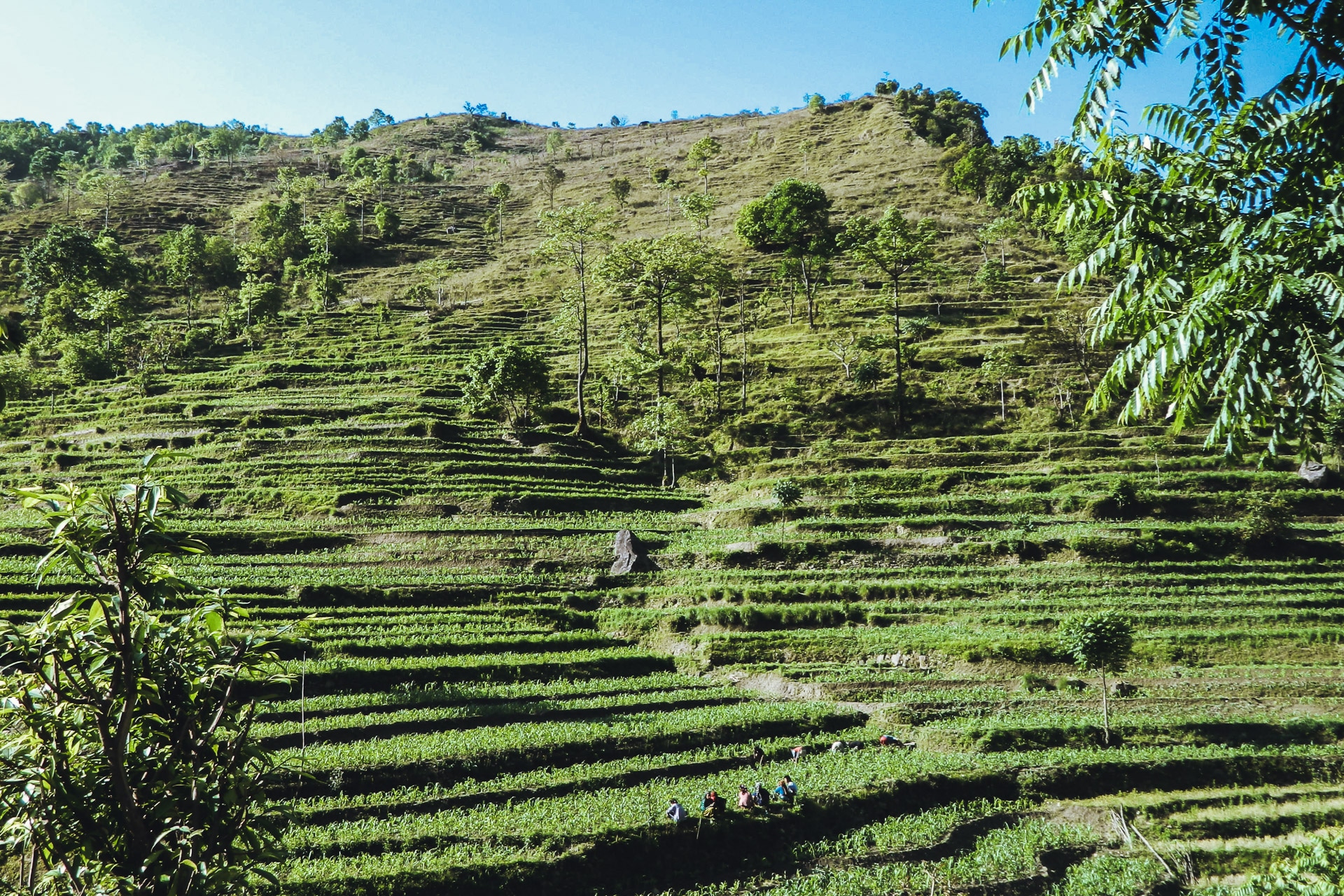
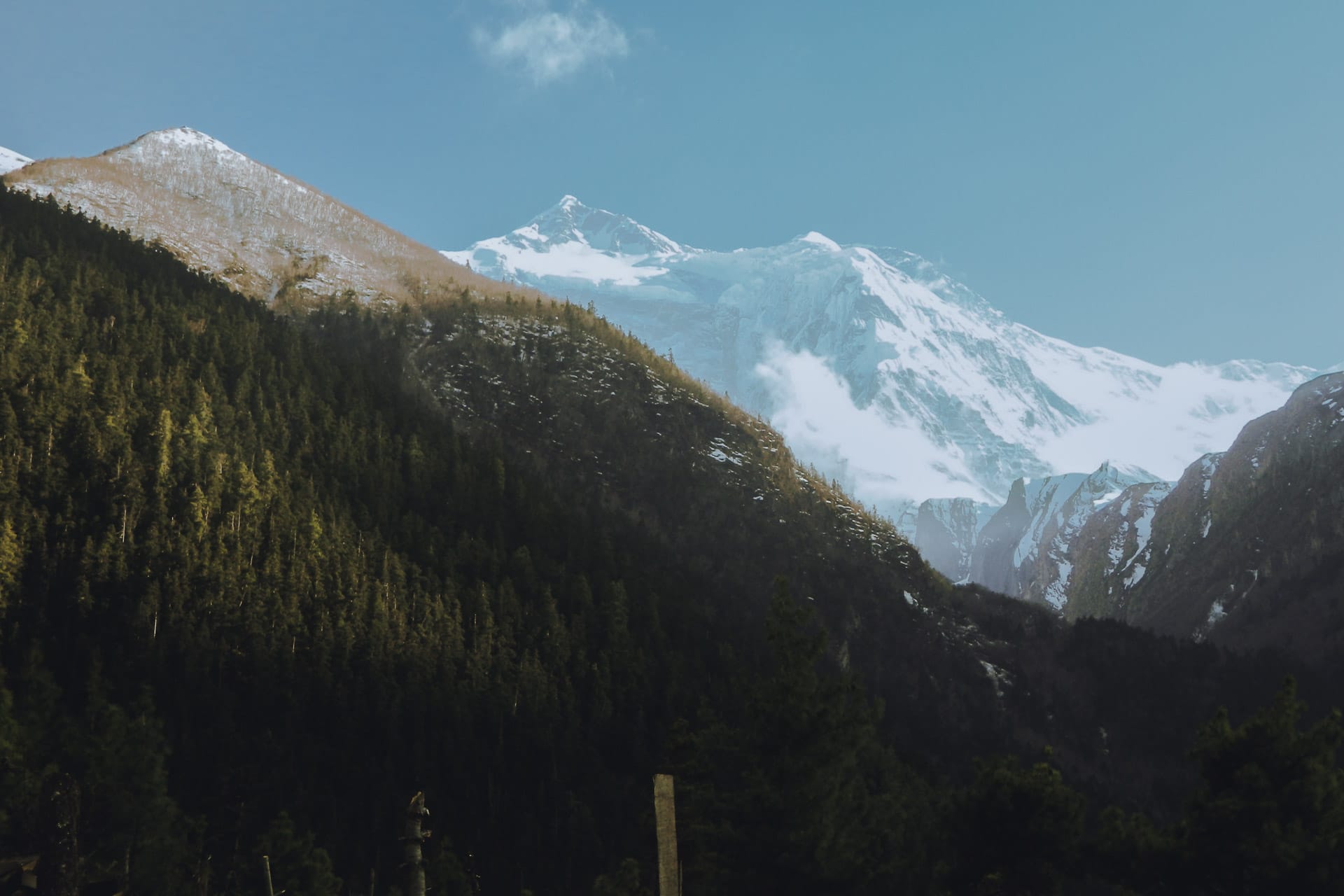
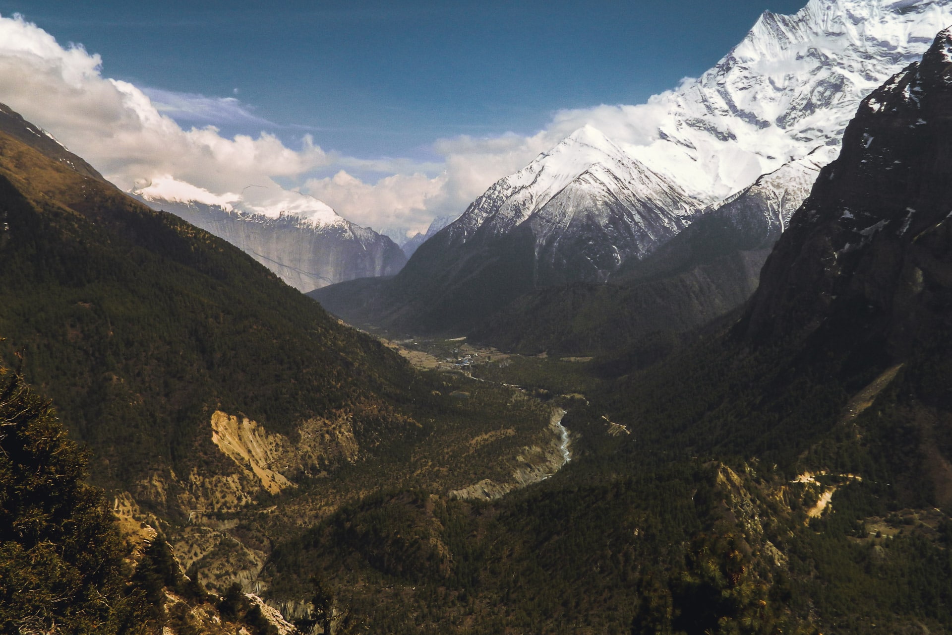
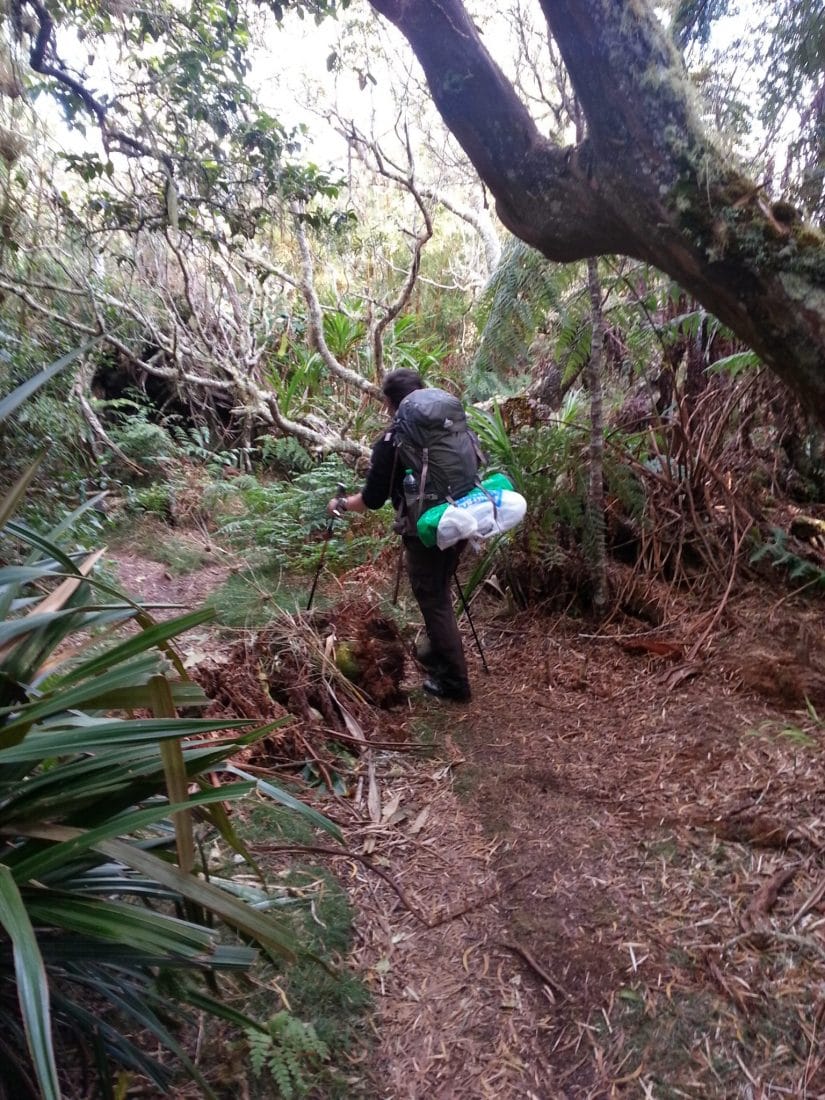
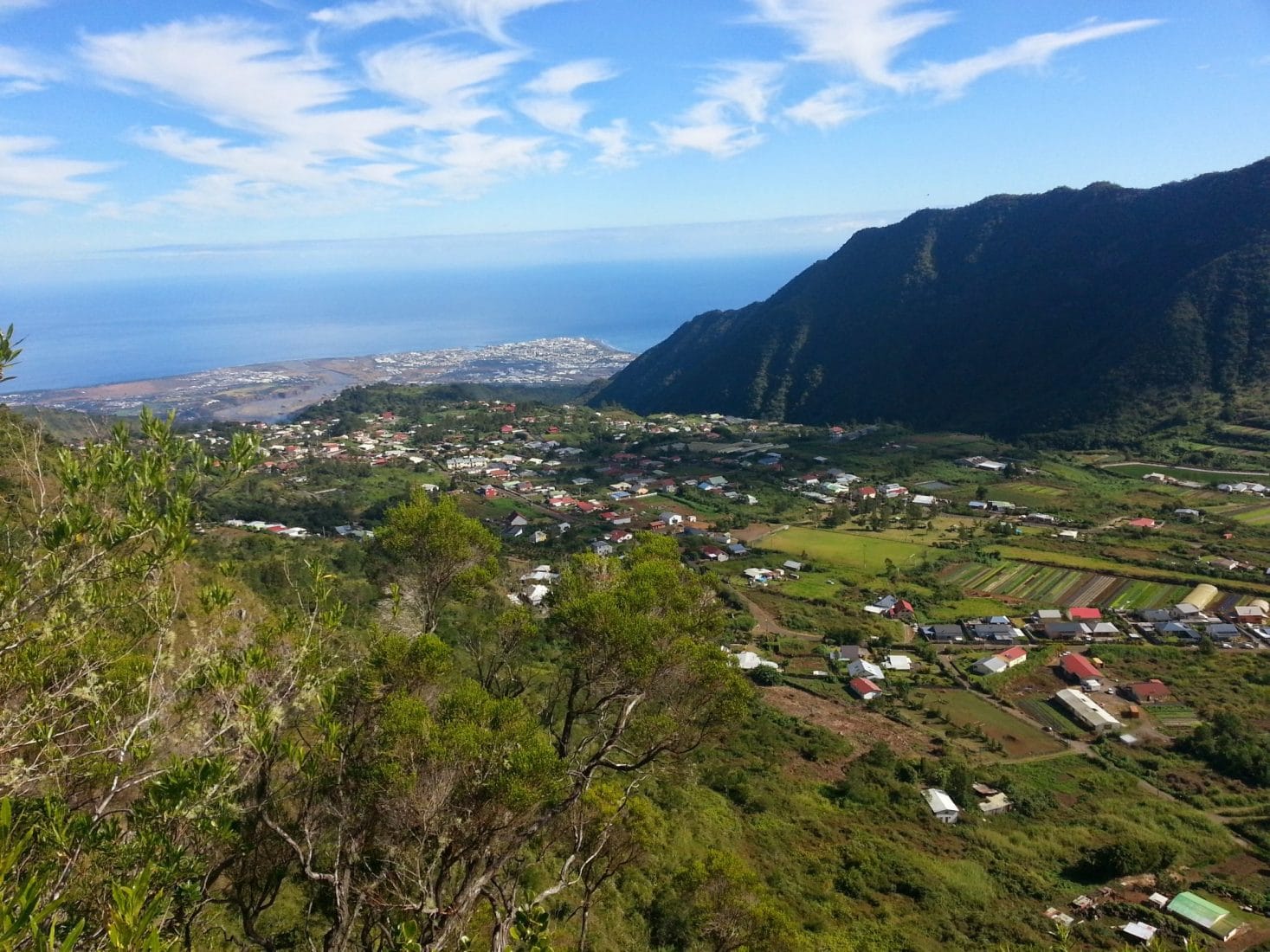
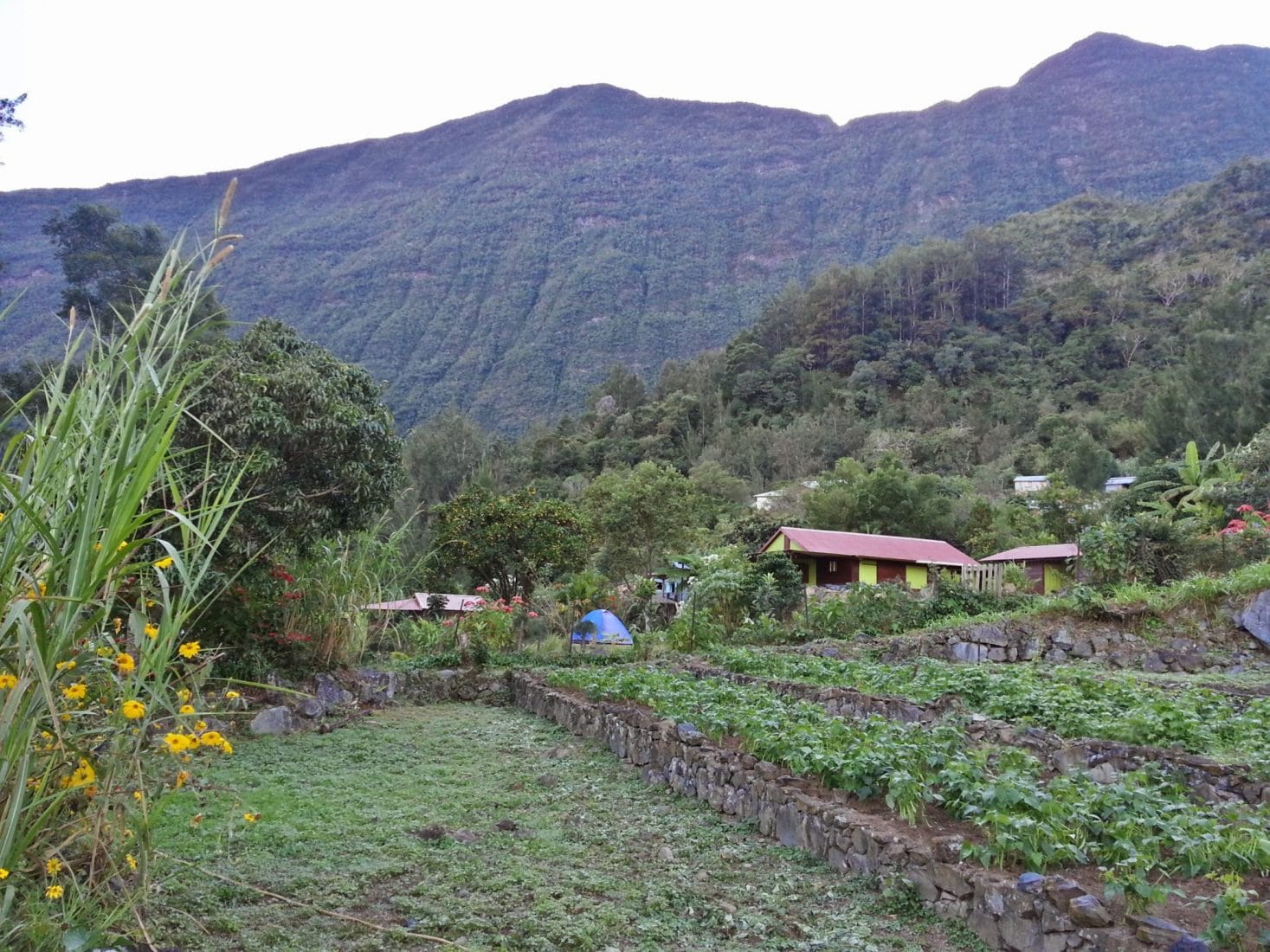
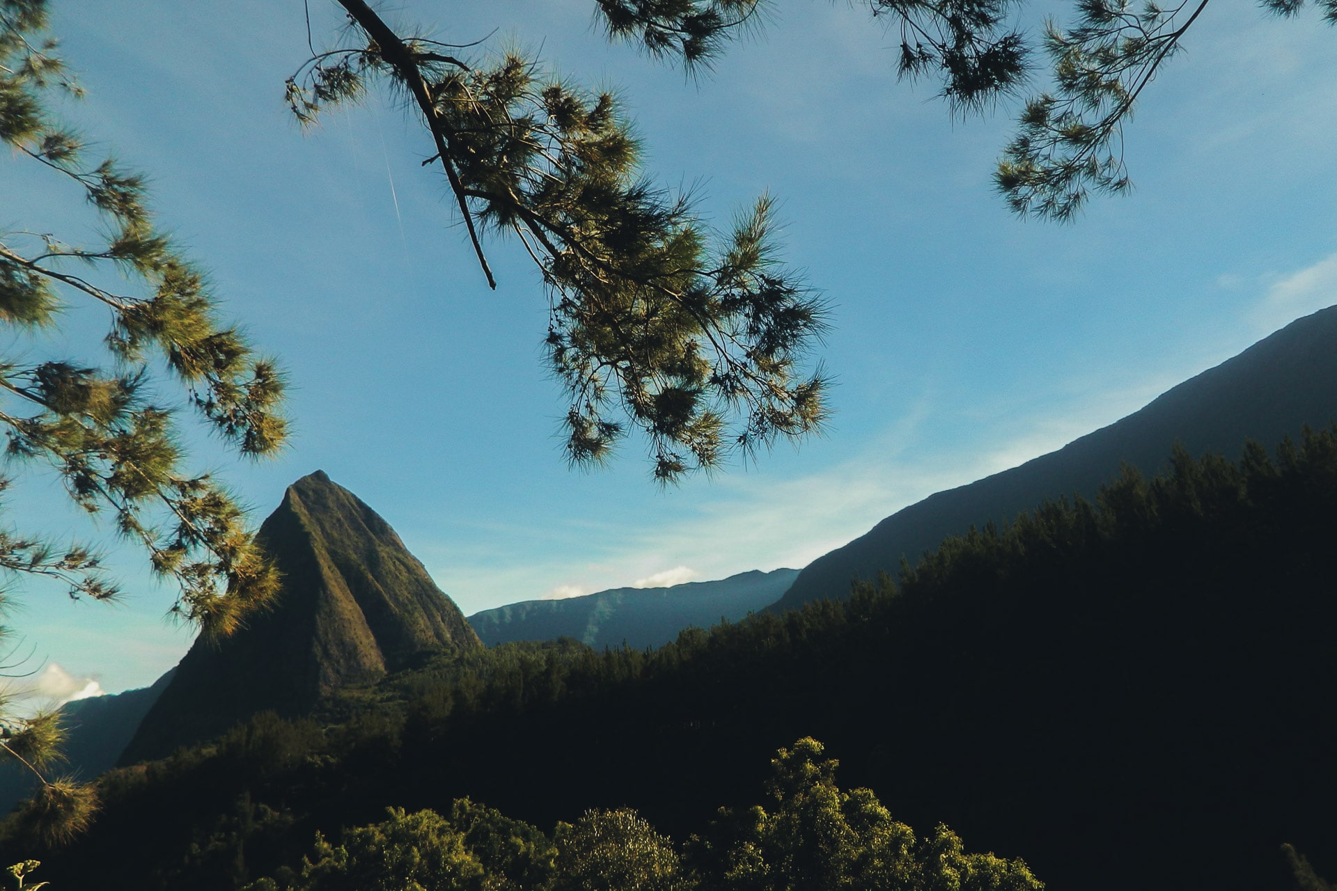
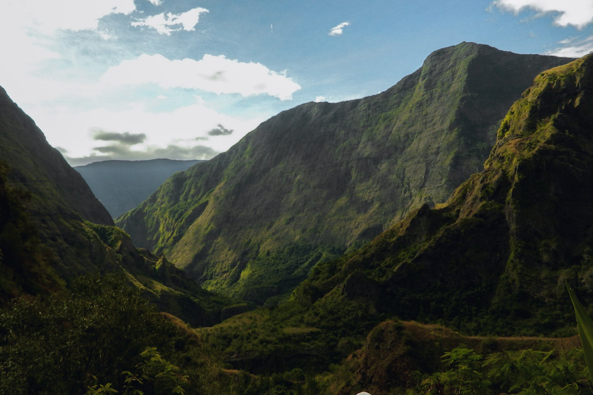
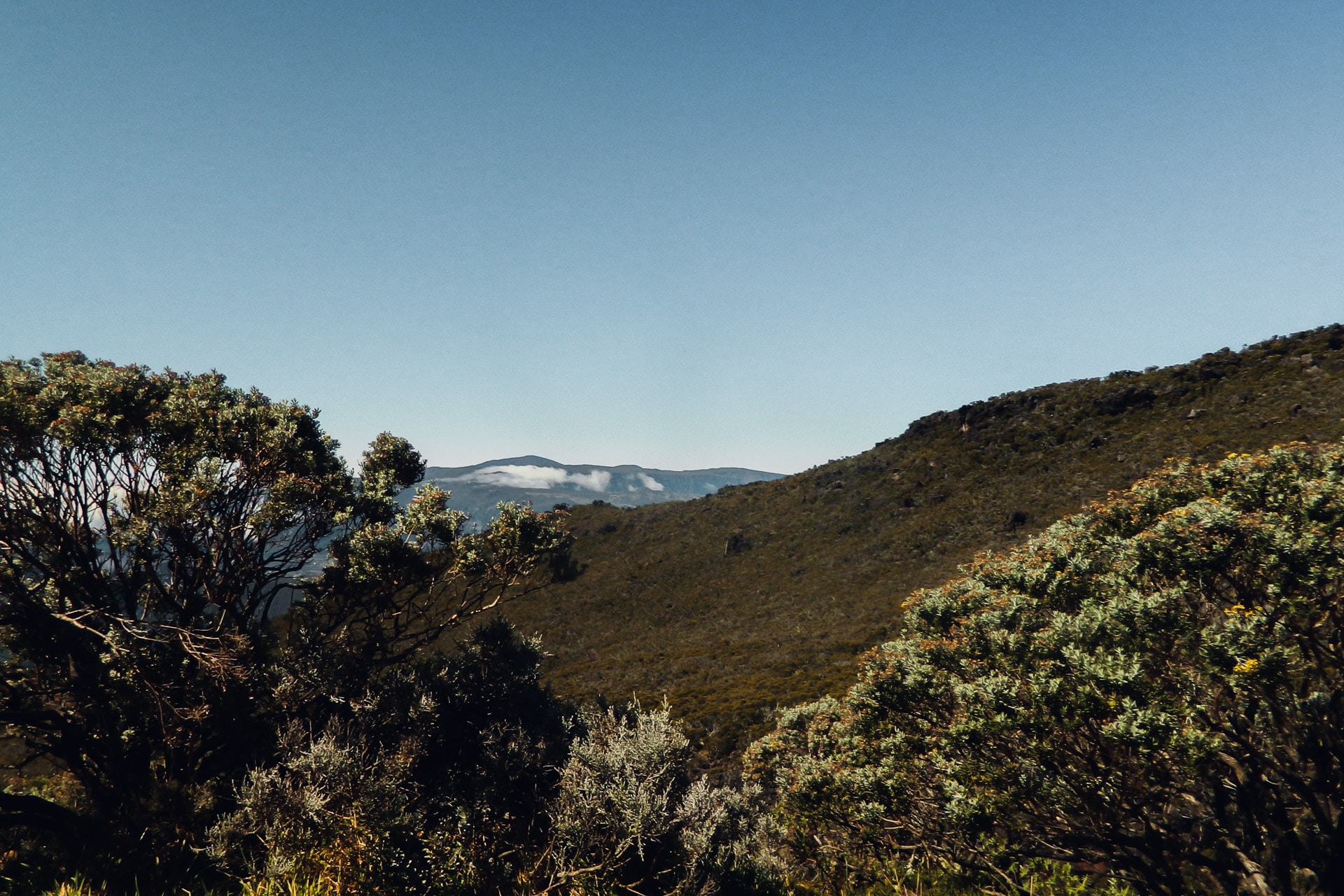
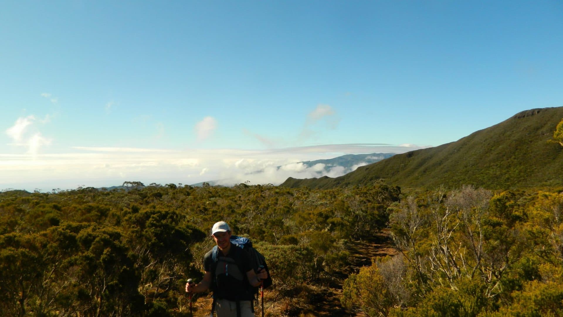
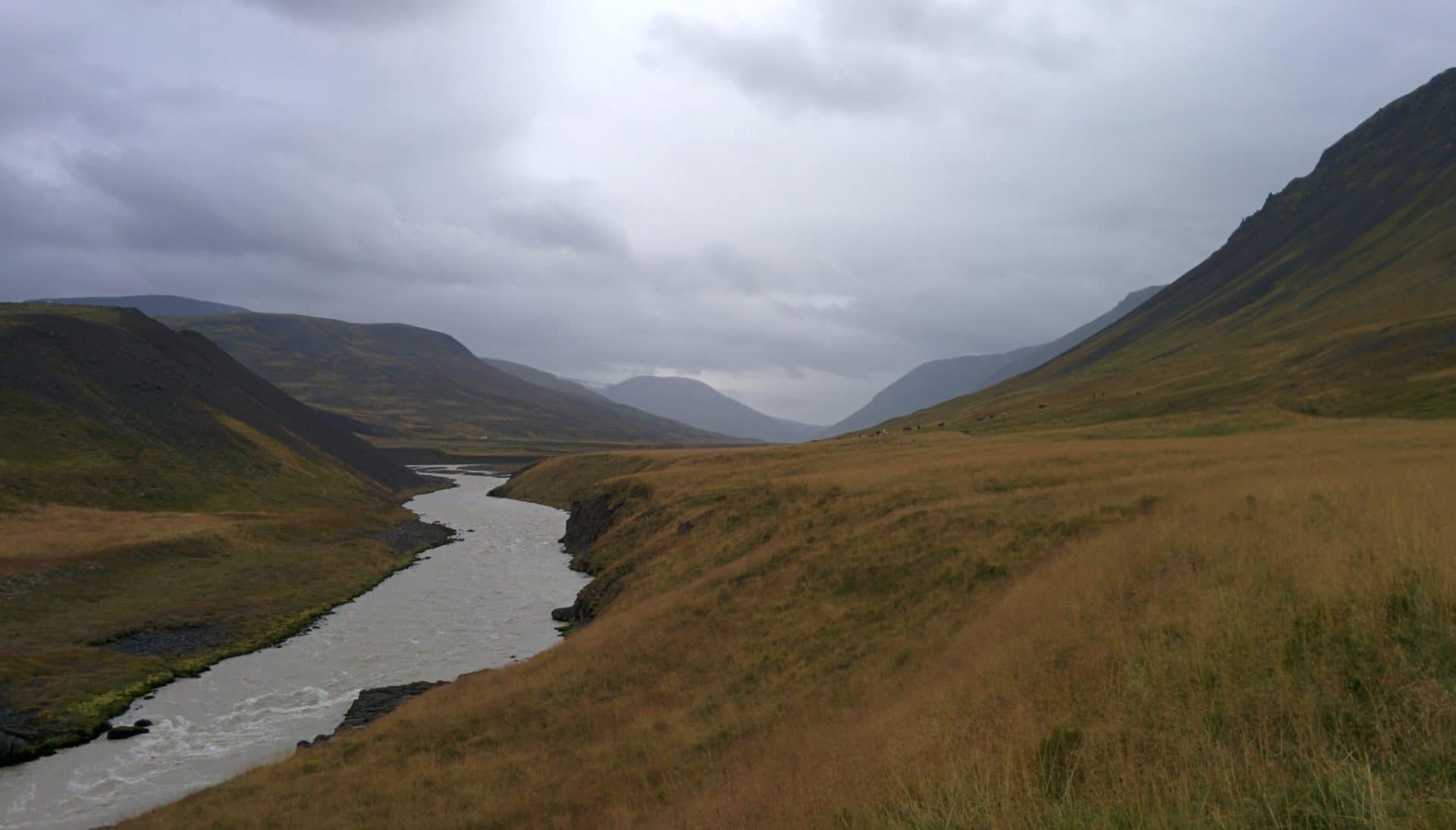
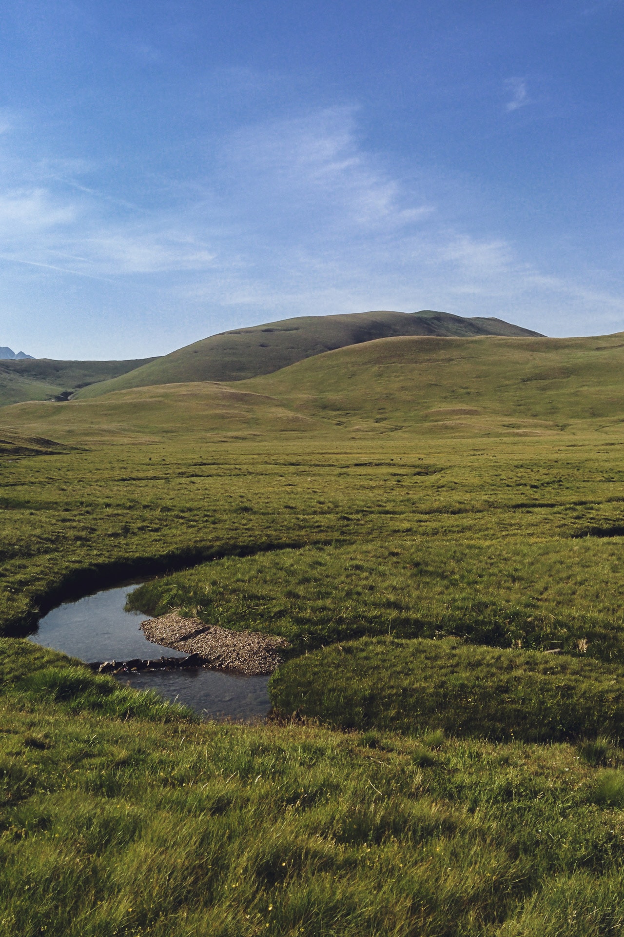
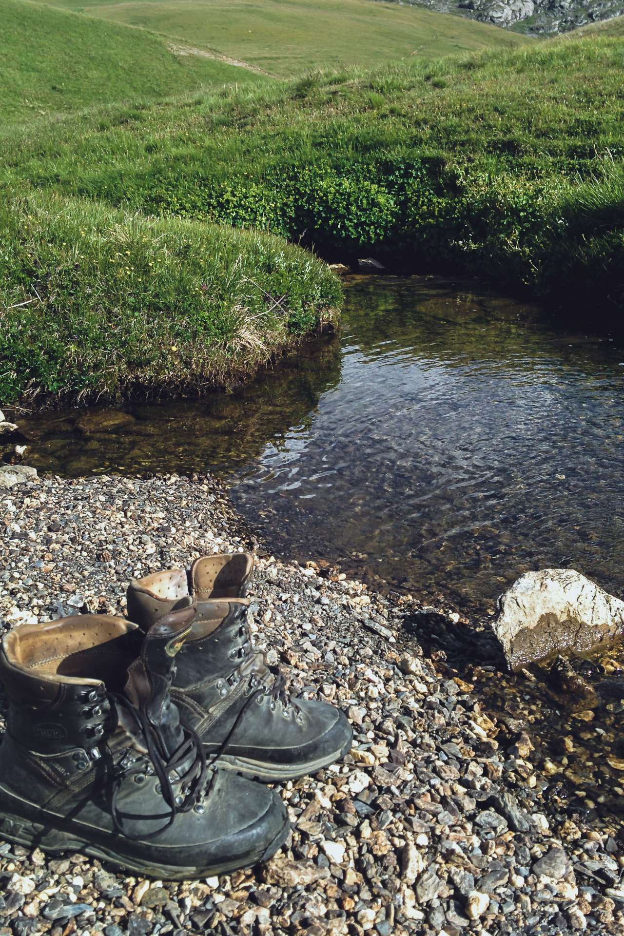
The first part of the trek is done in the rice fields. We are at 1000m above sea level the weather is good and beautiful. The path, well marked, evolves from village to village in a superb setting, there are many religious monuments along the road including the famous chorten which must always pass by the left.
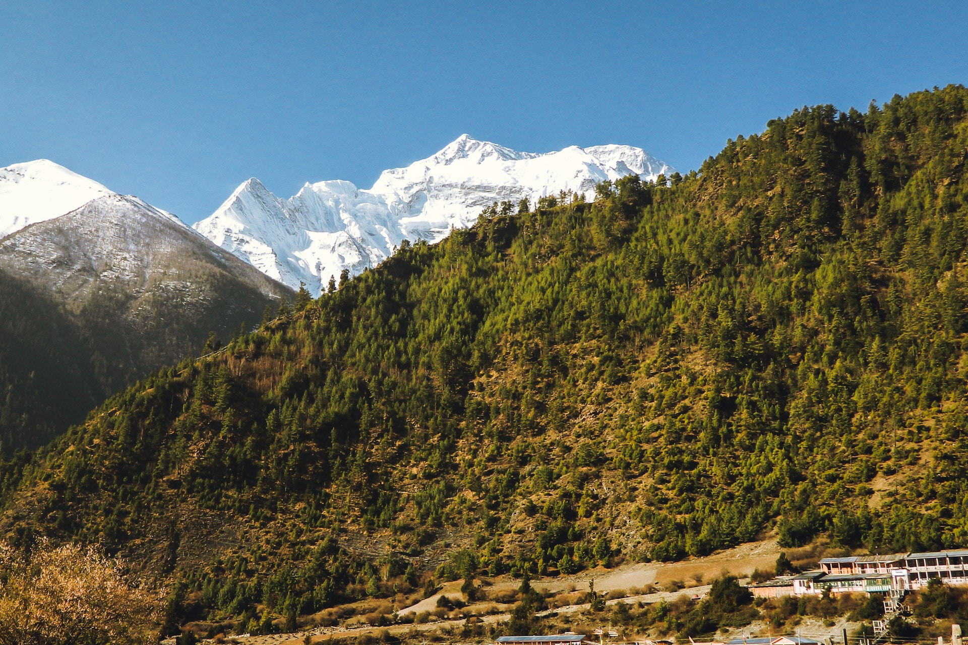
Ngadi (950 m), Jagat (1310 m), Dharapani (2000 m), Chame (2700 m), Pisang (3200m), the path climbs quietly. The stages are well proportioned and allow time to acclimatize.
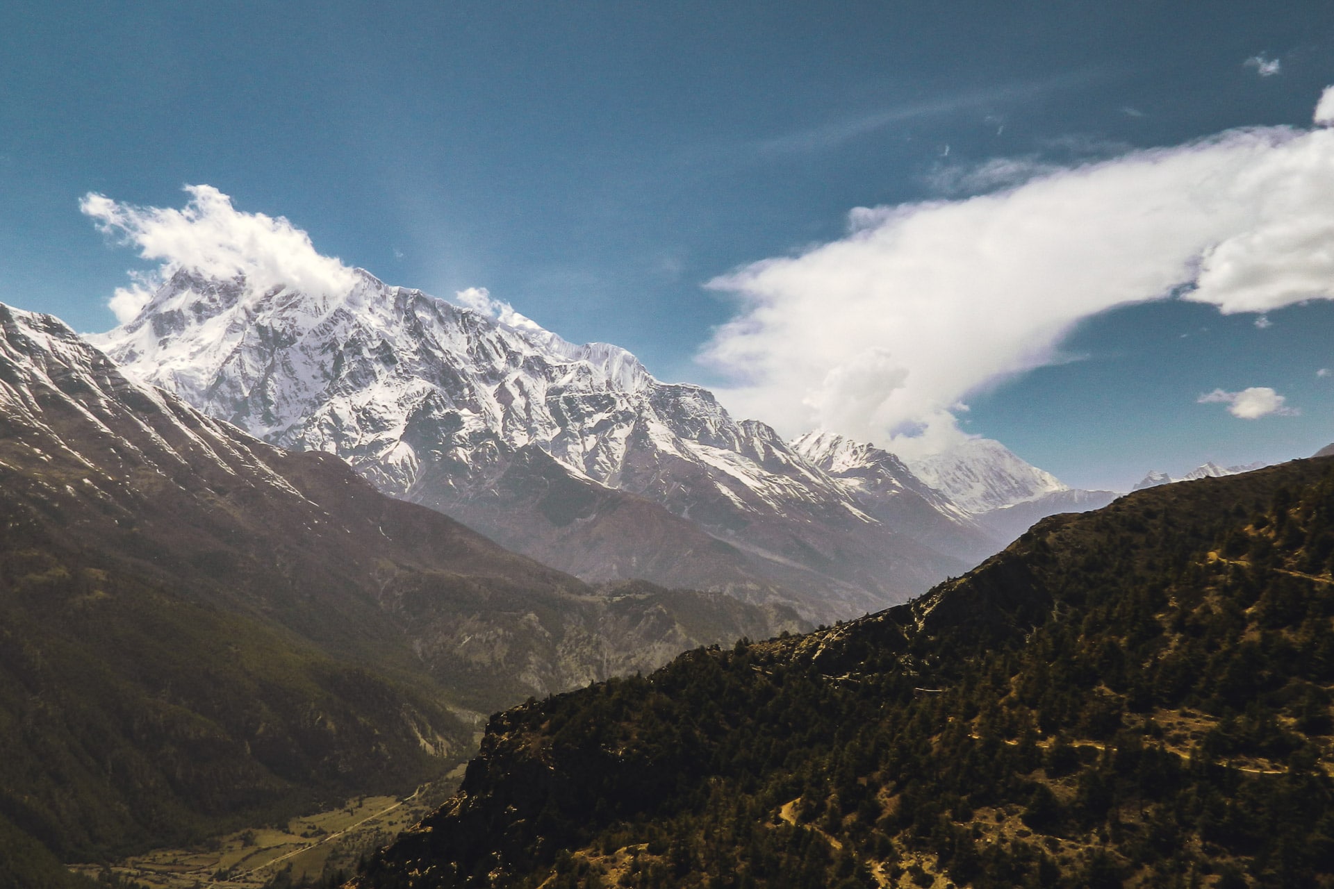
The references in terms of altitude are to be reviewed in comparison to the Alps. Here no snow or mineral landscape at 3000m, there are still quite a few trees (especially conifers).
Part Two of the Trek: High Altitude
The altitude begins to be felt gently from 2500-3000m but it is at 4000m that I started to really feel the effects. It started with a slight headache, but it got worse. The heart beats fast constantly, even when sleeping, which tires. I started to experience a slight loss of appetite but it was still fine. Learn about Mountain Sickness before leaving because you have to know what to do if you are affected.
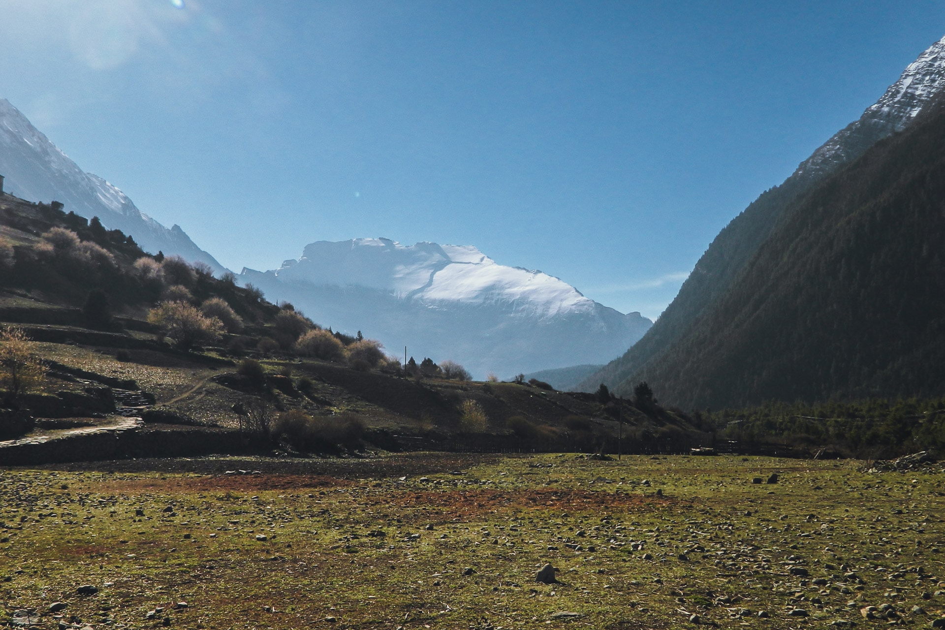
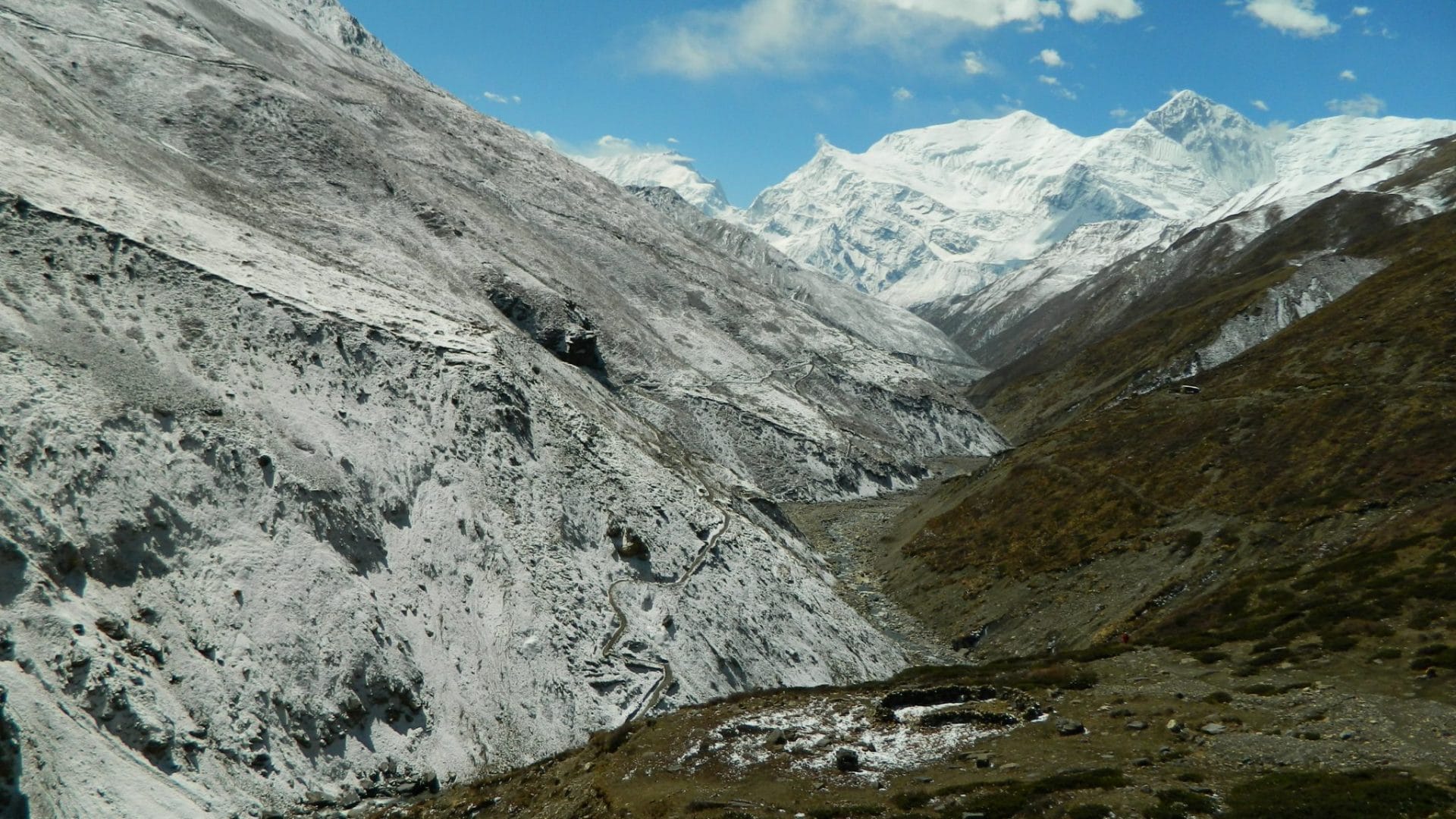
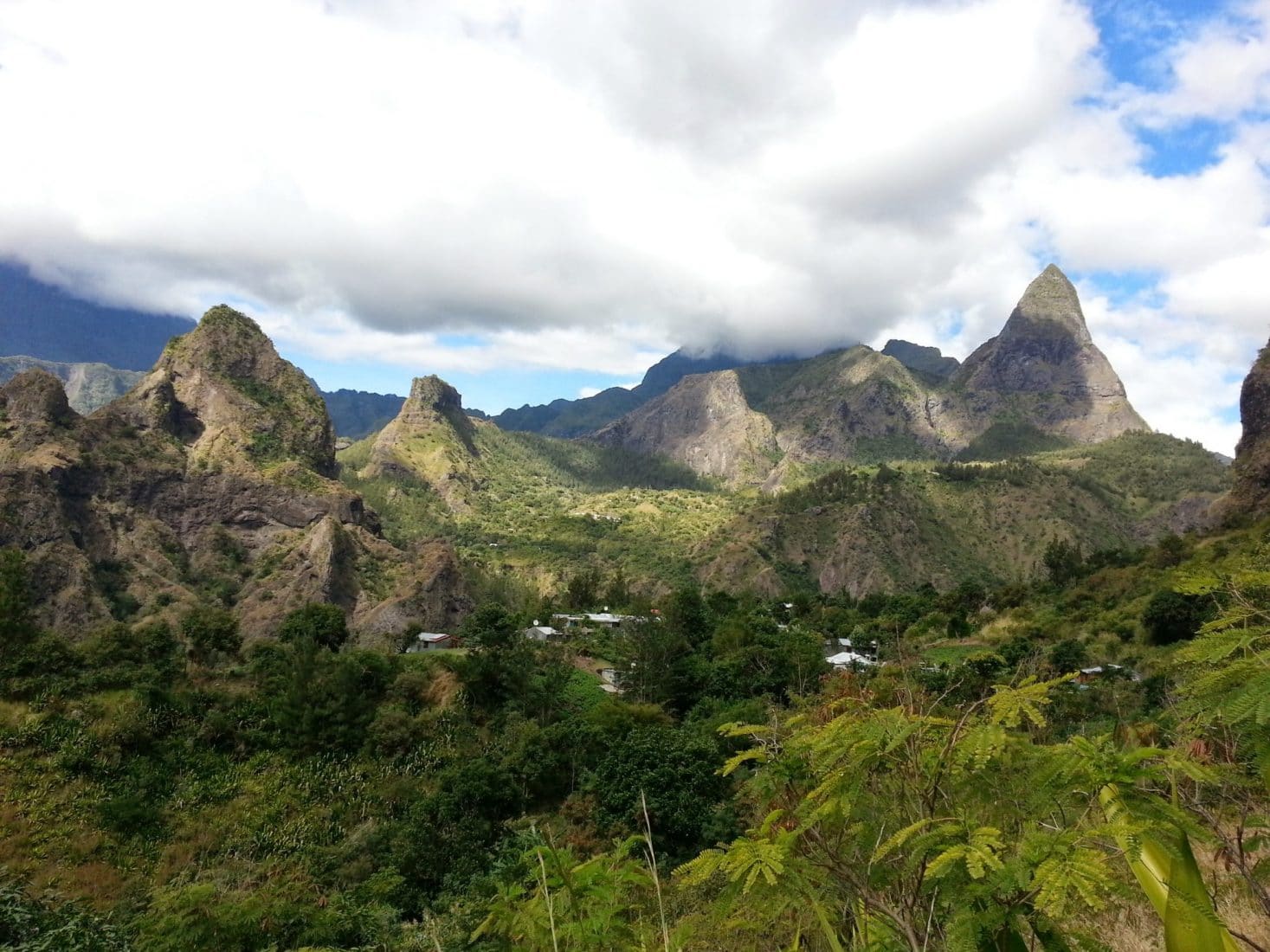
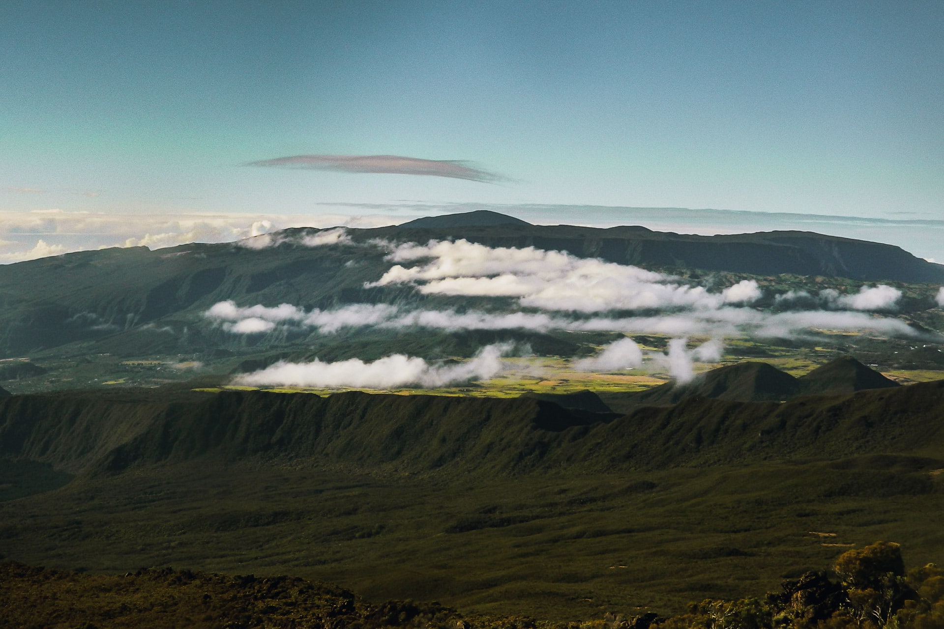
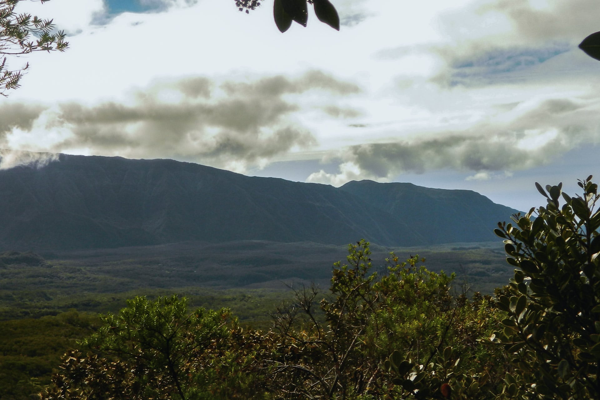
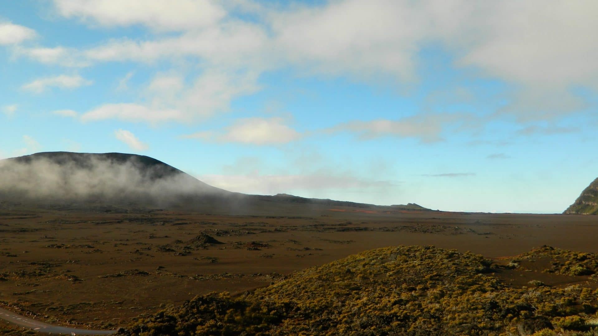
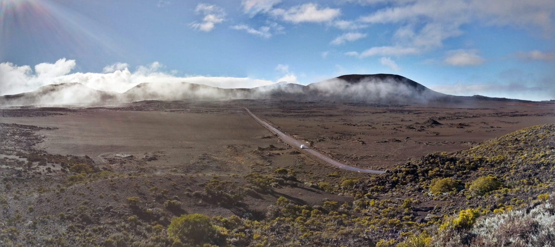
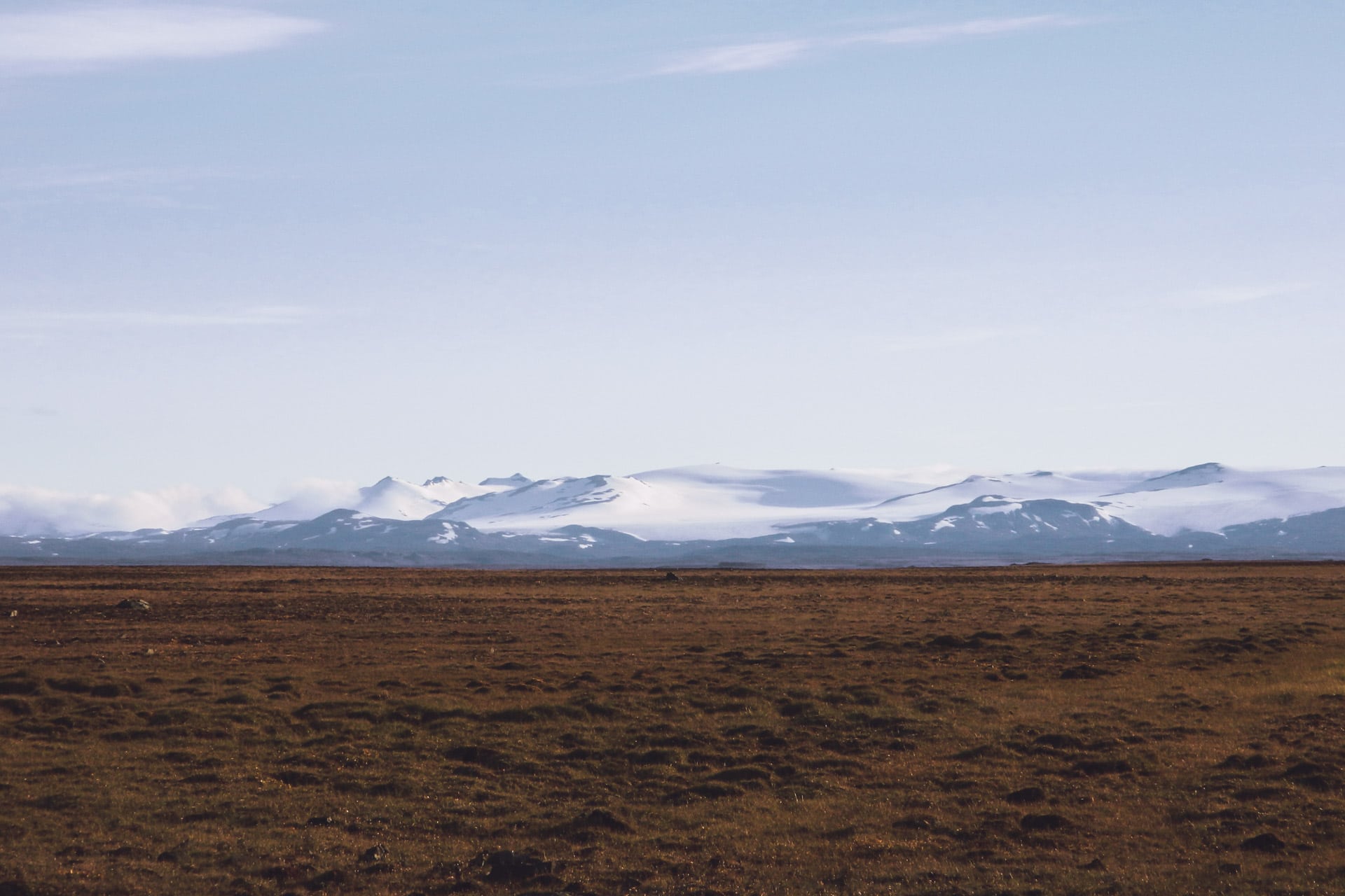
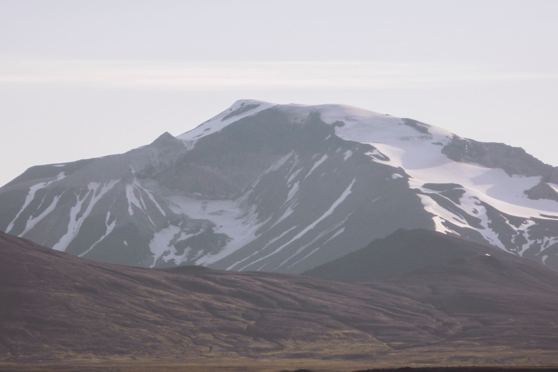
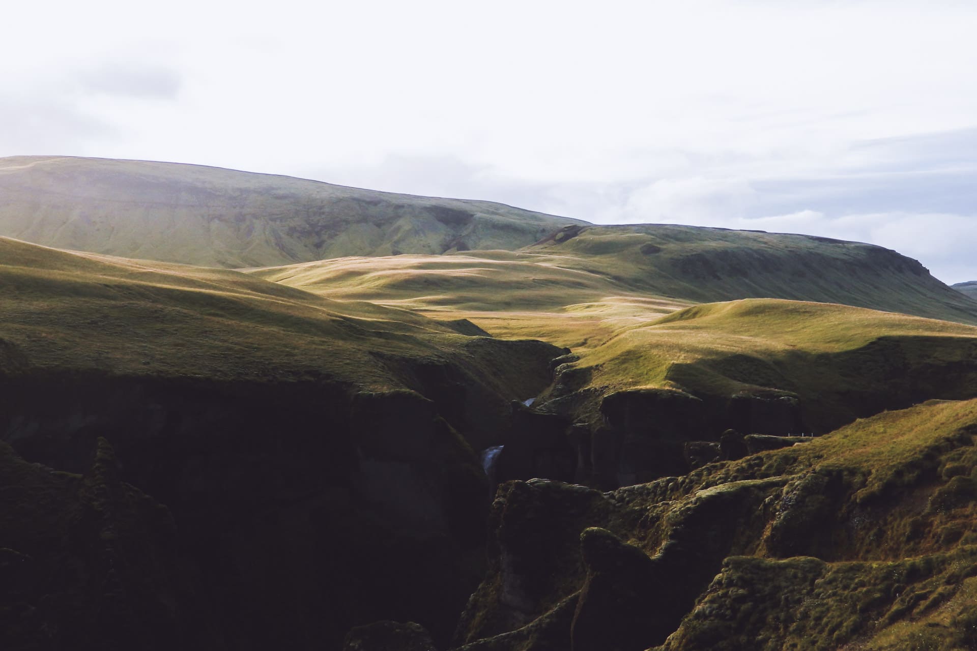
The landscape was getting drier and the vegetation sparse and sparse. We made a day break in Manang to acclimatize. The city is nice, there are day hikes to do or a bakery / pastry shop to recharge your batteries; you can even go see a movie in the local mini cinema. In any case, this break was good.
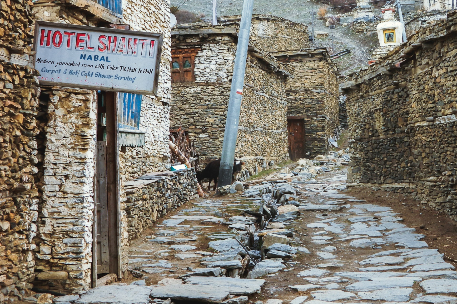
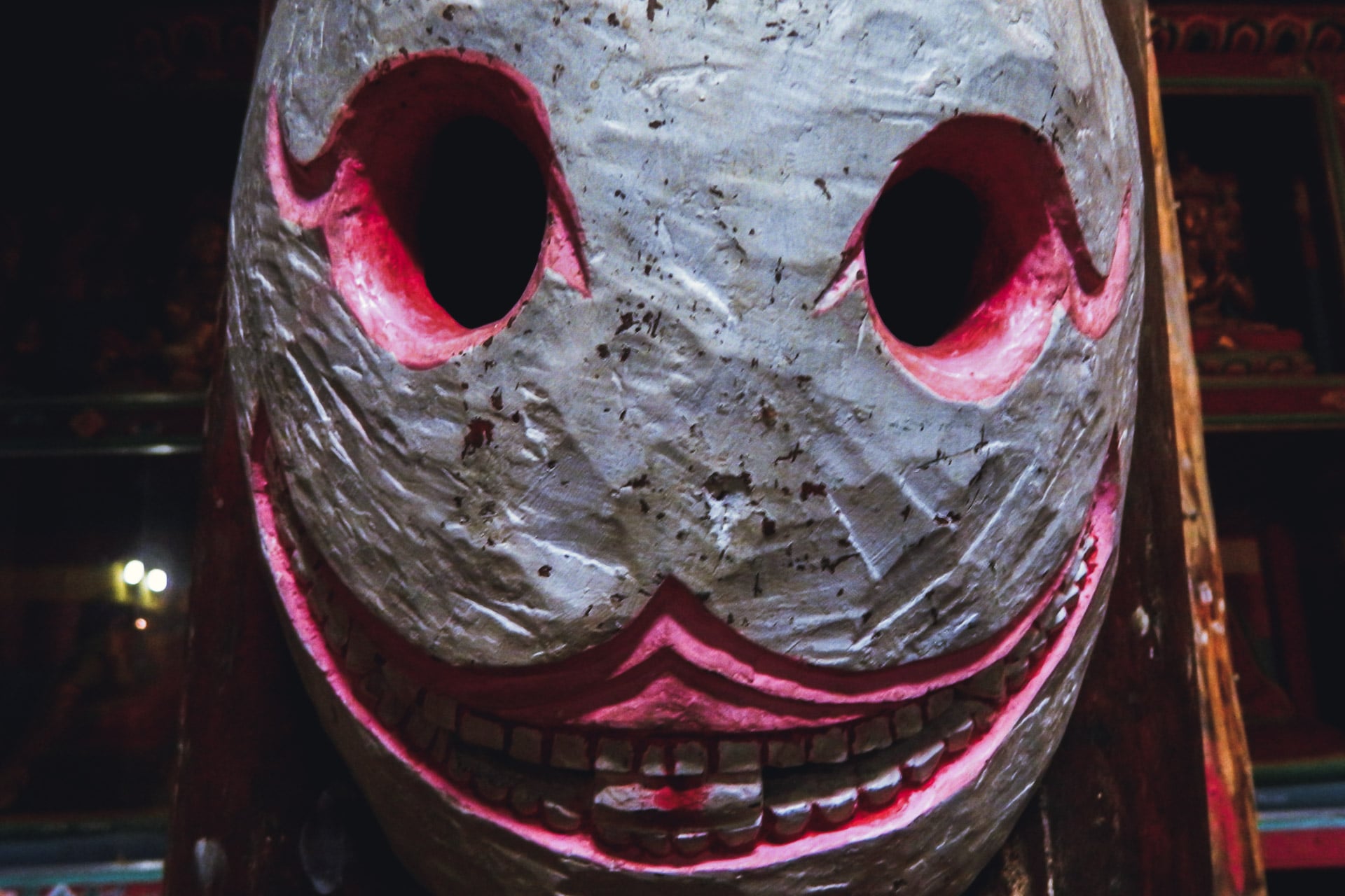
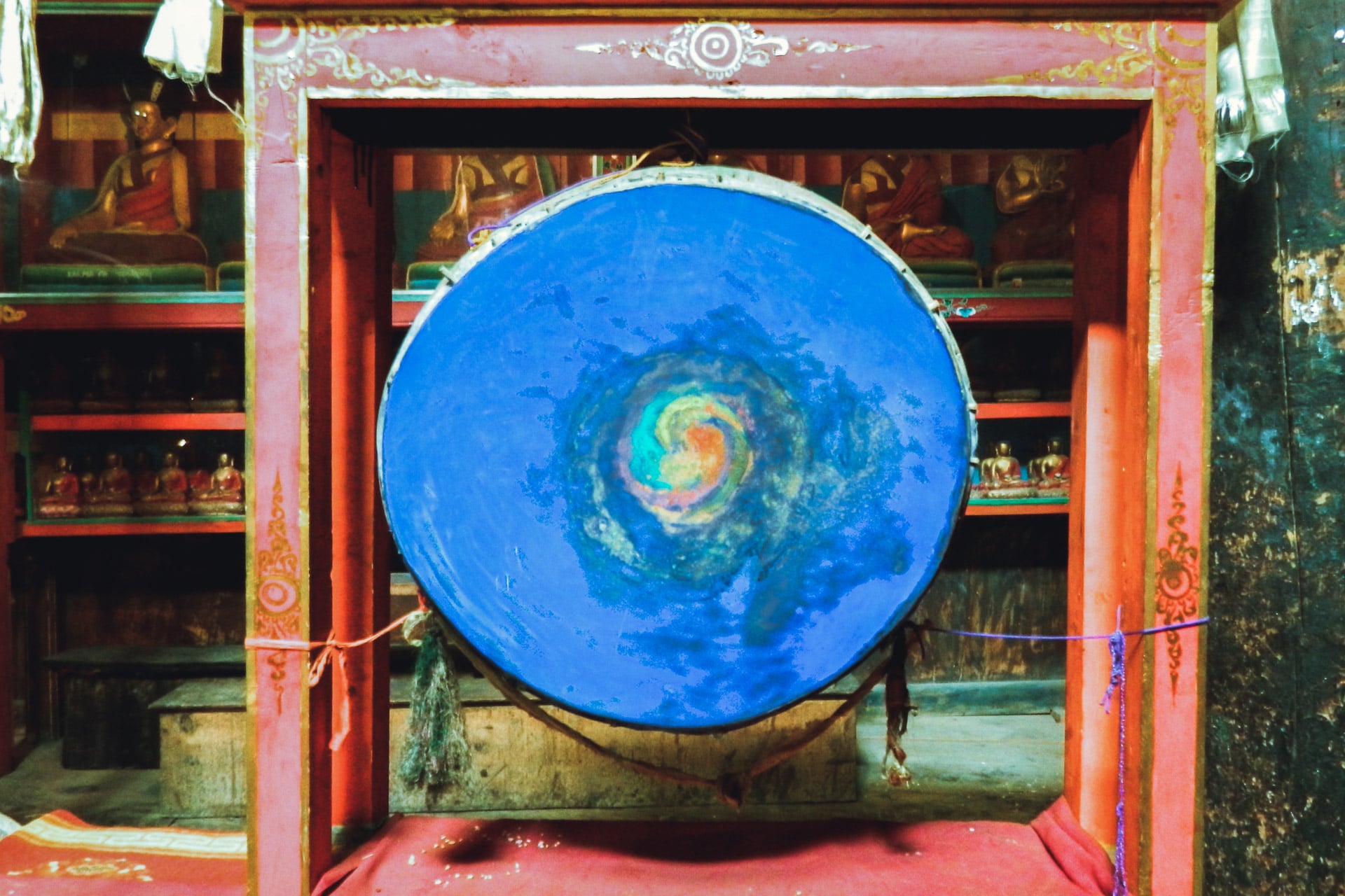
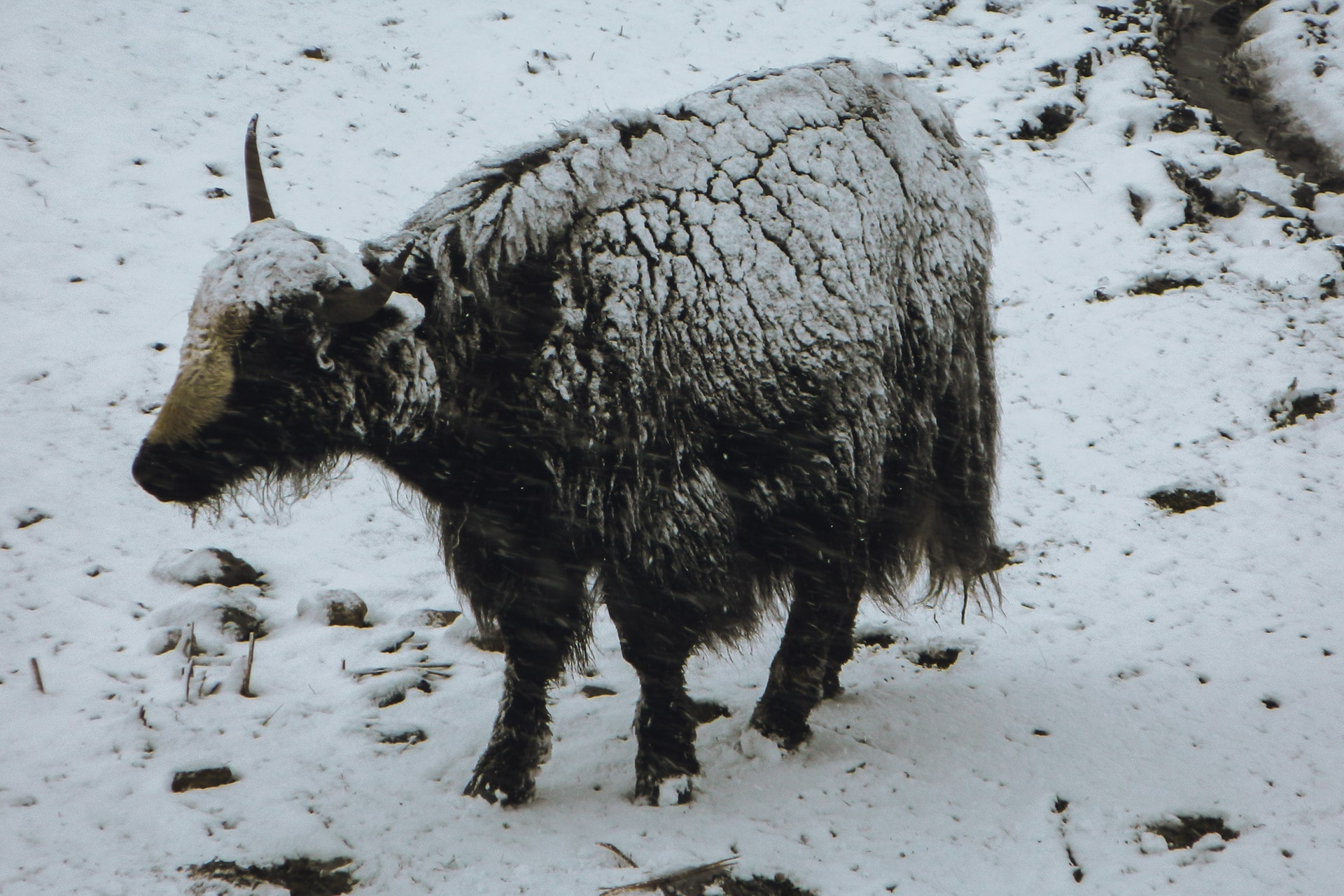
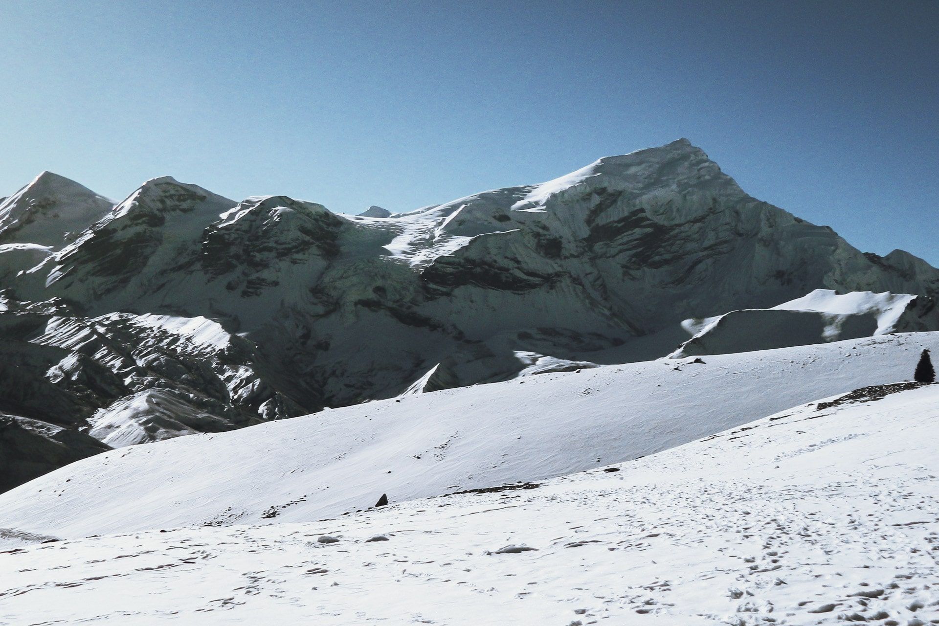
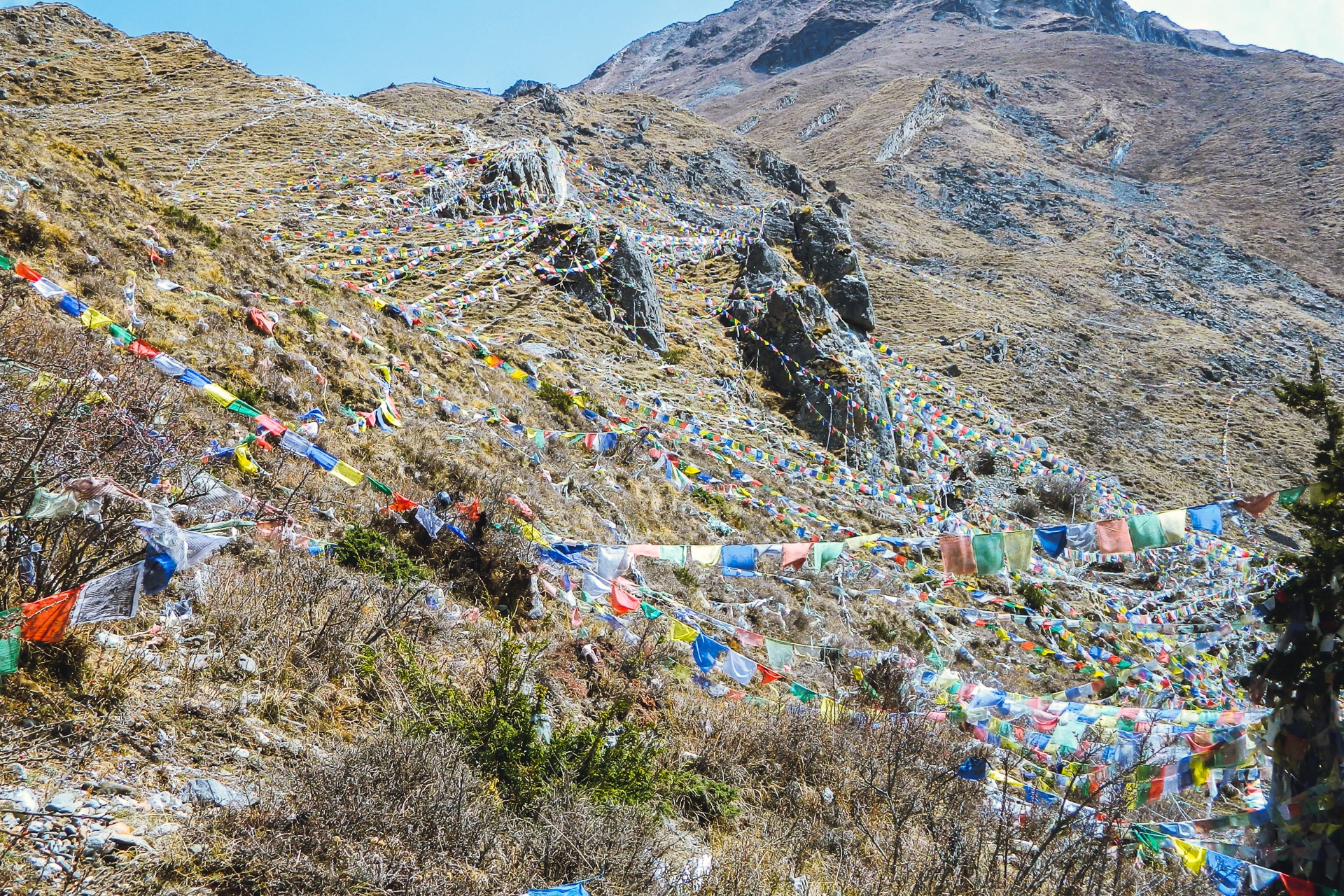
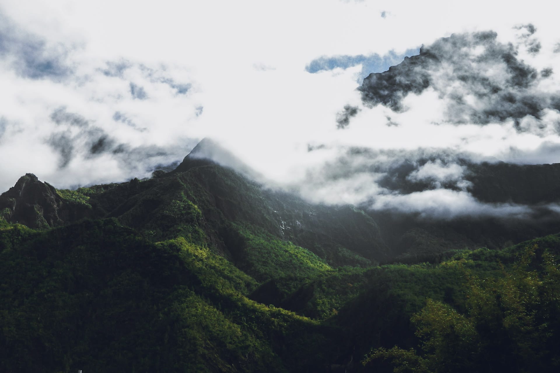
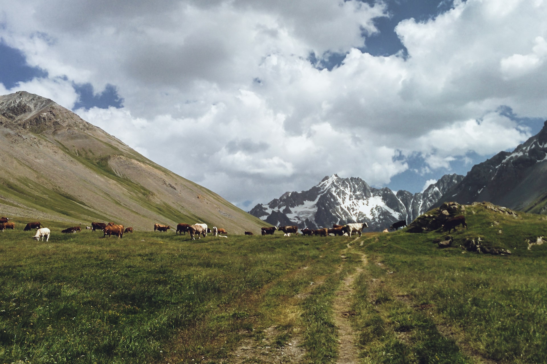
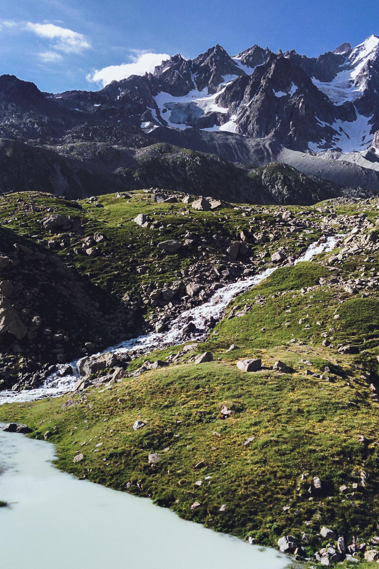
Above 4000m we find ourselves in a truly mountainous environment accompanied by increasingly cool temperatures and sometimes snow. Dzos, hybrid yak, cow, are also appearing. The villages at these altitudes are mainly made up of dry stone house “typical” of what we can also see in Tibet, we will also visit some Buddhist temples on the road highlighting the strong spirituality of the local populations.
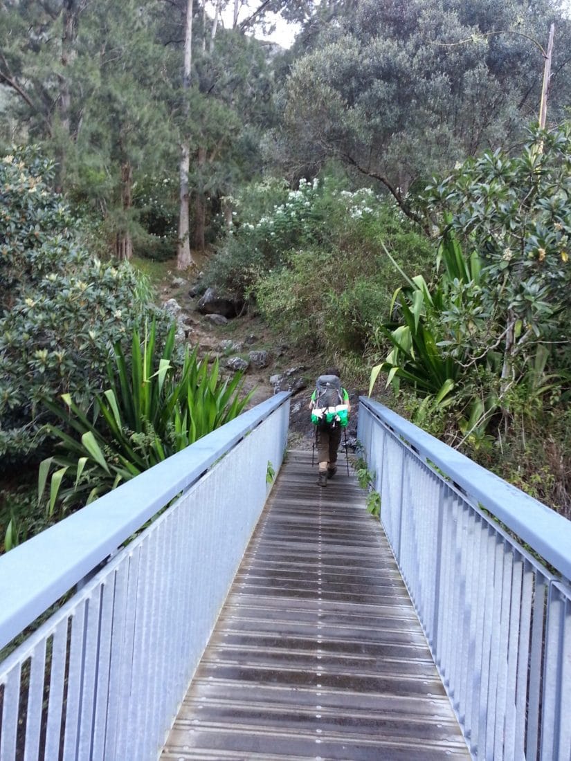
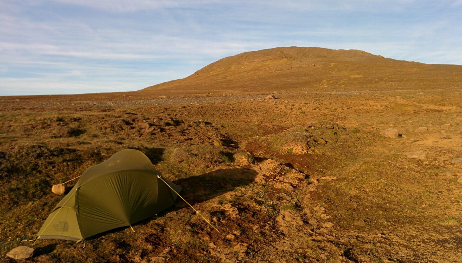
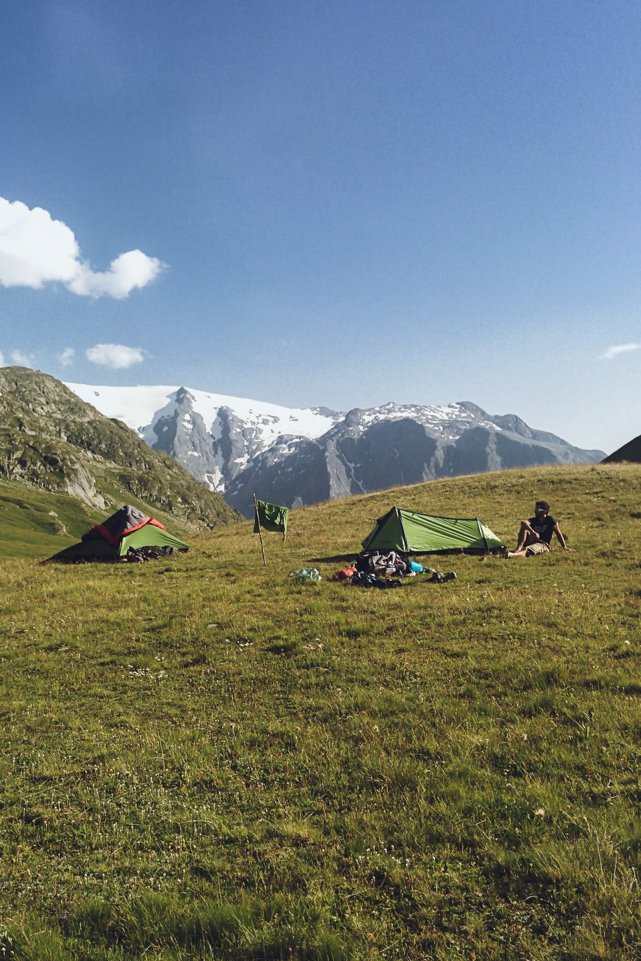
The two days before the pass will be hard due to the altitude. We also all start to have Dal bhat ie rice / lentil that we eat every day. In the evening it is really cold in the shelters but the prospect of crossing the pass motivates us.
The last climb is done in the snow but it goes pretty well on the day of the attack. There are a few hundred meters of elevation down which we slowly swallow. The heart beats very hard in the chest, each step requires a lot of effort (even if you are not that high after all).
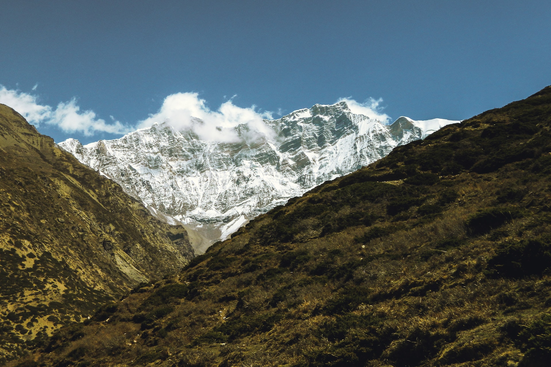
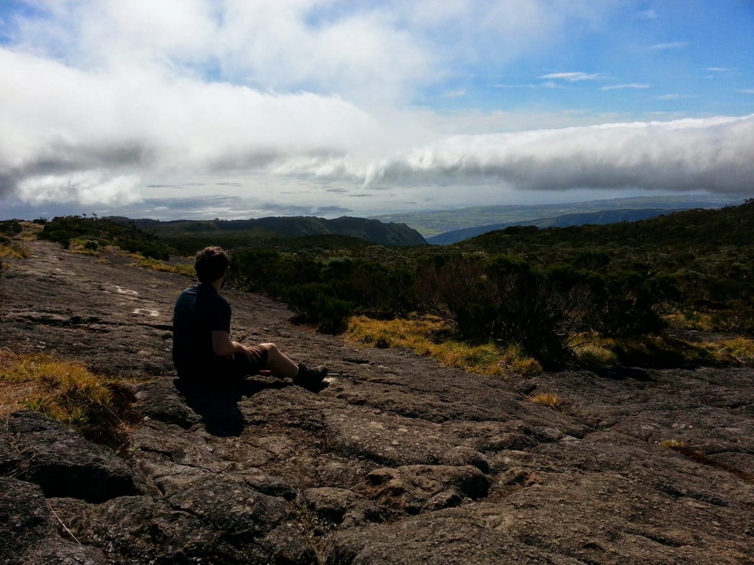
5000m … another 416m. The slope is gentle that facilitates the climb. Overloaded Nepalese pass us without difficulty sending us back to our small condition. The landscapes are beautiful, we feel the strength of the Himalayas; we are surrounded by peaks at more than 6000, 7000 or 8000m.
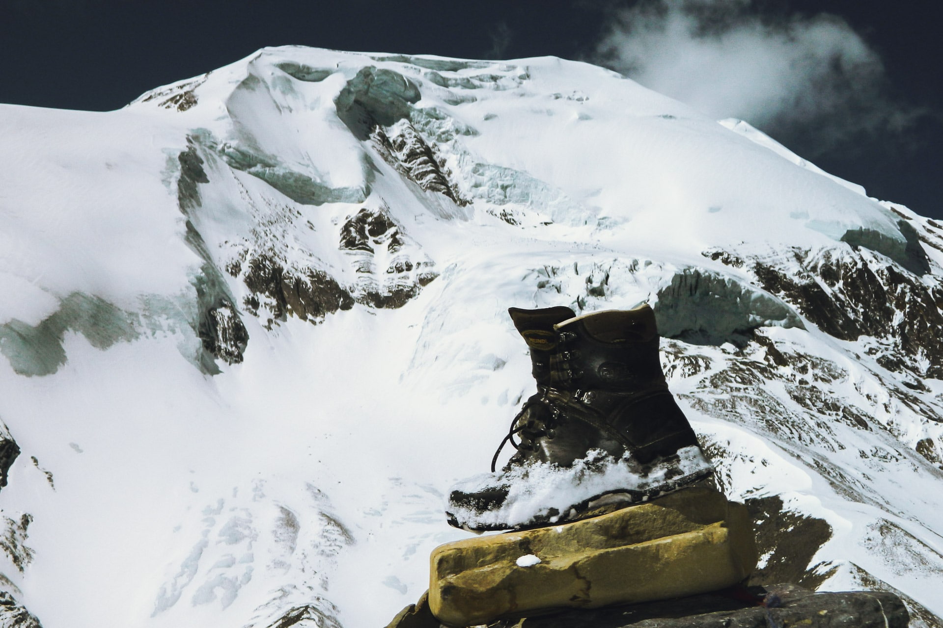
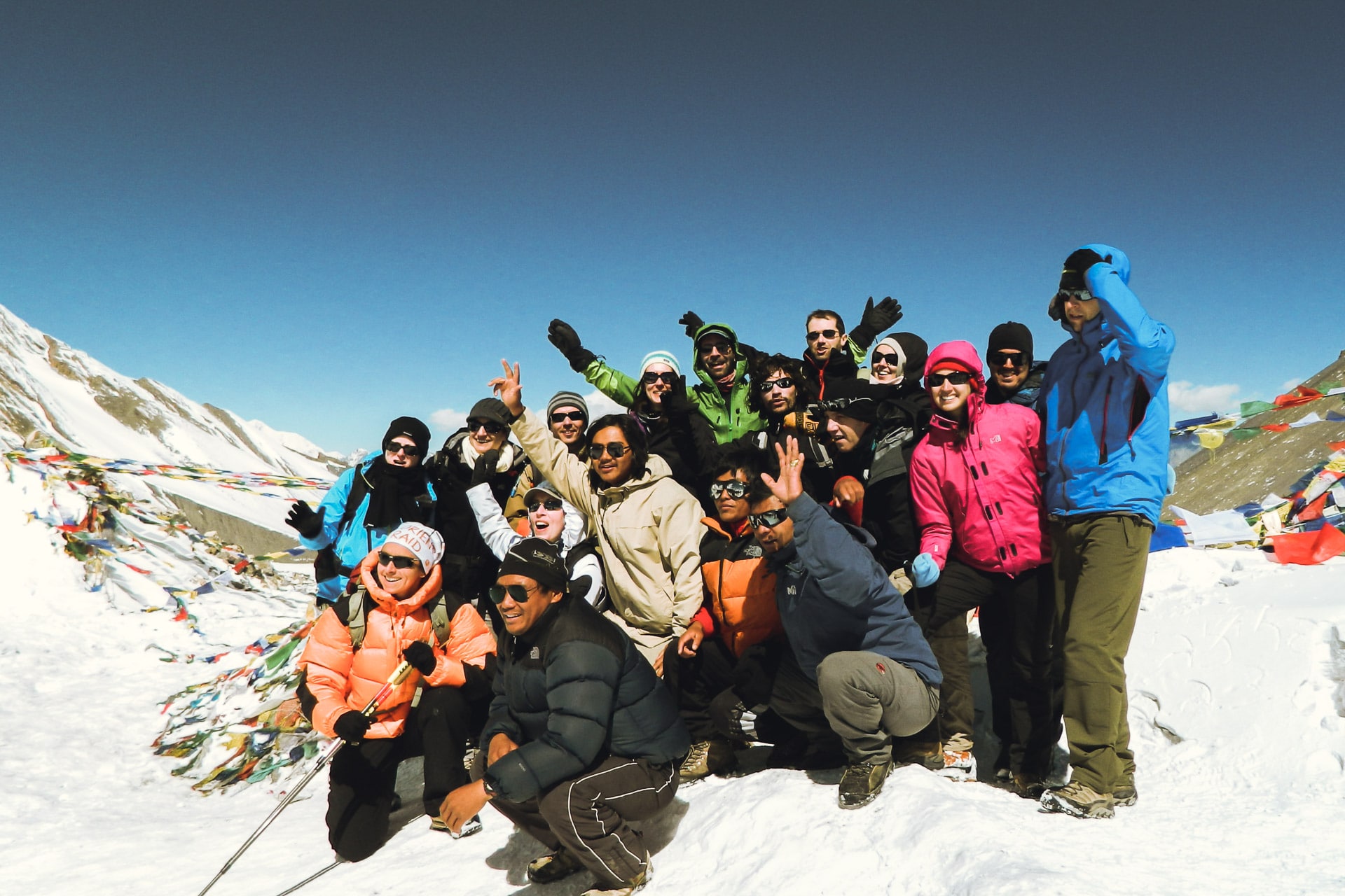
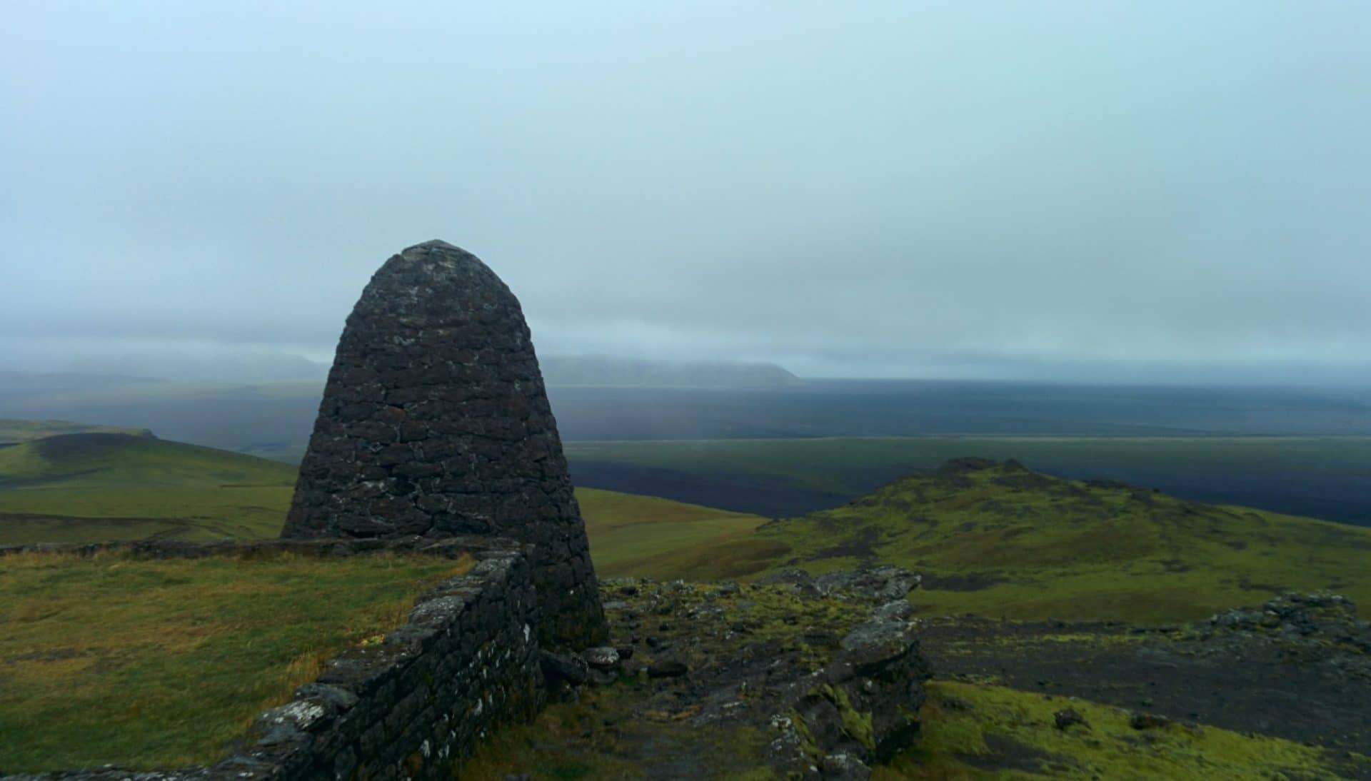
After these efforts we finally arrive at the pass. All the fatigue dissipates to make way for the joy of being there. We were talking about it from the airport over a week ago now. We take the classic photo break in front of the tag at 5416m! A nice moment shared with the group.
Last part of the trek: descent and return
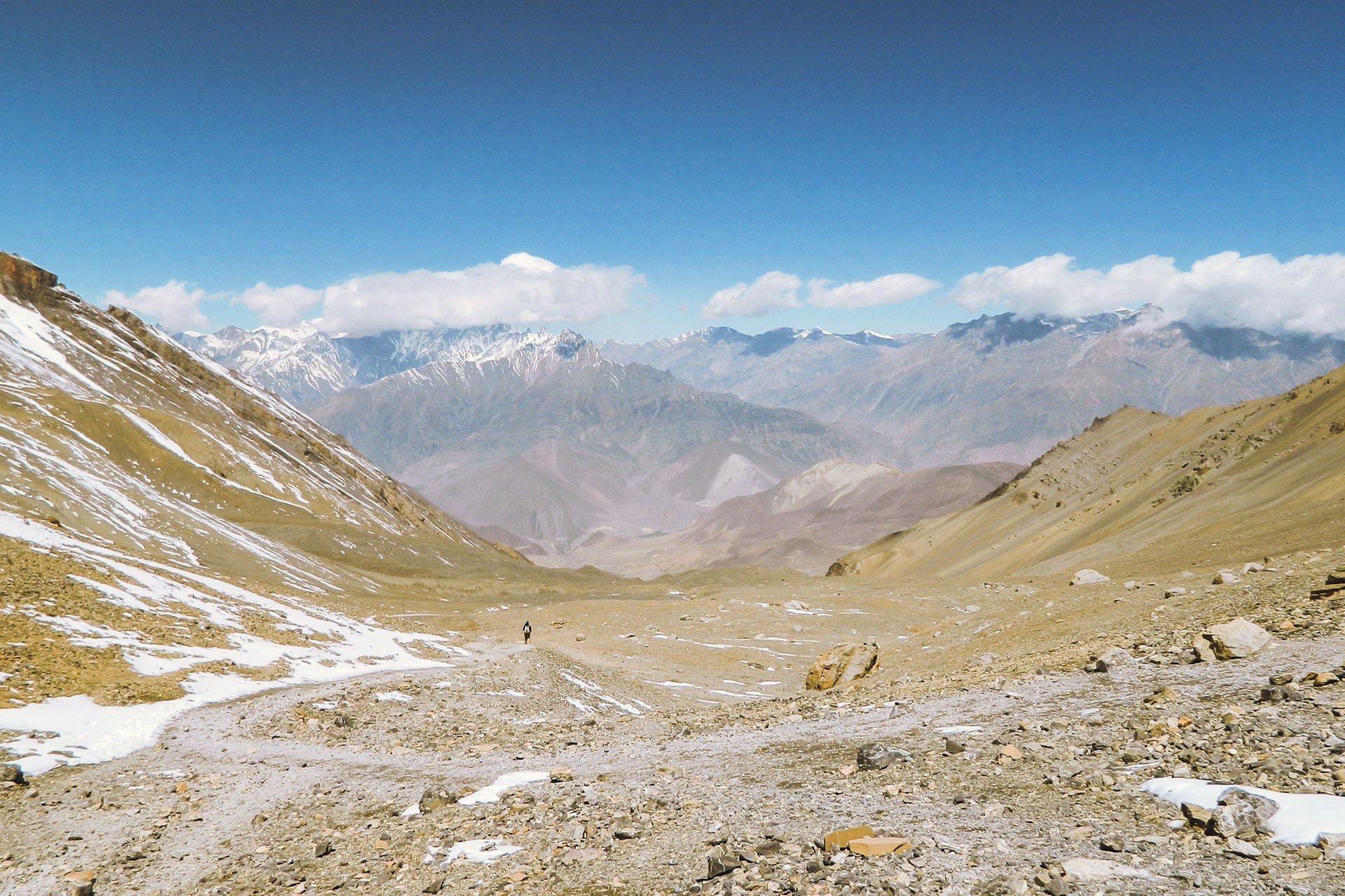
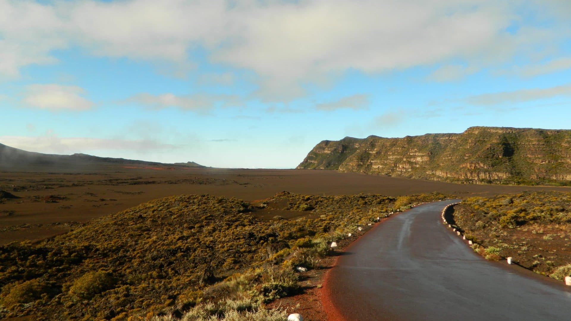
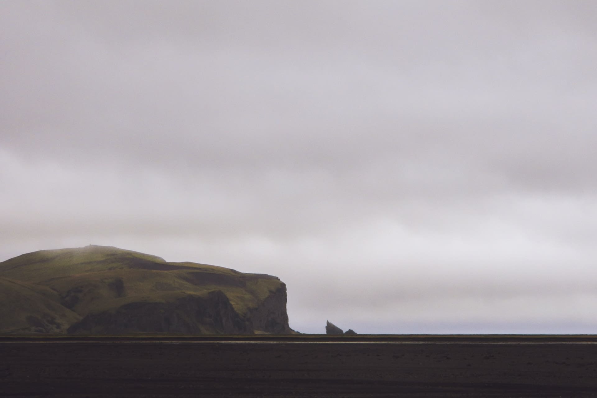
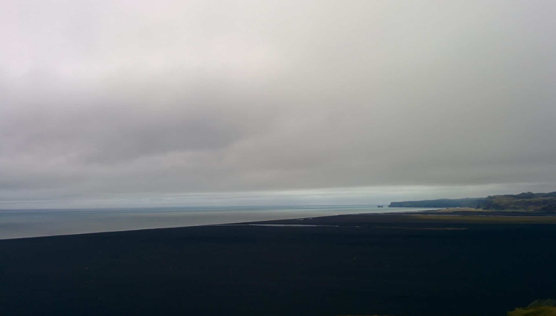
Once the pass is reached we start the descent. The landscape changes immediately, it’s much drier. Indeed the clouds are stopped on the other side of the mountain, here no rain …
The path leads us to Muktinath, a high place of Hindu and Buddhist pilgrimage. We take the time to visit the temple before settling down for the night in a guest house. We will celebrate our pass from the pass based on “Mustang Brandy” with our local guides. A great evening …
We will continue our road until Jomoson through these arid and dusty regions. Lots of wind and sand in the eyes.
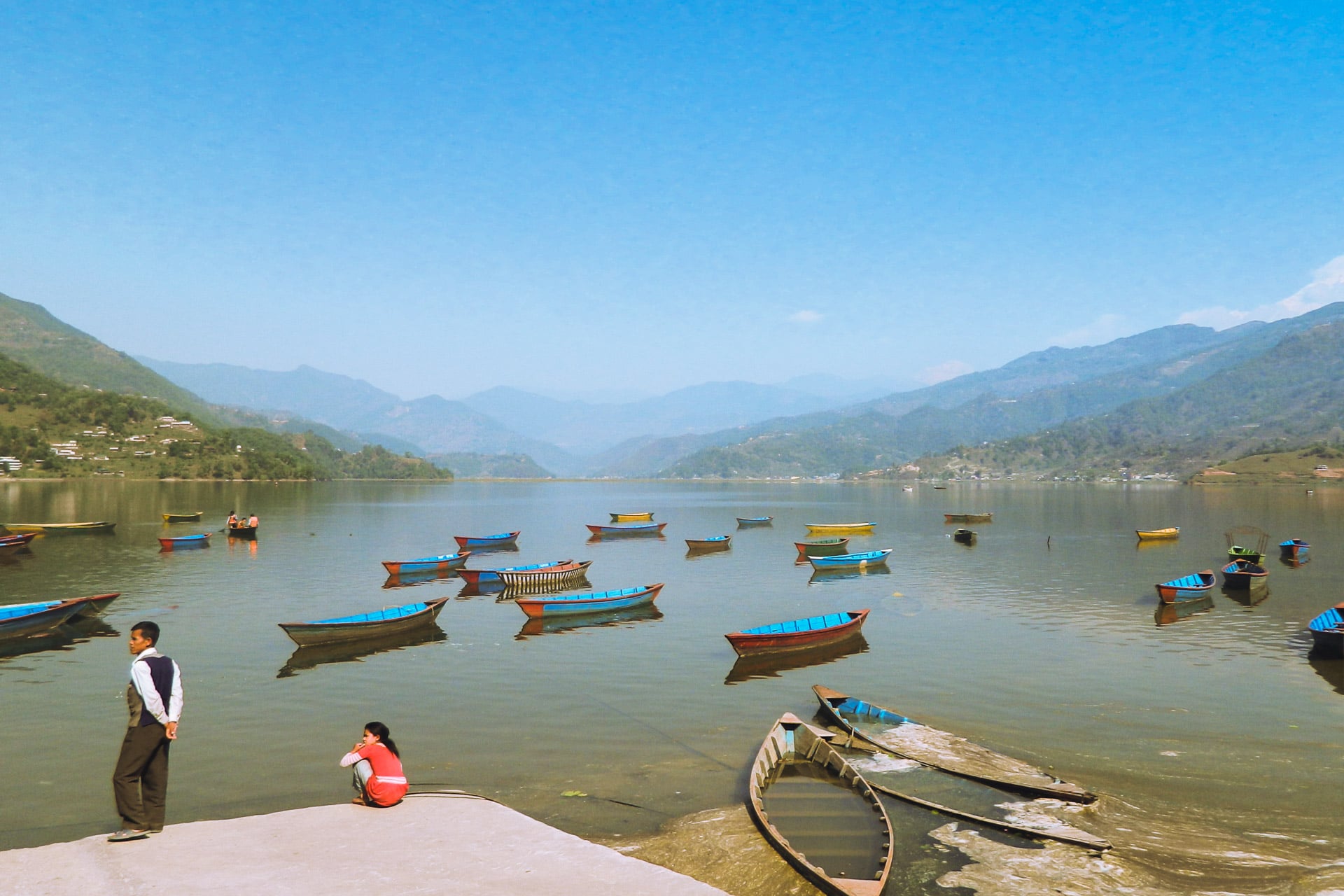
The “real” Annapurna Tour continues for a few more days but we will stop there. Back to Kathmandu but before that we reach Pokhara by plane for a short day of visit, including a temple in the middle of the lake. The city is very nice, I would have liked to spend more time there.
We will spend the last day in Kathmandu to visit the city and especially Durbar Square. This city is definitely worth visiting and spending some time there.
Conclusions
It’s already the end of the trip and the return to France. Nepal will have kept its promises by offering us magnificent landscapes and contact with a rich culture. The Annapurna Tour is perfect for tackling long treks. The physical difficulty is moderate and constant, only the altitude can be a little complicated to manage. I went through an agency as it was my first long hike but this trek is completely achievable alone, you just have to manage the few administrative formalities.
Small negative point: a road is being built towards the pass, so it is now necessary to go there before the road is finished (if it is not already the case) and that streams of tourists disembark in 4×4 …
Nepal has an infinite number of trekking and hiking possibilities, in particular the Everest base camp trek (a great classic) or the Manaslu tour (more wild). I don’t know when yet but I’m sure to go back …
Reunion Island Crossing
10days
trekking
140km
walked
9000m
D+
3070m
Altitude of the Piton des Neiges
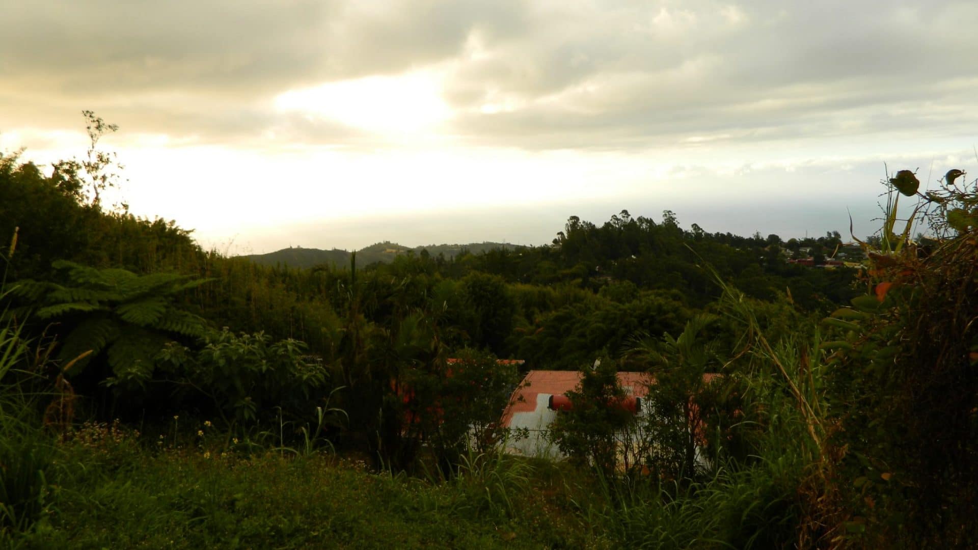
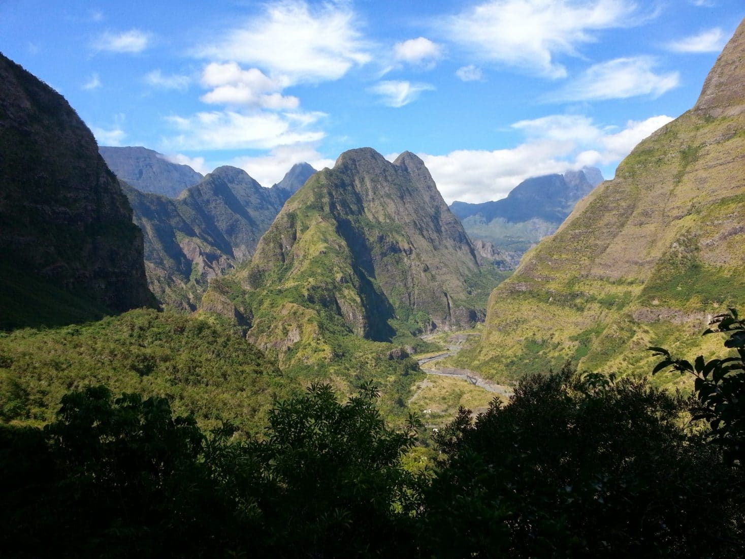
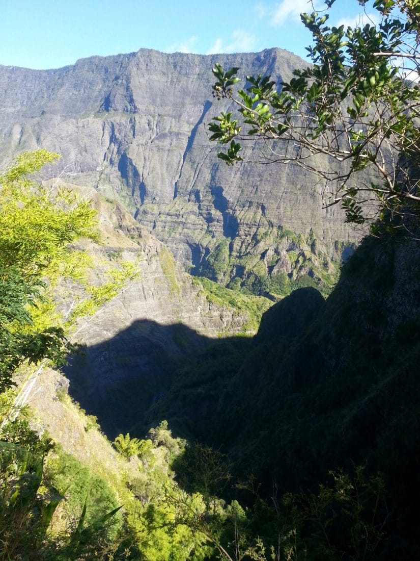
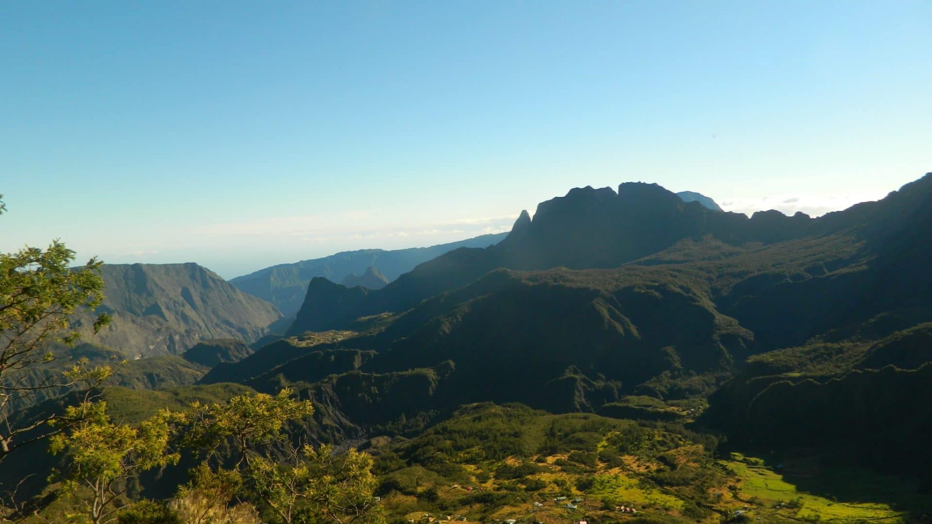
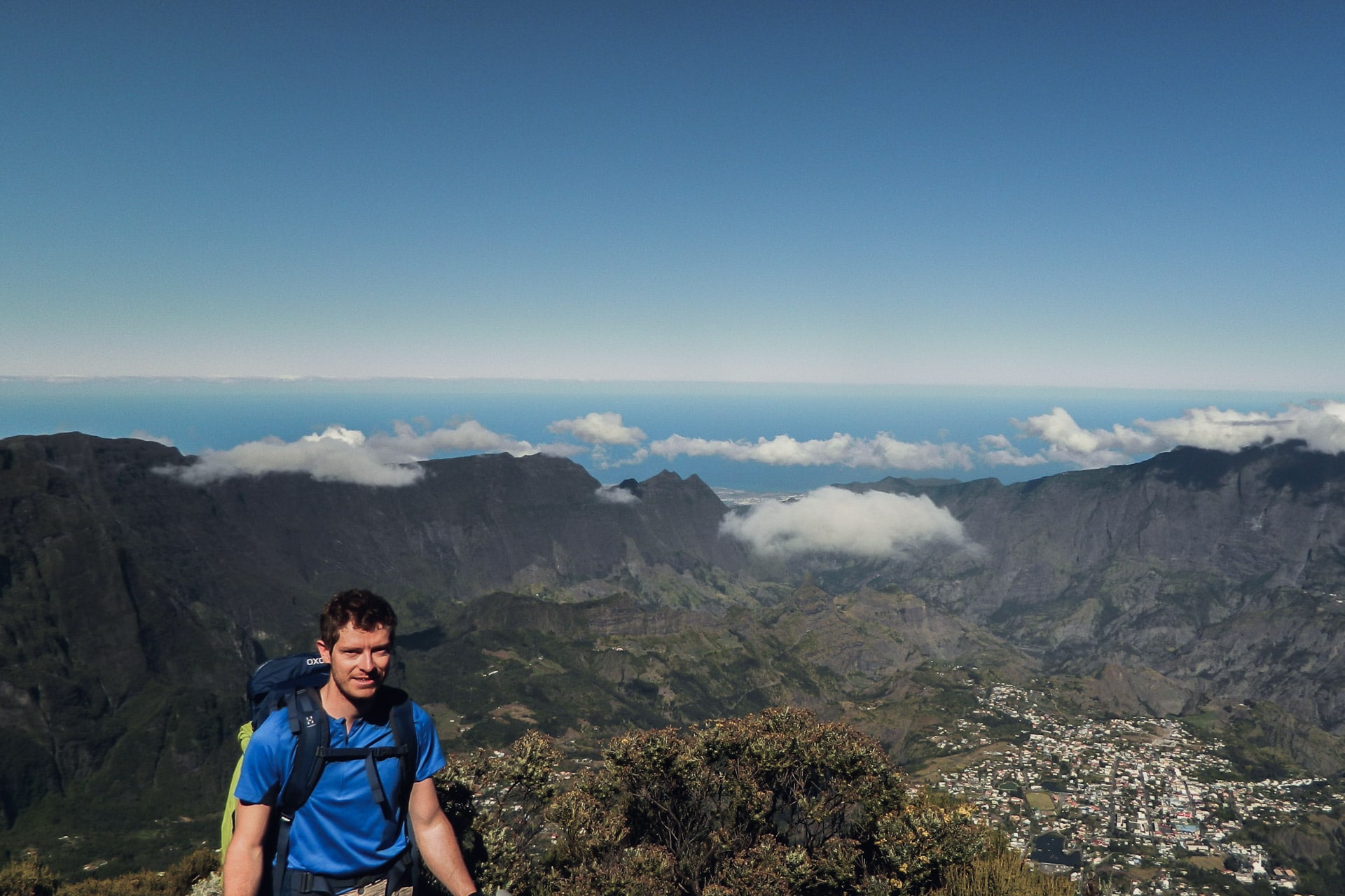
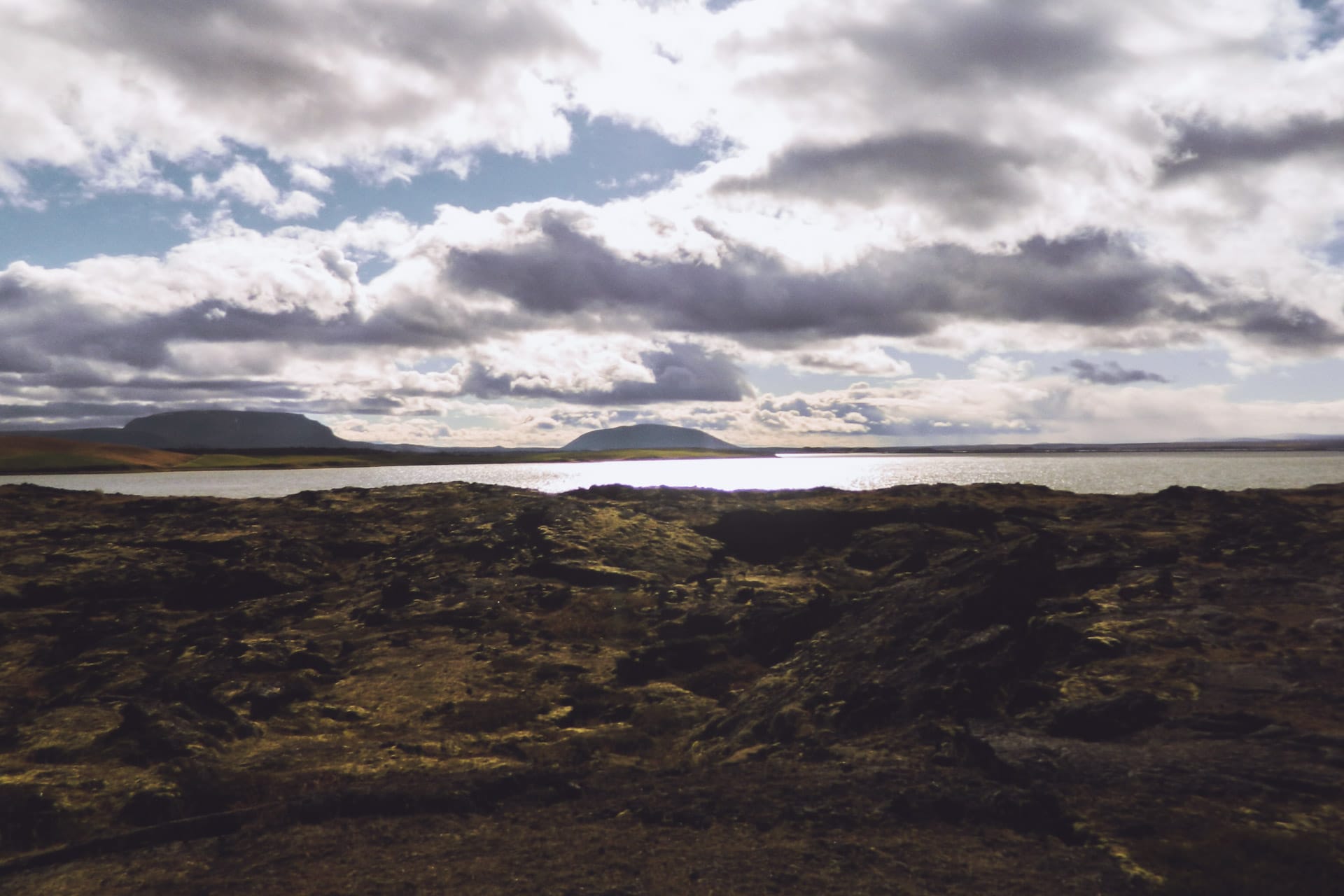
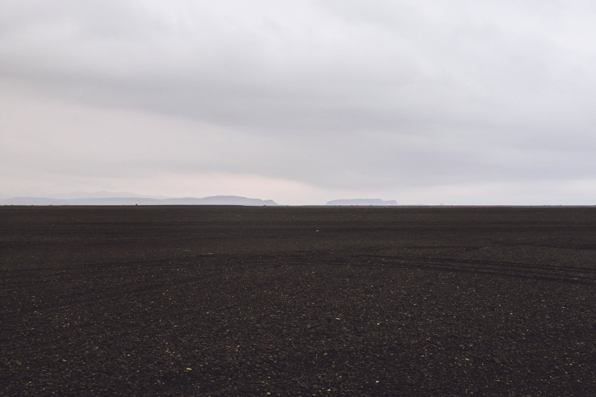
Located in the heart of the Indian Ocean, Reunion Island is a real treasure in terms of landscapes, culture or hiking. In order to better discover the island and in particular the Cirque de Mafate, we decided with Arthur, to follow the GR-R2 which crosses the island from side to side.
With a length of 140km and with about 8000m of elevation gain, the route starts from Saint Denis, in the North West and joins Saint Philippe, in the South-East passing by Cirques of Mafate and Cilaos but also the Piton des Neiges and that of the Furnace. The landscapes that it crosses its magnificent and the immersion in the atmosphere of the island is total.
Cirque or Circus are roughly circular depression closed by high clifs due to local volcanism. There 3 in La Réunion : Mafate, Cilaos and Salazie.
Few words about La Réunion
With its 2500km² and 150km in diameter, the island of Reunion is a small piece of land lost in the Indian Ocean located a few hundred kilometers east of Madagascar.
Its location, not far from the Tropic of Capricorn, makes it enjoy a tropical climate neither too hot nor too cold. One of the particular points of the island is the diversity of landscapes: humid tropical, dry / arid, even temperate … and the transition from one climate to another is sometimes very fast. This is due to the fact that Reunion is bathed by the Alizés winds, which bring the rain to the east on the “windward coast” and which are stopped by the central relief of the island and which thus dries up the “coast under the wind “in the West.
Reunion Island is a recent volcanic island following geological times, indeed it was born just 3 million years ago. It culminates today at 3070m with the Piton des Neiges, the original volcano of the island. Volcanism is today concentrated in Piton de la Fournaise (2632m). It is also one of the most active volcanoes on Earth, it is characterized by an effusive hot spot activity.
The age of the island and its isolation have fostered a strong endemism of animal and plant species.
Its “modern” and human history began in the 16th century with the first explorations by the Portuguese. The island is then totally uninhabited. The French landed in 1642 and invested in the name of the King by baptizing Bourbon Island in honor of the Royal family. It was not until the French Revolution (1793) that it was renamed Reunion Island, on the one hand to erase its “royal” past and on the other hand to pay tribute to the Meeting of the National Guards and Paris Fédérés de Marseille during the “attack” of the Palais des Tuileries in 1792.
Reunion is today a mixed land where live together populations of Malagasy, African, Asian or European origin. One can cross in the same street a Church, a Taoist temple or a Mosque. This crossbreeding has given its beautiful culture to the island, miscegenation that is also found in the local cuisine that mixes all these influences.
Day 1 : Arrival and first kilometers
The appointment was given on May 23 at Orly, I joined Arthur with whom we will therefore go to Reunion during these almost three weeks. The flight to Saint Denis lasts 10 hours, it is done by night it is perfect to arrive not too tired in the morning.
We were expected at the airport by the family of my friend Julien. After a jump at their home to drop some stuff that we will take back, they take us to a local restaurant to begin to discover the local culture / gastronomy. We discover in particular the Goyavier, a small red fruit that we will often enjoy during the trek. After this good meal, the last good meal for a few days, the family of Julien drops us at the beginning of the path to Providence. Their welcome was very nice and I thank them again.
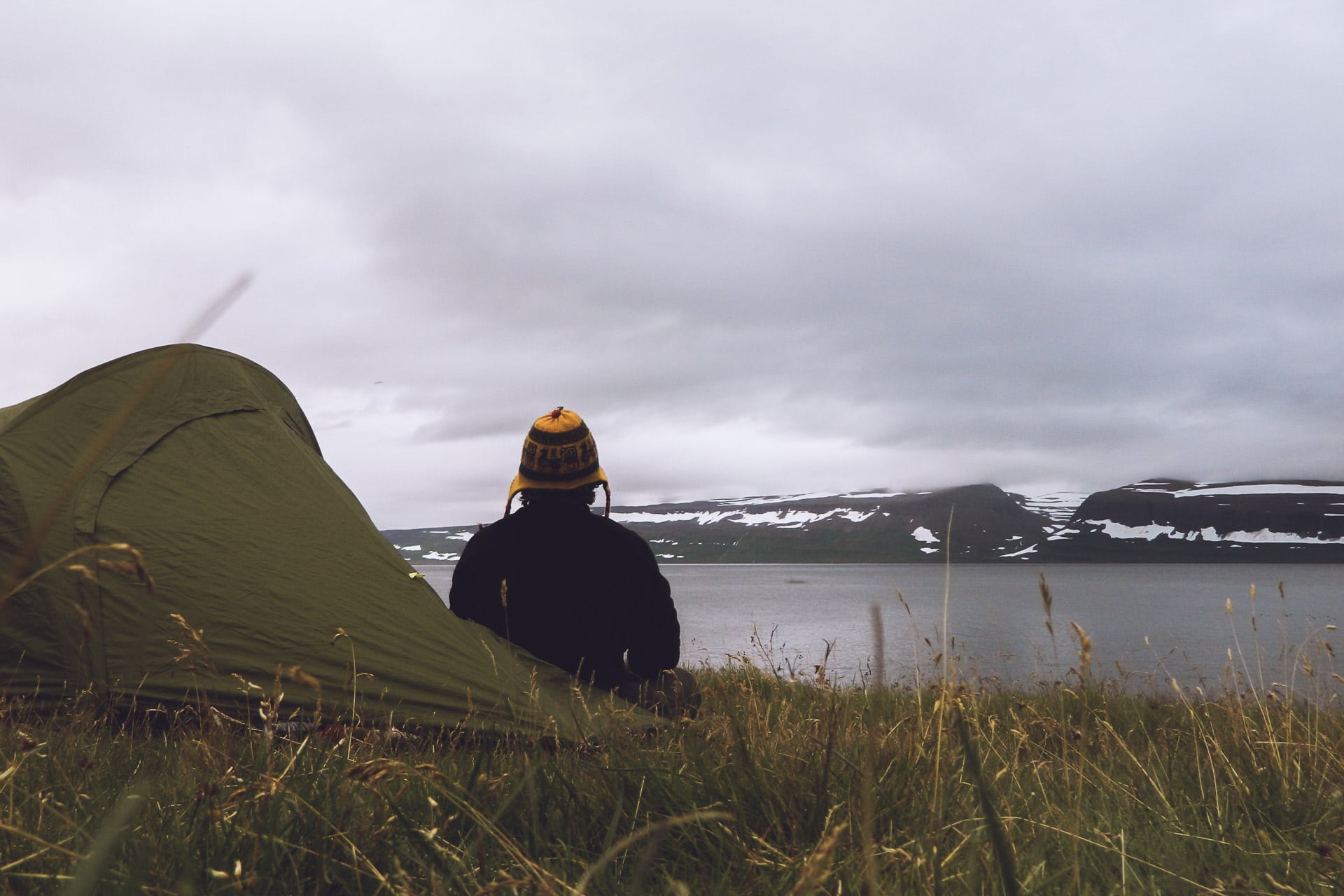
Here we are at two, at the beginning of the road with 140km in front of us and a few meters of altitude, all regularly punctuated by the famous red and white mark of GR.
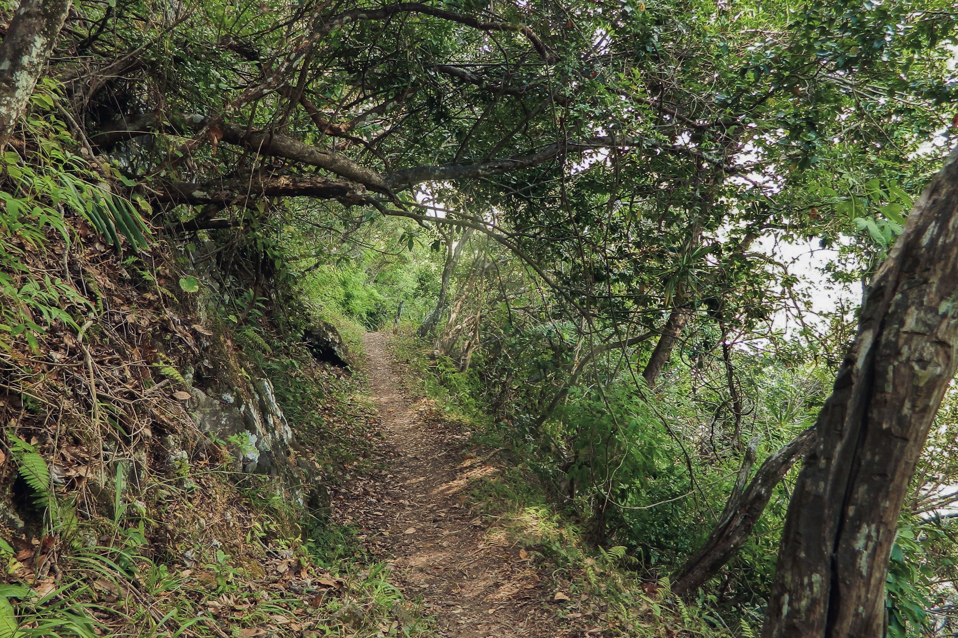
The path starts with a regular climb in the forest. Even if one is not very far from the “civilization” one finds oneself quickly immersed especially that the vegetation is dense. The path is easy but the fatigue of the trip, the warm-up and also the meal with its glass of rum slow us down a bit but we are in no hurry.
We continue to walk slowly. After 1h we are joined by a dog more or less wandering that will accompany us a good part of the remaining path.
The GR then arrives at Brûlé a nice little village but we do not stop. It is already quite late and we want to go a little further.
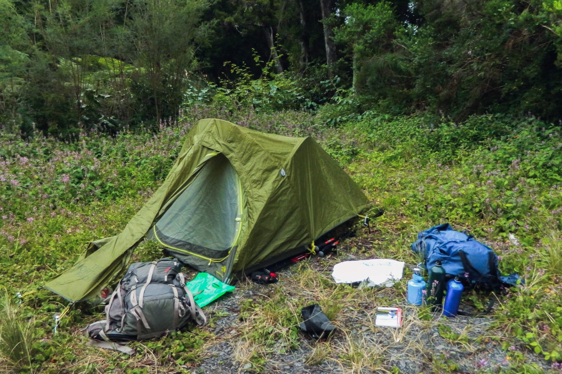
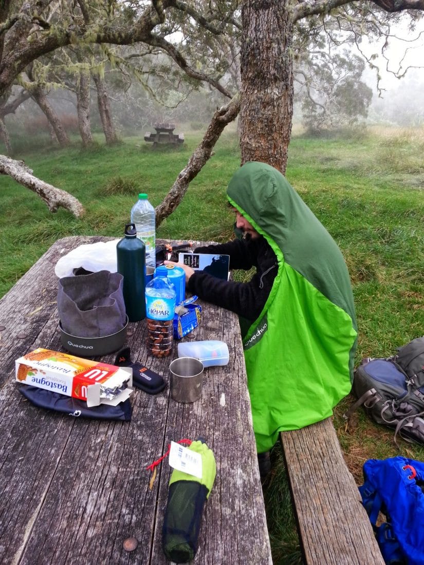
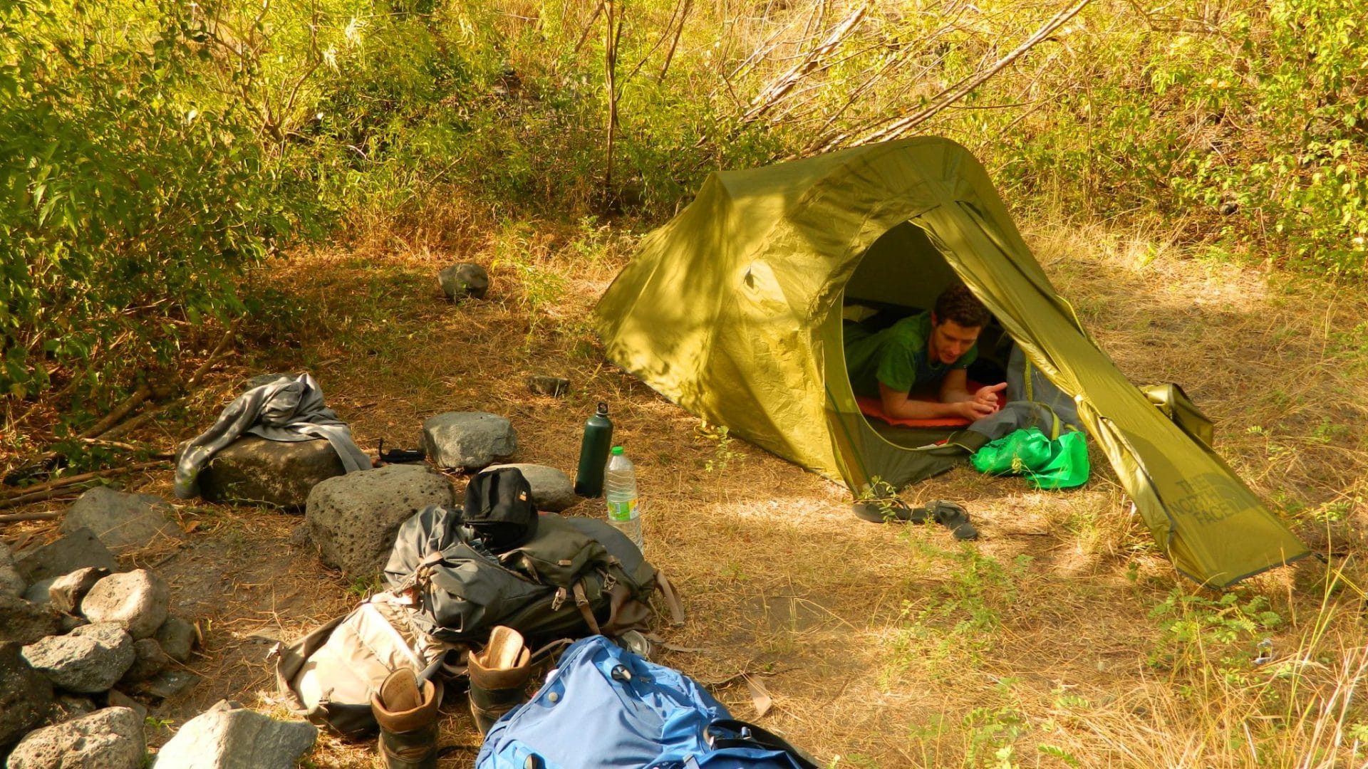
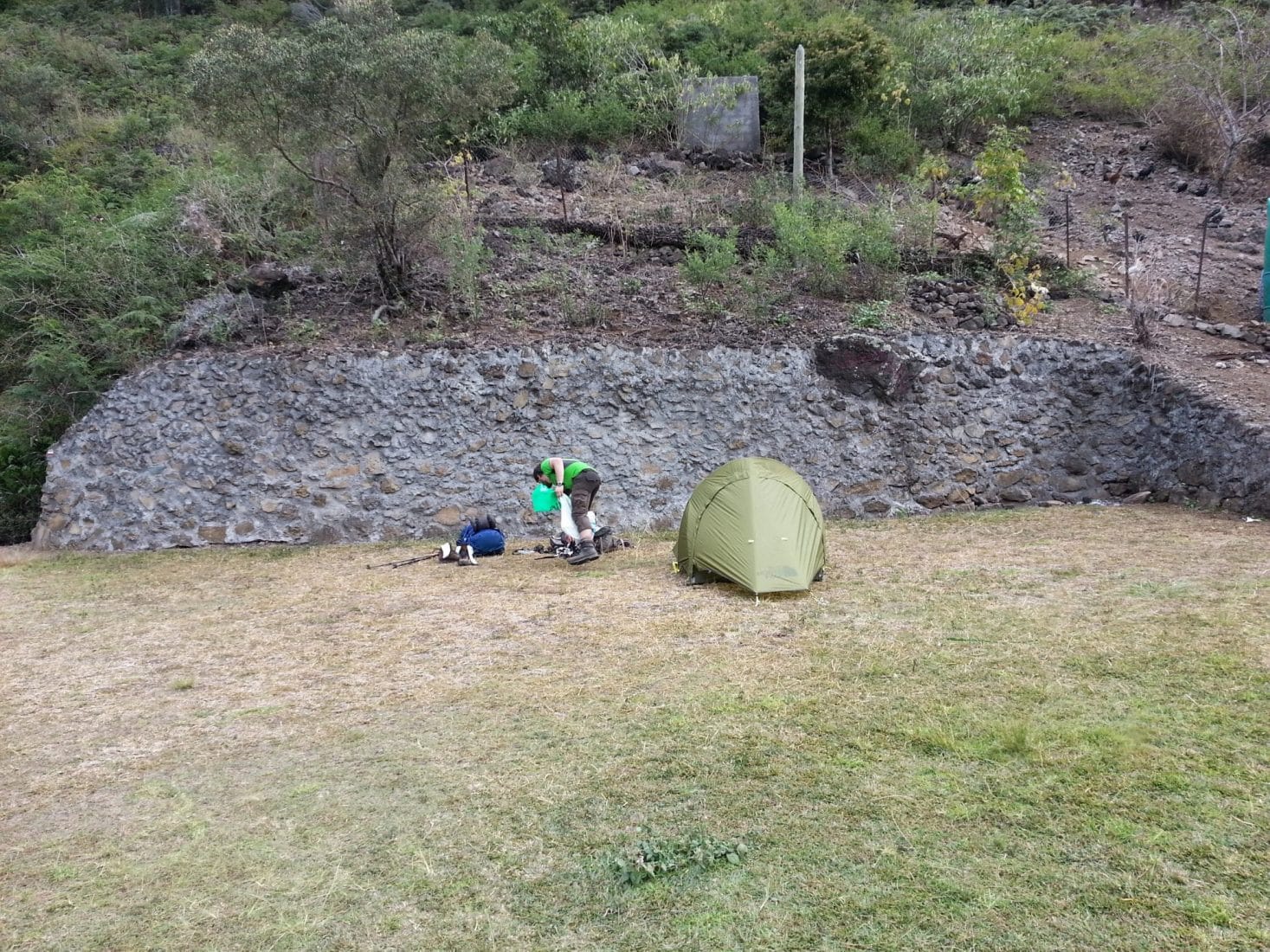
We will therefore put the camp a little further. Not finding a nice place, we will settle down along a forest path in a corner without charm. For the meal we try to make polenta but we have no salt and we did not cook it enough. Result : a meal really not good. A loosy bivouac to begin but it doesn’t matter, tomorrow is another day…
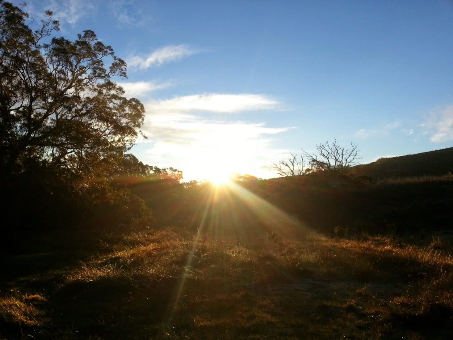
Day 2 : Climb to the Roche Ecrite
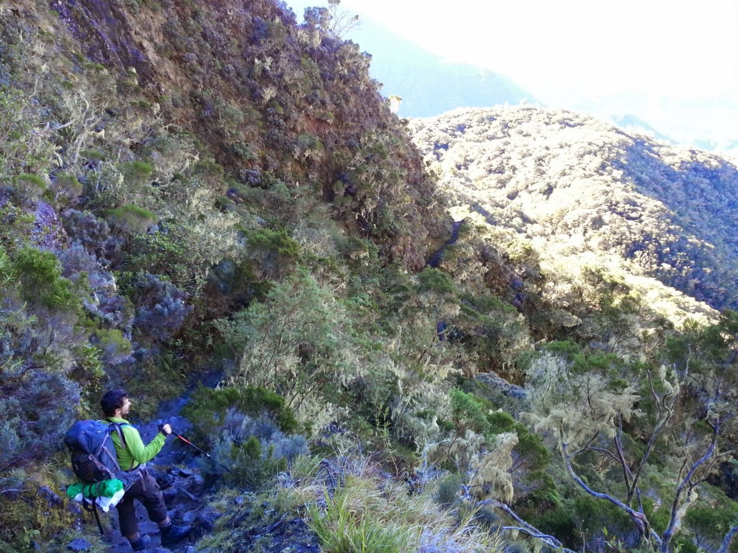
The first “bad” end of the day was well confirmed by a wet and cold night … So we quickly take the road towards the Roche Ecrite (2276m) for the viewpoint on Mafate and Piton des Neiges. We do not expect a very long walk.
We continue to progress in the forest until the Gîte de la Plaine des Chicots. Like yesterday, we do not meet many people.
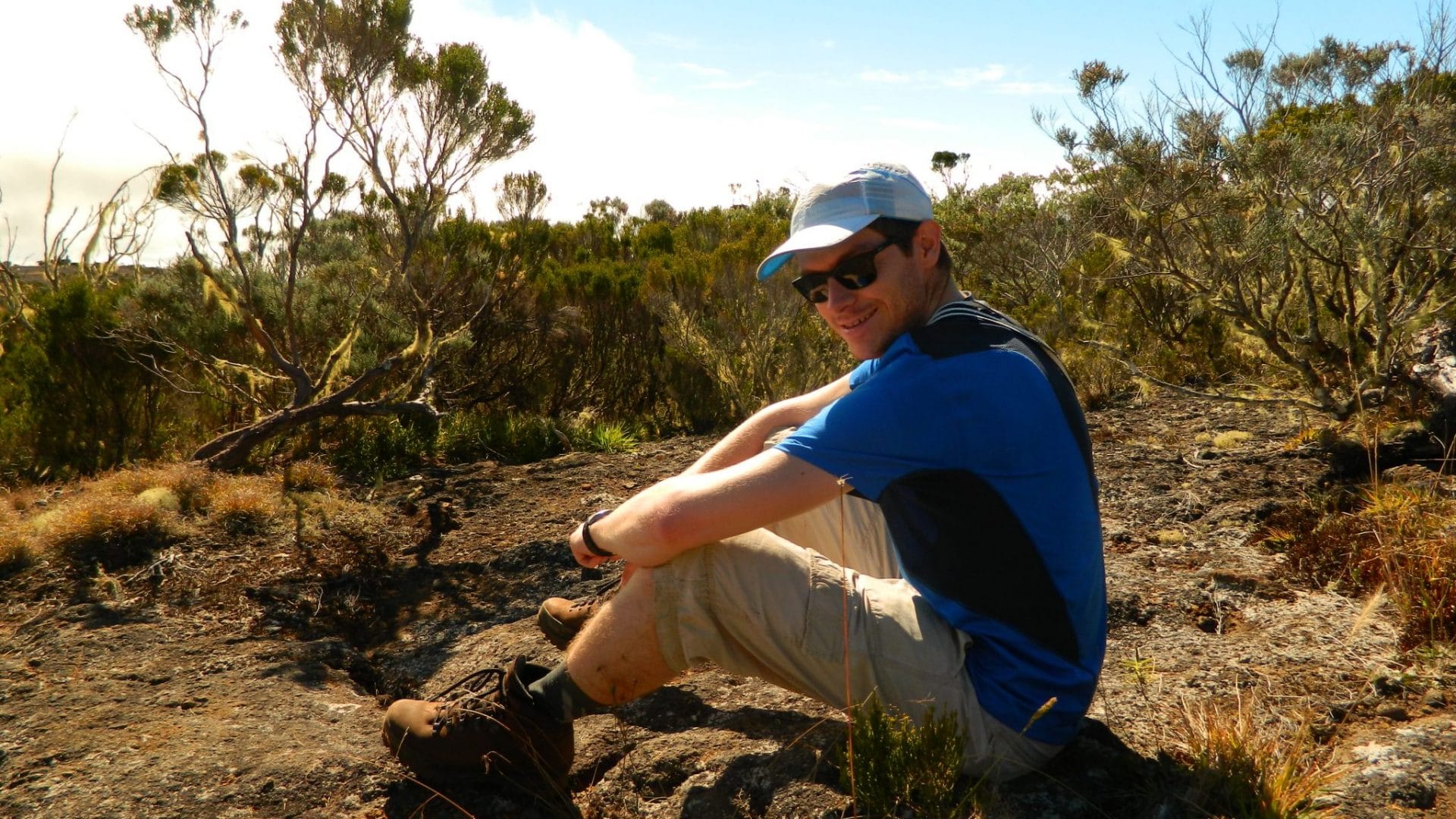
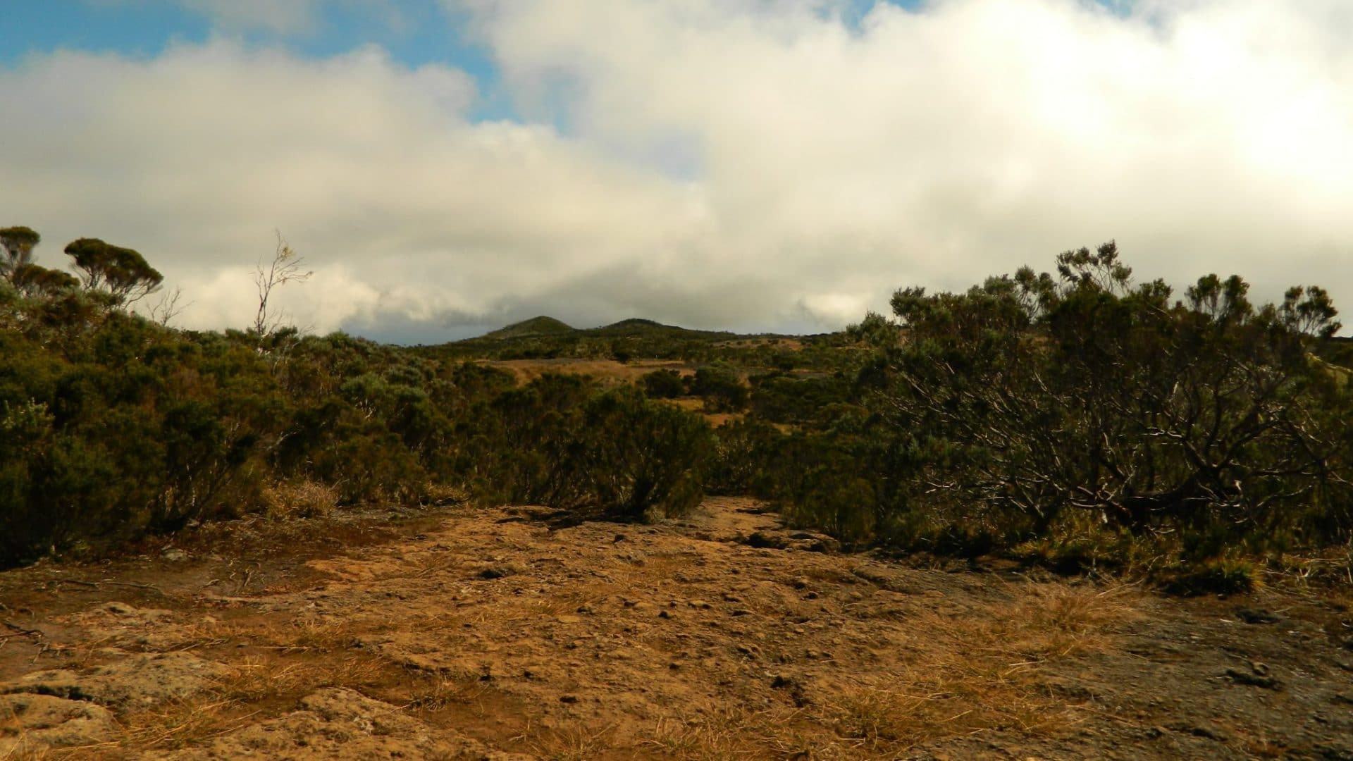
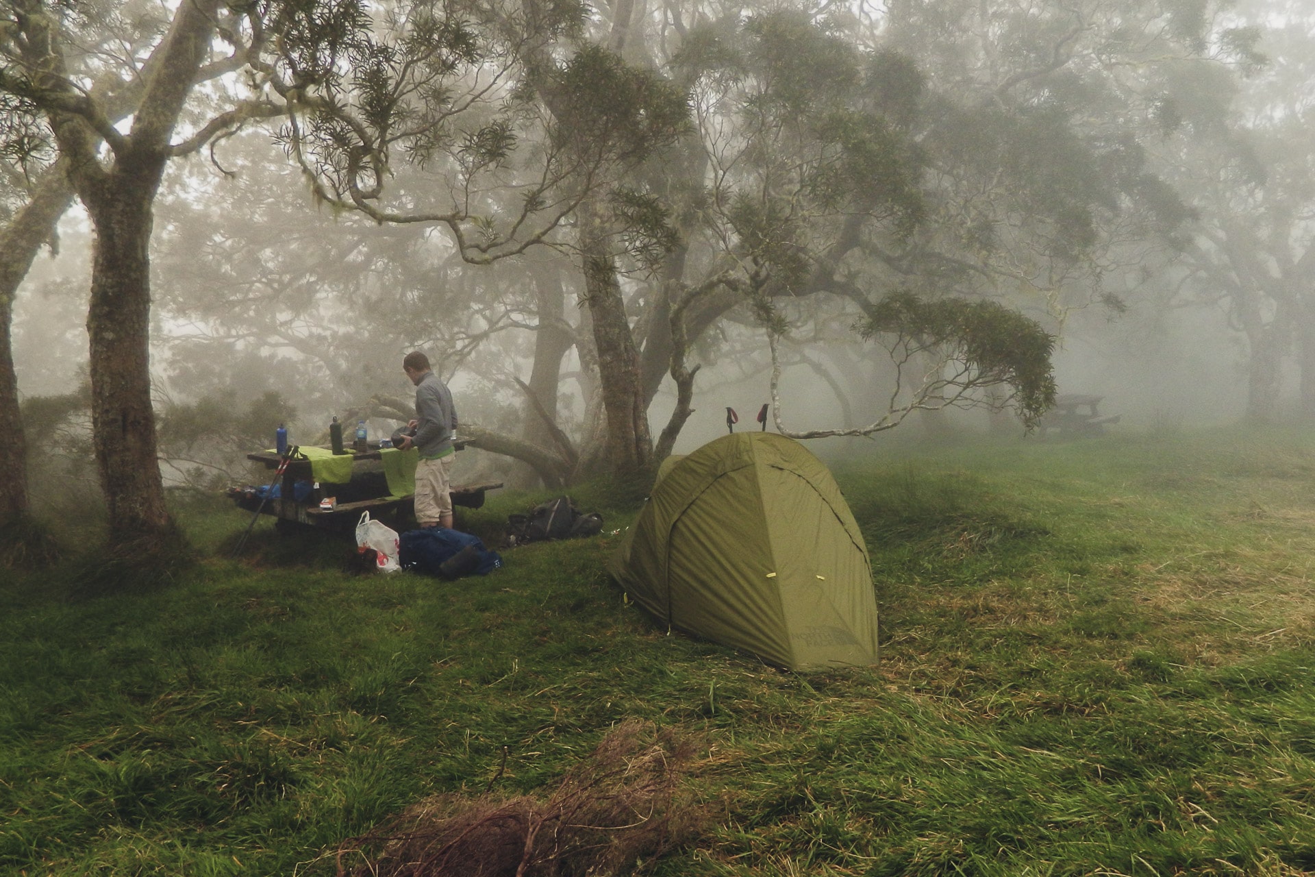
Once at the cottage, we leave the GR to fork to the Roche Ecrite. The vegetation is a little sparse, because of the altitude I think (about 1850m). There is a nice place a little further to the bivouac tonight with a beautiful grassy space and a picnic table that will be very convenient for the evening.
As we still have a bit of a climb to do and we are going back here, we find a place to hide the bags and continue with just a bottle of water. We move in a slightly less humid environment with shrubs and no longer trees. It’s nice and it’s great weather and there is still not many people we cross.
The problem is that some time after our departure, I start to have a big fat blow of fatigue, Arthur a little too but less. We continue the climb but I am worse and worse. I think the tiredness of the trip and especially the fact that we ate very little yesterday (polenta not good), nor this morning (stupid mistake) are at the origin of all that. We will go quietly it should pass.
The end of the climb is a horror, I’m totally exhausted … The path and the climb are easy but I really have no more energy.
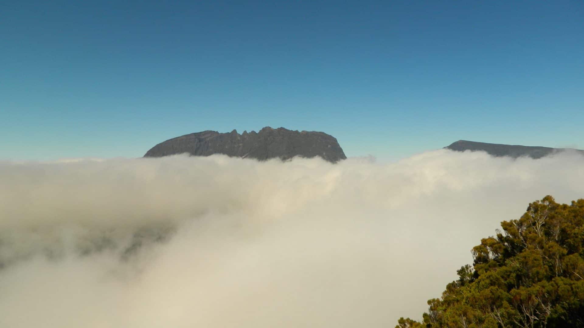
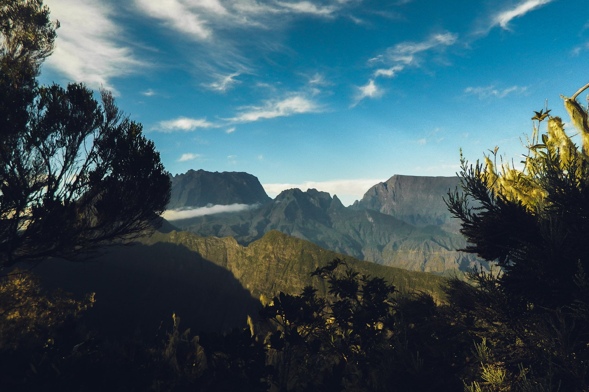
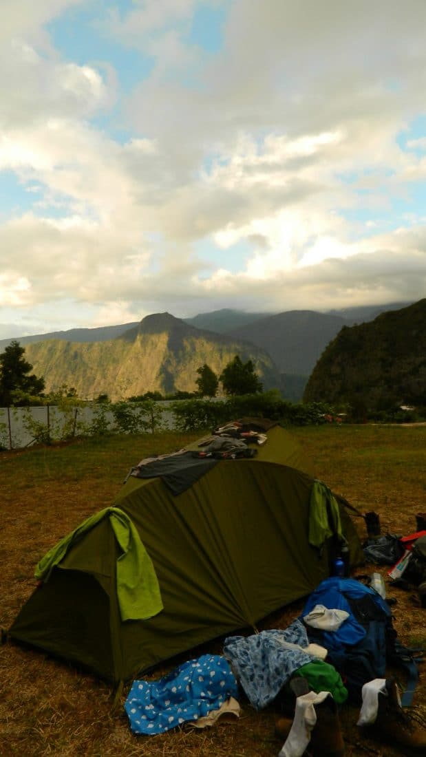
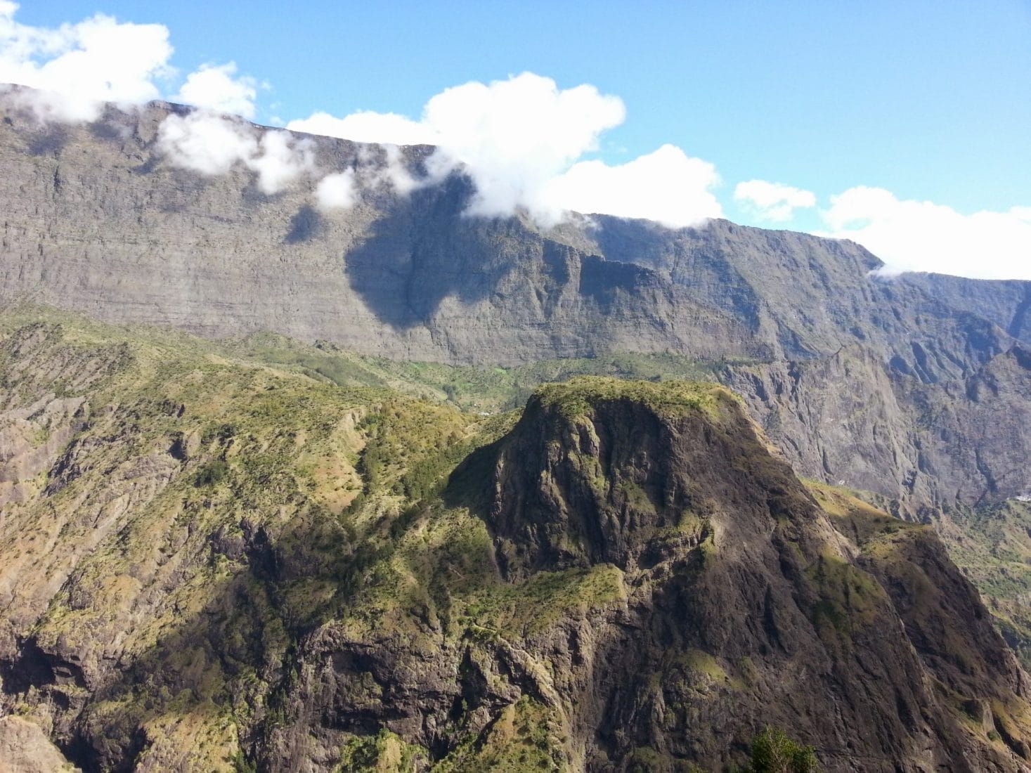
We still arrive at the top finally. The arrival at la Roche Ecrite suddenly reveals a superb view of Mafate and in the distance the Piton des Neiges. Unfortunately, as we arrived a little late in the day (afternoon) the circus is completely covered with clouds. This often happens, so prefer to go in the morning.
The view is when very beautiful with this sea of cloud and the Piton slightly protruding. We rest to admire. There are a few people.
Still tired and having no food with us (stupid mistake of beginner), I will ask a hiker a cake to put a little sugar in my blood.
In any case the detour to La Roche Ecrite is really worth it even if there are clouds.
The descent is easier and we quickly find our bags and our camp for the night. We settle down and take advantage of the end of the afternoon reading, resting. As we are at altitude (about 1900m), the temperature drops quickly and in addition we have the right to a few passages of cloud on us, so it is also wet.
We end the day with a big meal, we will not make the mistake of the day before twice.
Day 3 : from the Roche Écrite to Deux Bras
So we may be under the Tropic of Capricorn but what was cold this night! I had not anticipated very well the coolness at altitude thinking that the local climate will warm the air but around 2000m it is not hot especially when it is wet like yesterday.
In any case the sun is back and the breakfast (hearty) is nice.
We are back on the road to Dos d’Âne.
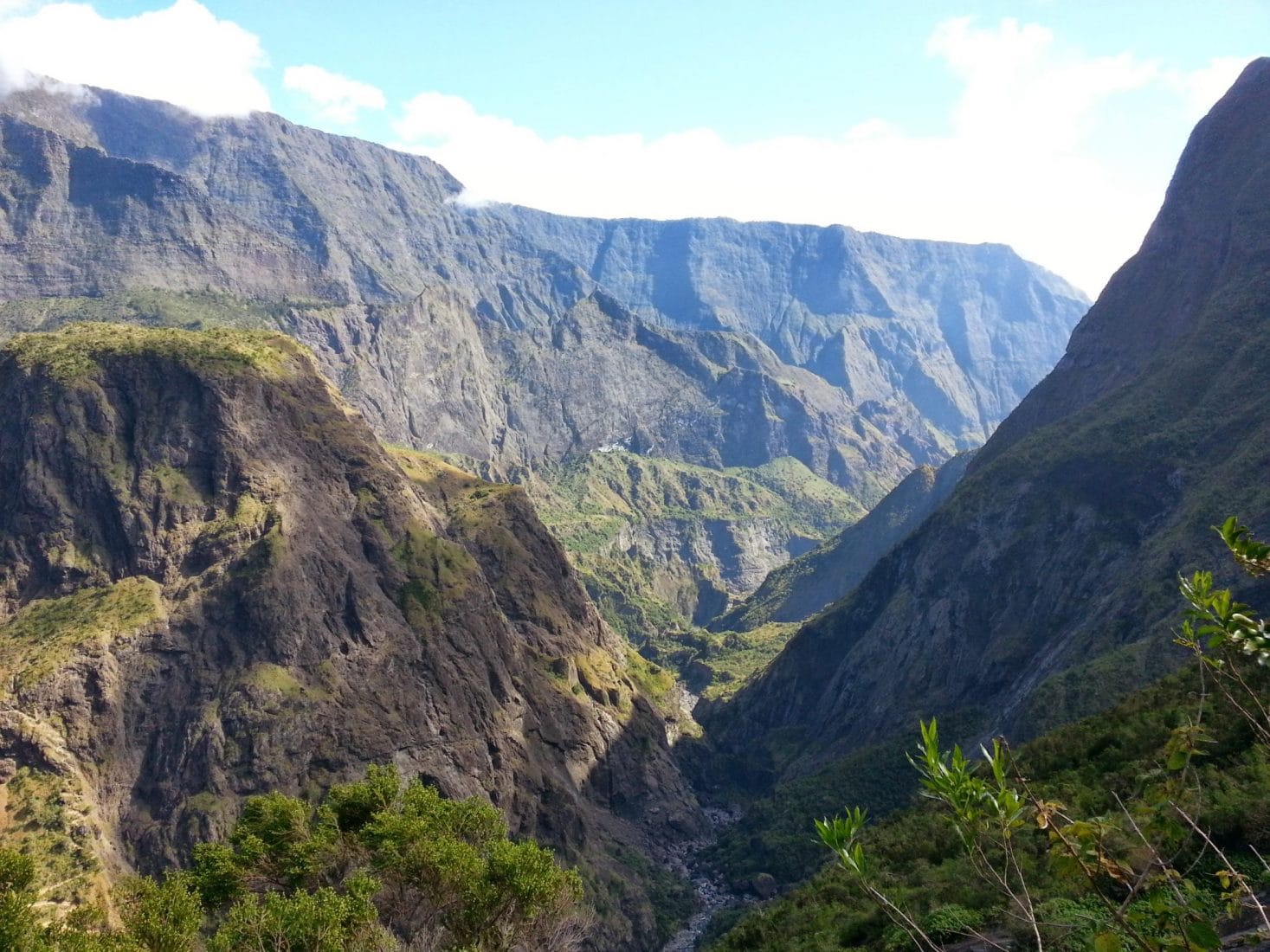
We quickly joined the GR. The trail will then go along the huge cliff overlooking Dos d’Âne which offers absolutely superb views, one of the most beautiful of the trip in my opinion.
The trail is slightly downhill and so nice especially that it is quite shady and therefore cool.
We then begin the descent to Dos d’Âne along a pretty ridge. We are just starting to meet some hikers who are climbing to the Roche Ecrite.
Once at Dos d’Âne, we go in search of a pharmacy because Arthur has a shortage of lens product. We will find it quickly but no product in stock … it will be a pain for him especially especially that the next city is in four days. We then look for a bar to take something fresh but everything is closed, even the grocery … By cons we need water for the long descent that will take us to Deux Bras. A nice ma will give us some water and will also put us back on the right road.
The descent of 900m to Deux Bras is impressive because the path really follows the cliff and offers a beautiful view but there is no difficulty except the knees will begin to groan to about 3/4 of elevation.
At the bottom of the descent we cross our first Îlet, the Îlet Albert.
An Îlet is a local plateau isolated by ravines and which serves to form many names of small villages in Reunion as Îlet to Malheur for example.
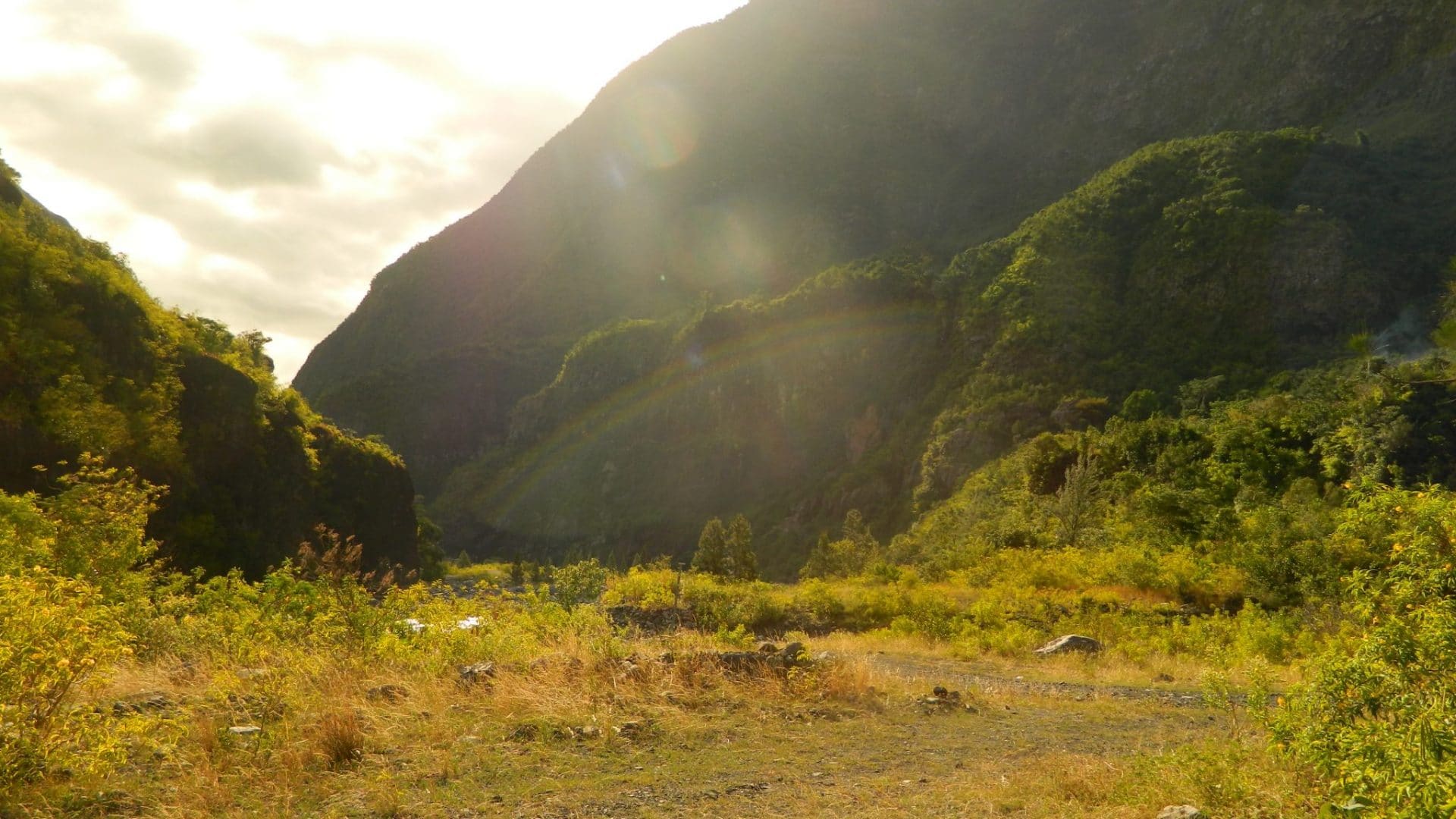
We will continue until the Rivière des Galets to find a nice spot for the bivouac. After setting up the camp, we’ll go bathing in the river. What a pleasure !
We will end the day by sharing the time between reading, rest and a good meal in the evening. This day was really nice, I can not wait to really get to Mafate.
Day 4 : from Deux Bras to Aurère
We start up again after a bad night crowned by a nice bleeding nose …
The path follows the riverbed for a while. There are some river crossing to go but the guide and indications of the GR misleads us making cross the river twice while it is useless. So try to rest on the right bank (in the direction of the current).
We then start the long climb of 700m which will lead us to Aurère. At the top of this hill is the real beginning of Mafate.
We climb nicely and it goes well especially that we find at the top a lot of Goyavier well red and super good! It will make vitamins …
We then quickly join Aurère and the cottage where we spend the evening after these four wild days. We start with a good shower well deserved!
Then we go down to the village. We do not cross many people but it’s nice. Here no tar, no asphalt, the “streets” are grass, everything is very well maintained and flowery. It reigns a serene and relaxed atmosphere.
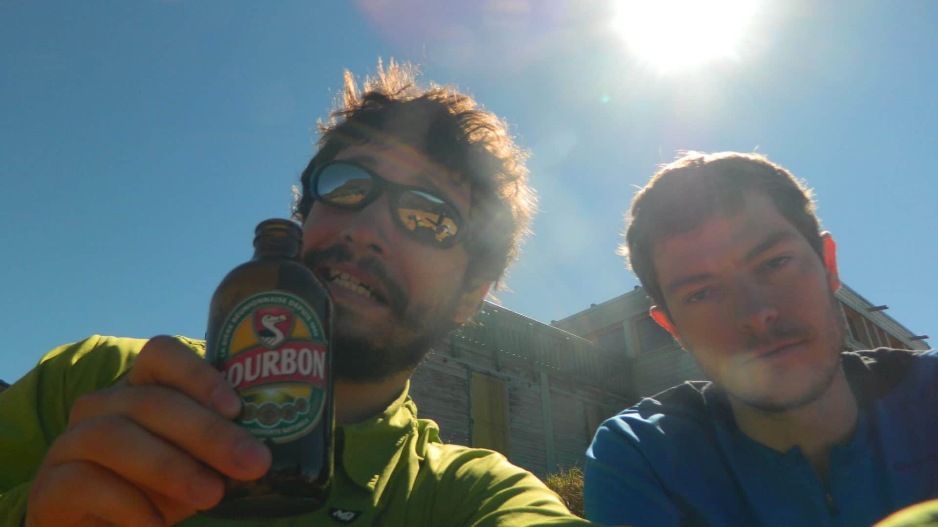
After this tour of the village, we go back to the refreshment bar and the grocery store to refuel a little and especially to have a good cold beer! It is then that we discover the “Dodo Lemon” a lemon-flavored alcohol-free beer that is a real pleasure after a day of walking and that will accompany us during the rest of the GR.
We then return to the cottage to spend an afternoon rest: nap and reading are on the program.
In the evening, we discover the famous Rougaille Sausage to which we will do honor by serving many times since it is our first “real” meal for a lot of day and especially that it is excellent! Obviously the meal ends with a delicious “special rum” and discussing with the owners of life in the Mafate circus.
To complete this rest day: a night in a real bed! Perfect !
Day 5 : from Aurère to the Orangers
Finally a good night! We take off around 8:30 direction Grand Place at first.
The road is nice and passes by small Îlet as Îlet to Malheur. The Îlets are all super cute with always a lot of flowers.
We then go on a series of ascent / descent including parts in full sun and it already warm. The landscapes are superb, the path pleasant. We feel isolated from the world.
We will arrive at Grand Place 3 hours after our departure instead of the 4 hours announced. We do not really meet many people except some locals.
There are a lot of helicopters doing rotations to supply the villages. As Mafate is not accessible by road, only the helicopter or walking are used to supply.
We take our meal break towards Cayenne, a little lower. As we have walked well this morning and it is barely noon we decide to go on. After checking maps and travel times we decided to do three stages in two days. We will continue to l’Îlet des Orangers.
We take the GR with a good descent followed by a big climb in the sun. It is very very hot and it’s hard! We sweat like never before. On the other hand the view is superb so we take the opportunity during breaks to drink a shot.
We will have suffered from the heat in this climb especially that there is no water (even if a water pipe passes right next … torture of Tantalus). We arrive at the top in a rather enclosed but cool gorge.
The road to Les Orangers will not be very long behind.
Arrived on the spot one directly targets the grocer to have a Dodo Lemon. It also offers a piece of flat land for the night for a few euros, we take it so we will have a water point and toilets …
We sit there for the evening, to dry things, to eat, to enjoy. A good day anyway. The GR-R2 really helps to “live” Mafate rather than just going for a quick ride to the day.
Day 6 : from the Orangers to Marla
In Reunion, the roosters did not understand their purpose : they spent the whole night singing! And as the duos are better all the dogs in the valley and those next door also spend the night screaming! Result: not a lot of sleep …
But hey it’s nice, we’re in Reunion, … everything is fine! We get up at 6 am and attack quickly afterwards.
We go first to Roche Plate. From there we continue on the GR-R2, we hesitated a moment to continue on the R3 and recover the original path to Marla.
After a relatively boring descent under the Bronchard, we attack a good climb of 571m. Nothing bad in itself but the heat and the sun make exercise more difficult than expected.
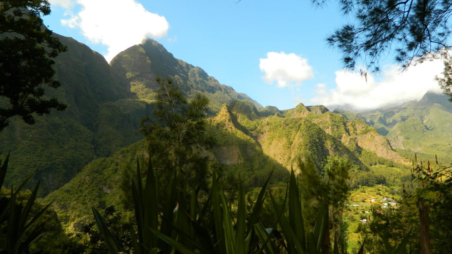
We come out at the top with a beautiful view of Mafate and its ramparts.
Small difficulty not planned before arriving at La Nouvelle: a bull cuts us off the road and does not want to move … Fortunately it is. We will be able to stagger him by stitching his buttocks with our poles and by quickly going …
La Nouvelle is the “capital” of Mafate, there are some tourists, finally a little more than in Mafate itself.
We will do our lunch break in a local restaurant that serves big sandwiches, Arthur takes Bouchons, another local specialty, kind of meat ravioli (very good). A grandma who is also there to eat suggests we try the rum which is very good according to her. Not being able to refuse we will each take a glass (more than generously served) including a geranium rum that is excellent.
We take the road towards Marla after this good break. The weather is cloudy … Between the overall moisture, the sandwich that weighs (too) heavy and the rum that I’m struggling this afternoon. I’m a little tired of this portion and I can not wait to get to my destination.
We arrive there after some suffering for my part. It is not far from the school because the area offers a good bivouac with water point. We will have another rum to congratulate ourselves. In the evening we will share the camp with local young people who speak only creole. Communication is not easy but we manage.
Tomorrow we are leaving Mafate … Three great days at the heart of this beautiful circus.
Day 7 & 8 : Cilaos
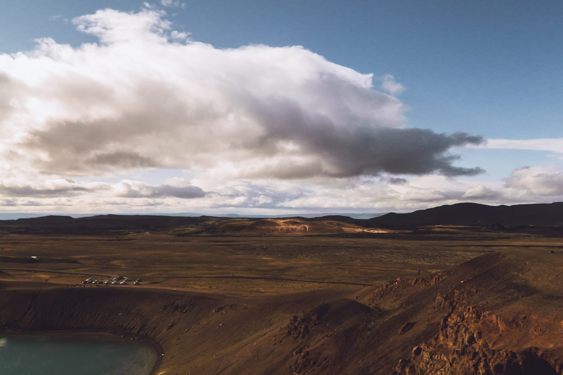
After six days in the wild, we decided to give ourselves some rest. Direction Cilaos but before that we have the pass Taibit (2142m) to pass.
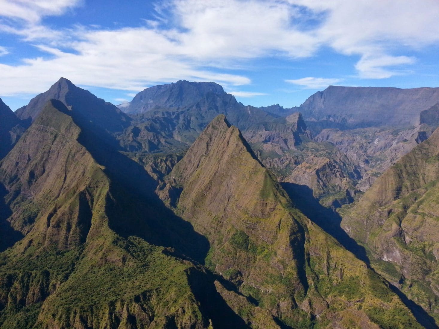
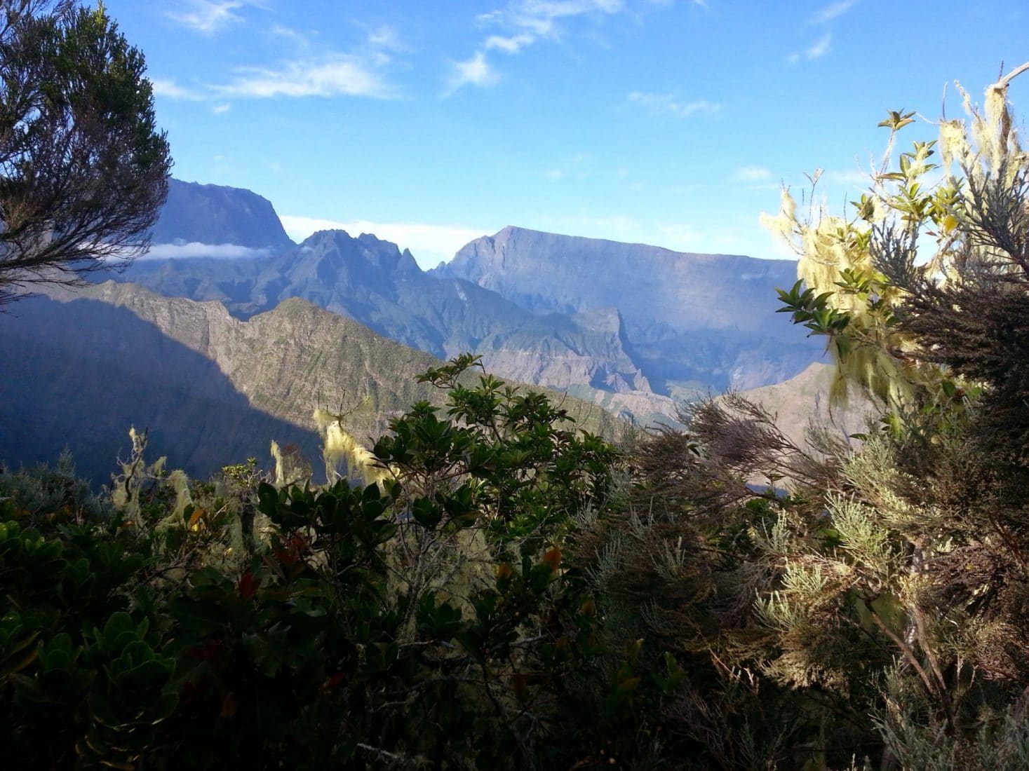
We leave early, in the freshness and 500m, climb is good. This offers, moreover, a beautiful sight on Marla and the circus of Mafate. Last look and already want to return one day in this circus.
The rest of the descent is a succession of zigzags to the road 1000m lower (the knees have warmed).
Once arrived at the road the call of the city makes us choose to finish the road until Cilaos in transport. There is a bus stop not very far but we missed its passage shortly. So we try to hitchhike and it works in 30s!
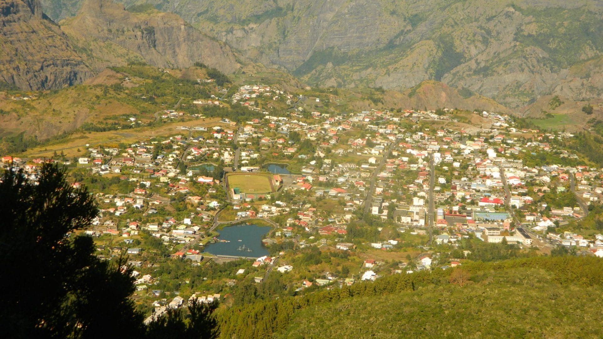
Still, we arrive quickly to Cilaos and our friendly hitchhikers drop us next to the Post Office. We join our cottage, the Ti Case Lontant for the next two nights.
We will enjoy the rest of the day quietly to rest. There is a lot of Bibe, the spider “emblematic” that we cross everywhere in Réunion. Although quite impressive, it is harmless and especially limits the number of mosquitoes!
The late evening offers us a beautiful show with beautiful effects of lights on the surrounding mountains. A good night’s sleep in a real bed awaits us, plus we are lucky we are only two in a large dormitory.
The next day will not be very productive. Mainly dedicated to eating and refuel, we will also take advantage of this day to visit the city but nothing very exciting.
In the evening we will test a good restaurant in the area (Chez Noé I think) to end the day.
Tomorrow we tackle the climb for the Piton des Neiges in two stages (we took our time during this trek …)
Day 9 : from Cilaos to the Refuge du Piton des Neiges (2460m)
Early start, the goal of the day is not very ambitious because we are just aiming for the climb to Refuge du Piton des Neiges (2470m). It still makes us a small climb of 1200m …
The beginning of the path is not very nice. We go through the forest of Grand Maturum, we could have taken the bus but we preferred to do everything on foot. Finally this portion adds useless height because it is not very beautiful.
The real climb starts at the parking lot. Unlike the previous days there are some hikers who attack the climb also but everything is very acceptable in terms of attendance.
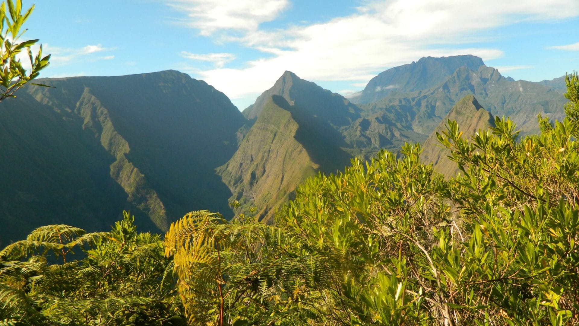
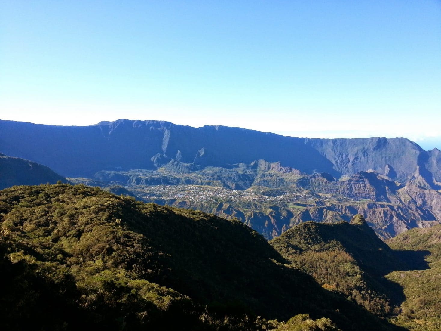
So we climb gently but surely the drop towards the Refuge admiring the superb view of the circus Cilaos offered to us. Finally we arrive at the Pass at 2500m, the climb will not have been so terrible despite the heat, I think our week of walking has warmed us well. We take the opportunity to make some pictures.
The refuge is not far behind. Here, at altitude, the vegetation is quite dry, more sparse, a little like the one we had at la Roche Ecrite.
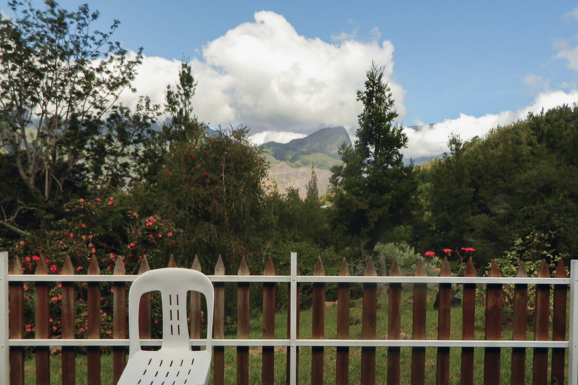
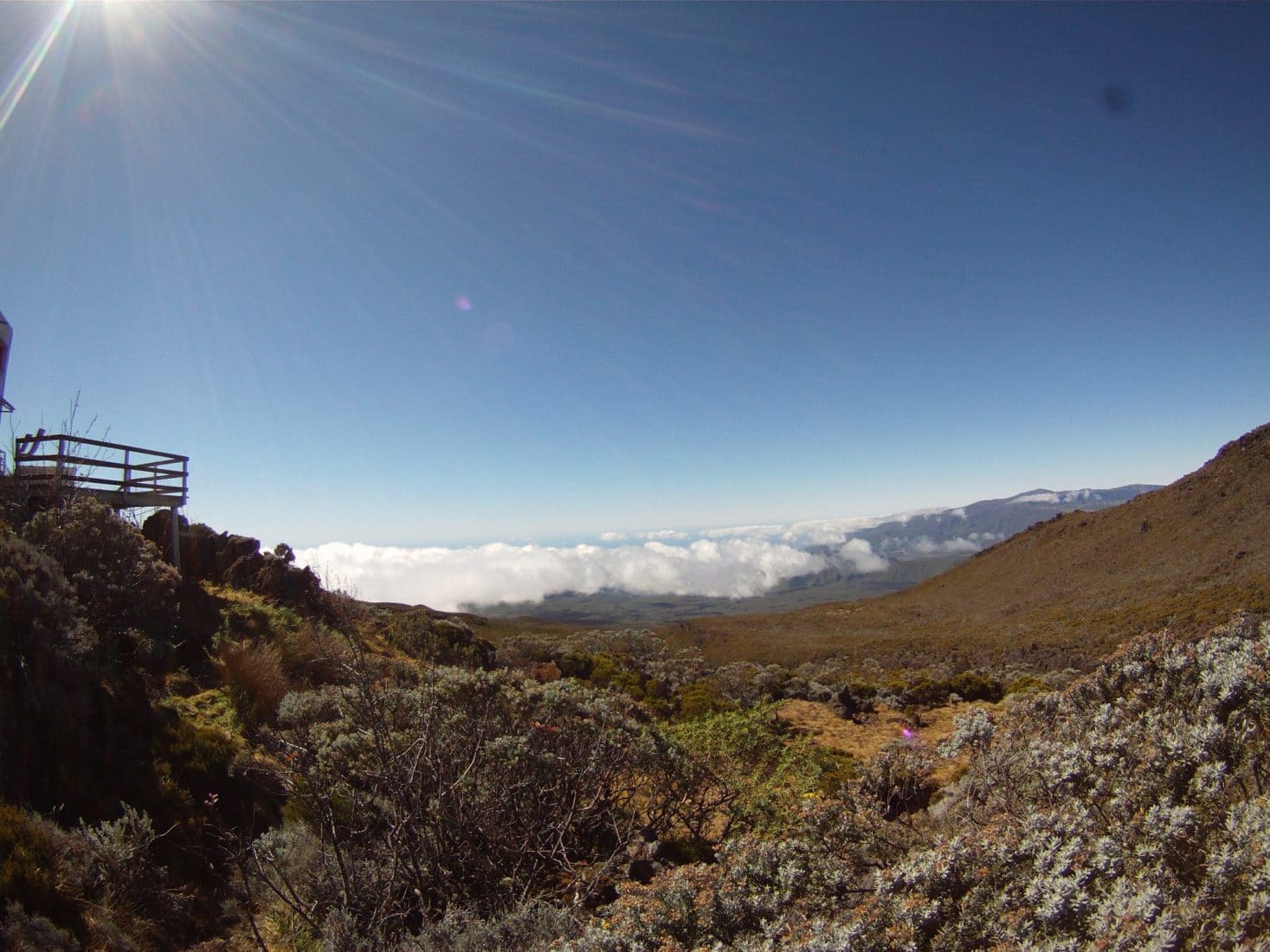
The refuge location is superb. It offers a view of all the East Island to Piton de la Fournaise. As we are at altitude, we dominate the clouds of the plain of Cafres, it is beautiful at home, we take advantage of this beautiful day to bask in the sun with a good Dodo Lemon!
As we arrived early, we could have attacked the climb to the summit and admire the sunset but we chose not to. Similarly we could have slept at the top, there is some place to pitch the tent but as my sleeping bag is very light, we prefer to stay lower.
So we have a good hearty meal at the shelter with other hikers who “climb” tomorrow morning. The evening will end on a frenzied card game but we do not go to bed late because tomorrow we will get up at night.
Day 10 : from Piton des Neiges to Bourg Murat
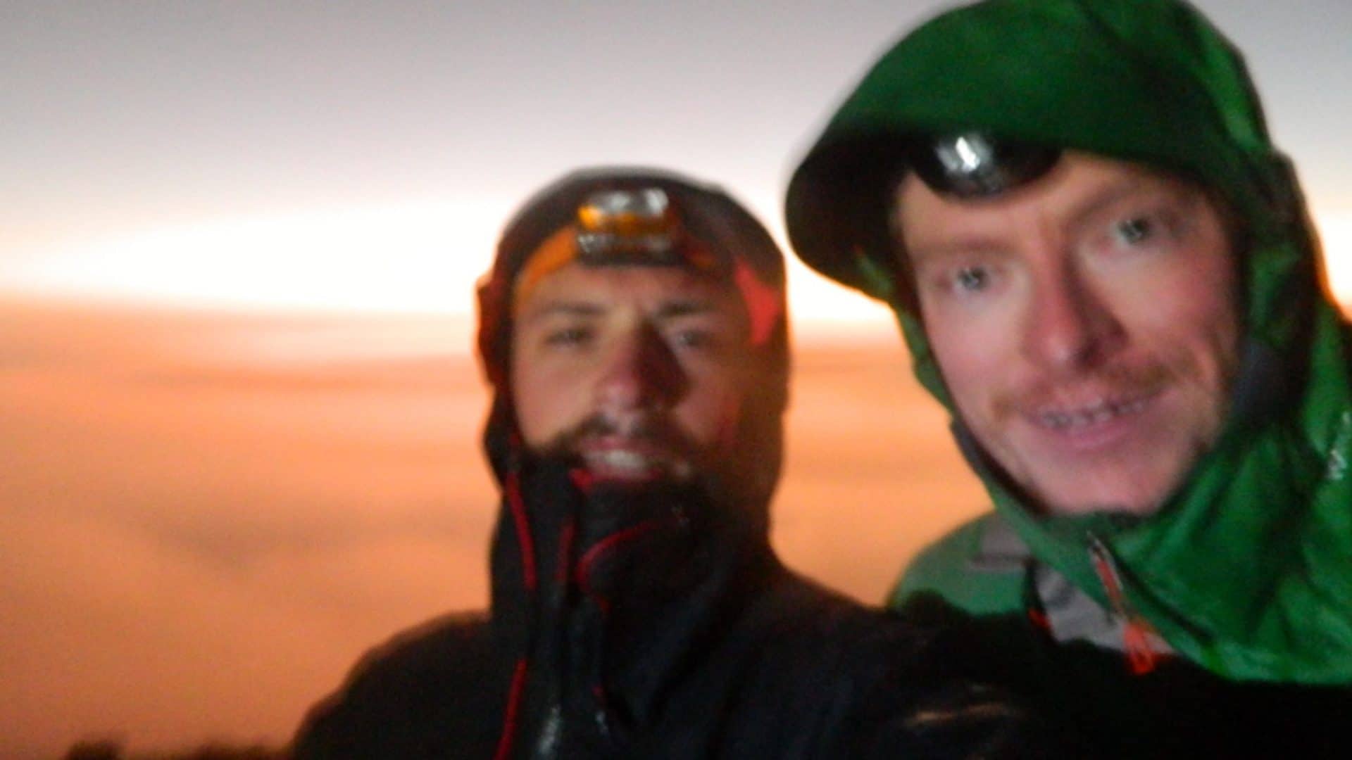
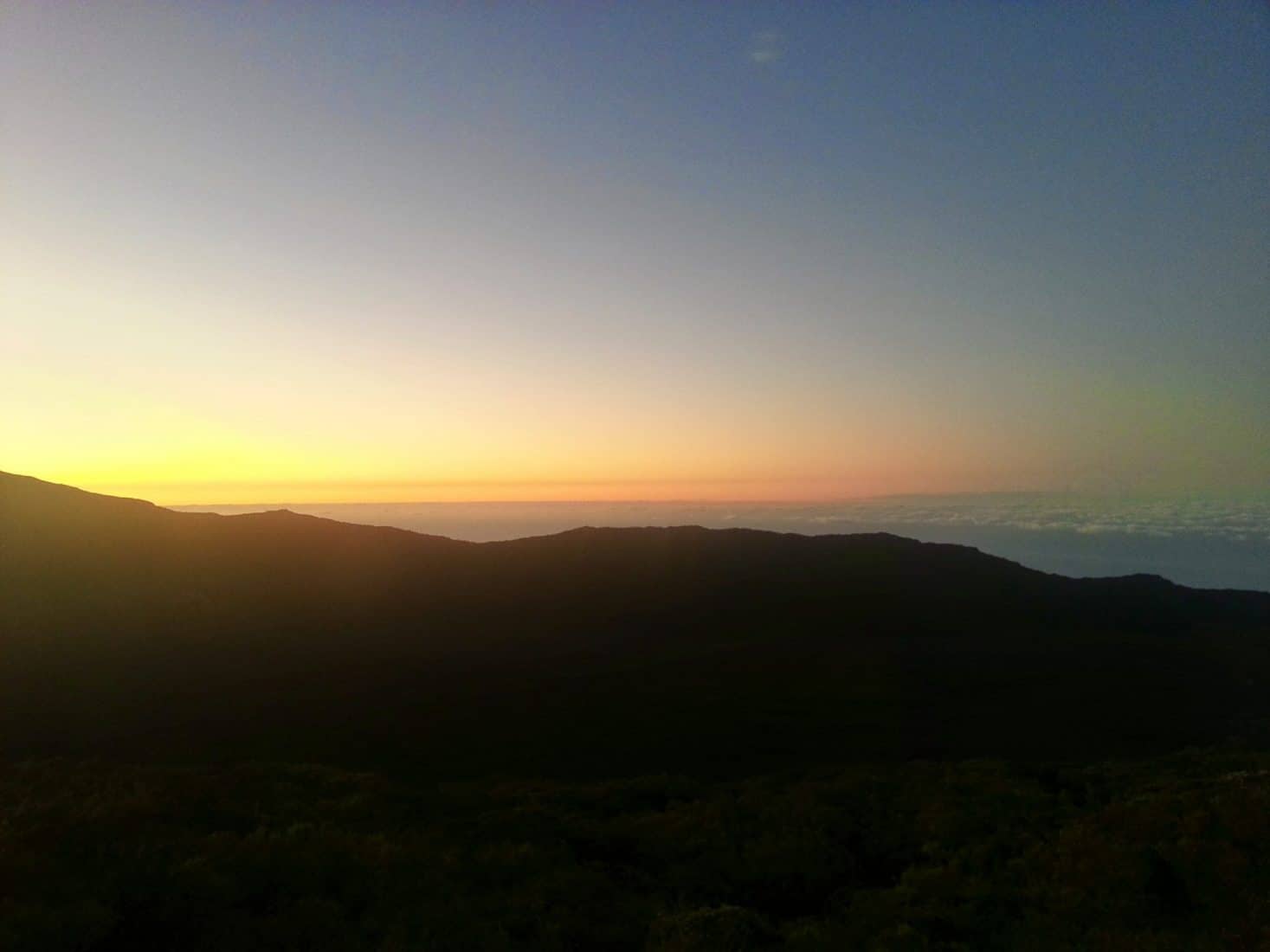
As we want to make the sunrise at the top, we leave early: about 5h. By cons a group did not understand the principle and got up at 3:30 making a crazy noise so short night …
The beginning of the climb is done with the headlamp, everyone attacks the climb so it’s not great fun, it’s an highway … We will quickly exceed the bulk of the troops because we are without our big backpacks, we’re pretty quick with Arthur this morning! The path is easy to follow because it is marked with white dots painted on the rocks (not to be confused in the dark with lychen as it happened to a group).
The beginning of the path is in good weather conditions: neither too cold nor too humid. On the other hand the sky is covered, it announces nothing good for the continuation …
We arrive quickly on the “last straight line” for the summit. The wind has risen very strong and it is more and more covered.
The summit is reached 1:15 after the departure of the refuge, not bad. That’s it we are at the top of the Reunion and the Indian Ocean at 3070m!
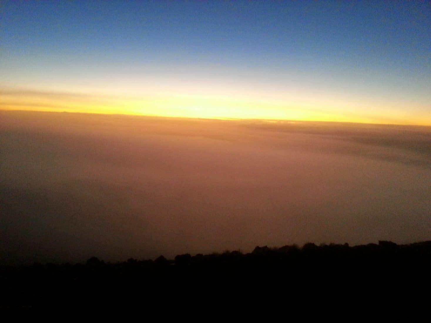
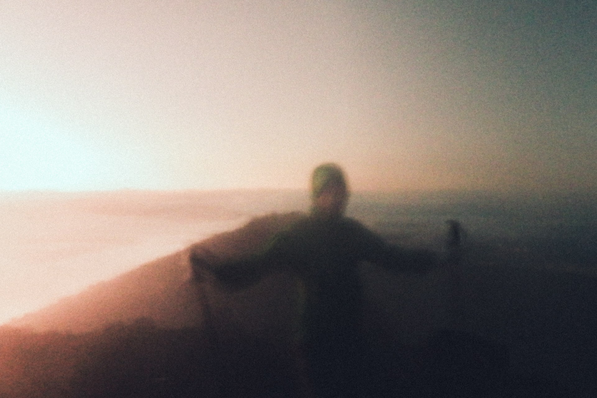
On the other hand time has turned: there is a lot of wind and it rains horizontally. Arrived at the summit we have time to see 2min the sunrise before it is covered with clouds … The atmosphere is nice though. We try a few photos but as you will see the result is poor …
We do not stay long at the top because already the weather does not give us envy and then we have a long day waiting for us behind. We go back downhill to the refuge, crossing a lot of people who are still in the climb phase.
At the shelter, we take the time to have breakfast. We close the bags and we attack at 8:40 towards the Plaine des Cafres and Bourg Murat.
The view from the refuge is absolutely beautiful.
The path although beautiful ishard: it is only slippery rocks and muddy paths for hours! We slip, we slip, we stumble! A real joy. In addition because of the nature of the terrain and may be days gone Arthur begins to have a knee ache. I hope it’s only fleeting …
The vegetation changes slowly. Because of the loss of altitude already but also because we are now on the Windward Coast, ie half of Reunion which receives the rain.
We really notice this change once in the plain of Cafres. Indeed, the GR passes in meadows with cows that give a funny air of Normandy to the island, if not the few exotic flowers … In any case the plain of Cafres keeps its promises and we are welcomed by the rain.
We had planned a bivouac in the area but we are tired by this long road and the ascent of the Piton and soaked with rain. As we have the choice we decide to take a small cottage in Bourg Murat.
We are greeted by a nice Grandpa who rents rooms. It’s not too late, so we’ll have a very big nap in the afternoon. In the evening the Grandpa takes us to a restaurant he knows well and we test the Boucanier, another delicious specialty of Reunion. We will not go to bed late, exhausted that we are having to spend the day trying not to slip into the mud. Tomorrow Piton de la Fournaise.
Day 12 : from Bourg Murat to Piton de la Fournaise
We are right after this good night! Arthur still has a little knee pain but it’s better now …
We meet a young couple, at breakfast at the cottage, who also went to Piton but by car. Given the tiredness of the last 10 days, Arthur’s knee and the prospect of gaining some time on the rest of the trip behind, we decide to ride with them by car. We gain a few hours of walking. In hindsight it would have been nice to do the walk because the landscapes are wonderful …
So take off not too late, direction the volcano.
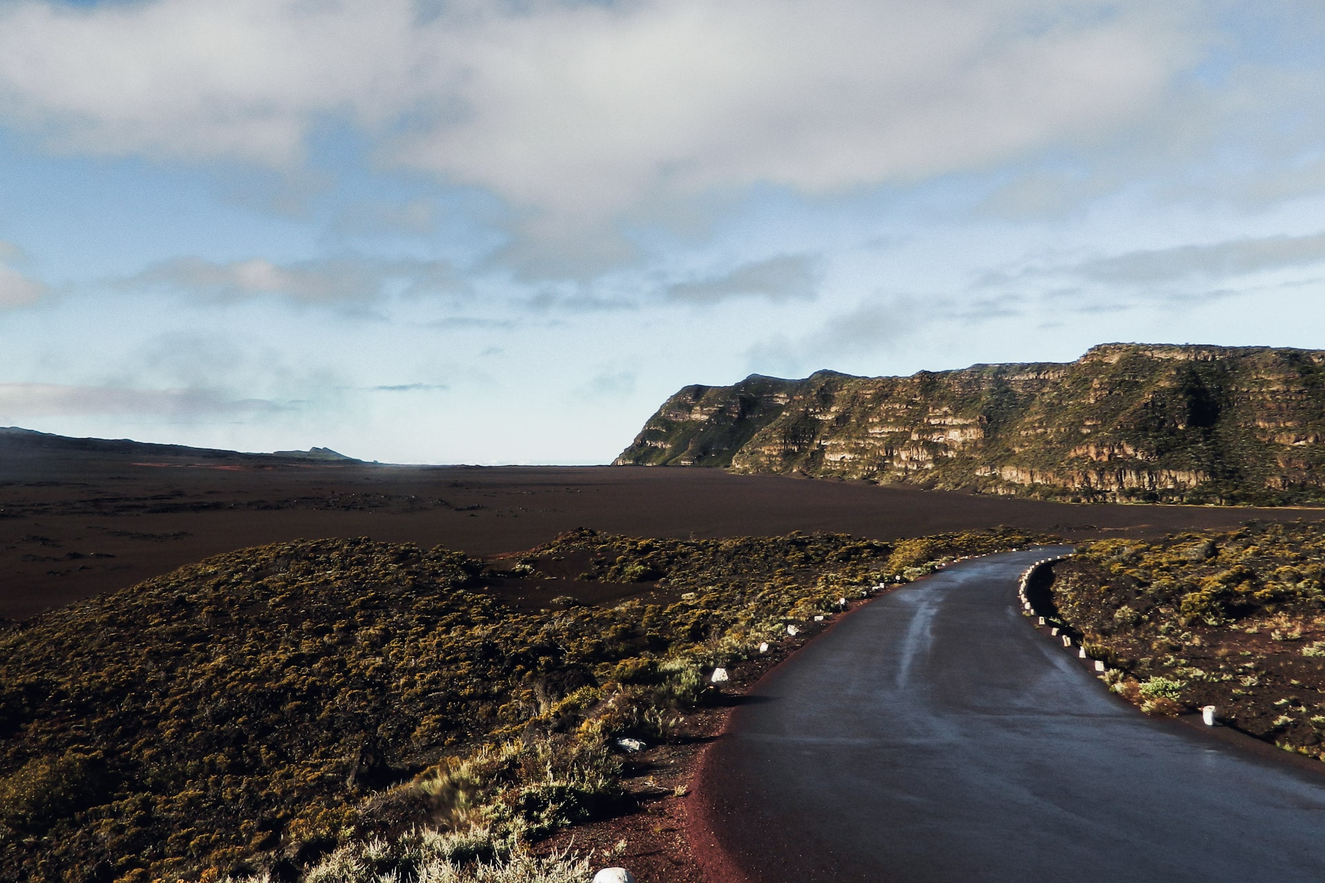
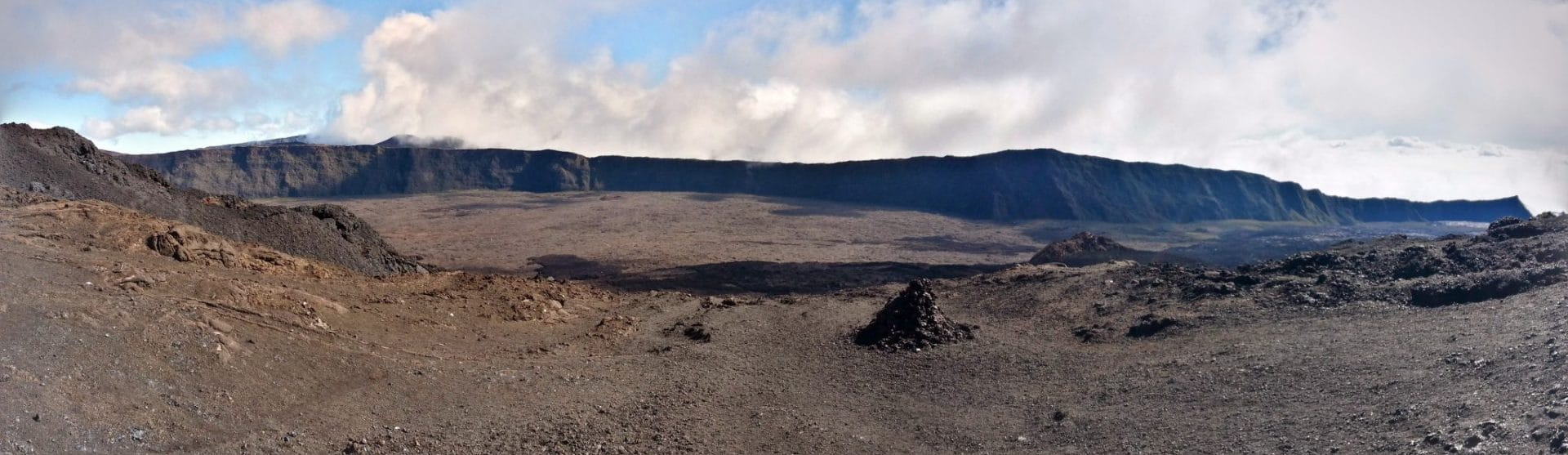
The Volcano Road is beautiful, it starts with a good climb that leads to the top of the ramparts, then down into the vast Plain of Sable, all made of basalt, totally desolate. Everything is very scenic. This is the first time I find myself in this kind of volcanic environment is beautiful and impressive.
We arrive then at the car park which gives access to the Piton as such. Before attacking “the climb” on the crater, we will drop our things at the Volcano Lodge where we will spend the night. The cottage offers incredible views of the slopes of the volcano to the Indian Ocean, 2200m below.
All light, without our big bags, we start for the crater Dolomieu.
The path to the crater is well marked but be careful not to deviate too much because the rocks may be unstable elsewhere. Accidents happen every year, not to mention the hikers who get lost in the Enclos Fouqué. Also do not forget to take water with you (in sufficient quantity) because the volcano is totally arid.
The beginning of the hike begins with the descent of the Remparts de Bellecombe, impressive wall of 100-150m high. Once down, we quickly arrive at Formica Leo, a small volcanic cone secondary to the beautiful glowing color.
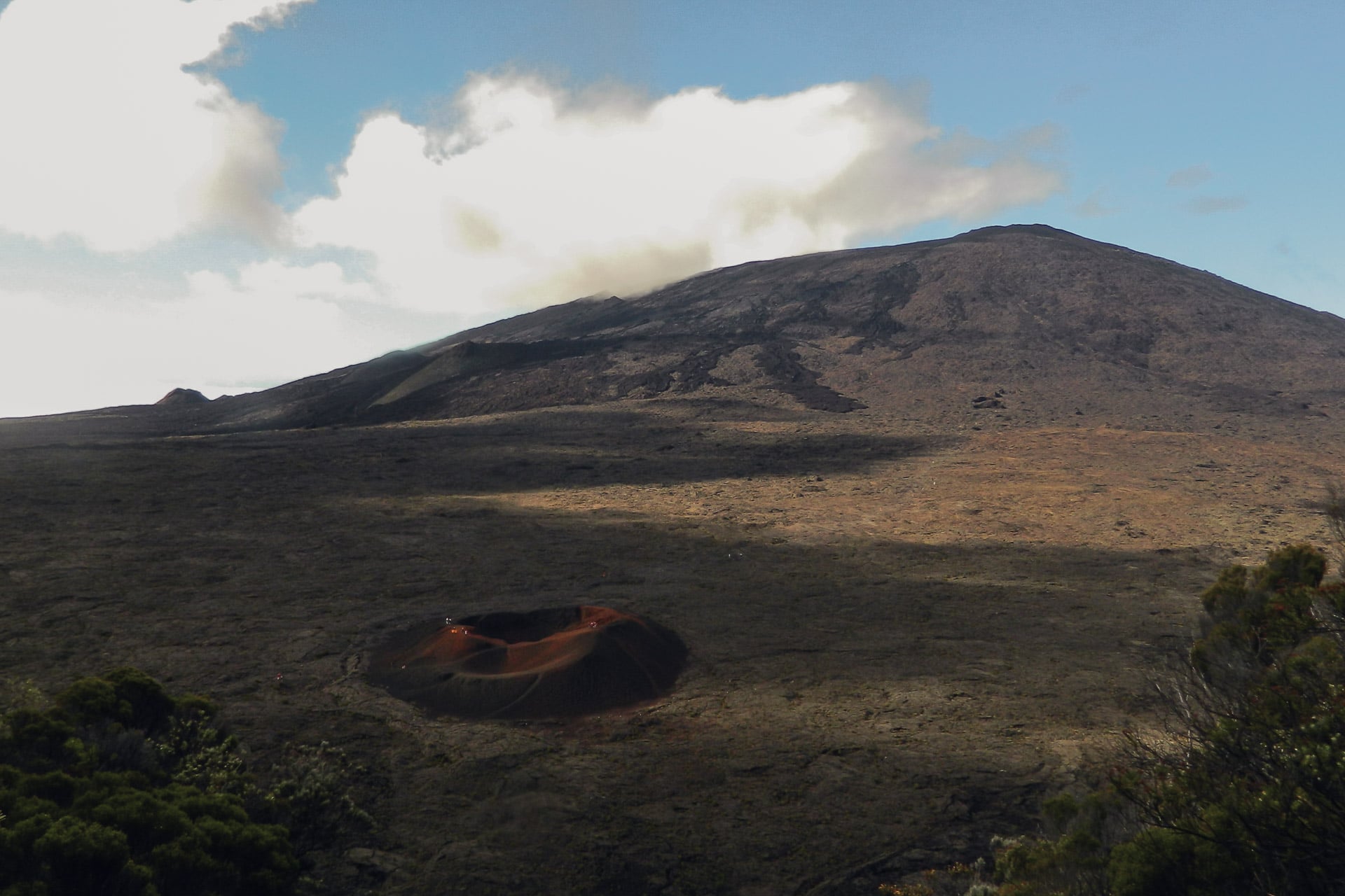
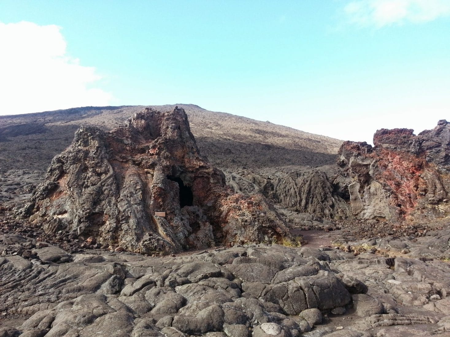
We then evolve in the Enclos Fouqué through ancient petrified lava flows. The diversity of shapes and rock structures is impressive.
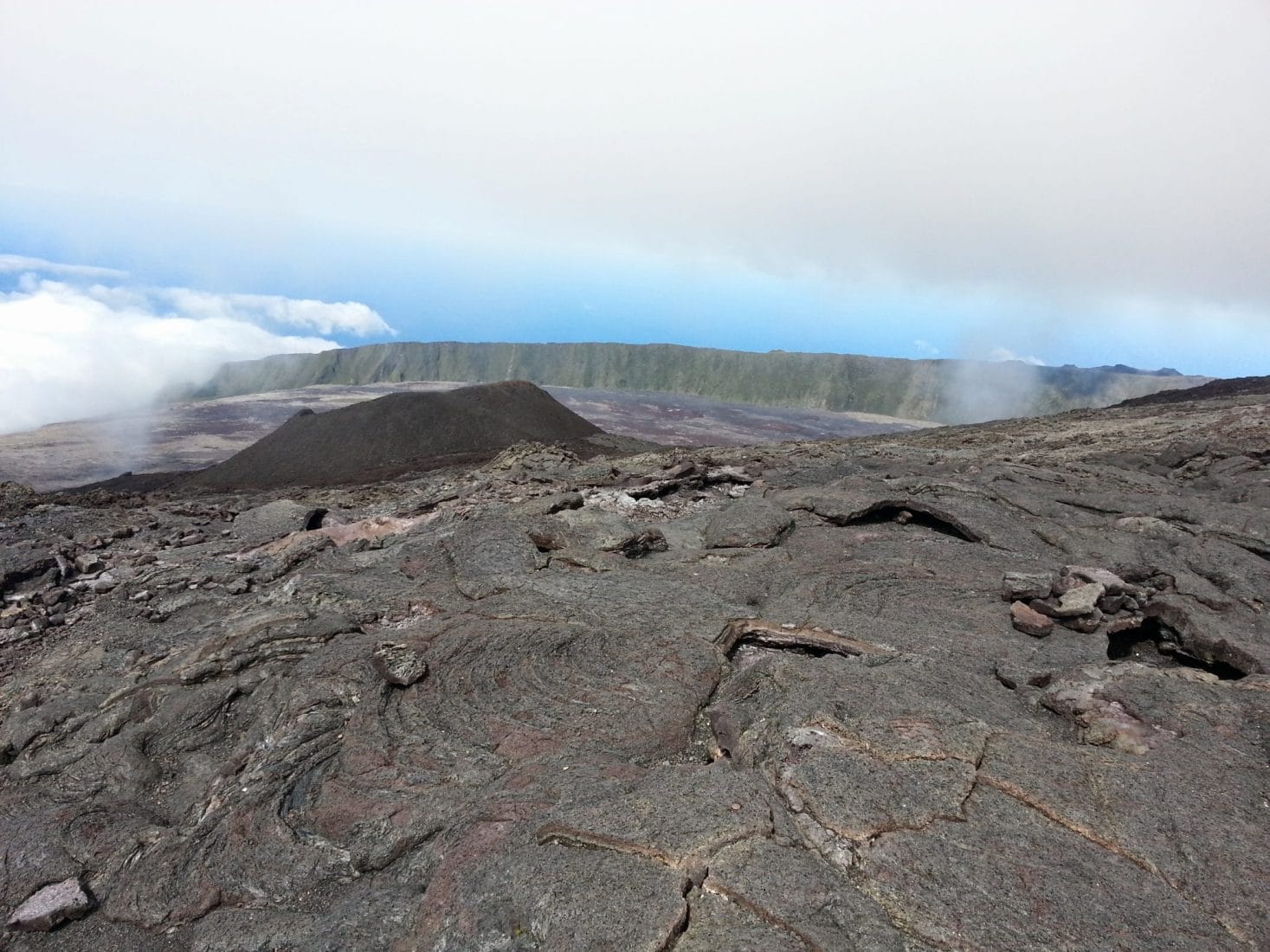
After this vast flat area, we really start the climb. As the northern part of the circus unfolds. The clouds coming from the Indian Ocean stopped on the northern ramparts, all around us the color has disappeared, everything is black gray, it’s beautiful. There are not many people.
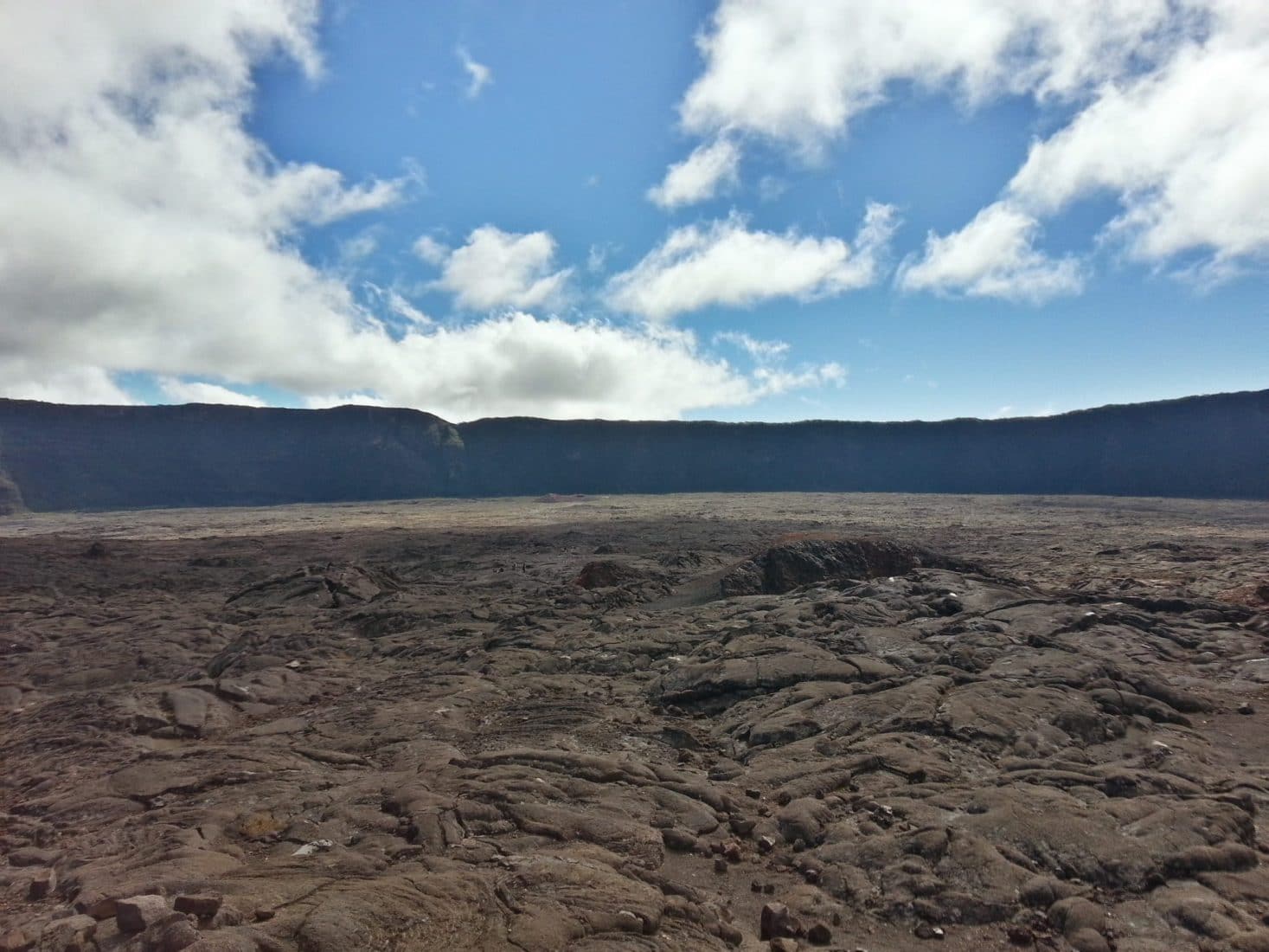
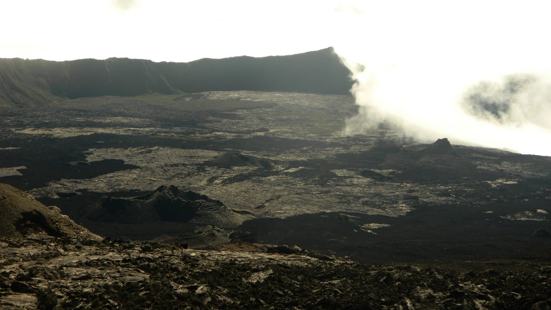
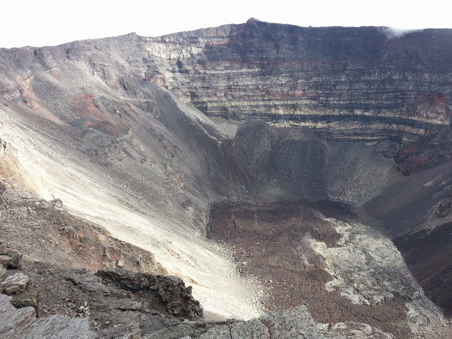
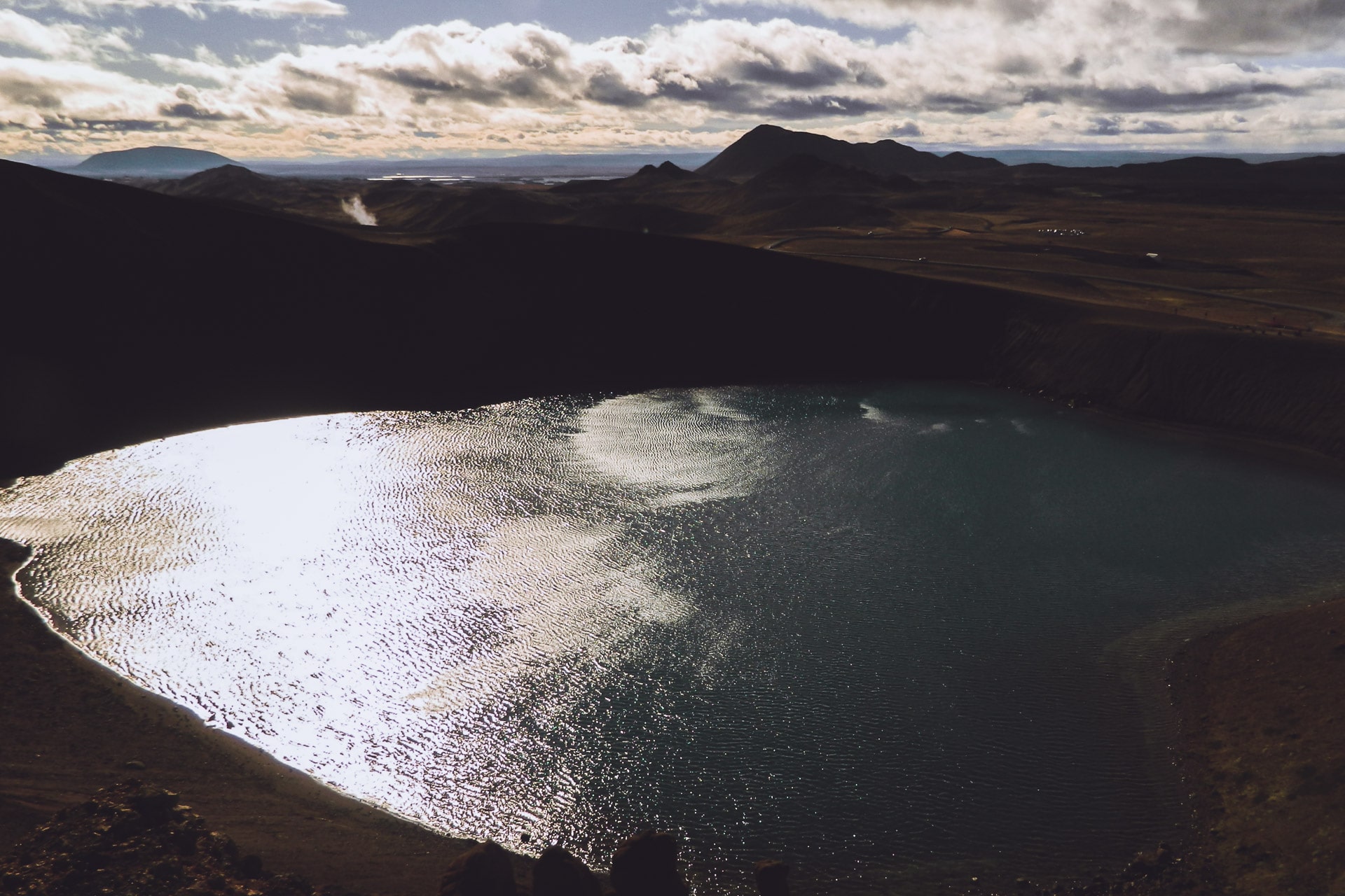
We finally arrive at the summit at 2632m. The path leads to the edge of the crater. This last 1km wide and 350m deep, gently smokes in the background, the only witness of its activity.
There are a few people, all enjoy the view, the atmosphere.
We start the descent after this little break at the top. We take the same path in the opposite direction. It’s very hot, luckily we took some water.
Back to the Bellecombe Rempart we start a run up and the 150m will be done in not even 15min.
We then settle in our pretty rooms of the Gîte du Volcan. The end of the day will be spent having a shower, resting and reading in the dining room of the cottage which offers a superb view of the ocean.
End of the trip
This is where the trek will stop for us. Indeed, the prospect of the descent from the Piton de la Fournaise to the sea level, that is to say a little over 2000m of D- did not delight us, our knees either. We also wanted to join “quickly” the west of Reunion to land a few days at the beach. We decided to join Saint Paul to continue the holidays in quiet mode but finally we will drive again this time make a four-day road trip around the island …
So we have to find someone who wants to take us hitchhiking and leave the GR …
Conclusions
What a fantastic trek! Each portion, each kilometer offers a landscape, an atmosphere, a different climate. The Piton des Neiges and the Refuge offer a breathtaking view, the Piton de la Fournaise is impressive in more ways than one but the most beautiful discovery of this “ride” will remain Mafate, its landscapes and its population. This small circus isolated from the world is a paradise that must be protected and kept intact.
Like all the GR, the GR-R2 is perfectly well marked which offers an appreciable comfort. We focus on the view and not only on the route. In addition it makes us go through the key places, so this is the ideal way to discover the island of Reunion.
To conclude: go to Reunion, go there the GR, eat rougaille sausages, drink Dodo lemon and enjoy the spectacle that landscapes offer!
Concerning Reunion, this little piece of France lost in the Indian Ocean is absolutely to discover. Its richness is exceptional whether in terms of landscape, culture or gastronomy. Regarding the locals, it’s very cliché to say, but the Reunionese are really hospitable and friendly. Everything is there to spend unforgettable holidays!
Iceland Road Trip
3500km
driven
65km/h
average speed
+50
wonderful waterfalls
1
volcanic eruption
3trolls
(petrified)
Iceland is very trendy currently and it’s easy to understand why. This country is amazing! Between the US and European tectonic plates, Iceland is experiencing a strong volcanic activity in an atmosphere of Far North, all dotted with majestic cascades, lakes, immense empty spaces … It is perfect! This trip was my first road trip solo, Iceland lends itself quite to this kind of travel. Follow me during this 14 days in the land of the Volcanoes, the elfs and the hidden people.
About Iceland
Although lost in the middle of the North Atlantic by 66 ° latitude, Iceland is part of Europe. The island has an area equivalent to one fifth of metropolitan France but has only 300,000 inhabitants. The population concentrates on the coastal strip and especially in the Reykjavik metropolitan area which welcomes 200,000 people as much as to say that the rest of the country is practically empty! Iceland is a paradise for hikers looking for of wild solitude or to undertake a road trip during which you will meet only one or two cars per hour …
Iceland is also interesting from a historical point of view. Although its settlement by Irish monks will go back to the 8th century AD, the island grew during the Viking period in the 9th and 10th centuries. It has been used for the conquest of Greenland by Erik the Red (in 984) and then surely of Vinland by Leif Erikson. There are many relics of this period in the country, be it buildings, but also in a certain way of thinking and in certain beliefs.
Concerning beliefs it is interesting to note that 40% of the population believes in elves and in a race of invisible humans but well present, hidden people. This belief is so strong that it is taken into account when building roads for example so as not to destroy an elven place.
Iceland is also known for its volcanic activity. We all remember the complete cessation of air traffic in 2010 after the eruption of the Eyjafjöll. Iceland is straddling the Atlantic rift, that is, part of the country is in America and the other in Europe to simplify. There are about 130 active volcanoes, geysers, fumaroles and other telluric phenomena, volcanism is omnipresent. Humans use this resource to create electricity (geothermal energy) or to heat themselves. Even the water from the shower had a small sulfur smell.
From a climatic point of view, Iceland has a relatively temperate climate although it is located just below the Arctic Circle. This is due to the fact that the island is bathed by the Gulf Stream, so temperatures are still relatively mild even in the middle of winter when compared with other countries at the same latitude; For example the average temperature of the coldest month (January) is -0.5 ° C. However the climate of Iceland is not to be taken lightly, this one is very changing and can be violent with a lot of wind and rain. One can easily see the four seasons in a few hours, an Icelandic proverb summarizes very well this changing nature of the weather: “If weather does not please you, wait just five minutes”
Day 1 : from Paris to Reykjavik
It is early September and it is the departure for Iceland for a journey that was in my head for a long time. Take off at 12:45 from Charles de Gaulle airport (France) and a few hours later here I am! I’ll be all alone for this trip, my first trip 100% solo … We’ll see how it is…
Once at the airport I get my little car that will be my companion for these two weeks, it will be a red Kia Rio. I would have preferred a 4×4 to explore the famous F-Road but the price of the rental on its own was a bit high.
In Iceland most of the inner roads are “F-Roads”. It is road are not tarred and can go through lookouts … The use of an appropriate vehicle is legally required, so you have to have a 4×4 to go through them. Do not engage lightly on these roads especially if you have to cross a river, on this point the F35 is very convenient because it stays dry all along.
First stop: to reach Reykjavik to finish the day.
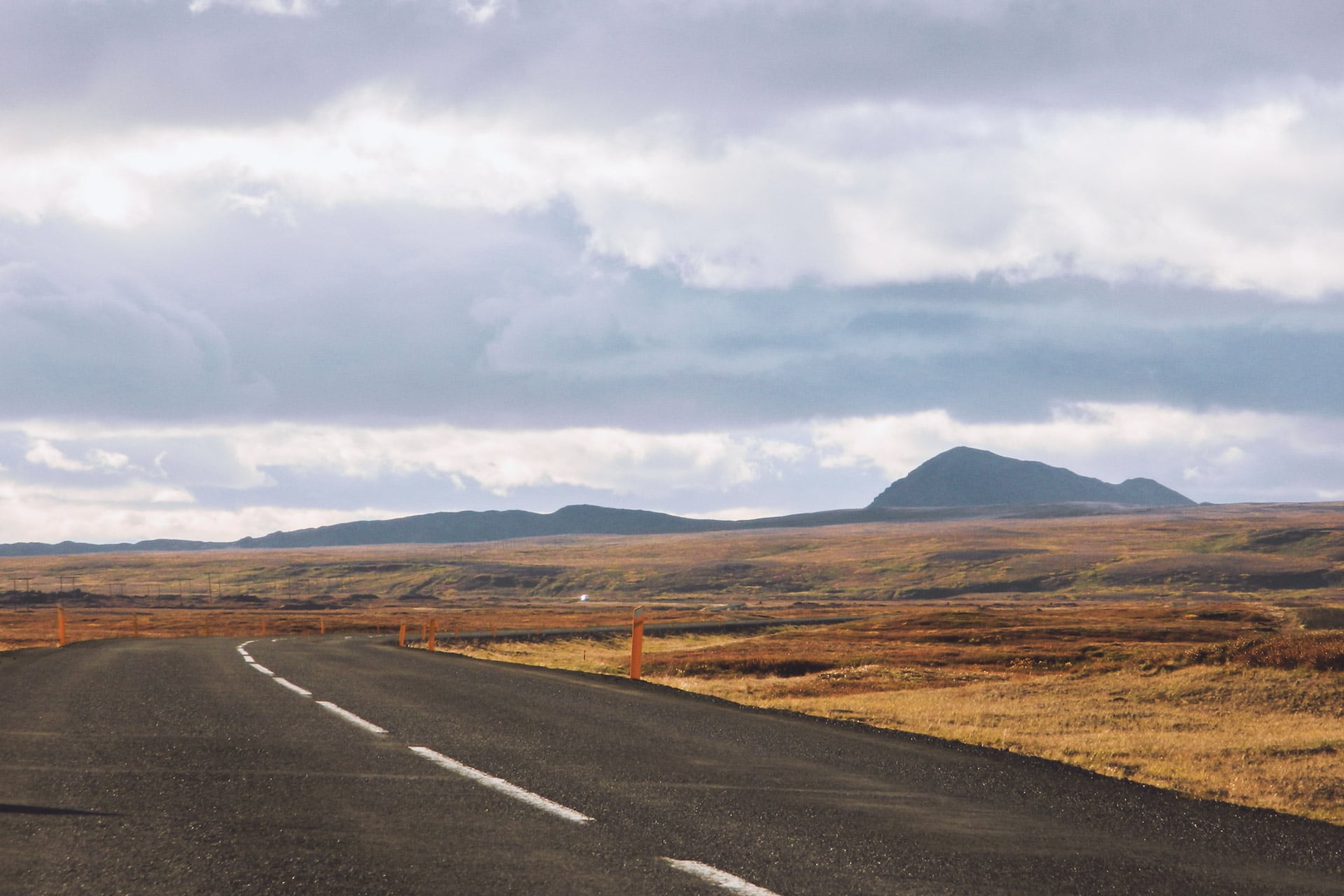
The road between the airport and the capital is nice : the landscapes are volcanic and empty. It’s nice even under the clouds.
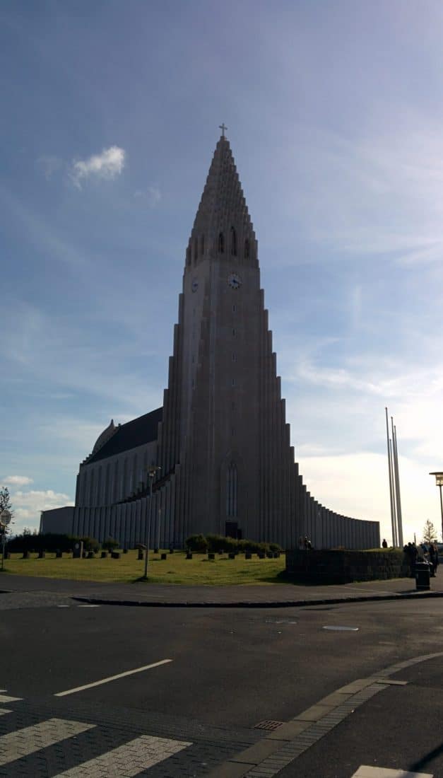
I arrive in one hour in the city center. Although it is the capital, there are only 200,000 inhabitants in Reykjavik. So the city is not very big. I find the hostel where I spend the night (Kex Youth Hostel). I then go on a tour in town and a complement of groceries.
The city is nice but I do not have much time to walk around, I will do this on the last day.
I will finish the evening by eating in a nice restaurant offering soups served in a loaf of hollow bread and going to bed early to be fit for the next day.
Day 2 : Golden Circle
Wake up at 6:30 am because today is the first real day here and it is busy. The idea is to go through the Golden Circle, the area to the north east of Reykjavik and which concentrates many places to visit. It is also one of the densest areas in terms of tourism even if it remains content.
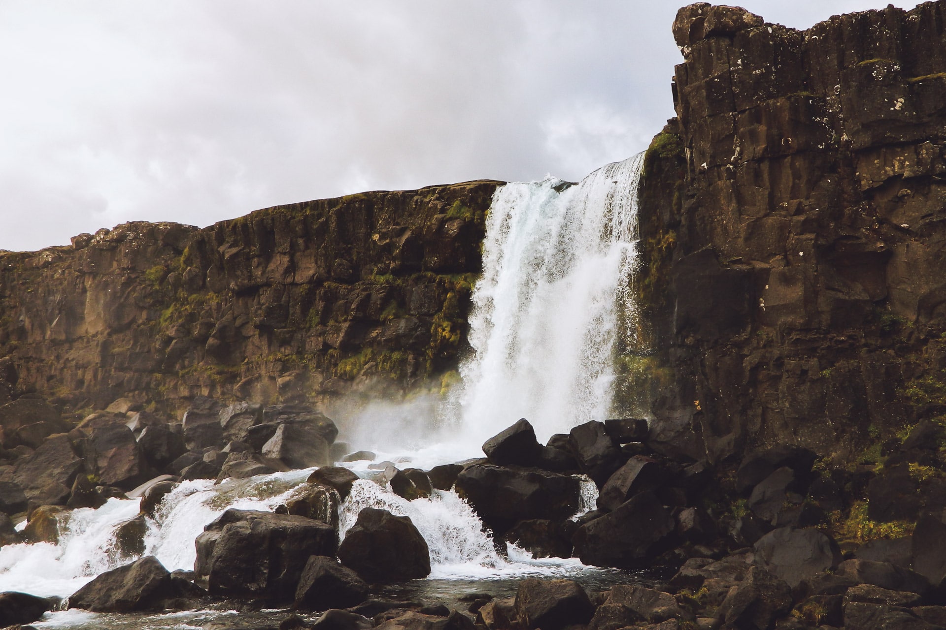
For the moment I leave the city and I am following the road 36 towards the lake of Þingvallavatn.
The “Þ” is pronounced much like the “th” in English. We find for example this letter in the name of the famous Norse god Thor: Þórr
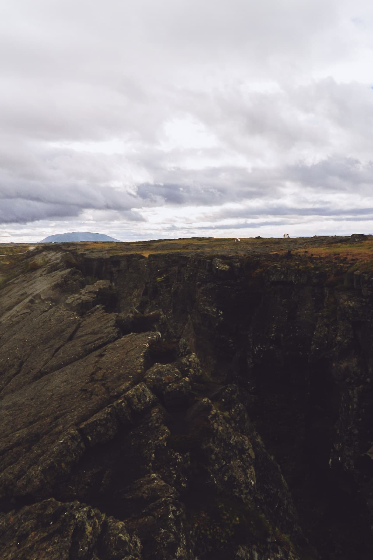
The landscape is beautiful especially under the morning light. The vegetation is reminiscent of the one found in the Nordic countries (like in Sweden), that is to say a shade of dark green and brown. After some time to roll I stop on the road to see a break typical of the local tectonics. The fracture is perfectly visible and the zone feels the suffer testifying to a close volcanic activity.
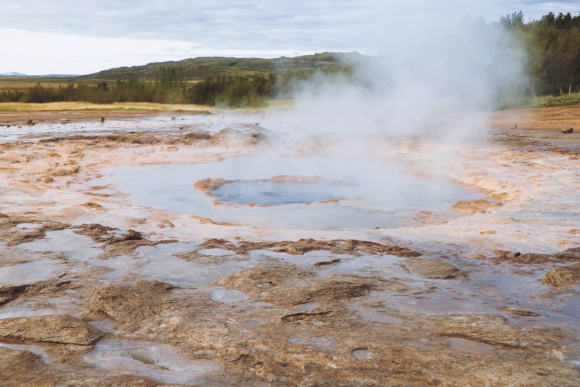
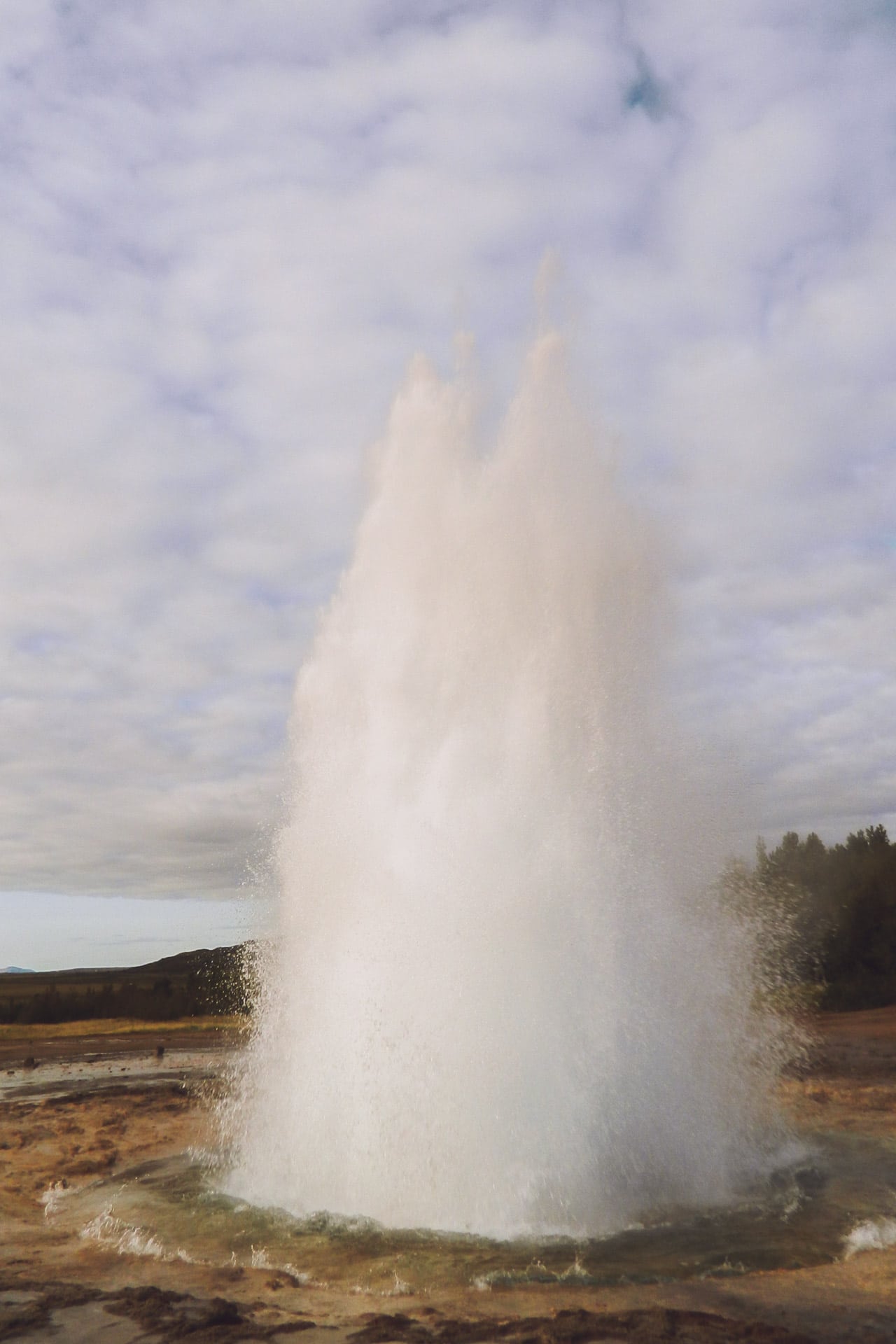
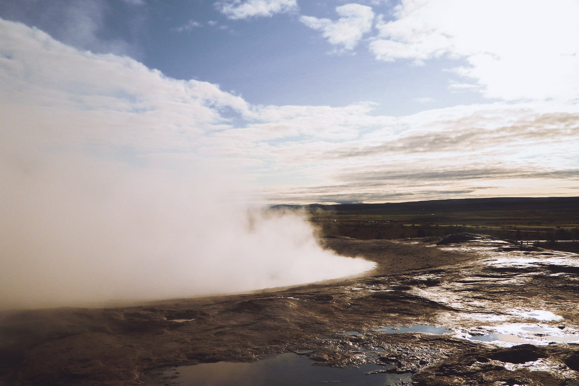
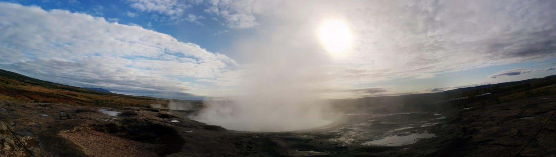
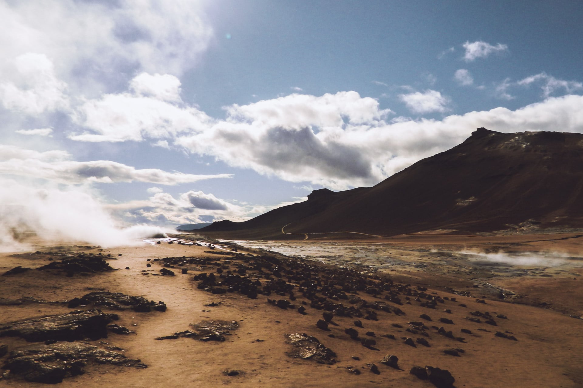
I then continue my route to the famous Geysir, the geyser to whom we owe the name of the phenomenon. We feel when arriving on the spot that the place is tourist but there are not too many people in this morning time. The area is experiencing intense geothermal activity: it smokes and it muddles everywhere.
The highlight of the show was Strokkur, the last active geyser, in fact Geysir stopped its impressive “eruption” a few years ago.
Having never seen any geysers before, I must admit that the show is impressive, especially the noise it makes when ejecting the water column.
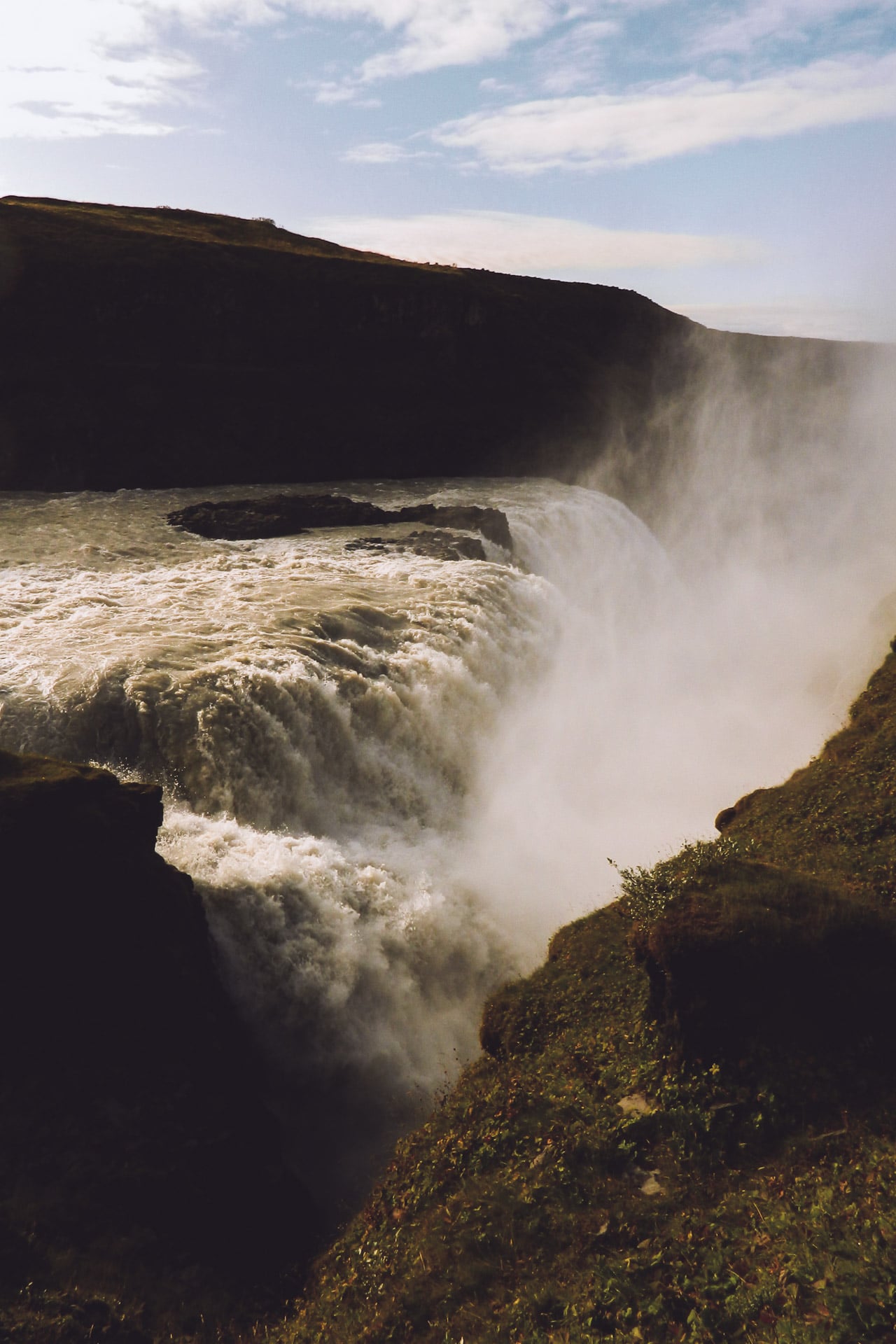
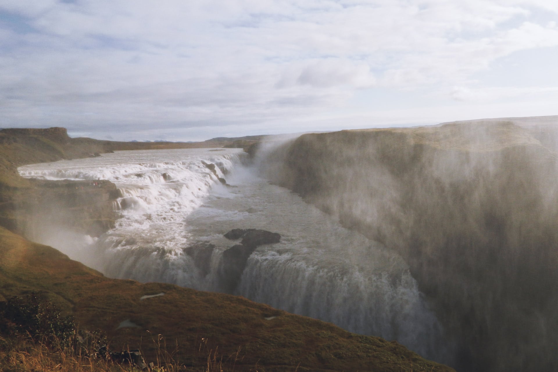
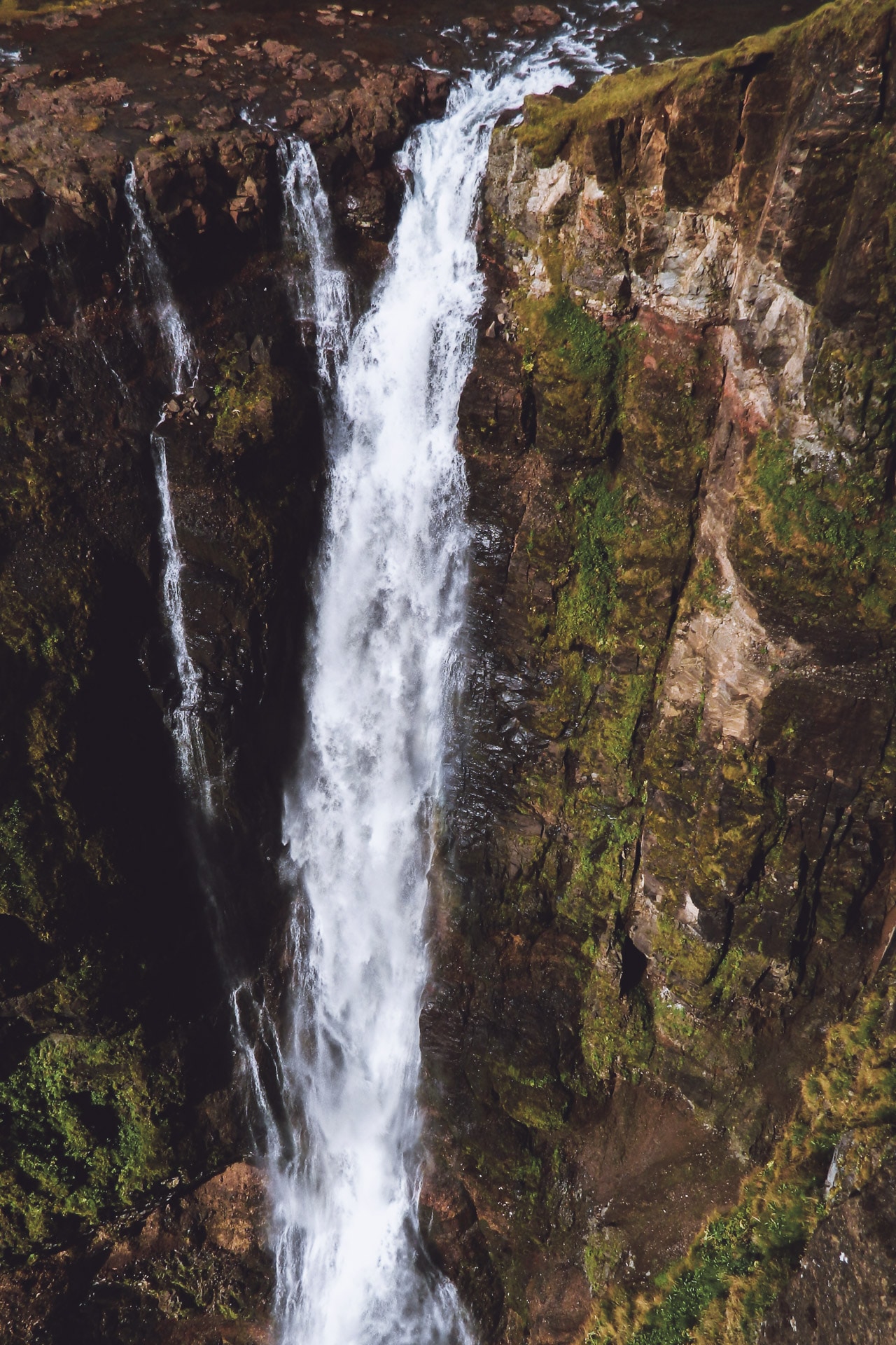
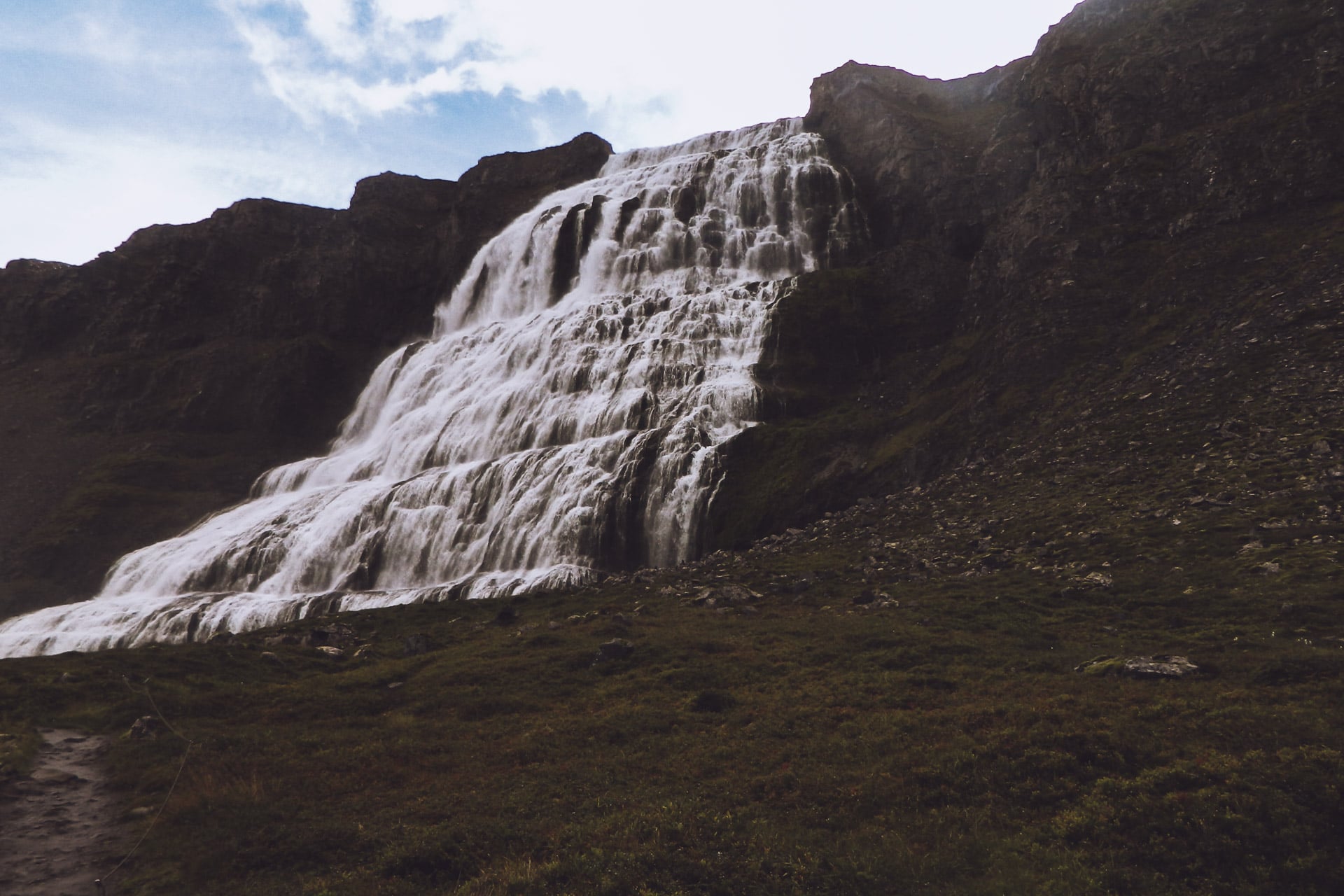
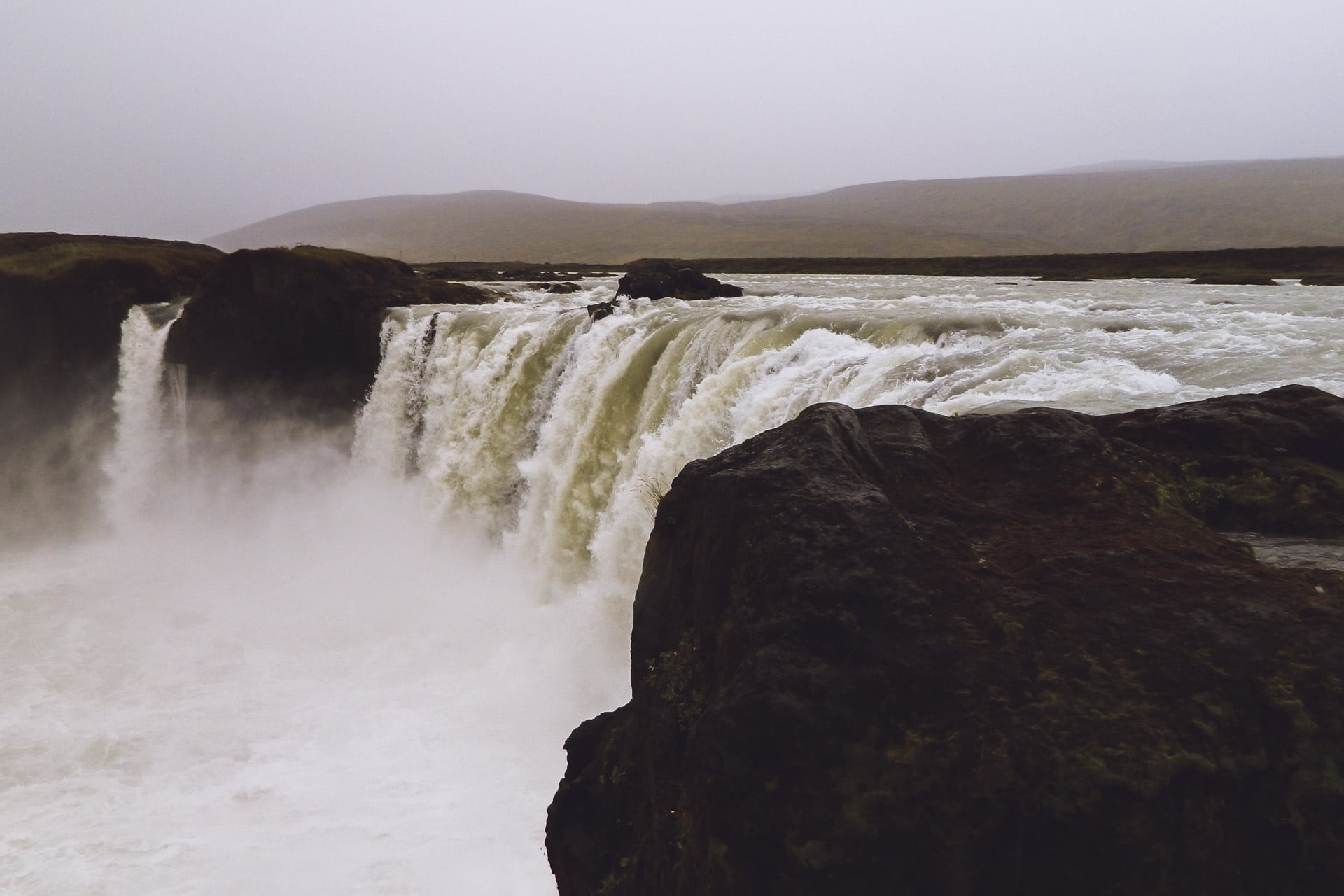
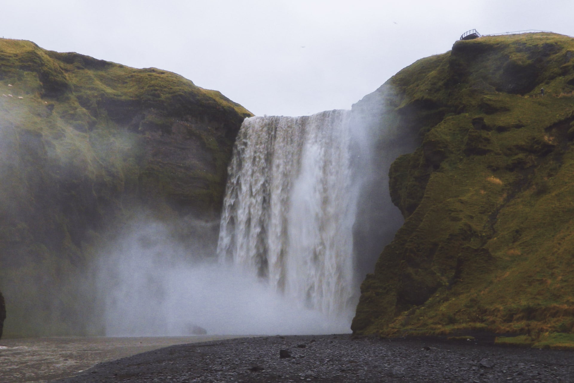
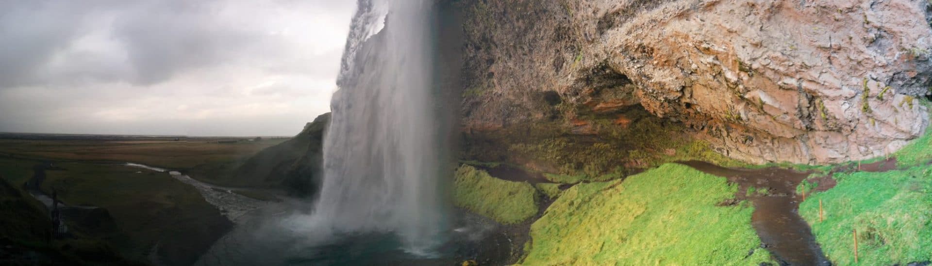
After a long time to admire Strokkur, I take the road to the beautiful waterfall of Gullfoss. This waterfall is stunning especially by the feeling of power it releases. It is not necessarily very high but the flow of water that every second discharges is amazing. I make myself a good coffee right by the water to admire the show.
A little vocabulary: the suffix “foss” means the waterfall.
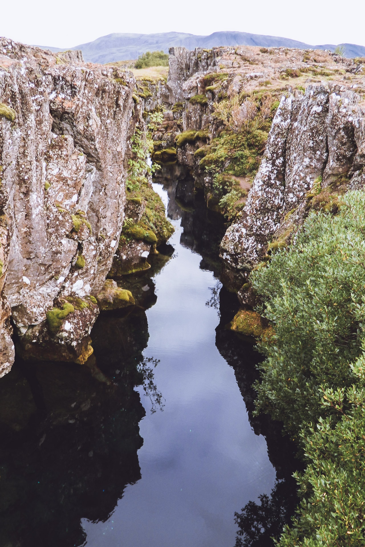
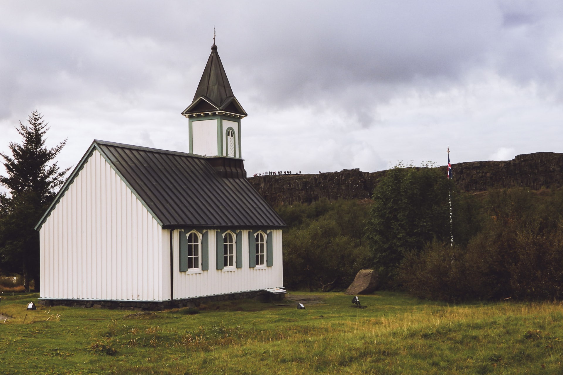
Once the coffee is finished, I turn to the Þingvellir. The site is located along Route 36. It is a very important place of Icelandic history because it is here that it is held for centuries of Þing ie the assembly. It is also a great place to observe the fracture of the rift and to dive in the crystal clear waters filtered by the rocks.
So I take the time to stroll until the tourists agitate me and push me to continue the journey.
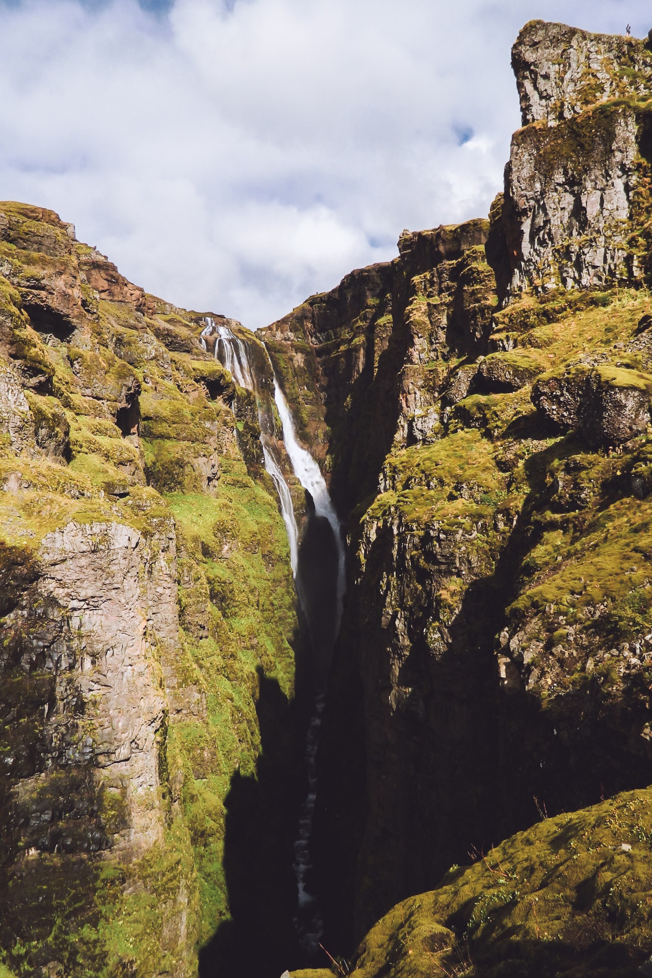
My route then takes me to the Glymur waterfall, one of the highest in Iceland. To get there you first have to follow the road 47 and then finish the way on foot by a small hike very nice even if it climbs hard at the end. The waterfall is very beautiful, nestled between the cliffs and high of its 198m.
Once arrived at the top of the waterfall I wish to go down the other side to vary. The problem is that you have to cross the river that feeds the waterfall. It is nothing very bad if it is that the water is frozen. So I do not hang around (in underpants) and I miss nothing to stumble in the first meters. On the other side I stop 2min to dry with moss …
The descent is much less friendly on this side (right bank) because it’s very muddy …
Back in the car I take the road again and finally, I join the road 1 which will accompany me throughout the journey. I do not stay very long on it because I then fork on the 60 towards the fjords of the North West. I will stop not far from the road in a corner without charm to spend the night in the car.
First good day although in hindsight I should have spent more time in Þingvellir I think.
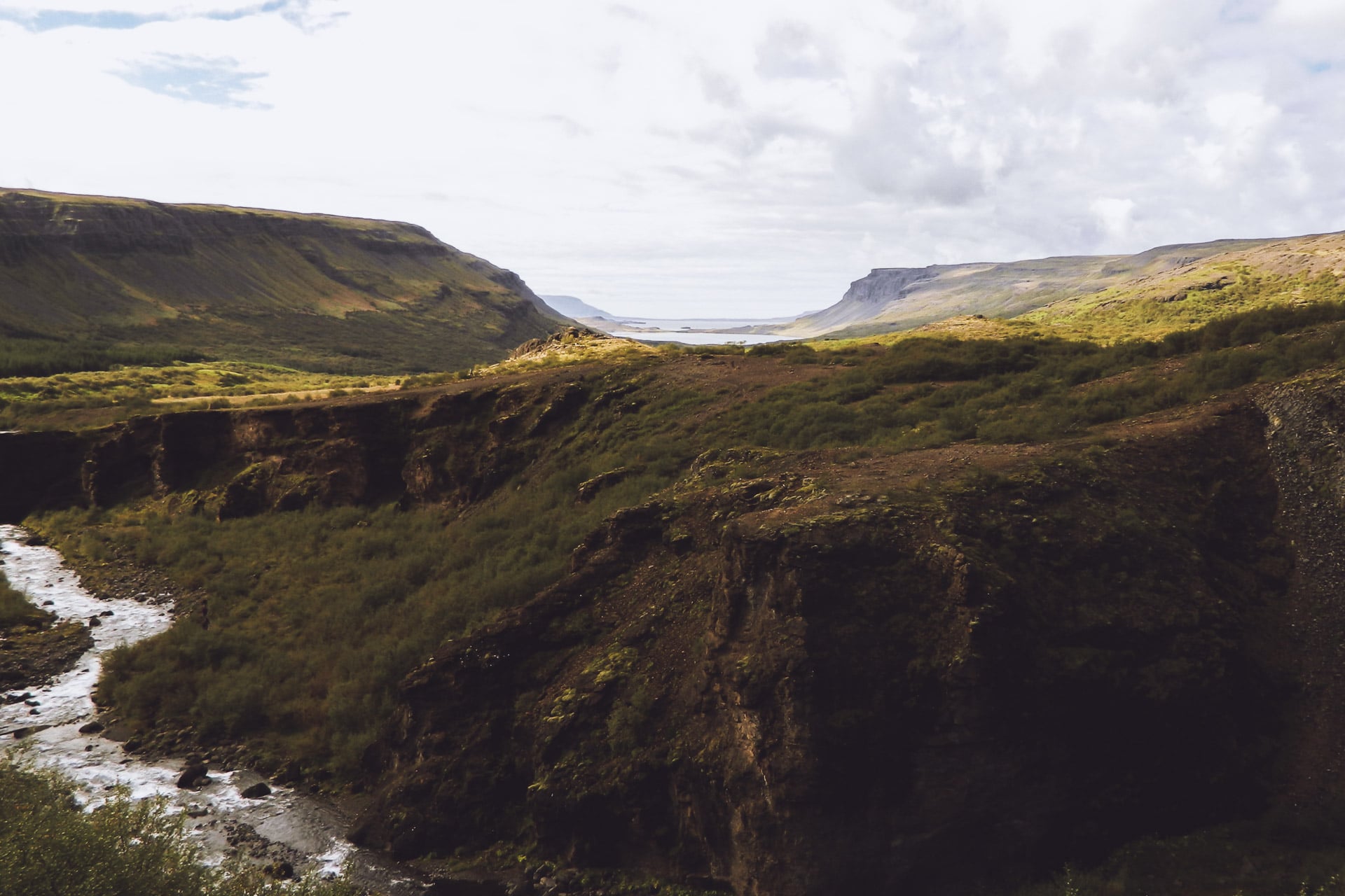
Day 3 : The NW Fjords
I have not slept badly in the car, better than I thought anyway.
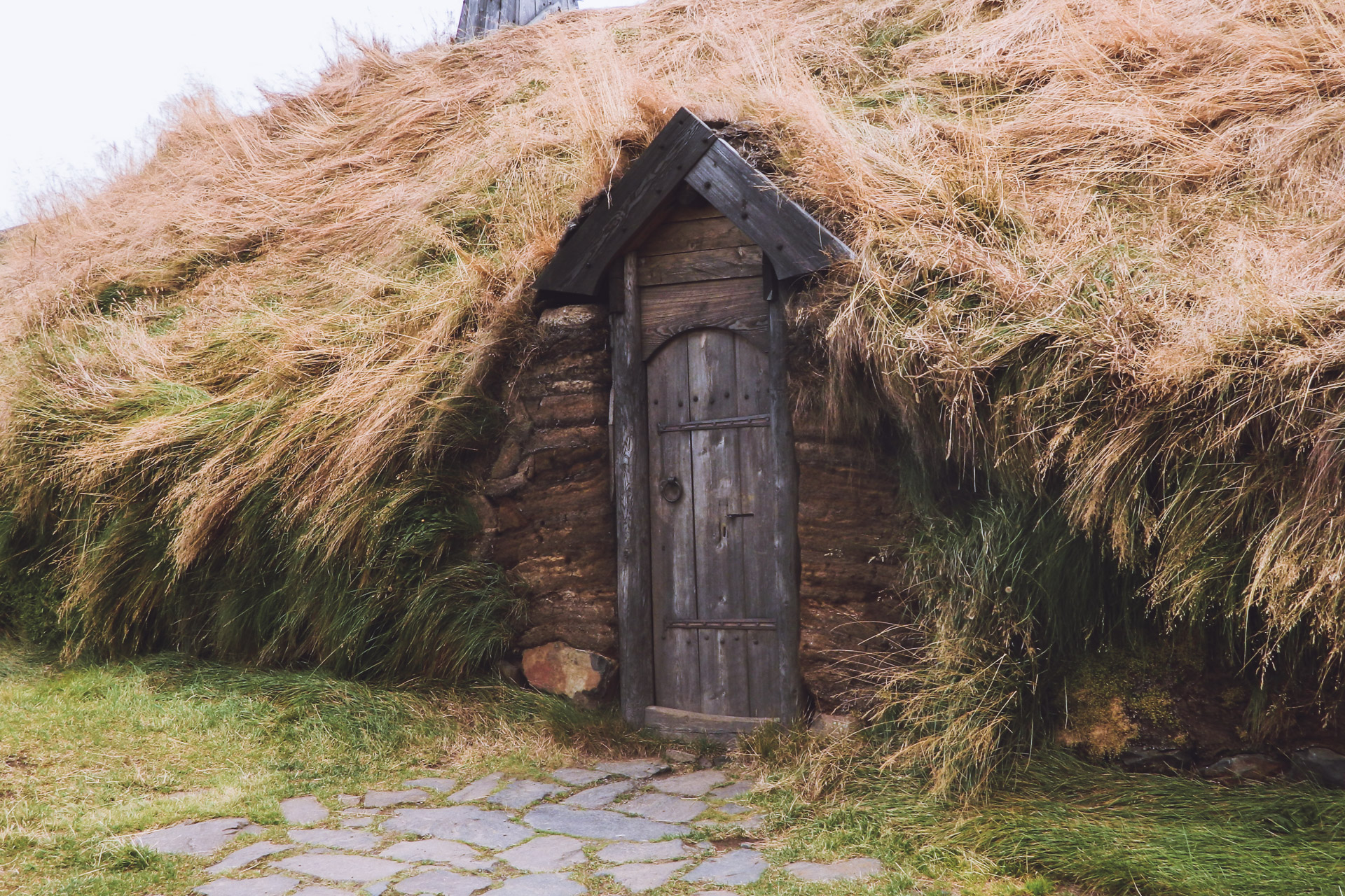
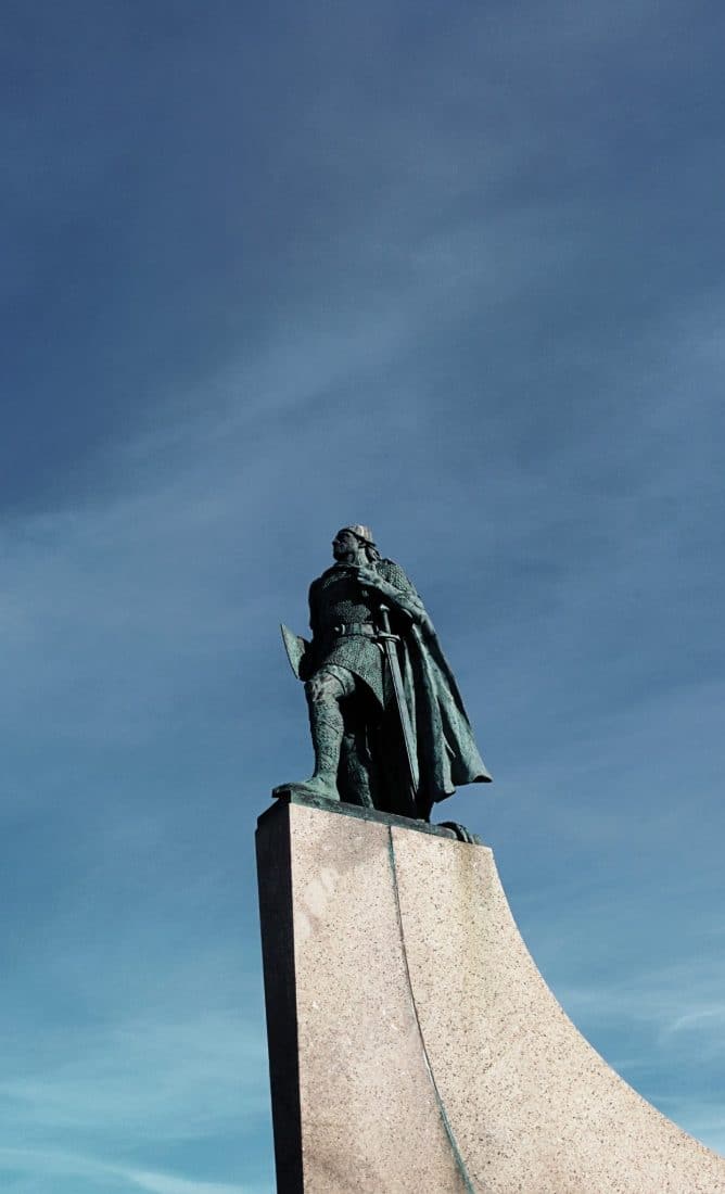
The first stop of the day will be a replica of the house of the Viking Eirik the Red, the first settler of Greenland according to the Sagas.It is a nice place to visit, full of history.
I then continue on to Route 60. New stop after a few kilometers at Sælingsdalur.
It is now to go to see a church of the Hidden People. This church is a big pyramidal hill for ordinary “mortals”, but according to the local sayings it is a spiritual place of the Hidden People. I go there so that I may see all this by myself. So I start climbing the hill. The view is nice but unfortunately no contact with a possible Hidden People …
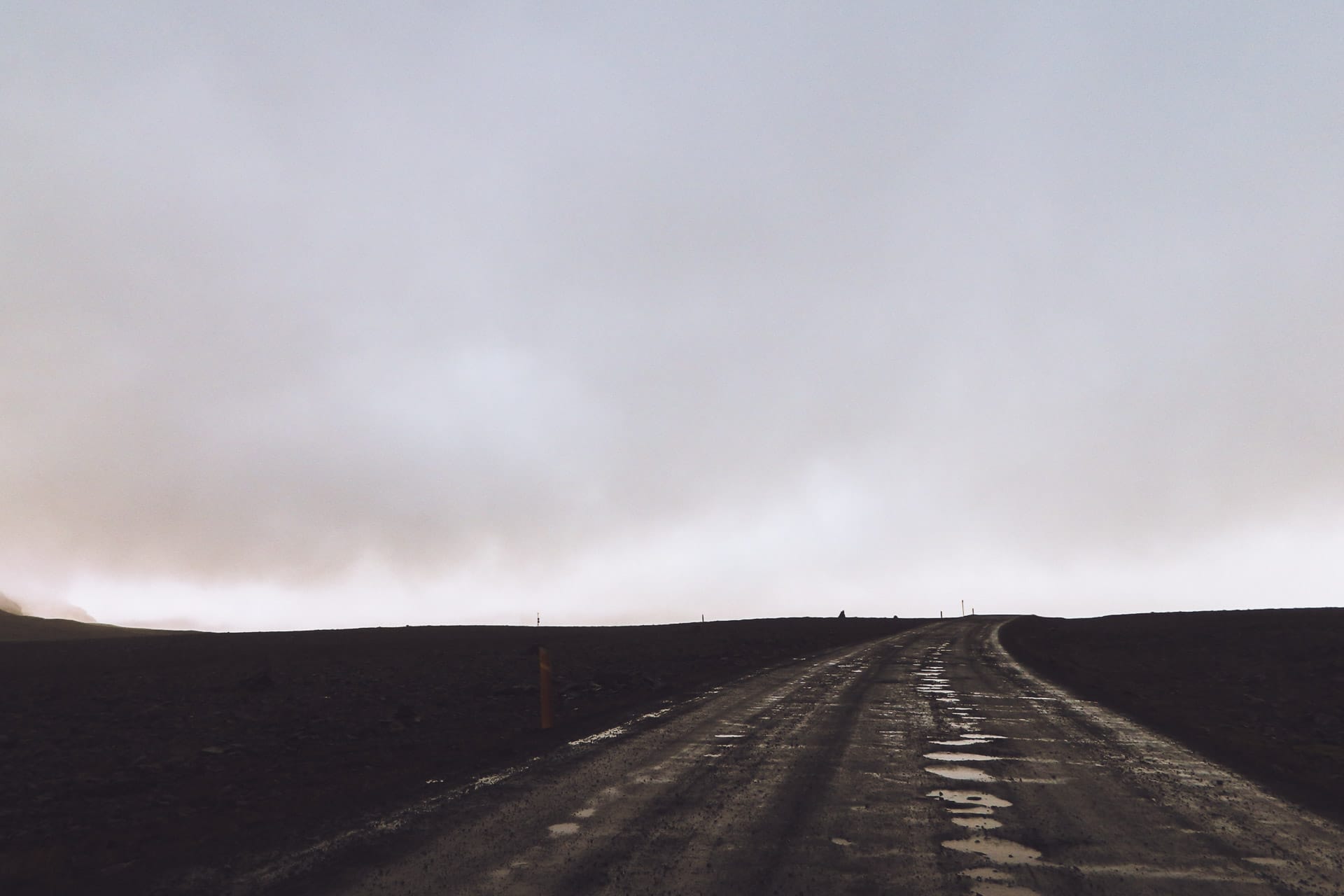
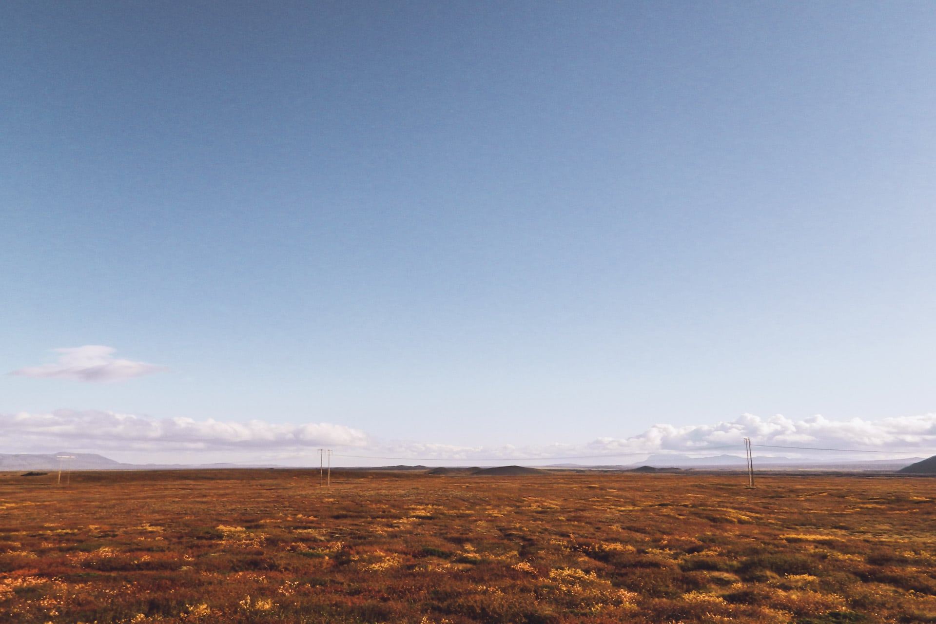
After this last stop I attack the heart of the subject of the North West Fjords because the road is no longer tarred. In Iceland, there is only the main road (the 1) and some adjacent secondary roads that are good. The rest of the roads are carrossable but with a small car is not ideal. So I go slow, not much more than 30km/h. At least I have time to enjoy the amazing scenery. There is hardly anyone on the road, the feeling of loneliness (in a positive way) gently sets in.
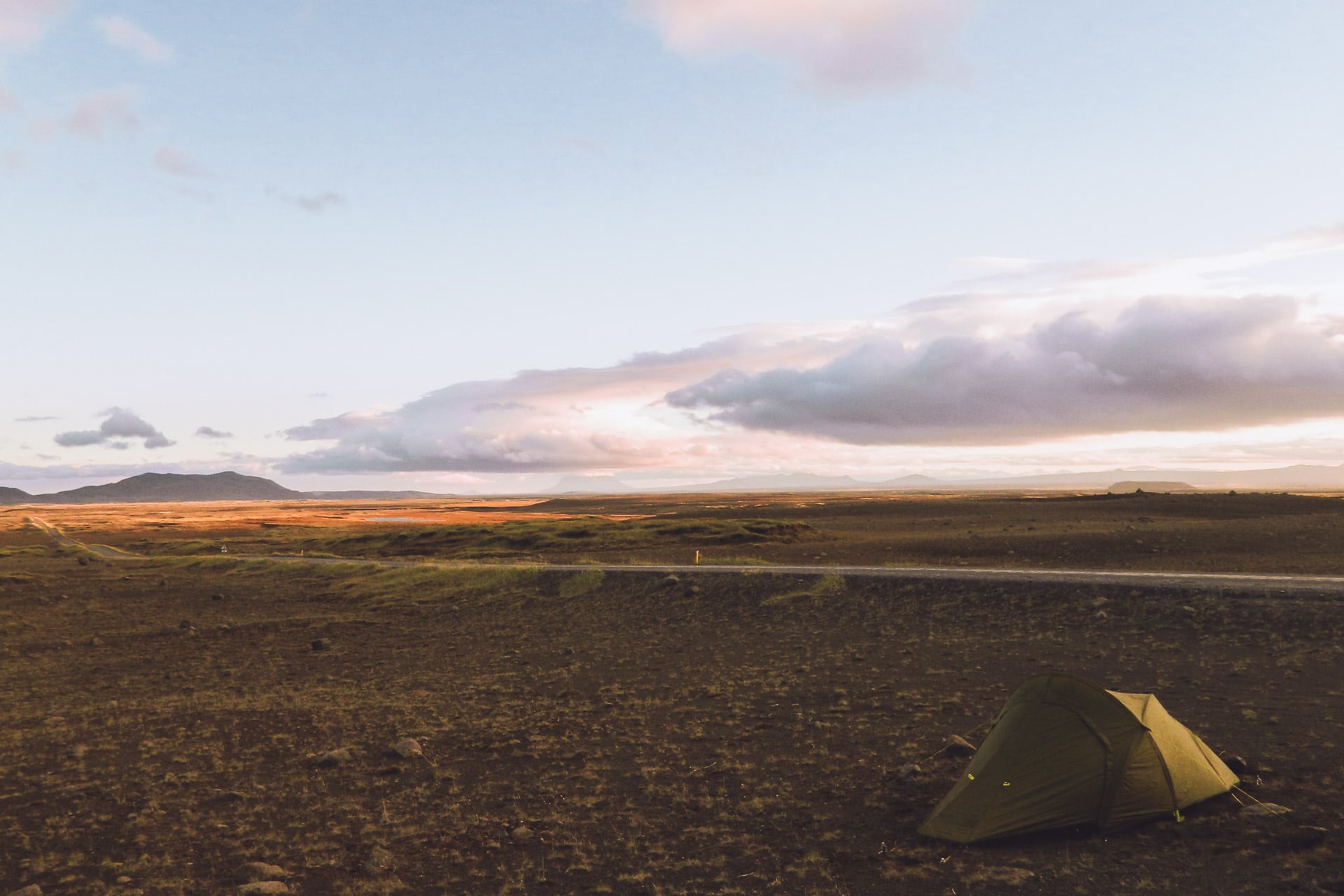
Quickly the weather turns to storm … I do not want to soak my tent tent tonight, so it will be another night in the car. I land at a small pass not far from a statue. Nothing is visible outside but rain. I’m totally wet because I wanted to go for a short walk … bad idea. I will finish the evening so eating cold …
Day 4 : Further in the fjords
In the morning the rain and the fog are still there. So I leave without seeing anything of the view, certainly beautiful of the place in good weather. The road is still so bad and I’m not moving very fast.
Towards the end of the morning, the bad weather calms down a bit and the sun seems to want to break through; which finally arrives around noon thus offering a superb spectacle of rainbows, light shades and light absolutely superb.
I then head for the Fjallfoss waterfall (also called Dyjandi). The road to get there passes through the mountains and I only meet one car for over an hour. The effects of light are still beautiful.
The waterfall is also impressive with 100m high and 30m wide. It looks like a veil on the mountain.
The road then takes me to Isafjorður. I stop there to eat hot (fries and a burger !!!) and also refuel and check that the car is fine. After this break I drive along the coast that undulates to the rhythm of the fjords.
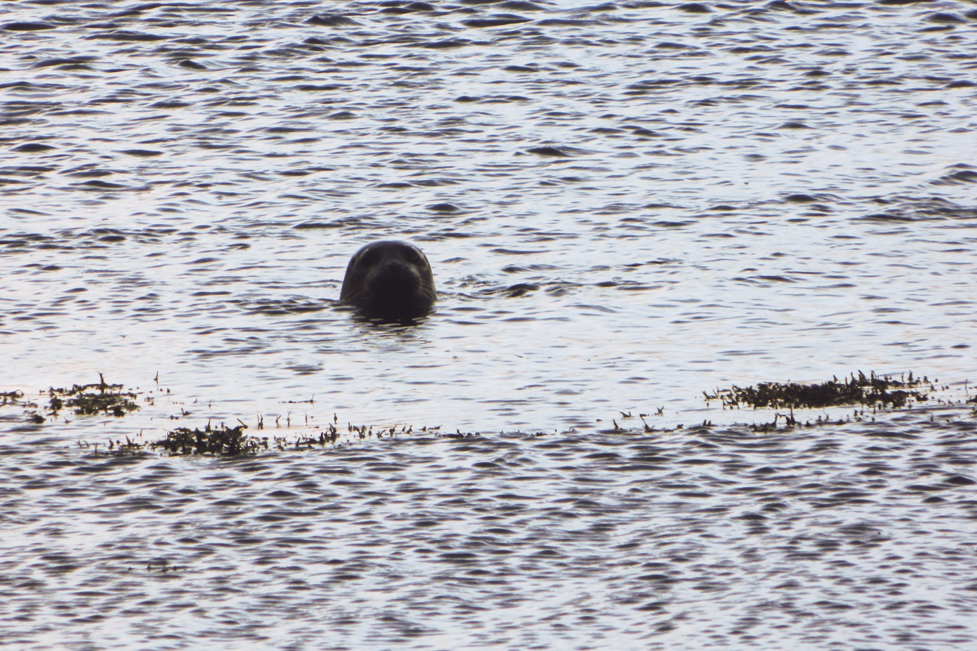
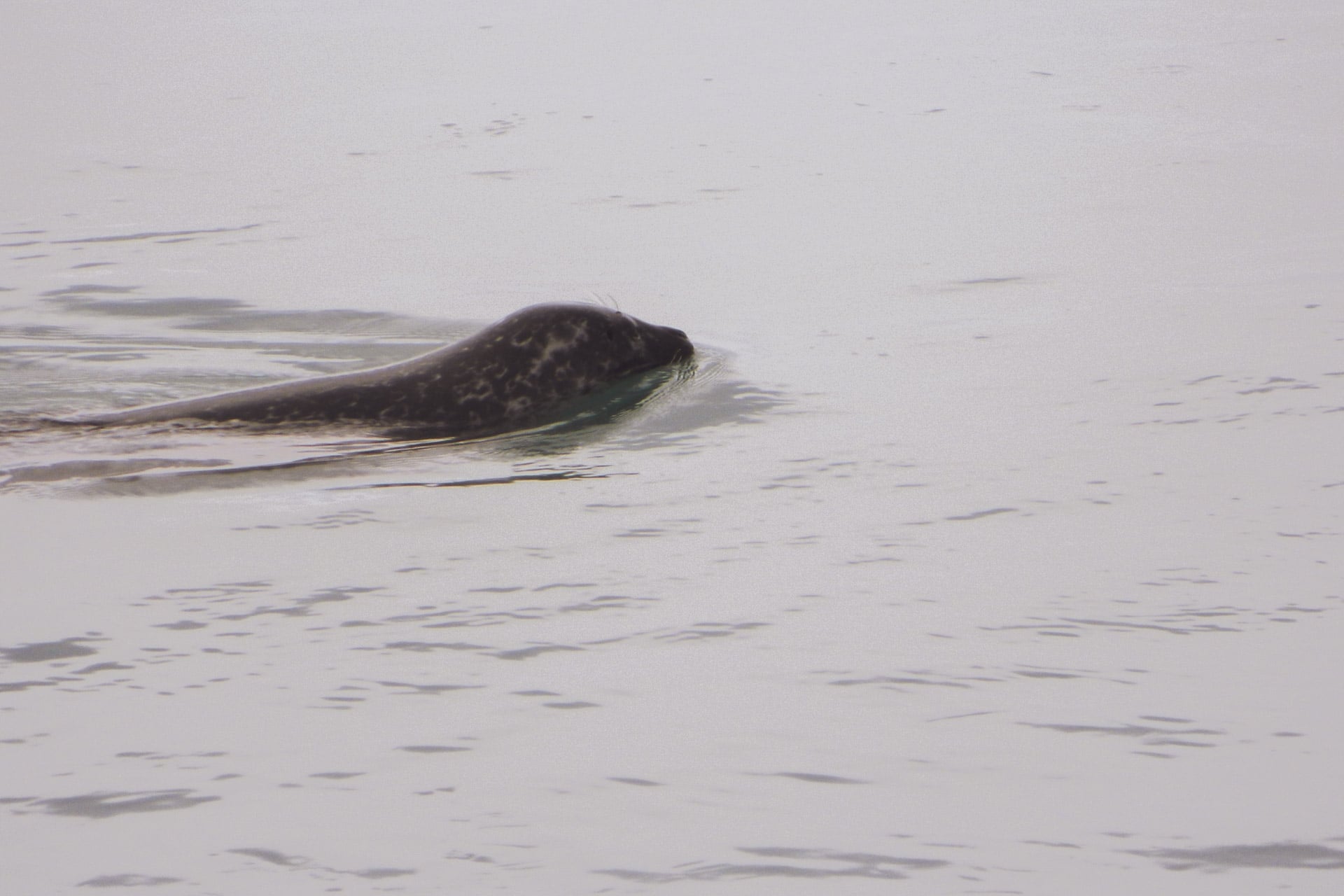
Further to observe the local fauna because a group of seals stays in the zone and by chance they are there at 50m. They keep their distance but they are easy to see.
It is time to find a place for the night, which will be done at the point of Ogurnes. I set up the camp not very far from the road but given the passage, close to zero, I will not be bothered. Last spectacle of a day, there, is in the middle of the fjord, a whale whose I can see the breath, too far for the camera but very nice nevertheless.
Day 5 : Out from the fjords
A good little night lulled by the sound of the surf and 0 cars. The mornings are cool in the beginning of September.
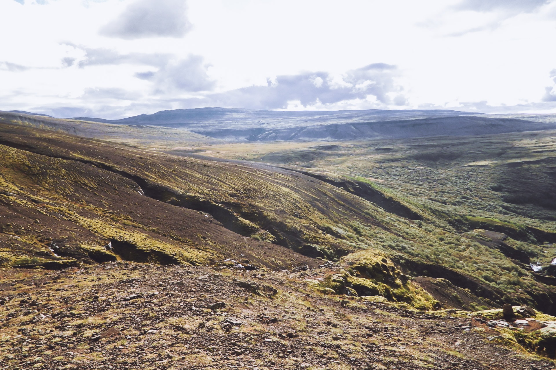
I take the road again to get out of the fjords. Before reaching Holmavik, I go through a kind of plateau, totally desolate and rocky. This emptyness is beautiful.
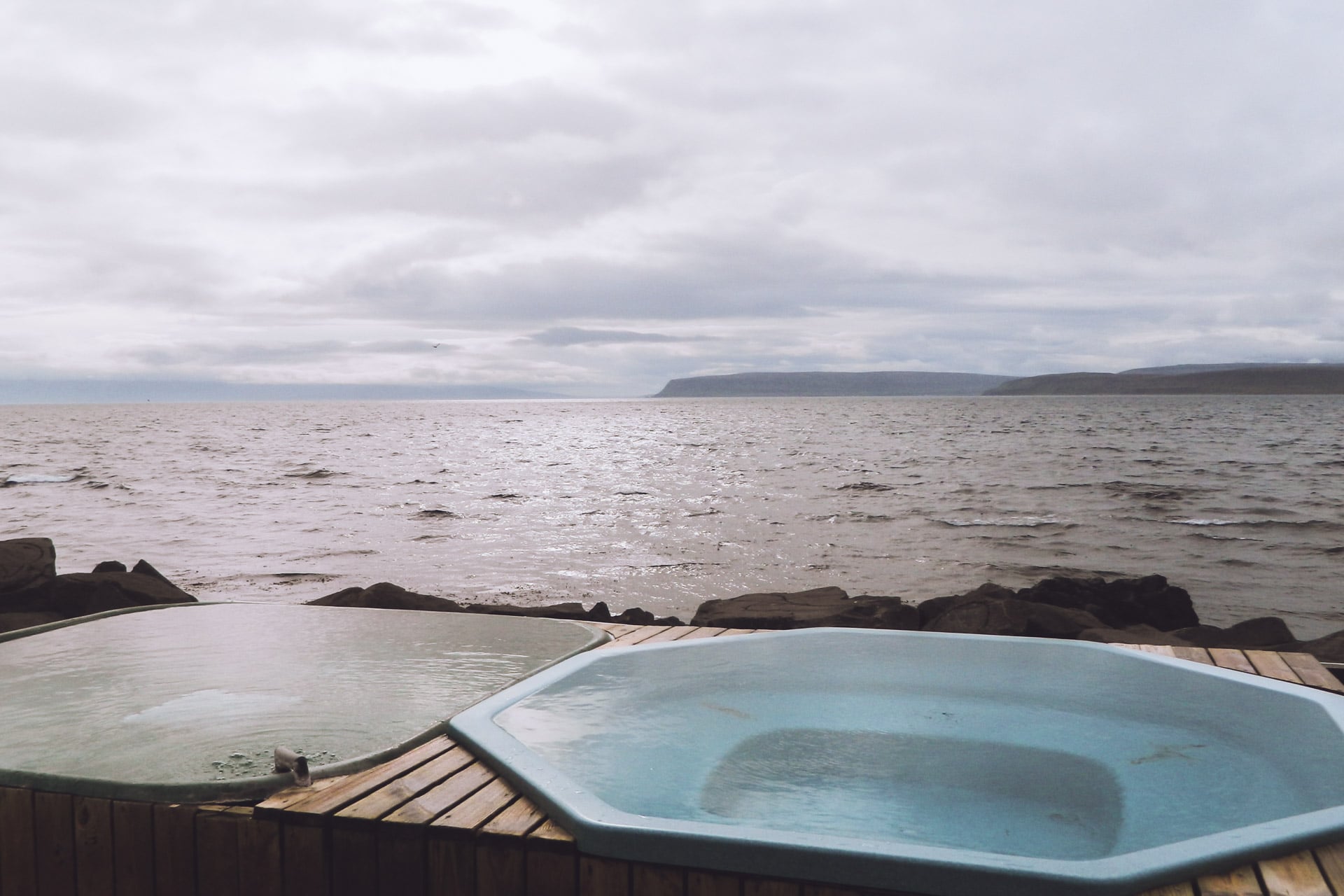
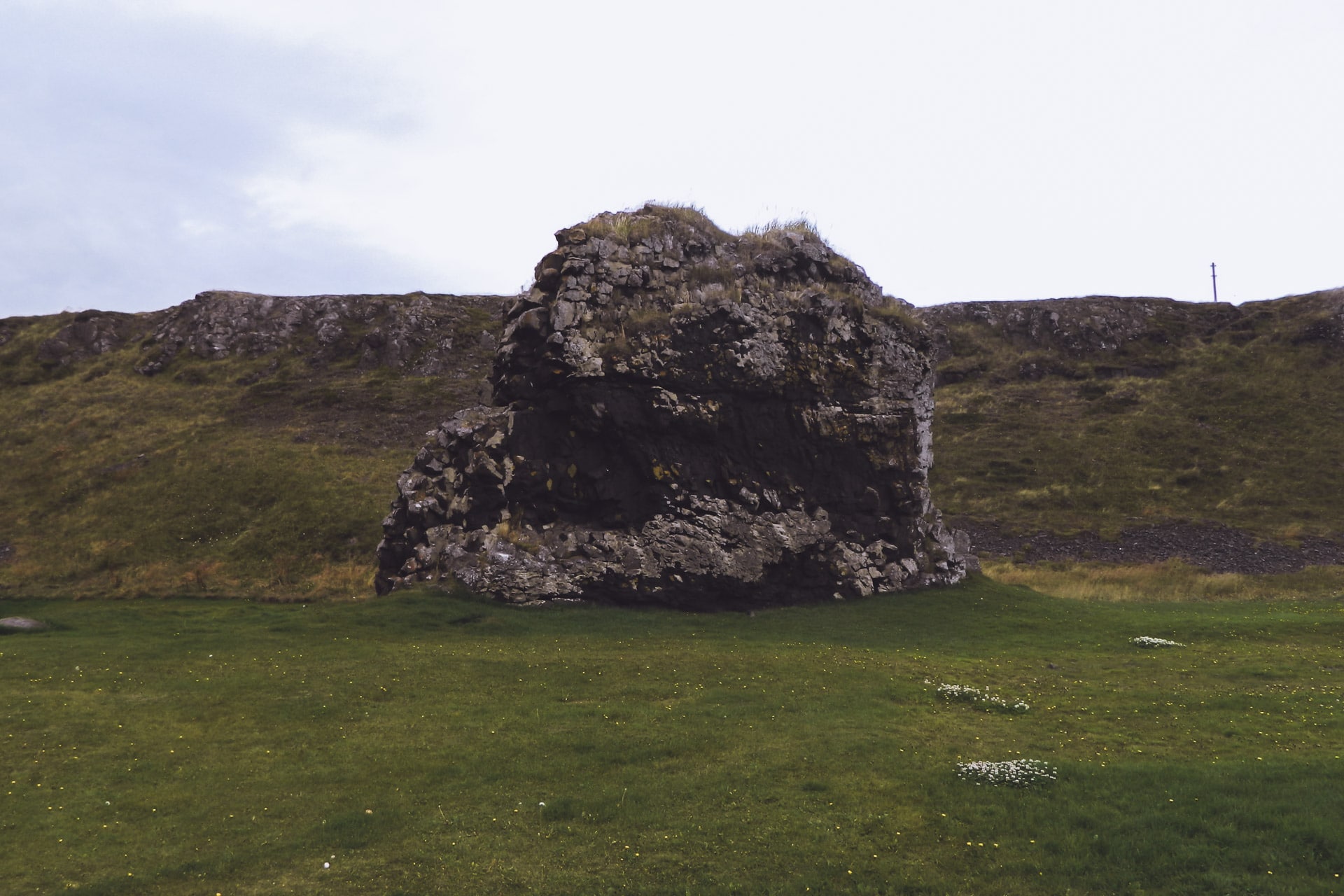
Holmavik is not very interesting as a city. I just do a little detour to go to a holy source but it’s not very impressive. I read in my guide that in a neighboring town at Drangsnes there is a petrified troll and especially a free public bath.
I go there especially after these 4 days without showers … The city is very small but they have installed on the waterfront three small pools fed by a hot spring certainly captured upstream. I dive after taking a shower. What a pleasure to be in a water at 35 ° C facing the sea. I rest and take advantage of the moment.
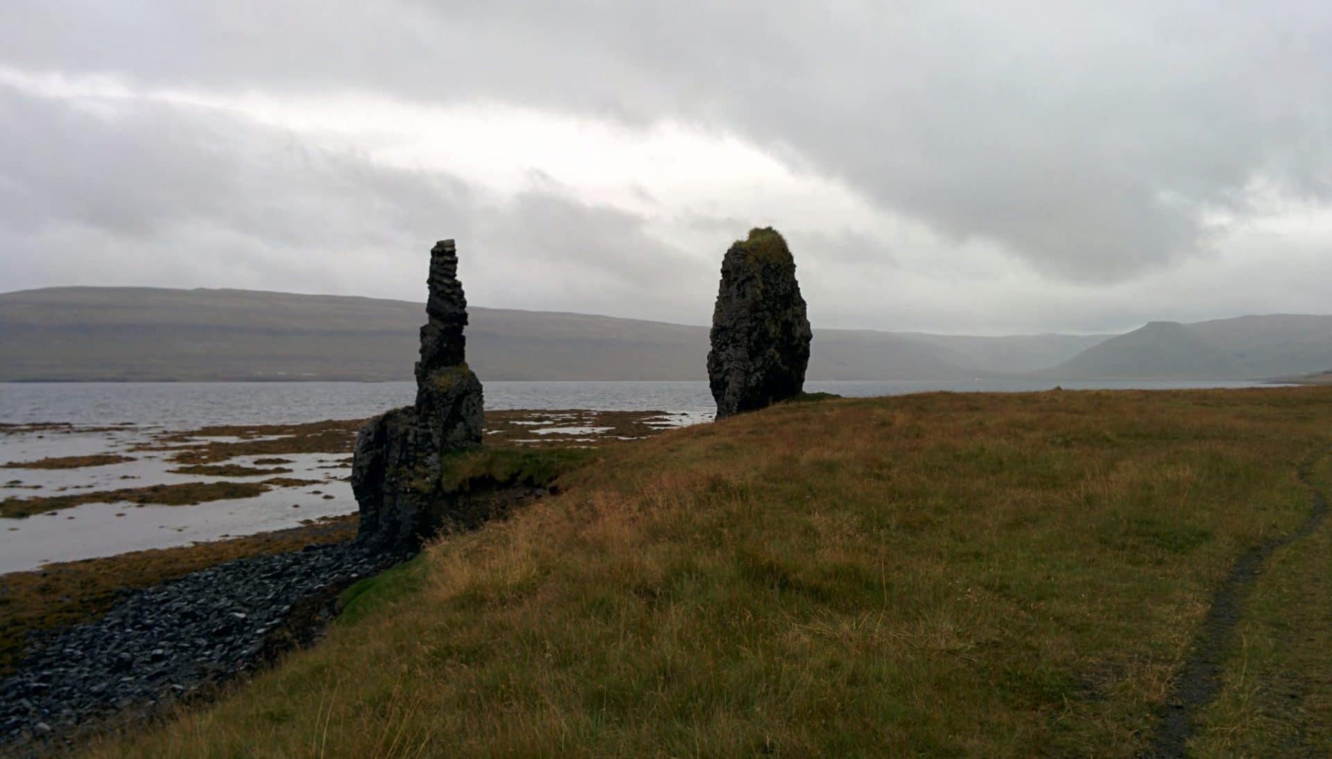
After this well deserved bath I will see Kerling the petrified troll. Today it is a big rock laid there, it is quite surprising.
From memory the legend says that three trolls wanted to dig a channel to separate the fjords of the northwest of Iceland. Busy with their work, they did not see the sun rise and were petrified on the spot. According to legend, still, the island of Grimsey facing Kerling would be her bull also petrified. The other two trolls are on the other side of the fjord, and they will be seen later.
Once this”trolly” break carried out I take the road and rejoin the road 1 after a meal break facing the sea.
The Fjords of the North West took me three days but it was worth it. The isolation of the place is superb, especially in this period because there really are not many people to cross.
Once on the main road I find a little traffic and the place is less friendly, more flat …
I will also make a small hook to see the two petrified trolls on this side of the fjord.
Tonight I will land at Kolufoss Falls. It is raining so I take my meal in the rain but I will make the night in the car.
Day 6 : Geocaching and "lost road"
Already 1700km … not bad. Today I do not have a big program, my main goal is to make a lost geocache at the end of a road in Skagafjord.
The principle of Geocaching is simple: people (anyone) will hide small boxes in interesting places and simply inform their GPS coordinates on the site. The goal is not so much to find the box as it is to discover something, a place, a bit of history. Almost all the stops I make in Iceland have been motivated by a geocache so far.
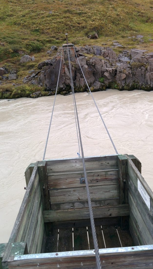
The beginning of the road for the geocache is rather good and it goes well. By cons quickly I find myself on a small road, stony and not wide at all. Impossible to turn around … I walk almost at a pace. I sometimes have to get out of the car to remove the stones on the road … I admit that at one point I wonder a little what I do there. After 2 hours (not easy) I finally arrive in the small abandoned farm. From there you have to descend towards the river and then cross by a kind of wooden crate suspended by three cables over the raging river … Not reassuring but it goes well. The geocache is finally there!
For the rest of the day I will go back on Route 1, which will take me a long time from the geocache, and then take on Route 76 in the direction of Siglufjorður, a pretty little village with colorful houses. Today there is a tunnel connecting this city to Olafsfjorður but I prefer to use the old mountain road (802).
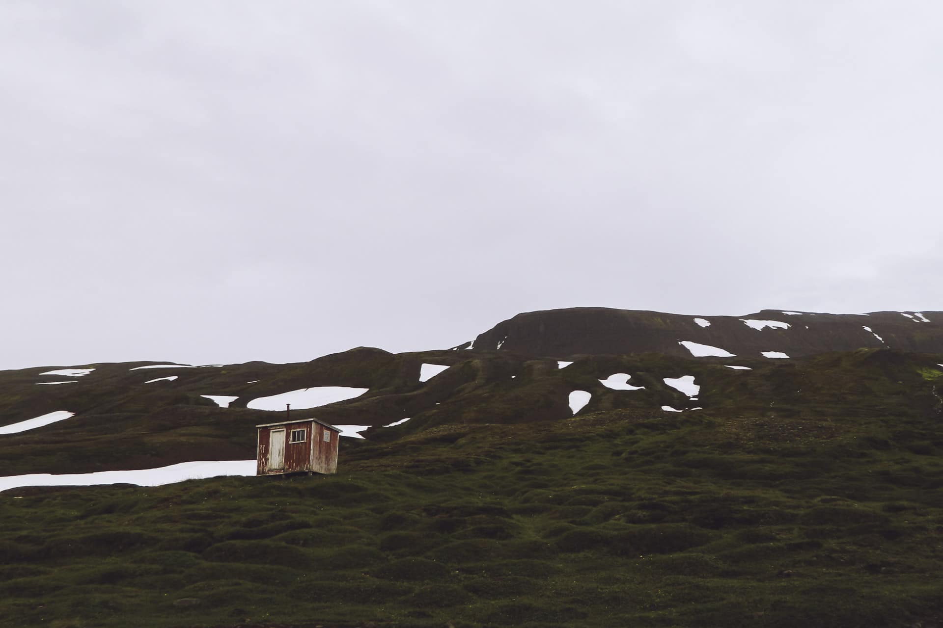
I will stop for the night at the level of the tiny shelter. The place is beautiful even under the clouds. I will calmly enjoy the late evening admiring the scenery and reading.
Day 7 : Akureyri
Not very busy day in perspective. I am about halfway through my journey and I need a good shower, a good meal and a bit of rest. Heading to Akureyri, the second biggest Icelandic settlement with 17,000 inhabitants.
Before that I have to join Route 1 but as it is still early I decide to go back my steps and go up for a ride to the small lake of Hraunsvatn. To do this, you have to park at a small farm not far from Route 1. You then attack the climbing route by a cattle barrier (which must be closed of course).
The climb is nice especially since it is sunny, on the other hand there is a strong wind especially at the level of the lake.
The site is beautiful, nestled between small peaks. The lake is known for salmonid fishing. I make a little geocache and I go down.
I then take the road to Akureyri. I spend the night at the “Akureyri BackpackersYouth hostel” in the small street of Hafnarstraeti. The hostel is nice and well kept. In the afternoon I take a walk around town but there was nothing very exciting to see (I did not explore very far). In the evening I will enjoy to be in town to eat a good meal, warm and cooked!
It feels good to see a little people and chat (especially with a guy from Quebec and a German from my room) but I also look forward to going back to nature and loneliness, one quickly needs it…
Day 8 : Myvatn and Krafla
Despite some snoring the night will not have been so bad. In the morning I have lunch with Pascal, the guy from Quebec. I then take the road towards the west and Myvatn which is a rather dense region in volcanic activity.
On the way I stop at Godafoss, historical place because here, according to legend, the pagan icons were thrown to the waves when Iceland decided to be Christianized. I then bypass the Myvatn by the south, it is a large lake to the east of which one already sees some interesting structures. Myvatn means “Lake of Flies”, in fact in summer the lake is covered with clouds of flies that can be a real pain in the a**. There are much less in September but these are annoying because attracted by CO2 produced by mouth, nostrils and eyes.
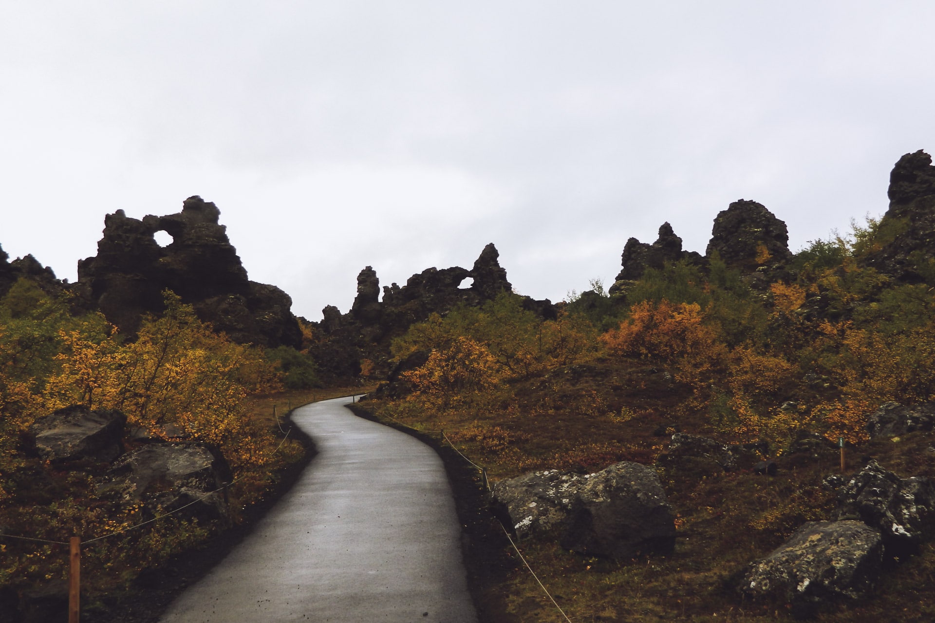
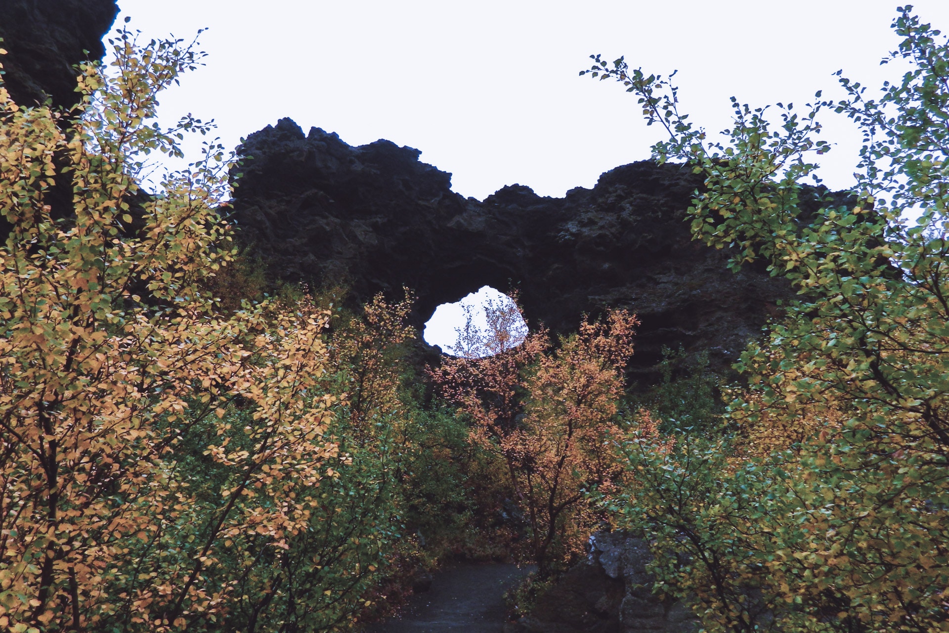
I begin my visits around Myvatn by Dimmuborgir. This amazing place is a set of basaltic structures with extravagant forms and forming a true labyrinth. I visit with Stefie, the German backpacker of the previous day that I met in the parking lot.
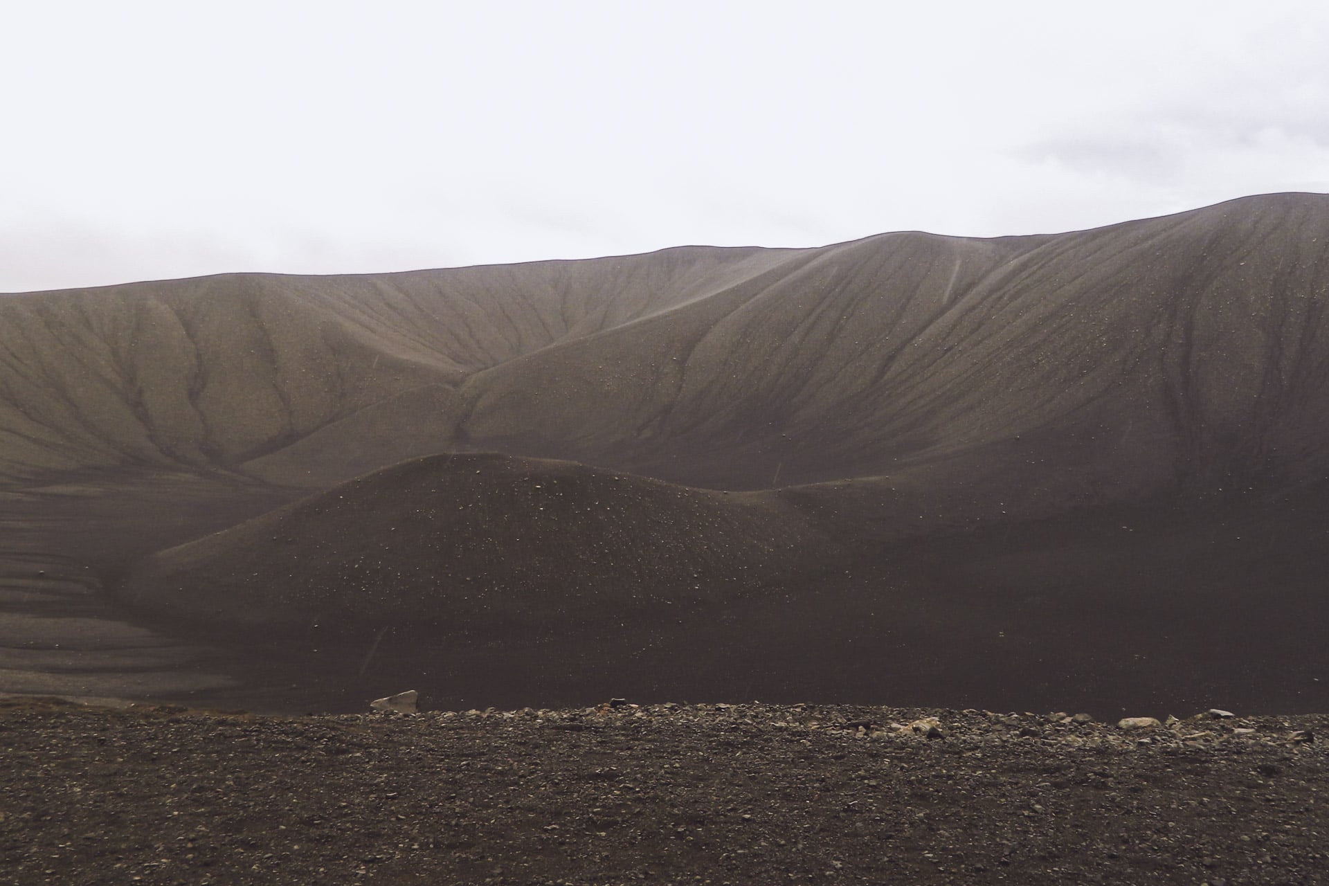
We then continue towards Hverfell, an immense cone of ashes and peebbles of obviously volcanic origin. It is gray at the end of the morning, so it gives the whole impression of Mordor or Lunar landscape. The view from the top is beautiful and the whole is impressive.
For the descent we make this full slope, it is more fun and faster.
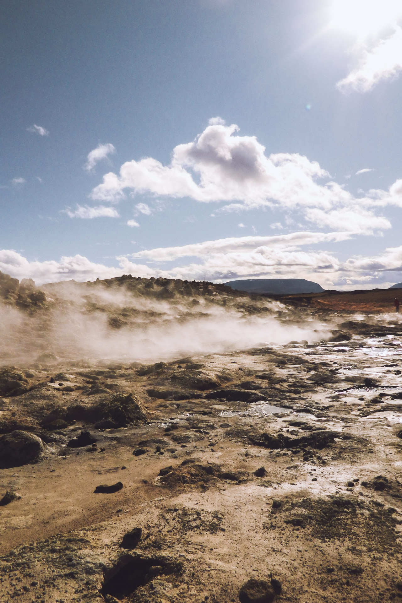
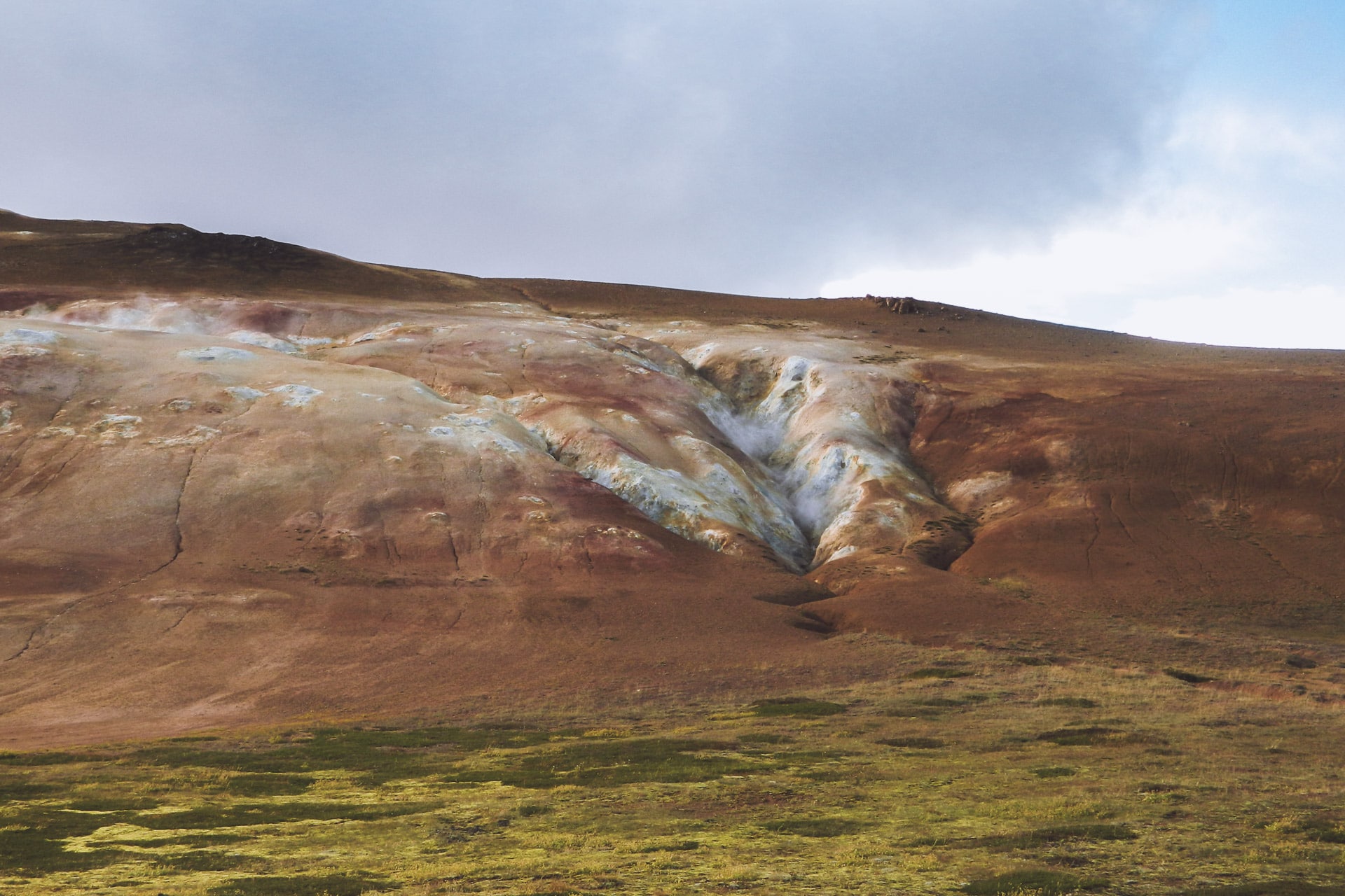
We then walk to a geothermal cave, Grjotgja. The cave is nestled in a steaming crack.
On returning from the cave, Stefie continues the road on his side. On my side I head for the Krafla. The sun is finally back and it changes everything!
I roll the windows wide open, the music to the max! The landscapes change it is more and more beautiful.
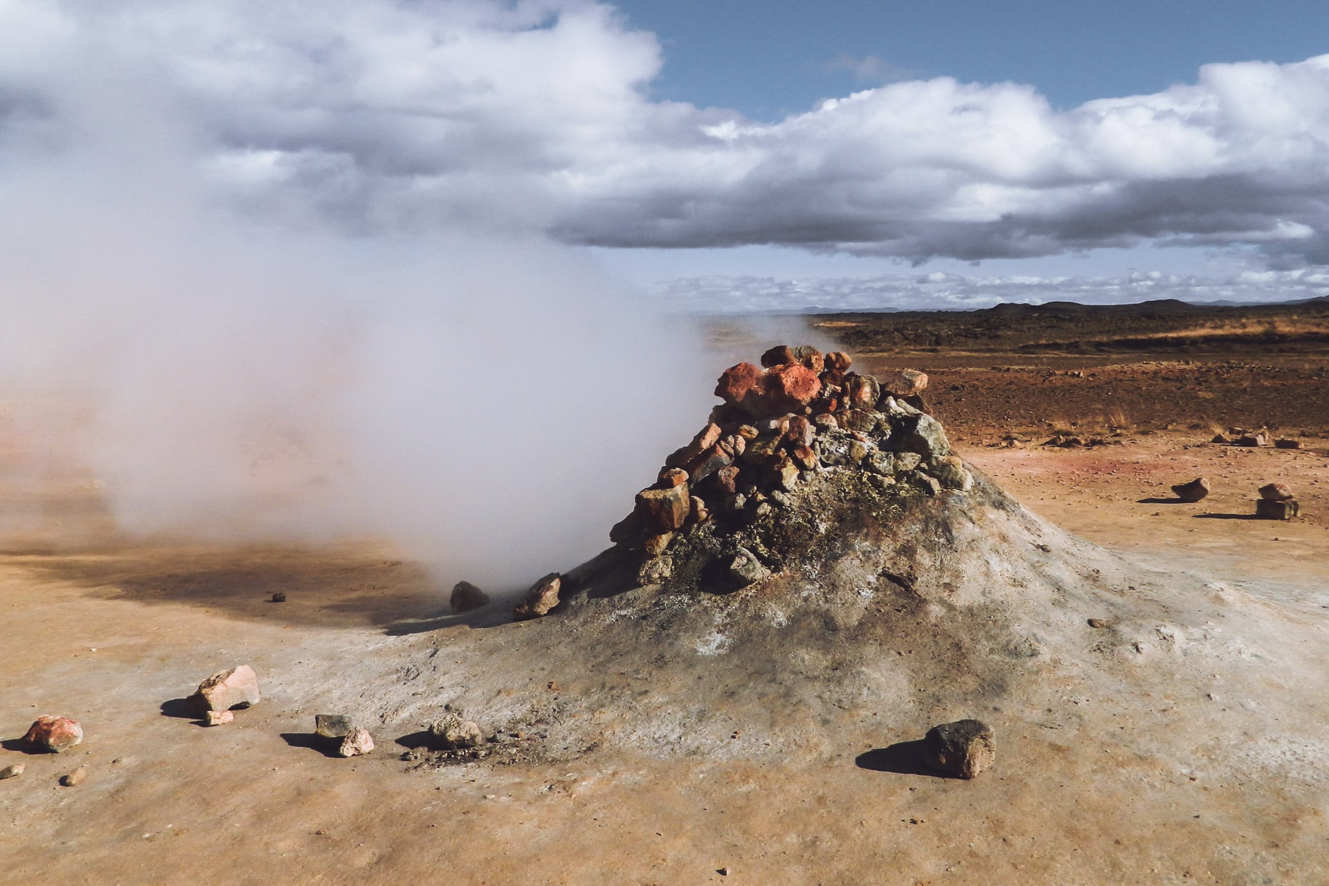
After a big hill, I stop at Hverir which is a large area with rich volcanic activity: fumaroles, boiling baths and a good smell of sulfur. It’s very beautiful, the colors are crazy.
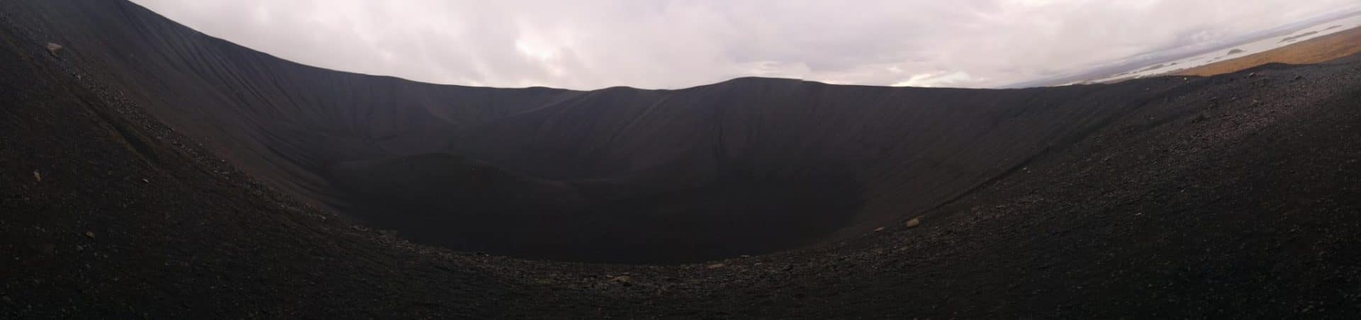
I continue the road a few kilometers before turning on the left towards Krafla, a volcano of 818m of altitude know to have a rich activity its last eruption dates from 1984. The place is very windy today, it adds to the majesty of nature here with the crater and its lake of unrealistic blue waters. It’s beautiful.
I then walk through a lava filed that is just a few years old. Life slowly resumes in the middle of the black rocks. There are not many people, it’s beautiful, all this invites to stroll.
Then back on the road 1. Direction to the east in absolutely wonderful landscapes! You can see dozens of kilometers around. There is nobody, it’s fine, I press a little (too much) on the gas pedal; the sensation of freedom is absolute! I feel very happy and lucky at this time…
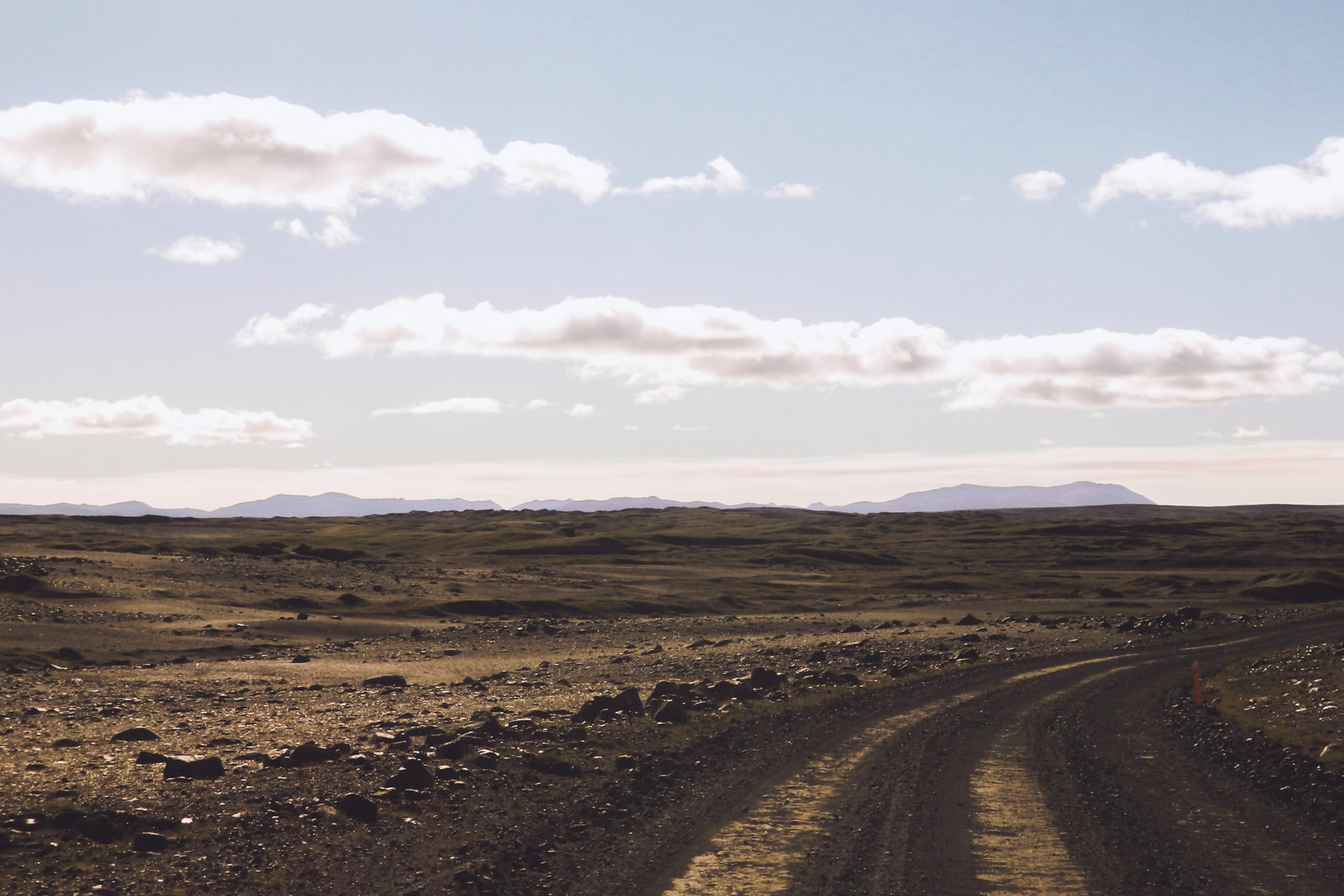
After the swiftly swallowed kilometers, I turn left onto Route 864 which will take me to Detifoss. But for the time being I’m going to find a little place for the night because it is getting late and I do not move fast on this small gravel road.
I will not be far from the road but as usual there is nobody to bother me … In the distance I see the Krafla despite its distance of about 40km. Superb camping place. This certainly has been the best day of the trip. So many beautiful things to see …
Day 9 : Detifoss, Seydisfjordur and Snaefell
What a silence this night … It gives an impression almost disturbing sometimes because the mind is quick to invent noises …
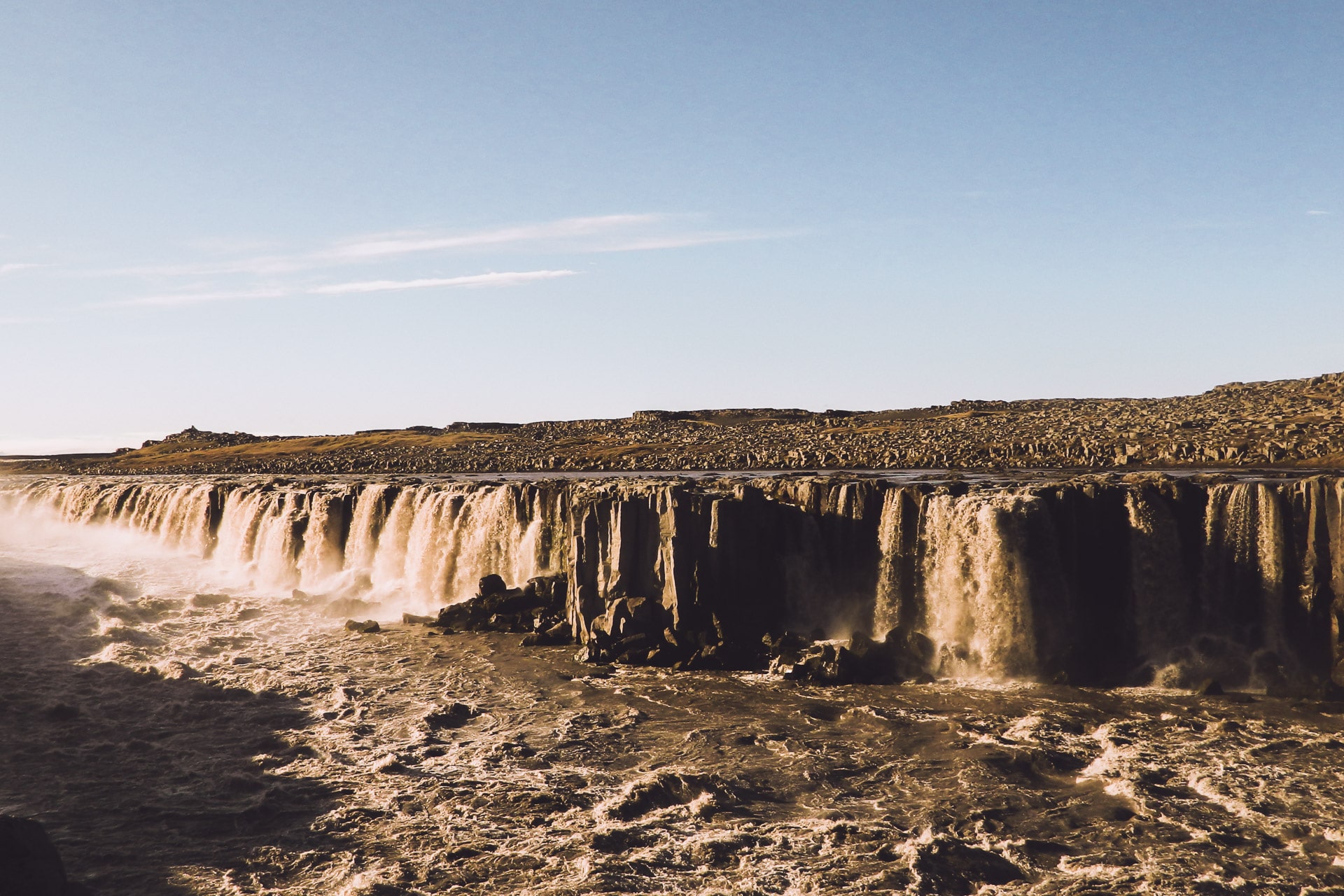
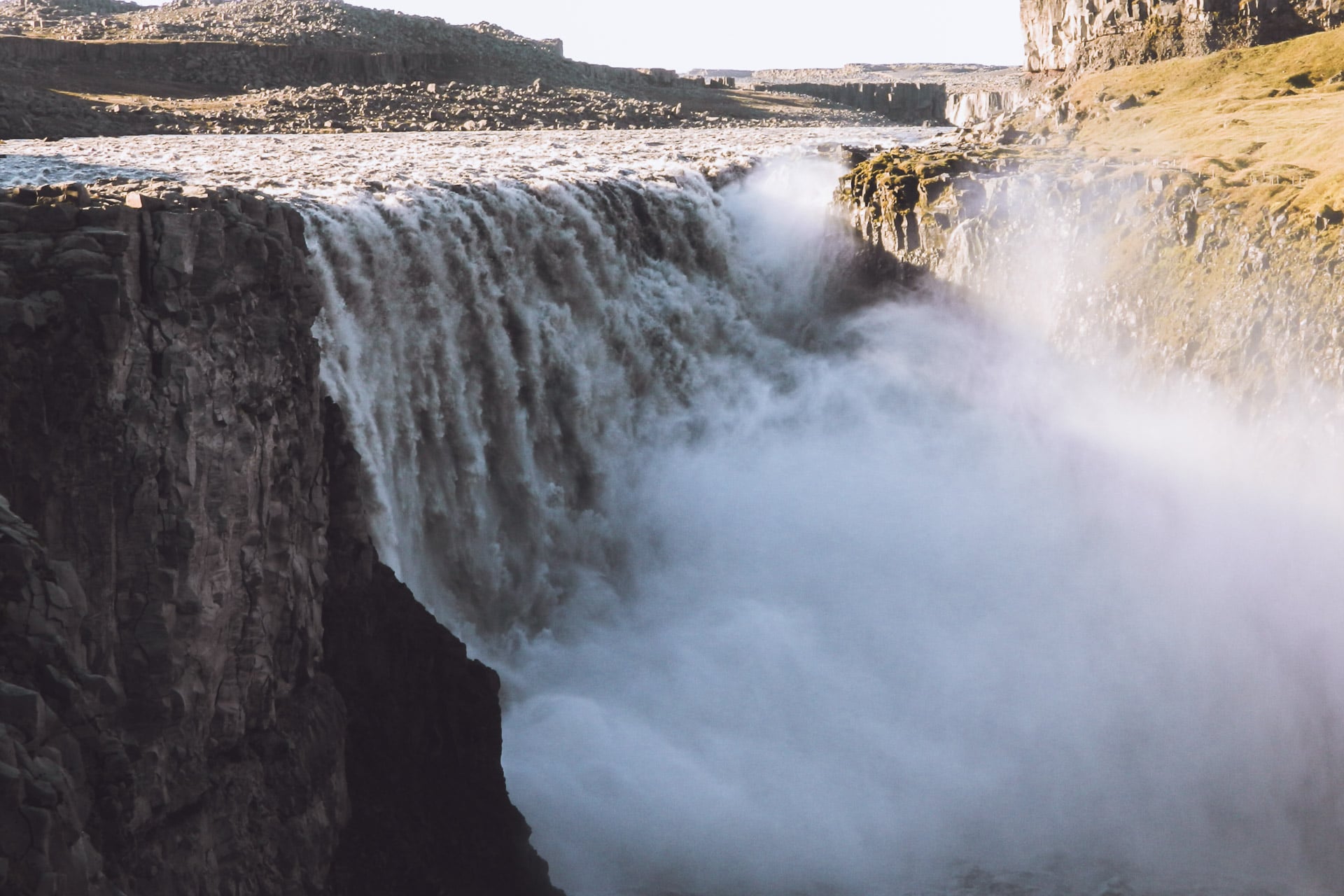
I am back on the road quickly because it is cool this morning, so I will have breakfast further. I arrived at Detifoss after 40min of road a bit difficult because very rippled and therefore uncomfortable.
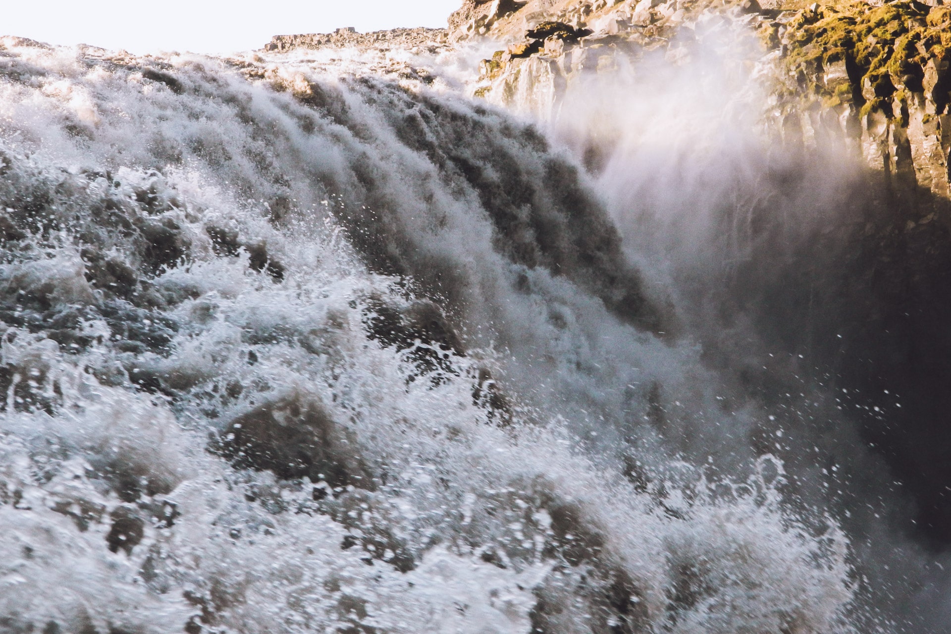
I go down to the waterfall, it’s stunning! Detifoss is the waterfall of Europe which has the biggest flow with 200 000 liters per second for a fall of 44m … It is the most impressive waterfall that I have been given to see. What is good in Iceland is that there is little barrier, so here we can advance until we have feet in the water at the edge of the fall … impressive …
The intro scene of the movie Prometheus was shot at Detifoss.
I then walk up the Jökulsá river to Fjöllum towards the Selfoss waterfall upstream. Also impressive by its width.
After returning to Detifoss, I enjoy a bit the show and do a geocache in the area, I then go back to the parking lot to have a coffee and breakfast.
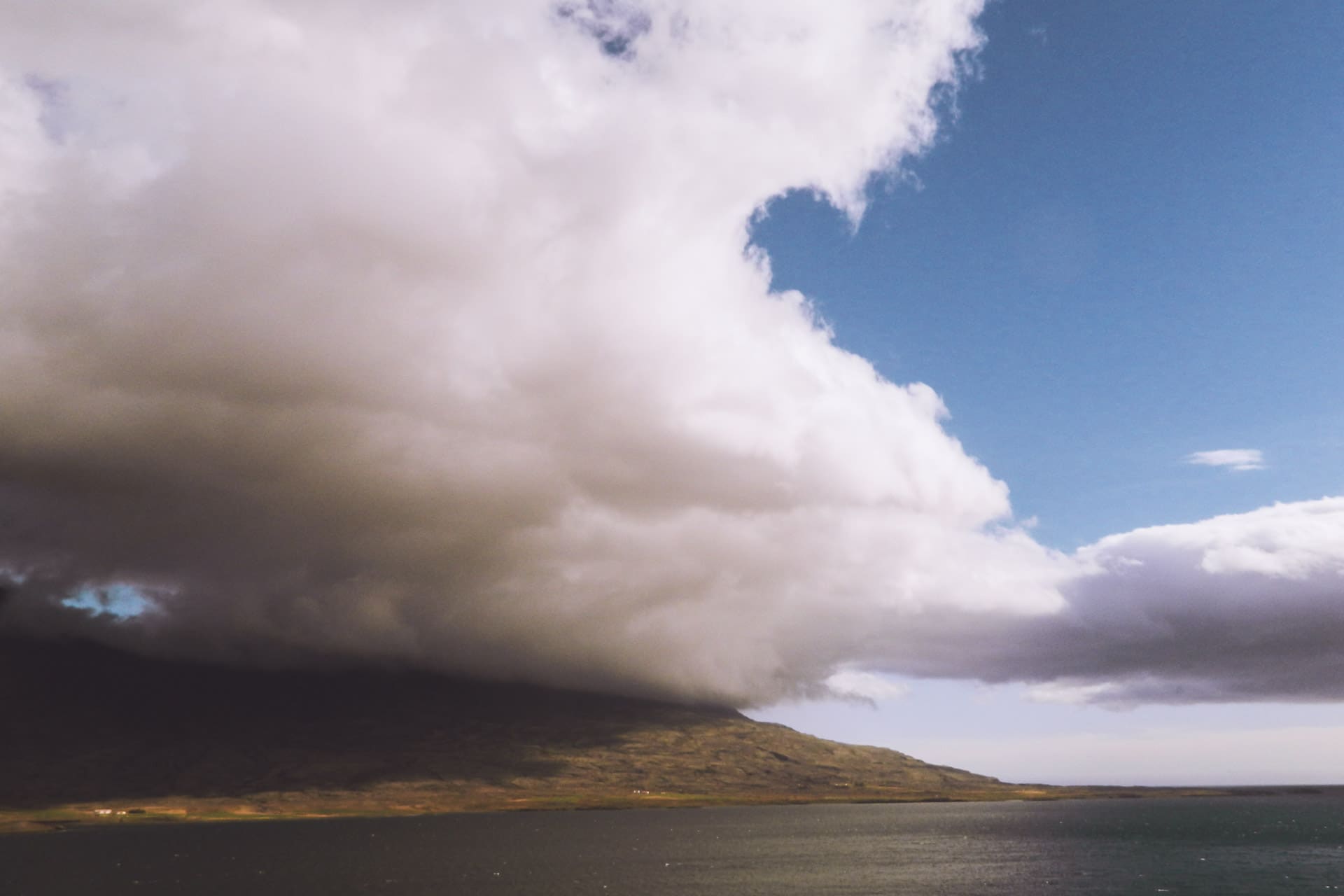
Then back to road 1. The sun is shining, the sky is blue and the road still wavy. The ground is black ash, which gives a moon face to the landscape. In the distance a cloud draws my eyes, looking carefully it is the plume of smoke of the eruption of Bárðarbunga which was going on when I was there. Despite the distance one can see it.
I run full east then. The landscapes, still amazing, pass too quickly. I arrive at Egilsstaðir but the city is very disappointing and I only stop for shopping and gas.
I then go on road 93 which leads me to Seydisfjordur. The descent is particularly interesting and fun by car. The small village is nestled at the bottom of a fjord, it’s nice. I stop at the little hostel / restaurant for a drink in the sun.
A scene from the movie Walter Mitty was shot at this hotel (when there is the eruption after the longboard descent)
Half turn then and I resume direction of the 1 but not for very long because I obliged towards the 931 in the idea to climb on the plateau of Snaefell. The view is beautiful on the height coming from Egilsstaðir but we see a kind of grayish fog that is due to the eruption of the Bárðarbunga.
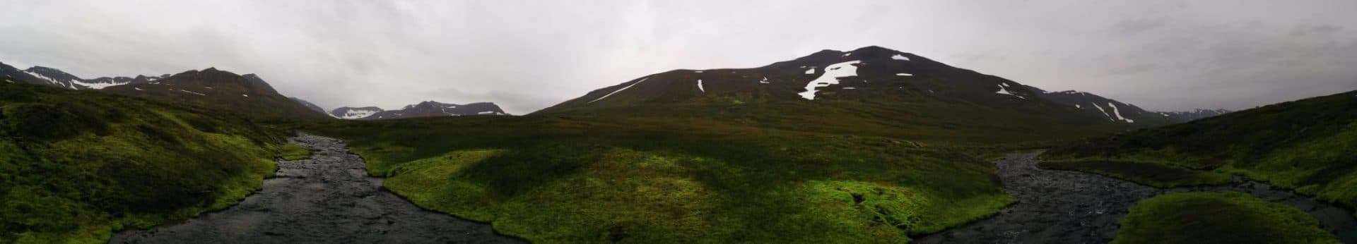
The climb on the plateau, by road 910, is impressive. Above, total change of atmosphere: we find ourselves in a kind of tundra as far as the eye can see. In the distance the Snaefell, highest point of Iceland with 1833m, and the Vatnajökull also.
The Vatnajökull is a gigantic glacier that covers 8% of Iceland, almost the surface of Corsica in comparison. It can reach 1000m thick, it contains several volcanoes within it, including some in activity.
For the evening I find myself a beautiful place with a great view to set the tent. The glacier, not far away, is cooling the air and there is a lot of wind. There are normally a lot of reindeers in this area but I have not seen them yet … maybe tomorrow. In the night, I go out to see if there is no aurora (as almost every night), no aurora but in the distance I see clouds all red, despite the night, due to the direction of them, I think it was the reflection of the light emitted by the lava of the eruption of the volcano on the clouds. The impression was singular.
Day 10 : South East
Cold night! But it was Ok. Light program of today.
So I take my time in the morning, first I go to see the hydroelectric dam not far from where I camped. Half turn then, on the way I do not drive fast to try to see reindeers but they are not here….
At the descent I witness a nice phenomenon : there is so much wind that a waterfall usually hung on the wall climbs towards the sky … not trivial ….
I then drive south. Rather than following only Route 1, I take the 939 which passes through the mountain and is much nicer.
The descent towards the coast is beautiful. The weather is nice even if it’s a bit cloudy on the shore, so it creates very nice light effects.
After a meal break in the village of Djupivogur, I continue on route 1 towards Hofn. I pass quickly without taking too much time.
Time flies and it is already time to find a place to sleep (I mainly drove today). Task arduous tonight because few places seem nice enough.
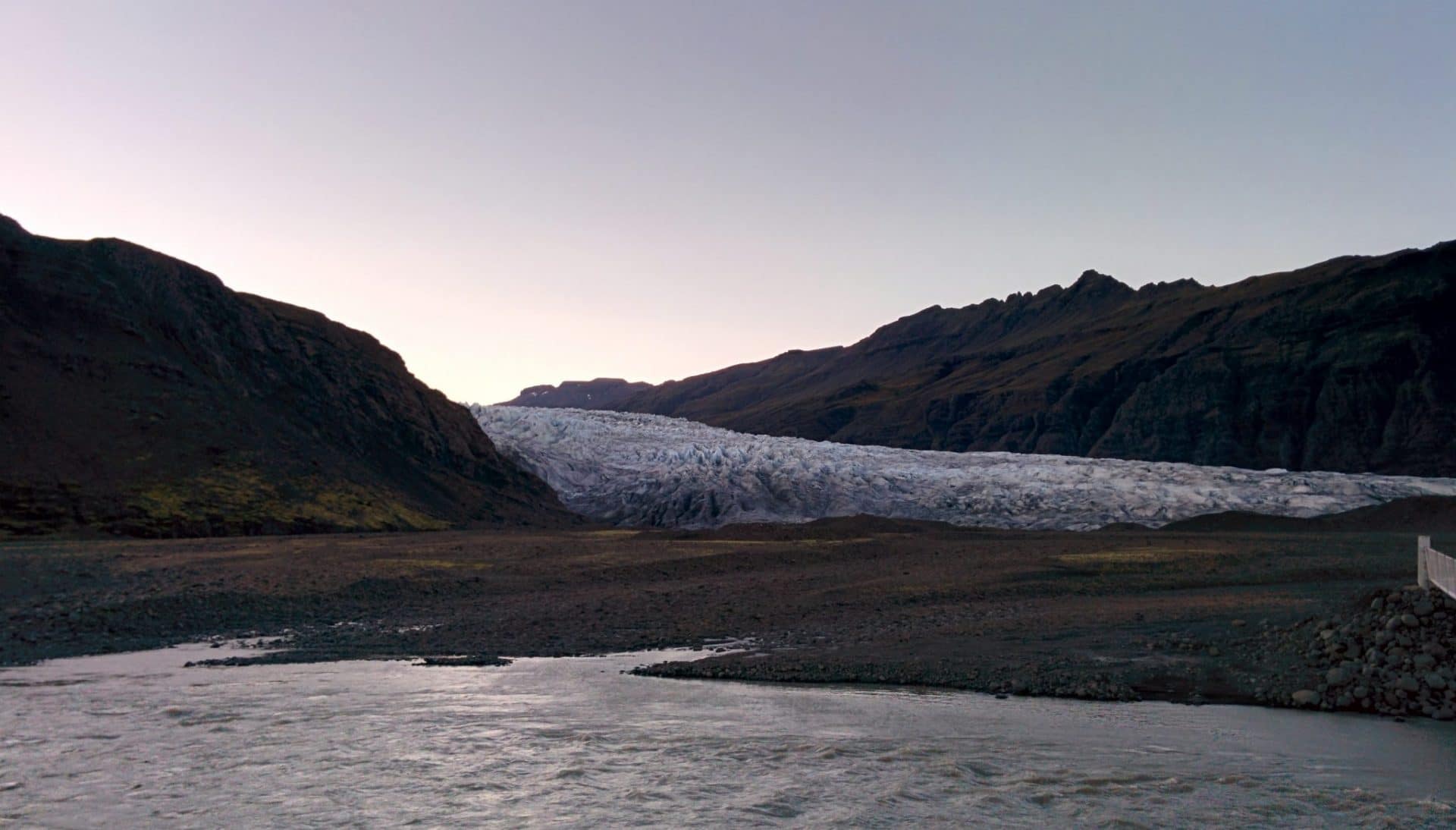
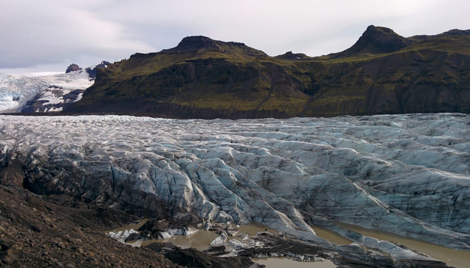
After a long search I headed for the Flaajokull. The glacier is a part of the Vatnajokull. Unfortunately, the glacier recedes due to its melting …
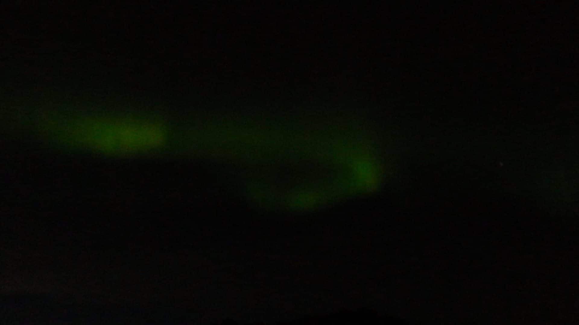
In the evening after having booked I take a look outside and there Ô miracle an AURORA !! It is quite covered and the aurora is not very strong but that is beautiful! I try the picture below but the rendering is not crazy … it will have been a beautiful gift anyway.
Day 11 : Jokulsarlon, Skatafell and Sandar
Today’s busy day will begin with the well-known Jokulsarlon.
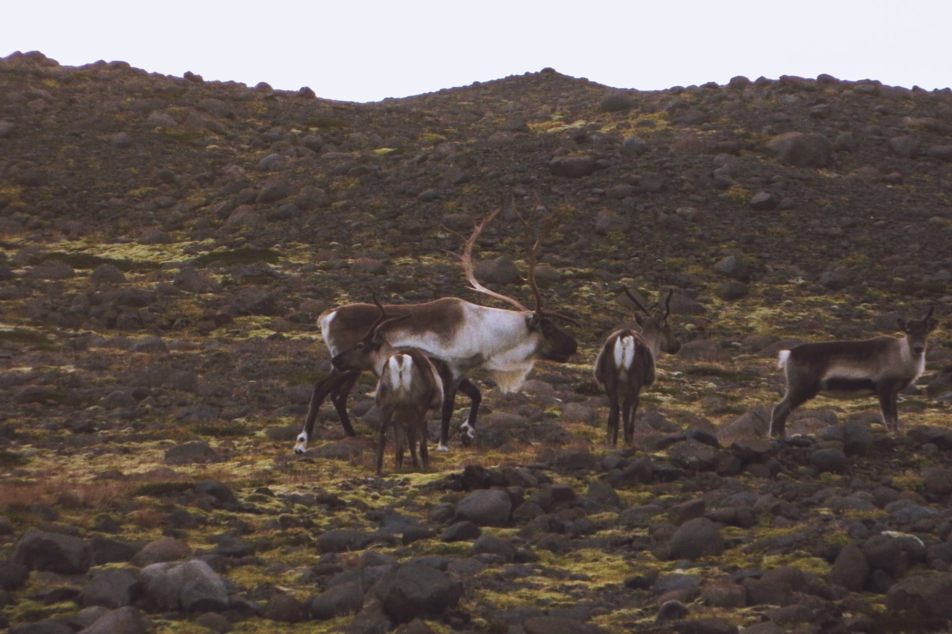
On the road that leads me to Route 1, I have the wonderful surprise of falling on a herd of reindeer. There must be about twenty animals and a superb male with impressive antlers. I enjoy a little while watching them grazing.
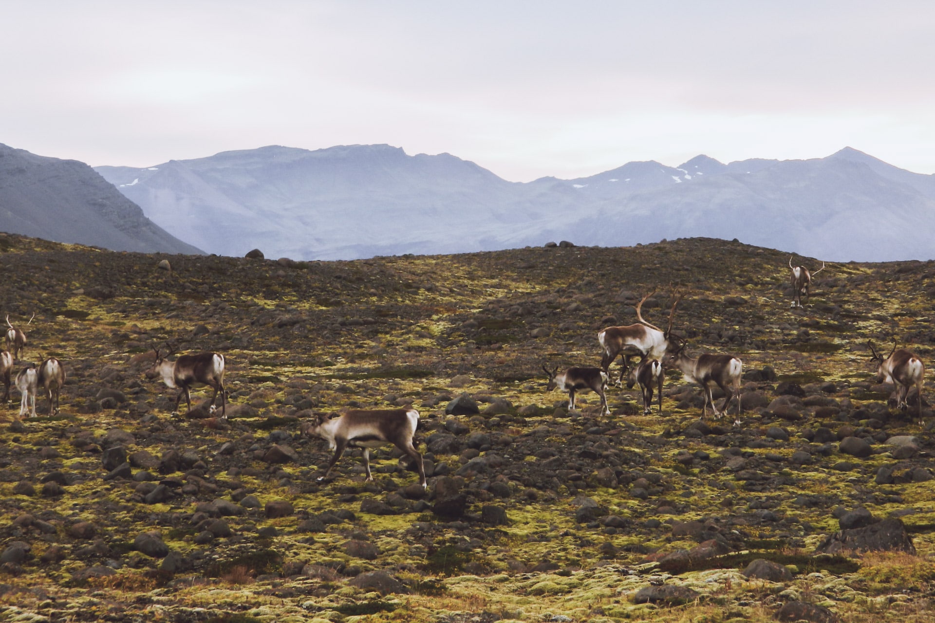
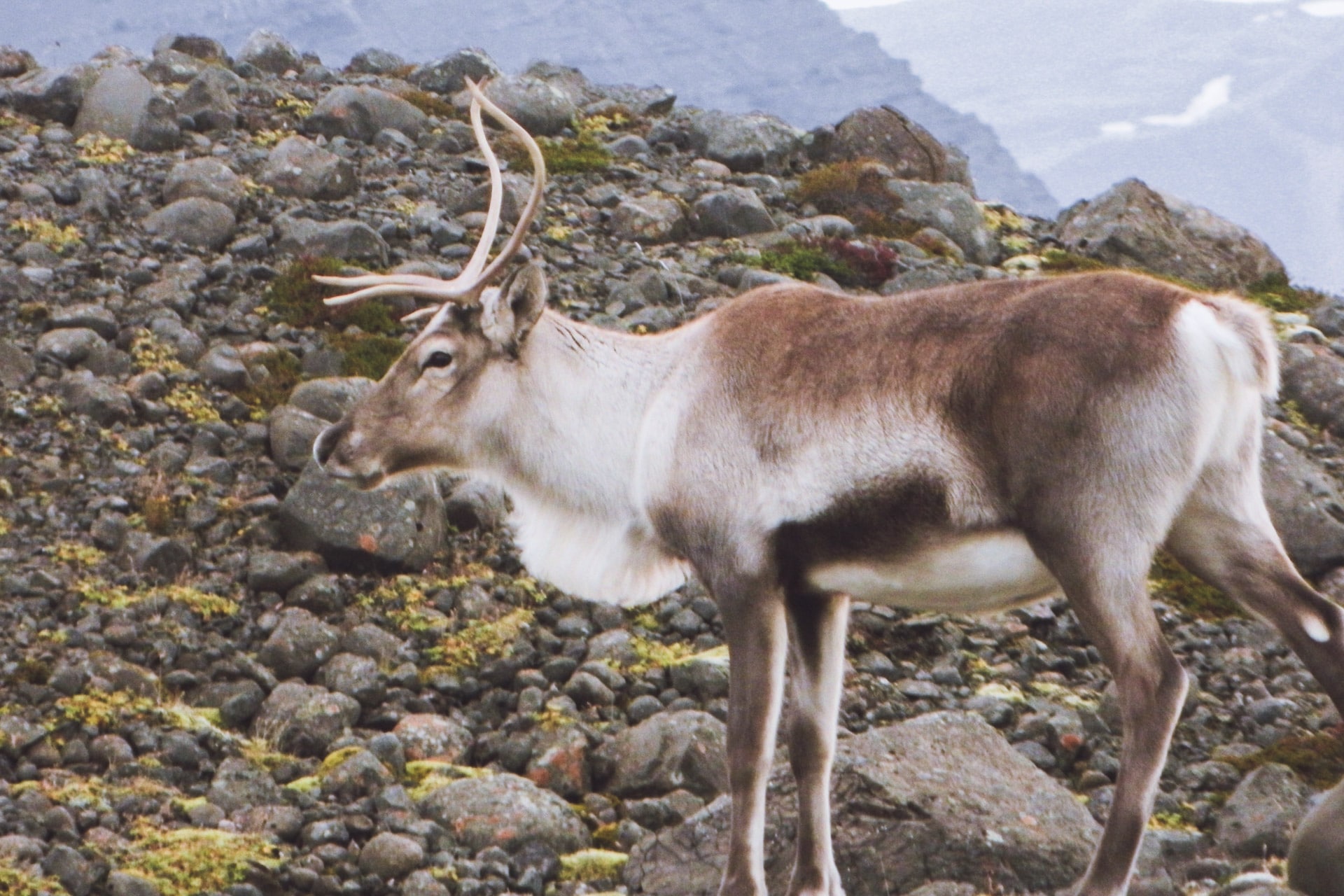
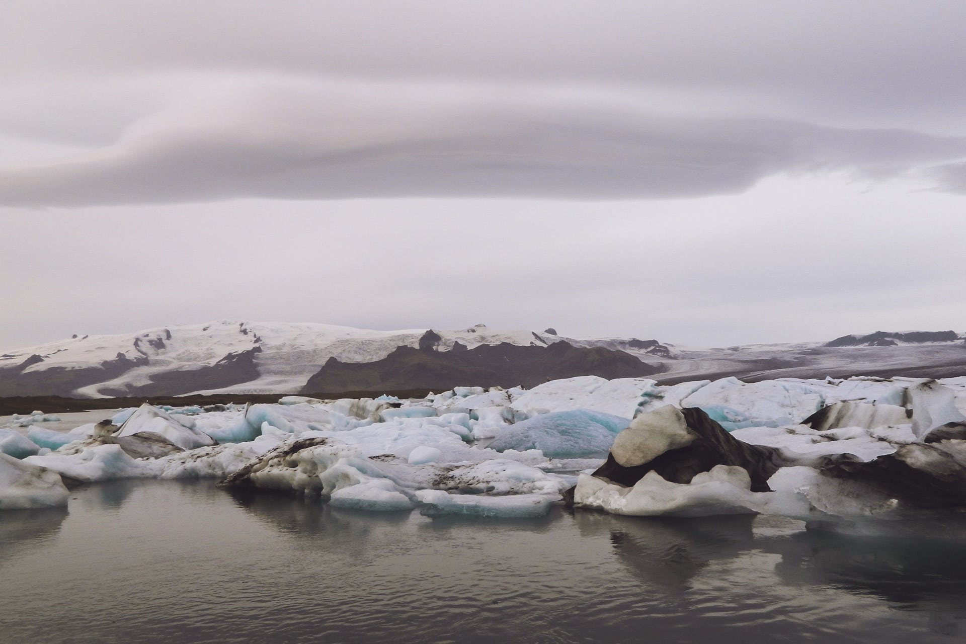
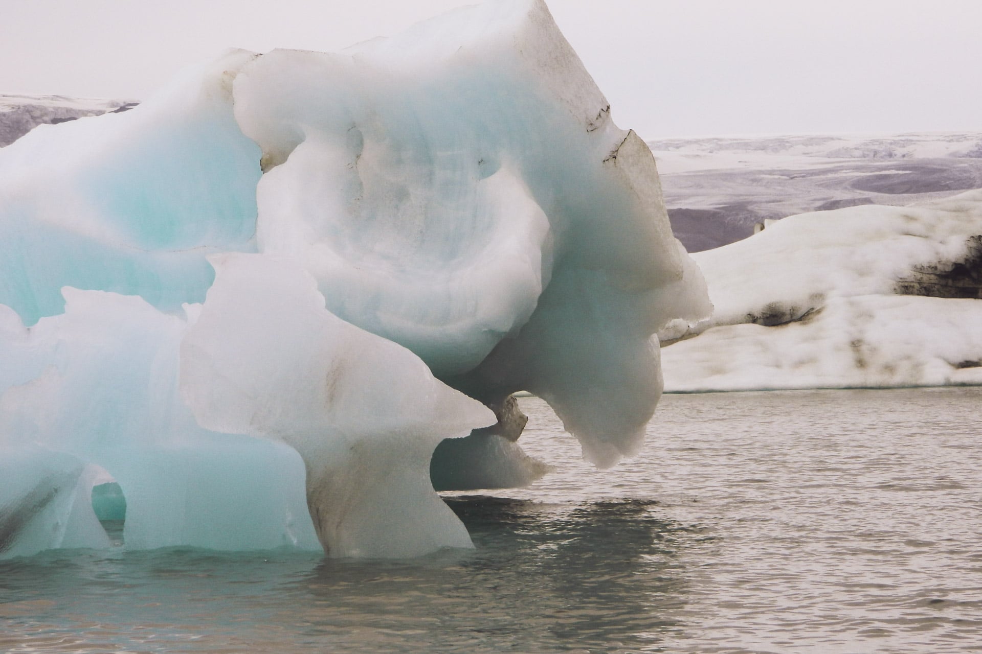
The road to Jokulsarlon is short. I arrive on site where there are already a few people.
The place is beautiful, the huge glacier flows into a large lake where it melts and then flows into the sea. As the glacier breaks as it arrives in the lake it is filled with blue and gray icebergs. It is very beautiful. To top it all, seals live here and let themselves be approached. On the black sand beach, the icebergs run aground, giving striking contrasts.
This place has been filming many films including Lara Croft and James Bond Tomorrow Never dies.
After Jokulsarlon, I take the road again and stop at a glacier to make a geocache.
A scene of Batman begins was filmed near this glacier.
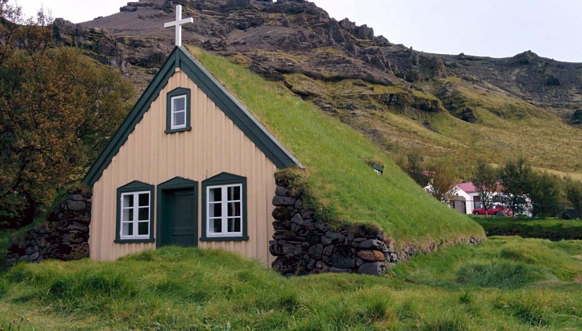
I then continue to another hidden geocache next to a beautiful church with a roof of vegetal.
Direction Skaftafell. Skaftafell is a national park offering plenty of hike possibilities and activity. With hindsight I should have spent a whole day there instead of few hours.
I decide to carry out the small hike that leads to the Svartifoss waterfall. There are trees, which is relatively rare in Iceland. The path is nice and easy. The superb cascade: it is a horseshoe cliff made up of basaltic organs. It is very beautiful.
I should have stayed a bit longer in the Skaftafell but I continued my route to the Sandar.
The Sandar, those are huge expanses of black sand that are created during eruptions. The volcanoes melt the ice, especially the Vatnajokull, creating enormous mudslides loaded with rocks and devastating everything in its path.
So the Sandar is a little depressing … Black sand as far as the eye can see and under the gray sky it does not make things more cheerful …
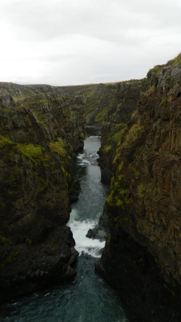
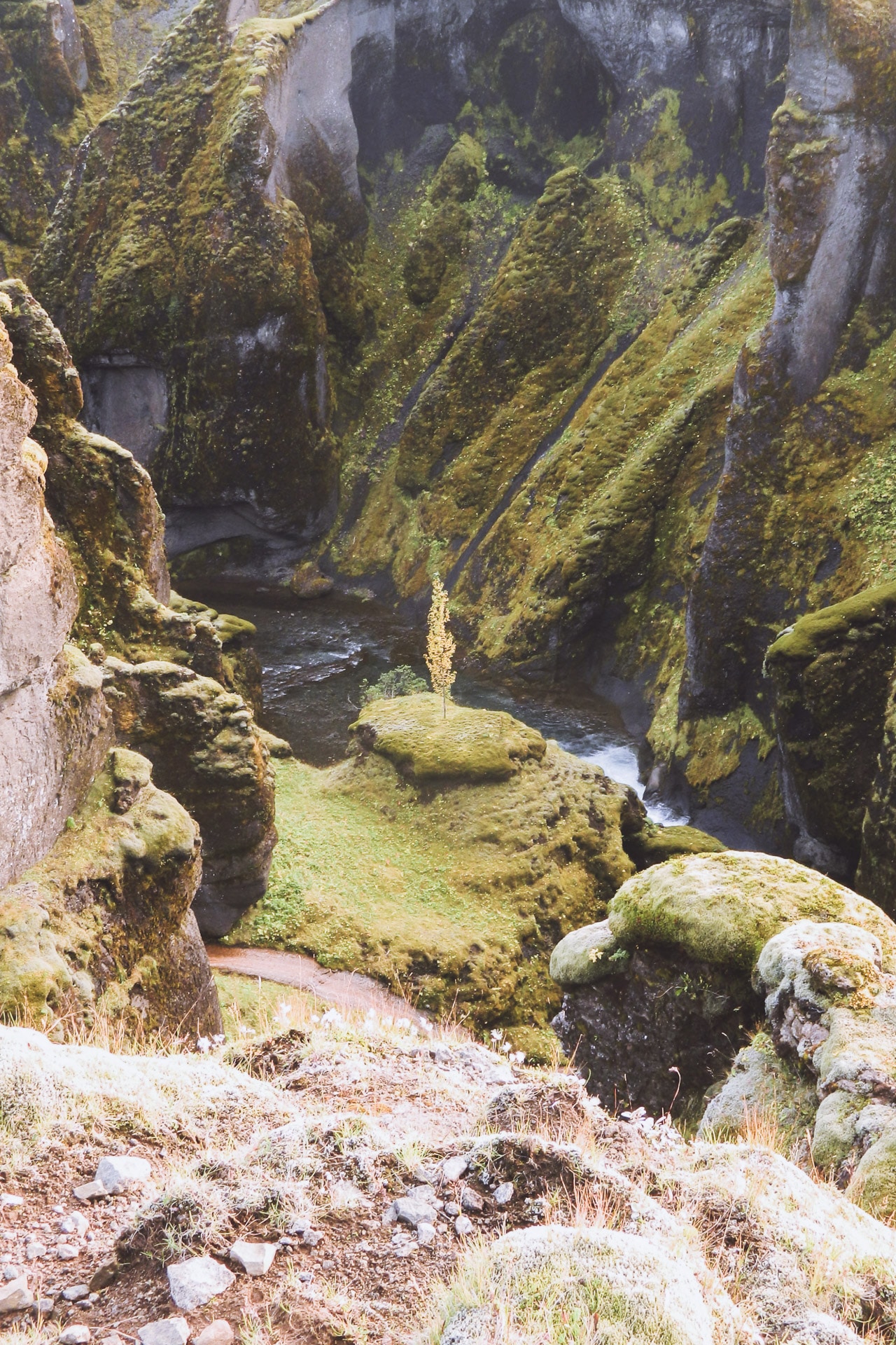
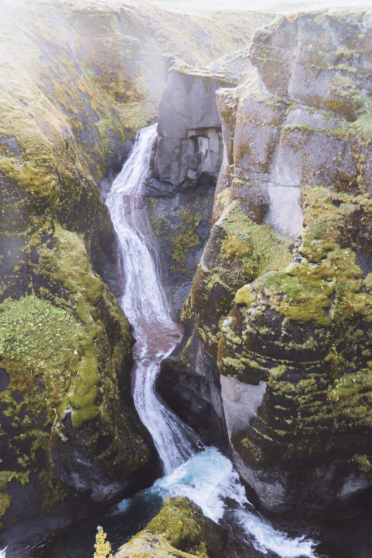
For the night I head towards Fjaðargljufur. It is a 2km canyon, the walls are vertical with the river at the bottom. The greens are impressive, with the black sandur at the bottom it’s beautiful.
The view for the night is good, more than a few days in Iceland, I have to profit.
Day 12 : Hjorleifjskofði, DC-3 et waterfalls
A long day ahead. It begins with the visit of the Hjorleifskofði. This place was advised by a friend, Julien, who went there in February. This place is historical and is one of the first places of settlement of Iceland and a Viking tomb is at the top. The place is a little magical, it looks like a lost island in the middle of a sea of black sand. In the past it was an island but the level of the sea fell thus linking the “hill” to Iceland.
The ascent of the 220m of the hill, alone, in the rain has something mystical. No one comes here because it is not known. Up the view from the tomb is sublime especially in bad weather, I think. A little further down are the ruins of Arnarson’s farm. I also find the trace of the passage of my buddy on the logbook of the geocache of the summit. I’m glad I came here.
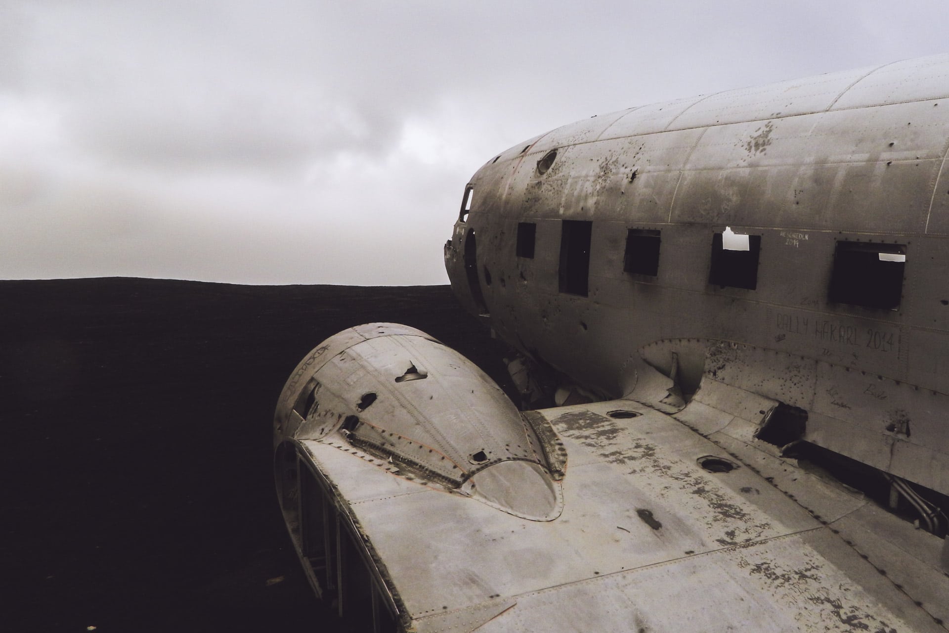
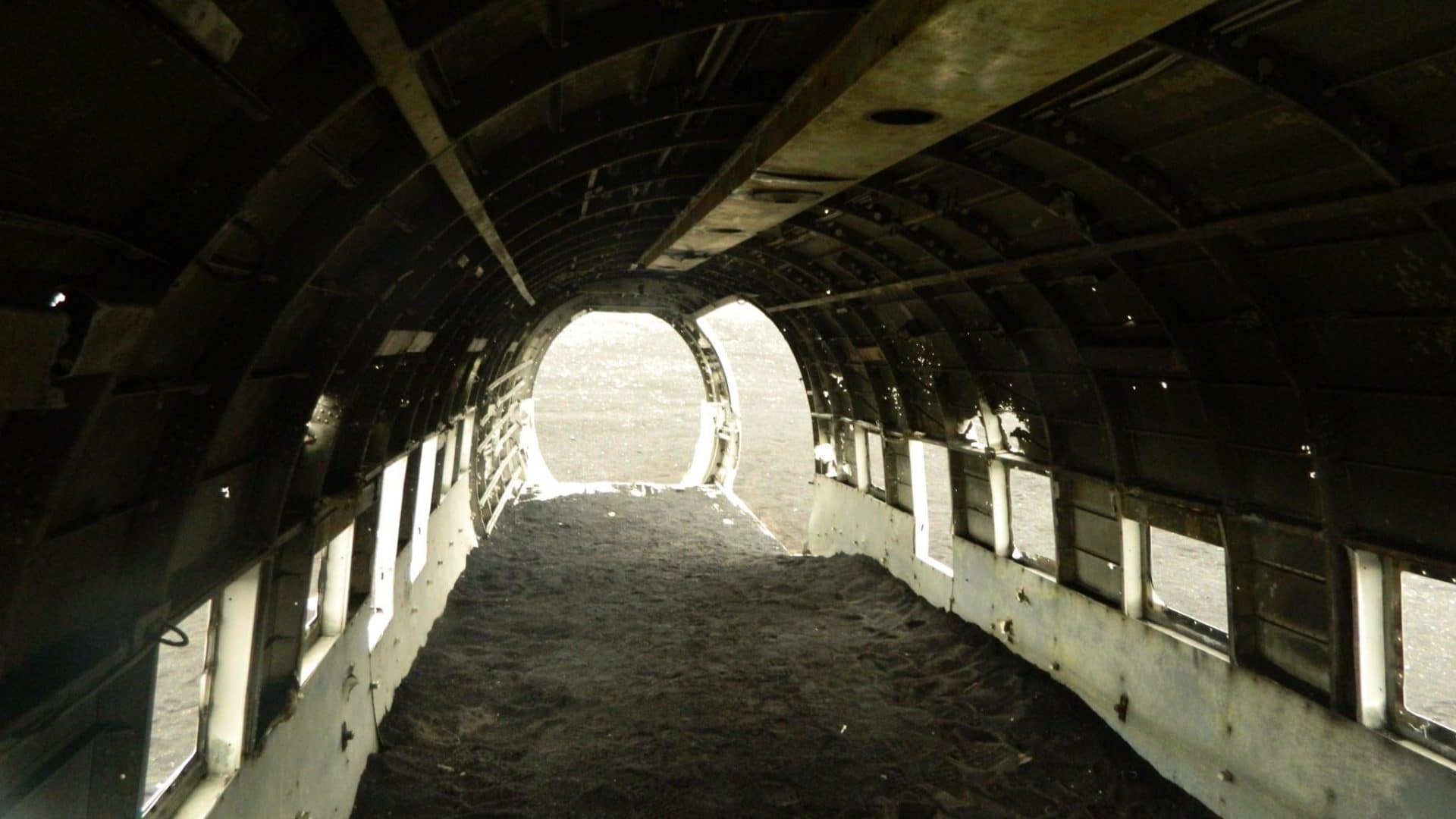
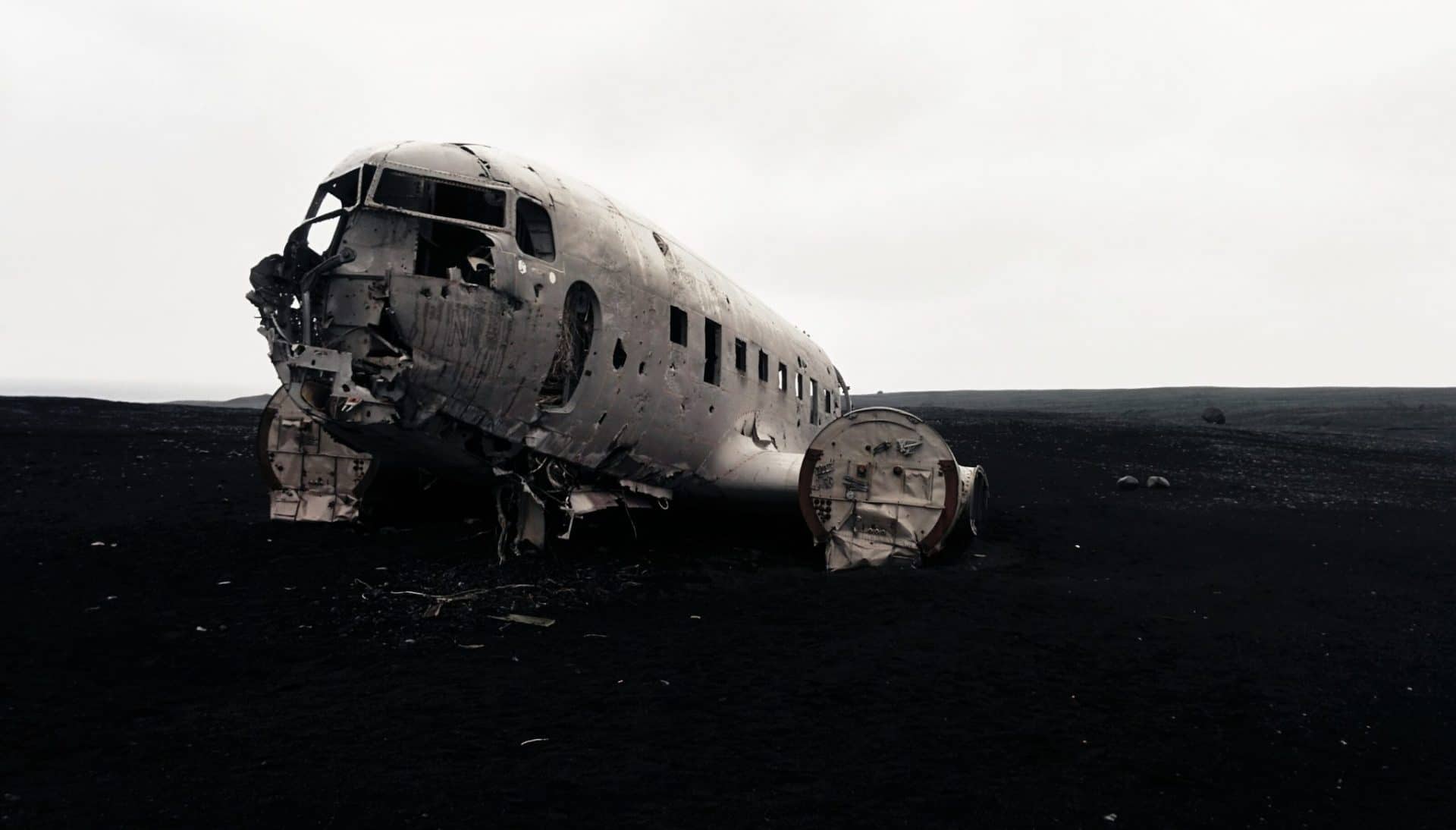
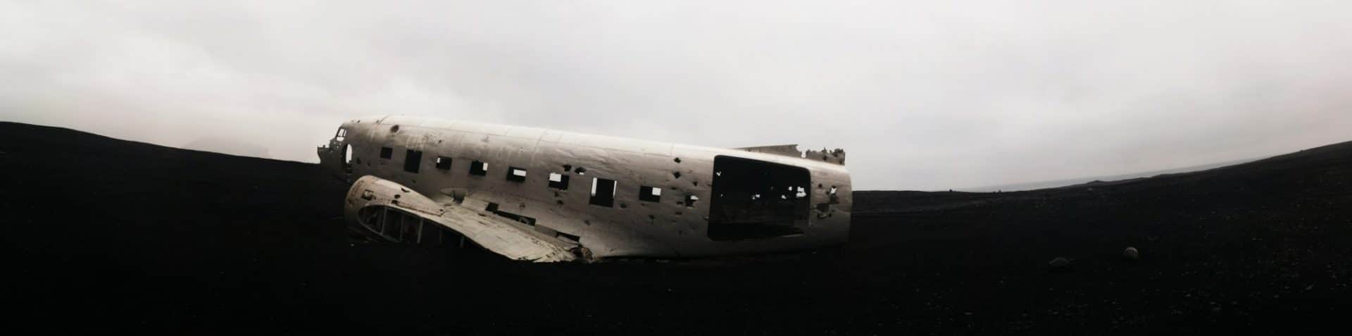
My next step is the wreckage of an old DC-3 who crashed here after the war. To get there you have to find the beginning of the road that I will walk because the car would not pass I think.
Rendering on the spot I attack the ride of 3,5km. I go well, in the immensity of the Sandur, and in the distance I begin to see the plane.
Except that … except that the more I get closer I think there is a problem: a good big river with a large flow cuts me the way for the plane … I decide to go lower down in order to ” Try to see if there is a passage. But no, no passage. Rather than taking risks to cross I turn back. Looking closer I realize my mistake and I resume the car to push 400m further and finally take the good entry for the plane … I attack the 4km again. The plane is approaching again but for good this time.
It’s a bit surreal to see it like that. It does not remain all the pieces but the plane is in good condition.
Another 4km back to the car and I drive in direction the beautiful waterfall Skogafoss which is also the beginning of the hike of the Landmannalaugar.
The Landmannalaugar trek is the hike to do if you go to Iceland, the beauty of the scenery is breathtaking.
The waterfall is impressive, a real wall of water of 60m.
The road continues and the series of stunning waterfalls also with Seljalamdsfoss which has the particularity of not being hung on the cliff. We can even go behind it’s very beautiful.
I’ll finish the day by joining Gullfoss for the night. I arrived relatively late because the day was very long …
This is the end of the journey soon …
Day 13 : Back to Reykjavik
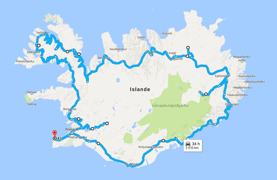
Back in Reykjavik in the early afternoon. The circle is complete. 3500km at 57km/h on average.
I take a bed in the “Reykjavik Backpacker” street Laugavegur (which I find better than the Kex). Here I meet Pascal, the guy from Quebec I met in Akureyri. As I have quite a long time I take the opportunity to visit the city. It’s very nice, Reykjavik has the perfect Scandinavian style. The day passes quietly in the sun.
The next day I visit, I take the time, I drink cafes in Reykjavik Roaster (which make excellent coffee).
At the end of the day, I meet Pascal with whom we take drinks at Dylon and with whom we try the “Rotten Shark”, shark kept underground for several weeks. It’s horrible it stinks urine, inedible … The evening continues at the bar of the Youth hostel with French guys, American and other people; I like those cosmopolitan moments.
11pm, I take the road for the last time towards the airport, I return the car then begins a long wait because my plane is late at night.
This is the return … bye bye Iceland and see you soon!
Conclusions
What an absolutely fantastic country! I used a lot of words like “Superb”, “Magnificent” or “Wonderful” but that’s because it is! Iceland really offers landscapes apart. We find the “codes” of the Nordic landscapes as we can see in Norway but the volcanism really adds a plus.
14 days to go around I made it a bit quick with hindsight. I will have had to be spending more time in places between Hofn and Reykjavik, in the golden triangle too but I do not regret the choices I made. The fjords of the North West for example took me almost three days but it was worth it. Taking a 4wd would also have been more fun, already to go faster on the gravel roads and also to explore the center but once again between the budget and the timing it was necessary to make choices.
In any case I loved this trip, doing it alone gave it a different appearance but very nice too. Iceland is not very big but you can spend a life exploring, I think! What is certain is that I have to go back, whether it is in the North West in the Hornstrandir or in the center crossing, … ideas are not lacking …
To conclude: if you hesitate to go to Iceland, stop! Go ahead you will not be disappointed!
GR54, Trekking in the Ecrins NP
10days
trekking
176km
walked
12000m
D+
14passes
This is not the best-known GR but the GR54 has nothing to envy to the GR20 or the Tour du Mont Blanc. Technically, on the one hand, the numbers speak for themselves: a little less than 180km and about 13000m of elevation gain, 14 passes and an average altitude of 1800m. But from a scenic point of view either, the GR54 does not have to blush: we cross one of the most beautiful massif of the Alps, we go through all the mountain stages, we cross Chamois, Marmots and Vultures, .. and cherry on the cake, the path is much less crowded than other GR such as those mentioned above. In other words, the Tour de l’Oisans and Ecrins is beautiful and wild and hiking was a pleasure for 10 days.
The GR54 et the Ecrins National Park
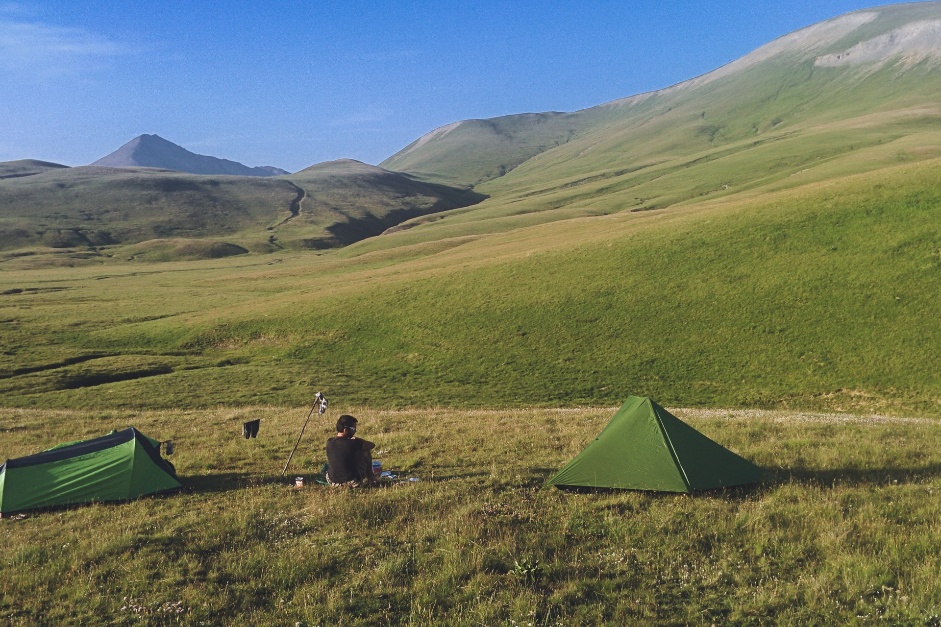
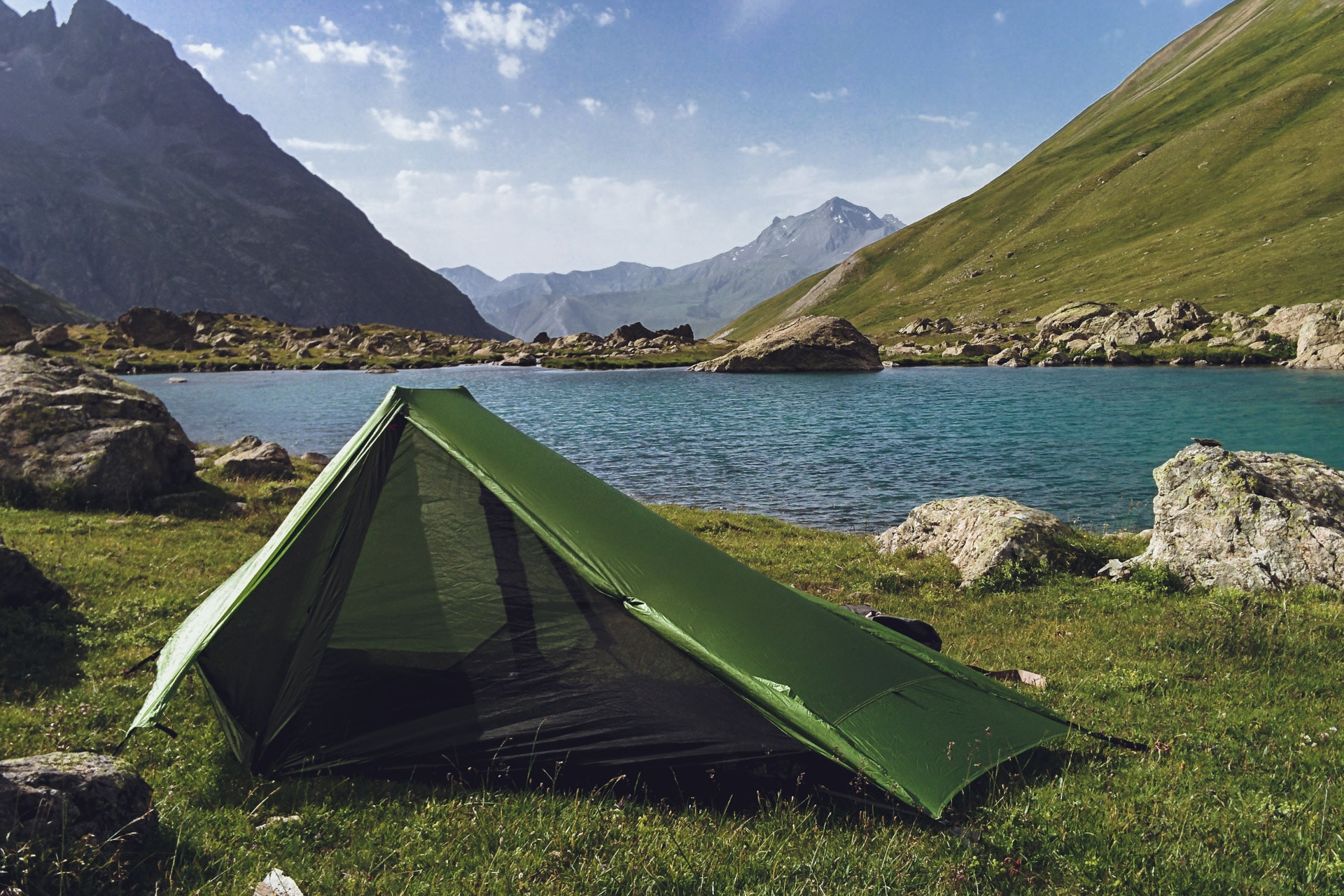
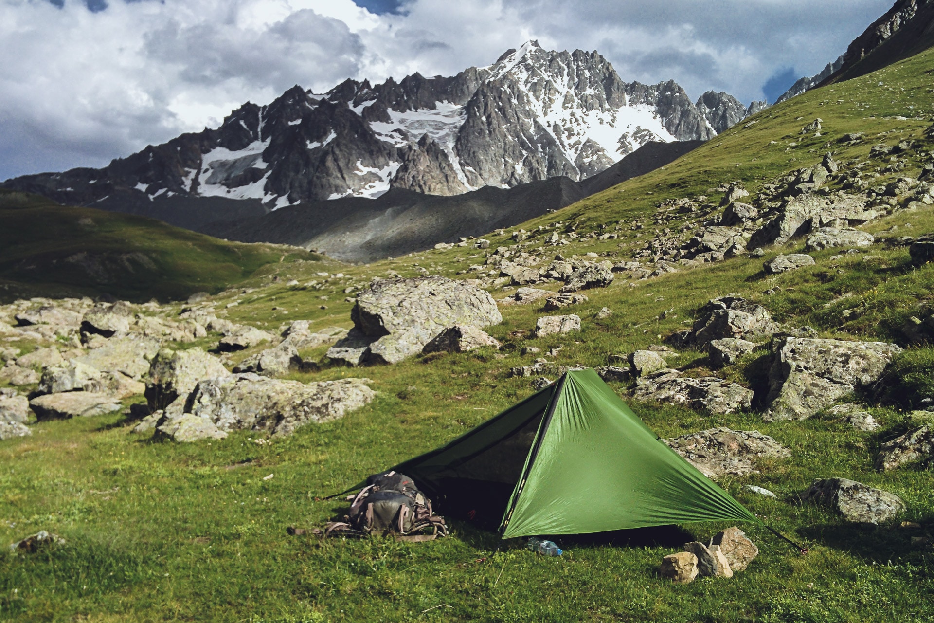
The Tour of Oisans and Ecrins is a loop that travels through these beautiful mountains in the heart of the Isere department. The diversity of landscapes, their beauty and wildness (especially for the southern part) make this GR one of the most beautiful. All days of walking are punctuated by the passage of at least one pass, by mountain lakes or majestic valleys. In terms of difficulties, the GR54 is not simple but remains accessible to the greatest number because it is quite possible to make each night in a shelter and therefore to travel light. For my part I chose the bivouac all along because this format offers the greatest freedom possible. Crossing villages or towns at least every other day also means you do not have to eat too much food or change menus.
We travel the GR54 largely in the Ecrins National Park. This area of protection of nature and mountain traditions is to be respected as a jewel. Fire is obviously prohibited as well as camping over several nights. However the bivouac is allowed between 8pm and 8am. The best way to know the rules to follow is to go to the park site what I recommend before departure: http://www.ecrins-parcnational.fr/
Day 1 : from Paris to the Ecrins
We are early July, it’s the day of departure! Finally ! As always before going on a hike (and on vacation …) the wait was long. But here we are ! I met with Quentin who should have accompanied me on all the GR54 but as we will see it will not be possible for him unfortunately. To make it to the Ecrins nothing easier: a little TGV to Grenoble and a little bus to Bourg d’Oisans where we will start the GR54.
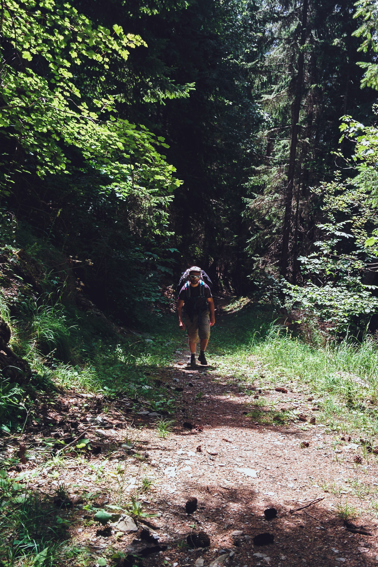
It only took us a morning to go from the city to the mountains. On site we complete our food supply with a little charge for the next days and noon. The “beginning” of the GR54 is easy to find, it is located behind the campsite Cascade and starts directly with a small climb in the rocks (be careful in case of rain it can be slippery I think). It is super sunny, even hot, and the weather forecast is good for the next few days …
We will stop on the heights of Bourg d’Oisans to nibble our lunch.
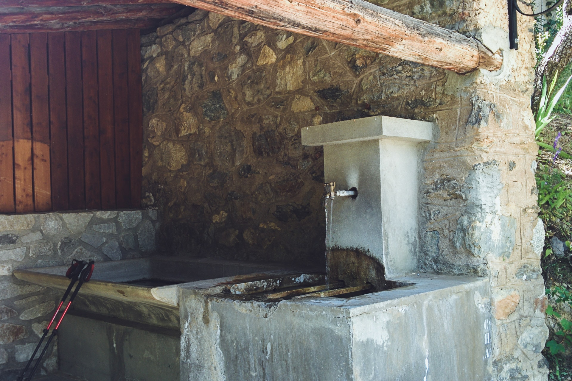
The path continues to climb then to finally arrive in the pretty hamlet of La Ville which we stop 2min enjoy the public fountain! The GR54 then continues alternating paths and tarred passages while passing through small typical mountain villages. Once again we take advantage of the fountains that we find in almost every one of them. It is very very hot and the flies are numerous and very annoying!
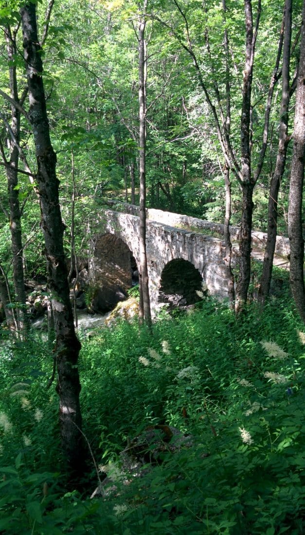
The path goes down once the village of Rosay pass. We reach the torrent of Sarenne at the level of a beautiful Roman stone bridge. We are now under cover of the forest so it is better but there are always so many flies it is tiring. We had planned to sleep in this area but the topology does not allow us to do so and the flies push us to move forward, moreover it is still early then so much to save time.
So we run along the torrent on a lot of distance, a little cool drink break at a refreshment bar and we continue.
We will find our location for the night a little further, a large expanse of fairly flat grass and not too far from the Sarenne. Flies are a little less present. It’s time to take our little evening meal after a long first day (between the ride and the walk) and we’ll go to bed early.
Day 2 : from The Sarenne Pass to the Highland of Emparis
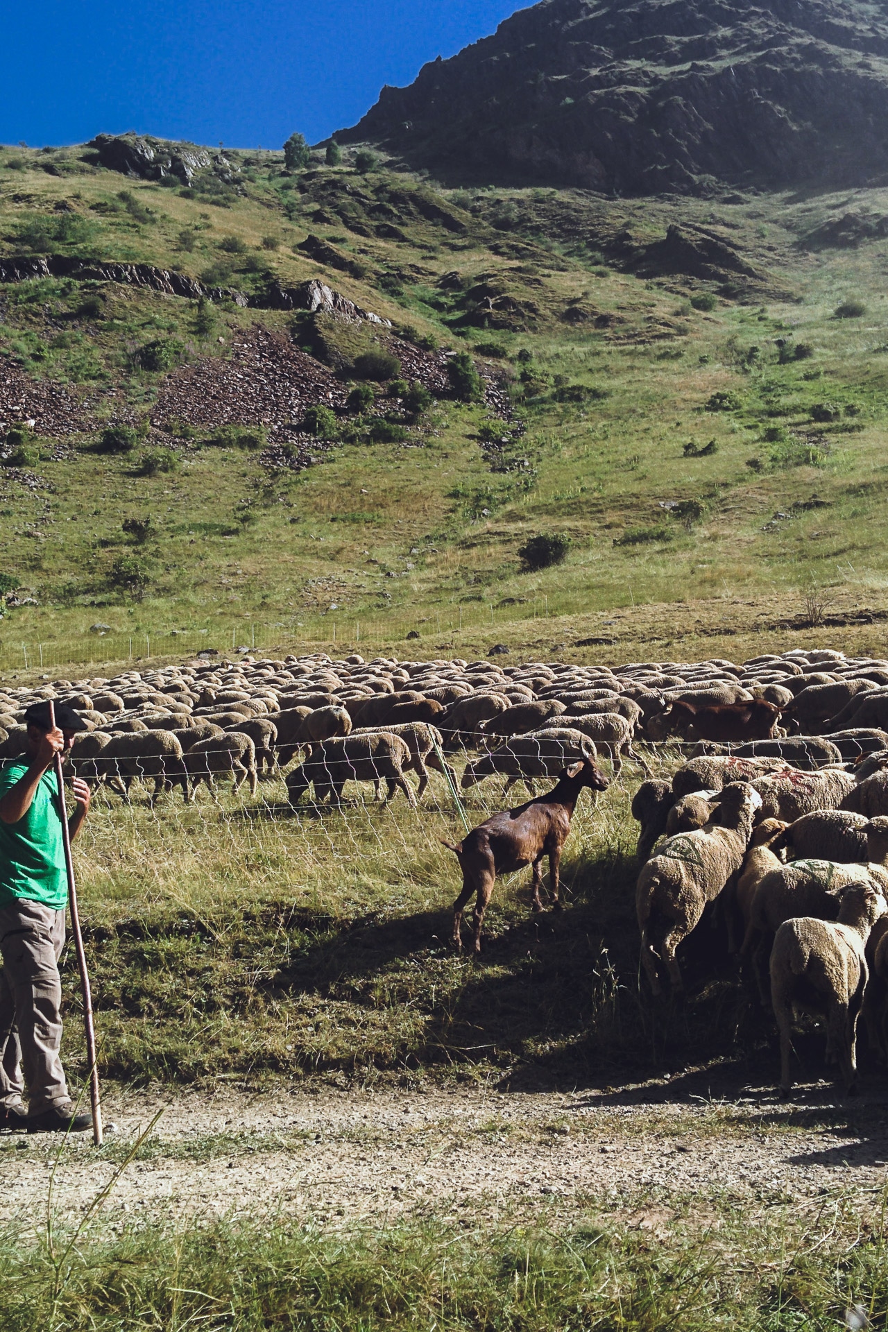
The second day begins gloriously invaded by flies. We therefore quickly leave the bivouac towards the Col de Sarenne (1999m). On the way we meet a shepherd who drives his sheep in a inclosure. Continuing to advance two “patous” come out of nowhere and come to me, one in front of the other behind. Fortunately the shepherd calms them …
“Patous” are shepherd dogs raised from a very young age in the flock. They think they are “sheep” and will do everything to protect them. So be careful when approaching an unguarded flock because the dog can be aggressive unfortunately. Hikers’ attacks are recorded every year.
The climb to the pass does not really charm because it follows a road. There are many cyclists. We take a break at the shelter to have a drink.
We then begin the descent to Clavans-Les-Bas. It’s already very hot and Quentin is starting to have his feet bad because of his shoes. He has big blisters on each foot and it hurts with every step … It’s not a good sign.
We take our lunch break at the beginning of the road that goes up to Besse. It gets hotter and the flies are a sore. Once in Besse we attack a climb of 700m vertical drop. Normally it would go well but there with the overwhelming temperature it’s really hard! Quentin has more and more pain in his feet …
On the other hand once at the top of the show is sublime: in front of us spreads the Plateau of Emparis, immense green meadow which is not without reminding the Great American Plains in a certain way, except that no bisons here but marmots.
I motivate Quentin to go a little further to bivouac next to a water point. His feet really hurt it worries me for the next day …
Our location for the night is very beautiful. It is slightly overhanging so we saw all over the plateau. Right next to the camp, the “Rif du Coin” allows us to cool off and wash our belongings …
The evening ends with a well-deserved freeze-dried fondue and an army of flies to wish us good night …
Day 3 : from the Plateau d'Emparis to the Lake of the Star (Lac de l'Etoile)
The day begins with bad news: Quentin decides to stop the GR given the state of his feet and the pain he feels at each step … He will go down to La Grave and continue hitchhiking until at a train station. I will continue without him.
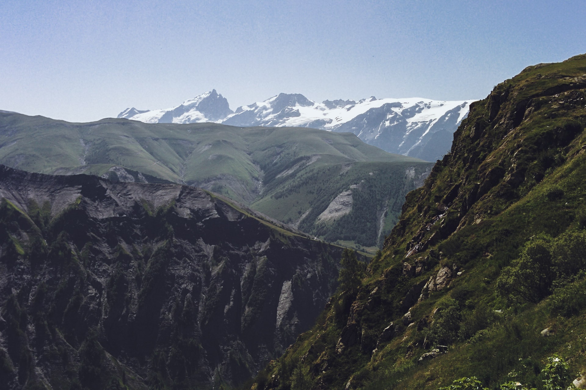
We are once again hunted by flies this morning. The climb to Col du Souchet (2365m) does not present difficulties and is quickly done. From the top, the massif of the Meije is revealed, beautiful and impressive.
The descent to the Grave is pretty especially thanks to the Meije (3983m) in the opposite side of the valley. The GR54 also passes through some pretty village like Chazelet or Les Terrasses. La Grave is also pretty but more animated already.
After the lunch break, Quentin stays there and I continue, sad moment … I wish he could continue but according to the state of his feet is better for him. I will continue alone but it does not matter it will give another dimension to the GR.
Let’s go to Villar-d’Arêne and further Pont d’Arsine. The path is flat and easy by cons it is a stifling heat … I stop almost every hour to drink 1L of water … I’m soaked …
But I cover ground and I quickly find myself climbing the path that leads to the Refuge de l’Alpe de Villar-d’Arene. I am greeted by a herd of cows.
To finish this long day, during which I did a lot of kilometers I’m looking for a corner for my bivouac evening (after taking a small beer at the shelter …).
My choice will be on the Lac de l’Etoile because it is a little hidden from the path and especially because the location is superb! A hell of a day that ends and especially a hot day! I will have drunk almost 7L!
Day 4 : from Lac de l'Etoile to Vallouise
I survived my first night alone … The most disturbing in the mountains at night is the silence that reigns not the noise around.
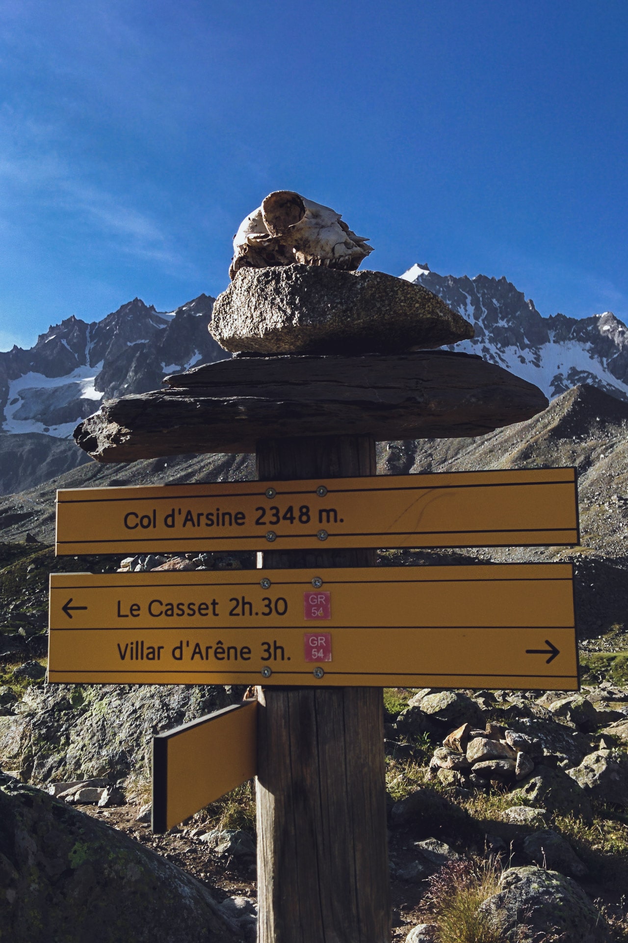
I fold my bag after a quick breakfast and I leave towards the pass of Arsine (2348m). At the pass there are a lot of marmots but the photos are not good….
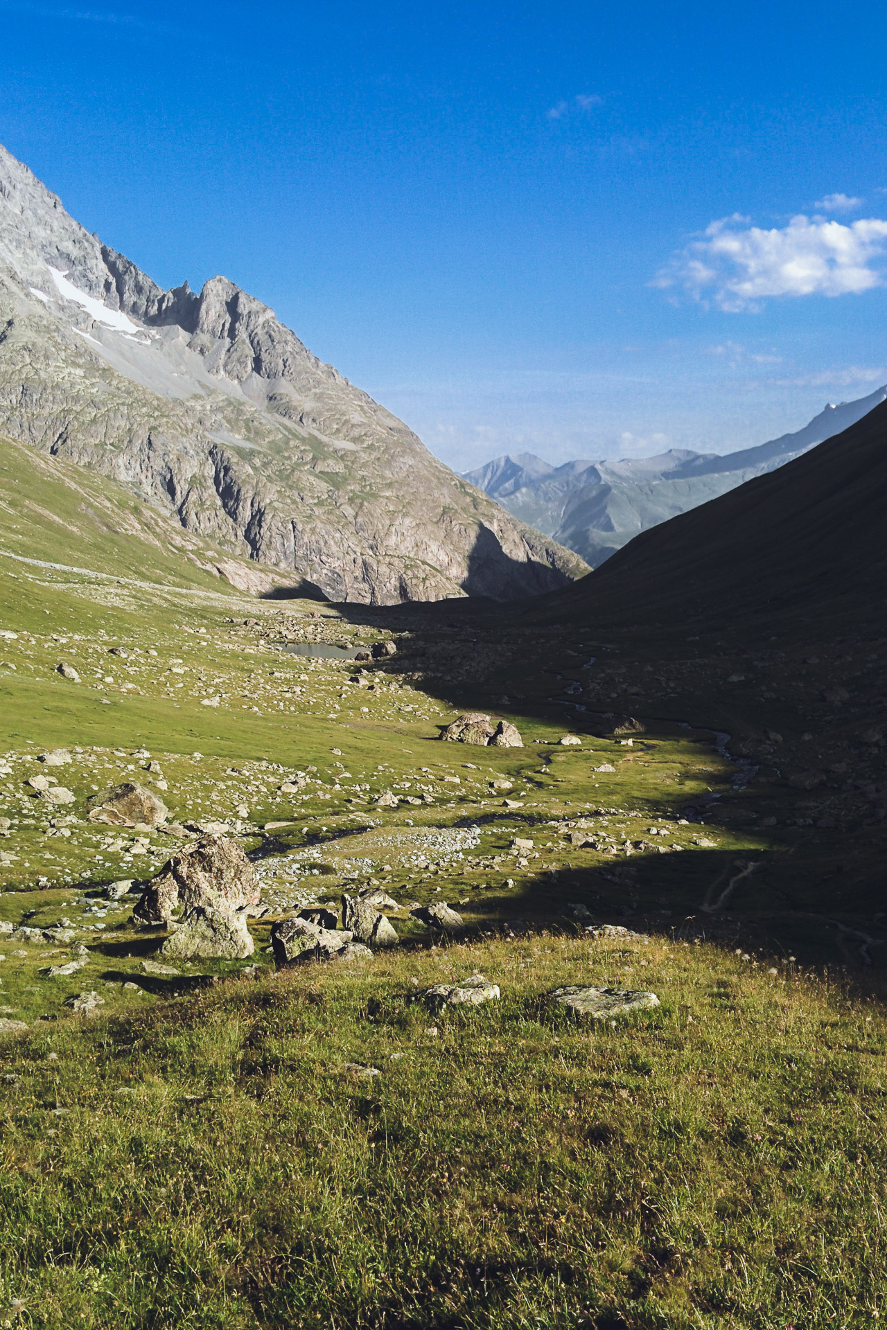
I then begin the descent. I follow the stream of Petit Tabuc which is growing while the altitude decreasing. The mineral setting gives way to coniferous forests. It is a beautiful landscape, it is still cool enough to enjoy and as the days before I do not meet anyone …
The path then continues to Le Casset and Le Monêtier-les-Bains. I start to meet hikers who go up to the pass. The trail begins to “civilize”, there are cyclists and more and more people. Everything has a less charm now …
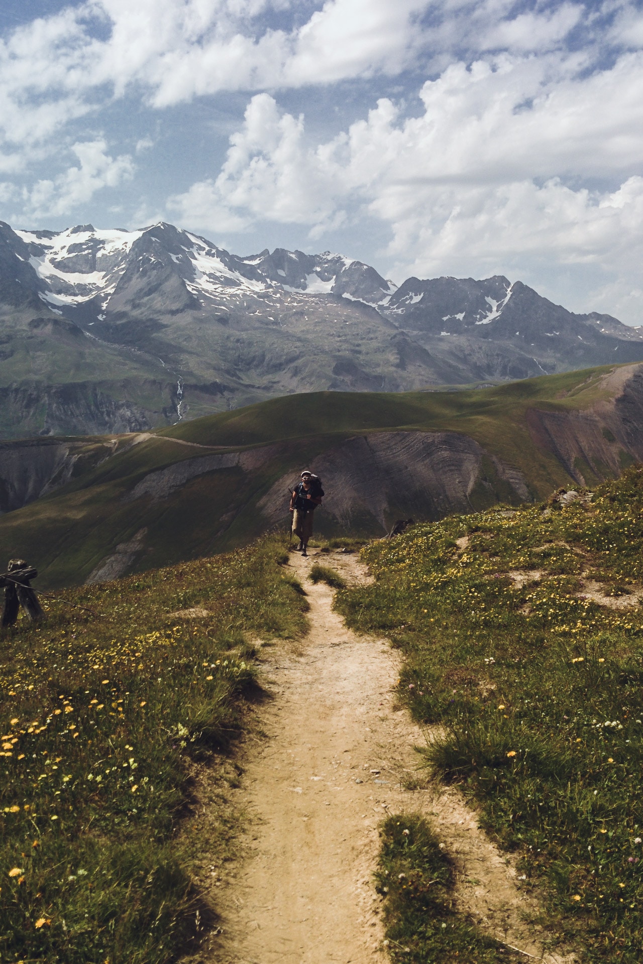
After a break in Monêtier, I start the climb to the Col de l’Eychauda (2425m). The beginning of the ascent is great in the shade under the cover of the forest. I meet some deer who also seek the freshness of the undergrowth. The climb is done following the Torrent de la Selle, it’s nice.
By cons, around 2177m, we land on a chairlift area and installation of winter sports … it breaks the whole atmosphere. The path is stony and dusty, everything is “controlled”, artificial. This is the way to the pass, which has a retention lake for artificial snow.
I continue in the Ravine of Neyzets, fortunately the view is nicer here.
The 600m descent to Chambrian hurts your knees especially if you count the 800m of D- after the Arsine pass … To top it off I’m entitled to a bleeding nose abundant probably due to heat, altitude and dehydration.
I decide to continue to Vallouise for tonight to spend a night at the camping to have a good shower. The problem is that Vallouise is not very close and the road to go is only tar.
So I’m going to do a little bit of hitch-hiking to save my little knees … A Dutch couple will take me after a few minutes and, lucky enough, they are staying at the campsite where I wanted to go!
They deposit me in front of the reception, great. After settling my tent I have a real shower, the first since the start! Then I spend a little time with “Vinz” another hiker who is doing the GR54. It is a former bar manager in Paris who has dropped everything and who is doing hikes since. We discuss all this around a little well deserved pastis after this long day again very hot.
Day 5 : from Vallouise to the Refuge du Prè de la Chaumette.
I slept less well this night than previous … Obviously in a campsite it is noisier in the evening than at 2300m altitude ..
Today’s agenda : passage of the Col de l’Aulp Martin, culminating point of the GR54 with its 2761m. This gives a difference in altitude of 1100 from the parking of Entre les Aygues followed by a descent of 900m. A sporty day but after four full days I’m starting to get fit.
As I just said I will start the day at Entre les Aygues because it is only tar since Vallouise. So I can get hitchhiking for these 8km.
The beginning of the path is very beautiful. We walk in the valley with the beautiful Torrent de la Selle next. After a few kilometers we arrive at the Jas Lacroix Hut where the shepherd is resting and where I recharge with water. The site is charming.
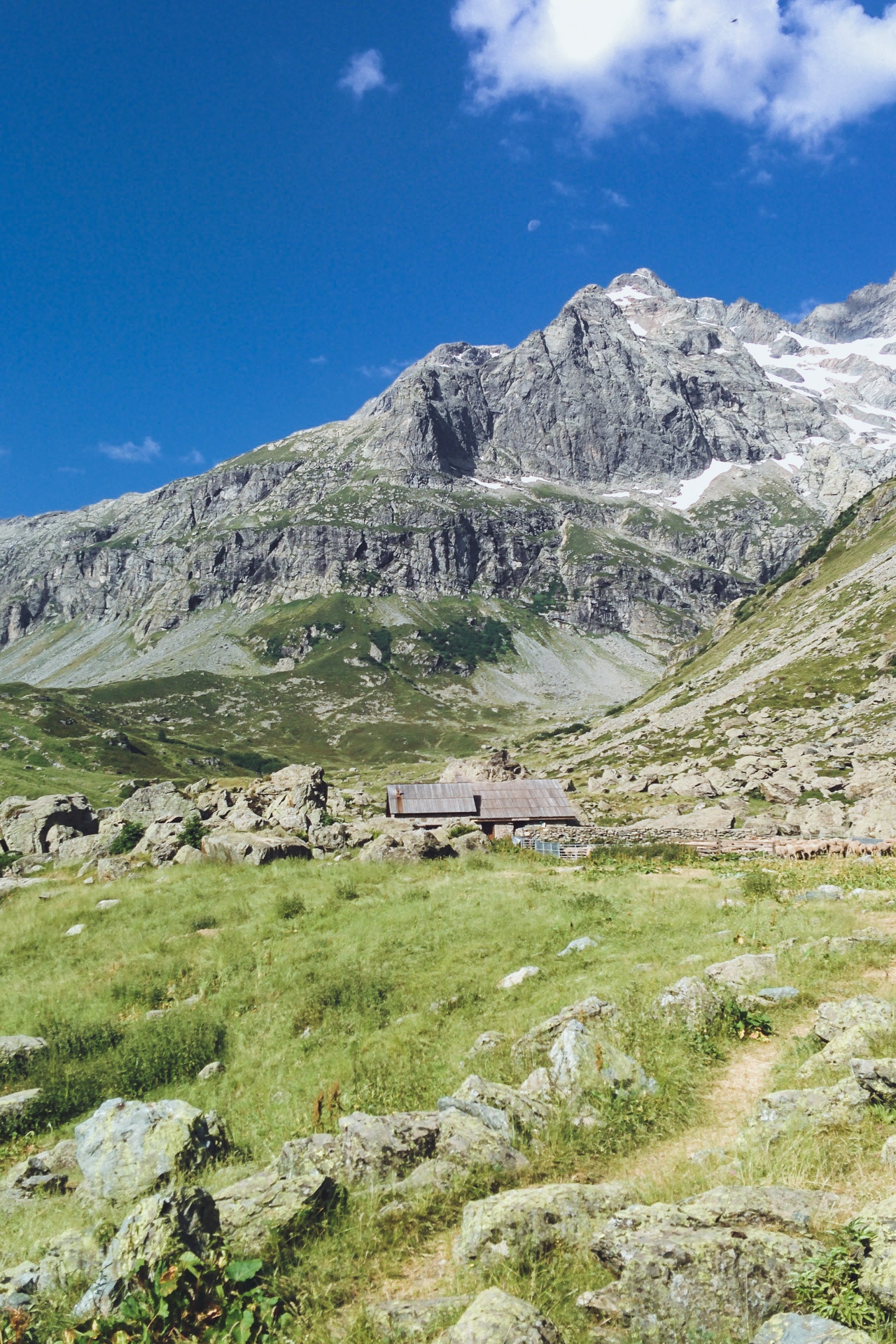
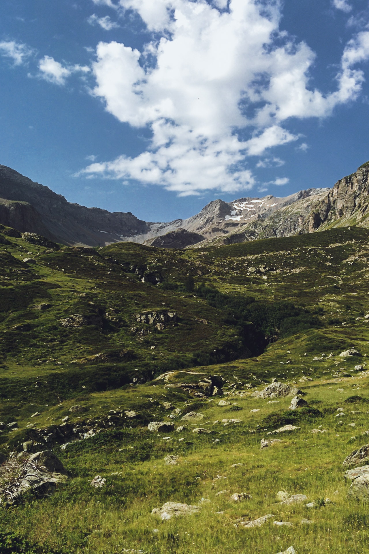
The GR54 changes quickly after the hut. The environment becomes more and more mineral. The 700m of D + above the cabin are not easy especially in this heat.
The end of the climb is carried out in a 100% mineral environment. I think the rock is Gneiss, those are kind of very friable stacked slates. You have to be a little careful if there are people above. I also think that in case of rain the path must be quite slippery, so be careful.
In any case I finally arrive at the top, very nice view. I meet a couple who makes the GR54 with whom we chatter a little.
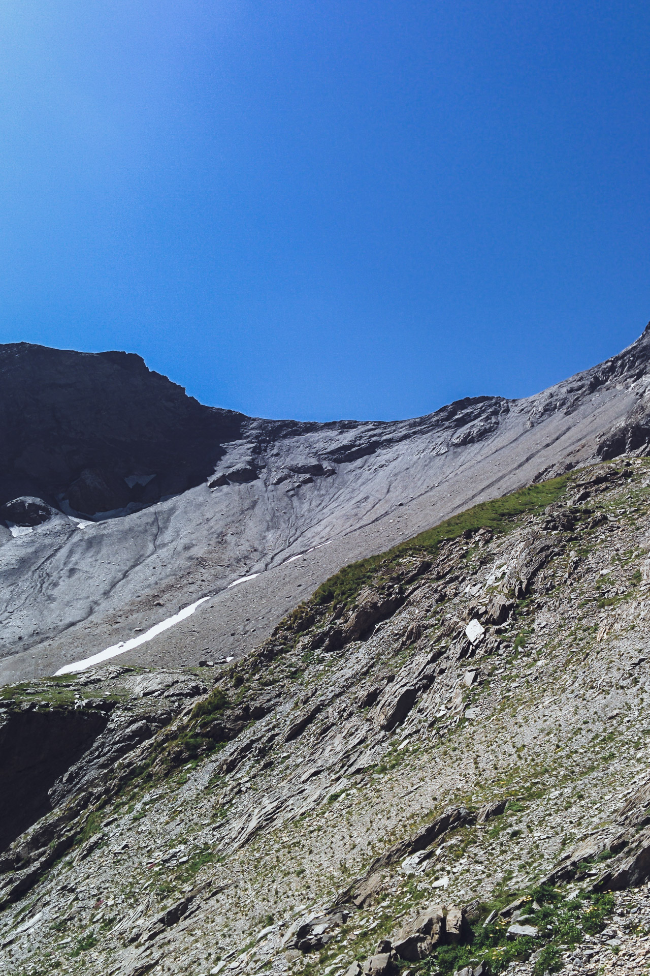
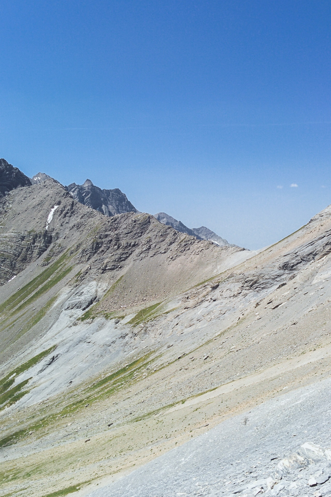
The path then crosses to the Pas de la Cavale (2735m). Then you have to start the descent to the Refuge. The view is beautiful. There are many sheep that hide behind rocks so as not to suffer too much from the heat.
I quickly loose altitude and I am relatively early at the Refuge of the Pré de la Chaumette (1790m). As I have time, I eat a good omelette, a piece of pie and a beer, great luxury! I spend a good part of the afternoon talking with the guardian. It’s always interesting to talk to the guardians of refuge, they have lots of things to teach us.
Later in the afternoon, the couple from earlier also arrives at the shelter. We will then look for a place to bivouac. The bivouac is allowed next to the shelter but in a specific area, just ask the guard to indicate it to you in case of doubt. Unfortunately the terrain is not very flat and especially very grassy (tall grass) it is not the most practical. In the evening Vinz finally arrives with his huge backpack which must be filled to more than 20kg.
End of the day always with flies and a good night sleep …
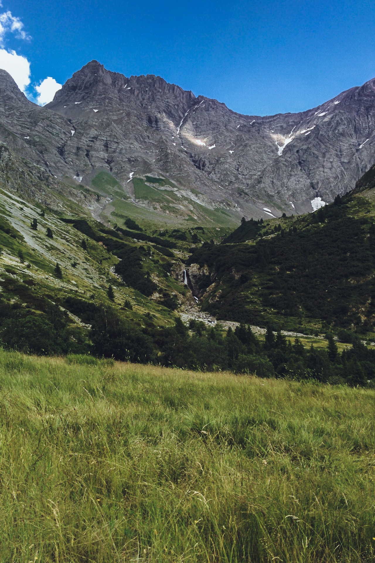
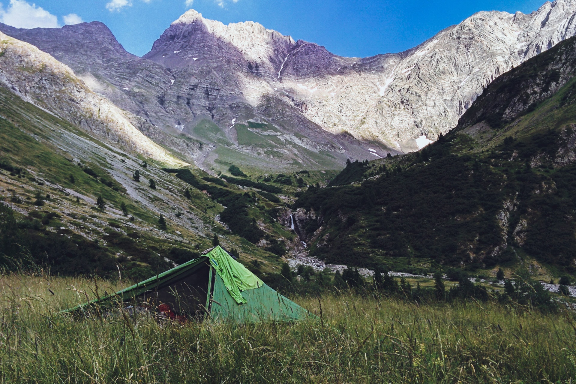
Day 6 : from Pré de la Chaumette to the Chapelle-en-Valgaudémar
One again a long day in perspective: three passes to do and quite a few miles to the village!
I begin early but the couple of the day is already gone! The beginning of the path is done quickly without difficulty. Despite the drop, I’m gaining altitude quickly. In the climb I catch up with the couple who is enjoying.
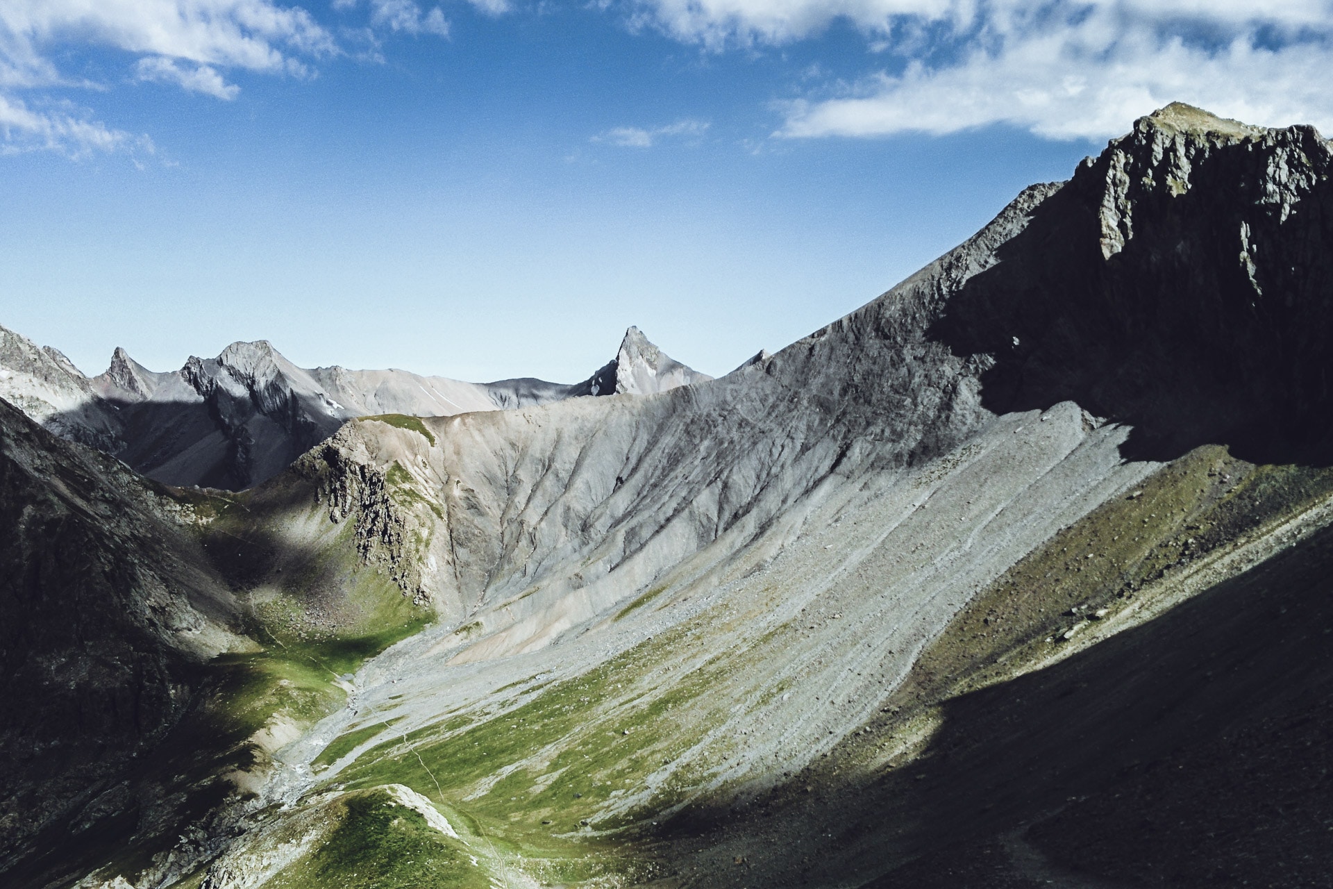
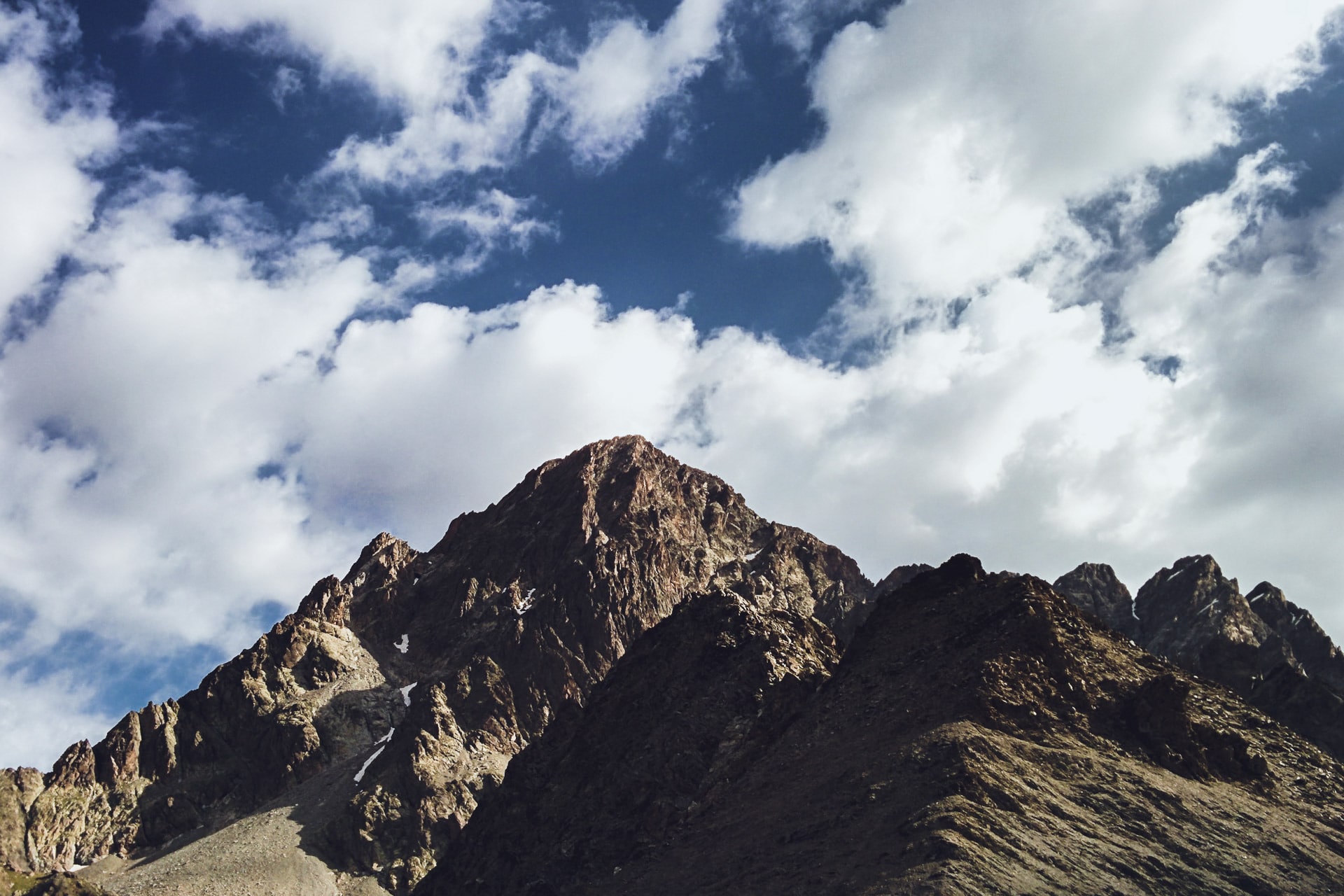
After the pass, a steep descent starts and it is made of this rock very slippery, so be careful especially if it rains!
A bit of flat and then the Col de Gouiran (2597m) that goes easily.
The physiognomy of the terrain has changed a lot in recent days, we are in the southern part of the GR54 which is much more “mountain” in terms of “minerality” and atmosphere. All this part will be my favorite until the Muzelle.
Once the Pass of Gouiran done, one follows the “Vallon Plat” until the Col de Vallonpierre (2607m). Unfortunately too much taken by the way to go I forgot to make photos here but it is one of the most beautiful scenery of the Ecrins that I have seen (you will have to go by yourself…). The view on the west face of Sirac (3441m) is striking and impressive!
The descent to the refuge of Vallonpierre (2271m) allows you to enjoy the show. The site of the refuge itself is beautiful with the lake and the surrounding rocky chaos, again I zap the photos (…).
I have an “omelette break” at the refuge before continuing my journey.
I think there is a very beautiful hike to do on 2 days starting from the bottom of the valley and then connecting the refuge of Vallonpierre followed by the one Chabournéou
Then follows the very long descent to the Chapel Valgaudémar, 1100m below. On my side it goes well until Refuge du Clot but then the long kilometers of flat break my knees. In addition to that it is always hot … The end of the road is along the fields is less fun. I am always surprised to see how in a few hours we go from the high mountains to the valley. The advantage of walking is to live the transition smoothly.
Finally arrived at the Chapelle en Valgaudémar, I take a place at the municipal campsite which is very good in terms of quality / price ratio. Once settle, let’s go to the shower that will be sooo good! I take advantage of the late afternoon to redo shopping and go for a walk in the village which is very pretty.
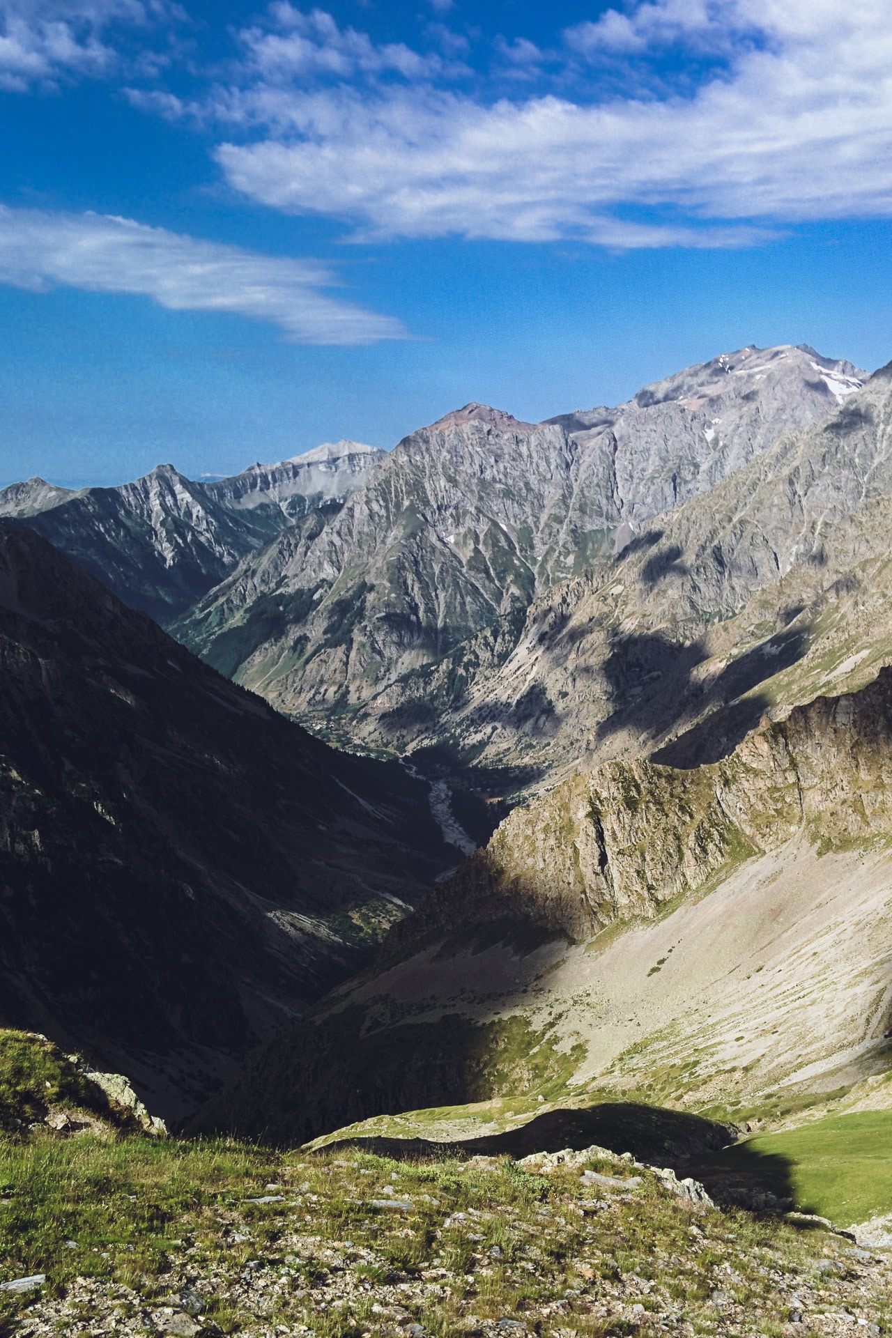
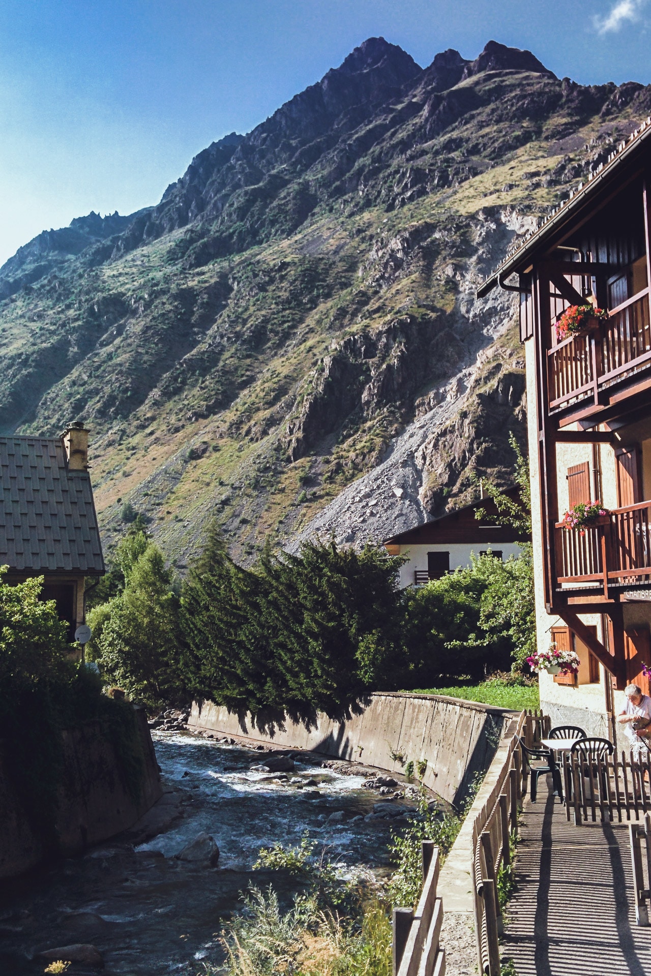
At the end of the day I meet Vinz who also stays at the campsite for the night by coincidence. So we have a little beer together to finish the evening.
Day 7 : From the Chapelle en Valgaudémar to the Col de la Vaurze.
Tomorrow, my friend Ben must join me in the village of Desert-en-Valjouffrey, the concern is that it is not far at all. So I will have to do a short way today and tomorrow.
For the moment, I’m packing up and I’m going to Villar-Loubière. The path is laid out and is not interesting. Villar is a typical and charming mountain village. It is from here that the real climb begins with the first stage of the Refuge des Souffles (1968m). I take my time but the 900m of D + are done well and in a beautiful setting.
The location of the refuge is very nice, slightly wooded. I take the time to eat one end and rest as it is still early.
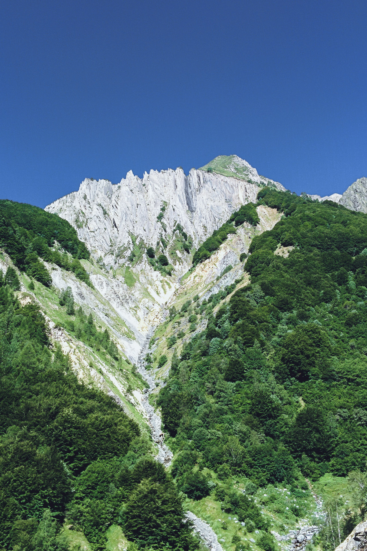
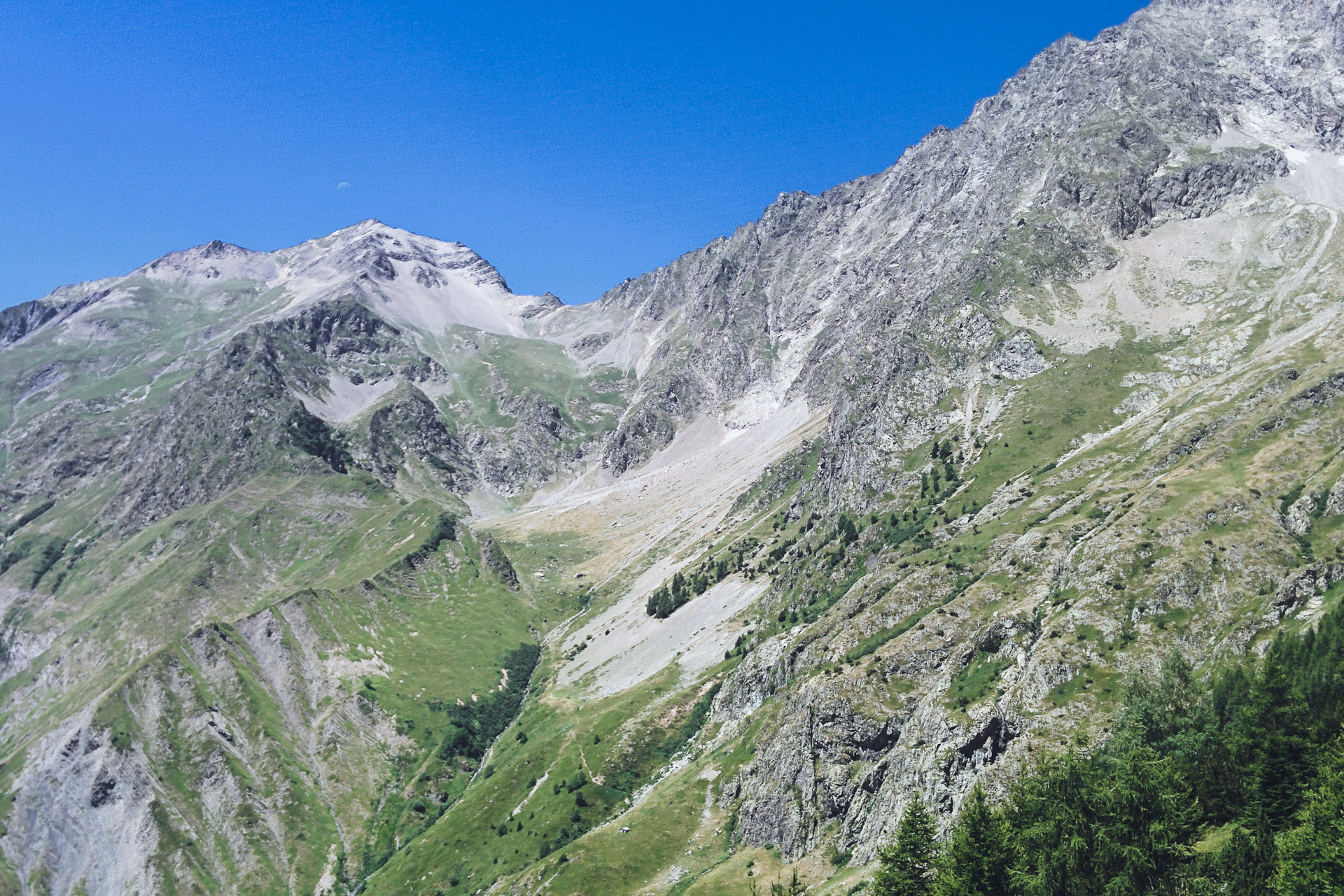
After this long break I take the road to the pass. After talking with the guardian I decided to sleep in the Perinon Ravine around 2050m. The only “worry” is that there is no water in the corner so I refuel at the refuge, I carry 4L for tonight and tomorrow morning. It may seem like a lot but considering the heat it is limited …
The path is pretty to the bivouac. It turns in the valley floor at a nearly constant altitude.
So I arrive quickly at my location for the night. I settle on the small hill south of the ravine. It’s a nice site, again there is nobody. On the other hand flies and horseflies have not forgotten to be there … No wonder since a flock of sheep graze in the corner. I hope there is no patou …
It is early so I have all my afternoon but not much to do. I turn around. I tried the nap in the tent but the sun is at the zenith and it is too hot …
The afternoon thus passes, slowly. In the early evening I visited by the herd of sheep that literally goes on my bivouac. So I play the shepherd so that they do not damage my tent and praying that there is no patou. I am impressed by the number of sheep injured, sometimes badly …
So ends the evening. Quietly … I feel good.
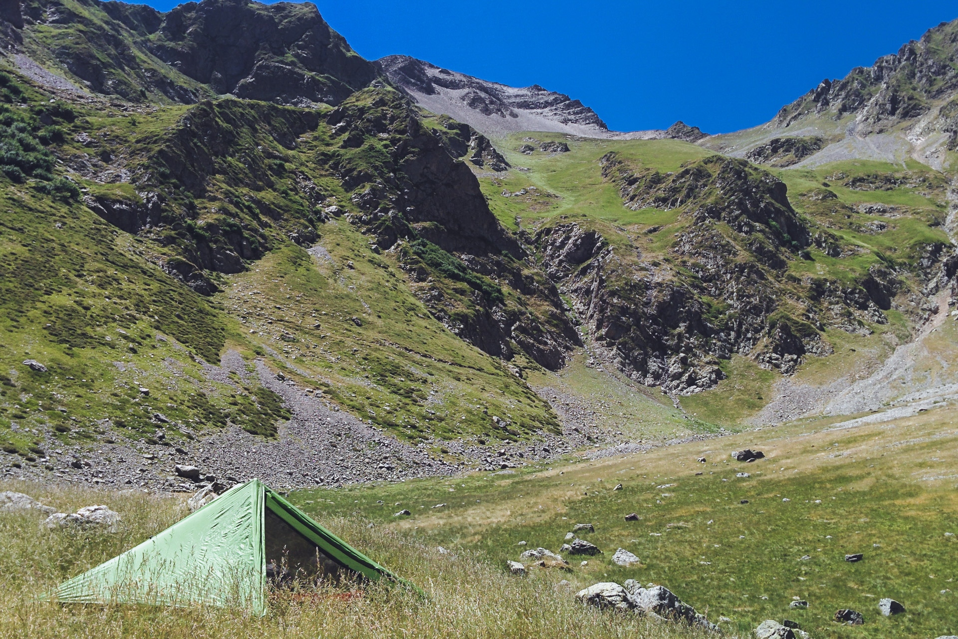
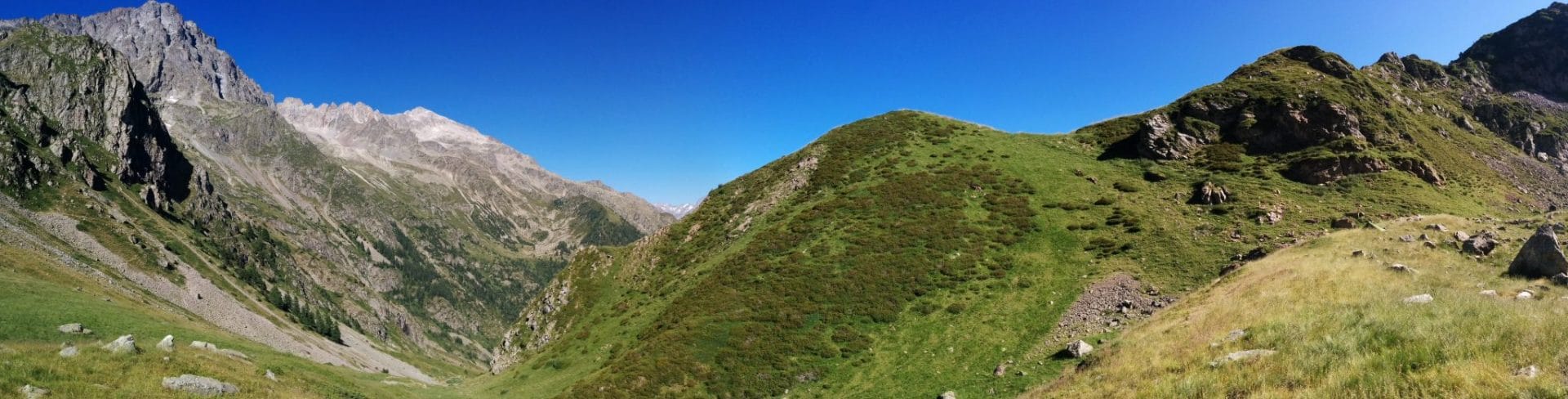
Day 8 : from the Col de Vaurze to the Désert en Valjouffrey
A short day in perspective: I pass the pass, I go down to the Desert and I’m waiting for Benjamin …
I start “late” by taking my time.
The climb to the pass is nice and not too difficult. From above the view is very beautiful, we can see the Desert in Valjouffrey far below, 1200m lower.
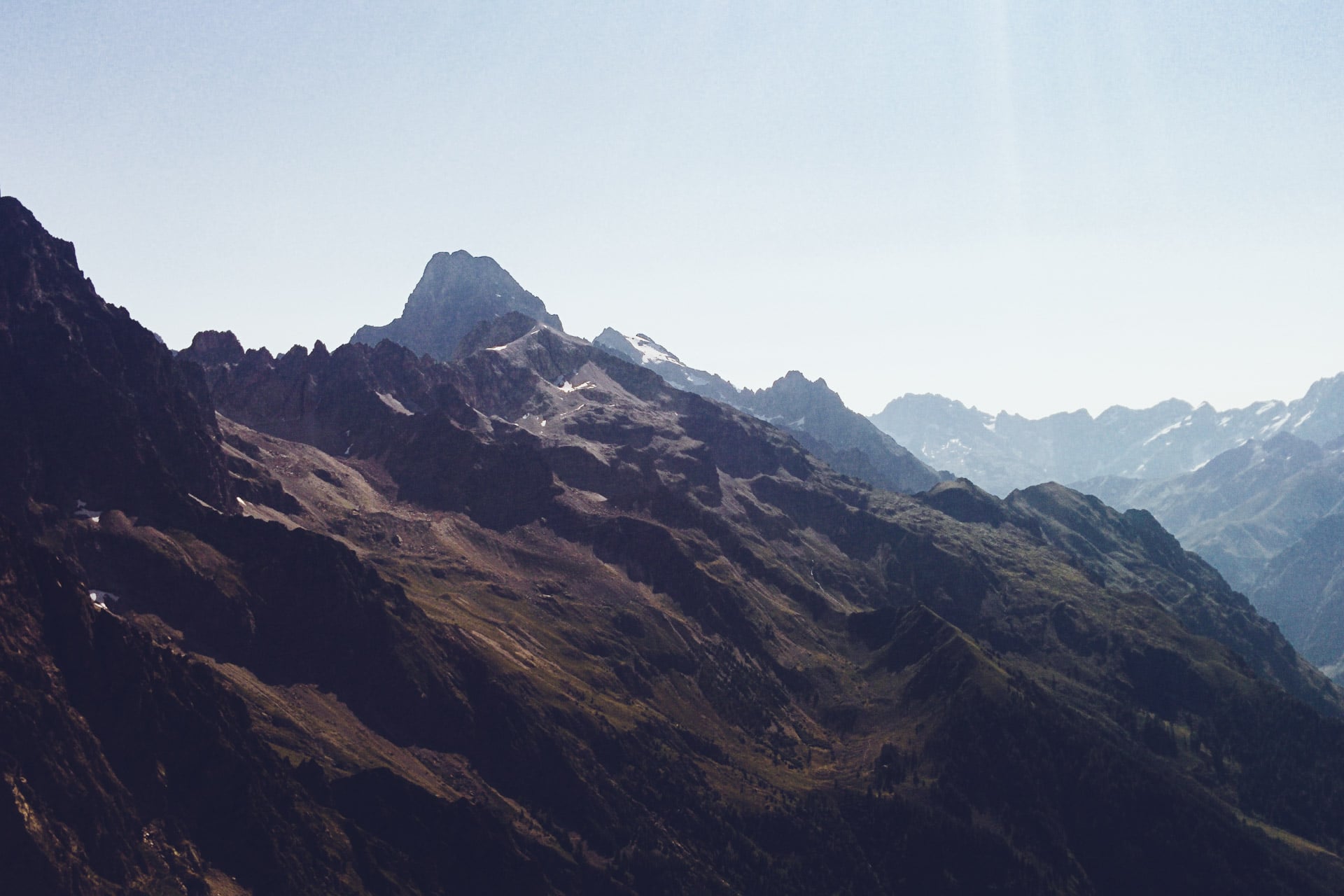
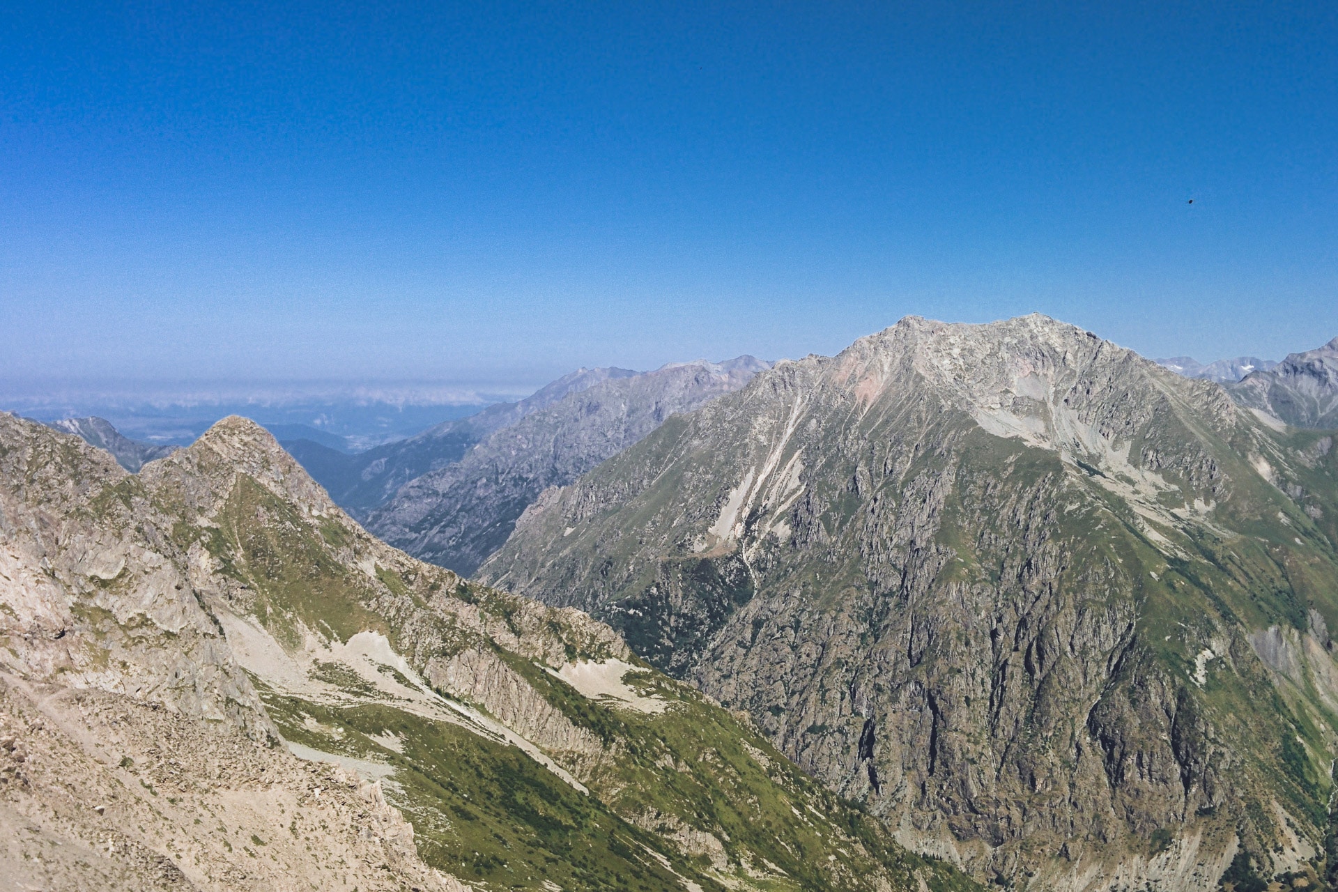
After a few minutes enjoying the view, I attack the long descent. In itself there is nothing really complicated but the many stones make the way a little dangerous. Shortly after arriving at the Desert, I witnessed a hoist in this way. I will learn later that it was a lady who took in the thigh a rock launched at full speed: report a fractured femur … The rock must have been “released” by a sheep upstream. All this to say be careful in this long descent. During mine I saw an impressive number of sheep with broken legs.
Still, here I am arrived at the small village. It has an air of end of the world, I like it. It is very typical. I do not have many news from Benjamin, I do not really know what time he will be there because there have been changes of trains and unfortunately the network is not good here.
In the meantime I settle at the bar “Les Ecrins” to have a drink and recharge the phone.
Time passes and still no news … I decided to go for a ride to find the evening bivouac. There is not much like a nice location and close to the village. However, I spot a corner north of the village towards Côte Belle.
I go back to the bar and I finally manage to catch a few network that allows me to receive an update from Benjamin: there was a big problem with the trains and he is not sure to find a bus to come here today in the Desert … Ouch … Anyway I have nothing to do but waiting for him. So I stay at the bar and finally I spend a lot of time talking with the manager who is of Corsican origin.
It is finally in the early evening that Benjamin arrives, carried from Entraigues to the Desert in the bucket of a van …
For the end of the evening we land at the corner I spotted, we eat quickly harassed by mosquitoes and hop to sleep.
Day 9 : from the Désert-en-Valjouffrey to Valsenestre
It is slightly wet this morning at the bottom of the valley, so we take off quickly from the camp. The first step of the day is to climb Côte Belle (2290m). The path begins gently sloping but quickly it stiffens. For my part it’s not bad as it’s been nine days that I walk but Ben struggles a little since it’s his first day and that his bag weighs heavily! But we go on. Anyway it’s useless to hurry we have the whole day ahead.
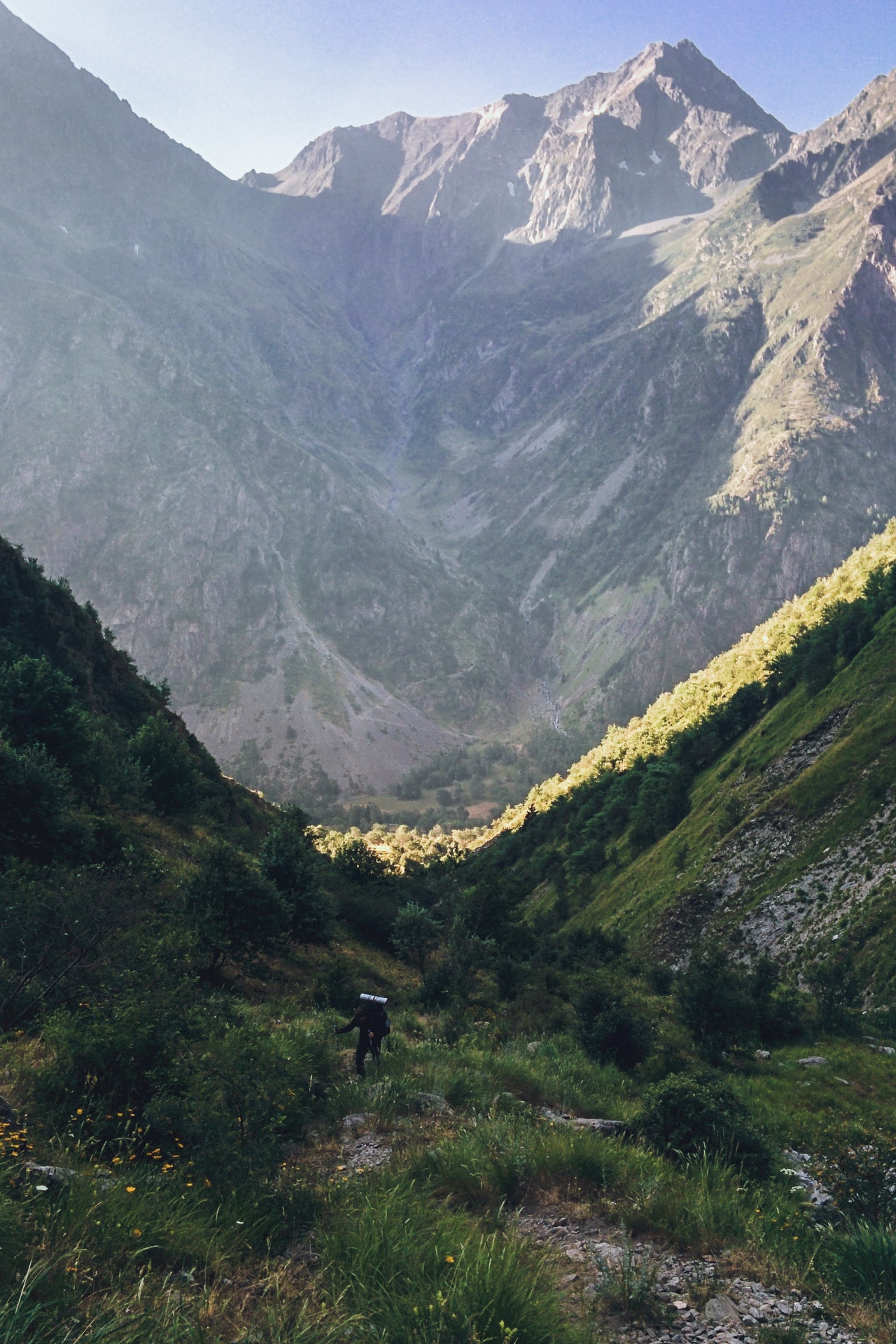
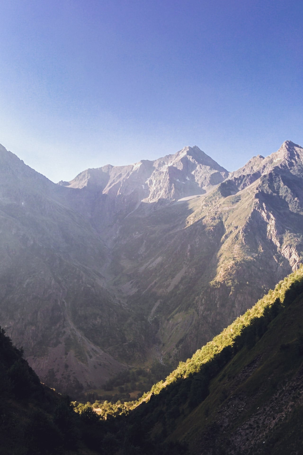
The “summit” will still be quickly reached and we give ourselves a good little break up. We meet a mother and her daughter that we’ll meet again in the Muzelle and two friends with whom we will spend the late afternoon.
The view from the top is nice; to the north we can see the Muzelle Pass, which is impressive from here.
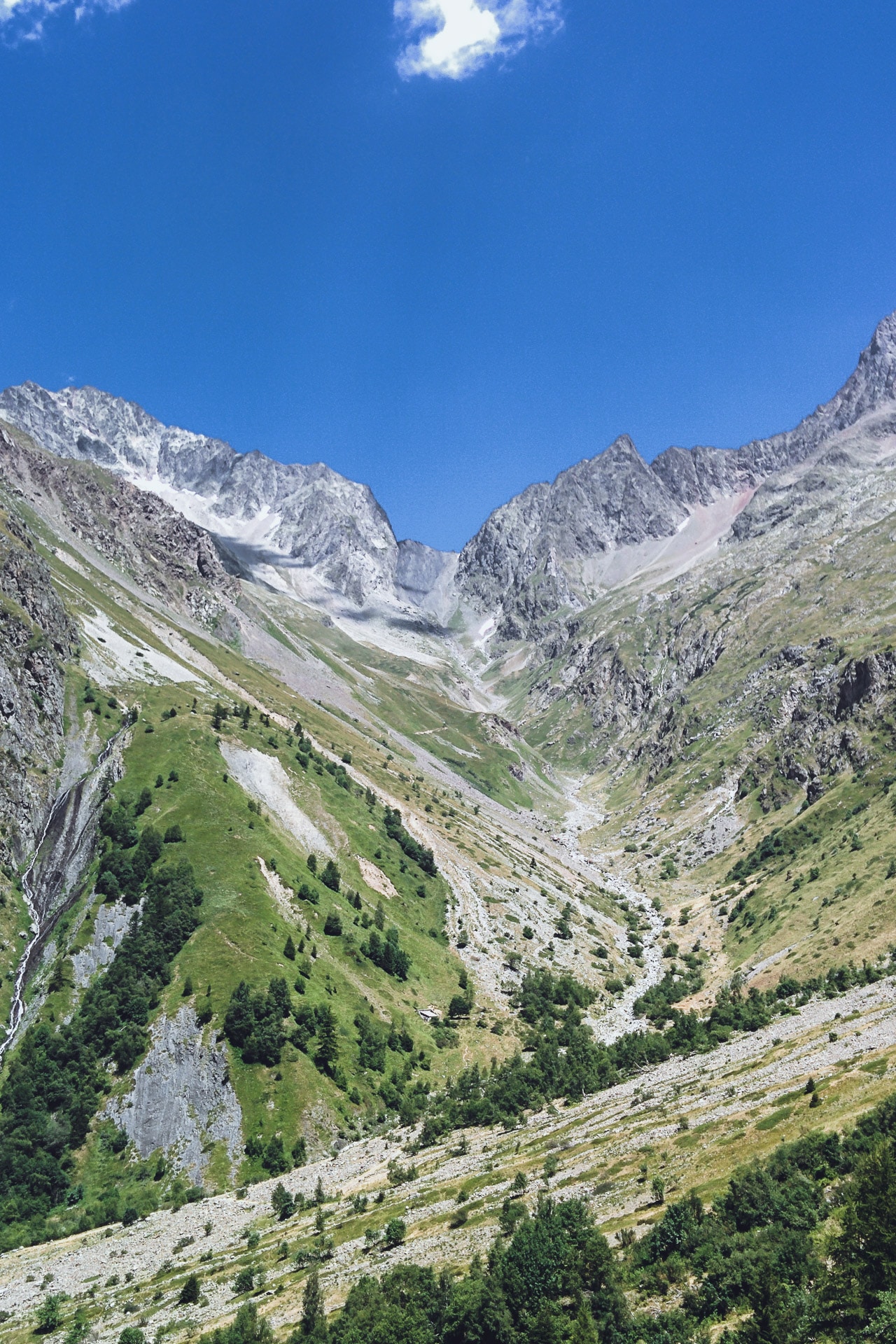
We then go down to Valsenestre. At the top of this section we find some interesting rock formations that could be reminiscent of sculptures.
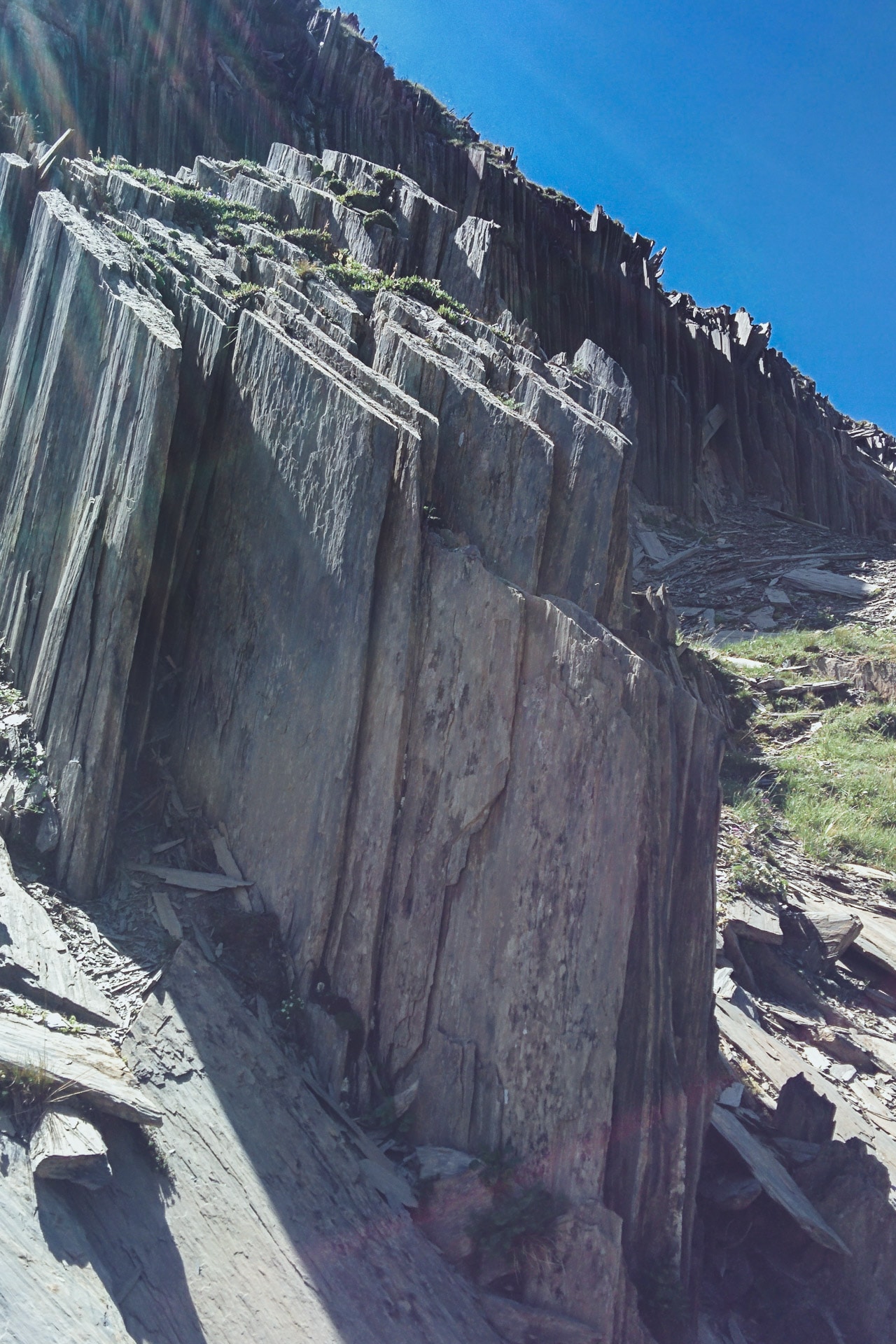
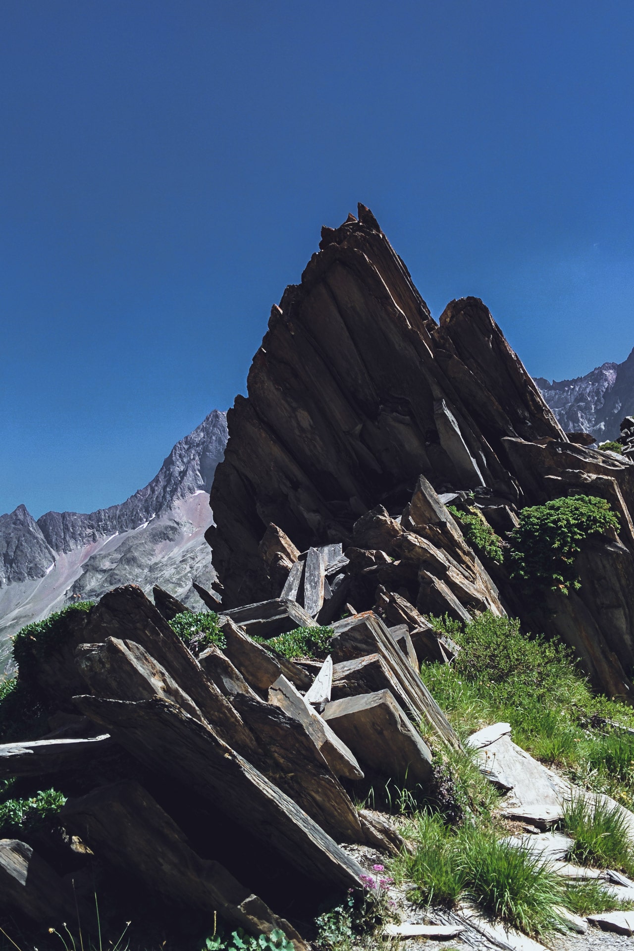
The rest of the descent is done in the scrub. It’s long and rather monotonous after a while … Not to mention the heat still present.
Arrived in the bottom of the valley we head to the village but we will stop before near the river to bathe a bit and wash our stuff.
It is still relatively early. So we kill time as we can at a picnic table. First of all, we are joined by the Cote Belle friends (a guy and a girl). We end the evening quietly with them.
For the bivouac no choice. There is a mandatory space and we will respect the rule. By cons there is not even a water point or any development whatsoever.
Tomorrow last day of real walk and last pass to pass …
Day 10 : from Valsenestre to the Lake of La Muzelle
We leave early to climb to the pass in the fresh morning. We reach the GR54 where we had left it, a little higher. 1100m to climb with a final that is deemed a bit dangerous.
The beginning slowly climbs up to the level of the Ramu Hut (about 2100m on the GR). After, it gets steeper and the laces are linked to the top. It is slippery rock but it feels comfortable. Viewed from below the pass is impressive. We ride each at his own pace. I’ll get to the top first followed by Ben a few minutes later.
The view of Col de la Muzelle (2613m) is fantastic ! Front extends the lake nestled between the cliffs and overlooked the Roche de la Muzelle (3465m).
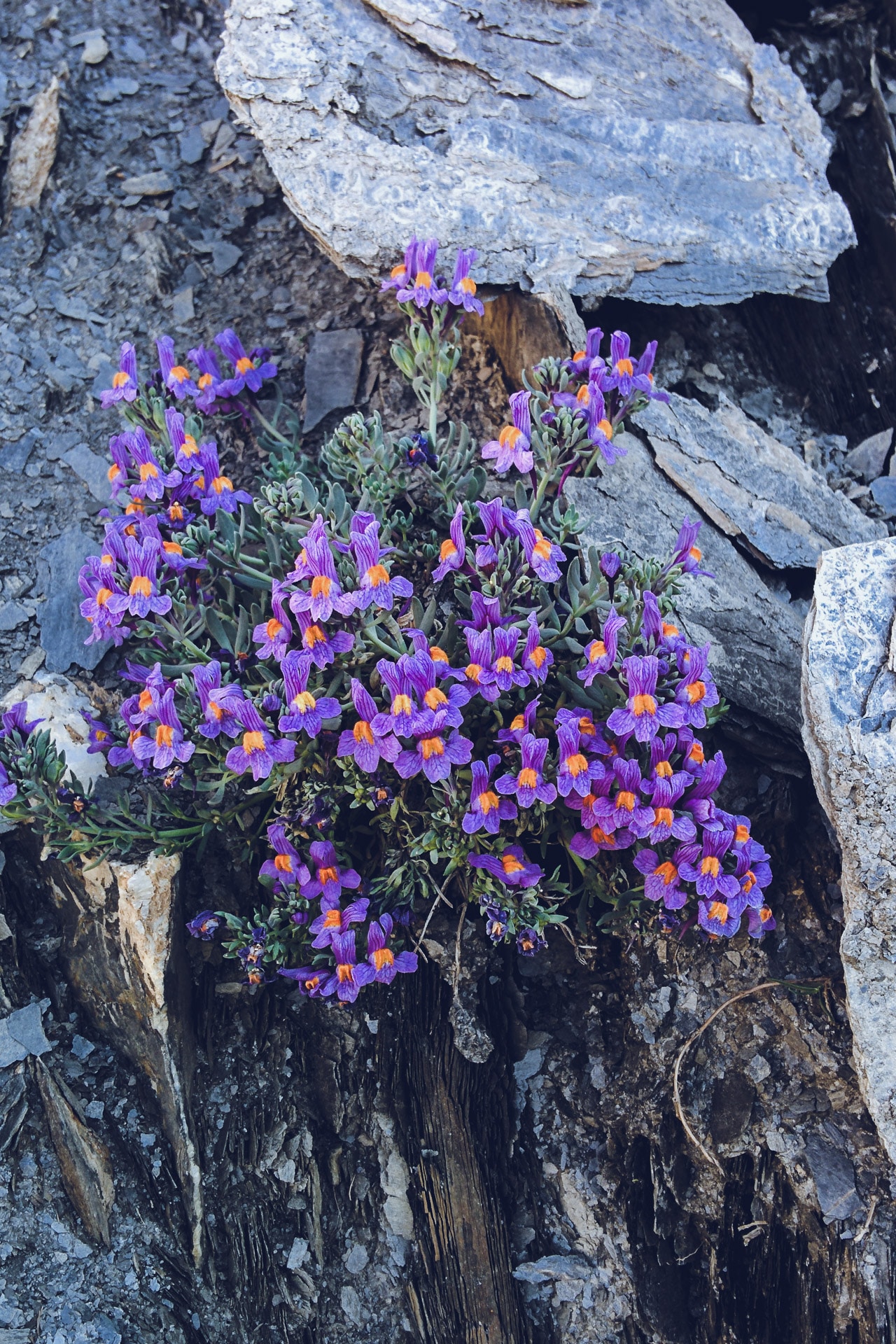
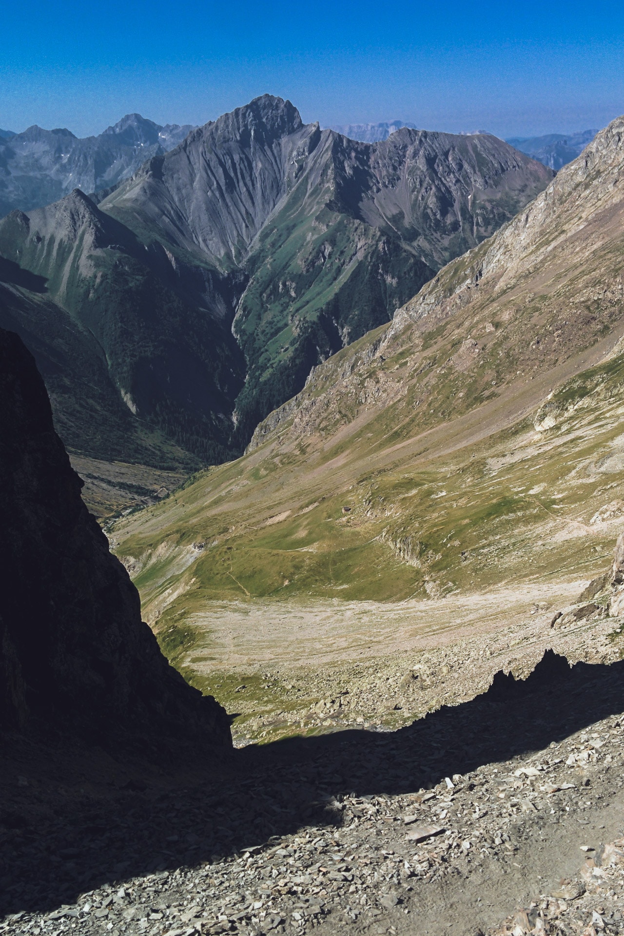
The descent to Lake Muzelle (2099m) is good even if you have to be careful with your ankles because there are many pebbles.
Arrived at the bottom we go directly to the refuge to savor a well deserved beer once again! It is early so we are also eating and we enjoy the moment. We meet again the mother and daughter of Côte Belle and the two of the day before.
We will join a place for the bivouac not too late because unlike the previous time I came here there are a lot of people since the lake is easily accessible from the valley. ..
But you will find some nice places around with a beautiful view of the lake. Last bivouac, last night in the mountains …
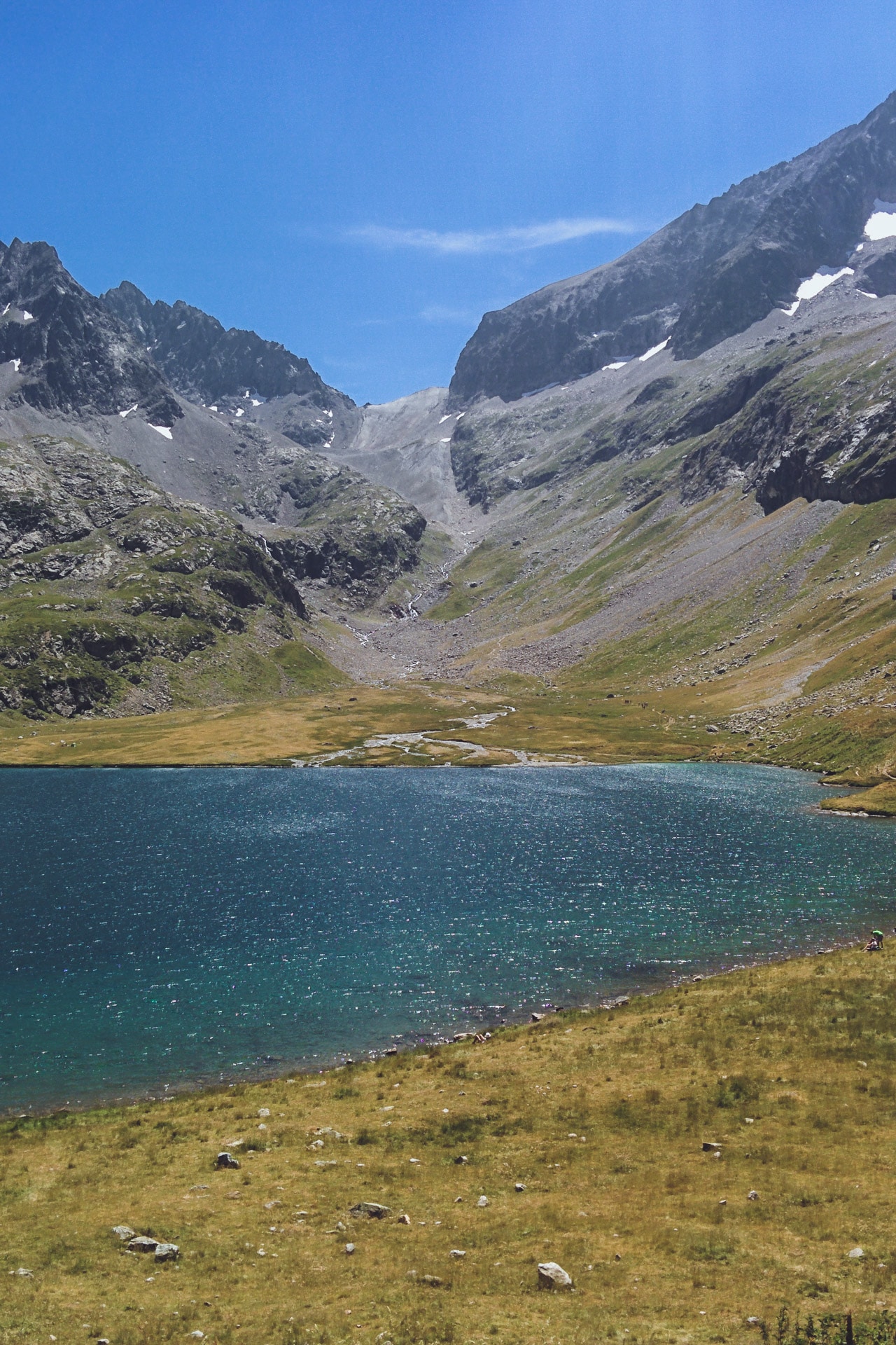
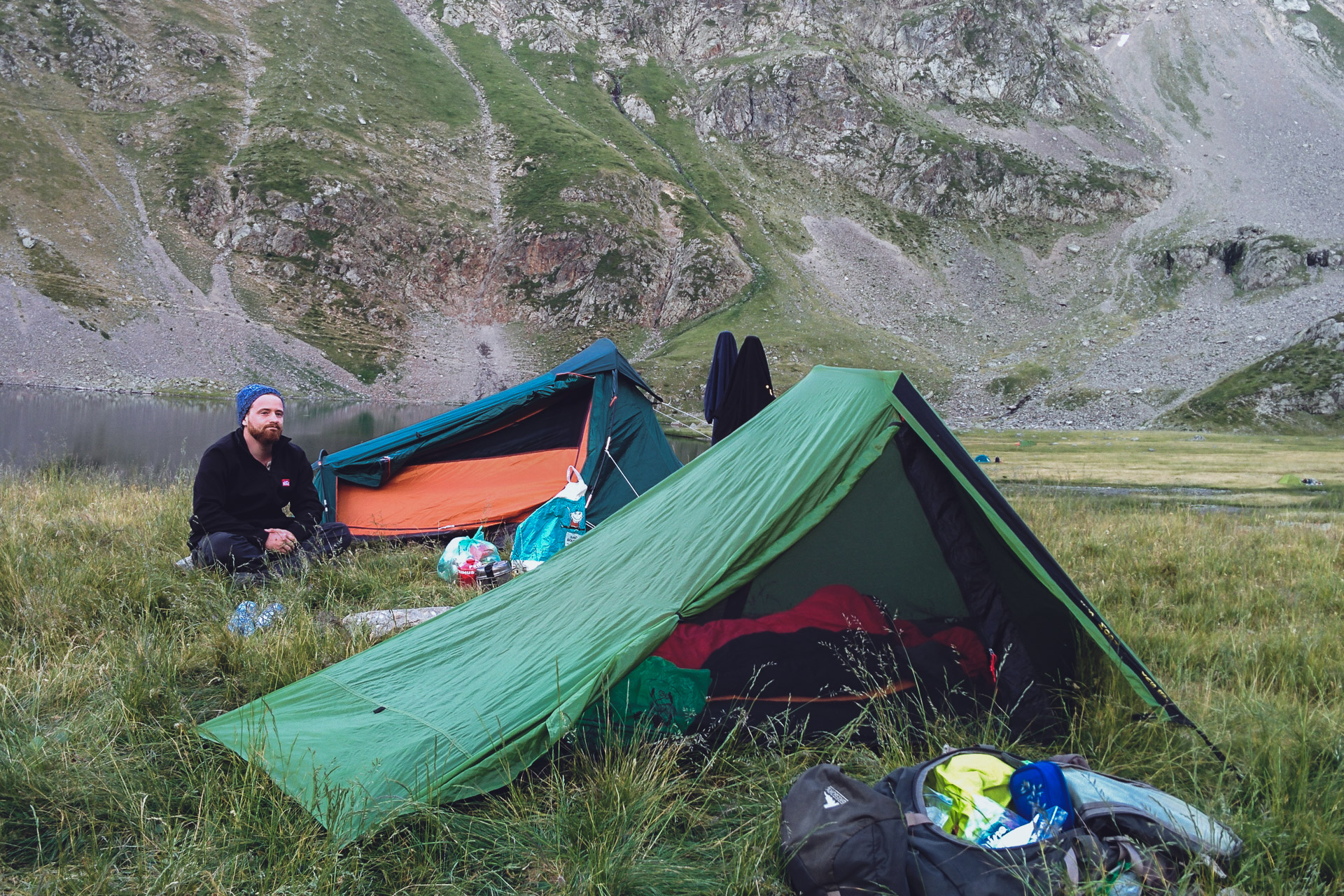
Last day : descent and going back home
That’s the last day. Tonight we’ll be in Paris …
We fold everything one last time and we start the descent along the Creek Piss. It is a pretty way well in the shade and embellished by the tumultuous waves of the torrent. We cross a lot of people who spend the day at the lake.
Once at the bottom, we quickly reach Bourg d’Oisans by hitchhiking to avoid a long, flat part and manage to catch an earlier train.
The loop is complete and the GR54 finished!
Pouf! Here we are back in Paris in a few hours while this morning we were still at 2000m in a superb setting. End of this adventure, prepare the next ….
Conclusions
It’s not going to be very original but I loved this GR. As I said in the preamble it has nothing to envy the GR20 or the Tour du Mont Blanc I think. On the contrary, the fact that there are few people still improves the experience.
The Ecrins are definitely one of the most beautiful mountains in the Alps, I really advise you to go discover it. Many of the GR54 stages can be done on a day (round trip) it’s worth it!
In addition to landscapes there are Chamois, Ibex, birds of prey and of course Marmots.
Like all GR, the GR54 is perfectly marked so no worries of mapping. We cross every day a refuge so you can do it without tent.
Walking alone was also interesting but it was a shame that Quentin had to stop so early…
Anyway this hike was amazing and I strongly suggest you to do it !
Quelques infos utiles :
- Pour la préparation du GR54, je vous conseille l'excellent TopoGuide de la FFRandonnée : Topo Guide
- Toujours utiles le numéro du PGHM des Hautes-Alpes : 04 92 22 22 22
- Site du Parc National des Ecrins : http://www.ecrins-parcnational.fr/
Lofoten Island, Norway
It has been a year that we wanted to go back in Norway and especially visit the Lofoten Islands. Why there ? Because Lofoten Islands are a magnificent jewel lost north of the Polar Circle. Imagine kilometer high mountains with their feet in the ocean. You begin your hike just by the sea on the morning and walk in high mountains by noon ! Lofoten are unique and magical.
Where are they ?
Located between 67° and 69° north, the Lofoten Islands are 300km north of the Polar Circle. The archipelago is 150km long in the north Atlantic. Despite they are located far north the climate there is quite nice due to the Gulf Stream which bath the islands.
They are seven main Islands (from East to West) : Austvågøya, Gimsøya, Vestvågøya, Flakstadøya, Moskenesøya, Værøy, Røstlandet. People living there are mainly of the shore because the inside land is mainly sharp mountains.
The archipelago is easy to cross by car thanks to the E10 road but it would be a shame to just visit the island in two hours. It is the perfect place to walk to discover all the hidden treasures that Lofoten can offer. So our plan was to walk from Svolvaer to Moskenes and to choose the details depending on the weather or our envy…
How to go to the Lofoten Islands
They are many ways to go to the Lofoten :
- by car : from Narvik and the E10 or from Bodø and Moskenes after few hours of ferry
- by ferry from Bodø : from there you can go the Moskenes, Svolvaer or Stamsund.
- by plane : there are two small airports on the islands : Leknes and Svolvaer. There are regular flight every day.
On our side we chose the following solution :
- Plane to Oslo (Gardenmoen)
- Train between Oslo and Bodø
- Ferry Express Boat from Bodø and Svolvaer
The train is 17h long but we like this soft way to travel. It allows the traveler to appreciate the moment, to enter slowly in his new environment. The Norwegian train are especially comfy thank to the private double compartments so the 17h were fine.
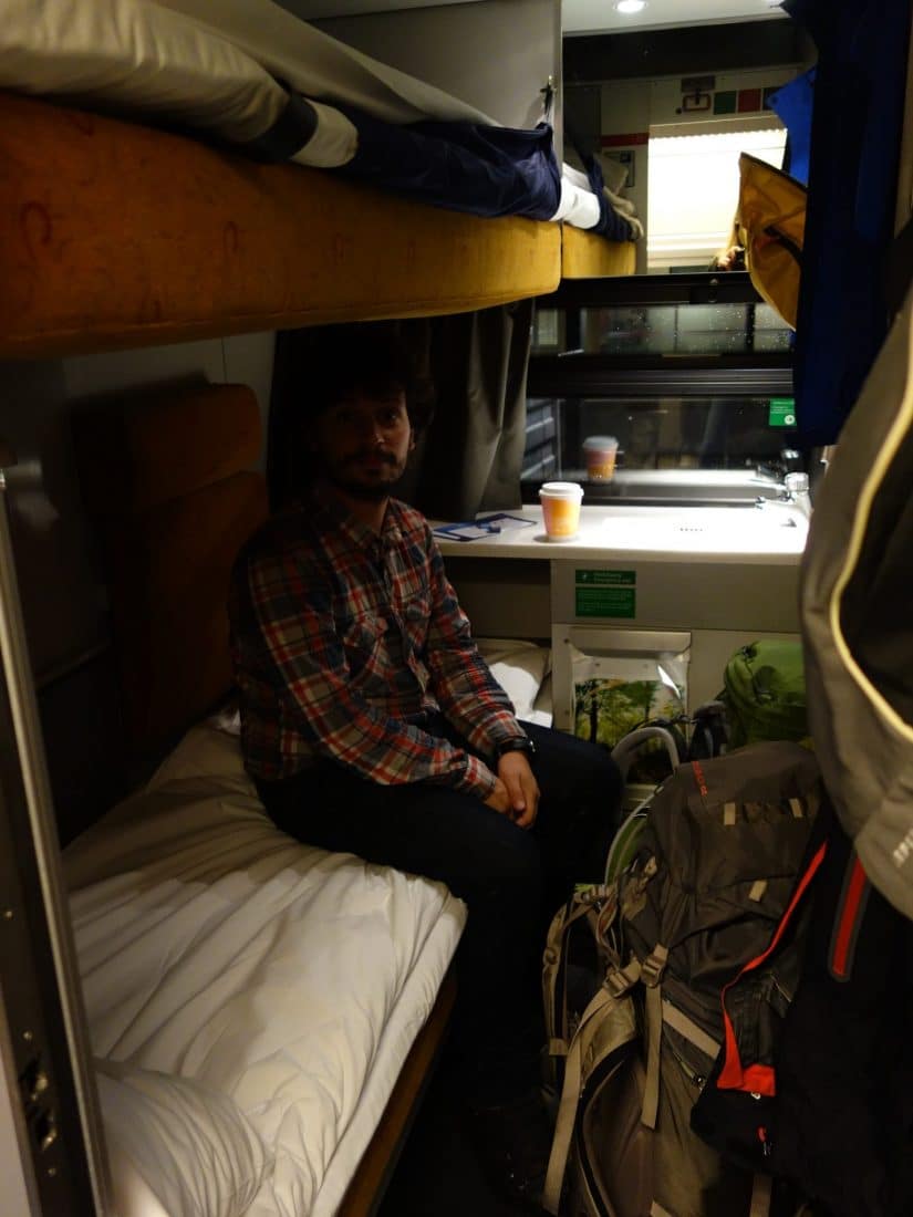
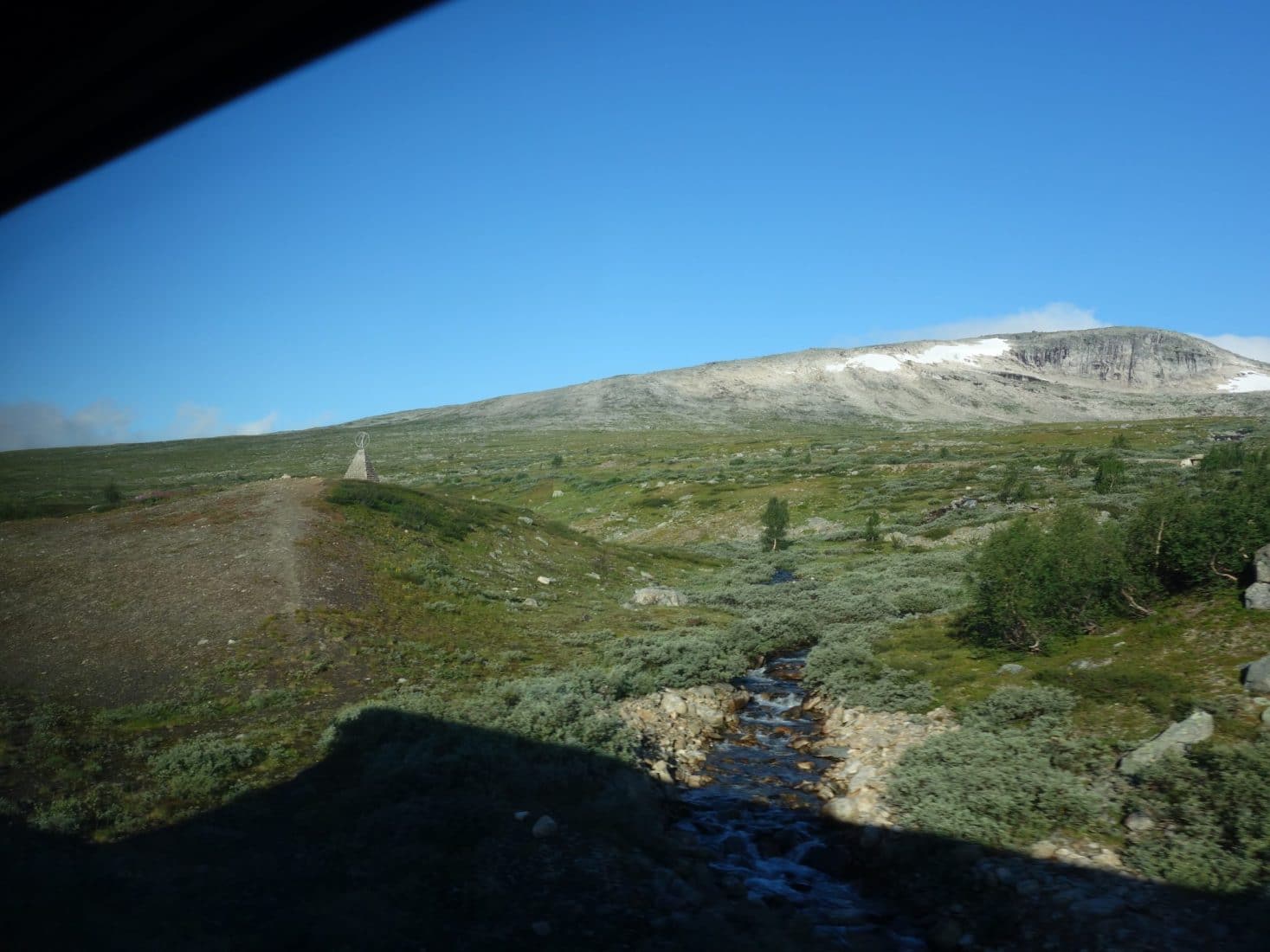
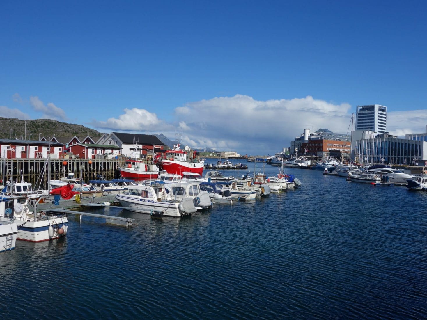
Day 1 : from Svolvaer to the Olderjforden
At last Svolvaer ! It’s just been a flight, “few” hours of train and a ferry but now we can really start. The hike begin on the road in the direction on Kleppstad. The beginning of the path is located near the Lille Kongsvatnet after the bridge over the Straumen, next walk toward the small power station. This part is not very interesting. The “real” path begins after that, following the Stor Kongsvatnet shore. We are walking quite slowly because of our backpacks full of food, the time to warm up but also because the ground is wet and muddy. In any case we are happy to be there and to discover the Lofoten !
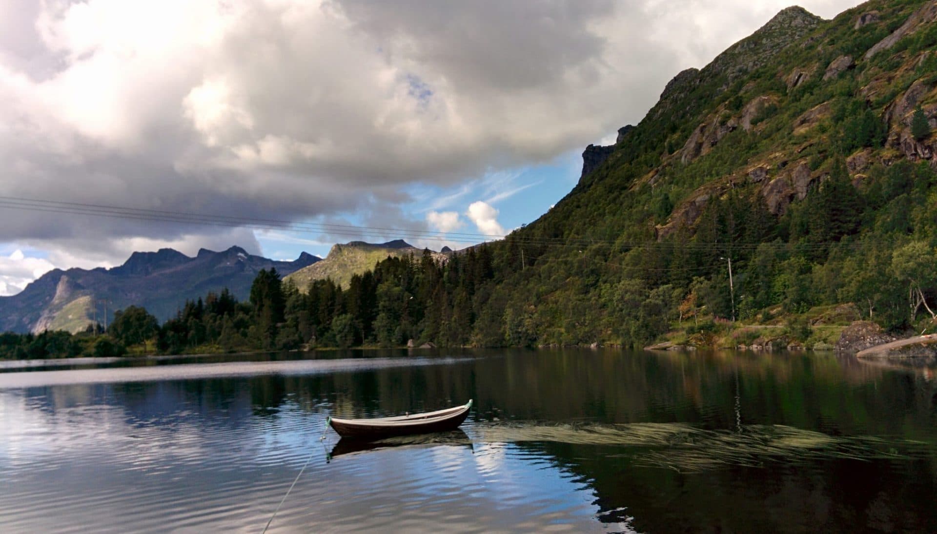
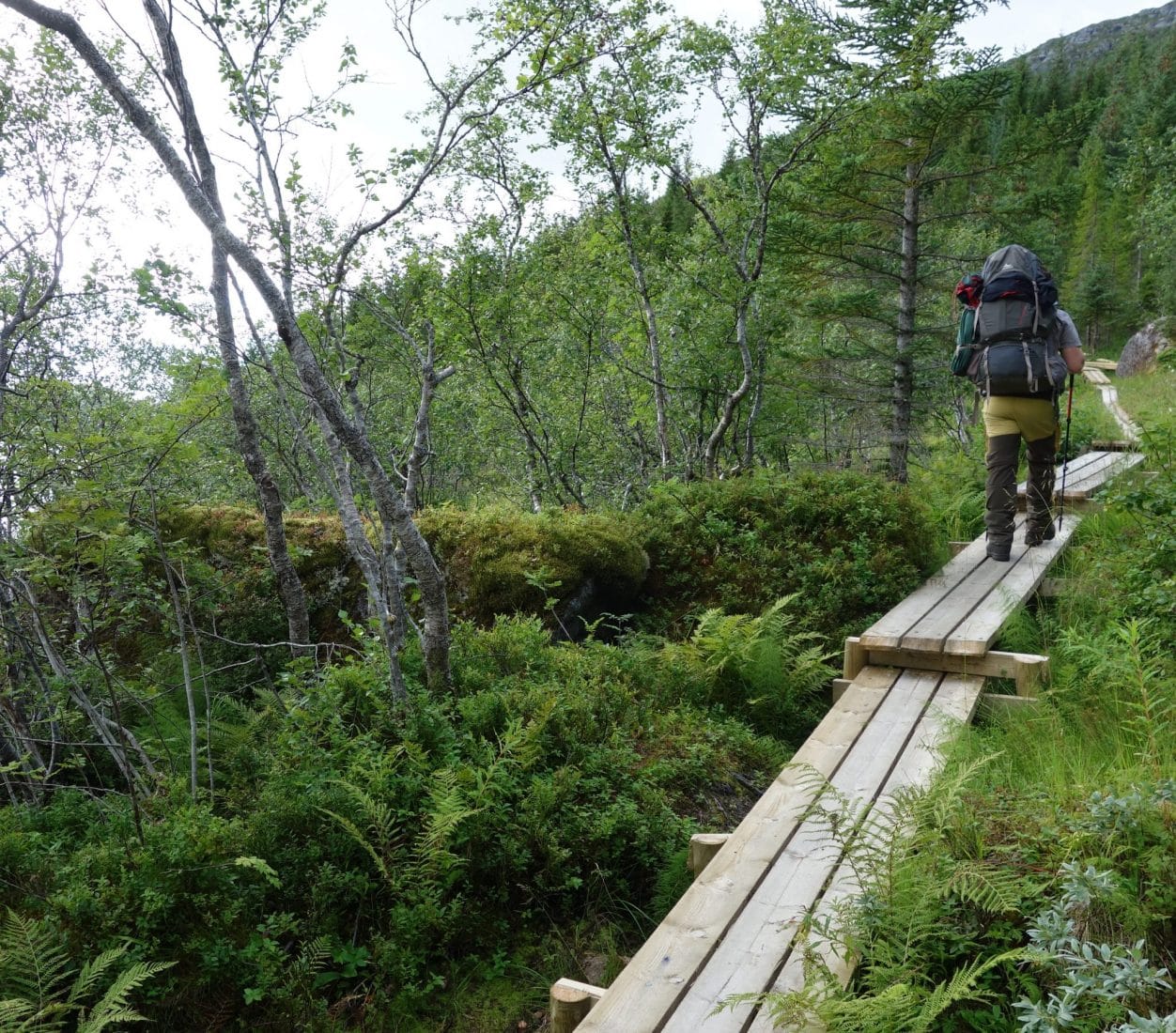
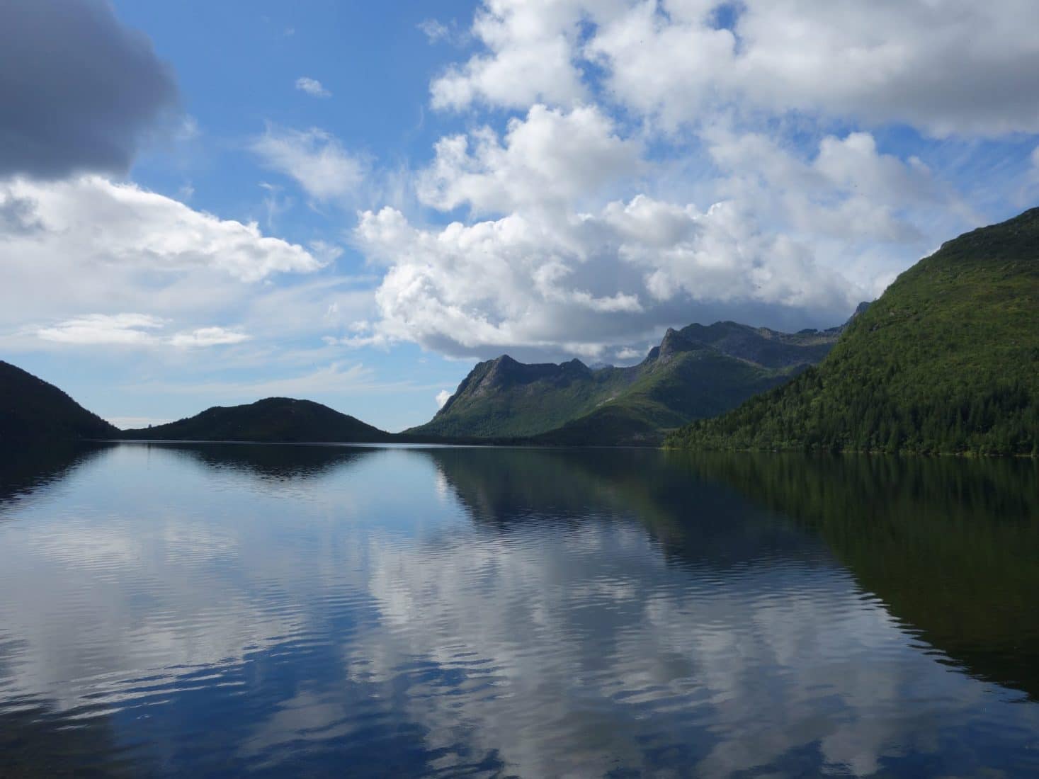
After a bit of time we arrive to a smal hydroelectric power station where we turn right to begin to climb to the Damvatnet. The bags are heavy on this first ascent but it’s ok… It’s around noon so we have a small lunch close to the lake. The view is beautiful on the lower lands with lakes and the ocean in the distance.
The next stop is Vestre Nøkkvatnet. From where we are we wonder a bit where the path goes because we can’t see it climbing to the lake. Following it we understand fast that it’s running along a water pipe (used for by the dam). The ascent is very steep, there are ropes to help climbing and it is a good thing because it is not that easy with the backpack on our back…
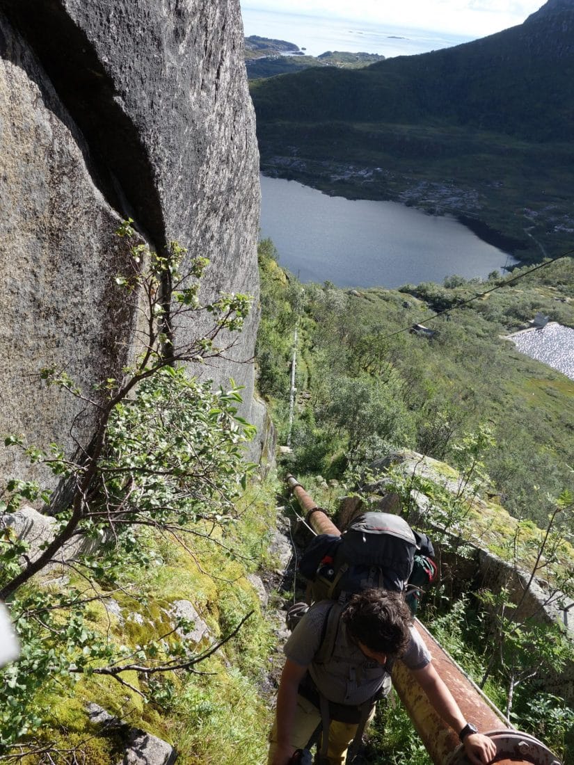
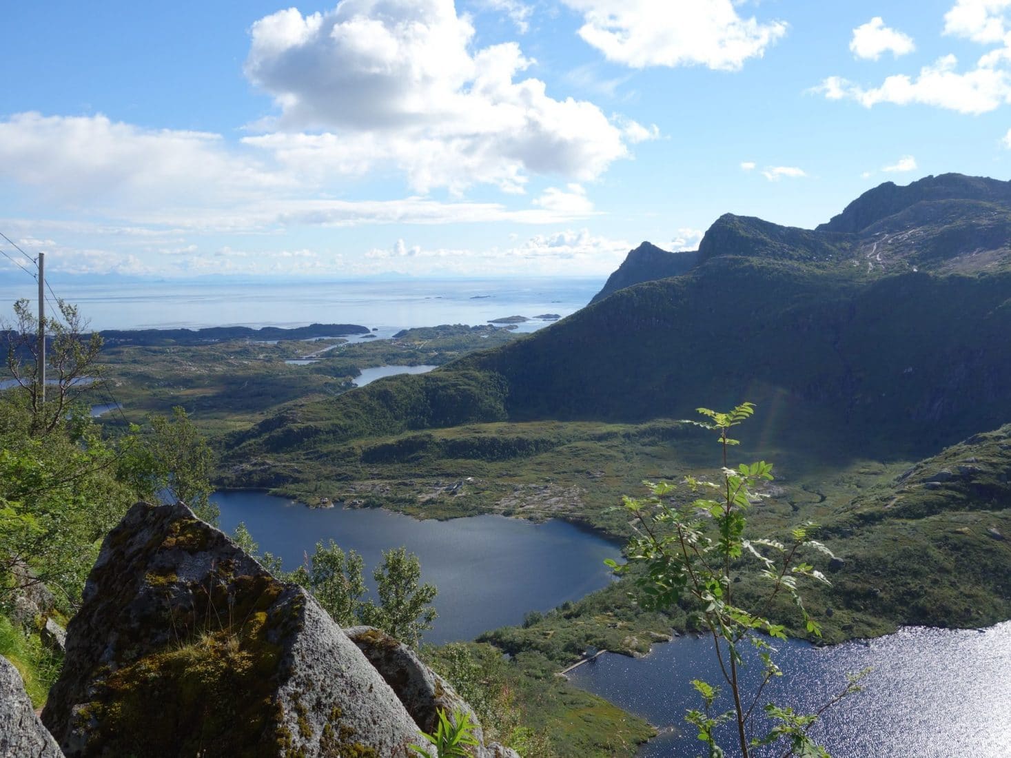
On the top weather begins to be be cloudy but the view is nice. No more trees here just bushes and grass. We are trying to go to a sort of pass to go downhill next but we miss a bit the right path. From he top we can see what is waiting for us : no path, a long way down and a swamp at the end. It is 5pm and there still is a long way to go and no obvious place to stay for the night so I begin to worry a bit for the end of the day.
We start walk the slope next. It’s very slippery and muddy. The path is not clear so I haeve to use the GPS to find it otherwise it is easy to go to a wrong way and to finish blocked by a cliff for example. We, both, begin to feel tired by this long day, we would like to find a place to camp for the night…
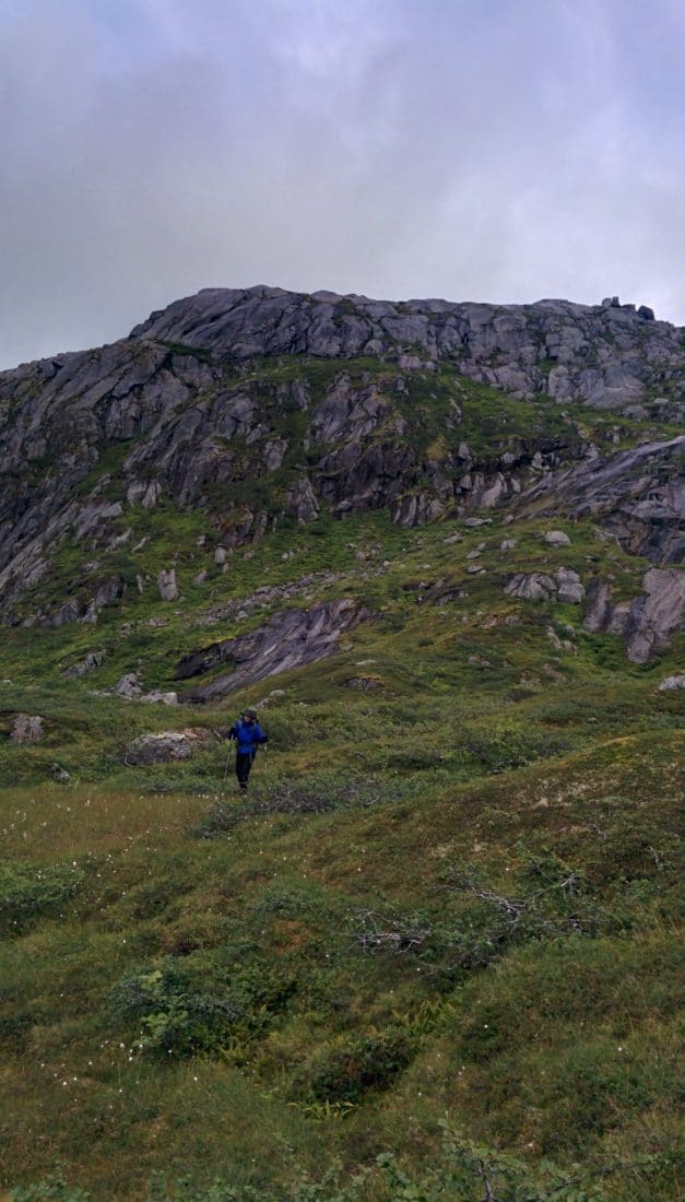
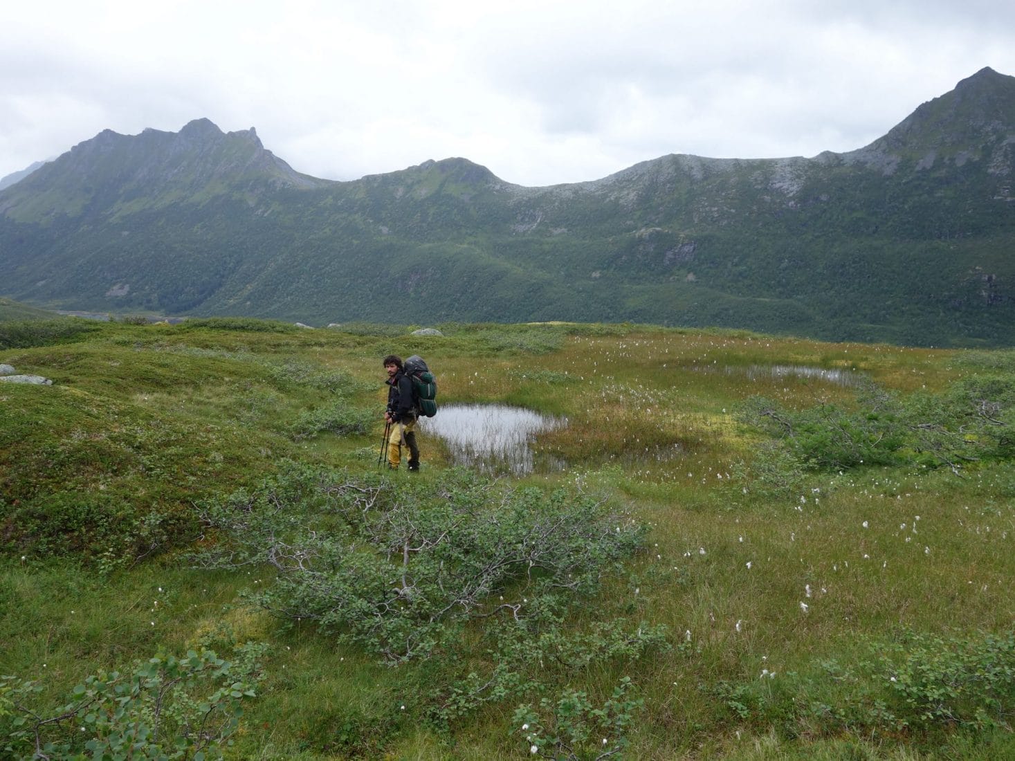
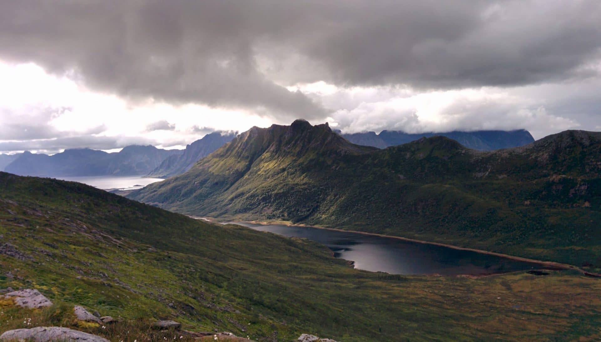
Two hours later we are at the bottom of the valley, it is a swamp, so it will be hard to find a place to camp there. We continue to walk a bit and suddenly we are passing by a small hut with a sign on it : “Open Cabin”, O miracle ! It’s a public cabin where everyone can stay freely. It’s perfect for us tonight ! The inside is simple but just as it needs to be to be comfy : two benches, a small table and a stove ! Perfect. We set for the night, we will be fine here.
It has been a long day for a first one ! The weather was not perfect but the landscape were still beautiful. We are going to change our plan a bit : we will do shorter distance and we won’t go to some place because we want to focus on Moskenoya which seems to be the most interesting island.
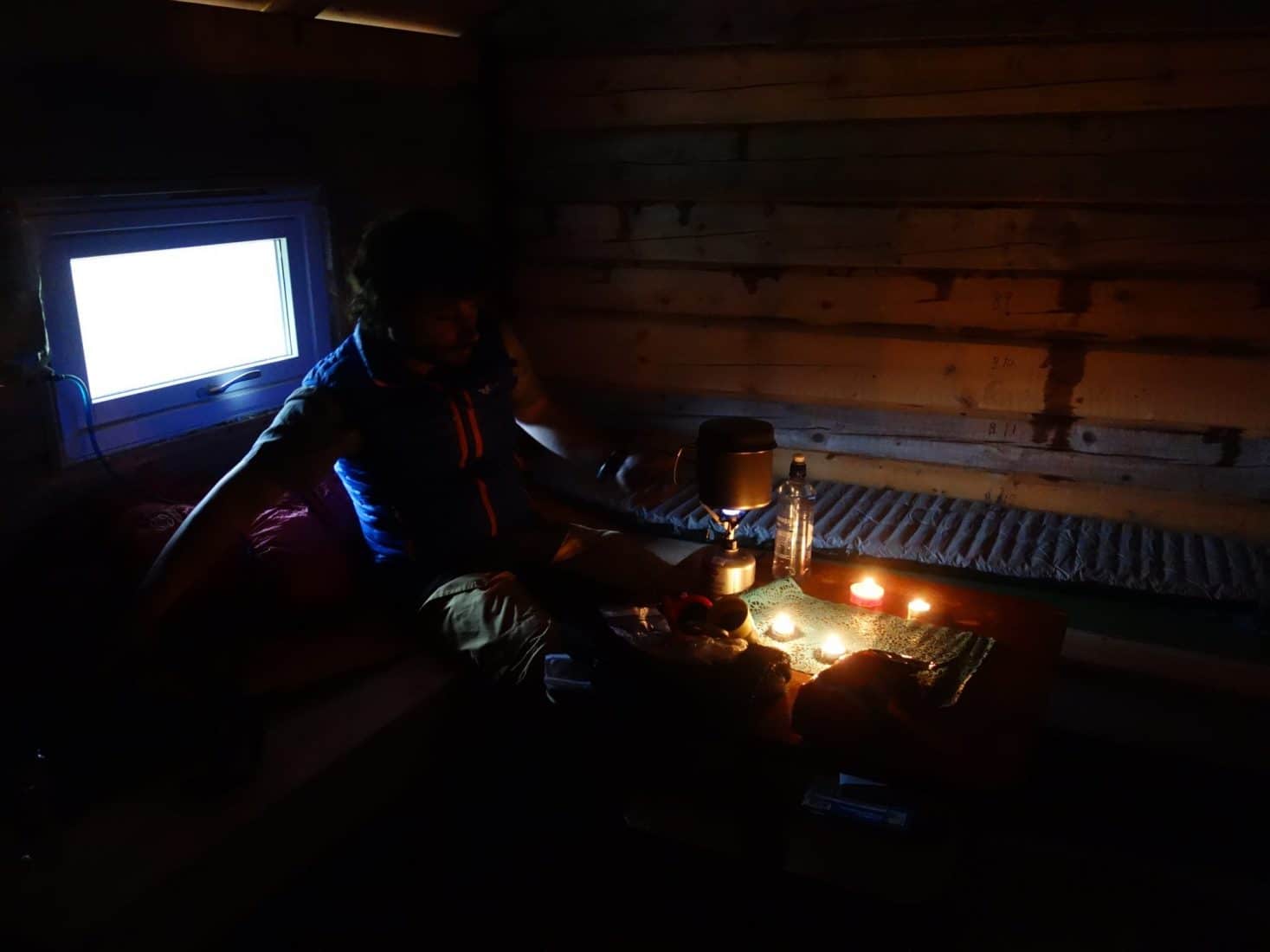
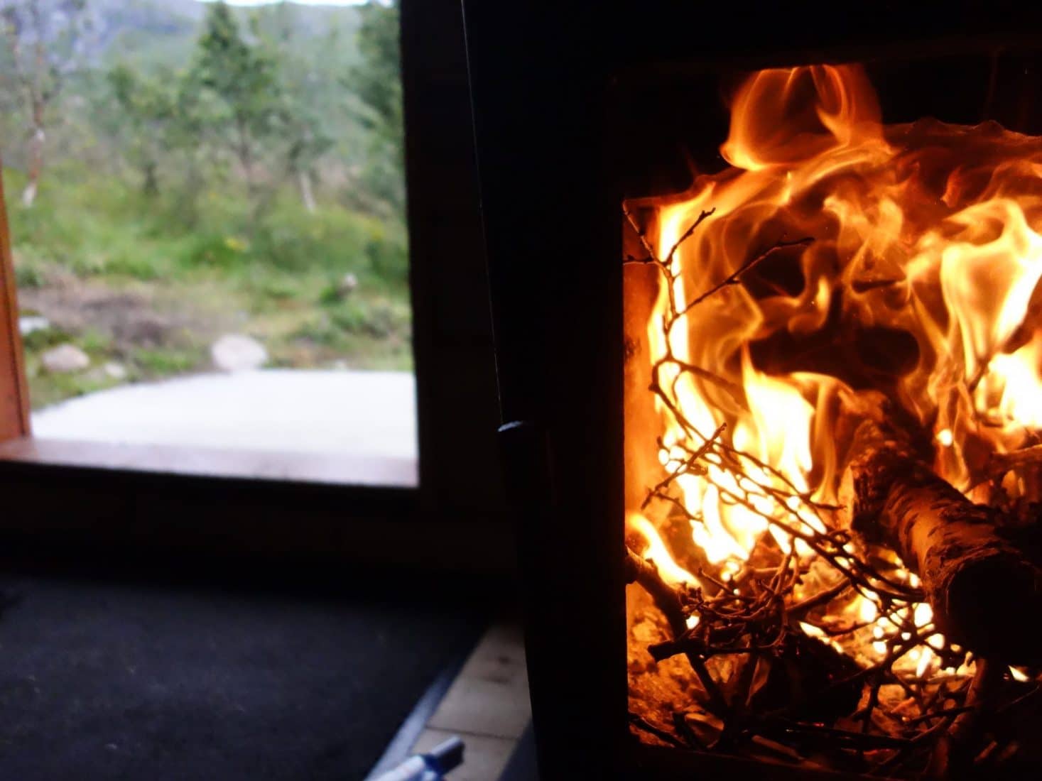
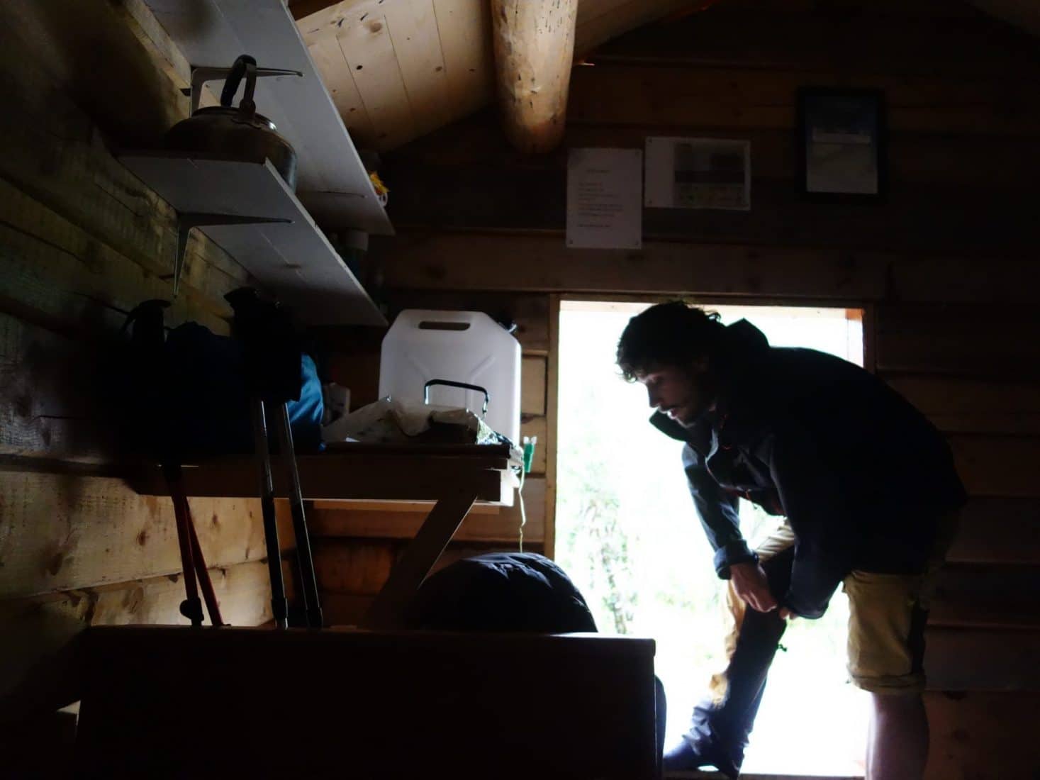
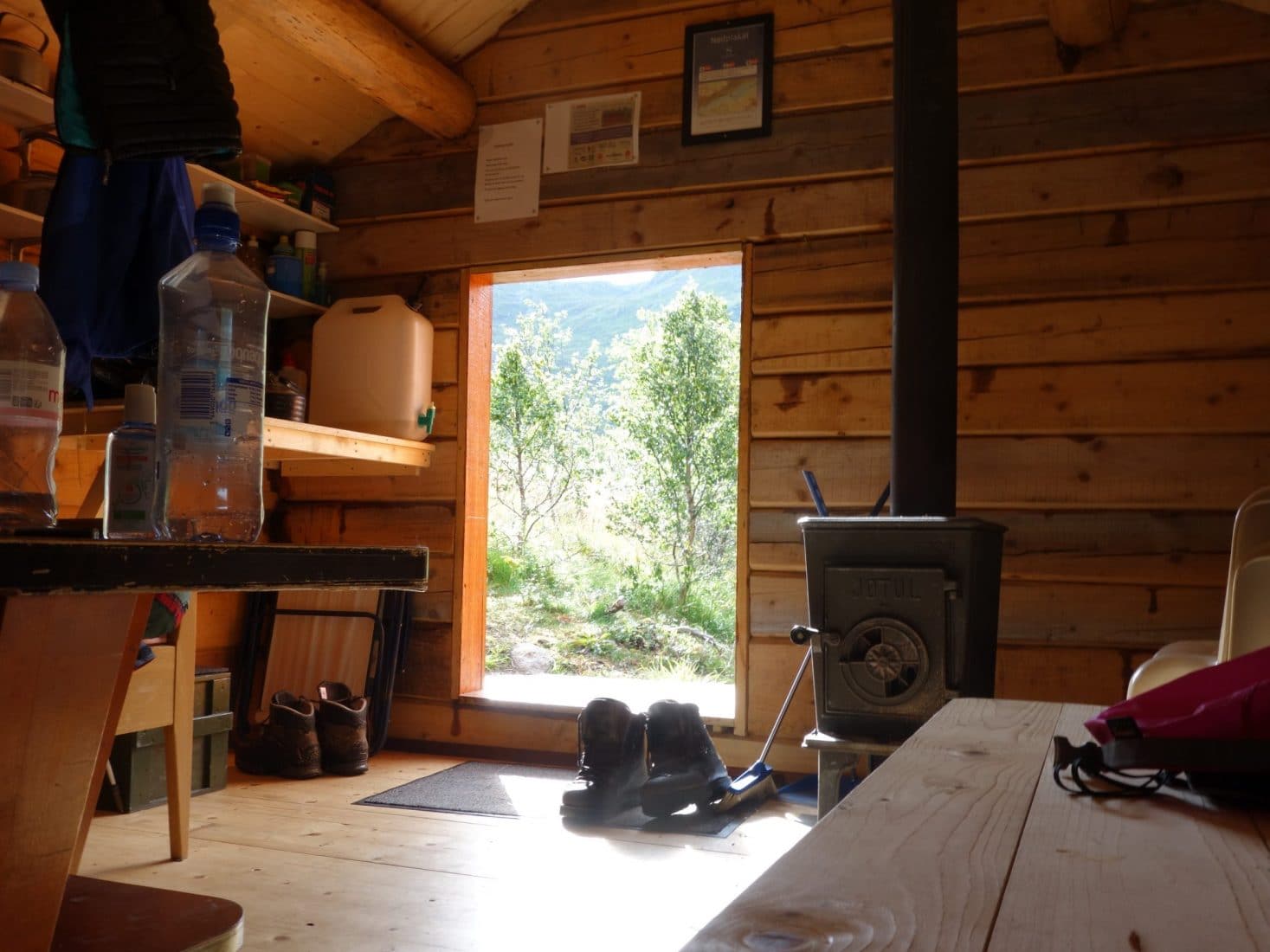
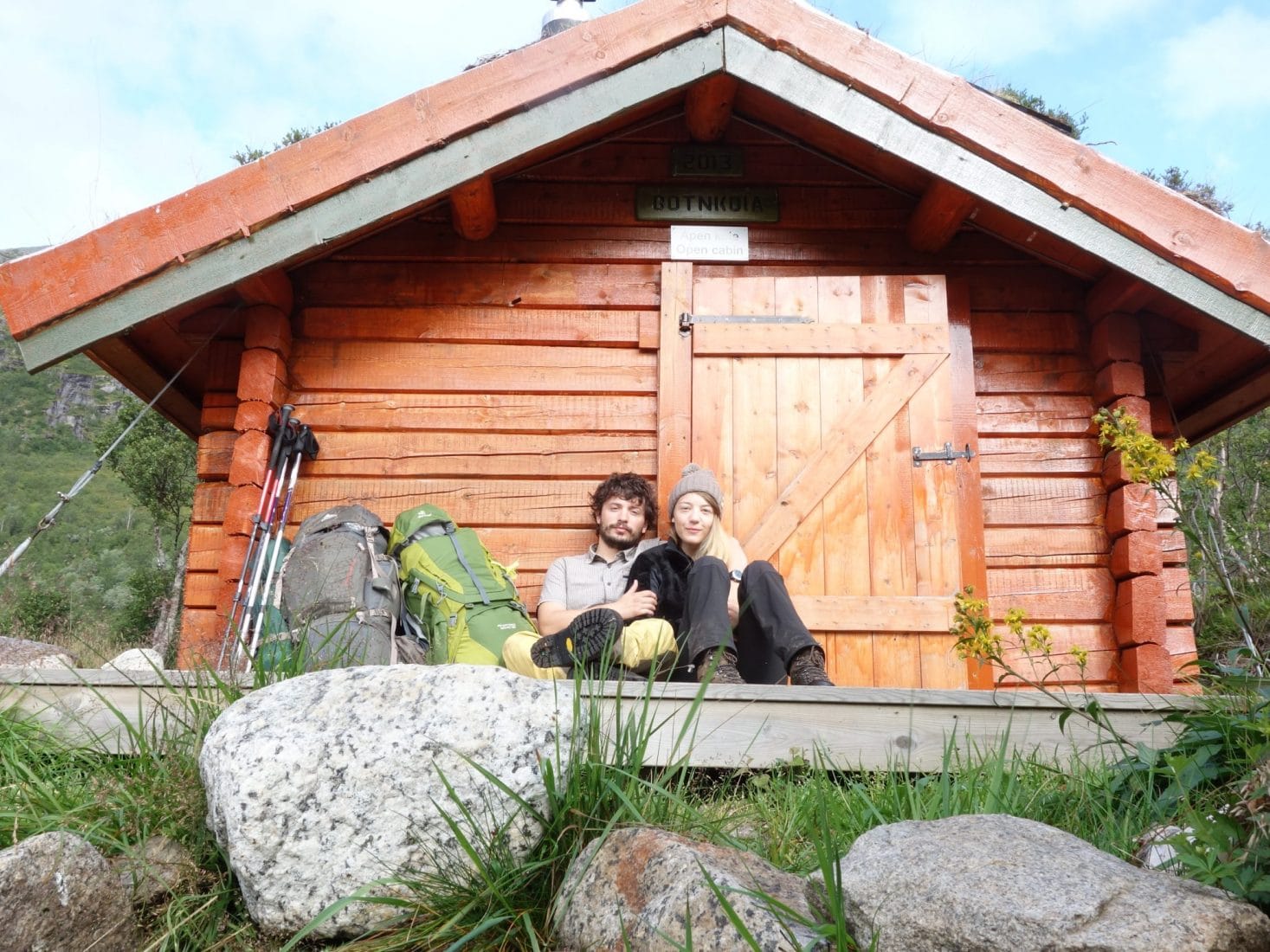
Day 2 : from the "Magic" hut to Haukland
A good night’s sleep ! We are back on the road after a good breakfast, after storing and cleaning and after signing the guestbook.
The plan of the day is the following: join the E10 road and hitchhike to reach the beaches of Utakleiv or Haukland, we will see on site where spend the night. We chose not to go through Vestvagoy because according to the map it is mainly the relatively flat wetland and we want something else. The weather is sunny this morning.
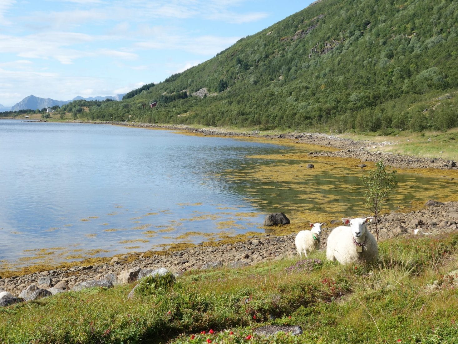
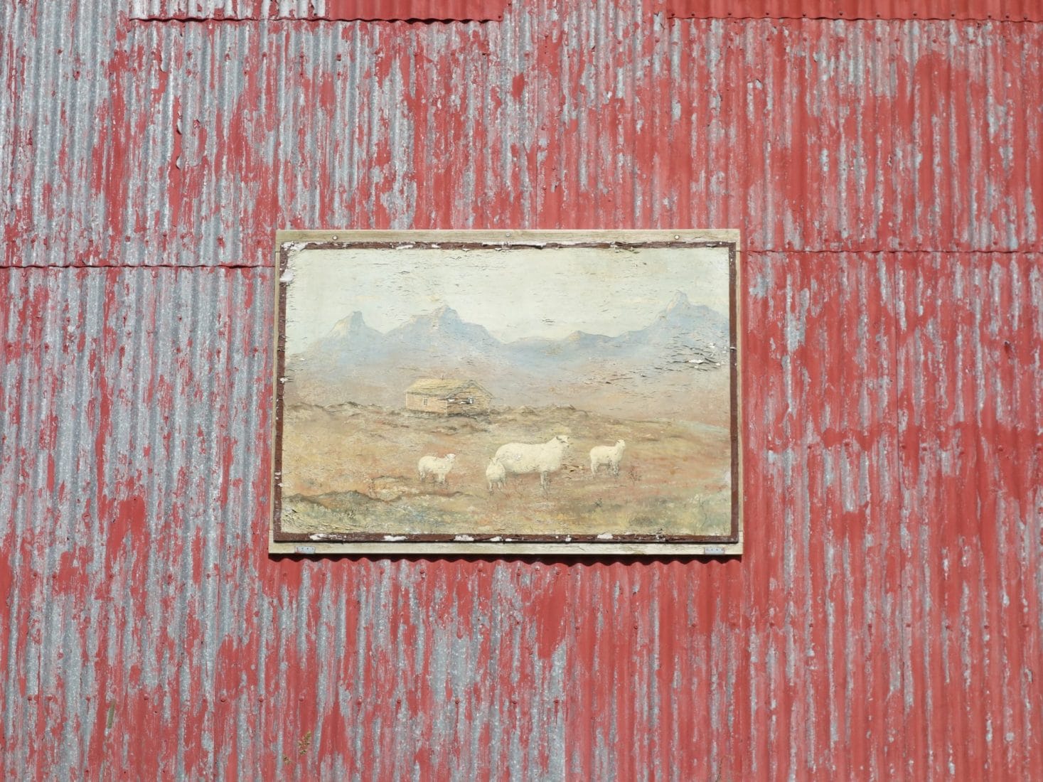
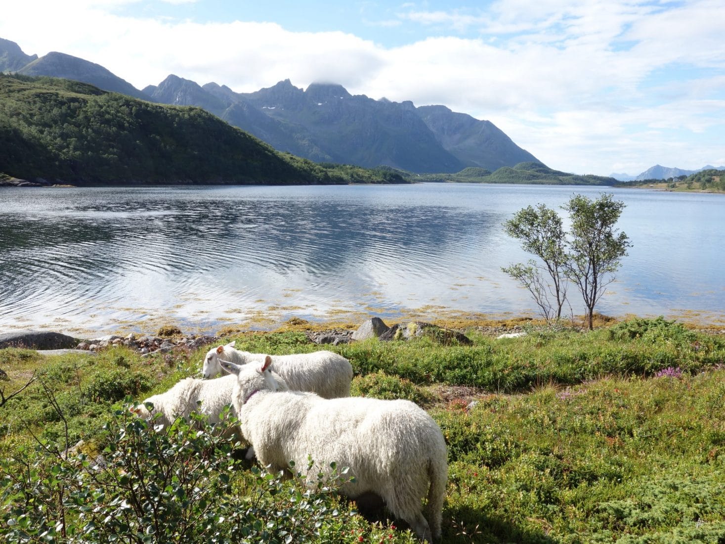
It will take us 1h30 to reach Kleppstad along the coast of the fjord. The path is nice. We try to find a strategic place to start hitchhiking and it seems to work because a couple stops to take us after a few minutes. Those are two Swedish climbers who spend a little time in the Lofoten. There are many possible and very wild ways given the number of parishes there are. They will drop us at the intersection between the E10 and the small road that leaves towards the beaches (Leiteveien). We will try again to hitchhike because the prospect of walking on the road for 2 hours does not please us too much. Our new driver will leave us on the beach of Utakleiv. The beach is very beautiful and wild, there are few people.
We wanted to stay on this beach initially but between the wind which strong, lack of water point and also a weird sign about the price of the night on the beach, we decide to return by the coastal path to Haukland. This path is beautiful and allows you to discover the beach as we walk.
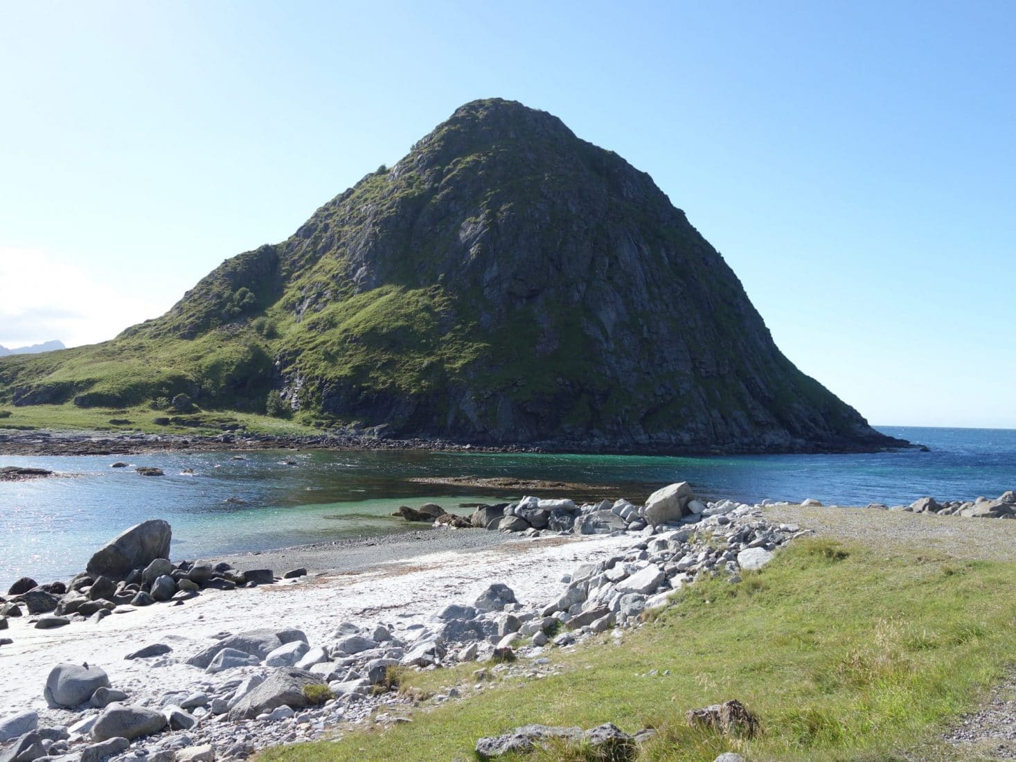
Haukland is a very pretty white sand beach nestled in a cove with crystal clear waters. It makes you want to swim there if the water had not been so cold. Behind the beach is a large grassy area perfect for setting up the tent. Unfortunately the car park that is behind attracts people and notably a lot of motorhomes. Tonight we will not be alone but the closest tent should be 20m away from us, not to bother us. Interesting point : there are washrooms on parking which also offer an easy water point. So we set our camp just behind the beach next to a picnic table. The entrance to the tent is facing the sea, it is sunny, life is beautiful.
From its height of 489m, the Veggen which is located between Utakleiv and Haukland is reachable on foot from the beaches and offers a superb view.
It was a small walking day but we needed to rest after the trip and the first day of walking. Anyway the goal is not to run but to enjoy. What we will do during the afternoon on the beach in the sun.
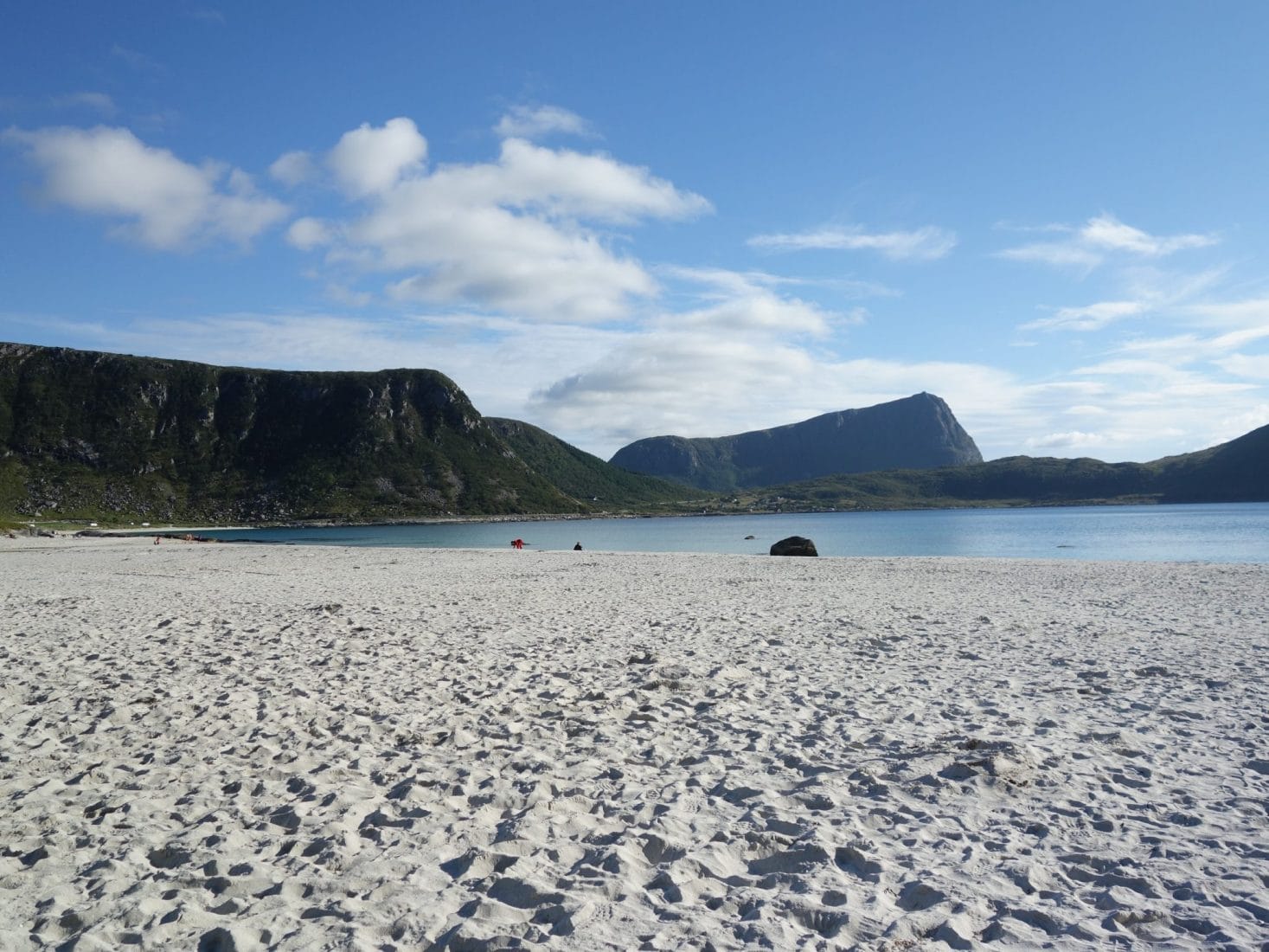
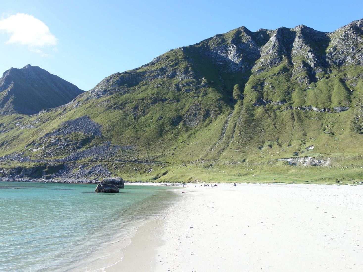
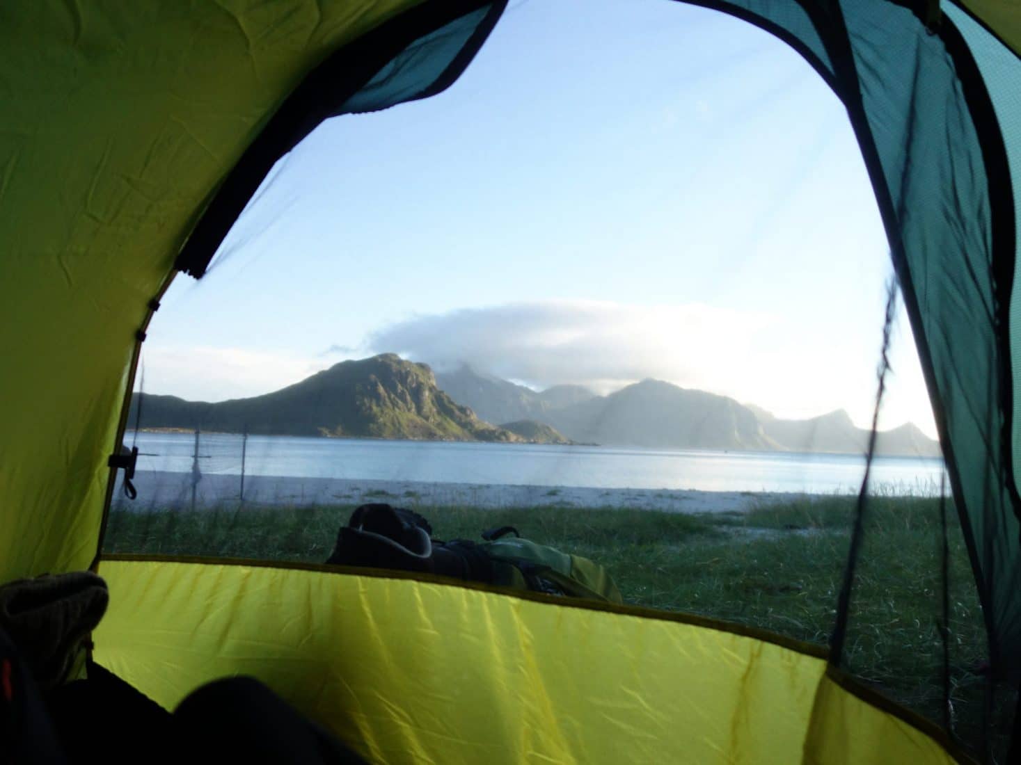
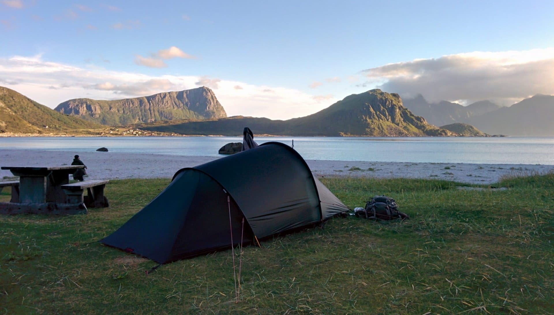
Day 3 : from Haukland to Nusfjord
Waking up to the sound of the waves and under the sun by 68 ° N … What a joy!
The program of the day is relatively simple. Join Nusfjord and hike to Nesland. The choice of this day without much walking is justified by the weather of the next days that will not be great, so we prefer to see the village under the sun. We also have to take into account that we will have to hitchhike to cross a tunnel (without pavement) to change island.
So we get ready early in the morning. Our first goal is to join the E10 at the crossroads with the Offersøyveien just before the tunnel. We will walk, it is not a very interesting part due to the relatively poor landscapes.
We finally arrive at the crossing with the E10, so we start our hitchhiking mission.
It will take us 1h30 in the wind and after several disillusions for a couple of Norwegians to stop finally. We ask them to drop us at the beginning of the FV807 which leads to Nusfjord but after explaining to them what this small village is, they decide to go there and deposit us there. Perfect! The road is nice and we feel that the landscapes are becoming more and more mountainous.
We will finally arrive in Nusfjord around 1pm. This village is said to be the oldest of Lofoten. It is an old fishing village converted into a museum village and listed on UNESCO’s “Sites to be Protected” list. We wanted to go there but we were afraid it would be just a tourist attraction where Tour Operators dumps tourists straggling with photos. Well no ! We were very pleasantly surprised, there were few people and the charm of the village is intact. This one has been preserved in the style of a typical “fishing village”. So of course there is a souvenir shop but it is “hidden” in the building of the old grocery store (there are also some fresh but overpriced products!). The Rorbus are to be rent (but Norwegian price …) with a superb view of the fjord.
The Rorbus are fishermen’s cabins mounted on stilts and laid directly on the rocks of the coast, feet in the water.
To sum it all up, I advise you to take a tour in Nusfjord, some rorbus have been transformed into a museum exhibiting old craft or old fisherman’s material.
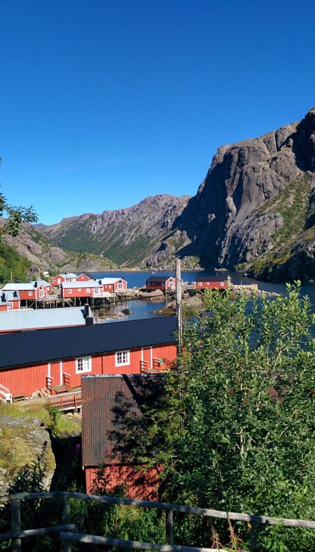
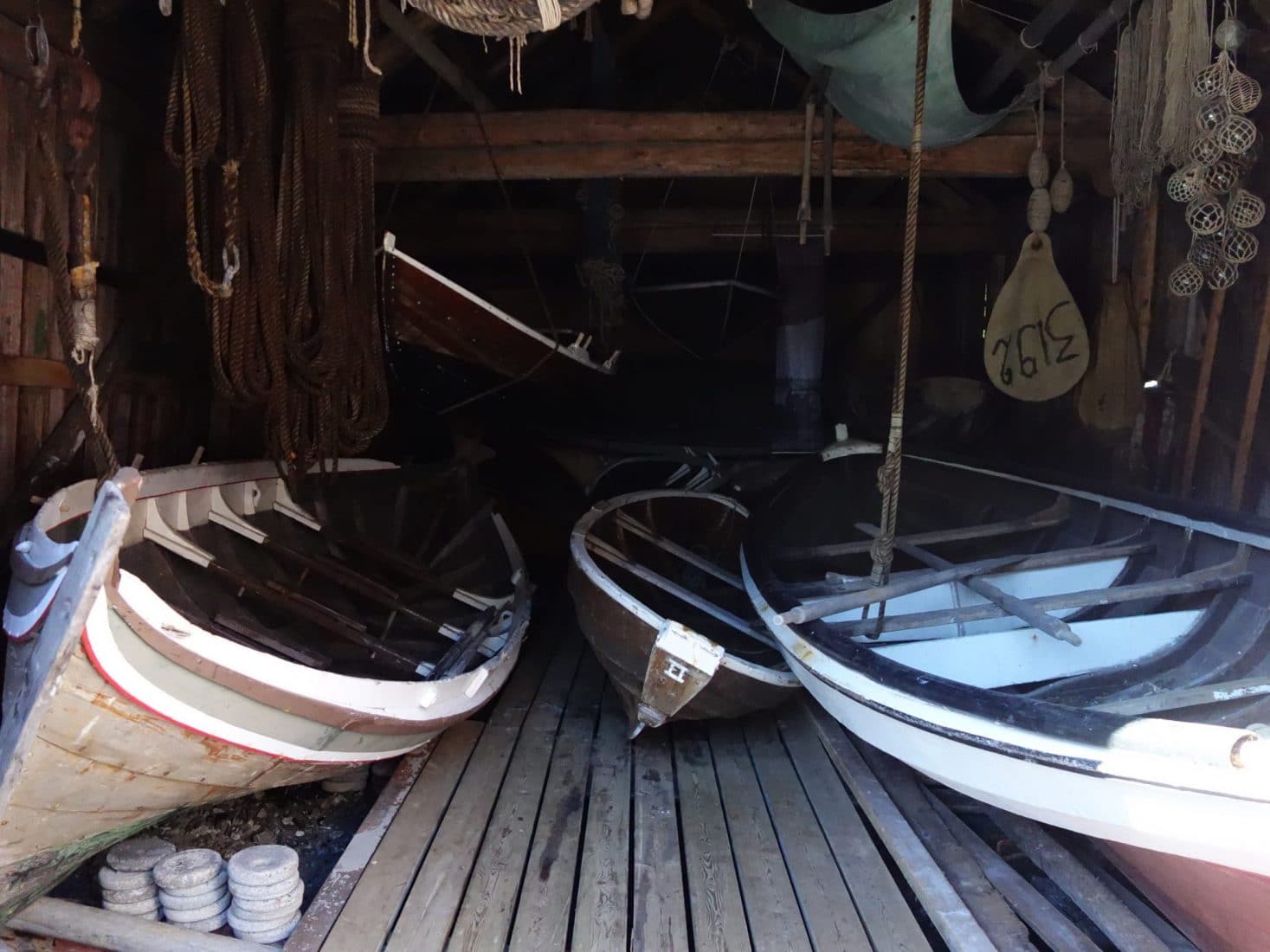
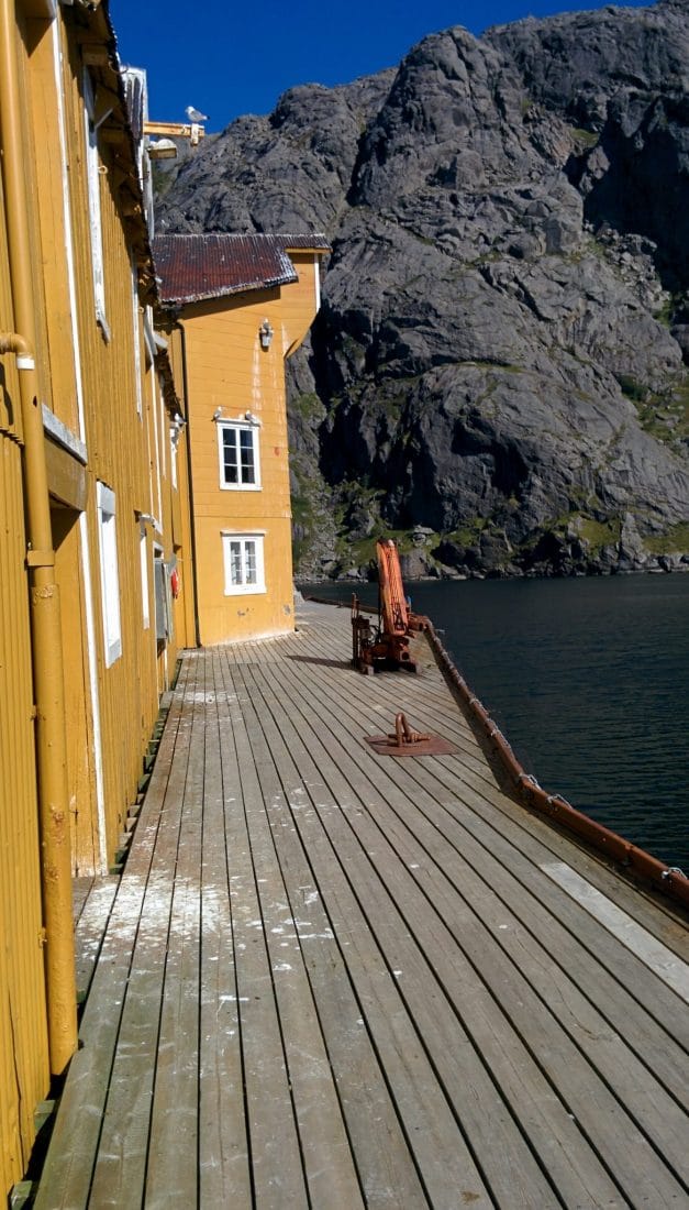
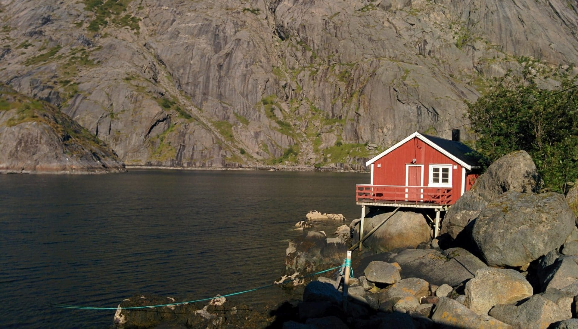
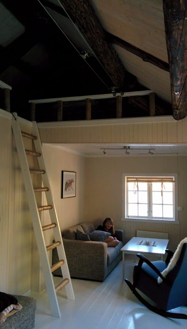
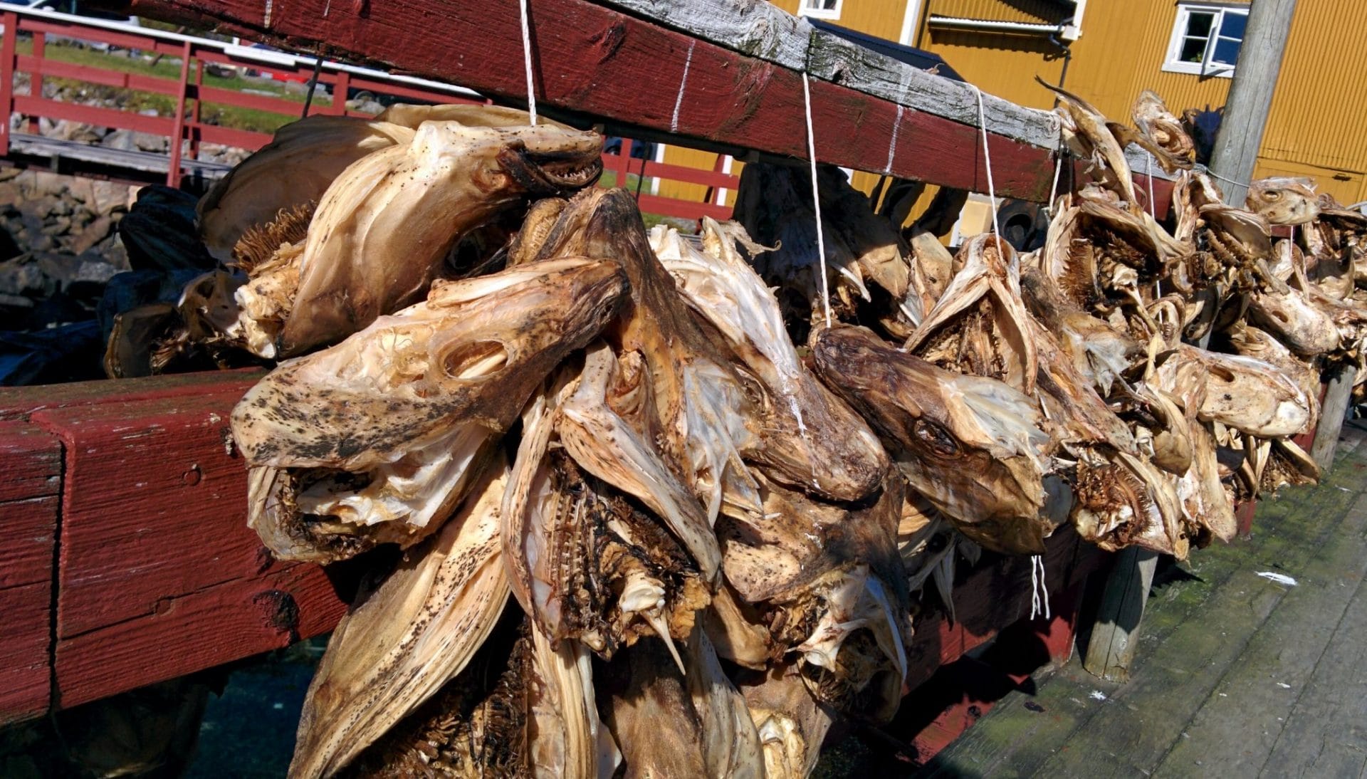
We pick up the keys of our rorbu, after leaving our backpacks, we decide to do the Nusfjord-Nesland hike which is reputed.
This one starts from the end of the village and follows the coast to the hamlet of Nesland. The coastline is beautiful during the walk especially under the great sun that we have today. One could believe oneself in the south of France with this crystal clear water. A small navigation error causes us to lose some time. In the end we will only make half of the hike in order to enjoy the village in daylight. The walk is really worth doing.
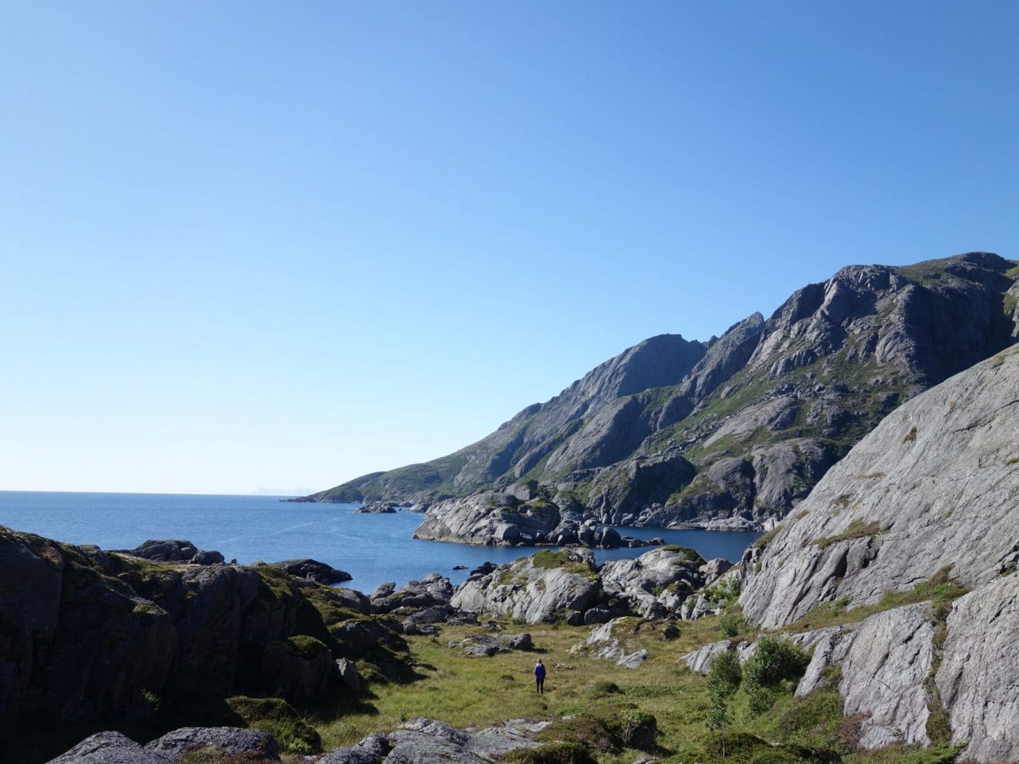
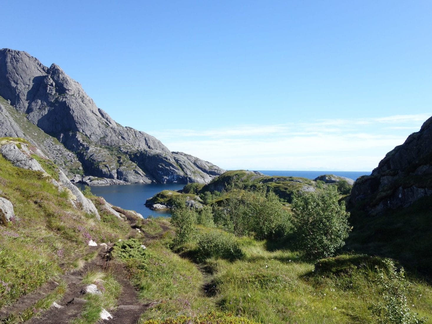
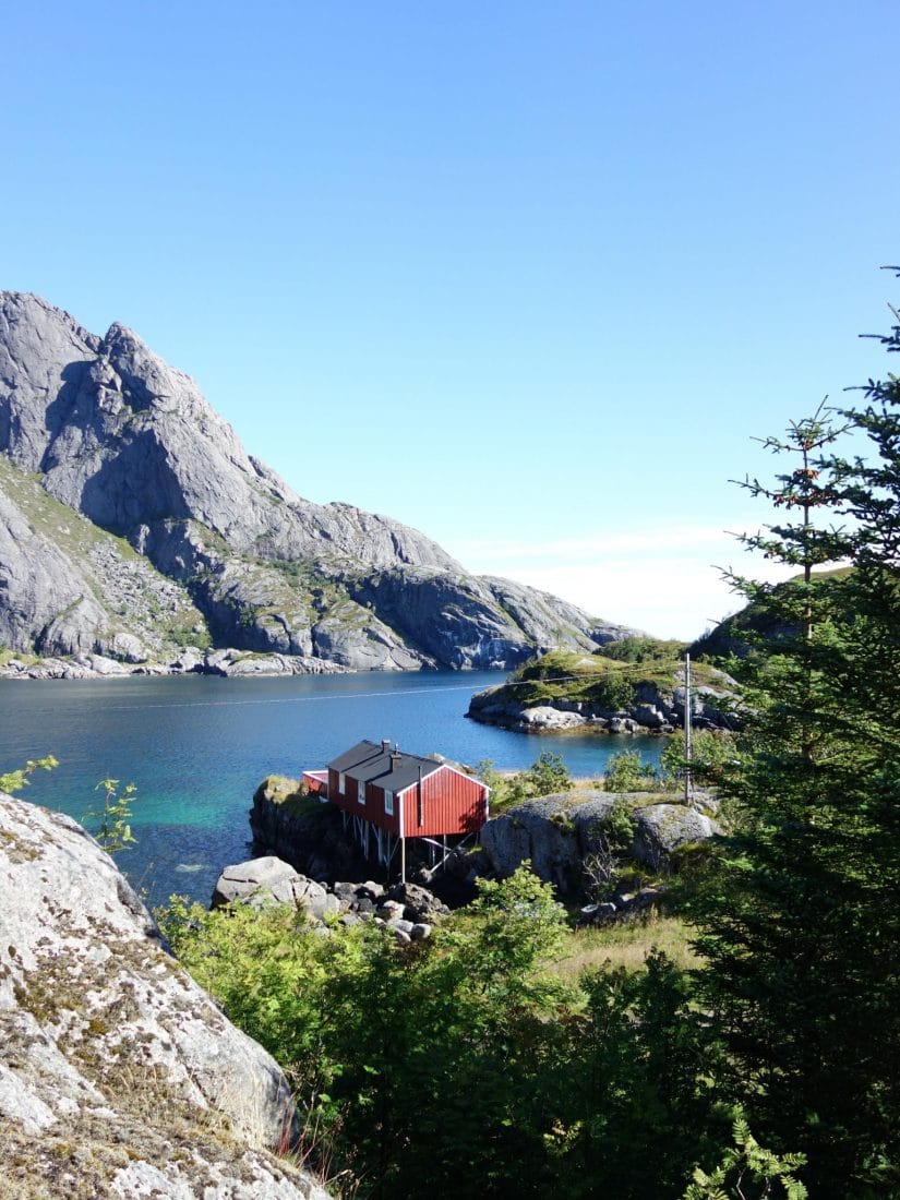
On our return we will make a little boat on the fjord; in the evening we will dine in a restaurant in the village and enjoy our rorbu …
Day 4 : from Nusfjord to Kvalvika
First day of rain this morning. The awakening is longer than expected especially when you are warm in a real bed and you know that you have to go walking in the rain … Anyway we have to go.
We are therefore on the road to go up towards the E10 direction Kvalvika. This part is not pleasant. We are along the road with little or no place to walk, there are few cars but not a lot of trucks and buses. All in the rain is not folichon.
Once on the E10 we hitchhike with very nice locals (again no choice because there are road bridges to pass). First we wanted just to be dropped off at Ramberg but the couple suggests us to drop us at the beginning of the path! Our lovely drivers are from Lofoten and lived there all their lives. Today retired they take advantage of their day to stroll by car and rediscover their islands.
They will leave us at the small carpark which serves as starting point for the hike towards the beach of Kvalvika. The trail, well marked, is simple to follow and is not complicated technically. However, we go through soggy areas especially after the rainy morning.
The path to the beach begins by climbing nicely to lead to a kind of pass to 200m altitude. Behind, the trail continues on the descent towards the beach in a more rocky terrain. Everything being soaked, you have to be careful because it’s slippery. The beach is revealing itself along the descent. It extends over two coves separated by a rocky outcrop. At each end are two summits thus closing the whole, to the SO the Kjerringa (585m) and the NE the Ryten (515m). It is sumptuous, even under the gray veil of this early afternoon. The first beach under the Ryten has to stretch about 500m, a stretch of grass runs all along perfect for a campsite. The second beach is smaller and more insulated. It is also slightly less oriented towards the sun especially in the evening.
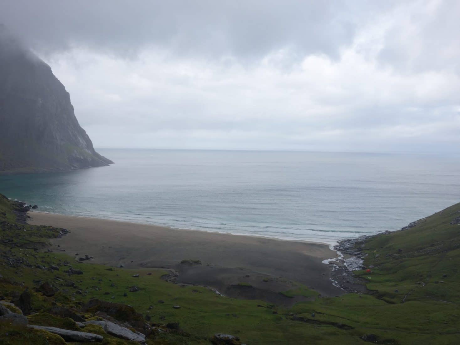
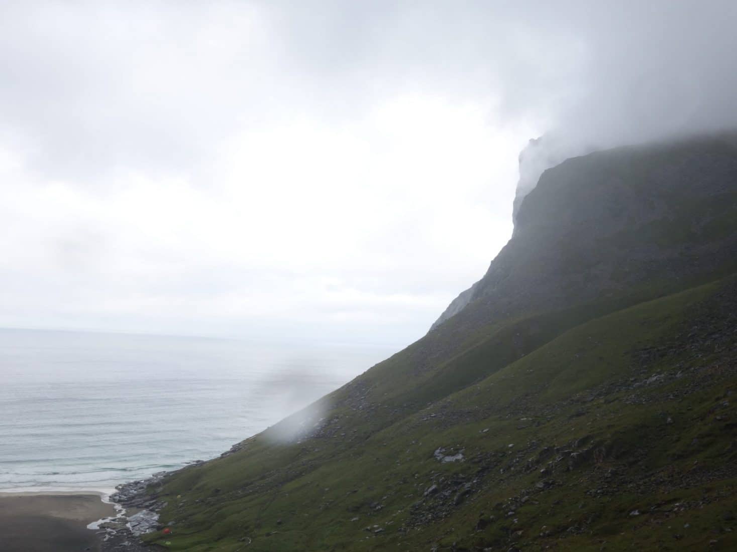
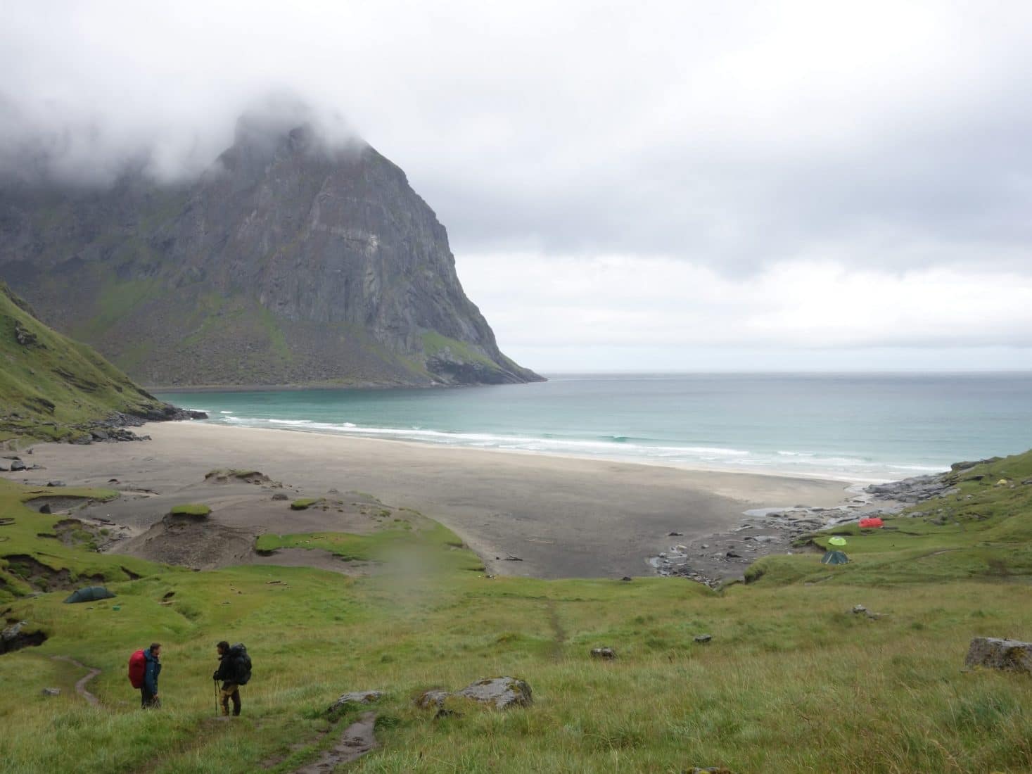
The place is magnificent and perfect for camping. Unfortunately, there are some rubbish on the beach, the majority being dumped by the sea.
On the SW side of the first beach under the Moltinden (600m) we settle on a pretty flat grassy platform.
The weather is always dull but we feel that the sun begins to break through. We rest under the tent waiting for the sun to appear. On my side, I go out for scouting and fall 50m away from the camp (next to the path) on a semi-buried hut tinkered in the hollow of rocks. This beach is known to have “hosted” two surfers during a winter, they had built a hut directly on the beach. I do not know if this is this one but in any case it looks like a Hobbit hole with its round door.
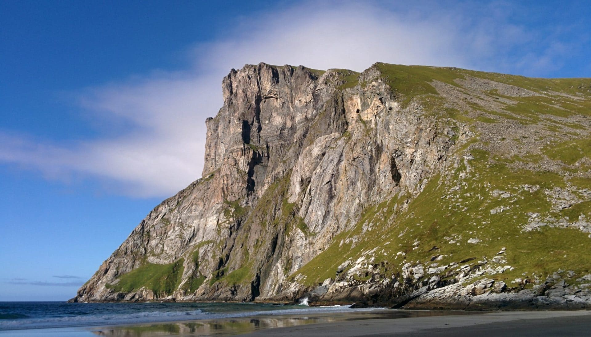
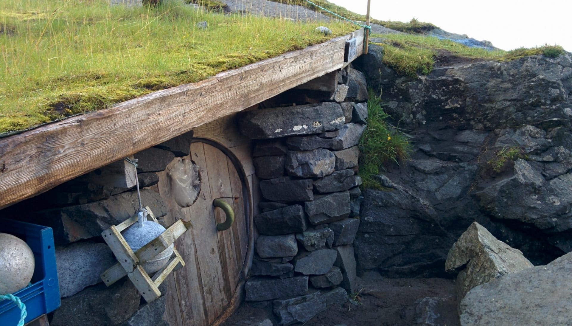
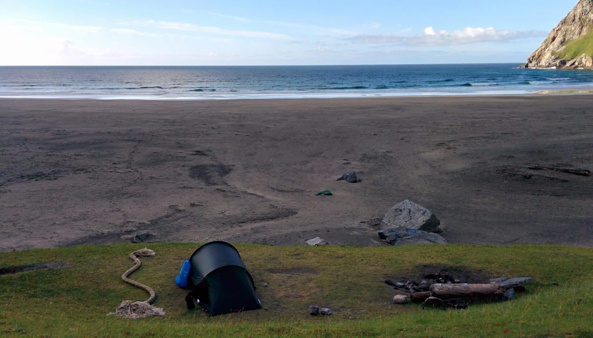
The sun will finally pierce in the late afternoon, the beach is transformed, it is even more beautiful under the rays of the sun with the mist of spray, the atmosphere is peaceful, serene.
We decide to climb up the Ryten in the evening to enjoy the sunset light. The sun sets at around 11pm so we have plenty of time. The ascent begins next to the small stream which descends from the Ryten, it is besides the best water point of the beach. About 250m higher, we arrive at the small lake which nestles in the hollow of this flat place. You have to take on the left a few tens of meters after the lake. We are barely 300m above sea level but the landscape has already completely changed: we feel more in the mountains than by the sea.
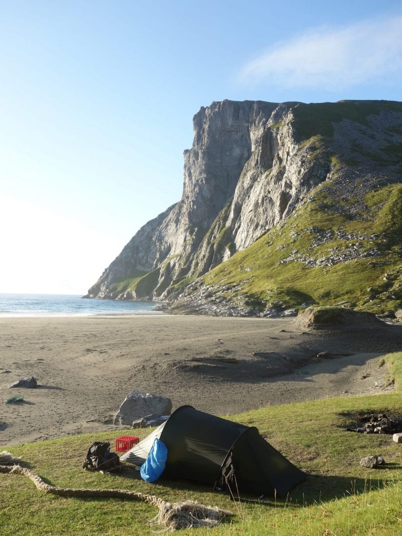
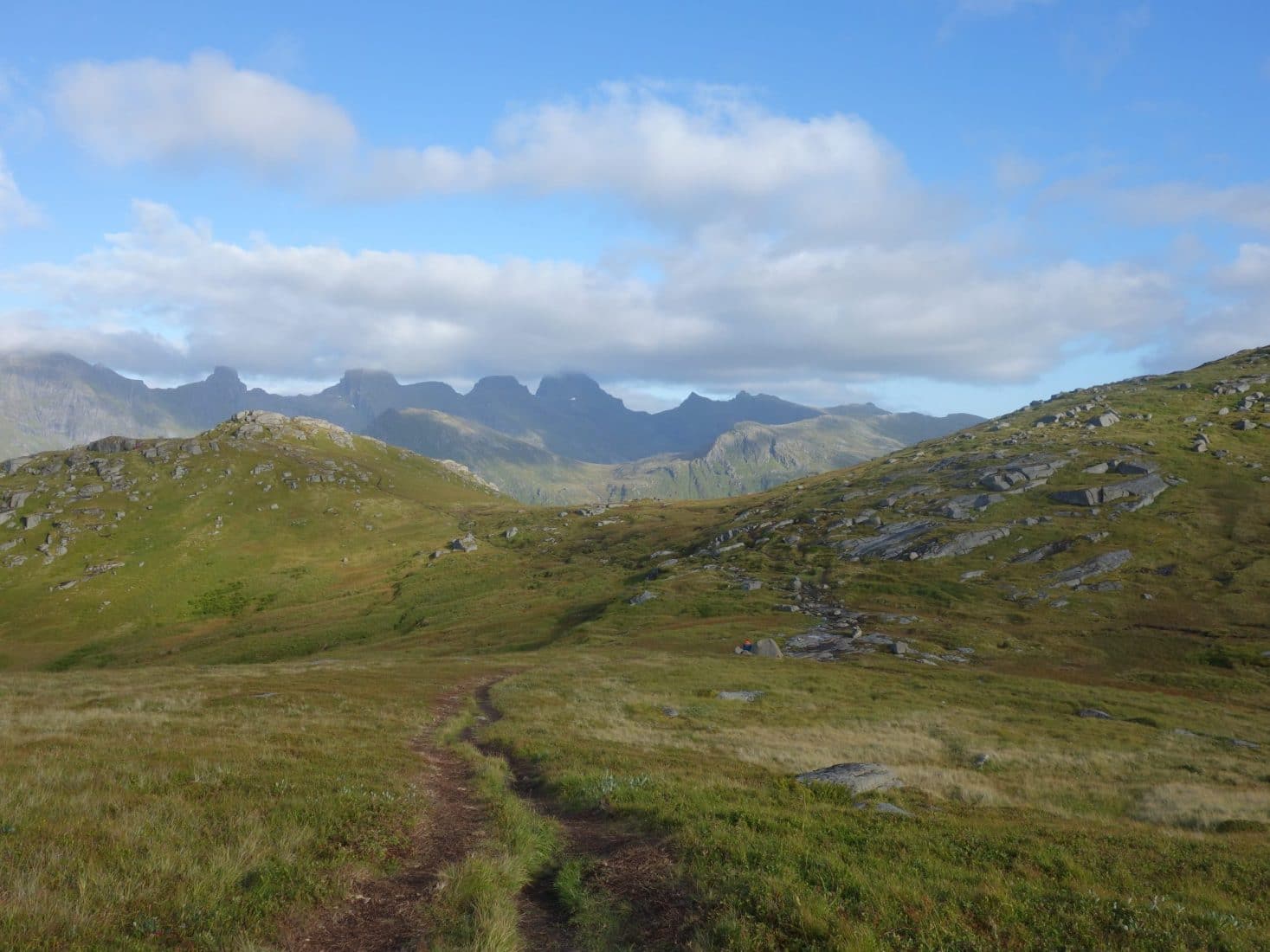
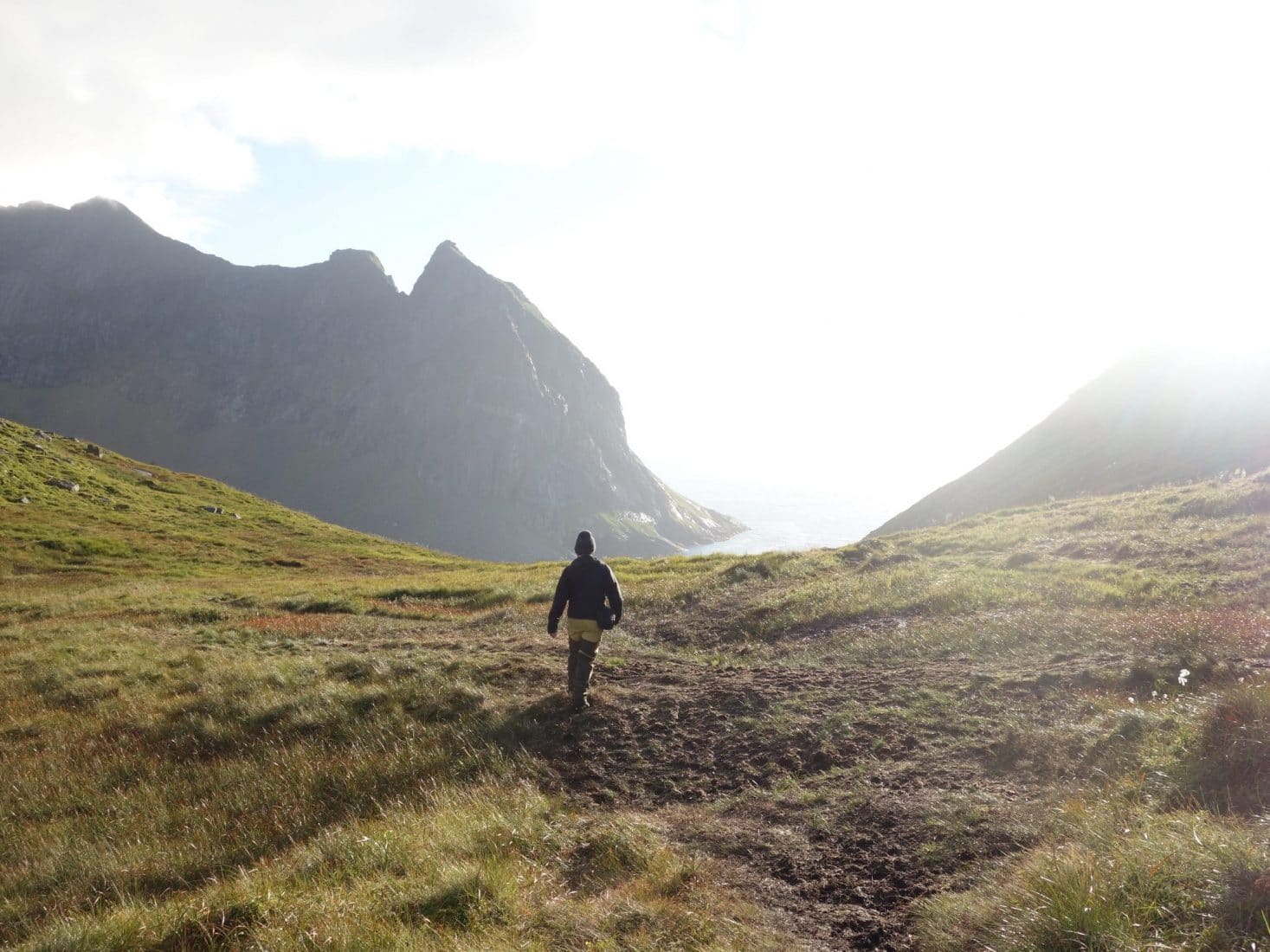
The following of the path follows the edge of the cliff and ascends gradually towards the summit. The main point of view is a little below the summit. The view is absolutely beautiful and stunning, especially at this hour with the evening light ! This will be one of the most beautiful views of the trek with the Reinebringen and the Hermannsdalstinden. We enjoy the view and the calm, there is nobody, we are well, it is a beautiful moment.
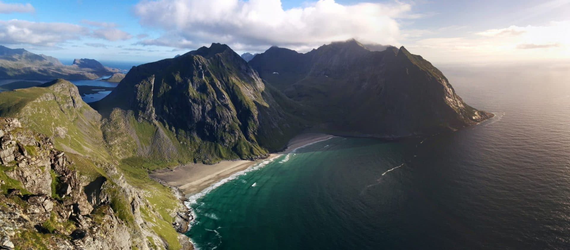
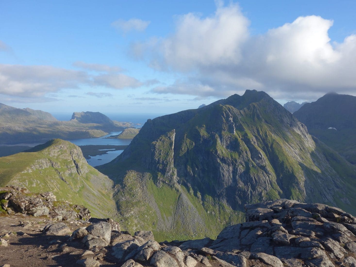
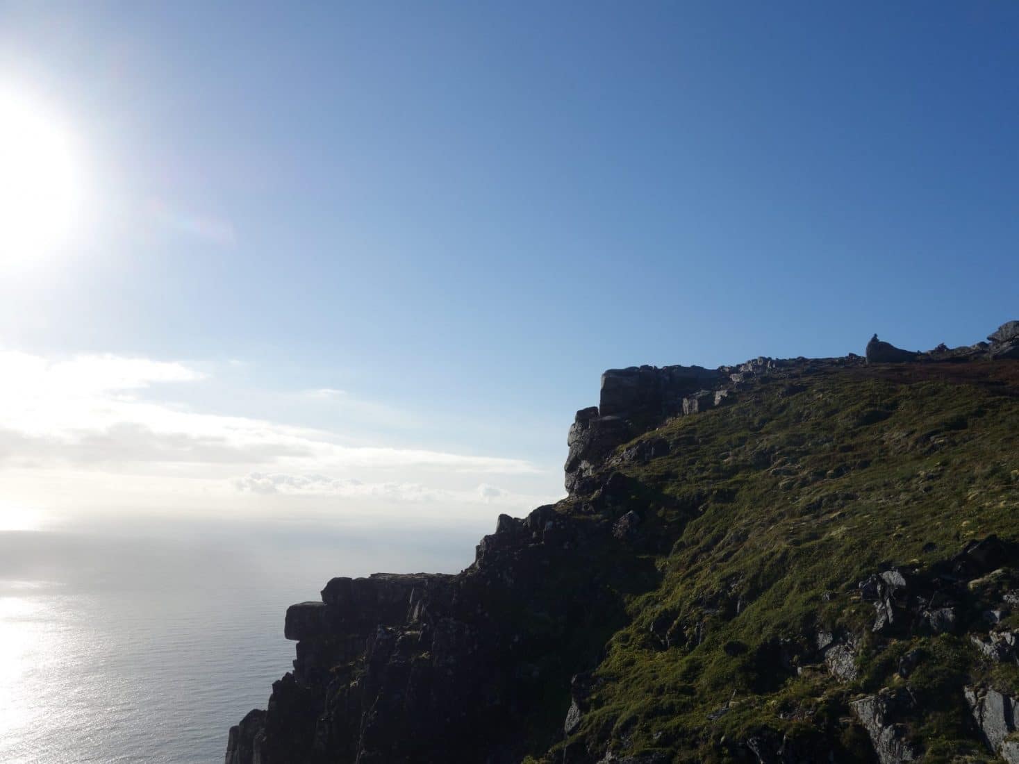
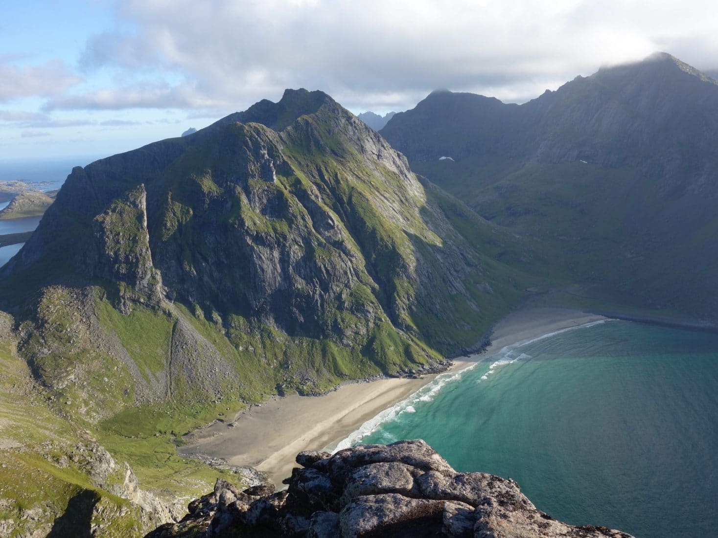
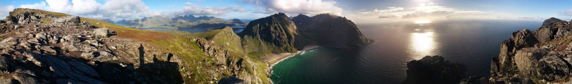
We begin the descent which will be very fast obviously. The end of the day will be peaceful and beautiful on the evening atmosphere. It is only four days that we are here but Svolvaer and France seem already far away.
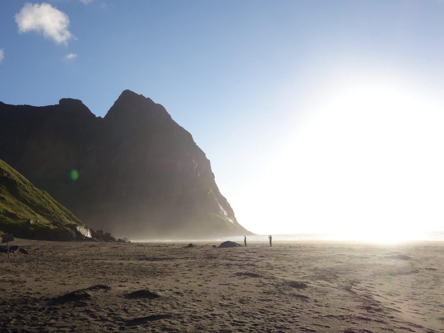
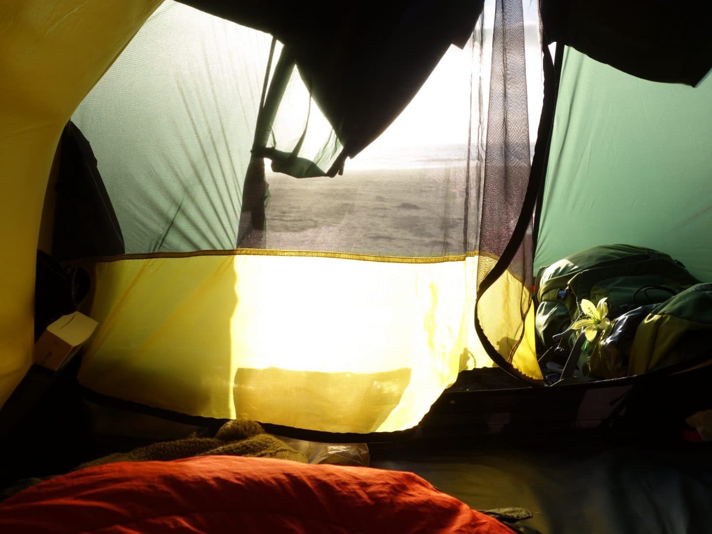
Day 5 : from Kvalvika to Reine
Pleasant awakening by the sea, although the surrounding mountains hide the sun. So it’s a fresh awakening this morning. We get ready to go and resume the ascent to the pass. The rocks are a little less slippery than yesterday. We arrive quickly at the small pass, we already cross some people who come to make the ascent of the Ryten.
Last look at the beach that will have been one of the most beautiful places of the trip. We continue on the descent which, it is always well slippery and damp. The schedule of the day is to go to Reine, once on the spot we will advise according to the hour.
Arriving back to the car park we head towards Fredvang. We will arrive in the small town in an not very exciting hour of walking on the road. We take a break just before the bridge series which will allow us to join the E10. We settled on a picnic area without charm. A few minutes later a large van arrives. We are starting to talk with the driver who is Norwegian. After exposing our plan he proposes us to come with him as he also goes to Reine. We accept and embarks then after having eat a piece with Ian (the driver) and his son.The road to Reine is very beautiful. The journey is high in color. Ian is a great talker and has a lot of story to tell!
The arrival on Reine is beautiful, the road passes from islands to islands suspended above the water. Reine is nested on a small peninsula. The village is built around a central square with pretty wooden houses, including a great cafe that makes delicious cinnamon rolls and good coffee (right next to the kayak rental)! There is a set of Rorbu / hotel which forms a typical ensemble.
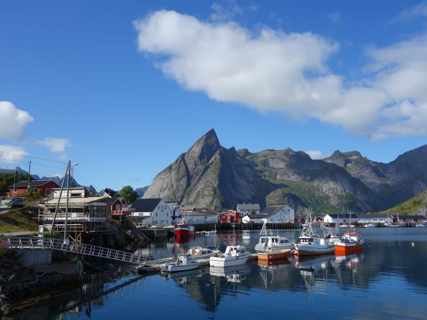
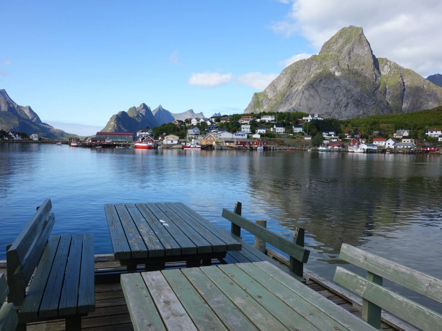
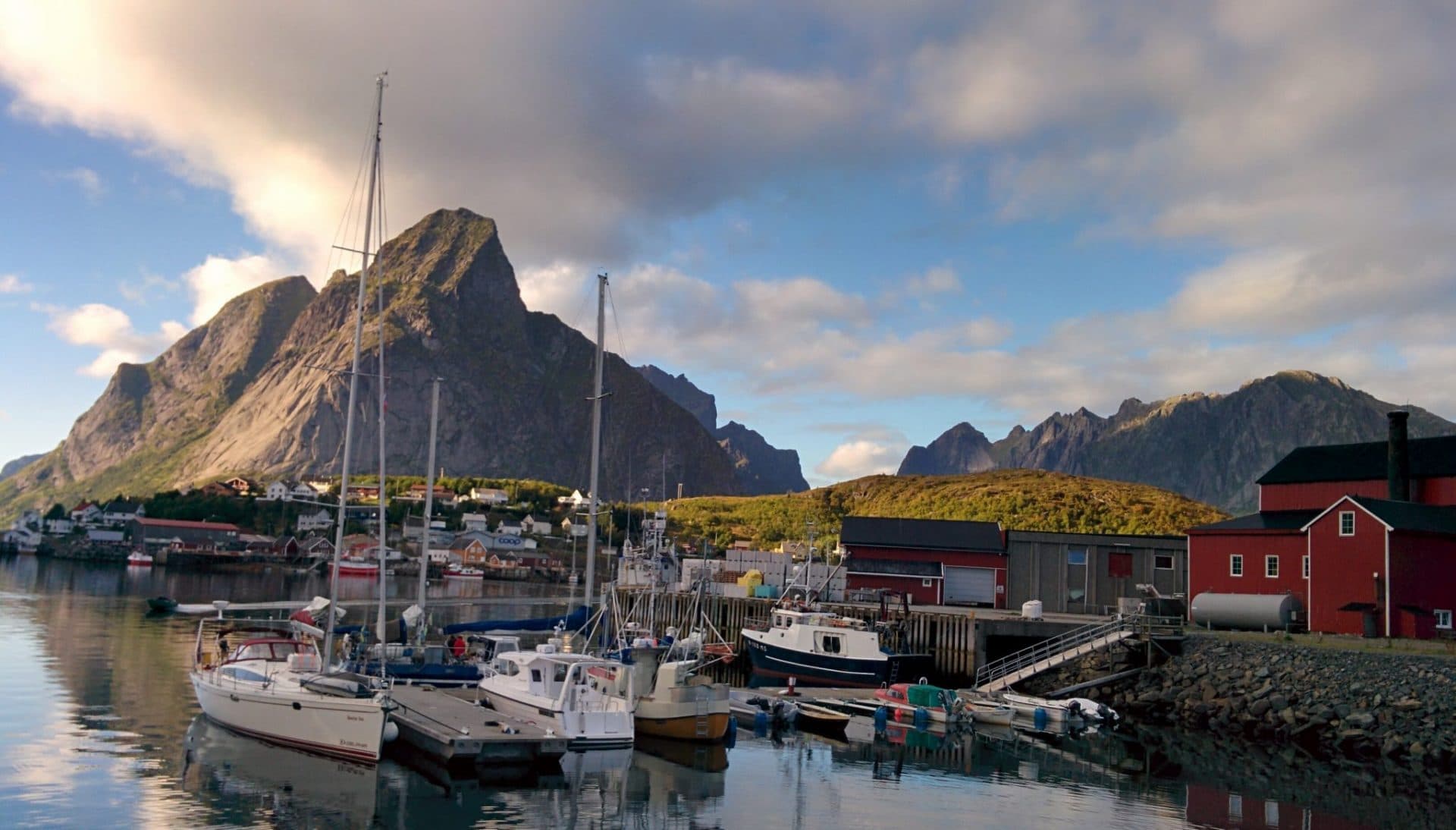
Ian drops us on the square. We had originally rented a rorbu but we are ahead of schedule and we will not be able to change nights as they are full. So we try other hotels in the area (there must be two more from memory) but the same, there are full. We are a victims of Reine’s success.
We need a roof for the night and there are not great campsite possibilities for the night otherwise. In the end we find the contact of a resident who rents rooms for the night. Luckyly she has a room left!
So we settle here for the night. On the spot, we meet Felicie, a Franco-Swiss who spends a month solo in the Lofoten. We debrief the things we have done / seen so far and we exchange tips for the future. In the evening we will dine with Ian, his son and Félicie in the restaurant of the Rorbu hotel which is good. It will be our last day “conveyed” we will do all the follow on foot.
Day 6 : from Reine to Bunes passing by the Reinebringen
A good day ahead, especially as it begins under a great sun, it is even hot. We will have an insolent luck during all the holidays on the weather …
The program is simple. In the morning we head to the Reinebringen (448m) to climb and to admire the most famous point of view of the Lofoten. Then head towards the beach of Bunes on which one will join Ian, his son and Félicie.
We set off light for our summit of the day. The beginning of the hike meets by following the road (direction Å) over 200-300m. The path is marked by a sign that warns of the dangerousness of the ascent. Regarding this panel and various things that can be read, I think that the path is quite practicable and without other immediate dangers when the weather is dry for a few days, on the other hand it is that in wet weather it can become very slippery. It should be noted that when we went hiking (in 2016), a path was being constructed in order to make the climb more secure.
We begin the ascent in the trees. The trail is good and one rises quickly. You just have to pay a little attention to the direction you follow because “false” paths lead nowhere. A little higher up the vegetation clears and the view emerges. You can see the zigzag climb up to the small pass just below the summit. It’s very hot, it’s sweaty. The heat in the Lofoten is all relative but in any case we feel the difference with the previous days. We arrive at the point of view on the other slope after this long ascent. It’s really beautiful. You can see the village below but also the road that runs along the coast and all the islands in the distance. It was well worth the effort to climb here, the reward is worth it!
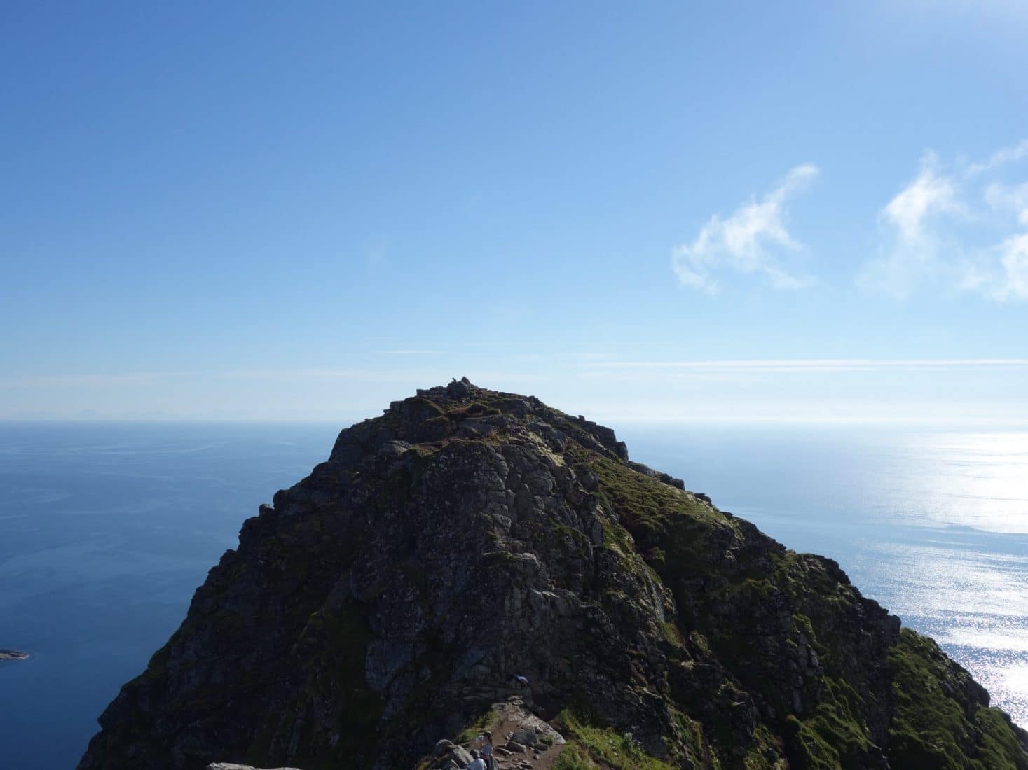
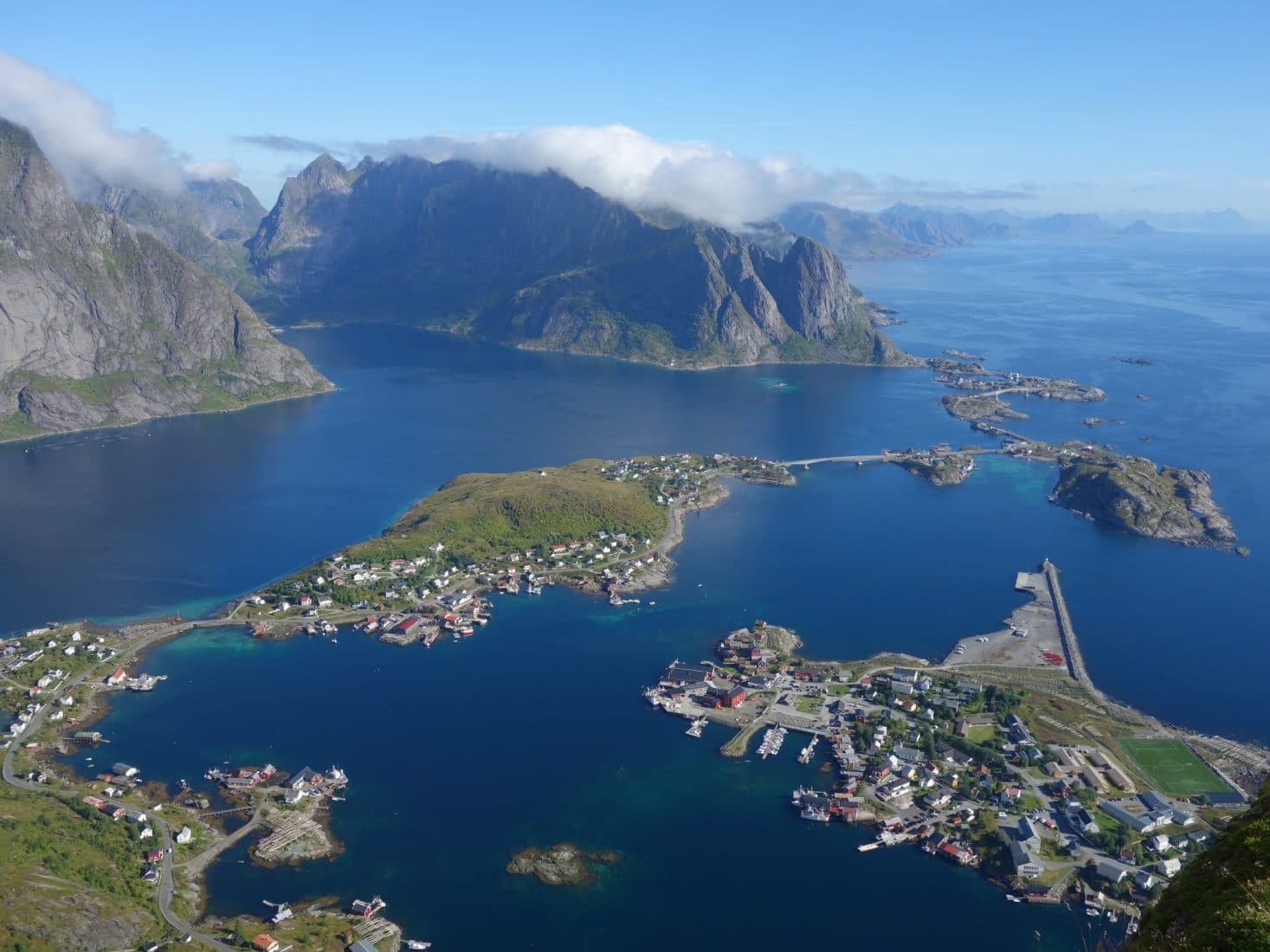
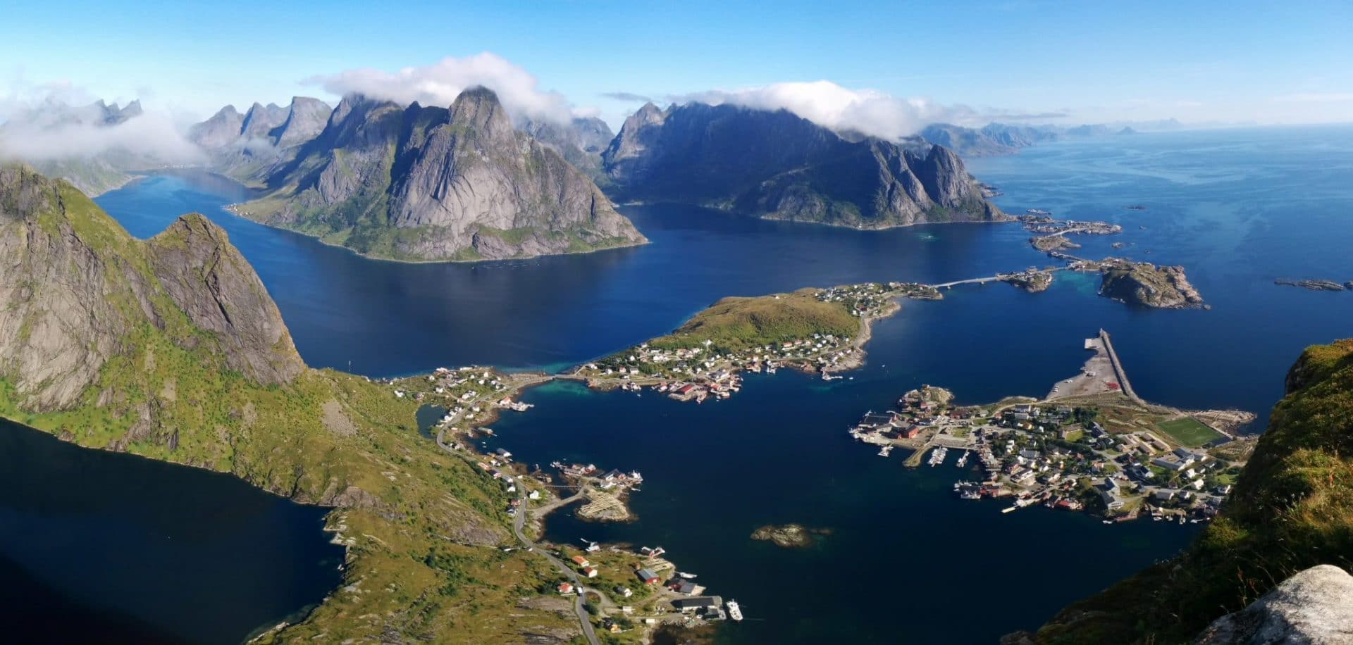
We take our time to admire the view and walk along the ridge. However, we have to think of going back because we have to take the ferry for Bunes.
You have to pay a little attention to the descent because it can slip. We meet a lot of people who climb. Some, just equipped with sneakers or flat shoes, struggle a lot in the mud …
Back in the village we pick up our bags from our yesterday room and we head for the ferry.
The ferry is an old fishing boat converted to go back and forth in the fjord. The trip is pleasant and above all fast. Our companions, Ian and Félicie will paddle 1h30-2h in kayak to Bunes.
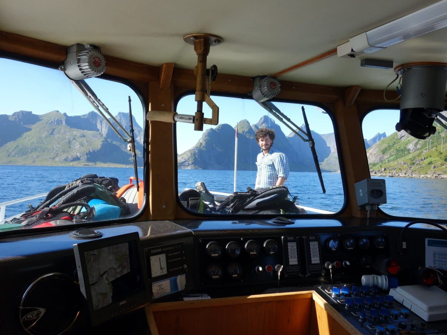
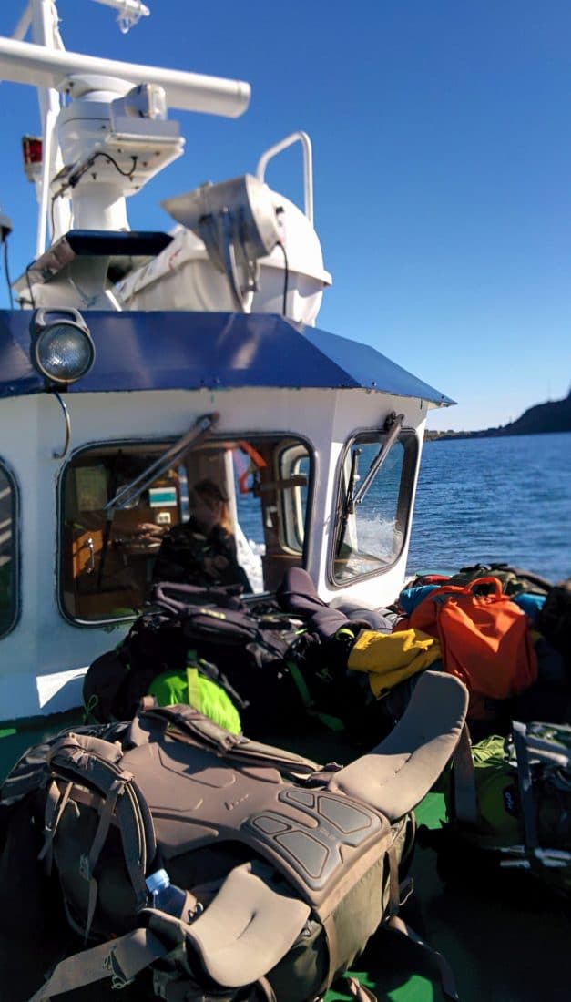
The arrival in Vinstad is done by a small pontoon on which a real crowd of tourists is waiting for the return to Reine. Luckily those are people who are just day tripping to the beach. Bunes is, therefore and hopefully, less crowded on the evening.
Walking to the beach is fast. Follow the path along the fjord and turn left just after the small cemetery. All you have to do is climb up the small hill which is within 80m and there you are !
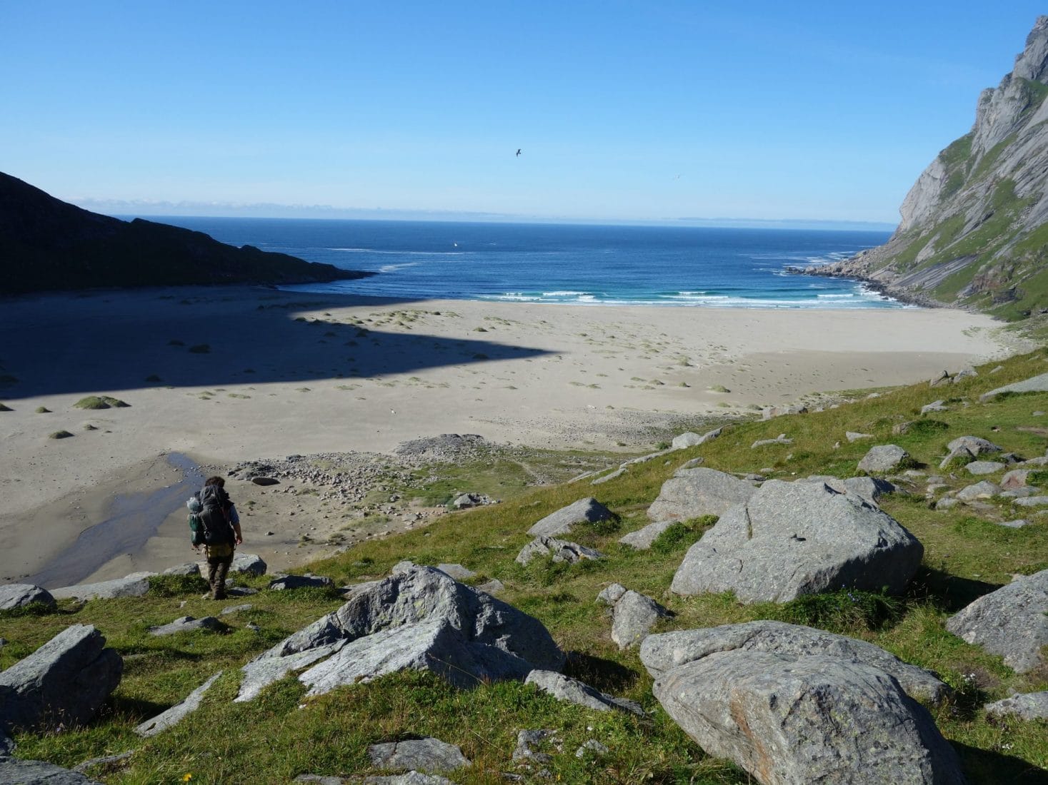
The beach is large and there is plenty of choice to settle our camp. We decide spend the night on the right part of the beach to be a bit away from people. Bunes is overlooked by the Helvetestinden, impressive smooth rock face of 510m high. The place is very beautiful and soothing. The sea is quite distant because the beach is deep. There are many buoys stranded on the beach in the middle of the scattered vegetation. This is another great place to discover.
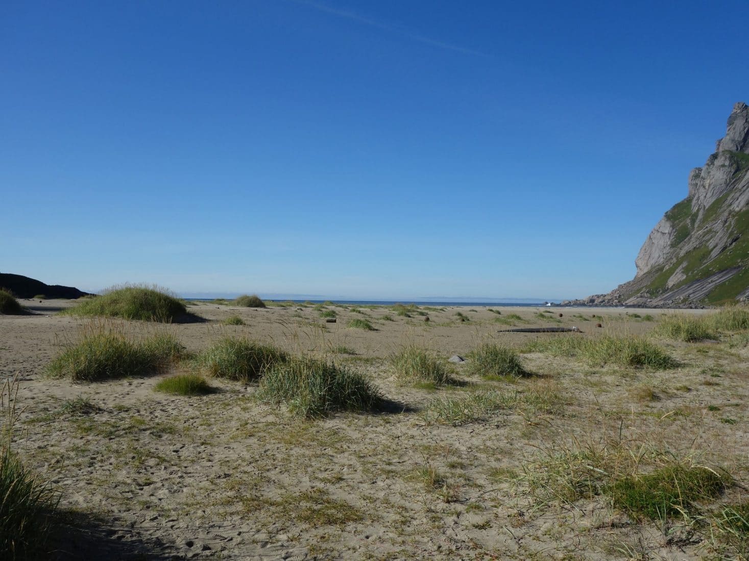
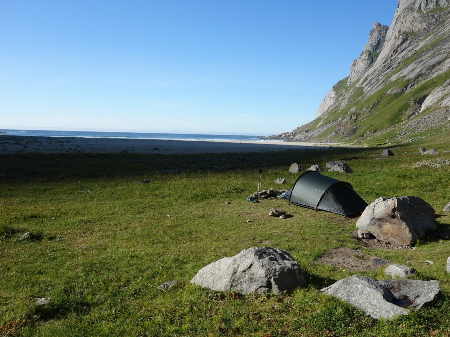
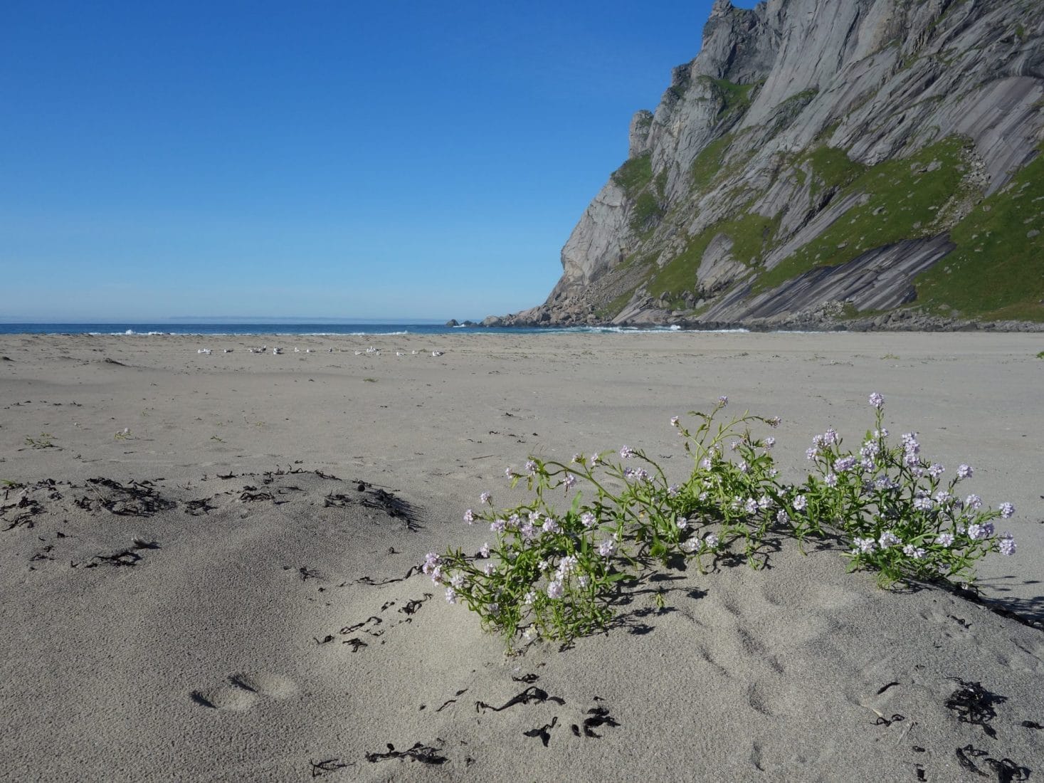
We spend the end of the day enjoying the beach and its variations as the hours pass. In the evening, Ian and Félicie will join us, but also French, Americans and other Norwegians. We spend the evening chatting around a fire with the sunset that never ends in the background.
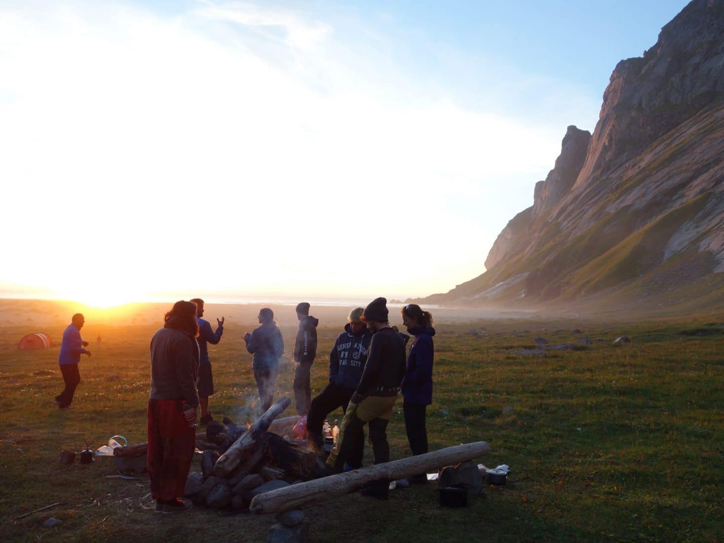
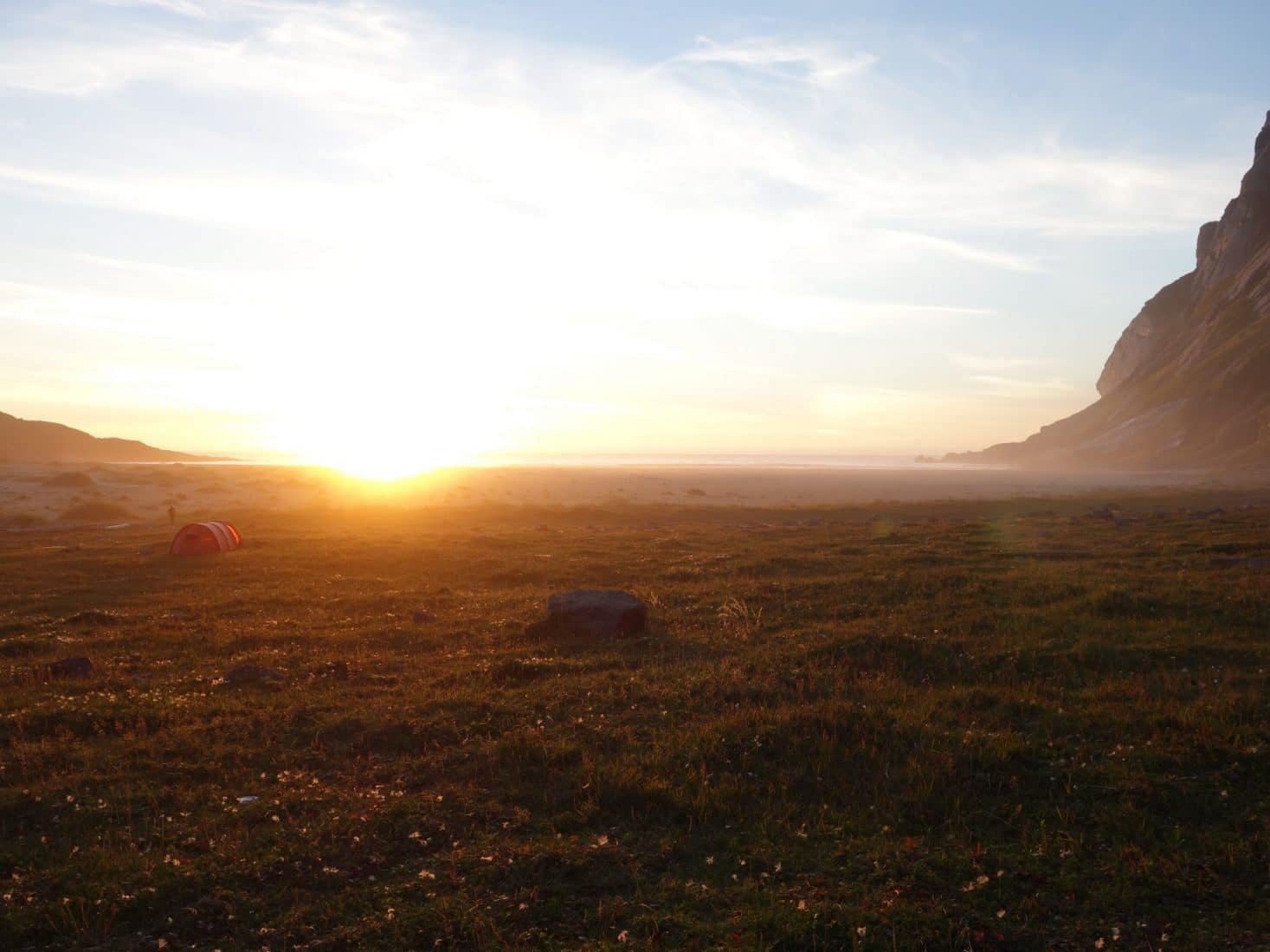
Day 7 : from Bunes to "Hill 448m"
Awakening in the shadow on this seventh day in the Lofoten Islands. But the weather is nice, which augurs a hike in the sun.
The goal today is to reach the summit of a small hill at 448m under the Hermannsdalstinden (1029m) which will be climbed the next day. Normally a small ferry will allow you to be dropped off at the Forsfjorden power station, but according to the information on the internet, the ferry does not pass this year. So we’ll have to walk around the fjord. Afterward we notice that the information that we had was not good because we saw a ferry coming from Vinstad and going to the electric station.
Relatively close on the map the station will prove to be longer to reach than expected. The path from Bunes is very bad and difficult. To reach it you must return to Vinstad and go on the right before arriving at the level of the pontoon. The path begins by following the fjord in rather spongy terrain but which allows a rapid progression. However, we arrive quickly in the “complicated” part: the greater part of the path passes by a path that slips through large rocks covered with moss and in dense vegetation. The mossy rocks, in addition to being slippery, hide holes covered with moss … So we pass the leg through holesvery easily and there, we risk getting hurt. We progress, therefore, gently, by groping with the sticks the ground before us. This portion is so long and boring. The power plant does not come close and it is really hard for a long time.
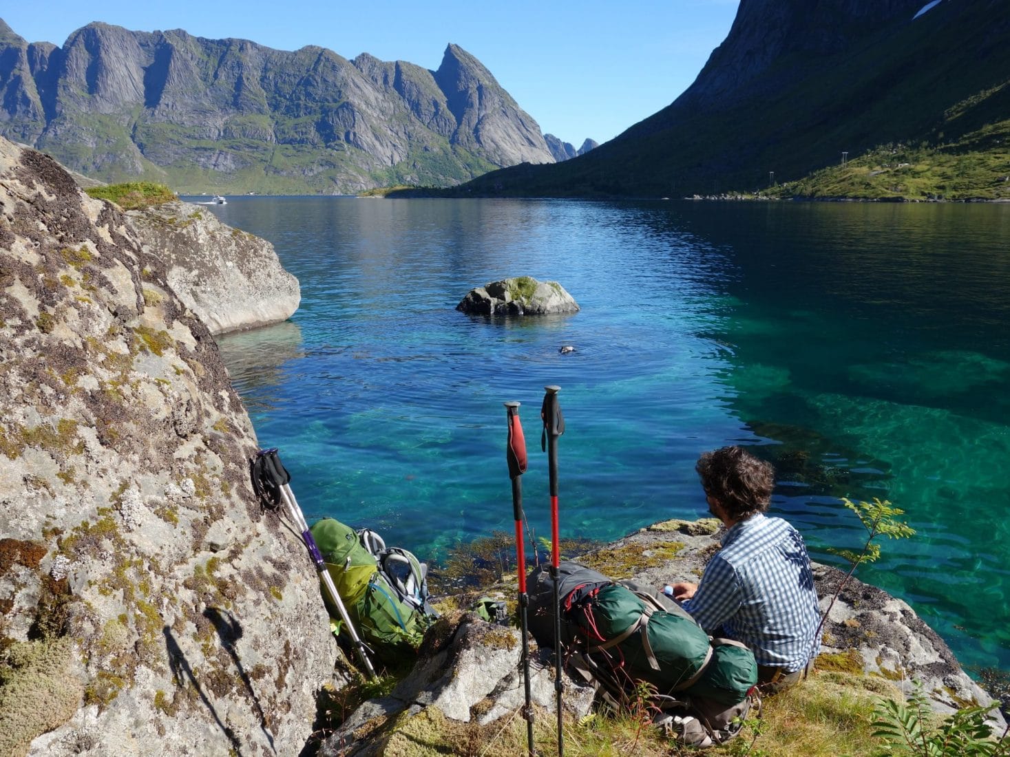
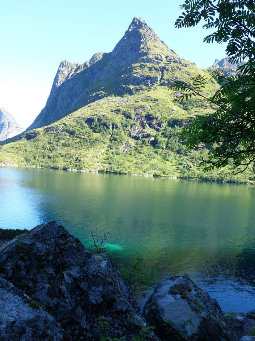
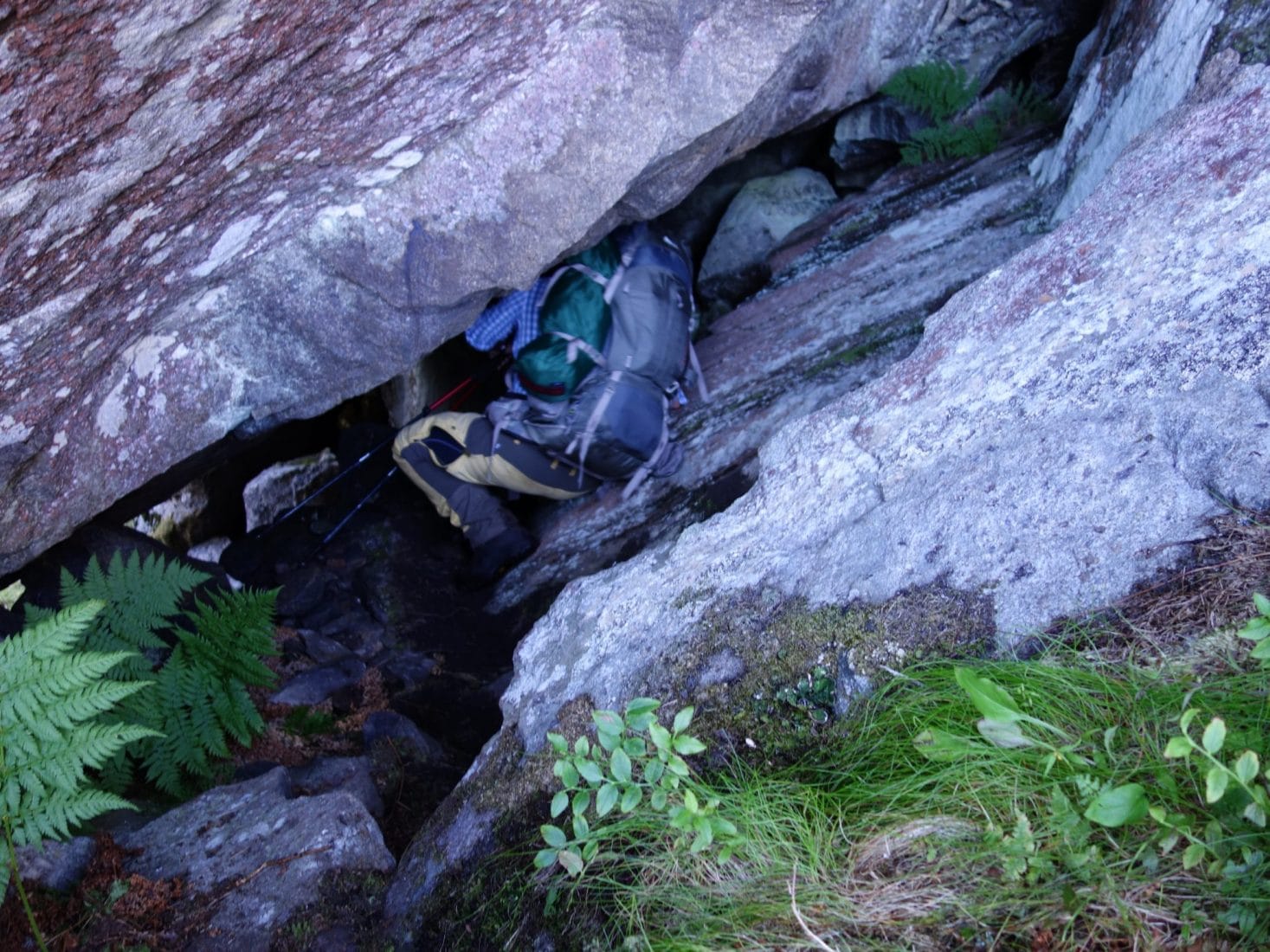
We will finally get to the power plant a little broken by the fact of having taken so long to travel such a little distance.
From the station we take to the right following the big pipe. The ground is very muddy and slippery. It climbs quickly over the fjord and the view is beautiful.
We reach the lake of Tennesvatnet once at the top of this relatively steep ascent; from there we take to the right to reach the summit of the hill that separates the lake from Krokvatnet. In the climb we meet an old gentleman who climbs with his dog (the only person we will meet today), we discover by discussing with him that it is the landlord here and that he is going to his cabin near the Krokvatnet to spend a few days with friends …
The climb of the hill is steep but we finally reach its summit. We are very tired … We find a place to set the camp. This is an arduous task because although there are a lot of flat areas, these are mostly swamps.
Finally we will find a good location whose view embraces the fjord and the Hermannsdalstinden. We enjoy this beautiful place in the sun for the rest of the afternoon.
Another long day of walking even though few kilometers were made. Tomorrow we will climb the highest peak of Moskenesoya, the Hermanndalstinden.
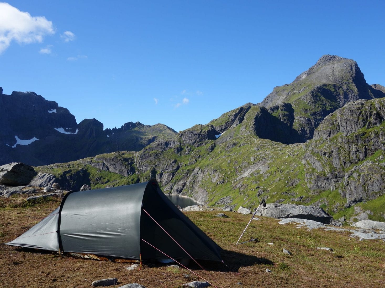
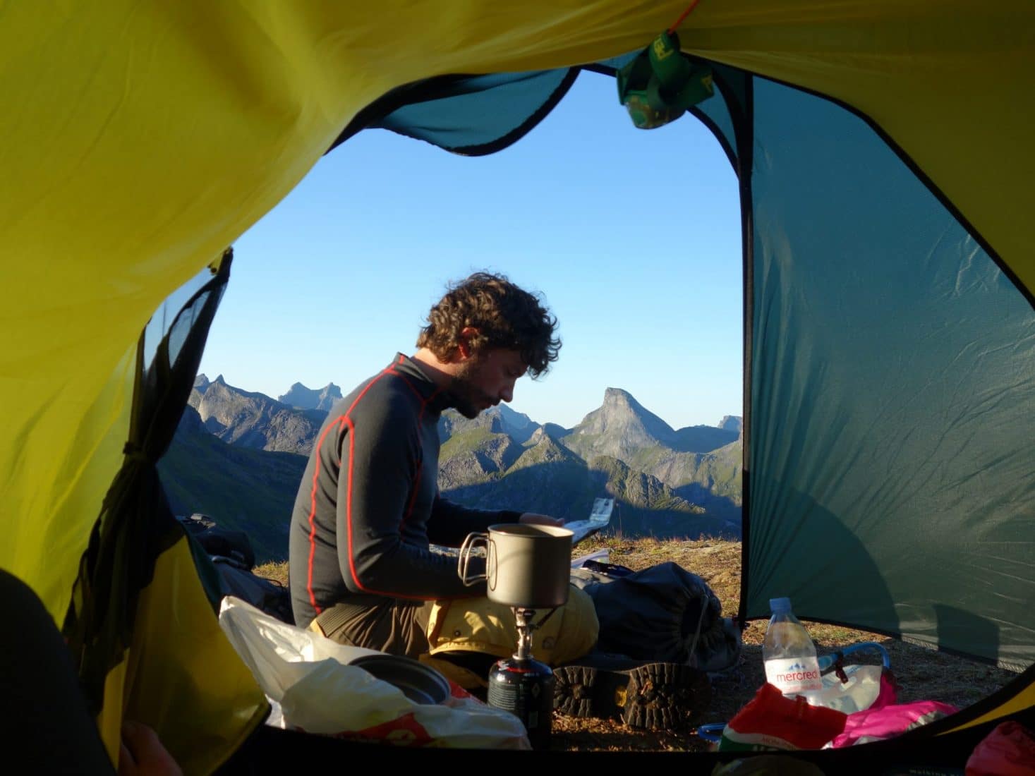
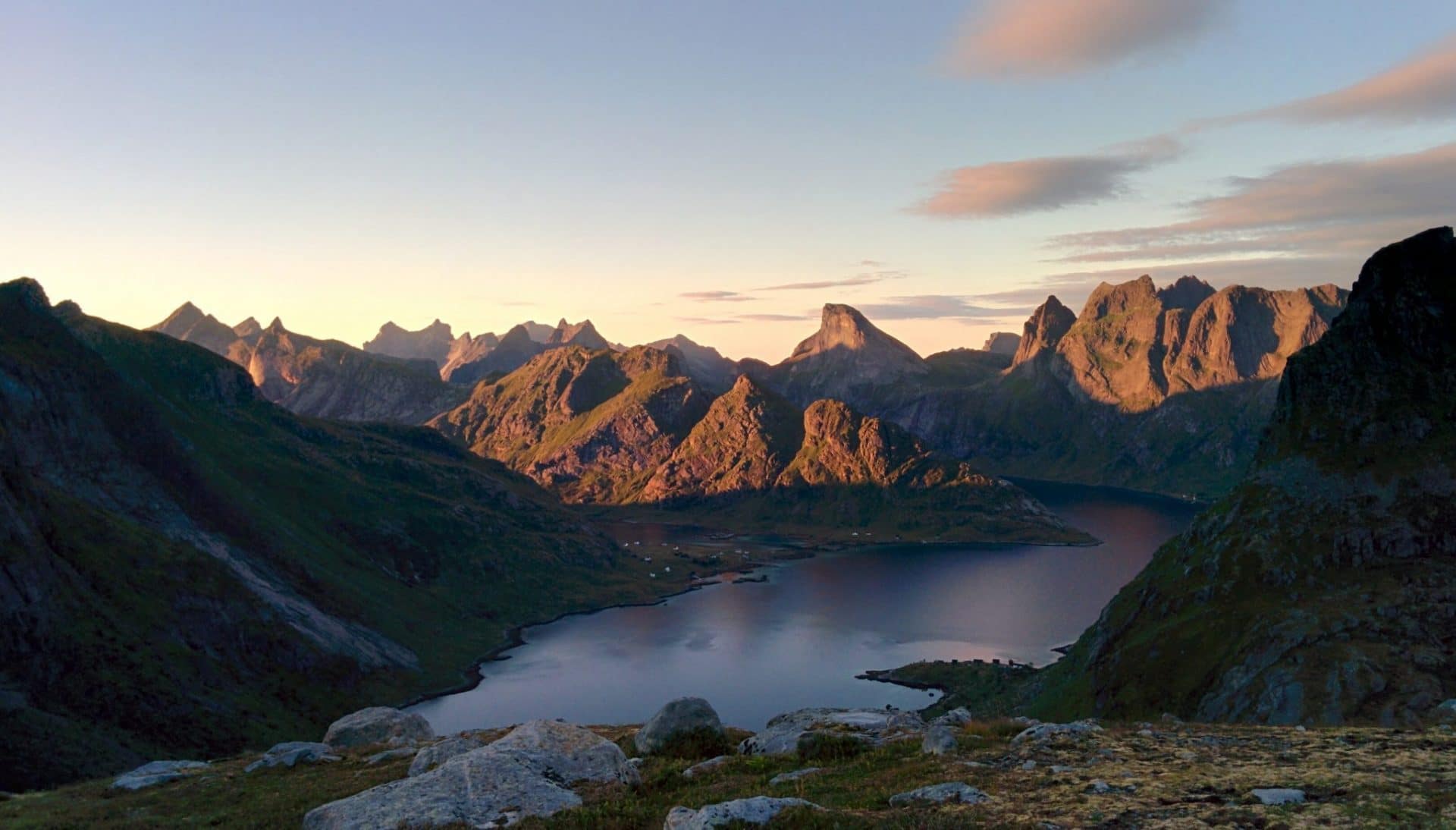
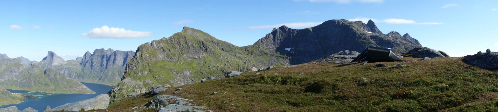
Day 8 : from "Hill 448m" to Munkebu passing by the Hermanndalstinden
We get up this morning under a great sun. Head towards the summit of the Hermanndalstinden (1029m) this morning. We leave the camp relatively early in the morning after having a good breakfast. We leave light, leaving the tent and the big bags behind and taking only the bare necessities for the return trip.
The trail begins by descending almost to the level of the lake and then back up into a relatively narrow path, muddy and lined with dense vegetation that can hide some holes. We will meet a couple who goes down and who had to spend the night higher. The view is rapidly becoming more beautiful.
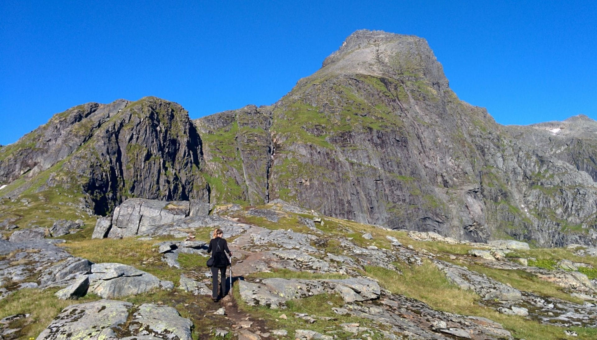
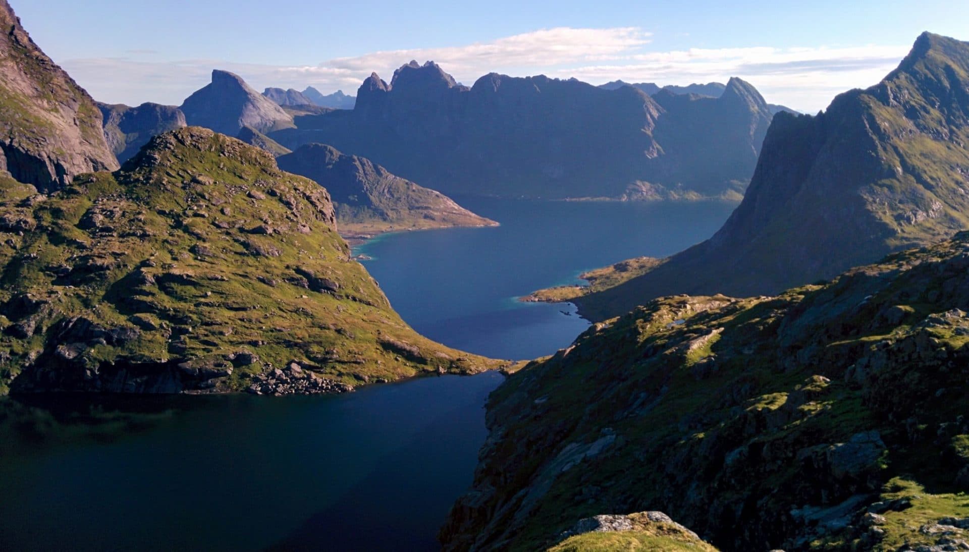
The ascent is deemed difficult especially in rainy weather. There are no difficulties on the beginning of the path but the following section can be scary if one is not accustomed to a little air and emptiness. The road climbs suddenly strongly on a ridge that leaves a lot of air especially on the left. Chains and ropes were installed to help the walker. We went there while the terrain was dry but I think that doing this portion in the rain may be slightly more dangerous and in any case we should not be impressed by the vacuum.
The advantage is that you quickly take the difference in altitude.
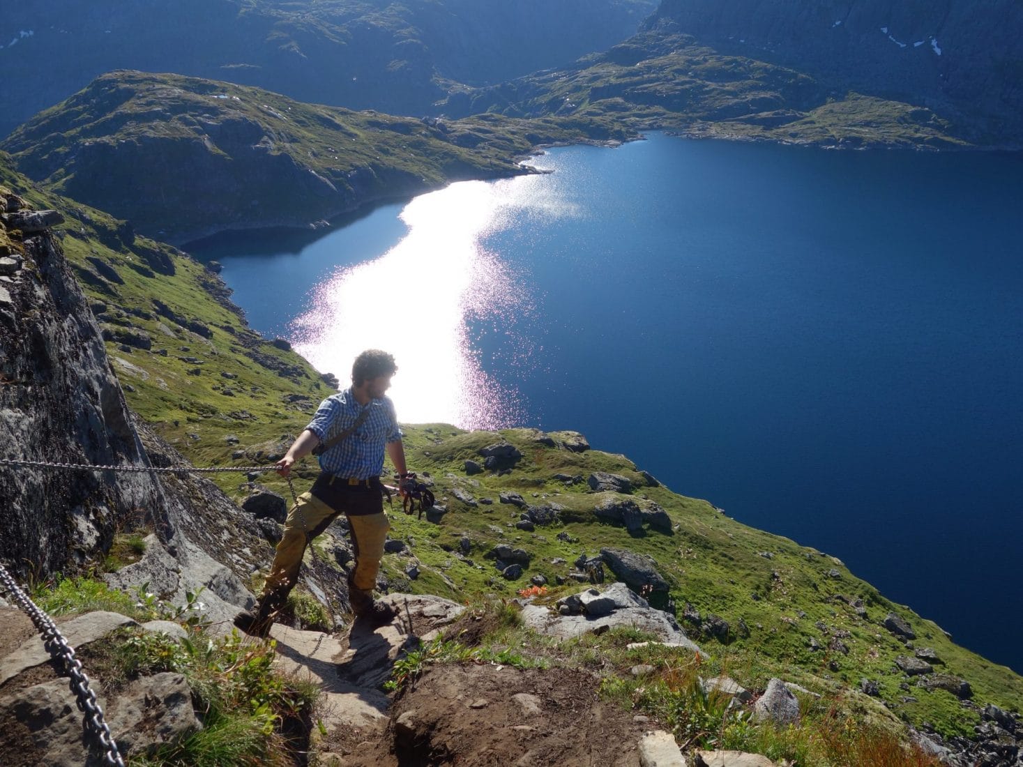
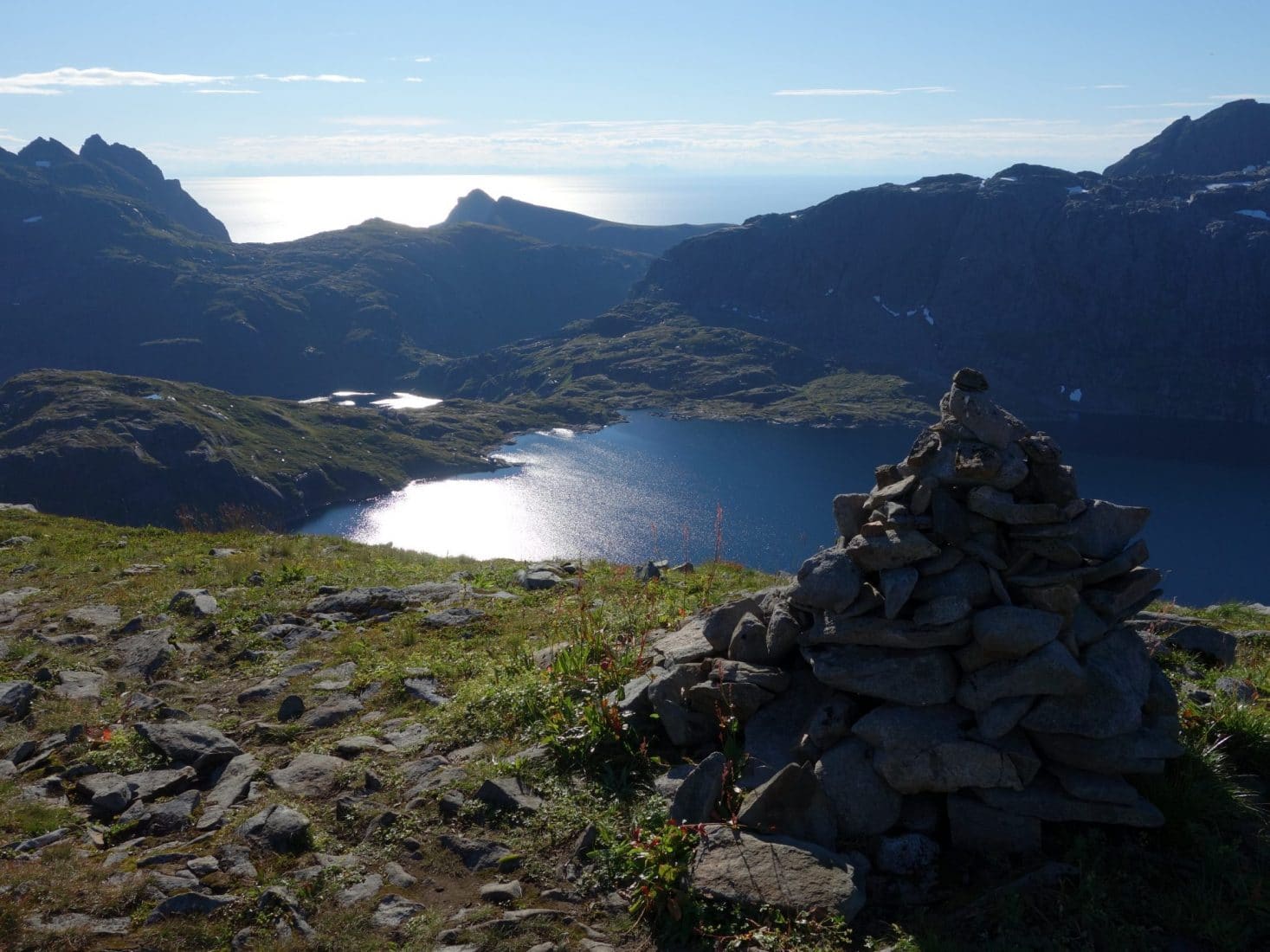
Arrived at the cairn of the previous picture the path leaves on the right. Vegetation is beginning to become scarce. The climb then continues on a path that could recall a trail of the Alps. The view is very beautiful and unobstructed, it promises for the suite.
On the end, the path is 100% mineral. We are not even at 1000m and it looks like 2500m in France. Only a few lichens remain. On this part the path becomes a little less visible and red paint points give the direction to follow. We finally arrive at a small pass (very windy when we were there) that is not yet the summit.
This one is a few tens of meters on the left and is marked by a post. To reach it you have to go through large rocky blocks that must be slippery if wet.
A few more meters and that’s it where we are at the top ! The view is breathtaking, sublime, stunning ! The surrounding area is totally dominated. To the west, the Lofoten threw themselves into the ocean with Vaeroy in the distance. To the east, the archipelago extends for tens of kilometers, far to the south one perceives the continent. It’s absolutely perfect! Surely the most beautiful view we had during the stay (with the Ryten) …
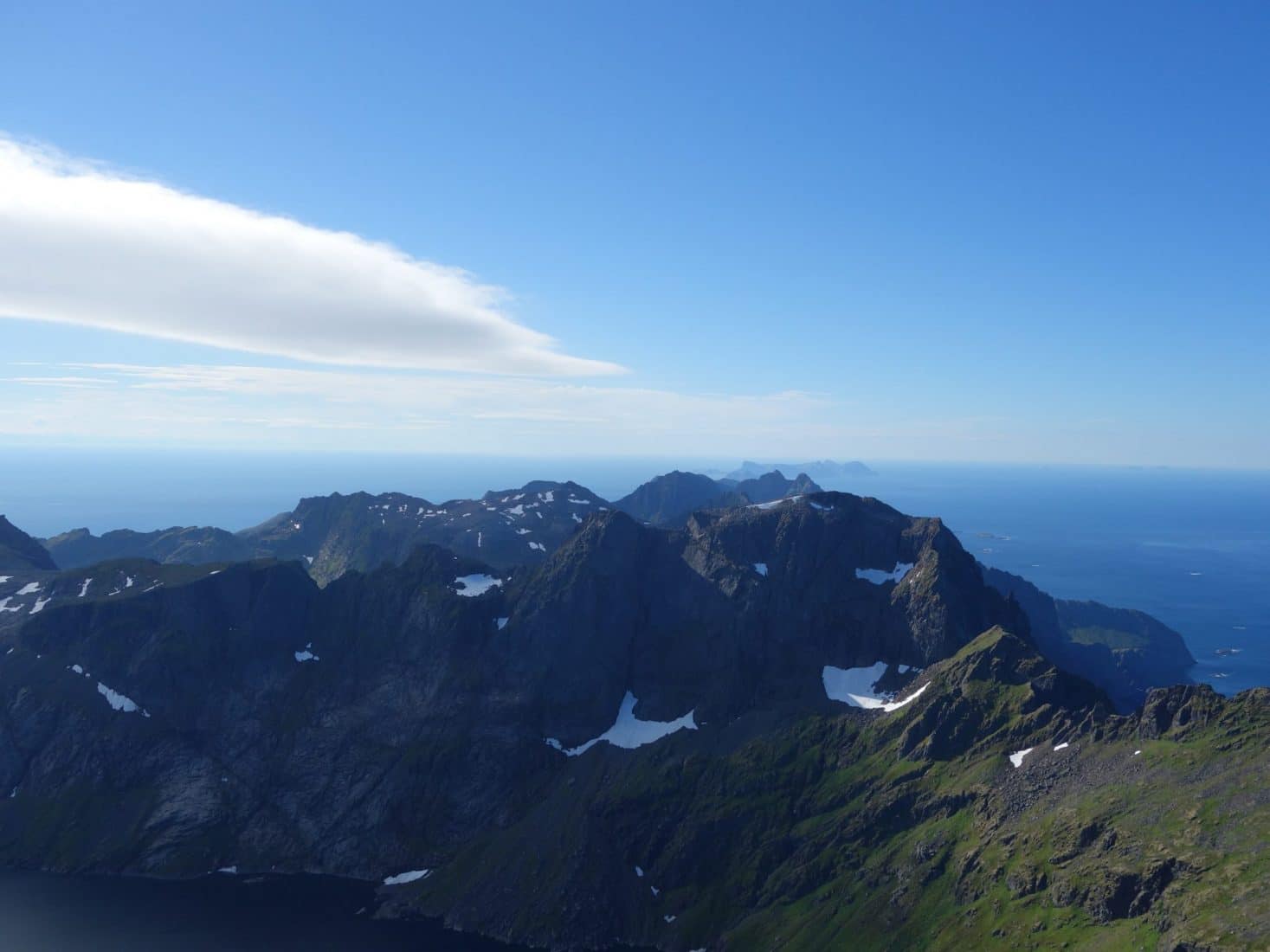
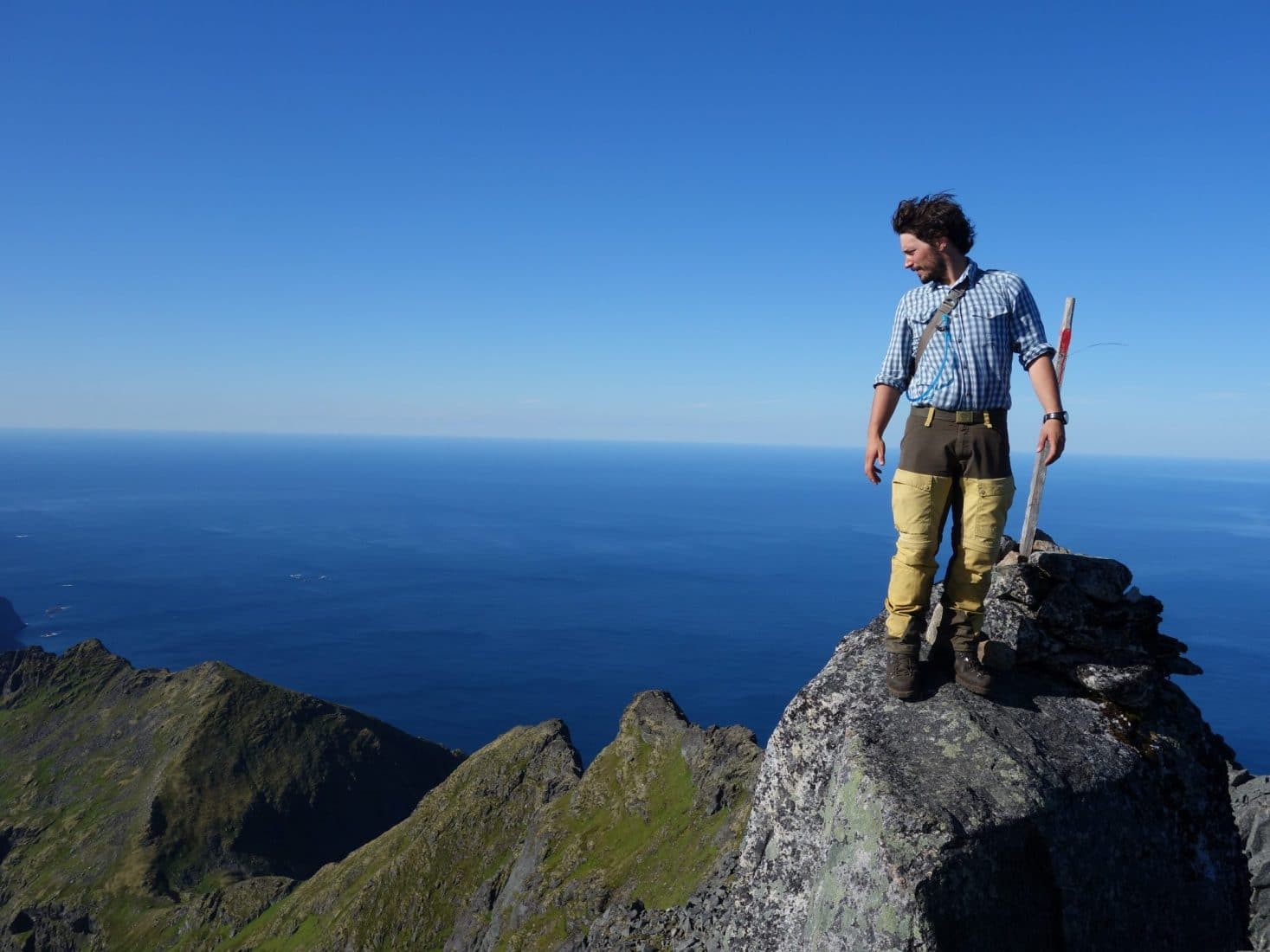
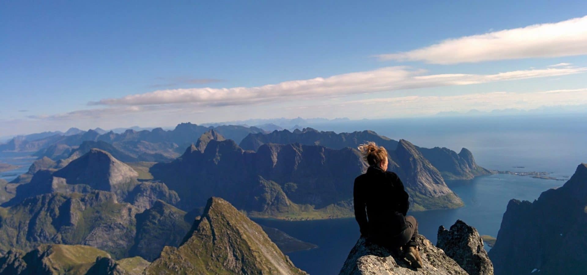
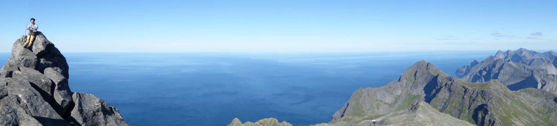
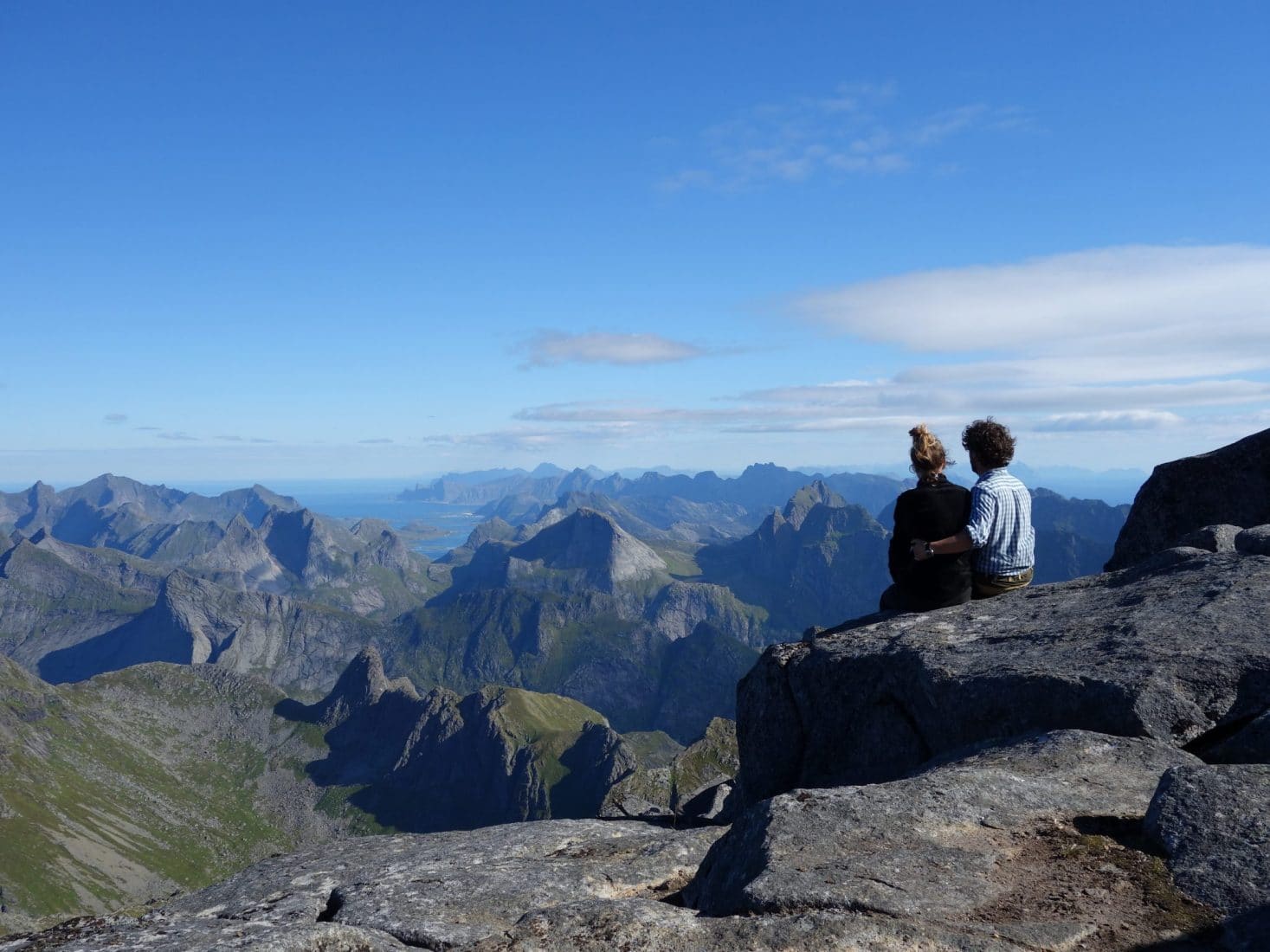
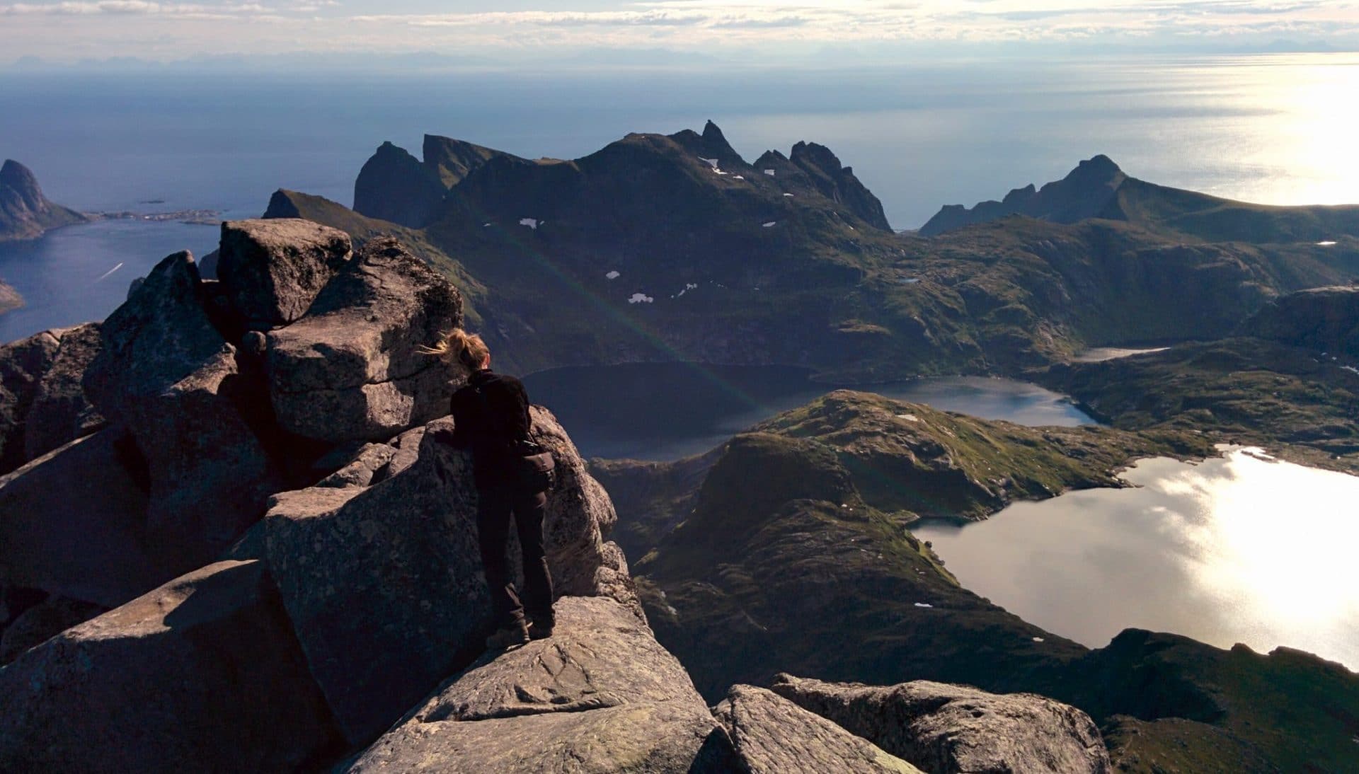
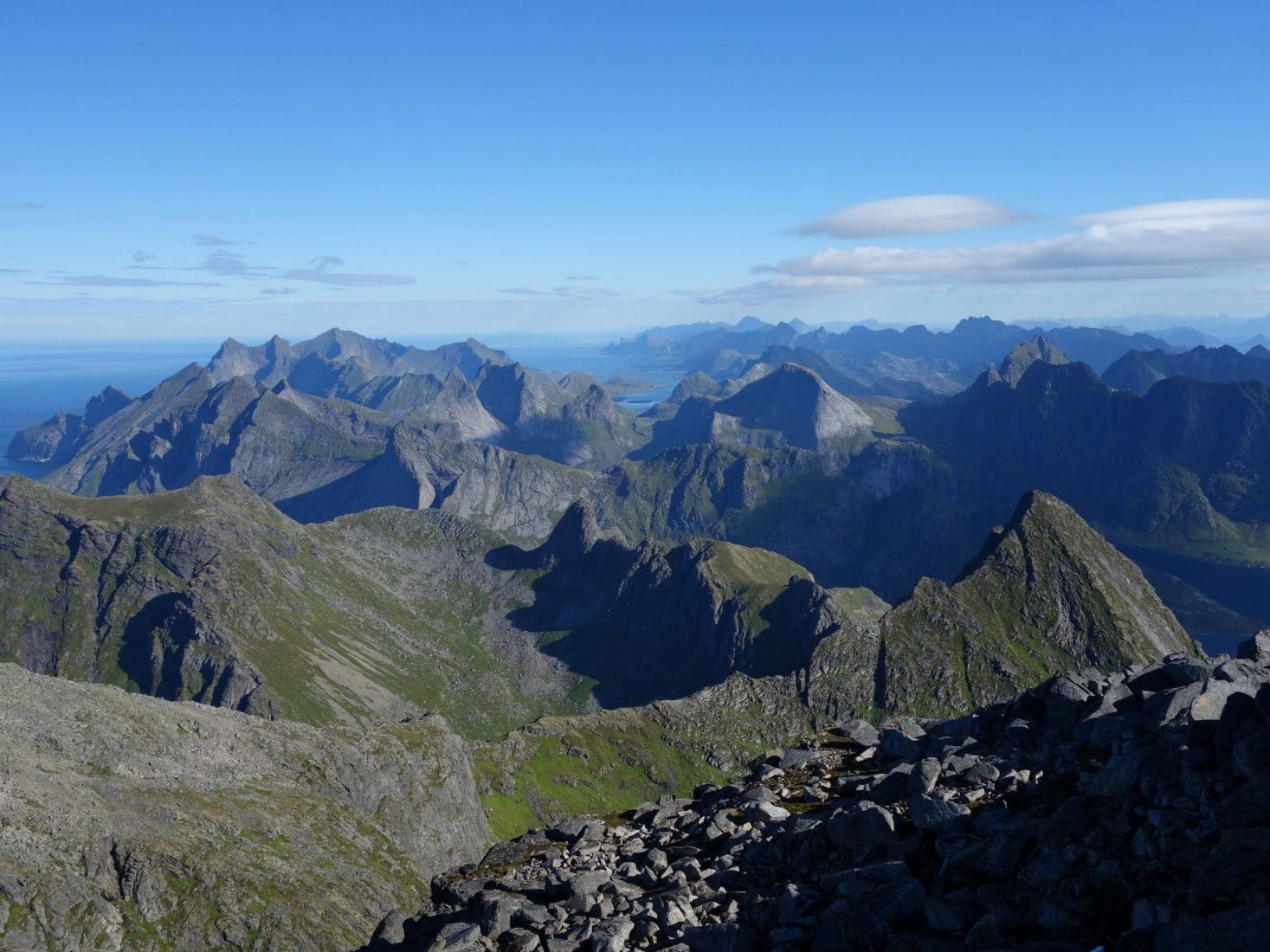
We take the time to savor the moment, alone, well sheltered from the wind.
After this moment of plenitude, we decide to go down again. We will meet some groups of people going up. Some will not pass the passage with chains and ropes.
Once back at the camp, we give ourselves a small lunch break before re-bags and head towards Munkebu.
The path is relatively simple to get there.
Munkebu is a refuge located under the Munken. Several bivouac spots are available in the area. The refuge itself is accessible only if you have the keys to be collected in Sørvagen from the DNT (Norwegian Alpine Club).
The Munken is within walking distance and offers a beautiful panorama of its summit.
Concerning the campsite, the area is quite swampy, there are pitches to put the tent but not so much in the end if you want to be dry. For our part we will choose to put ourselves on the heights to have less moisture. We have a lovely view of the refuge with the Hermann as a backdrop. We will end the day that will have been sunny all along again.
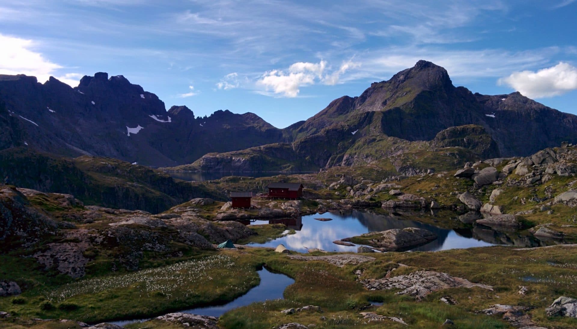
Day 9 : from Munkebu to Sørvagen
The night has been wet… Munkebu is really a beautiful place but not necessarily the most suitable for a bivouac.
So we leave the area after packing everything again, direction Sørvagen for a return to civilization.
The beginning of the path undulates between small secondary summits. We stay on the heights it is beautiful even if the weather is more sullen today. We then begin the descent which will be progressive on the beginning and quite steep at the end with some passages with chains and ropes to help; but nothing impossible. We meet a few people who certainly climb to Munkebu for the day.
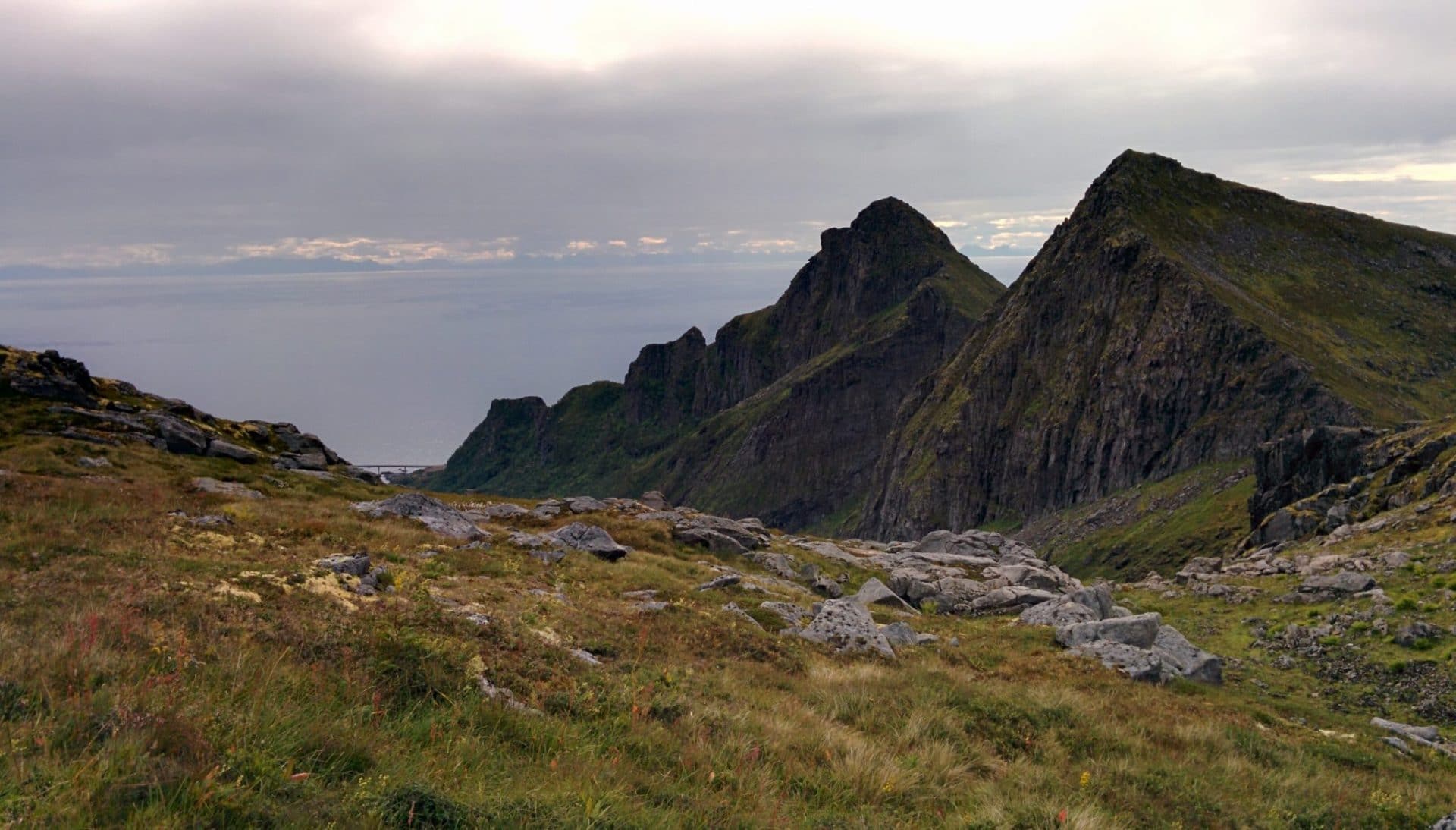
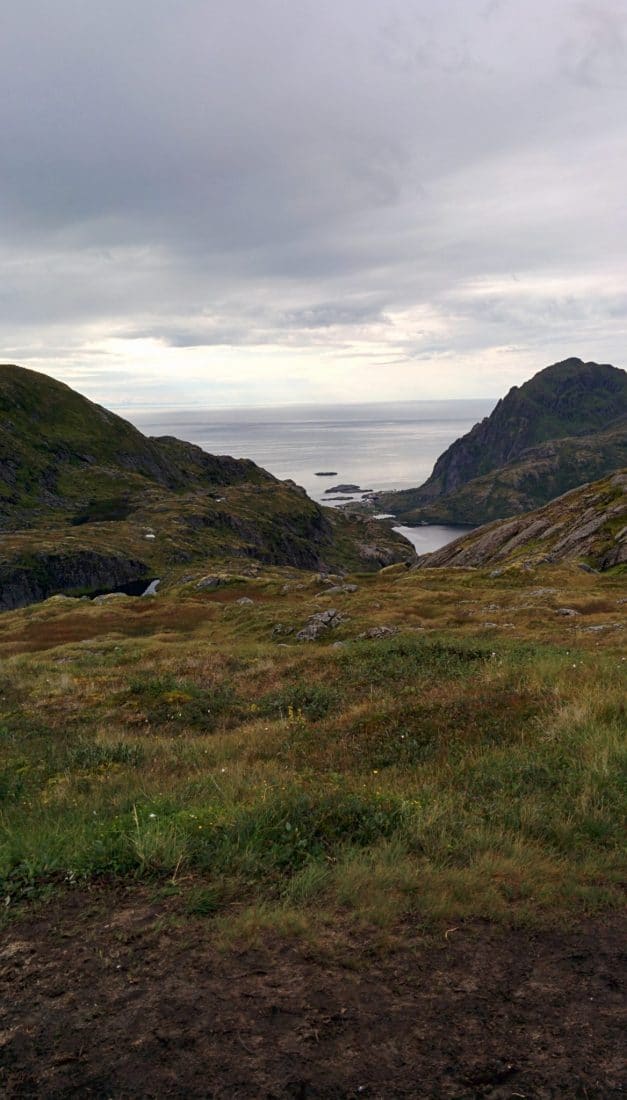
The arrival on Sørvagen is by Lake Sørvagvatnet. The city stretches along the E10. There are two convenience mini-supermarkets. For the night we choose to sleep under a roof so we book a room that belongs to the restaurant the Maren Anna. The room is not extraordinary even a bit austere … but we wanted to sleep in a bed and especially have a nice hot shower …
The day was not very busy. We will end it by a walk in the city and especially a good meal at the Maren Anna which serves a very excellent cuisine!
Some guidebooks suggest a round trip to the Hermanndalstinden from Sørvagen during the day. I do not doubt it is feasible but I think it requires a good physical condition and especially to travel light. Moreover it leaves little time to take the time which is also a pity. Another possibility is to do the opposite of our way: from Sørvagen and finish to Reine by the ferry which is already more possible in a day.
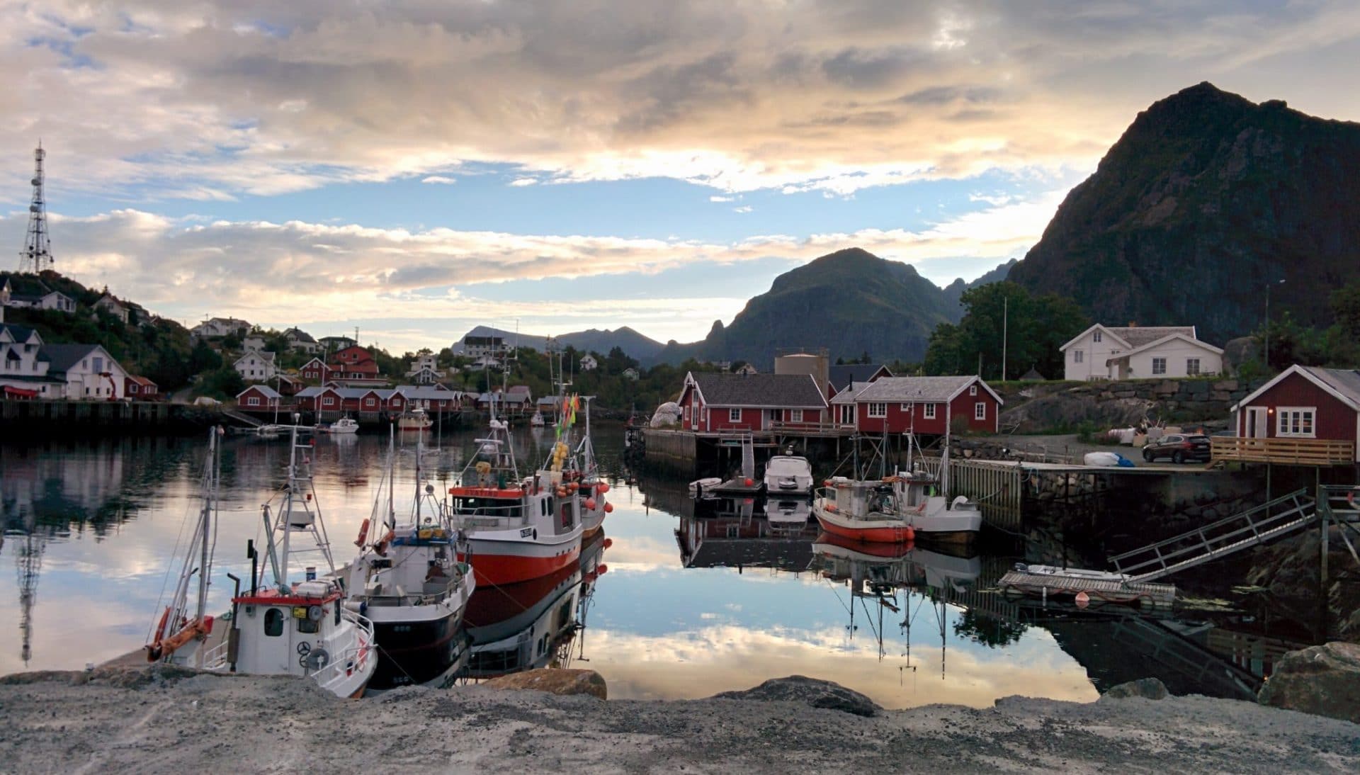
Day 10 : from Sørvagen to Moskenes passing by Å
Transition day today. We chose to leave for Væroy the next day, so this day will be devoted to the visit of Å and to rest.
To reach the small town of Å which is at the end of the E10 is relatively easy and fast from Sørvagen following the road. The scenery is beautiful along the route and fortunately there is not too much traffic. The coastline is not far from the water, passing by small local villages.
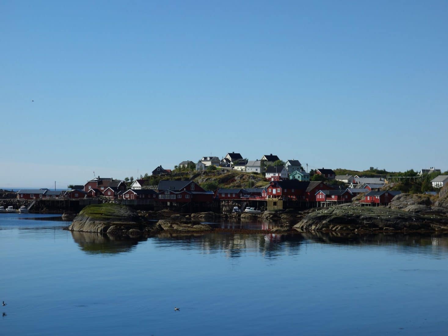
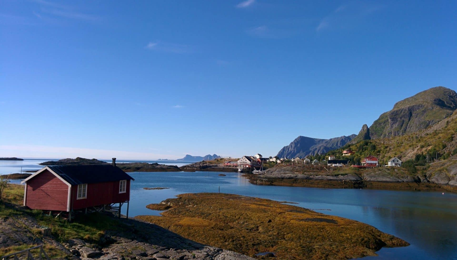
Å is a small village museum at the end of the road. We were afraid it would be ultra tourist because there is a large bus parking and that is quite well known. Luckily there are not any crowds. We will cross Félicie, our friend from Reine, right at the entrance of the village who is hicthhiking to return to Svolvaer.
We start our tour in the village by buying bread and cinnamon rolls with a coffee in the bakery of the small main square. We will then land near the water to enjoy the sun and viennoiseries. We will be joined by two groups of French with whom we will share our experiences of Lofoten.
We will take a further tour in the village. This is not very long given the size of it. The village is friendly but not extraordinary either when compared to Nusfjord.
We do not stay very long in the end. We prefer to go to Moskenes, stay at the campsite and enjoy the late afternoon. We therefore take the road on foot in the opposite direction.
Several beautiful excursions are possible from Å: one of them is the beach of Stokkvika passing by Ågvatnet Lake, another beautiful hike is the ascent of the Andstabben (514m) west of town.
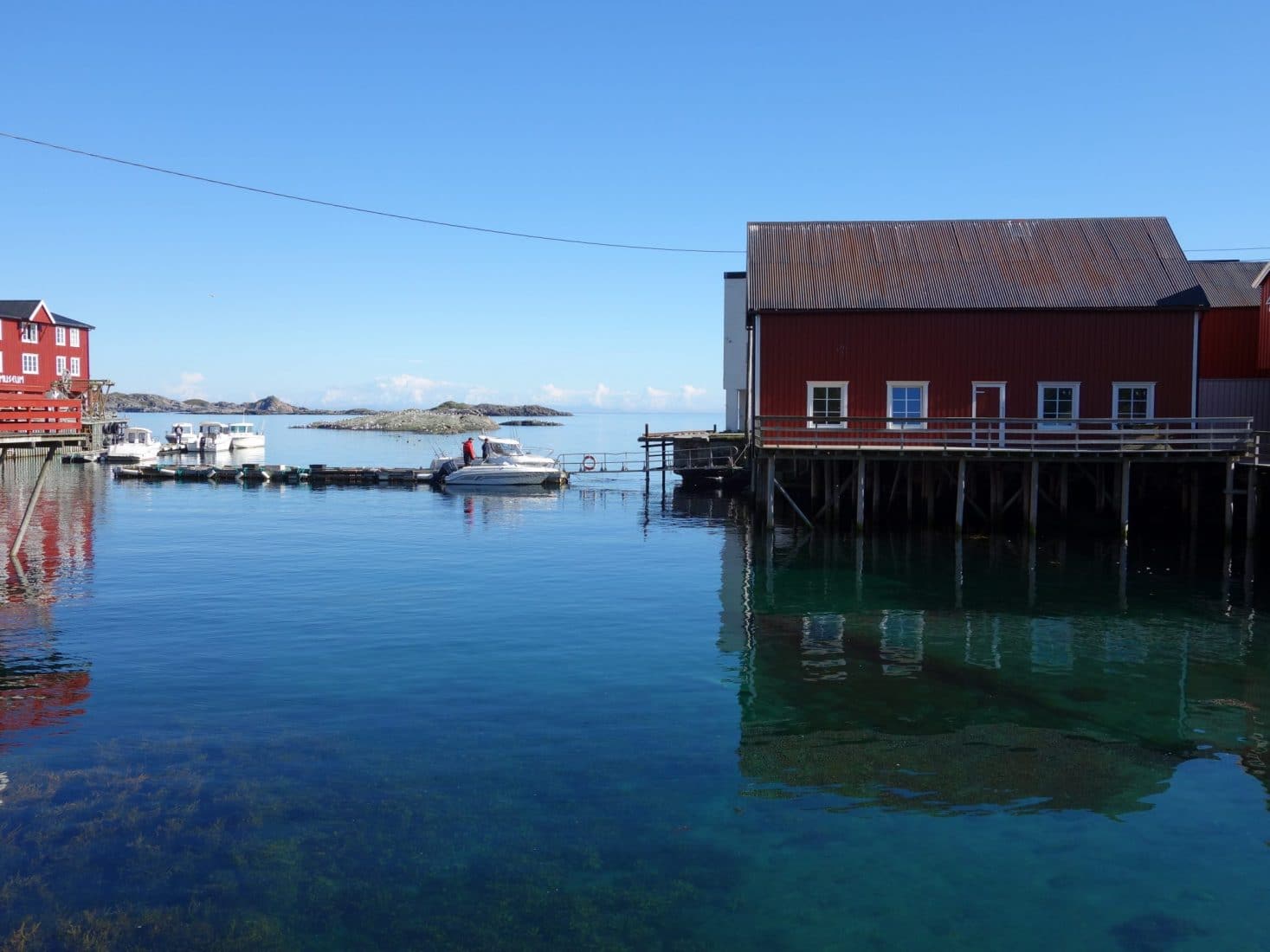
As we take the ferry tomorrow in Moskenes we choose to spend the night at the small campsite of “Moskesnes Camping As”. The place is ok but we can take a shower, do a little laundry and have a beer under the Lofoten sunset. The end of the afternoon and the evening will thus pass calmly. Tomorrow we leave the main islands of Lofoten in the direction of Vaeroy.
Days 11 & 12 : Vaeroy
Before we talked about Vaeroy as such, I wanted to explain why we were there. First, we hitchhiked with a couple who had spent a few “unforgettable” days on the small island, another couple who drove us originally from the Lofoten and had sold us Vaeroy as “special” in the good way; finally some photos and his isolation had finished persuading us to go there. We will see.
To reach the island, we start from Moskenes via the ferry which then reaches the mainland (via Røst). The crossing takes about one or two hours.
The arrival will be made in a cloudy weather on a concrete landing without charm… There are not many people who come down or not many people who get on the ferry … Let’s see in the village of Sørland.
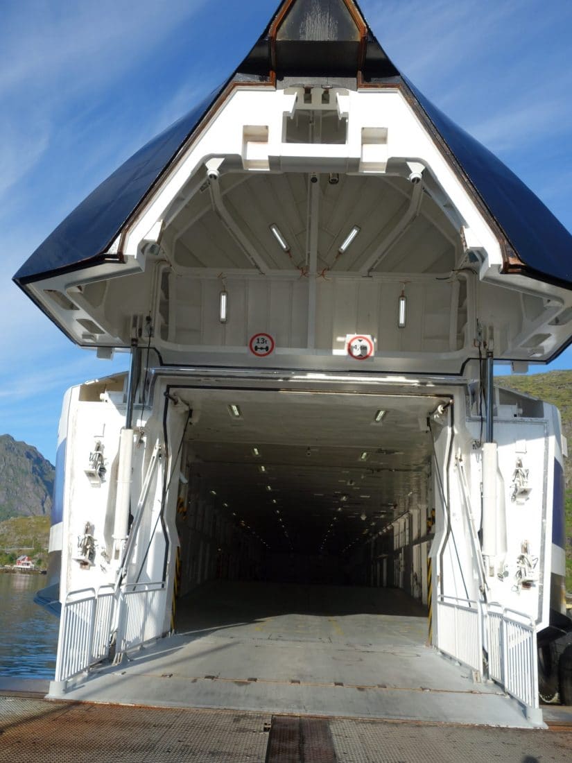
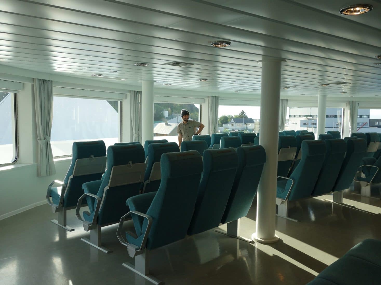
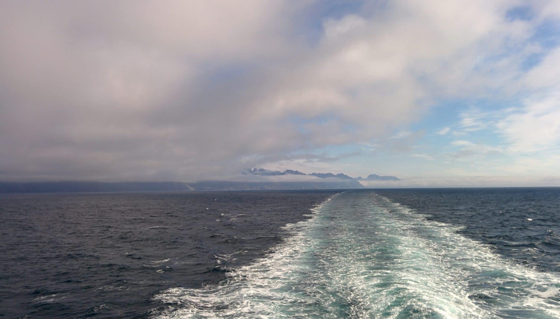
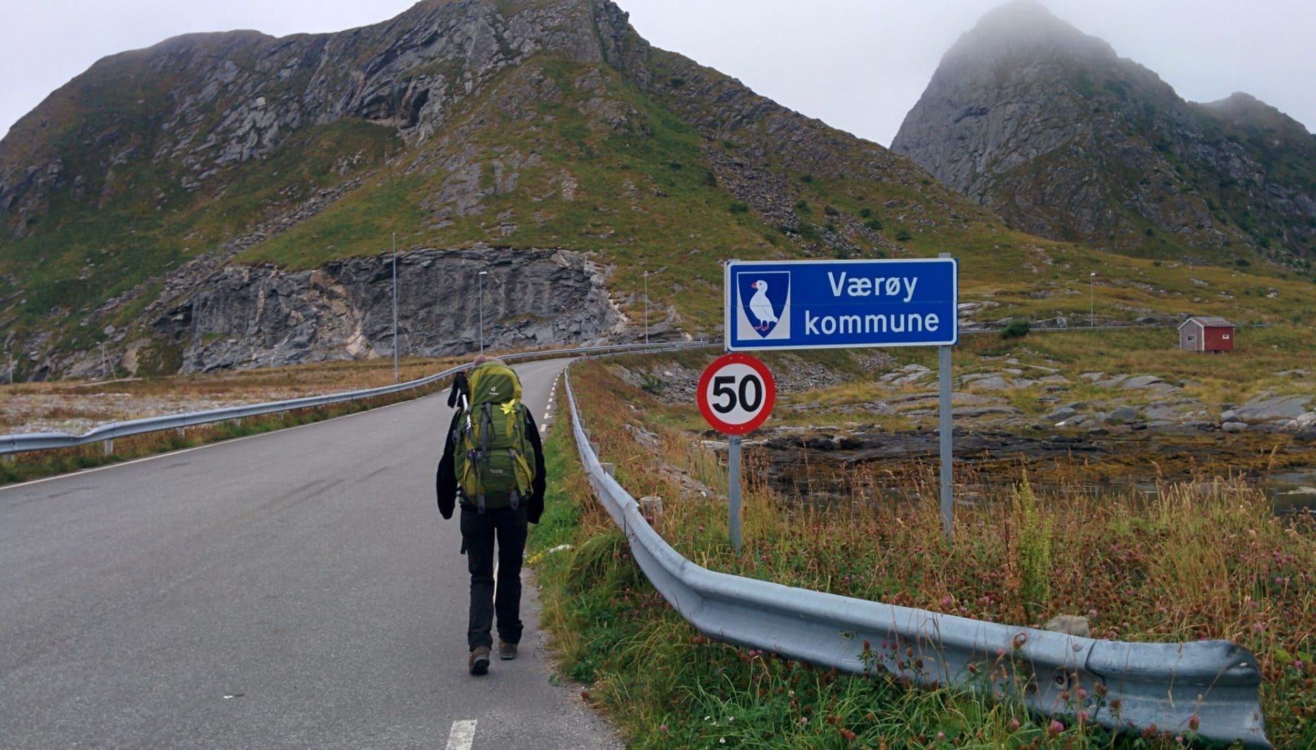
The road to Sørland is relatively sad and the village also … There is no one in the streets and the greyness does not help … We pause at the local shop to buy some groceries for this evening. I try to chat with locals so they give us nice places to stay but they do not speak very good English and also do not seem very motivated to help us …
We decide to reach the beach at the end of the road on the north coast not far from the disused aerodrome which hosts the “Midnight Sun Festival” during polar day.
The road passes through a small pass and then follows a coastline of little interest. The path is relatively long to the beach. We will get there after a local stopped to drive us there.
The beach is nice: in its back are large vertical cliffs on which the clouds form. The beach opens to the ocean with a nice view of the Lofoten. It’s still gray but it should change. On the beach and in the surrounding area there are traces of the festival in the form of pebble or wood sculptures, large wooden huts on the beach or a fake pirate ship stranded. The whole is nice and looks like a old pirate place.
We spend the evening strolling along the beach or on the road that runs along the coast to the west. The sun will return in the late afternoon so we warm up a bit and allow to dry the moisture of the day.
From our eleven days this day is the least sympathetic at the moment. We shall see tomorrow what Vaeroy has left us.
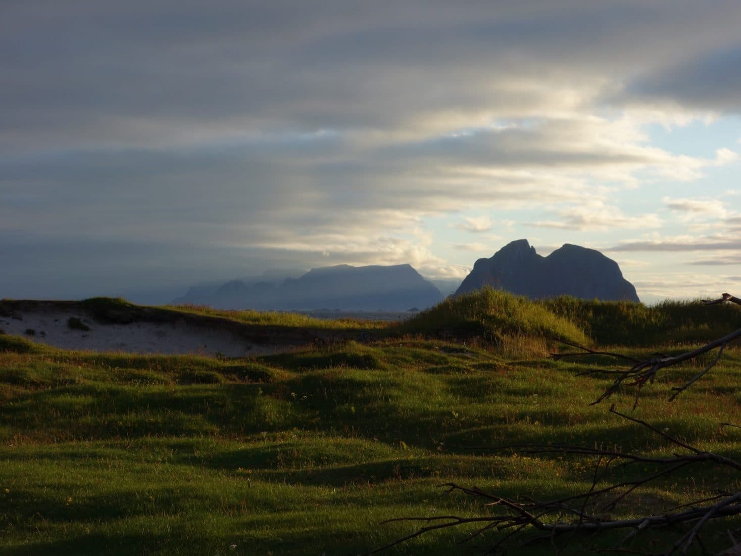
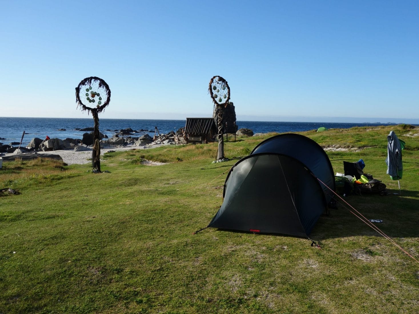
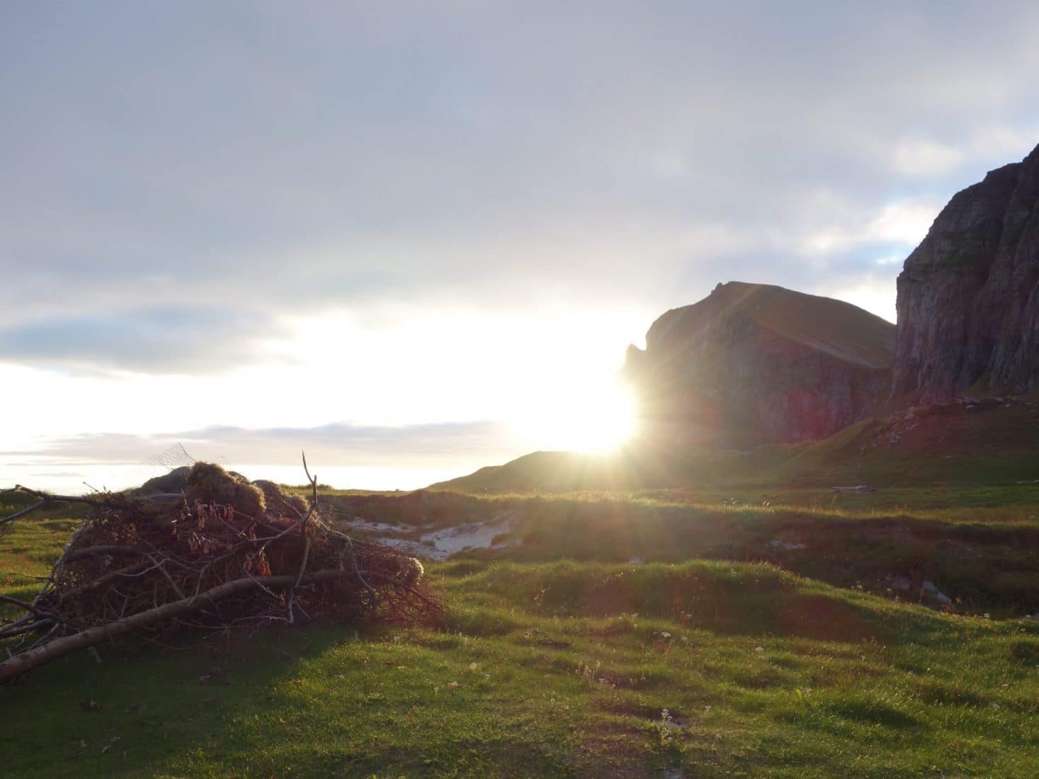
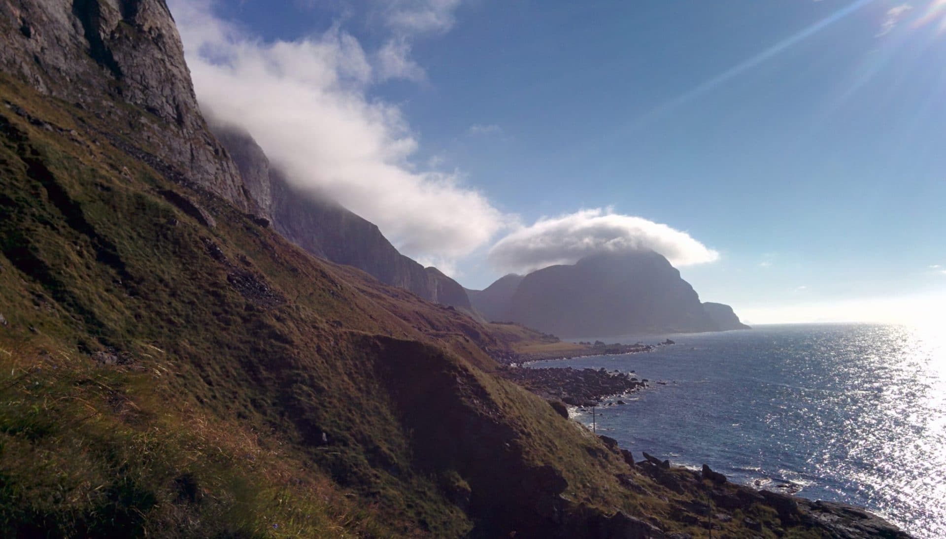
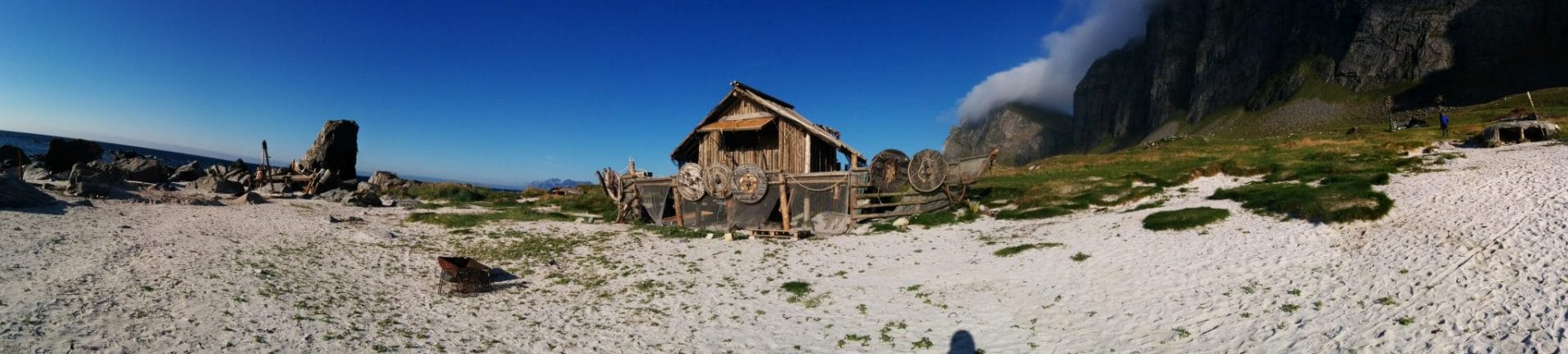
The next day we do not really have a plan. We wish to reach Sørland by cutting through a pass above the beach and going to see the famous sight of the horseshoe.
We pack all our equipment (for the last time) and attack the climb by the well visible path that leads to the pass. This one is steep but not complicated and offers a nice view as the area. From the top you can also see the small town of Sørland and the particular physiognomy of Vaeroy with its large plain surrounded by high cliffs.
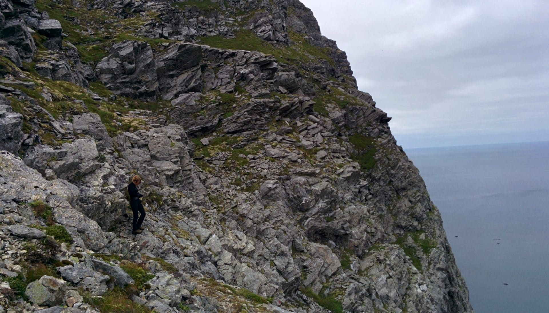
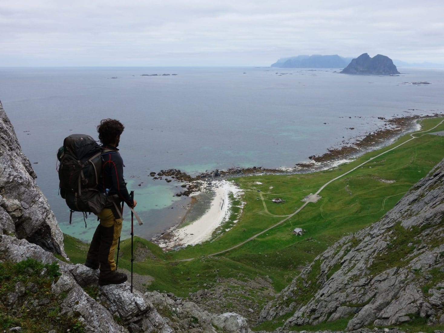
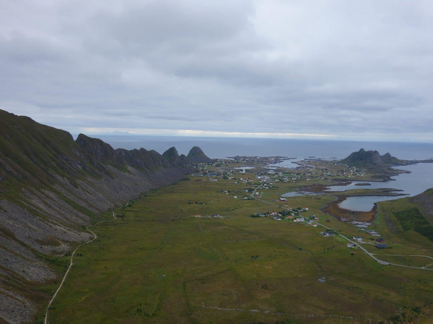
We then wanted to reach the point of view that we see everywhere and that allows to admire the horseshoe cliffs. Unfortunately we will be wrong thinking that the view was accessible from the radio station. In fact no, you have to fork to the left but we have not really seen any panels or even clear path. So big disappointment … this and the weather and the general atmosphere of the island is a bit depressing… So we decide to join the city and find a hotel. One of the few hotels on the island is in the harbor area and has no charm. We will have to wait for an hour that the receptionist arrives but “fortunately” we will be accompanied by two guys completely drunk and relatively freaking that we will not get rid of until we have the room!
A bad day !! Vaeroy is a huge disappointment… An impression of misery, lassitude is felt everywhere. Many people live here fishing and are unemployed … In any case we are truly disappointed by these two days … Of course this is just our experience and it could have be better with more sun and luck …
We will take the ferry at the first hour the next day.
Days 13 & 14 : Bodø and back home
The ferry between Vaeroy and Bodø takes about 5 hours and passes through Røst. Enjoying the view of the sea. Back in Bodø we join the Airbnb that we had booked with a Norwegian who lives here for 3 years. We will pick up our bags leaft at the check-in at the airport. The end of the day will mostly be marked by a big pizza at Bjørk in the city center.
For the return we will take two planes with a stopover in Oslo. It’s faster than the train … Bye bye Lofoten and Norway after these two busy weeks.
Conclusions
This trip have been for us one of the most beautiful we have ever done. Definitely in the TOP 3 of the most beautiful destinations. We had made Fjords ofNorway the previous year but the Lofoten Islands have nothing to do with the south of the country. These mountains with their feet in the water are truly unique, magnificent. We stayed there for fourteen days but felt as if we had not made half or a third of the possibilities offered by this extraordinary playground. On the plus side, there are not too many people and a lot of tourists stay along the main road so as soon as you walk away you are alone.
We had during this holiday an insolent chance with the weather: only three days of bad weather! It is extremely rare in these islands. In addition we have even had quite comfortable temperatures near the 20 ° C.
Aside from the landscapes and the weather we have also meet a lot of very nice people, in the spirit of “backpacker” which is nice to exchange, share.
I advise to 200% to visit of the Lofoten Islands and especially to take the time to explore them. One thing is for sure we’ll be back, I do not know when, but we’ll be back!
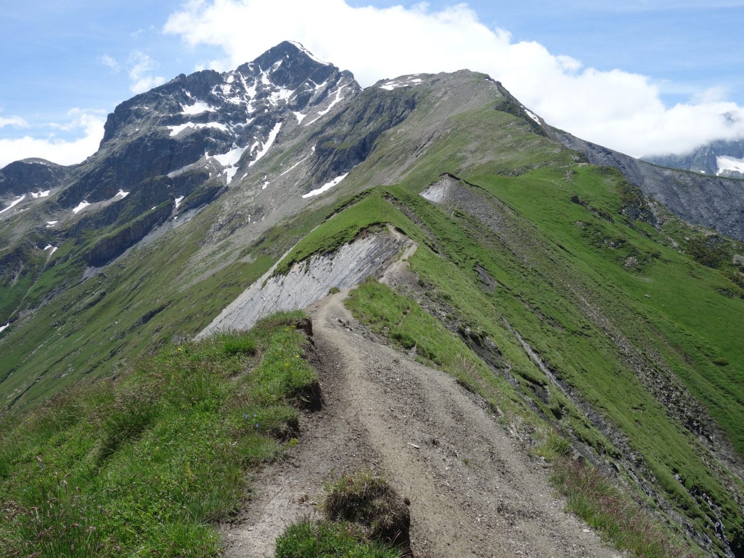
Between La Muzelle and Lauvitel
3days
hiking
18km
walked
1800m
D+
2lakes
We were looking for a hike of a few days with the possibility of bivouac and in particular near lakes. I already knew the Ecrins National Park and more particularly the Bérarde. I have wanted to go back for some time. It is therefore by searching in this massif that we found these two lakes: the Muzelle perched at 2105m overlooked by the Roche de la Muzelle (3465m) and the Lauvitel located at 1530m, surrounded by impressive walls. It was decided: we will spend a few days in autonomy between these lakes between June 18 and 22, 2015.
The Ecrins National Park is a French National Park located in the Alps near Grenoble and extending largely over the Massif des Ecrins. It was created in March 27, 1973.
Covering an area of 918km², the park culminates at the top of the Barre des Ecrins at 4102m.
For more information: http://www.ecrins-parcnational.fr/le-parc-national
First day - Ascent to Lac de la Muzelle (2105m)
We arrived the day before in the Massif des Ecrins. We spent the night at the charming Plan du Lac gîte between Vénosc and St Christophe en Oisans.
The ascent to Lake Muzelle is generally made from Bourd d’Arud following a portion of the GR54 (also find our Tour des Ecrins and Oisans along the GR54 – Link). We decided not to follow the usual path and past by the Cîme du Pied de Barry. This little-used path (we will meet absolutely no one until arriving at the Muzelle refuge) starts behind the Plan du Lac gîte, not far from the Pisse waterfall and climbs up to 2637m at Cime du Pied of Barry before going back down on the Muzelle. It offers superb views of the Ecrins and offers a passage over a pretty wide ridge which remains aerial.
We left the cottage without rushing around 8:45 am. The day starts very quickly because we meet a chamois right next to the waterfall. The weather is good and the forecasts are good. Everything comes together for a great day.
The hike begins directly on a steep slope which leads us to Lanchatra, a tiny hilltop village, little or not inhabited. Once above the village the slope remains steep but the view over the valley becomes clear. By cons we begin to be invaded by flies. This will remain a constant throughout this day and on the following (slightly attenuated): dozens of flies that turn around your head and a lot of horseflies …
This part of the path becomes even steeper, you have to use your hands a lot. The evolution is almost vertical because after almost one or two hours of walking you are still in sight of the lodging below. After a good elevation (600m?), The path begins to follow the ridge. We are in full alpine stage while in bloom in June.
Possible variant: a variant to consider is “climbing” the summit of the Bell (2328m)
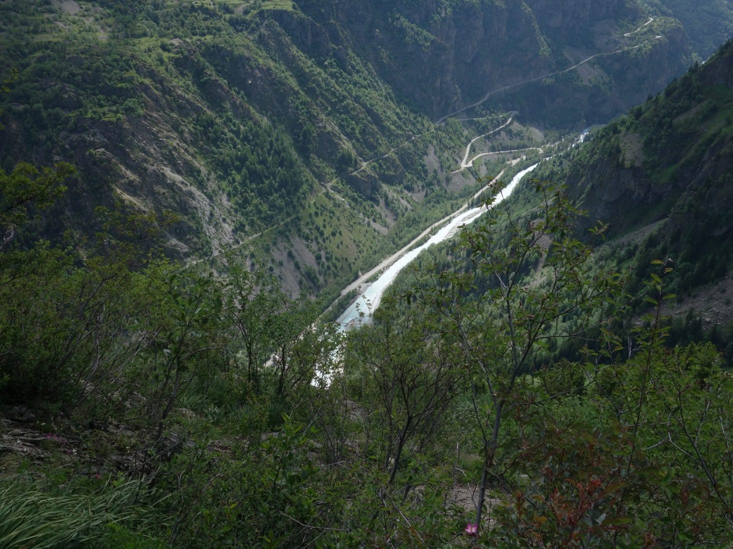
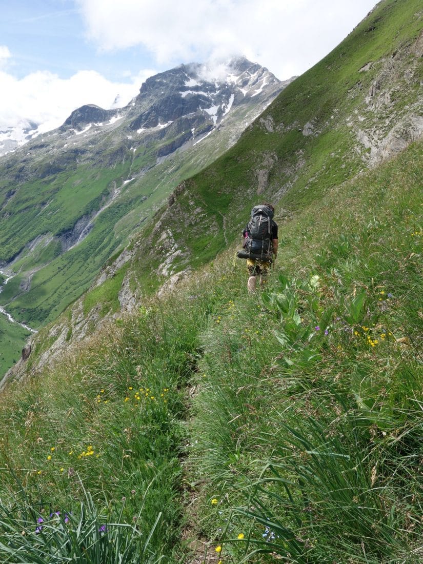
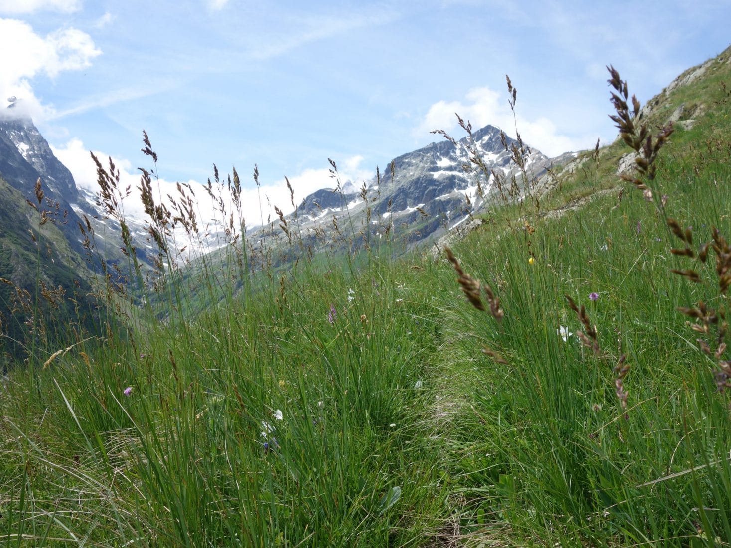
After the Col de la Clôche we land for lunch. Attacks by flies spoil the moment a bit and I get bitten by a horsefly … We leave in the direction of the famous ridge; it is a very beautiful passage which does not present a risk if you pay attention but which gives a beautiful aerial impression. We have already been leaving for 2-3 hours, we have and we will not meet anyone, we are in the heart of the Ecrins, … everything is fine.
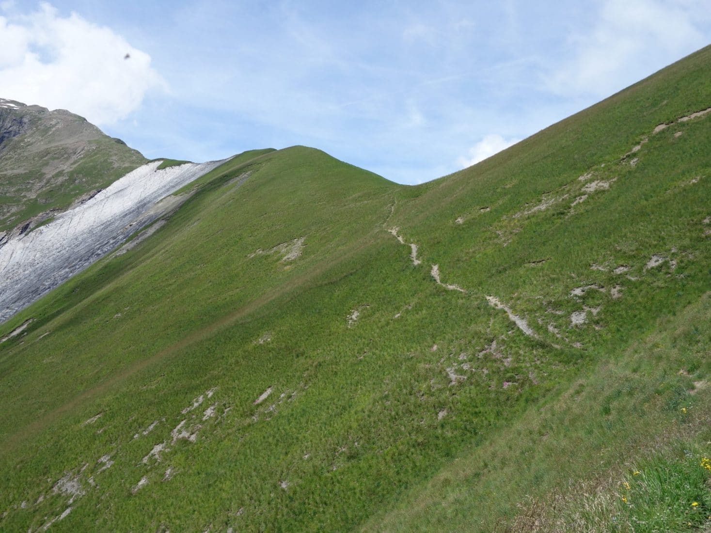
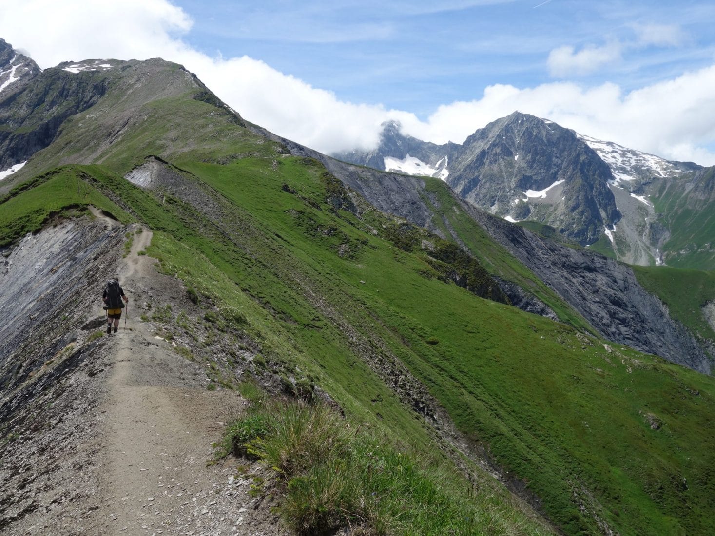
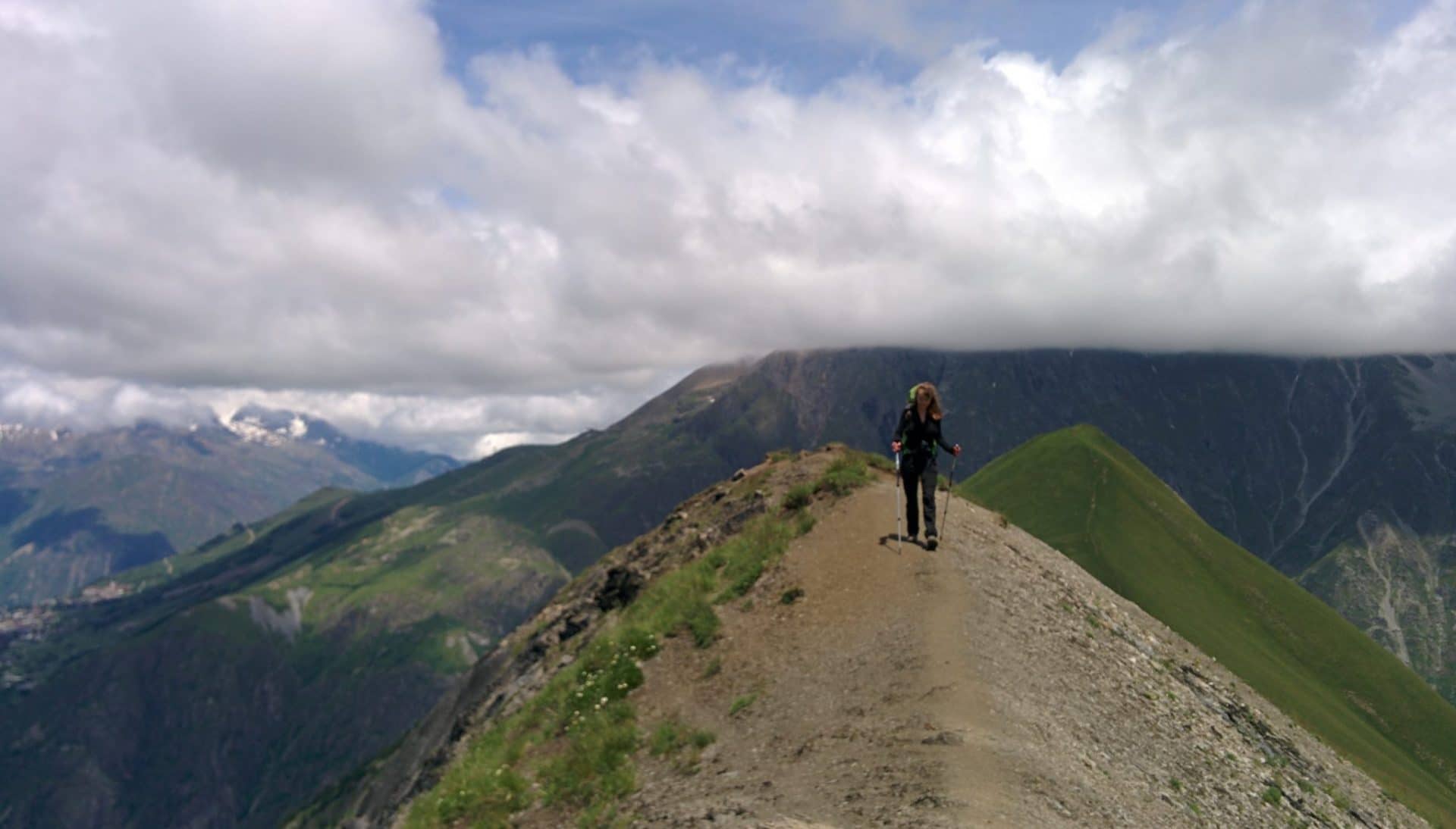
The climb resume again after this beautiful passage. We will meet a small flock of sheep grazing peacefully and happily for us not guarded by a dog. We finally arrive below the Cîme du Pied de Barry. The path almost disappears here and branches off to the right (towards the ONO) to attack a relatively steep descent with no visible trace. We will take advantage of the view just before this part by having a coffee (we had the Mocca …) facing the Massif.
The descent although tiring because it evolves in a fairly chaotic grassy terrain also offers us a spectacle of spring flowers and marmots. We join the path below, not far from what seems to be a ruin (an old sheepfold may be) to go to the refuge which is not very far away. On the way we pass not far from one of the last bogs of the Ecrins, extremely fragile environments. It is only there, after almost that we meet people and not just anyone: the refuge keeper and a person from the team who goes up to open for the weekend.
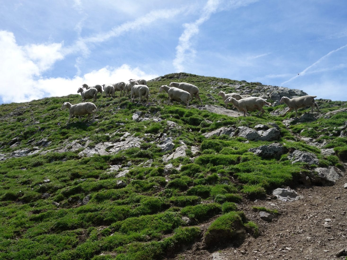
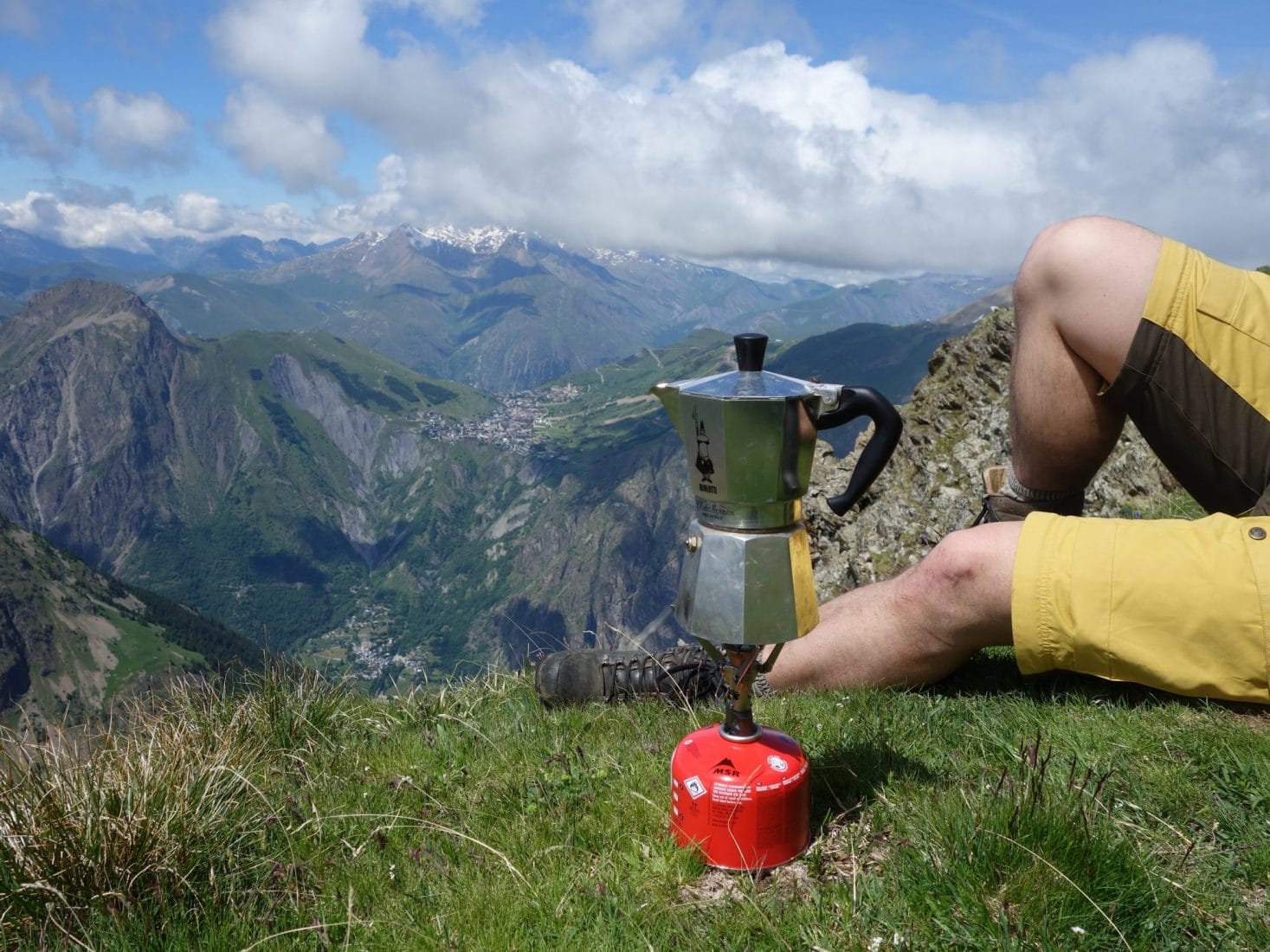
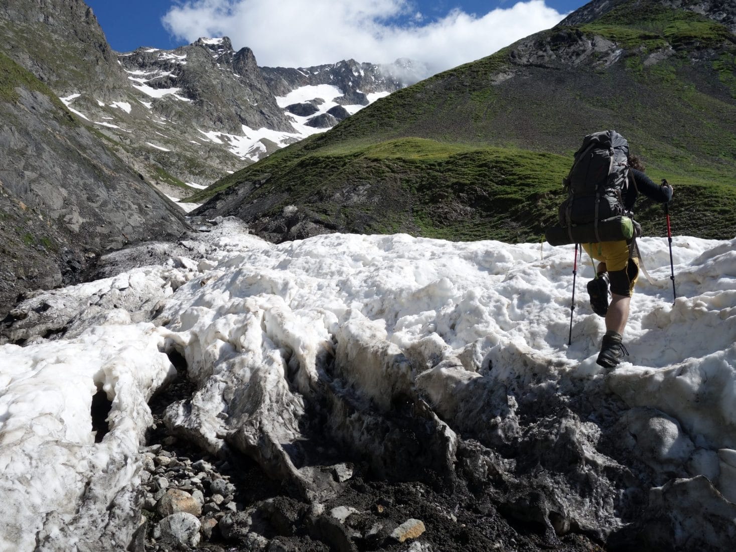
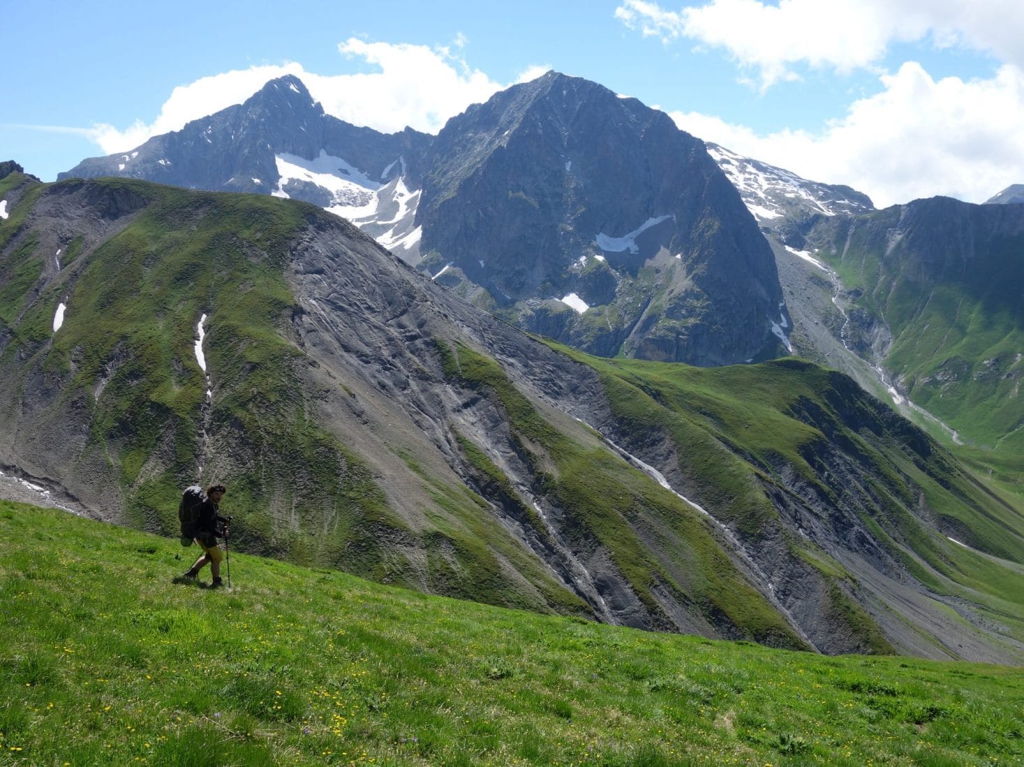
The arrival on the refuge and the lake of Muzelle is superb. The landscape reveals a large circus closed at the bottom by the impressive Col de la Muzelle. The Lake is nestled at the bottom of the depression. Since we are early in the season, many snow patches are present on the surrounding walls and are reflected on the surface of the lake. After a refreshing break at the refuge, taking advantage of the babysitter’s present, we will put the bivouac slightly above the lake near the spillway. The view is superb, the weather is nice and we will only have met the babysitter, her teammate and a guy who does the GR54 and with whom we will eat in the evening. We will not go to bed late after the 1500m of D + that we have just completed.
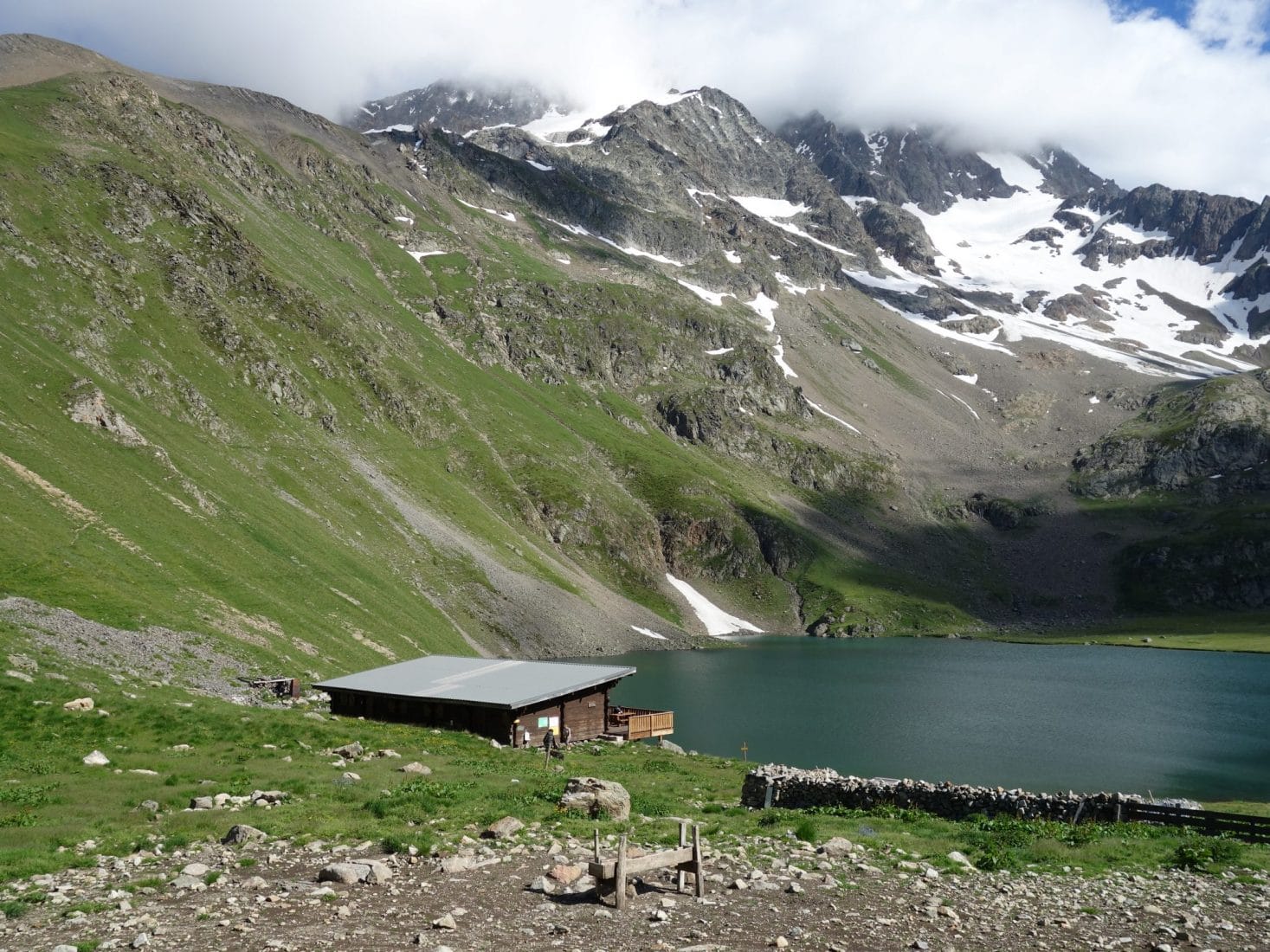
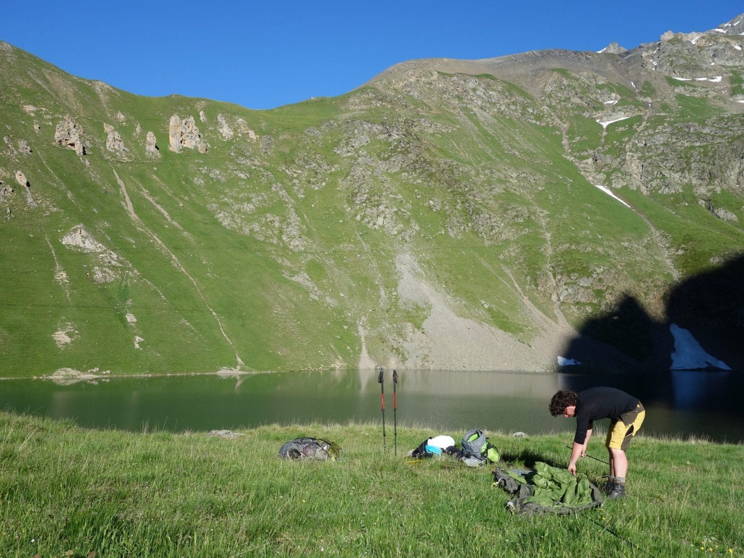
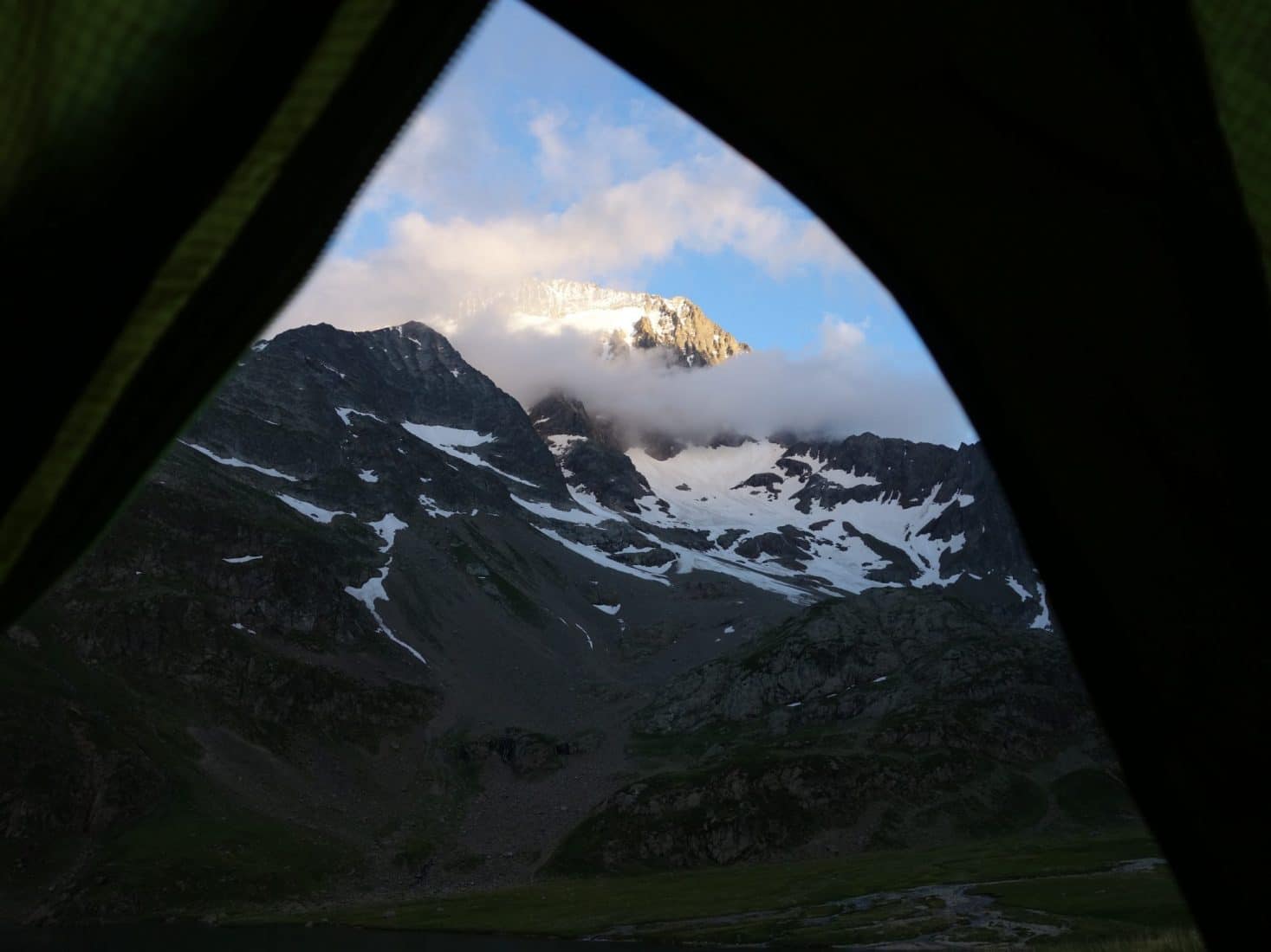
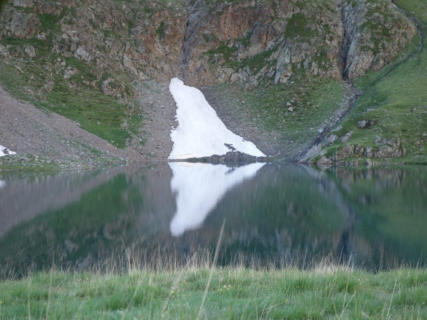
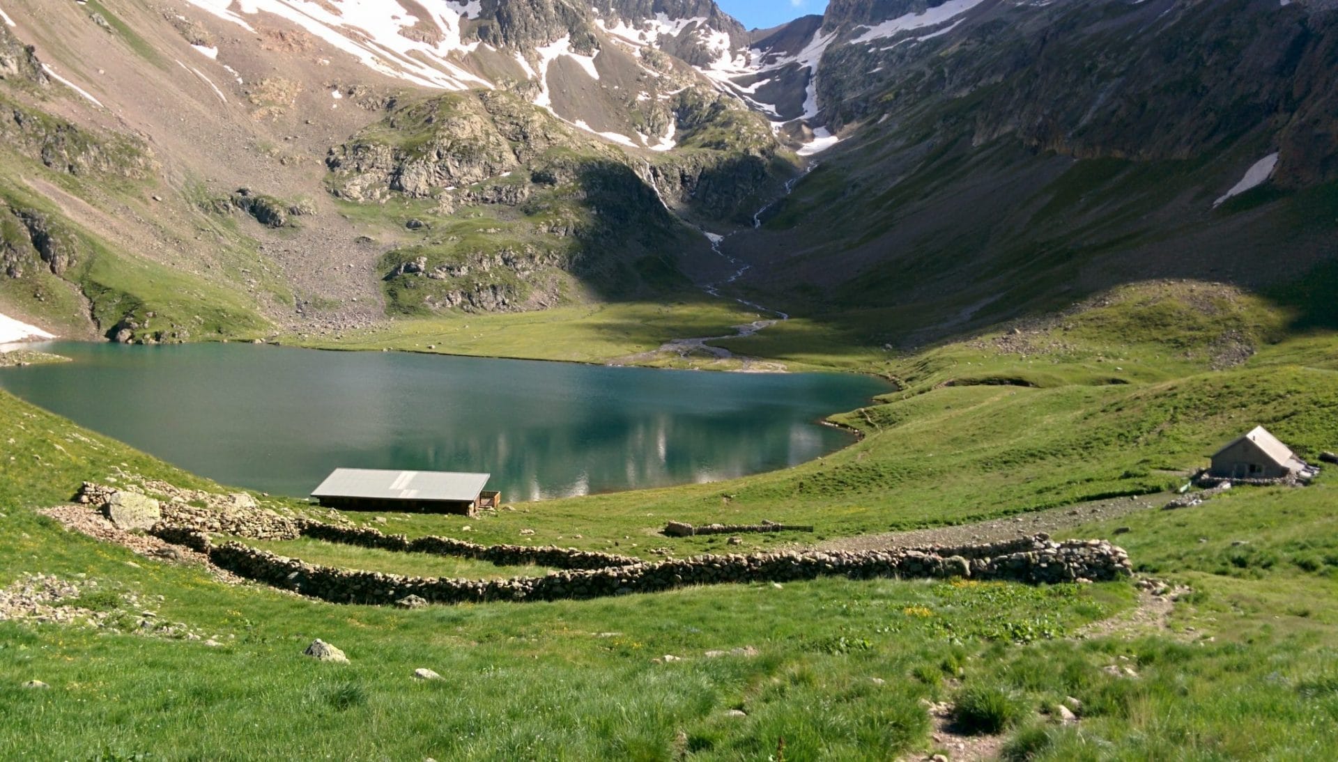
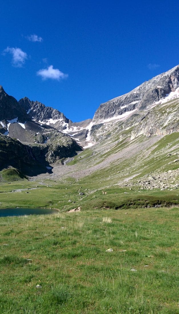
Day 2 - From Muzelle to Lauvitel
It was relatively cold last night since the tent was frozen in the morning but we slept well in our cozy sleeping bag. As the program of the day is not very busy we take our time in the morning while waiting for the sun to come warm the tent.
Breakfast will be quickly swallowed and we put the camp away before leaving in the direction of Lac du Lauvitel.
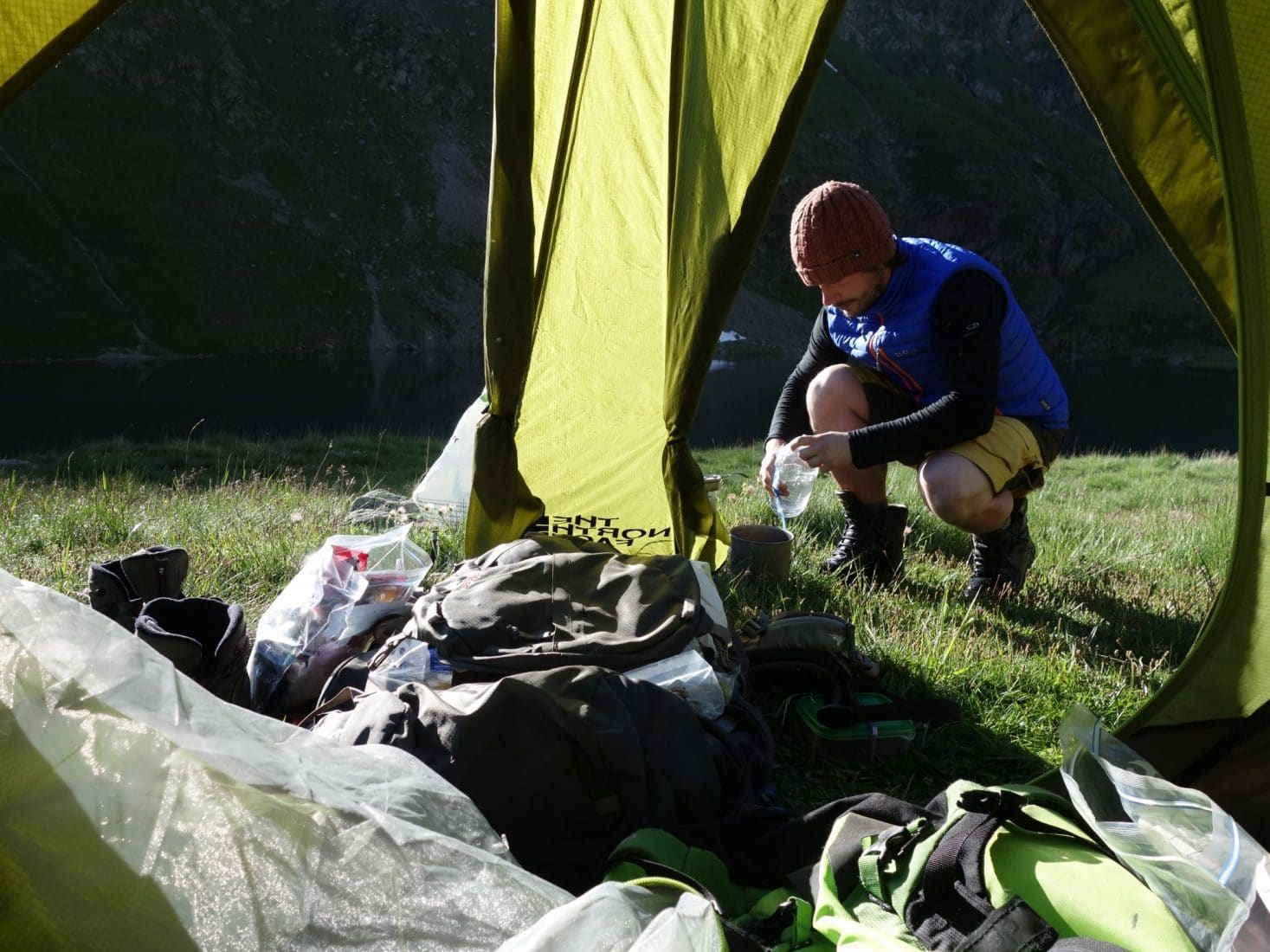
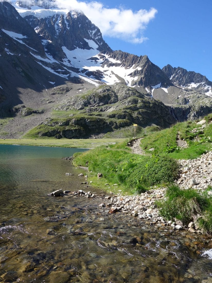
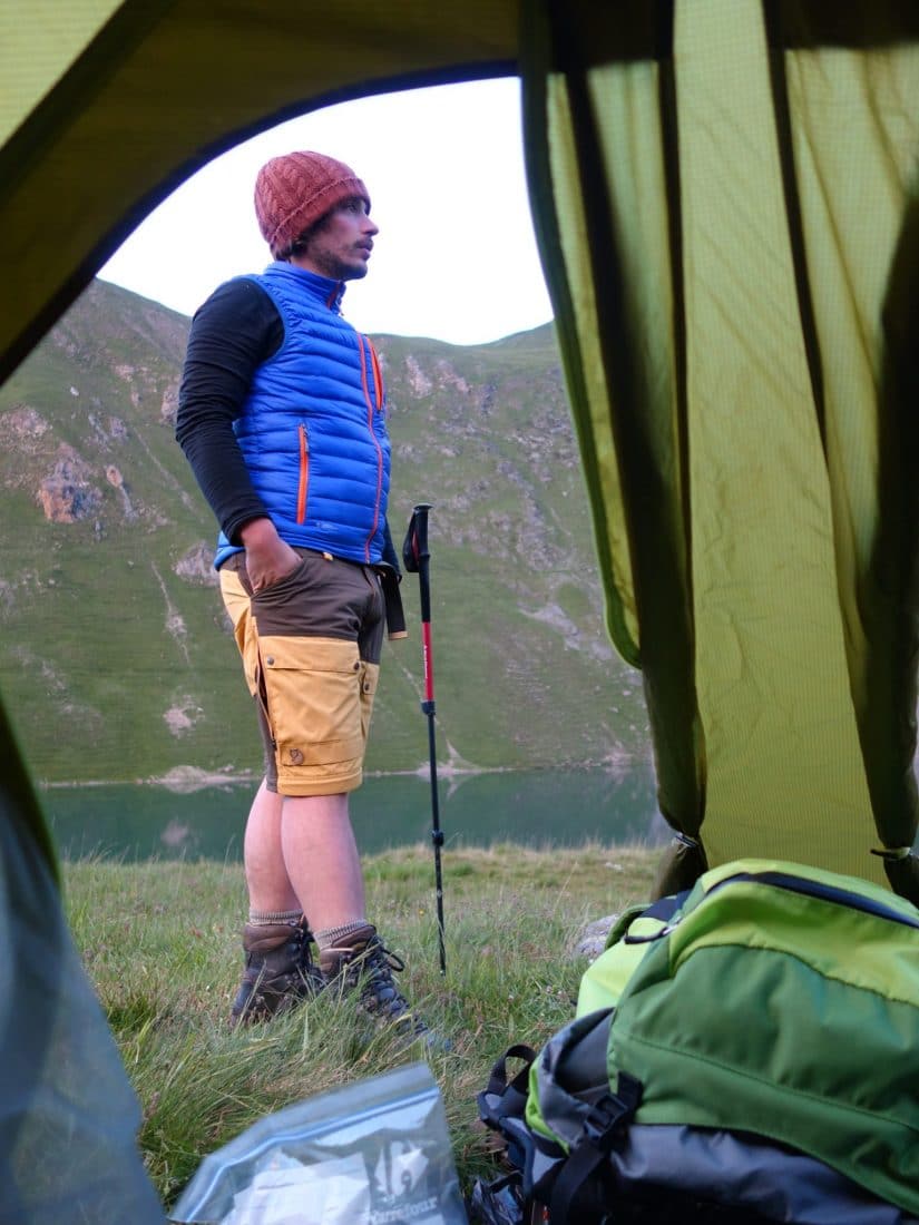
We will pass by the Col du Vallon (2540m) to reach the Lac du Lauvitel. But before that we stop 5min to find a Geocache placed under a rock not far from the path.
The ascent follows a path that zigzags up to the pass. The view is absolutely superb on the Lac de la Muzelle below. We are lucky because it is under a bright sun that we will still be walking today. The climb does not pose any particular difficulty, in particular thanks to the well-stepped path. Arrived at the pass we land for a bite to eat and above all to admire the landscape. An ibex even gives us the pleasure of passing right by while taking our time. There is nobody…
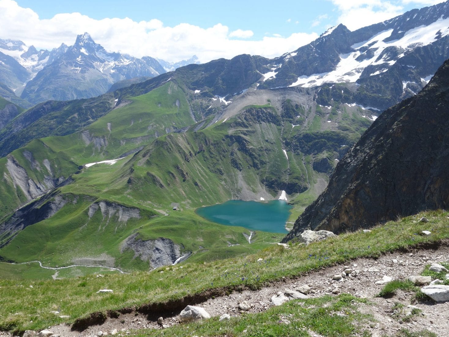
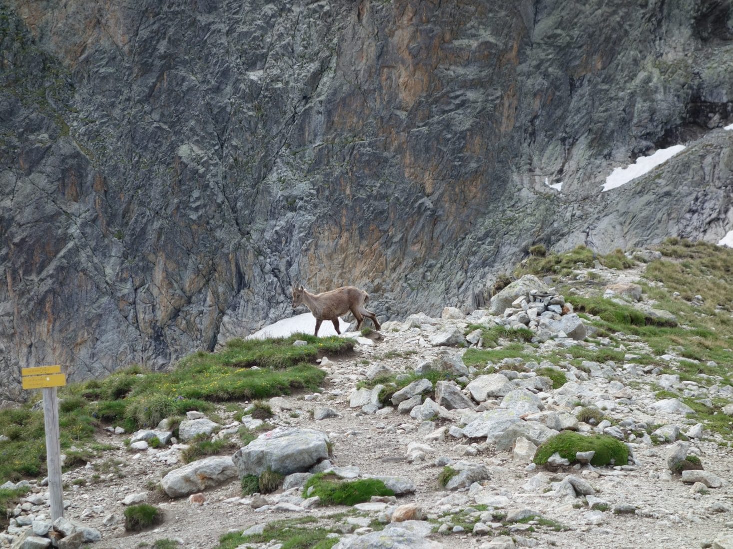
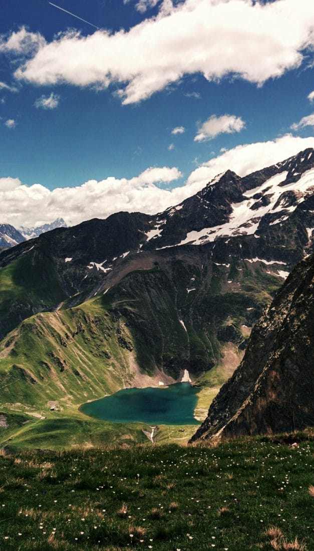
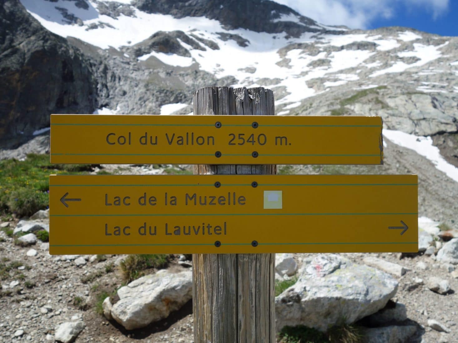
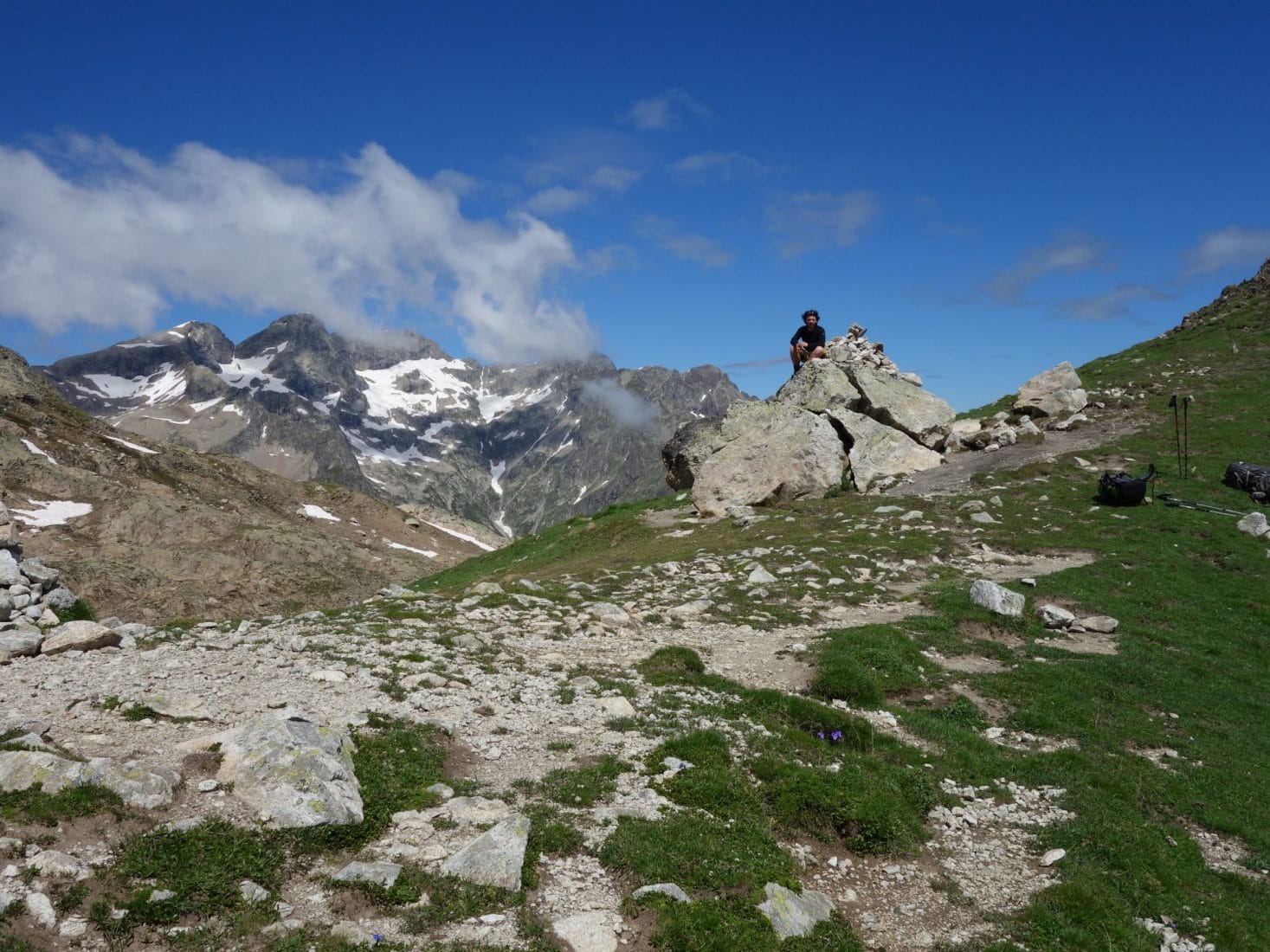
We begin, after this break, the long descent to Lake Lauvitel. More than 1000m of D-. Fortunately the path is good and the view is beautiful, it follows the Embernard stream for almost the entire descent. The Lake is quickly revealed below us and we see it approach gradually, slowly. The lower part of the trail passes through a freshly collapsed area. We had also postponed the stay because security works were underway in the previous weeks and the path was prohibited. But this day we pass without a hitch.
We finally arrive at the Lake. There are a few people because the way to go up there from the valley is simple and fast. There is a large expanse of grass with two tents already and a few chalets on the other side of the lake. The Lake is very beautiful, it is nestled between large cliffs except on the west side where it opens onto a valley which is an integral reserve. Only downside, an electric line that passes over the lake but which does not spoil the beauty of the place either.
We don’t want to be too close to the other campers, so we leave on the left towards a rocky chaos because we think we will find a site for the tent behind it if we believe the map. We actually find a space right next to the lake and back to the rock well hidden from other people who may be on the grassy part. We put up the tent quickly then we take advantage of the place and its serenity.
We will end the evening with a good hot meal and admire the sunset over the mountain.
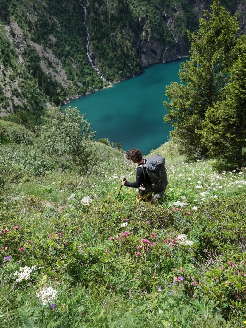
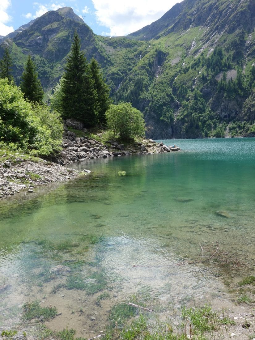
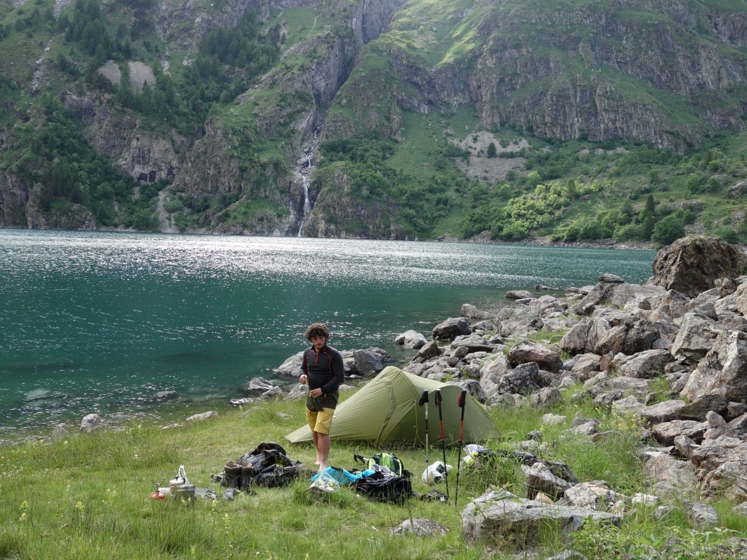
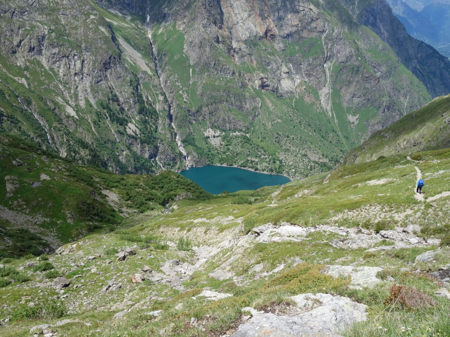
Day 3 - Descent and return
The night will have been good and less cold than the day before since we were much lower. The alarm clock is done in the shade but the place is still as beautiful. We have breakfast without rushing because the program of the day only involves going back down to La Danchère before returning to the Plan du Lac to take the car and go home.
The descent is nice, it follows the Selle stream which turns into the Lauvitel stream below. We meet a few people who are climbing.
Here we are, downstairs … After 2 big days upstairs, alone, the blocked view of the valleys is strange. In order to speed up the return (we have the road then to return) we decide to hitchhike. I don’t think there has ever been a more efficient stop, barely the thumb was lifted when two guys in a van stopped and dropped us off at the lodging for the first day.
This three-day getaway was a breath of fresh air. The Ecrins are magnificent and are less popular than other parts of the Alps. Nature is strong and present there. This tour is recommended for all those who want to discover the mountain and spend two nights in bivouac. We can facilitate it by going up to La Muzelle from Bourd d’Arud.
Some info:
- IGN map: IGN TOP 25 3336 ET (1 / 25000e)
- Muzelle refuge site: Link