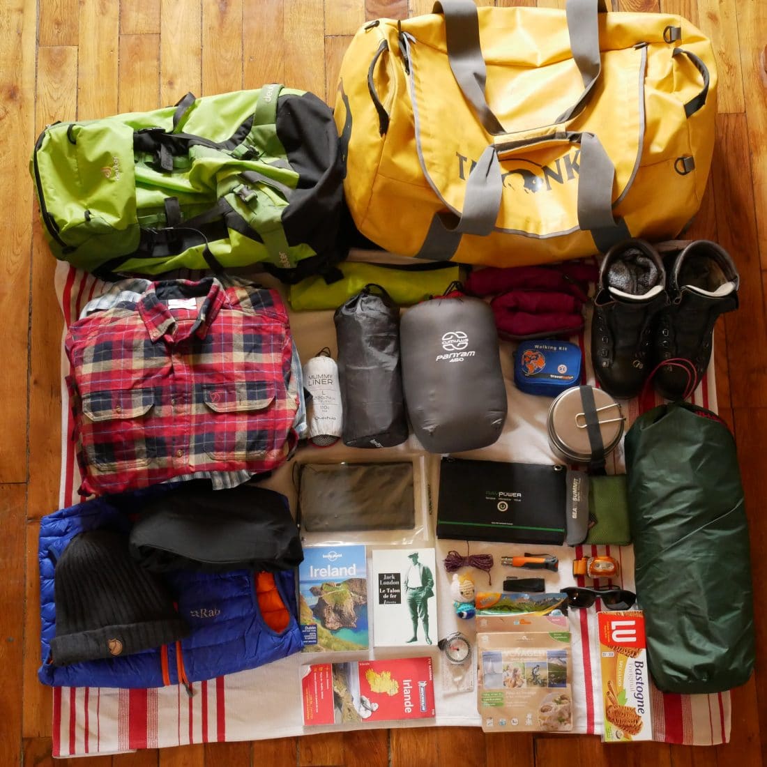
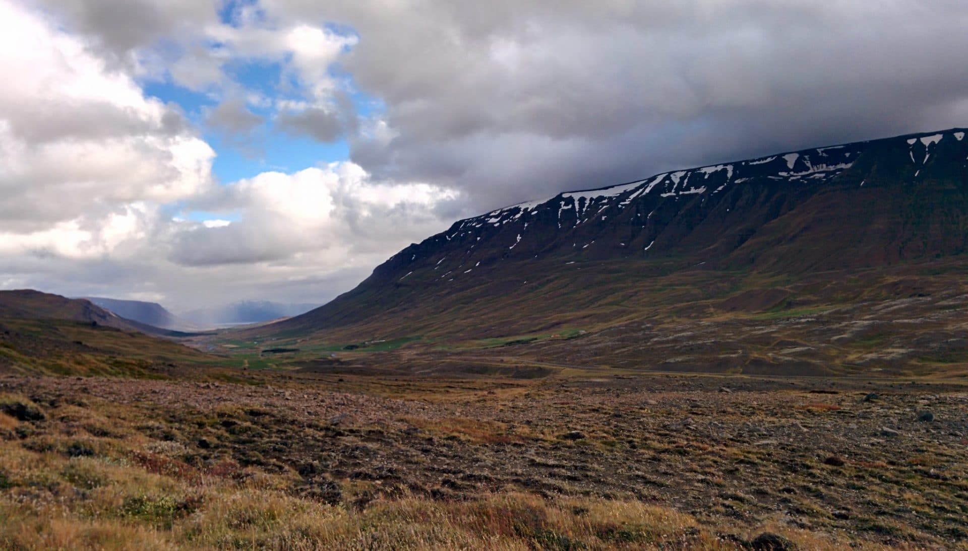
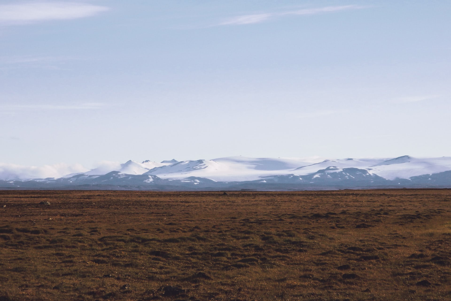
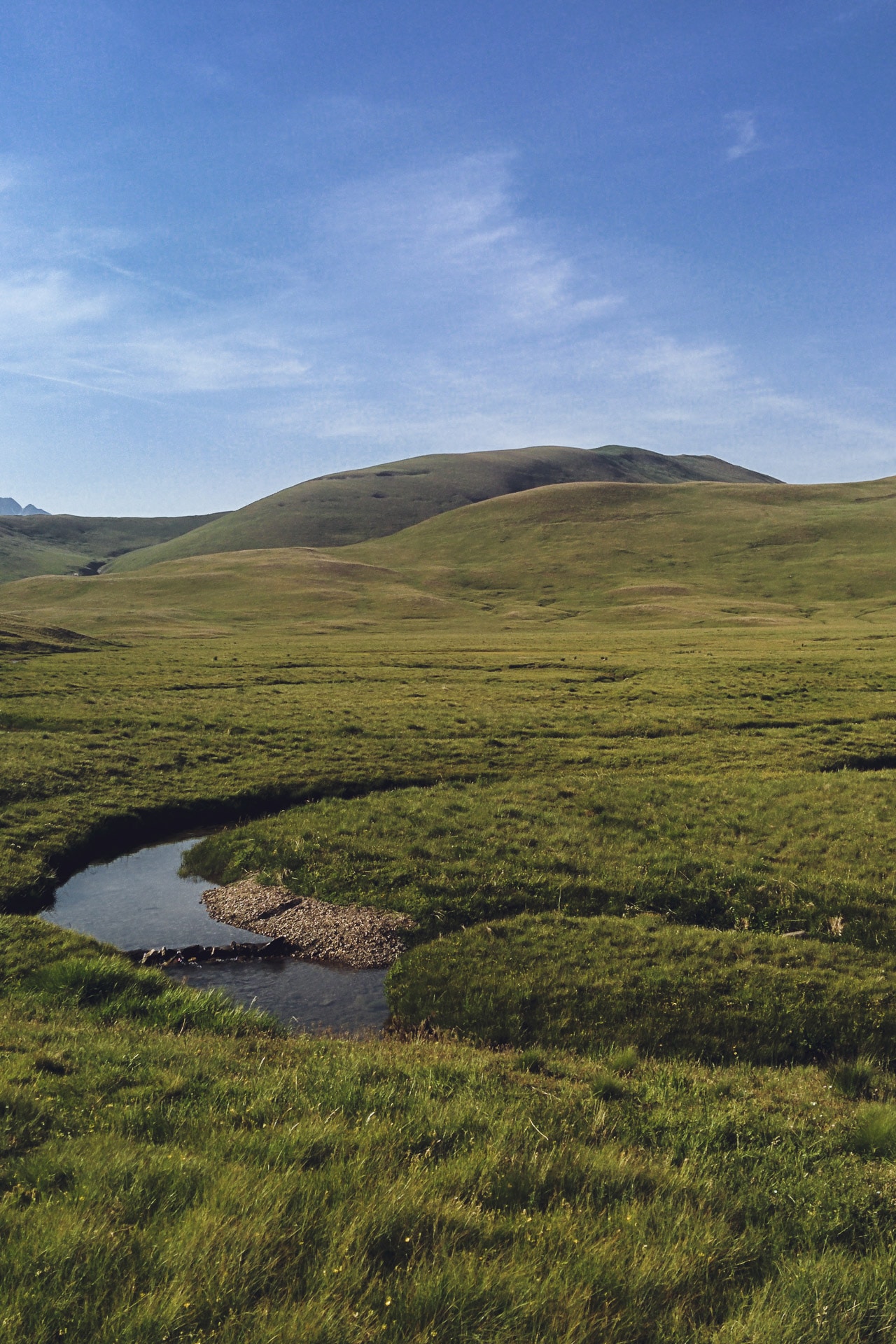
Equipment lists
One of the biggest questions to ask is: what should I take in my backpack? This will obviously depend on the season, the “commitment” of the hike, its duration. I therefore suggest here lists depending on the hike to help you in this choice. Again these lists will not necessarily reflect everyone’s opinion, some will take more, others less. The idea is above all to give a basis with which you will get away.
I do not give advice on the number of items to take with you, especially for clothes. Just keep in mind that clothes require a lot of space especially in autonomy so you must not be too greedy. For my part, my philosophy is to have a set that I wear and another in reserve (except the pants). I wash my clothes as soon as I can.
Try to travel as lightly as possible, you will gain comfort, speed, but also the ability to take more food and therefore leave longer, farther.
Do not hesitate to share your opinion, tips and advice!
Clothing - Plus d'infos
- Water and wind proof jacket : even in summer it can rain a lot or one can experience a thunderstorm. A rain protection is therefore mandatory. The jacket can be Gore-tex or just a K-way. Ponchos are a good solution to.
- Breathable top: It gets warm in summer and no one like to hike in a sweaty top. So choose breathable textile, it will also dry faster.
- Option - warm top: especially if you sleep in a shelter, it can get cold by night. Choose something light.
- Pants or short : of course it depend on your habits. For my part I chose a pant with removable legs. Choose breathable textile once again.
- Underwear : choose what you like but it should be soft and none irritating.
- Sock : Your socks are one of the main elements to pay special attention to because having blisters on both feet after 15min of walk spoils a little the day. In summer you need breathable socks that sweat away quickly. Wool (merino) is the best material for this in my opinion.
- Hat : Be careful with the sun! Wearing a cap or hat is more than advised in the summer.
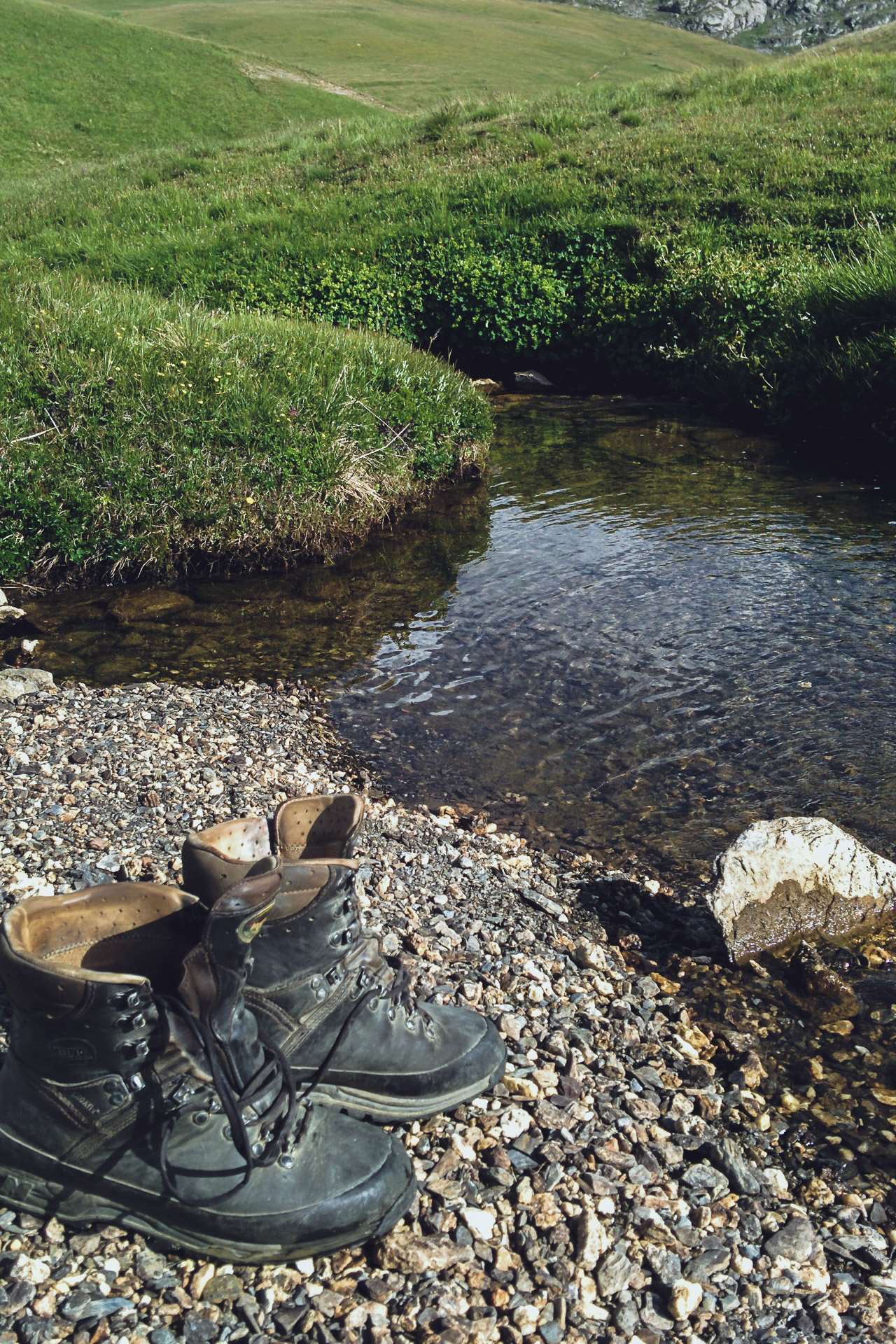
- Shoes: The most important choice. Your feet are your way to move so you have to take care of them and therefore choose suitable shoes. Whether they are high or low (according to the tastes of each one) they must breathe.
Equipment
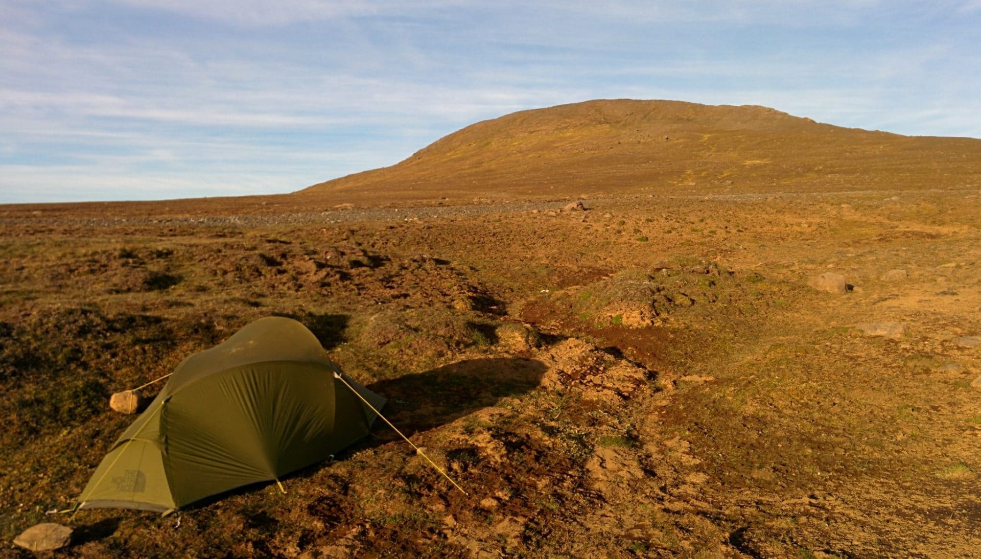
- Backpack : For a day do not exceed 35L (and still it is already a lot). Privileged bags with abdominal belt to relax your shoulders.
- Sunglasses : Very important especially in the mountains because UV are "more aggressive". Choose categories 3 or 4.
- Walking sticks : I am quite adept of the sticks even for a day hike but it really depends on everyone.
- Water supply : Take enough water for the day (or plan for refueling points). The water pocket (camel bags) allows to drink regularly without having to open its bag. For the gourd, I usually take a plastic bottle, it is light and solid.
- Liner : mandatory if you sleep in a shelter
- Orientation : Depending on your itinerary and your orientation skills, do not forget the map and the compass (even GPS but not necessarily useful for the day). However, it is only useful if you know how to use it. Fortunately the trails are very well indicated in general in France.
- Knife : a small knife is always convenient if only to cut the sausage from the lunch break.
- Headlamp : The headlamp does not take up space and can save you in case of serious delay on the schedule. It is also very useful at the shelter. The phone lamp can be handy too but you will have a busy hand and the battery holds less well ...
- Food : Do not forget the lunch snack and what to nibble during the hike.
Clothing
- Water and wind proof jacket : even in summer it can rain a lot or one can experience a thunderstorm. A rain protection is therefore mandatory. The jacket can be Gore-tex or just a K-way. Ponchos are a good solution to.
- Breathable top: It gets warm in summer and no one like to hike in a sweaty top. So choose breathable textile, it will also dry faster.
- Option - warm top: especially if you sleep in a shelter, it can get cold by night. Choose something light.
- Pants or short : of course it depend on your habits. For my part I chose a pant with removable legs. Choose breathable textile once again.
- Underwear : choose what you like but it should be soft and none irritating.
- Sock : Your socks are one of the main elements to pay special attention to because having blisters on both feet after 15min of walk spoils a little the day. In summer you need breathable socks that sweat away quickly. Wool (merino) is the best material for this in my opinion.
- Hat : Be careful with the sun! Wearing a cap or hat is more than advised in the summer.
- Shoes: The most important choice. Your feet are your way to move so you have to take care of them and therefore choose suitable shoes. Whether they are high or low (according to the tastes of each one) they must breathe.
- Gloves and cap : For certain treks especially in the mountains or in regions like Scandinavia, I systematically take gloves and caps for the evening or in case of sudden drop in temperatures; even in summer.
- Option - gaiters : The use of gaiters can be advised in wet and / or muddy terrain to protect the pants and to avoid the infiltration of water into the shoe.
Equipment
- Backpack : Its volume will depend on the duration of the trek and the "civilized" points encountered. In any case avoid large volumes to avoid filling them with useless items. I have a 65L which allows me to stand full autonomy 7 days alone (food included).
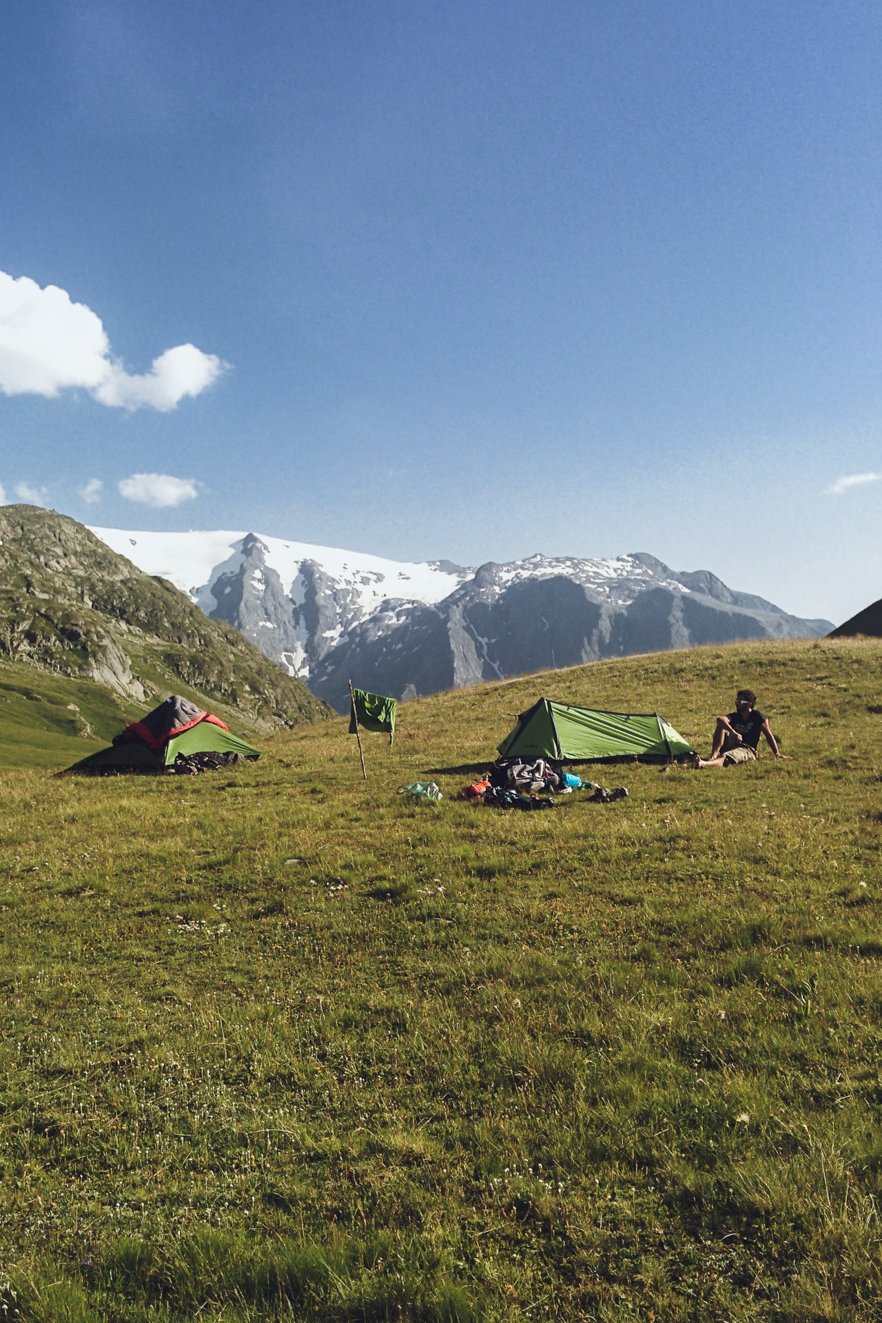
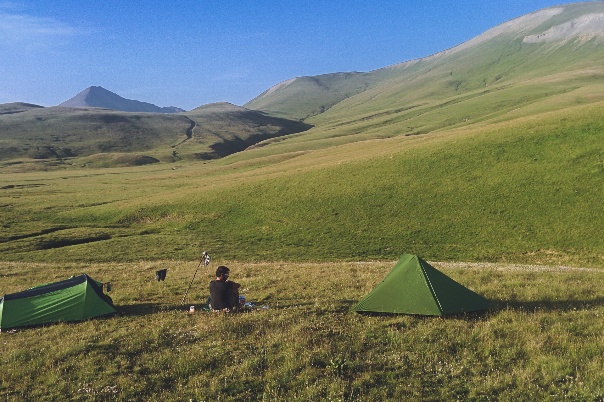
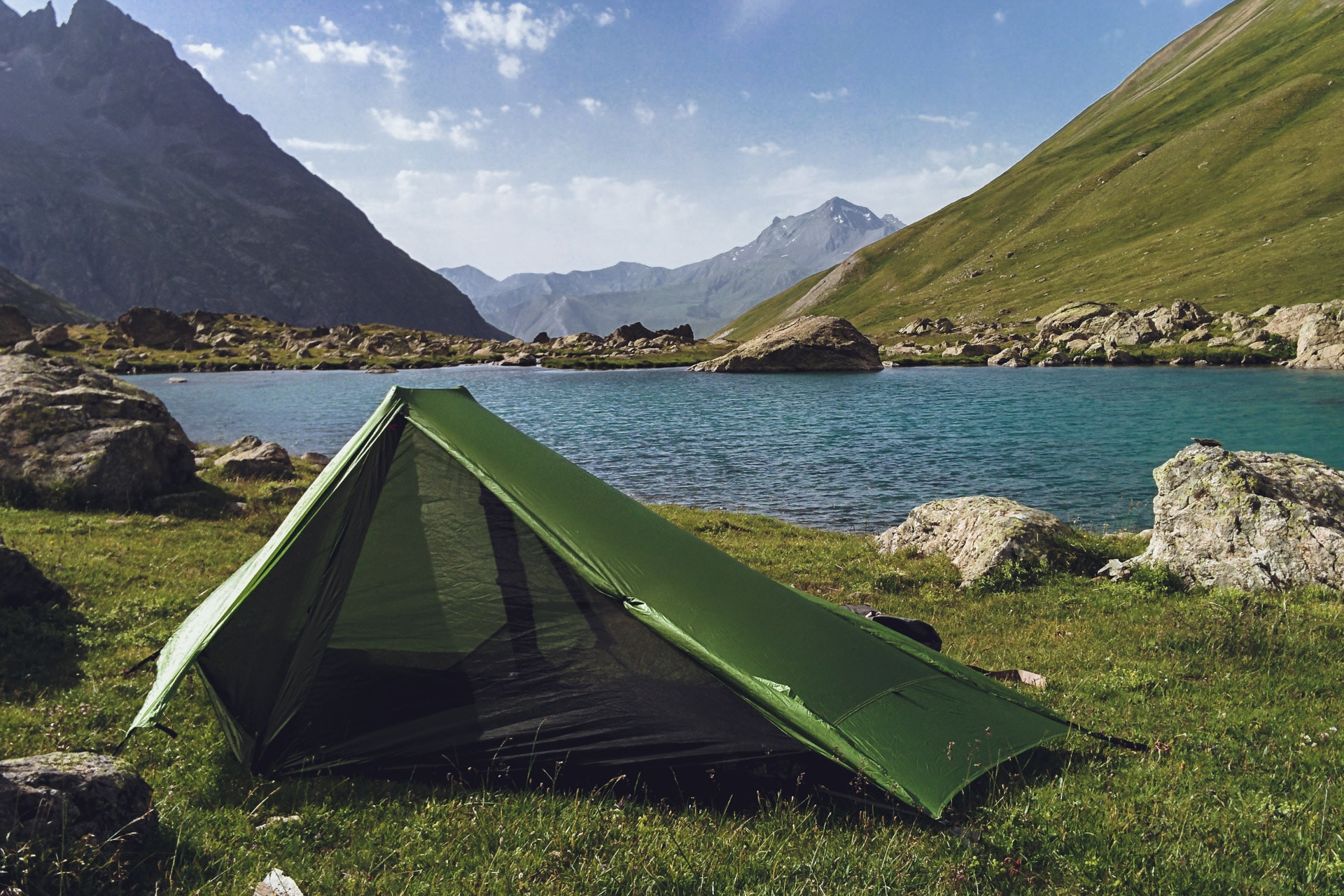
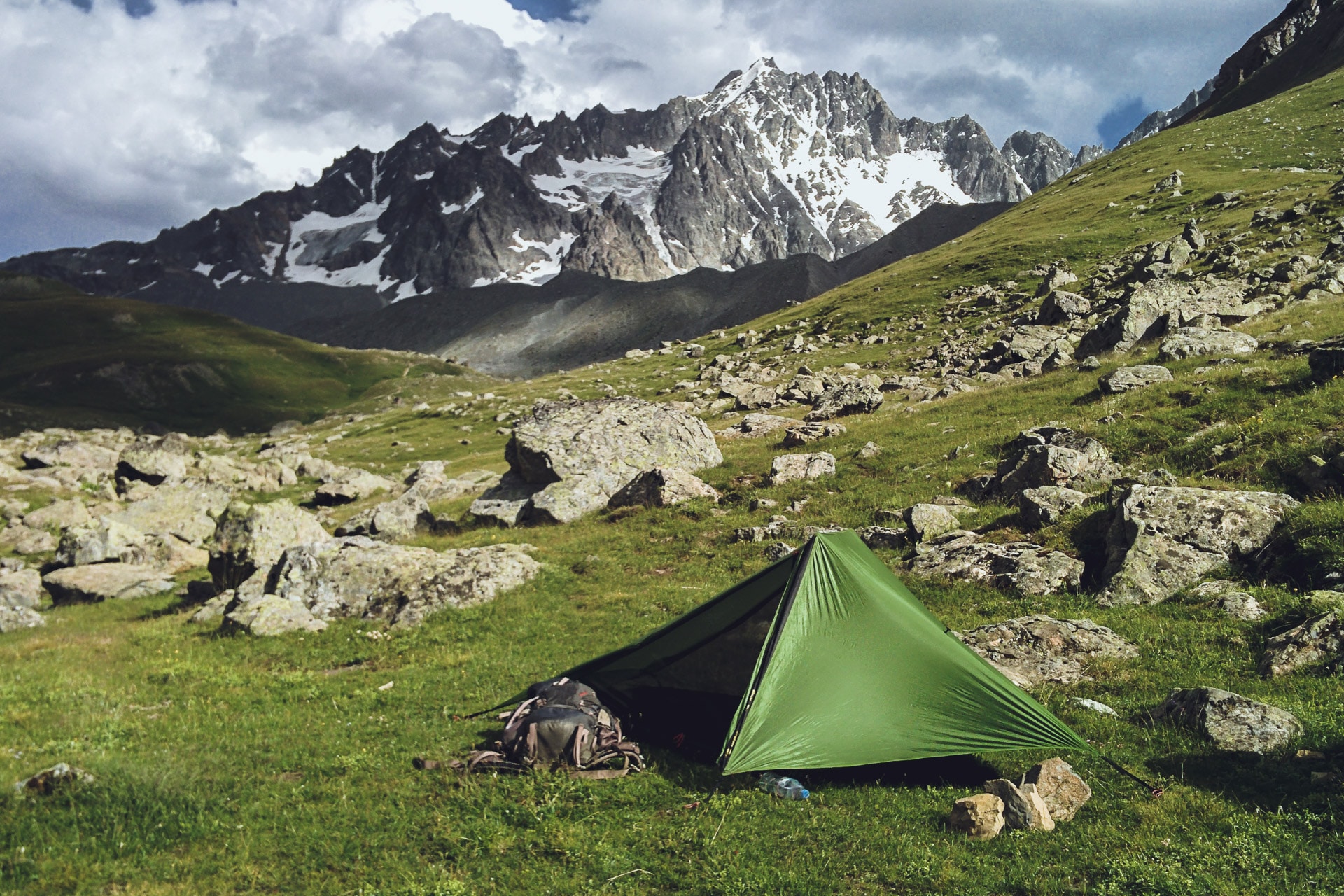
- Shelter : An extremely important element because it will be your "Home" for the duration of your trek. You have the choice between the tent, the tarp or even the over-bag for a beautiful starry night.
- Sleeping bag : Take with you the "good" bag, neither too hot nor too cold. In general I put my bag in a waterproof bag to have it always dry for the evening.
- Mattress: You have the choice between foam mattress, self-inflating or inflatable. The R-value is important to estimate the thermicity of the mattress (a R-value of 2.5 corresponds to a suitable mattress up to 0 ° C, the higher the R-value the more the mattress can be taken in the cold) .
- Option - Liner : Useful for not dirtying down too much.
- Stove: Gas, gasoline, alcohol or wood, there are different types, sizes and weights. Try it before leaving to not have bad surprises.
- Cooking stuffs: Depending on the number of people. Do not carry unnecessary utensils that will weigh heavily.
- Combustible : Suitable for your stove. Boil 1L of water at home before you leave and weigh the lost mass of the gas cartridge (for example) to estimate your need. For my part I go on 16g / L (with my stove and my cooking).
- Water supply : Allow about 2L of continuous water. The water pocket allows to drink regularly without having to open its bag. For the gourd, I usually take a plastic bottle all stupid, it is light and solid.
- Option - Micropur or filter : Provide pellets to decontaminate water or a filter. So you can drink water from virtually any stream. Just make sure the water you are drawing is clear and free of suspended particles.
- Orientation : Depending on your itinerary and orientation skills, do not forget the map and the compass to even see the GPS if you are traveling along an unmarked route. However, it is only useful if you know how to use it. Fortunately the trails are very well indicated in France, in general.
- Knife: A knife can be useful in many circumstances but a "Rambo" model is useless.
- Headlight : always useful on the evening or if you walk by night
- Sunglasses : Very important especially in the mountains because UV is "more aggressive". Choose categories 3 see 4.
- Walking Sticks : I am quite adept of the sticks especially if the bag is a bit heavy and there is a lot of uneven.
- Option - Solar Panel : If you leave away from any source of electricity for a long time, a small flexible solar panel can be useful to recharge phone, GPS or camera.
- Survival blanket : Very useful in case of problems but also to isolate the bottom of the tent (used as floor mats). Always have it in your bag.
- Kit "Bag end" : I often take a few small items such as a string (clothes rack or emergency laces), a sewing set (such as those found in hotels - very practical in case of tearing clothes), notebook, pen , ... little things that must be really useful and weigh nothing.
- Health kit : Go to the most useful : pills for headache or stomach. If there is an emergency : call the rescue !
- Towel : Small microfibre towel, for the bath, the toilet or to mop the tent for example.
- Food : To adapt according to the duration, the effort, ..
Clothing
- Waterproof jacket : Essential to protect oneself from external elements. The gore-tex is a good solution not to be soaked with sweat.
- Breathable top : It is necessary to avoid being wet in order not to be cold. A warm and breathable top is essential.
- Warm top : Privilege the polar during the effort and the down jacket in the evening if the temperatures are not too extreme otherwise to take down jackets adapted to the temperature.
- Pants : Choose a waterproof pant, preferably not to be wet by snow. I am not fan of polar lined pants, I prefer to add a tight underneath;
- Underwear : this will depend on you ... Especially favor the materials that do not irritate!
- Socks : Your socks are one of the main items to pay special attention to because a lot of the heat is lost by the feet and you have to keep them healthy. Choose merino socks adapted to the temperatures encountered.
- Cap or chapka: The majority of heat loss occurs through the head. It is therefore necessary to protect oneself effectively especially in the evening at the camp. So choose a warm hat or even a down filled chapka in extreme cold.
- Shoes : The most important choice. Your feet are your way to move so take care and keep them warm. Whatever they are they must breathe.
- Gloves : The centerpiece of the winter wardrobe if you do not want to lose finger tips. Take waterproof and windproof gloves appropriate to the temperature conditions encountered.
- Balaclava : In case of extreme cold or strong wind the use of a neck strap or even better a hood really helps to protect the face. The nose and cheeks tend to freeze, be careful!
Equipment
- Snow shoes or ski : To choose according to your preferences or your ability. Prefer the robust one and easy to repair.
- Backpack: Its volume will depend on the duration of the trek and the meeting points encountered. In any case avoid large volumes because they will quickly fill them with useless things. For my part I have a 65L which allows me to stand full autonomy 7 days alone (food included). However in winter the necessary material may need to use a:
- Pulka : On snow and in case of large volume transported, the pulka can be interesting because it allows to release the back of a heavy load.
- Shelter : This is an extremely important element because it will be your "Home" for the duration of your roaming especially in winter in case of a snow storm. Prefer a 4 seasons tent provided for this purpose. Do not hesitate to take one size bigger and a large apse for comfort.
- Sleeping bag : Take with you the "good" bag, that is to say adapted to the winter temperatures. In general I put my bag in a waterproof bag to have it always dry for the evening.
- Mattress : You have the choice between foam mattress, self-inflating or inflatable. The R-value is important to estimate the thermicity of the mattress (a R-value of 2.5 corresponds to a suitable mattress up to 0 ° C, the higher the R-value the more the mattress can be taken in the cold) .
- Option - Liner : Useful for not dirtying down too much.
- Stove: Gas, gasoline, alcohol or wood, there are different types, sizes and weights. Try it before leaving to not have bad surprises.
- Cooking stuffs: Depending on the number of people. Do not carry unnecessary utensils that will weigh heavily.
- Combustible : Suitable for your stove. Boil 1L of water at home before you leave and weigh the lost mass of the gas cartridge (for example) to estimate your need. For my part I go on 16g / L (with my stove and my cooking).
- Water supply : Allow about 2L of continuous water. The water pocket allows to drink regularly without having to open its bag. For the gourd, I usually take a plastic bottle all stupid, it is light and solid.
- Option - Micropur or filter : Provide pellets to decontaminate water or a filter. So you can drink water from virtually any stream. Just make sure the water you are drawing is clear and free of suspended particles.
- Orientation : Depending on your itinerary and orientation skills, do not forget the map and the compass to even see the GPS if you are traveling along an unmarked route. However, it is only useful if you know how to use it. Fortunately the trails are very well indicated in France, in general.
- Knife: A knife can be useful in many circumstances but a "Rambo" model is useless.
- Snow Shovel : Always practical. Do not choose a plastic but metal shovel.
- Headlight : Good in the evening in camp or if you walk sooner or later especially that the nights are long and the short days in winter.
- Sunglasses : Very important when everything is in snow. Choose categories 3 see 4.
- Ski Mask : More suitable than glasses in case of wind or storm. Choose one that breathes well.
- Option - Solar Panel : If you leave away from any source of electricity for a long time, a small flexible solar panel can be useful to recharge phone, GPS or camera. The advantage of this solution, however, is that of taking out replacement batteries or batteries.
- Survival blanket : Very useful in case of problems but also to isolate the bottom of the tent (used as floor mats). Always have it in your bag.
- Kit "Bag end" : I often take a few small items such as a string (clothes rack or emergency laces), a sewing set (such as those found in hotels - very practical in case of tearing clothes), notebook, pen , ... little things that must be really useful and weigh nothing.
- Health kit : Go to the most useful : pills for headache or stomach. If there is an emergency : call the rescue !
- Towel : Small microfibre towel, for the bath, the toilet or to mop the tent for example.
- Food : To adapt according to the duration, the effort, ...
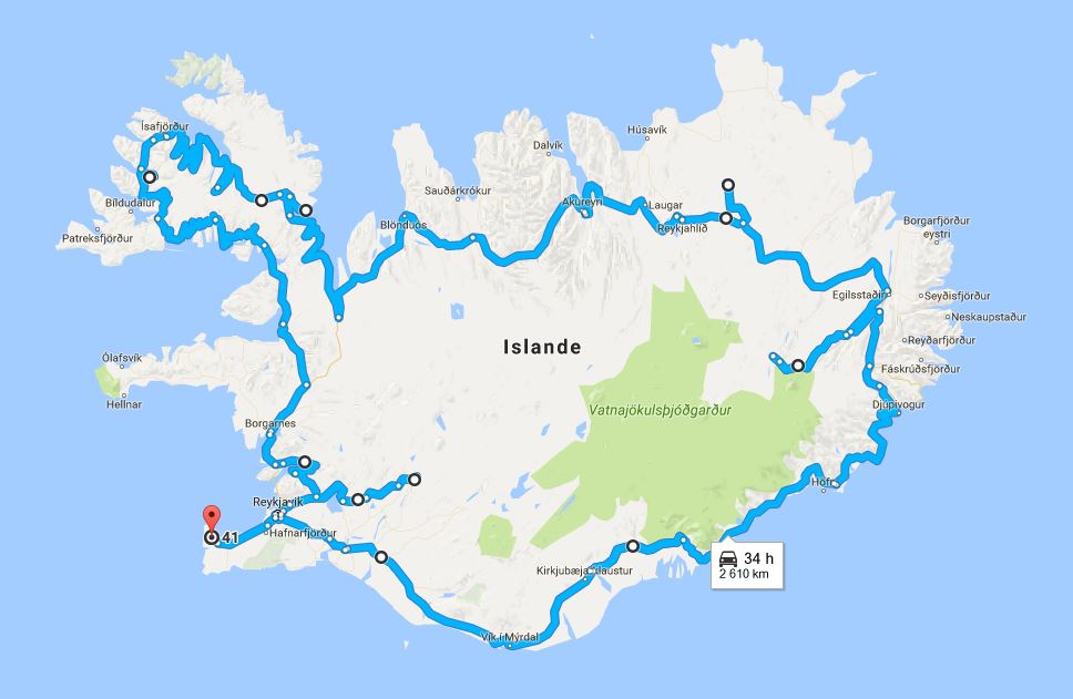
Iceland Road Trip
3500km
driven
65km/h
average speed
+50
wonderful waterfalls
1
volcanic eruption
3trolls
(petrified)
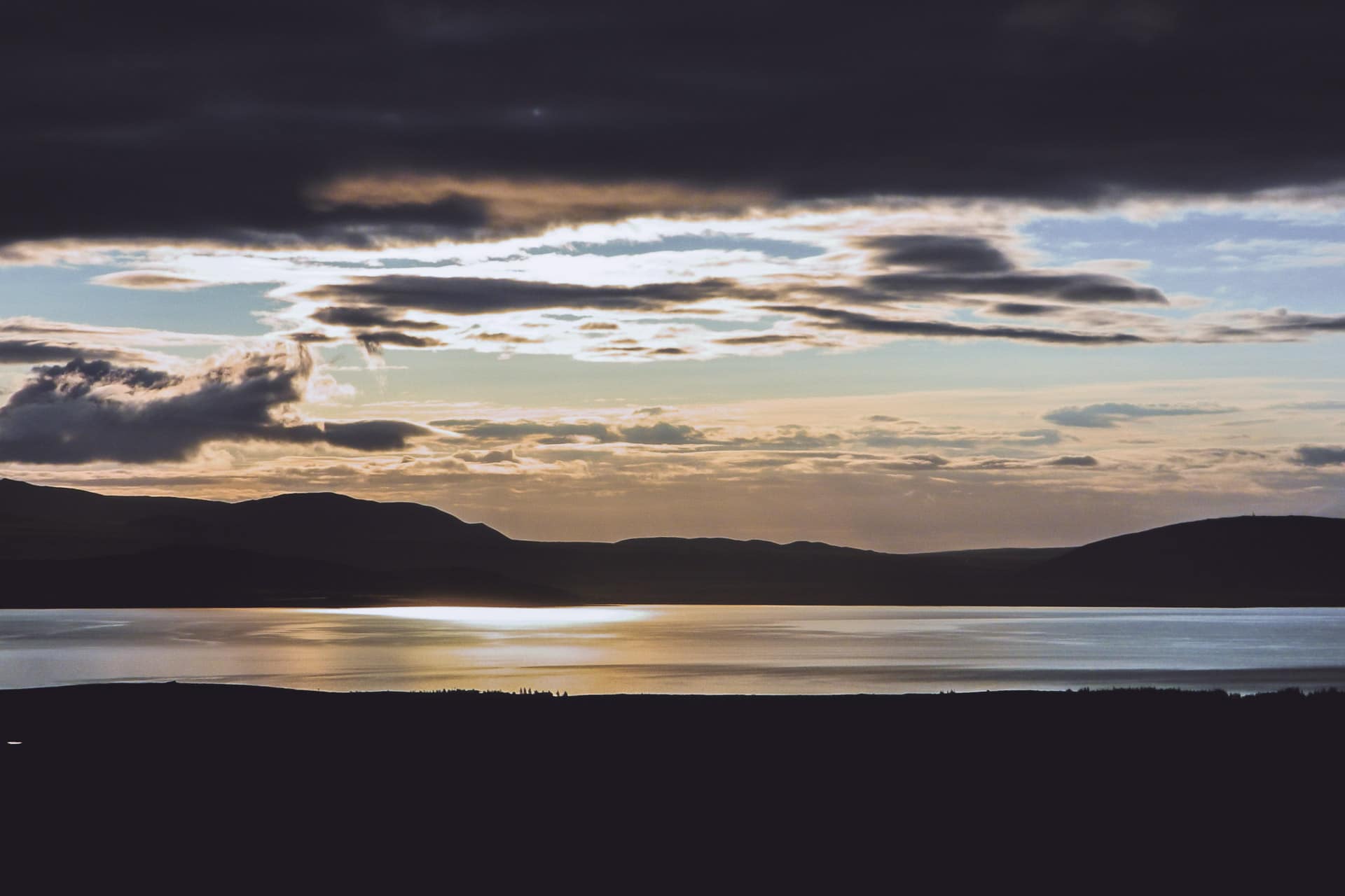
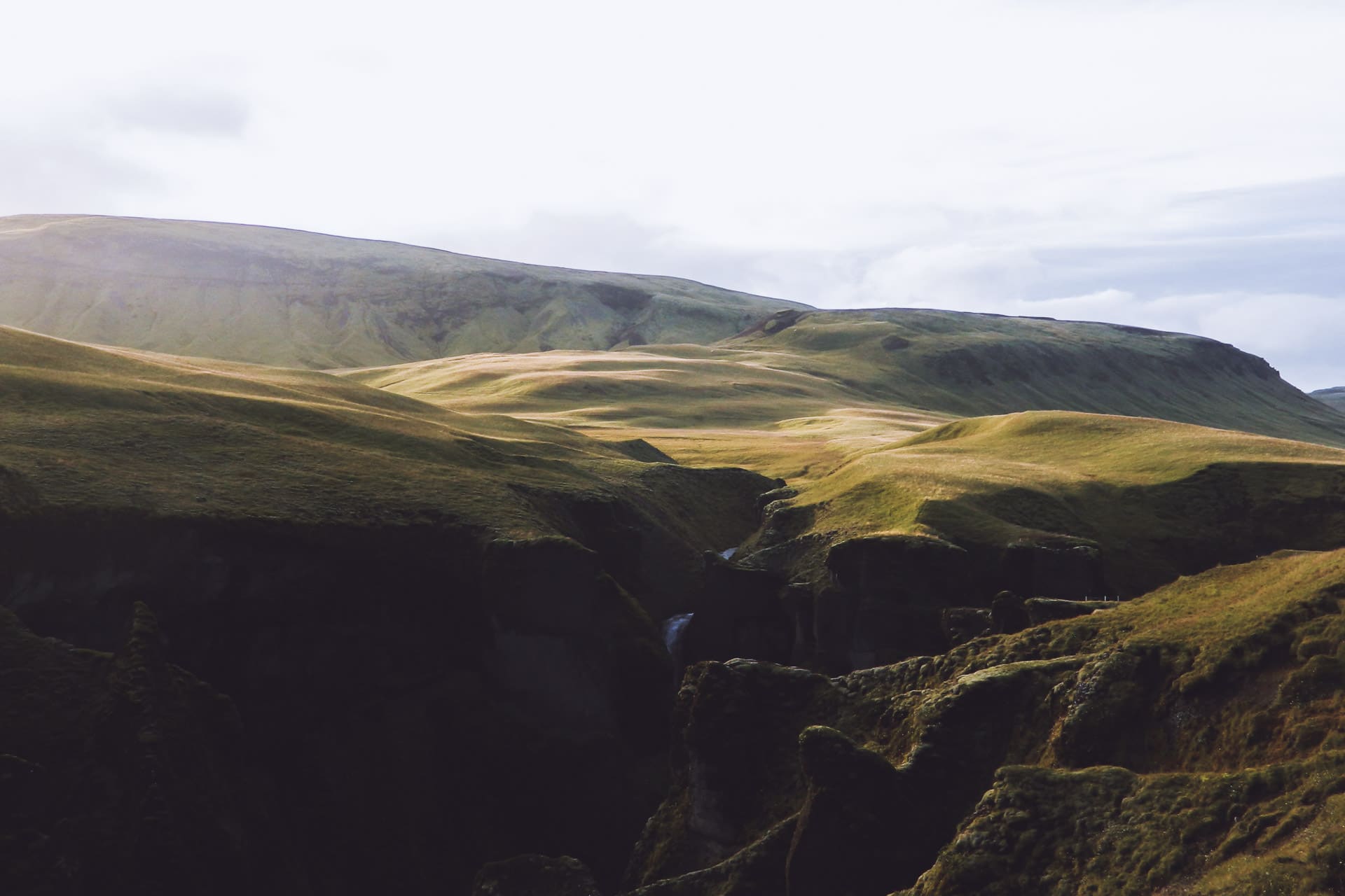
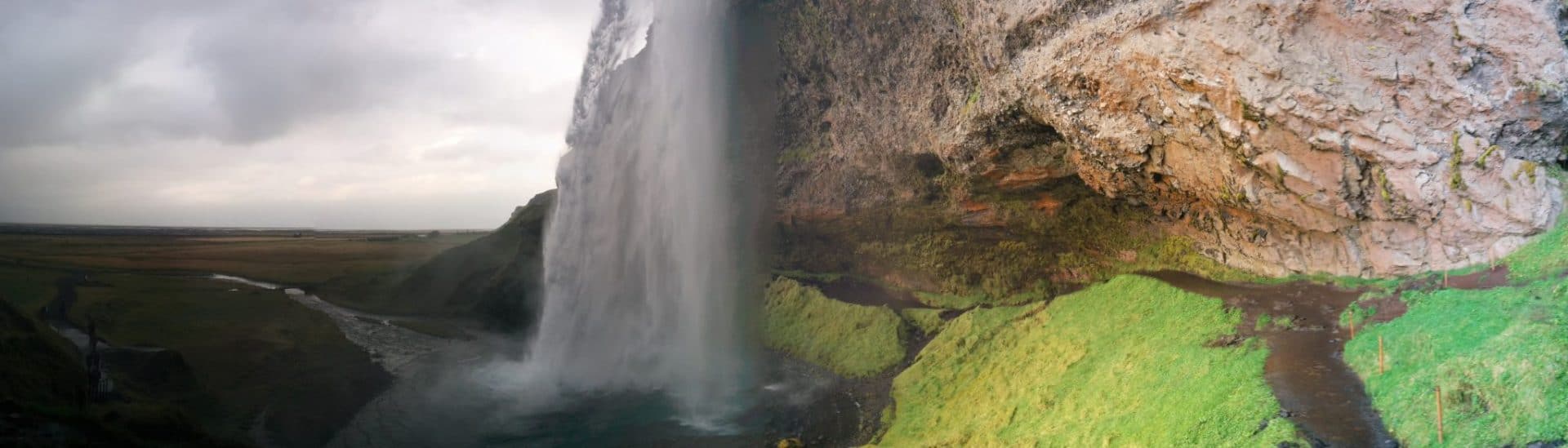
Iceland is very trendy currently and it’s easy to understand why. This country is amazing! Between the US and European tectonic plates, Iceland is experiencing a strong volcanic activity in an atmosphere of Far North, all dotted with majestic cascades, lakes, immense empty spaces … It is perfect! This trip was my first road trip solo, Iceland lends itself quite to this kind of travel. Follow me during this 14 days in the land of the Volcanoes, the elfs and the hidden people.
About Iceland
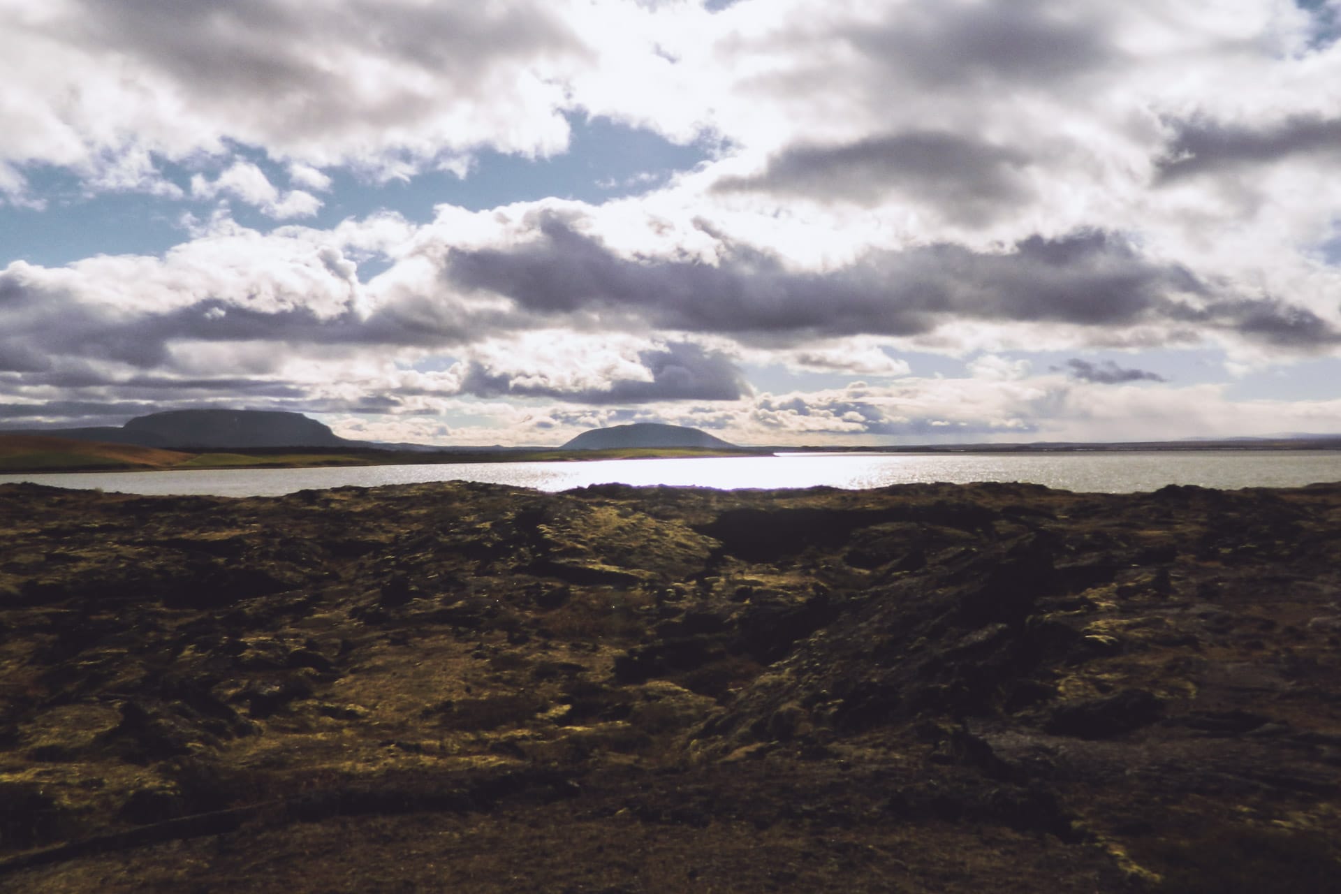
Although lost in the middle of the North Atlantic by 66 ° latitude, Iceland is part of Europe. The island has an area equivalent to one fifth of metropolitan France but has only 300,000 inhabitants. The population concentrates on the coastal strip and especially in the Reykjavik metropolitan area which welcomes 200,000 people as much as to say that the rest of the country is practically empty! Iceland is a paradise for hikers looking for of wild solitude or to undertake a road trip during which you will meet only one or two cars per hour …
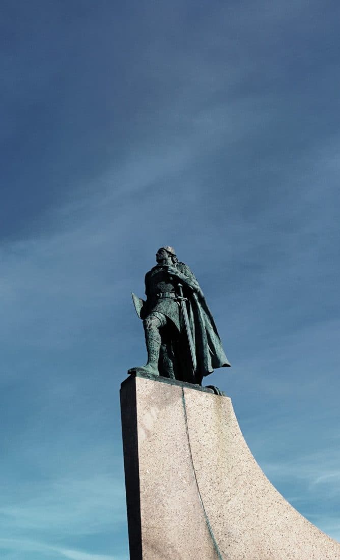
Iceland is also interesting from a historical point of view. Although its settlement by Irish monks will go back to the 8th century AD, the island grew during the Viking period in the 9th and 10th centuries. It has been used for the conquest of Greenland by Erik the Red (in 984) and then surely of Vinland by Leif Erikson. There are many relics of this period in the country, be it buildings, but also in a certain way of thinking and in certain beliefs.
Concerning beliefs it is interesting to note that 40% of the population believes in elves and in a race of invisible humans but well present, hidden people. This belief is so strong that it is taken into account when building roads for example so as not to destroy an elven place.
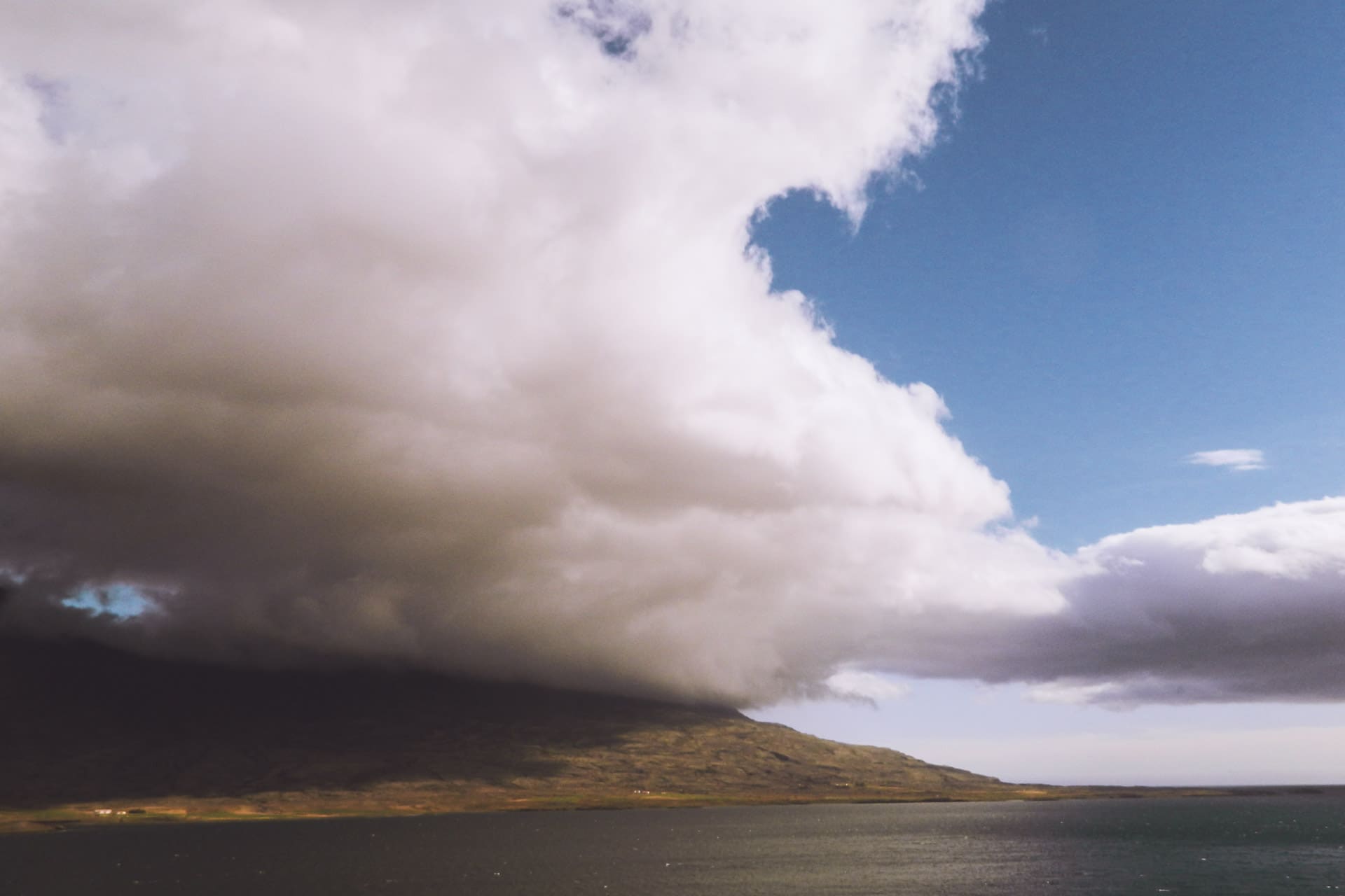
Iceland is also known for its volcanic activity. We all remember the complete cessation of air traffic in 2010 after the eruption of the Eyjafjöll. Iceland is straddling the Atlantic rift, that is, part of the country is in America and the other in Europe to simplify. There are about 130 active volcanoes, geysers, fumaroles and other telluric phenomena, volcanism is omnipresent. Humans use this resource to create electricity (geothermal energy) or to heat themselves. Even the water from the shower had a small sulfur smell.
From a climatic point of view, Iceland has a relatively temperate climate although it is located just below the Arctic Circle. This is due to the fact that the island is bathed by the Gulf Stream, so temperatures are still relatively mild even in the middle of winter when compared with other countries at the same latitude; For example the average temperature of the coldest month (January) is -0.5 ° C. However the climate of Iceland is not to be taken lightly, this one is very changing and can be violent with a lot of wind and rain. One can easily see the four seasons in a few hours, an Icelandic proverb summarizes very well this changing nature of the weather: “If weather does not please you, wait just five minutes”
Day 1 : from Paris to Reykjavik
It is early September and it is the departure for Iceland for a journey that was in my head for a long time. Take off at 12:45 from Charles de Gaulle airport (France) and a few hours later here I am! I’ll be all alone for this trip, my first trip 100% solo … We’ll see how it is…
Once at the airport I get my little car that will be my companion for these two weeks, it will be a red Kia Rio. I would have preferred a 4×4 to explore the famous F-Road but the price of the rental on its own was a bit high.
In Iceland most of the inner roads are “F-Roads”. It is road are not tarred and can go through lookouts … The use of an appropriate vehicle is legally required, so you have to have a 4×4 to go through them. Do not engage lightly on these roads especially if you have to cross a river, on this point the F35 is very convenient because it stays dry all along.
First stop: to reach Reykjavik to finish the day.
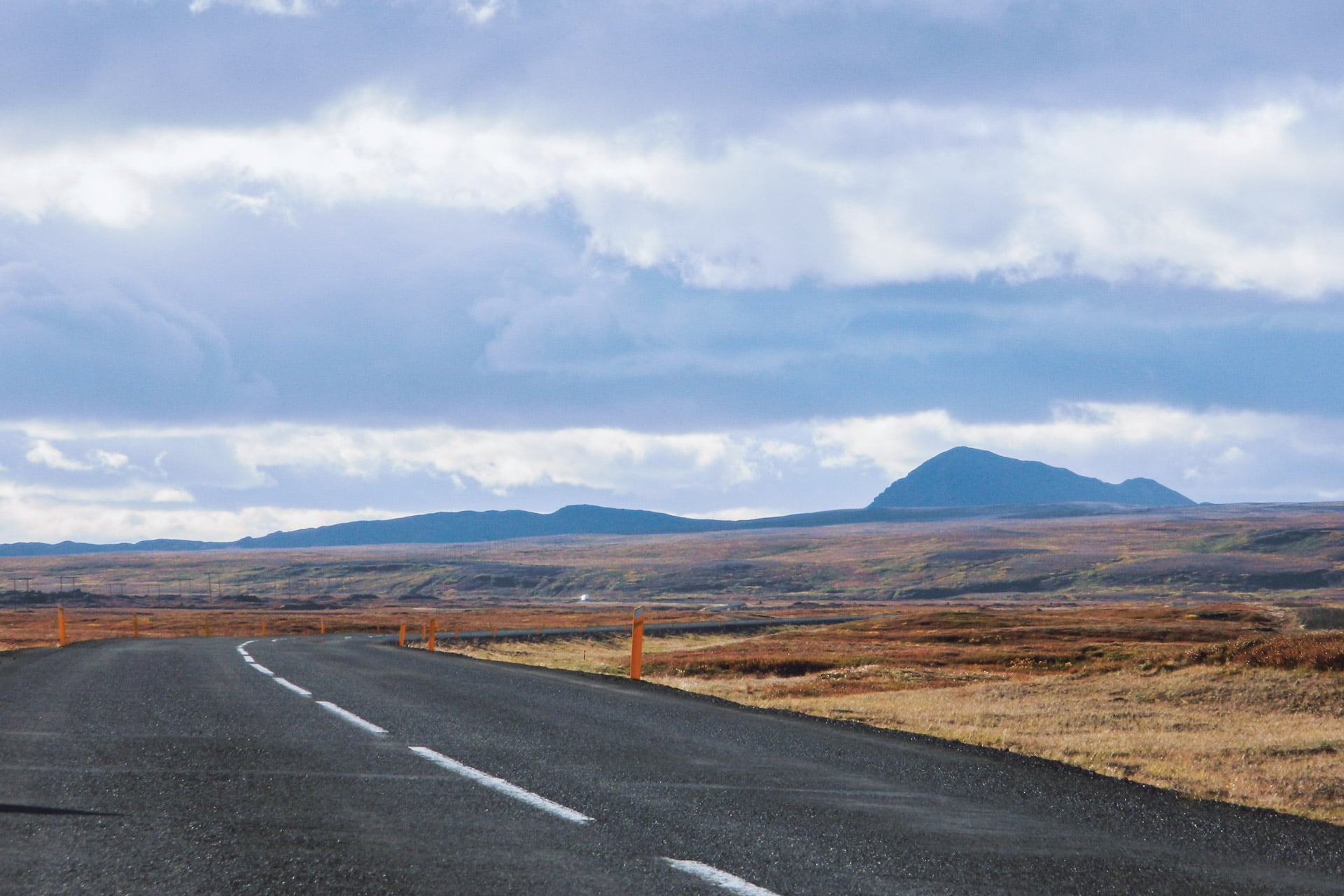
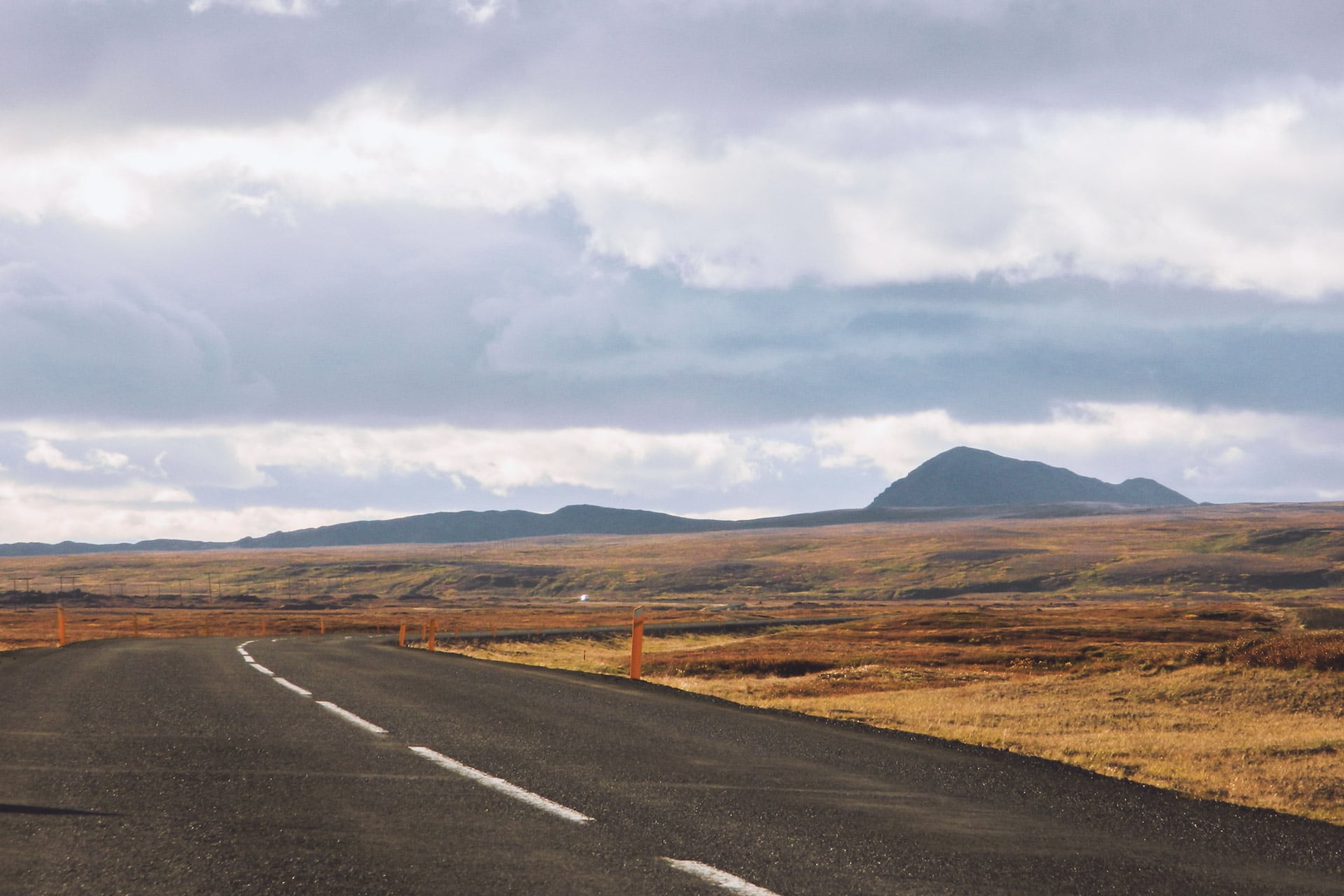
The road between the airport and the capital is nice : the landscapes are volcanic and empty. It’s nice even under the clouds.
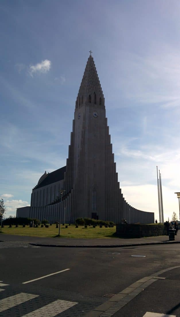
I arrive in one hour in the city center. Although it is the capital, there are only 200,000 inhabitants in Reykjavik. So the city is not very big. I find the hostel where I spend the night (Kex Youth Hostel). I then go on a tour in town and a complement of groceries.
The city is nice but I do not have much time to walk around, I will do this on the last day.
I will finish the evening by eating in a nice restaurant offering soups served in a loaf of hollow bread and going to bed early to be fit for the next day.
Day 2 : Golden Circle
Wake up at 6:30 am because today is the first real day here and it is busy. The idea is to go through the Golden Circle, the area to the north east of Reykjavik and which concentrates many places to visit. It is also one of the densest areas in terms of tourism even if it remains content.
For the moment I leave the city and I am following the road 36 towards the lake of Þingvallavatn.
The “Þ” is pronounced much like the “th” in English. We find for example this letter in the name of the famous Norse god Thor: Þórr
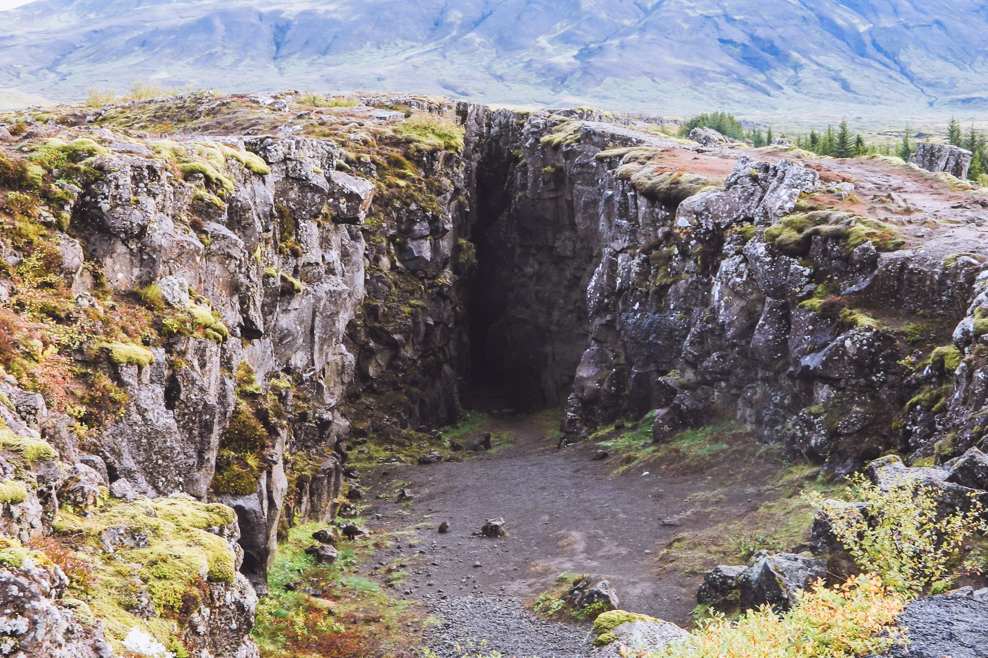
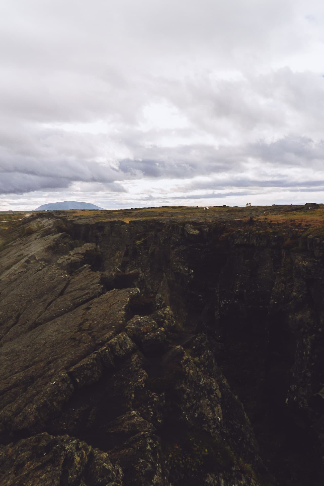
The landscape is beautiful especially under the morning light. The vegetation is reminiscent of the one found in the Nordic countries (like in Sweden), that is to say a shade of dark green and brown. After some time to roll I stop on the road to see a break typical of the local tectonics. The fracture is perfectly visible and the zone feels the suffer testifying to a close volcanic activity.
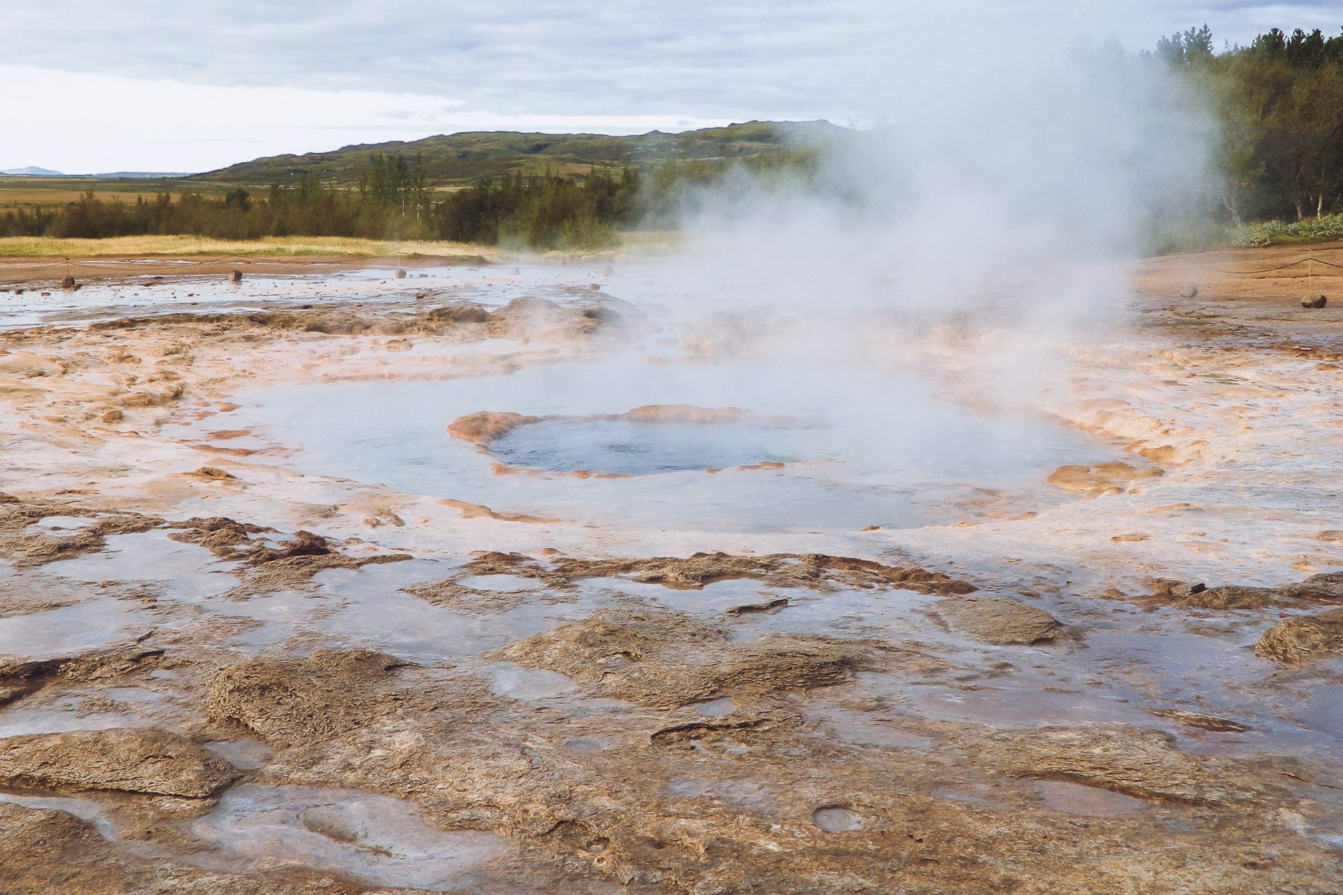
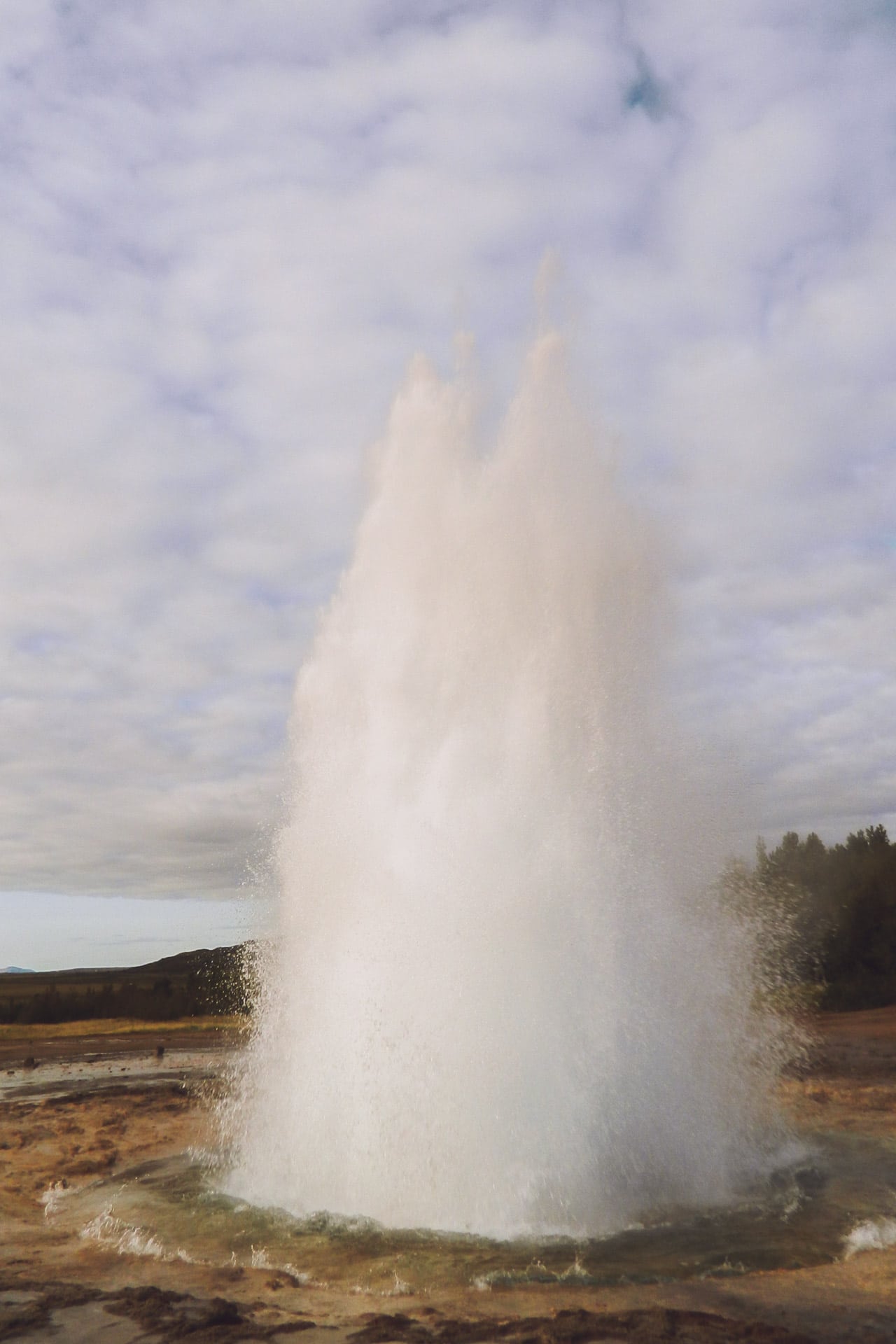
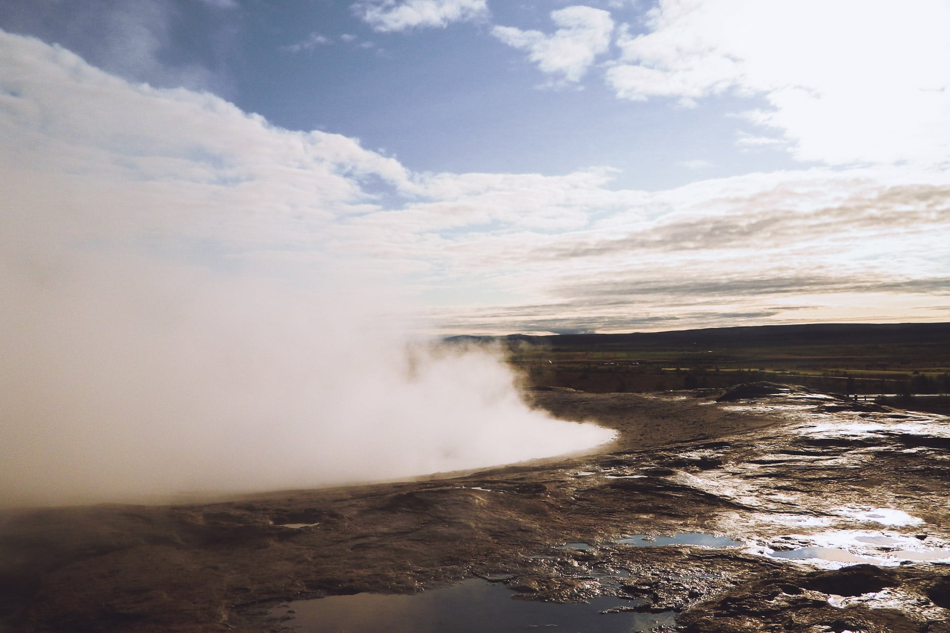
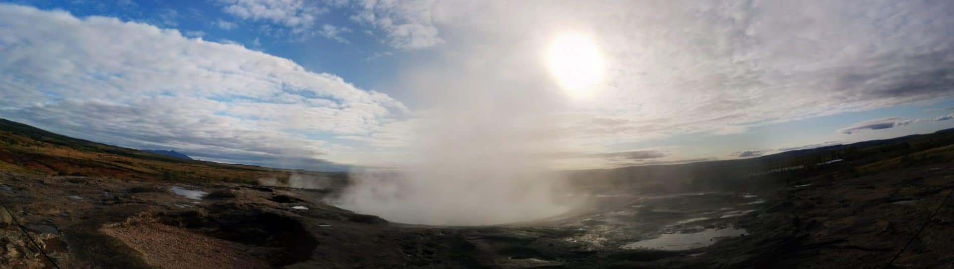
I then continue my route to the famous Geysir, the geyser to whom we owe the name of the phenomenon. We feel when arriving on the spot that the place is tourist but there are not too many people in this morning time. The area is experiencing intense geothermal activity: it smokes and it muddles everywhere.
The highlight of the show was Strokkur, the last active geyser, in fact Geysir stopped its impressive “eruption” a few years ago.
Having never seen any geysers before, I must admit that the show is impressive, especially the noise it makes when ejecting the water column.
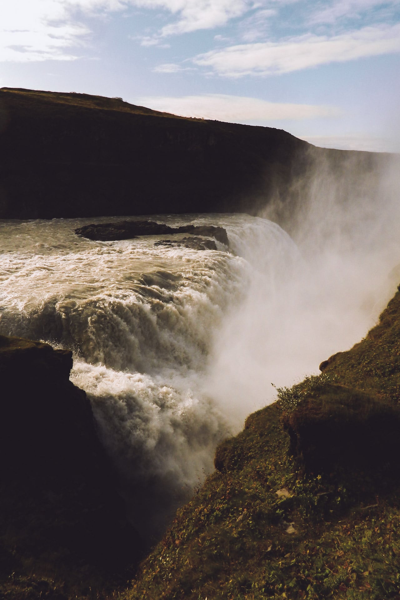
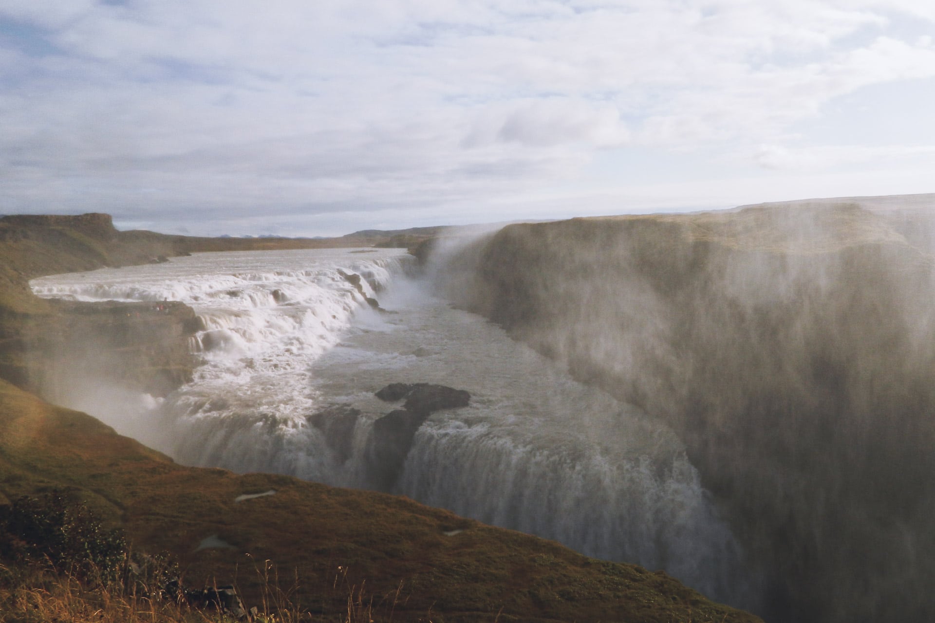
After a long time to admire Strokkur, I take the road to the beautiful waterfall of Gullfoss. This waterfall is stunning especially by the feeling of power it releases. It is not necessarily very high but the flow of water that every second discharges is amazing. I make myself a good coffee right by the water to admire the show.
A little vocabulary: the suffix “foss” means the waterfall.
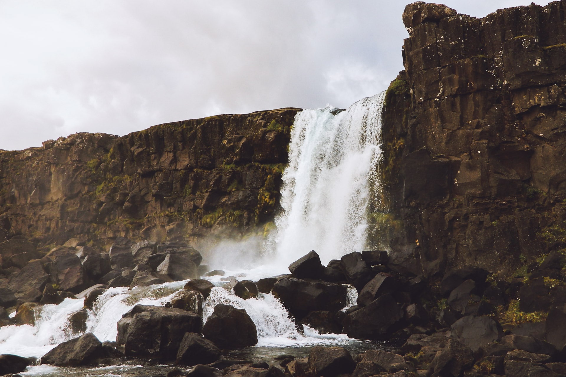
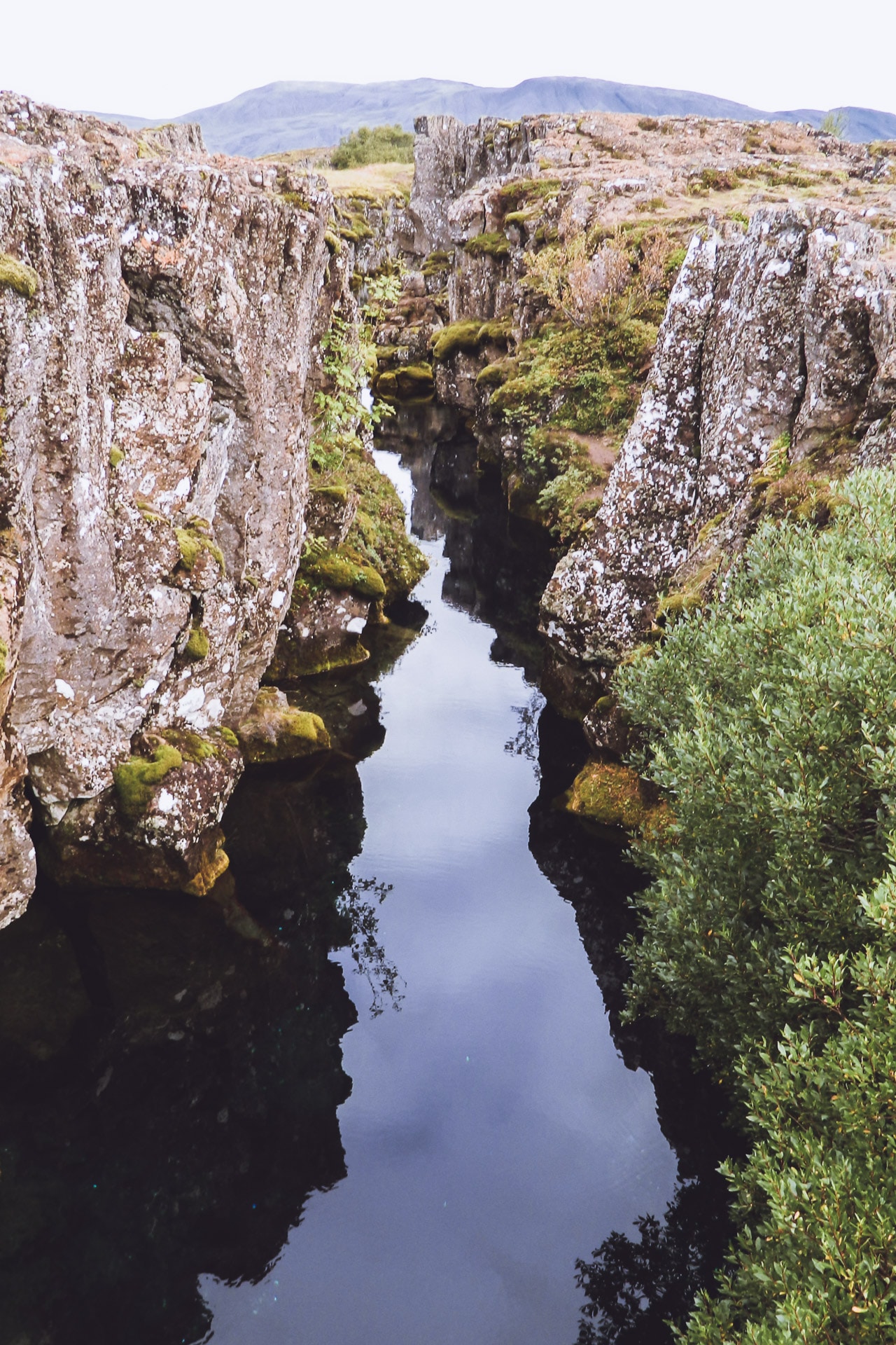
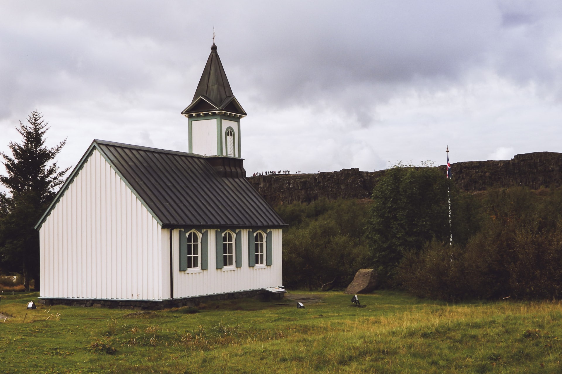
Once the coffee is finished, I turn to the Þingvellir. The site is located along Route 36. It is a very important place of Icelandic history because it is here that it is held for centuries of Þing ie the assembly. It is also a great place to observe the fracture of the rift and to dive in the crystal clear waters filtered by the rocks.
So I take the time to stroll until the tourists agitate me and push me to continue the journey.
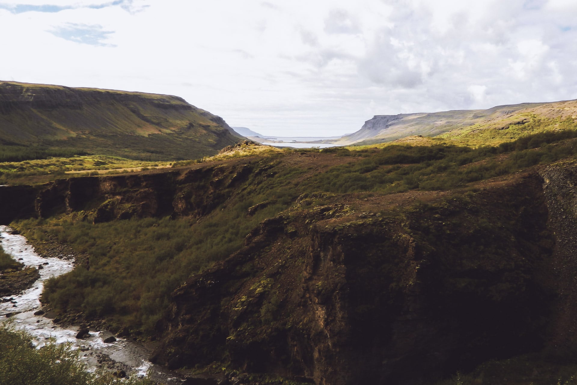
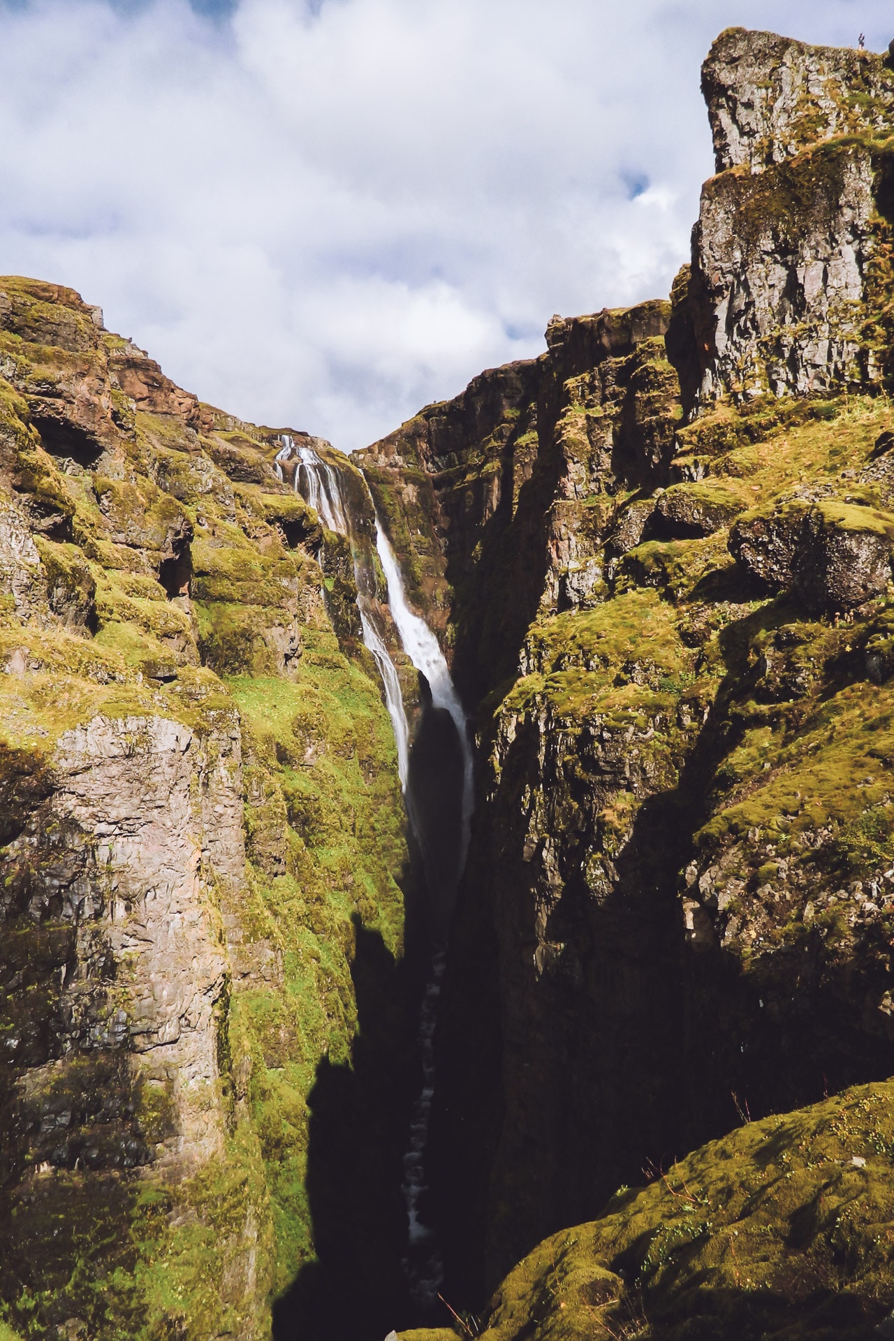
My route then takes me to the Glymur waterfall, one of the highest in Iceland. To get there you first have to follow the road 47 and then finish the way on foot by a small hike very nice even if it climbs hard at the end. The waterfall is very beautiful, nestled between the cliffs and high of its 198m.
Once arrived at the top of the waterfall I wish to go down the other side to vary. The problem is that you have to cross the river that feeds the waterfall. It is nothing very bad if it is that the water is frozen. So I do not hang around (in underpants) and I miss nothing to stumble in the first meters. On the other side I stop 2min to dry with moss …
The descent is much less friendly on this side (right bank) because it’s very muddy …
Back in the car I take the road again and finally, I join the road 1 which will accompany me throughout the journey. I do not stay very long on it because I then fork on the 60 towards the fjords of the North West. I will stop not far from the road in a corner without charm to spend the night in the car.
First good day although in hindsight I should have spent more time in Þingvellir I think.
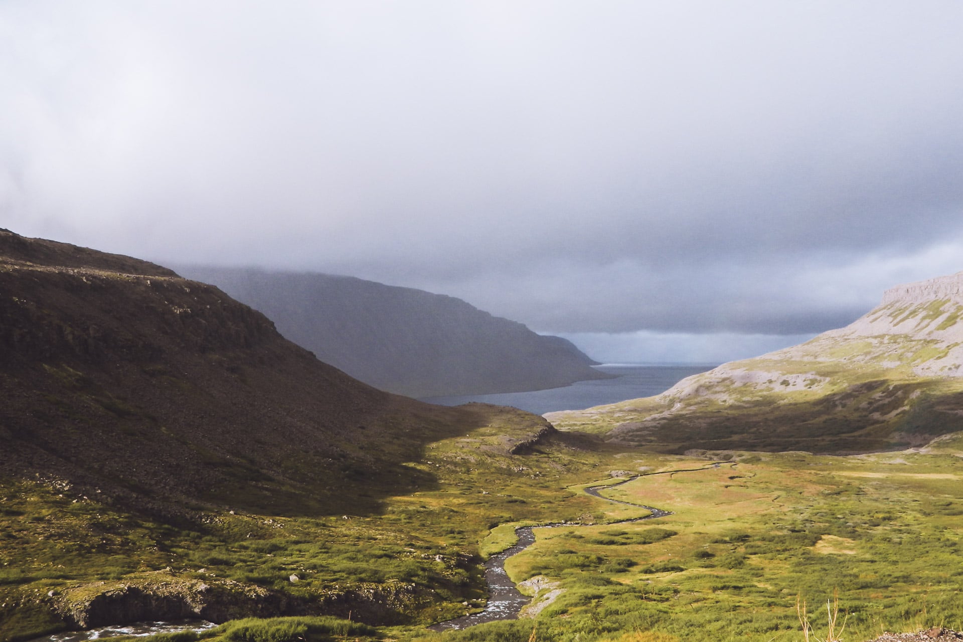
Day 3 : The NW Fjords
I have not slept badly in the car, better than I thought anyway.
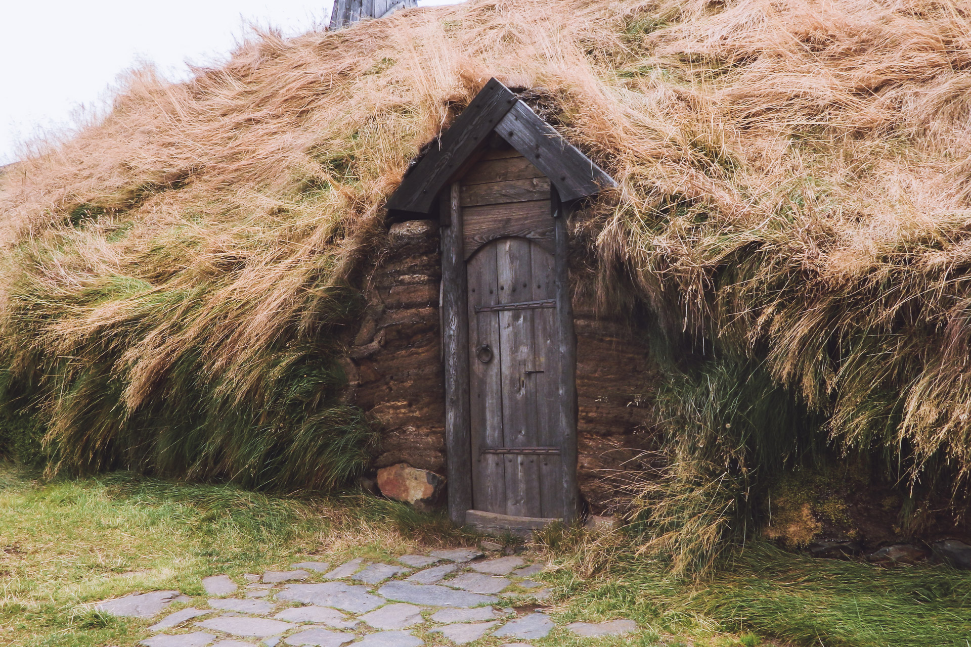
The first stop of the day will be a replica of the house of the Viking Eirik the Red, the first settler of Greenland according to the Sagas.It is a nice place to visit, full of history.
I then continue on to Route 60. New stop after a few kilometers at Sælingsdalur.
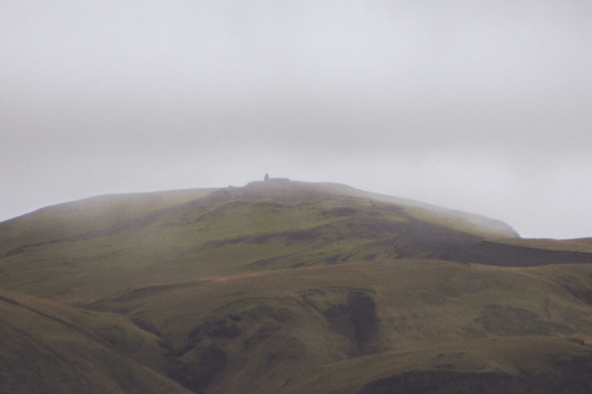
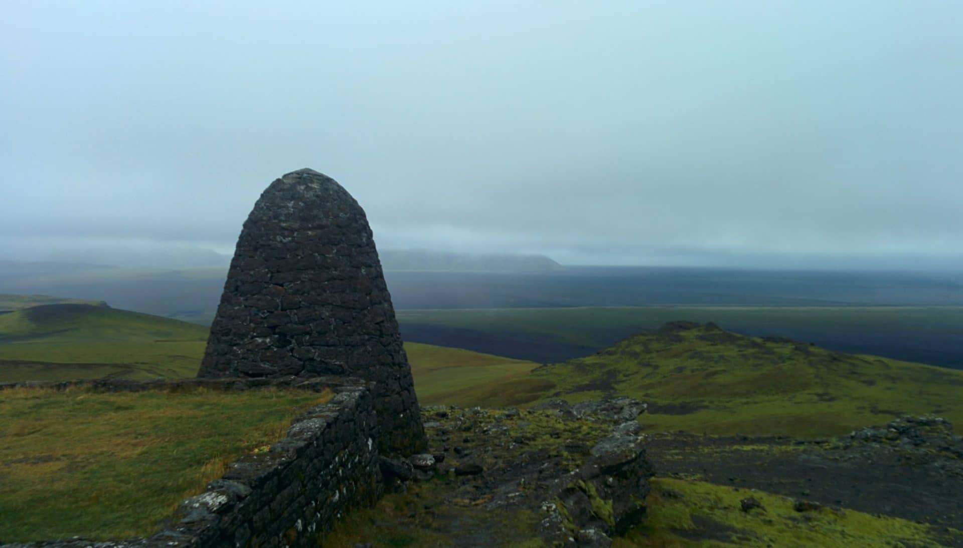
It is now to go to see a church of the Hidden People. This church is a big pyramidal hill for ordinary “mortals”, but according to the local sayings it is a spiritual place of the Hidden People. I go there so that I may see all this by myself. So I start climbing the hill. The view is nice but unfortunately no contact with a possible Hidden People …
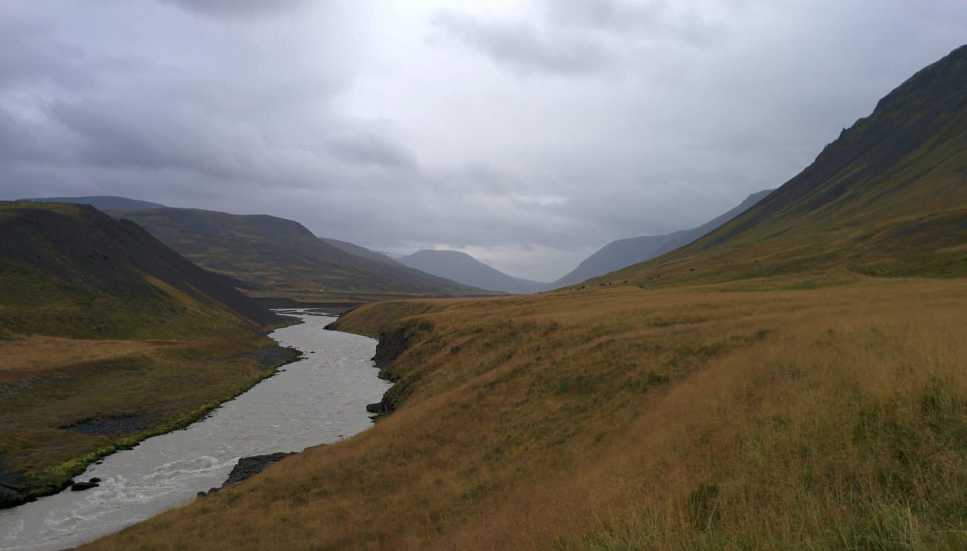
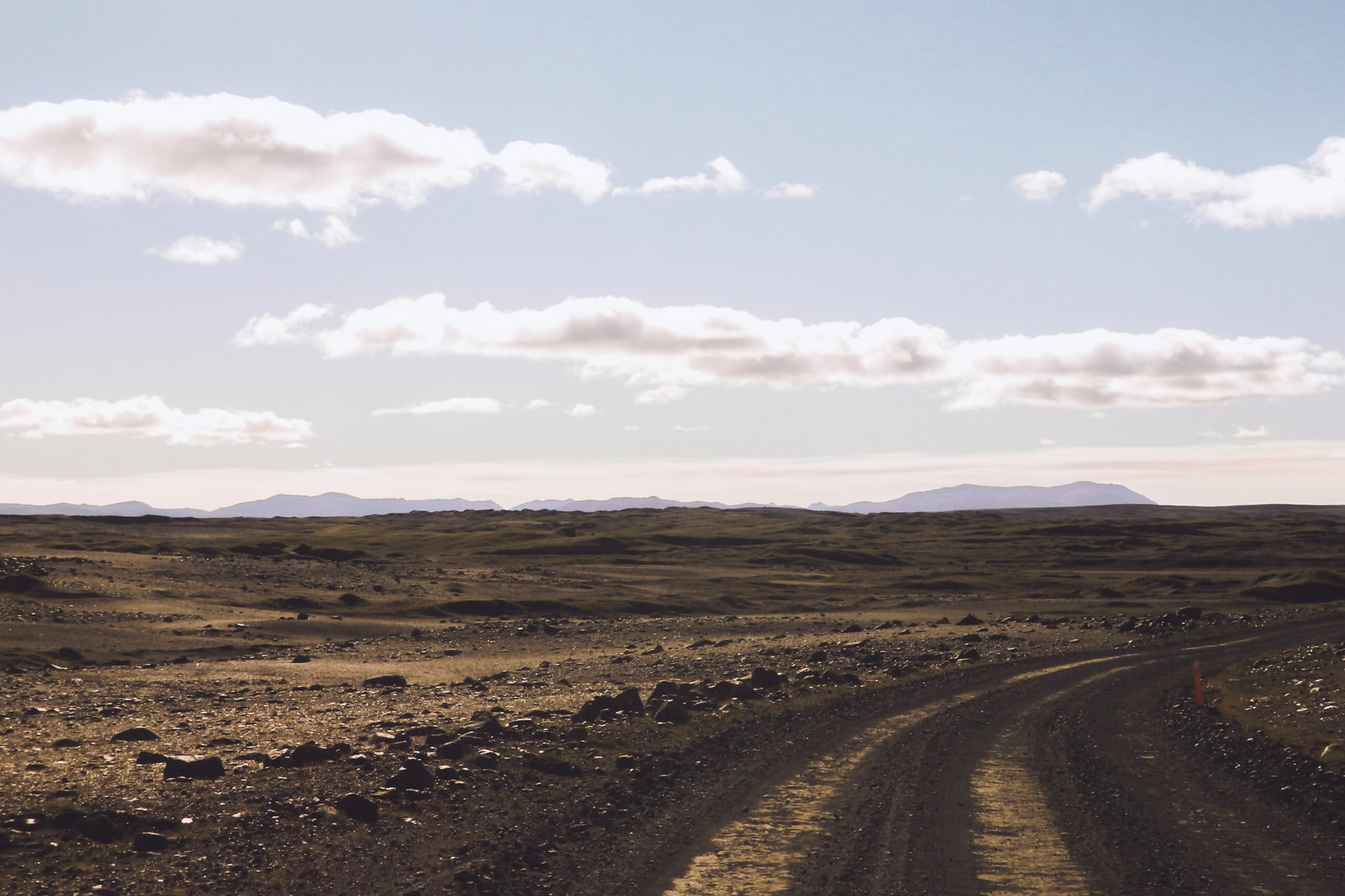
After this last stop I attack the heart of the subject of the North West Fjords because the road is no longer tarred. In Iceland, there is only the main road (the 1) and some adjacent secondary roads that are good. The rest of the roads are carrossable but with a small car is not ideal. So I go slow, not much more than 30km/h. At least I have time to enjoy the amazing scenery. There is hardly anyone on the road, the feeling of loneliness (in a positive way) gently sets in.
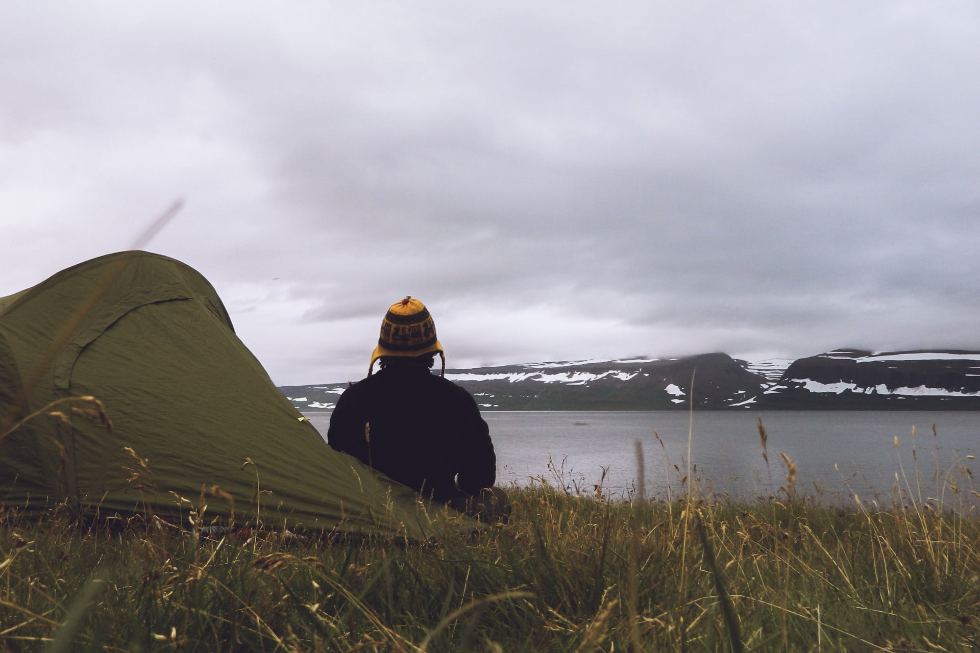
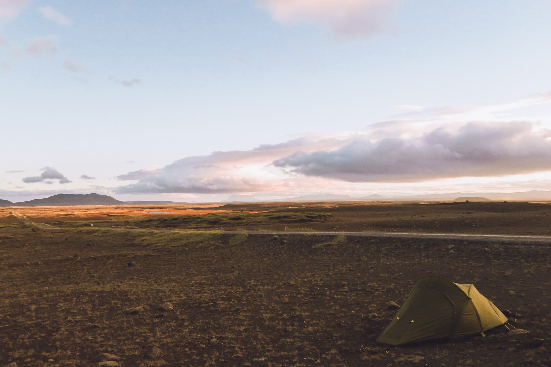
Quickly the weather turns to storm … I do not want to soak my tent tent tonight, so it will be another night in the car. I land at a small pass not far from a statue. Nothing is visible outside but rain. I’m totally wet because I wanted to go for a short walk … bad idea. I will finish the evening so eating cold …
Day 4 : Further in the fjords
In the morning the rain and the fog are still there. So I leave without seeing anything of the view, certainly beautiful of the place in good weather. The road is still so bad and I’m not moving very fast.
Towards the end of the morning, the bad weather calms down a bit and the sun seems to want to break through; which finally arrives around noon thus offering a superb spectacle of rainbows, light shades and light absolutely superb.
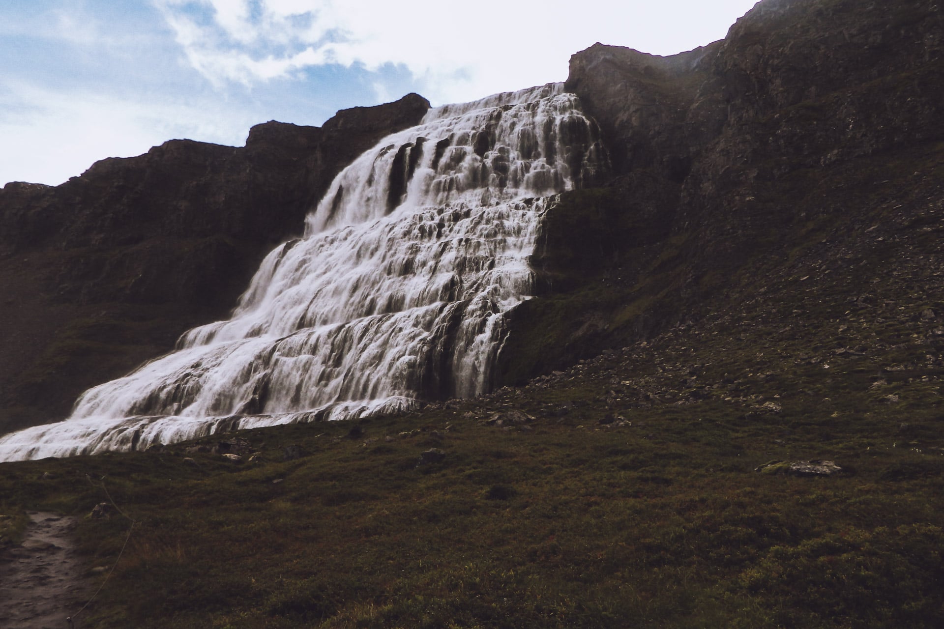
I then head for the Fjallfoss waterfall (also called Dyjandi). The road to get there passes through the mountains and I only meet one car for over an hour. The effects of light are still beautiful.
The waterfall is also impressive with 100m high and 30m wide. It looks like a veil on the mountain.
The road then takes me to Isafjorður. I stop there to eat hot (fries and a burger !!!) and also refuel and check that the car is fine. After this break I drive along the coast that undulates to the rhythm of the fjords.
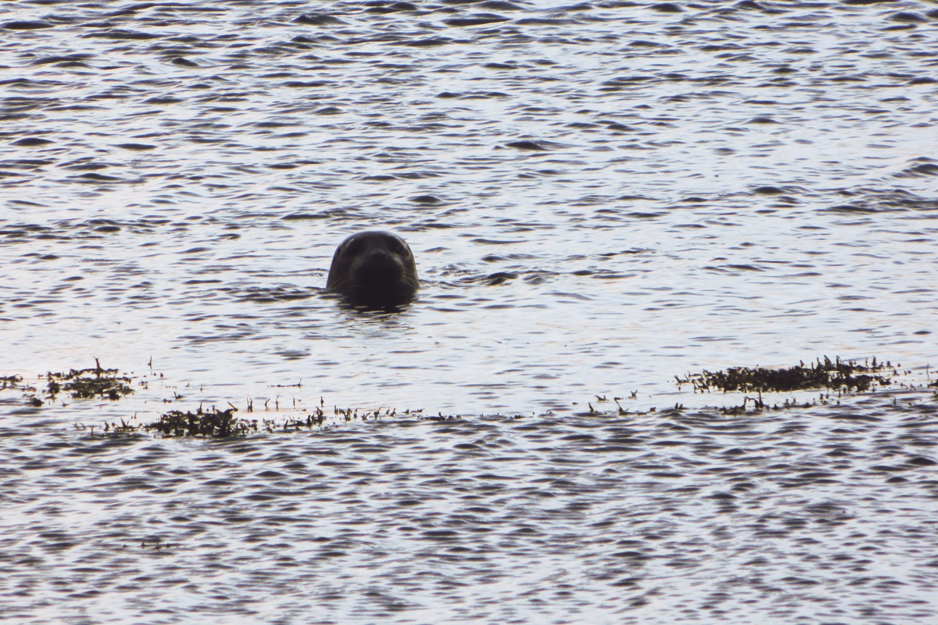
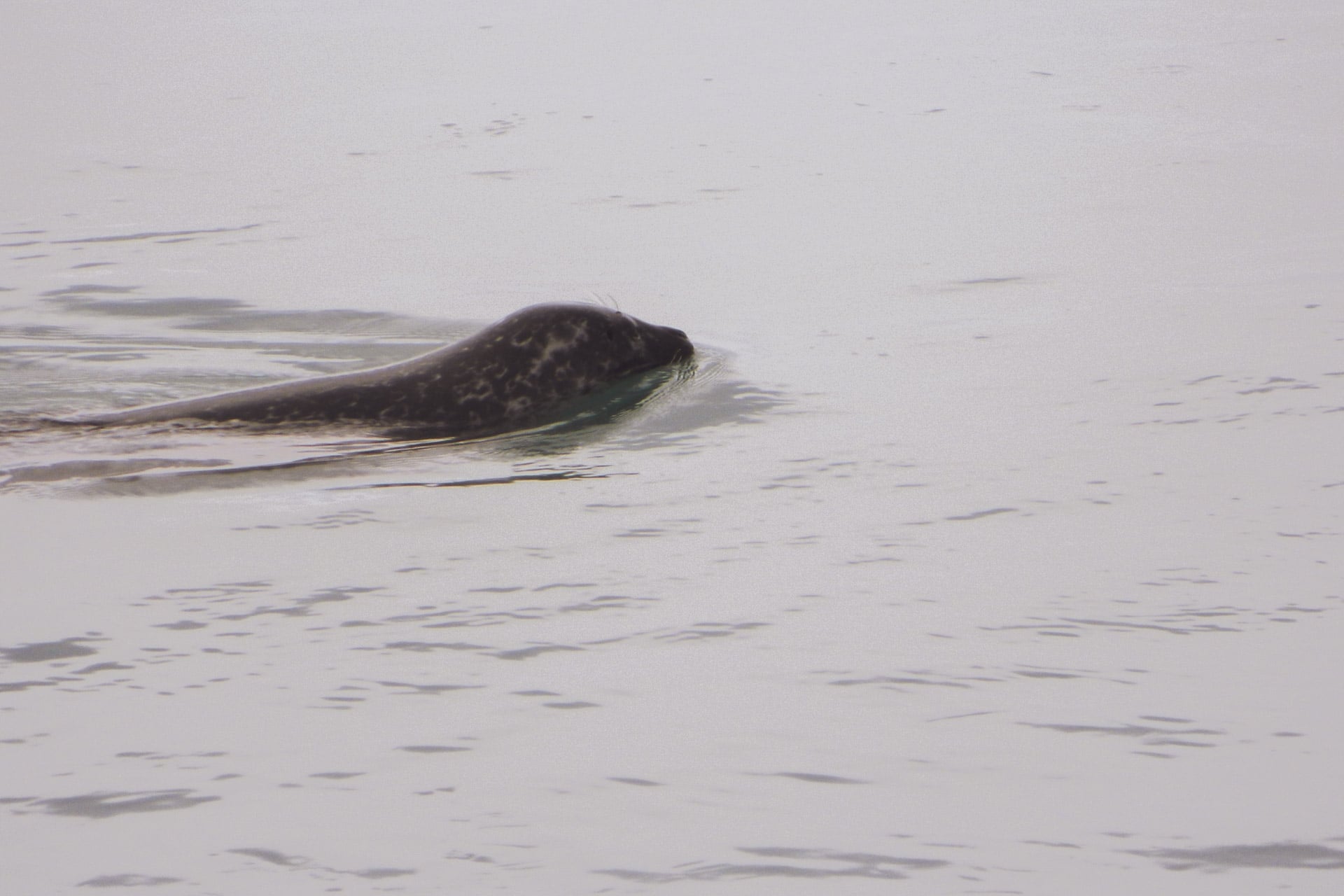
Further to observe the local fauna because a group of seals stays in the zone and by chance they are there at 50m. They keep their distance but they are easy to see.
It is time to find a place for the night, which will be done at the point of Ogurnes. I set up the camp not very far from the road but given the passage, close to zero, I will not be bothered. Last spectacle of a day, there, is in the middle of the fjord, a whale whose I can see the breath, too far for the camera but very nice nevertheless.
Day 5 : Out from the fjords
A good little night lulled by the sound of the surf and 0 cars. The mornings are cool in the beginning of September.
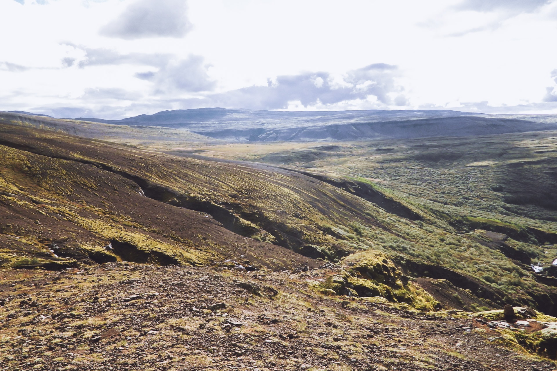
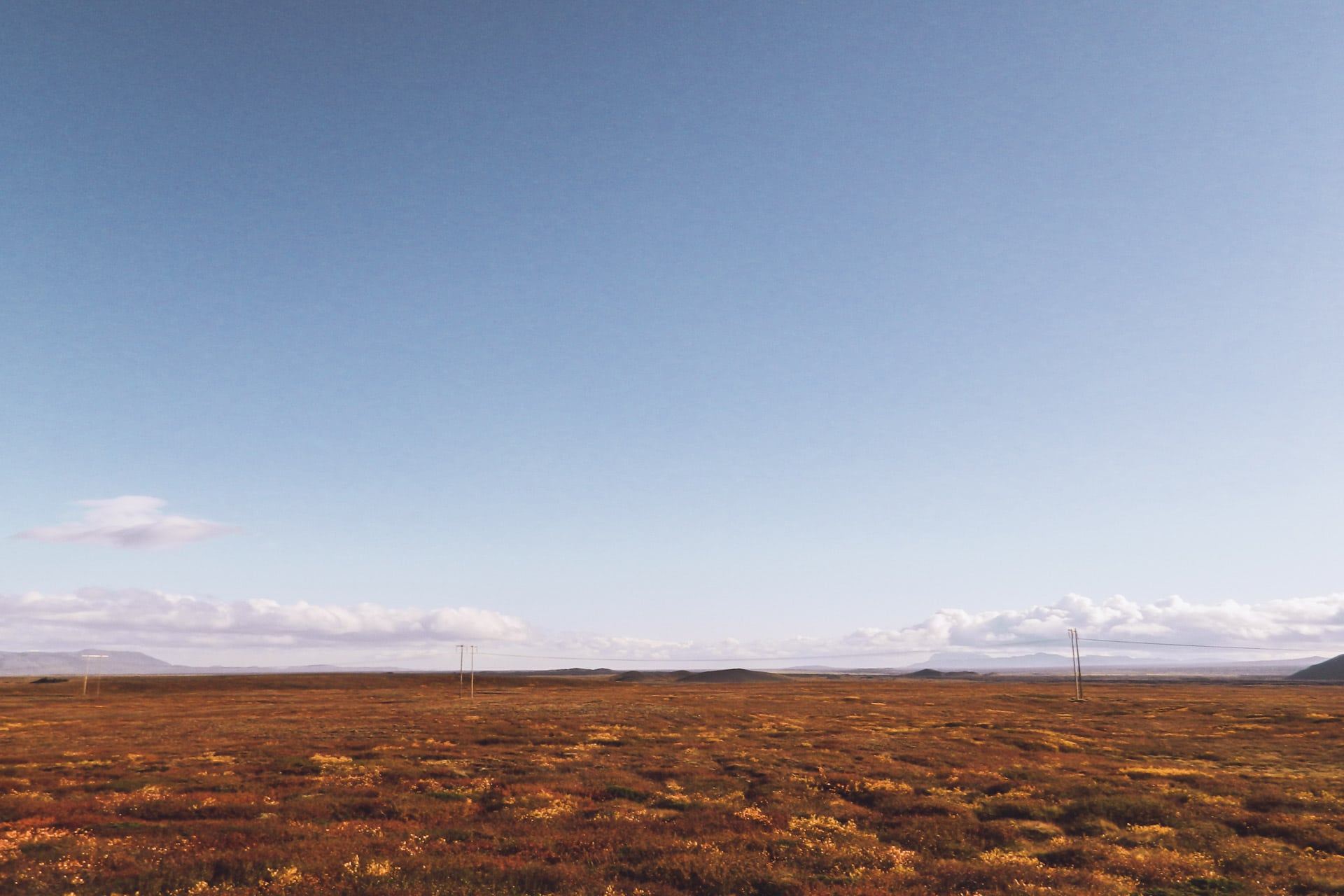
I take the road again to get out of the fjords. Before reaching Holmavik, I go through a kind of plateau, totally desolate and rocky. This emptyness is beautiful.
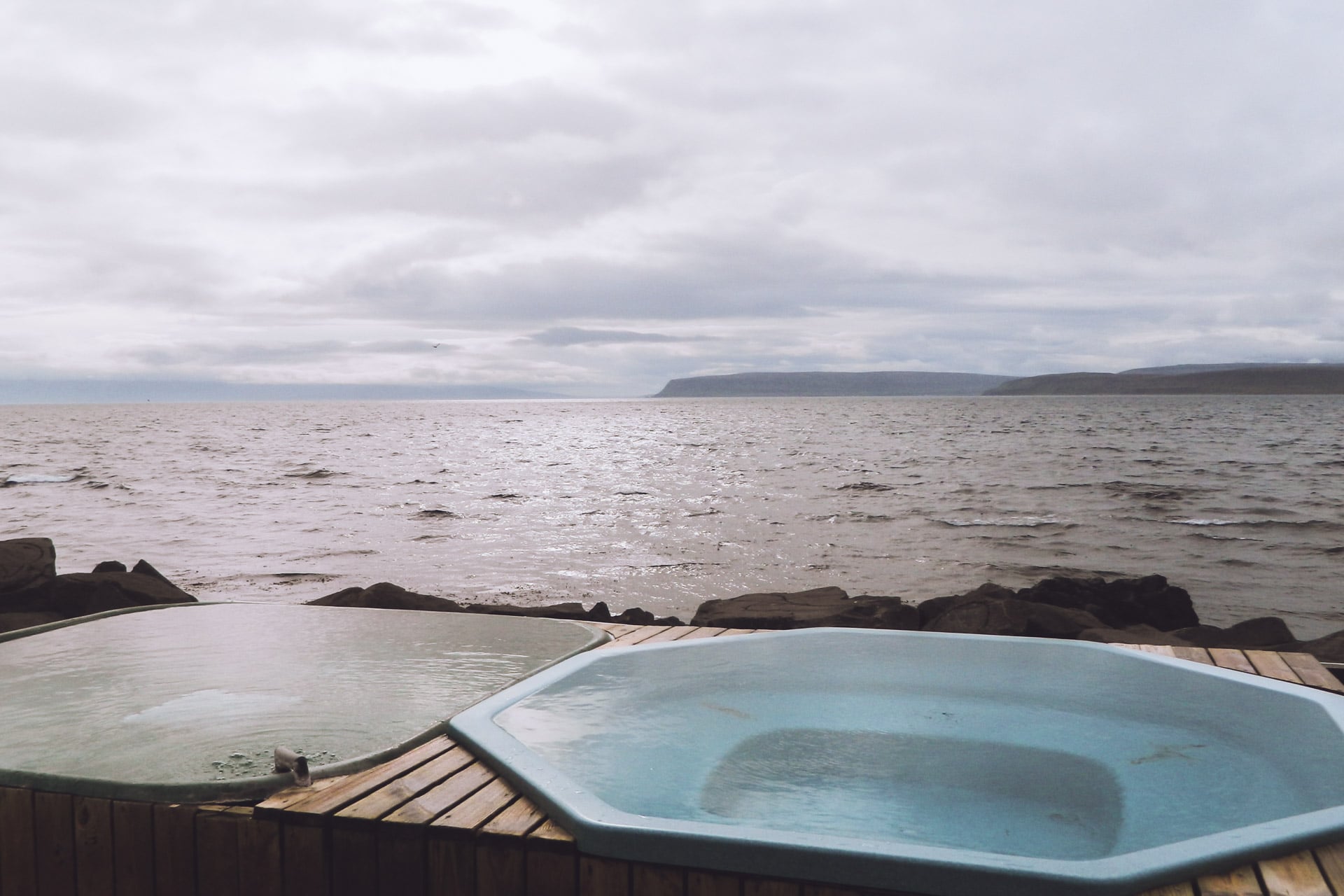
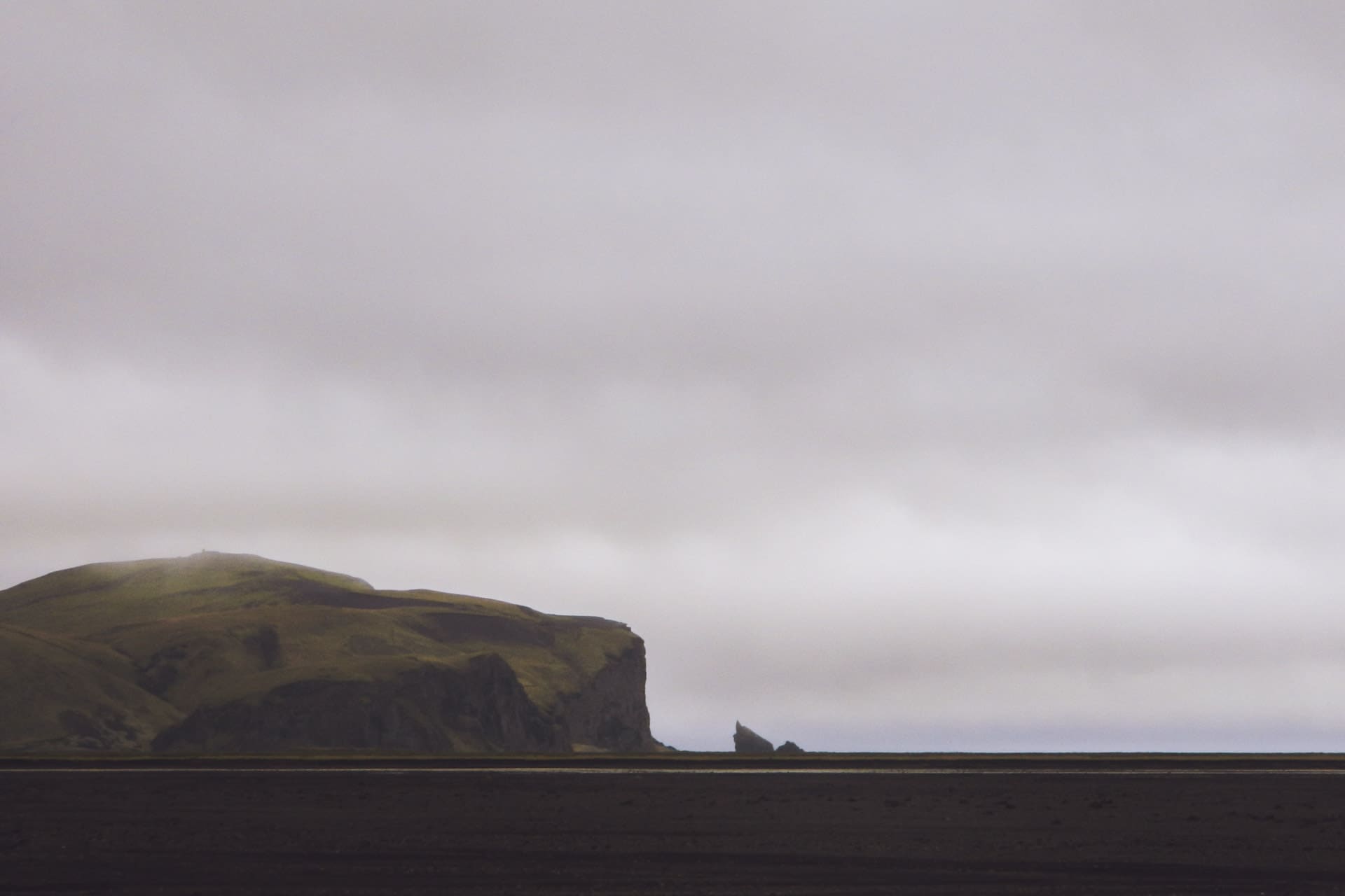
Holmavik is not very interesting as a city. I just do a little detour to go to a holy source but it’s not very impressive. I read in my guide that in a neighboring town at Drangsnes there is a petrified troll and especially a free public bath.
I go there especially after these 4 days without showers … The city is very small but they have installed on the waterfront three small pools fed by a hot spring certainly captured upstream. I dive after taking a shower. What a pleasure to be in a water at 35 ° C facing the sea. I rest and take advantage of the moment.
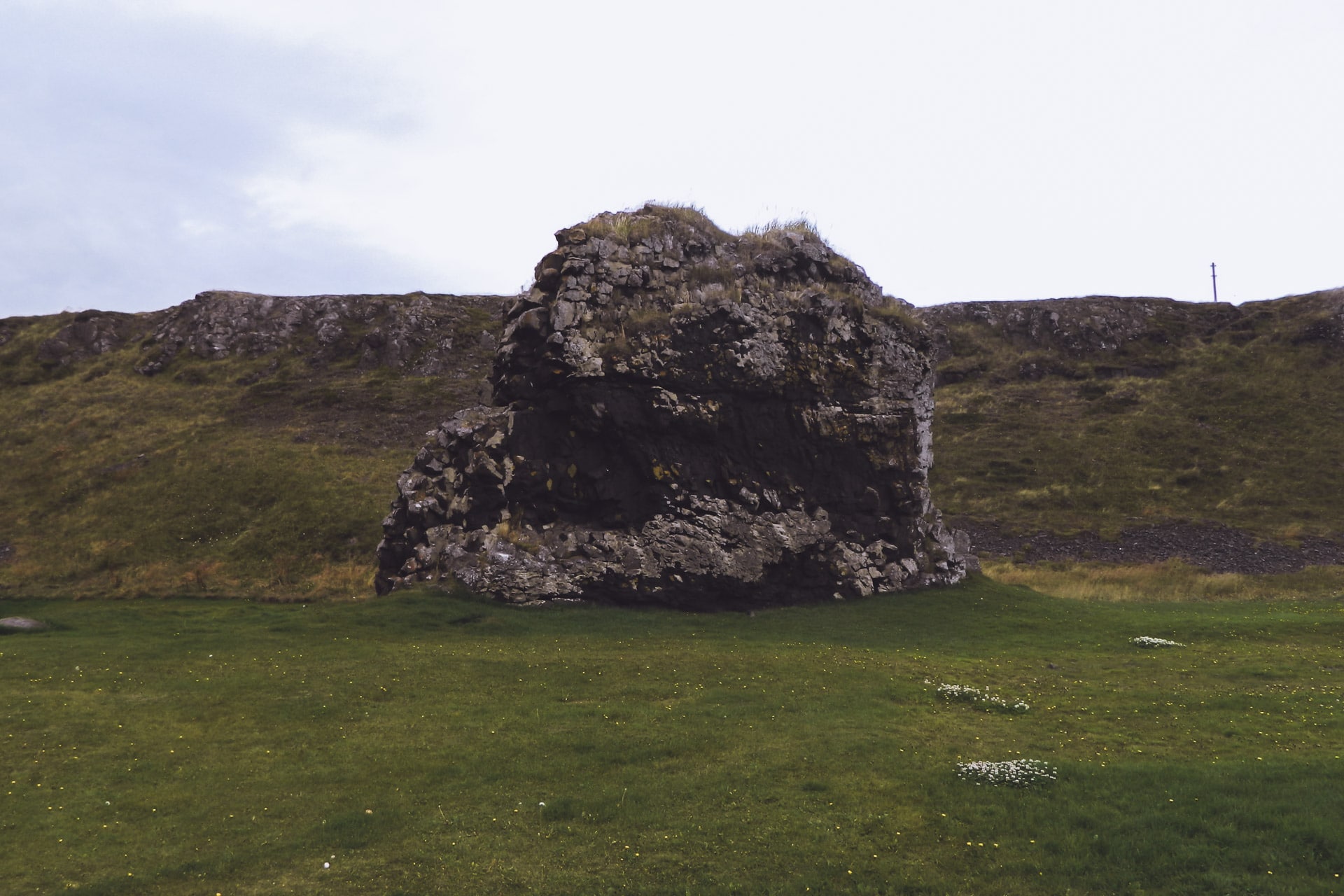
After this well deserved bath I will see Kerling the petrified troll. Today it is a big rock laid there, it is quite surprising.
From memory the legend says that three trolls wanted to dig a channel to separate the fjords of the northwest of Iceland. Busy with their work, they did not see the sun rise and were petrified on the spot. According to legend, still, the island of Grimsey facing Kerling would be her bull also petrified. The other two trolls are on the other side of the fjord, and they will be seen later.
Once this”trolly” break carried out I take the road and rejoin the road 1 after a meal break facing the sea.
The Fjords of the North West took me three days but it was worth it. The isolation of the place is superb, especially in this period because there really are not many people to cross.
Once on the main road I find a little traffic and the place is less friendly, more flat …
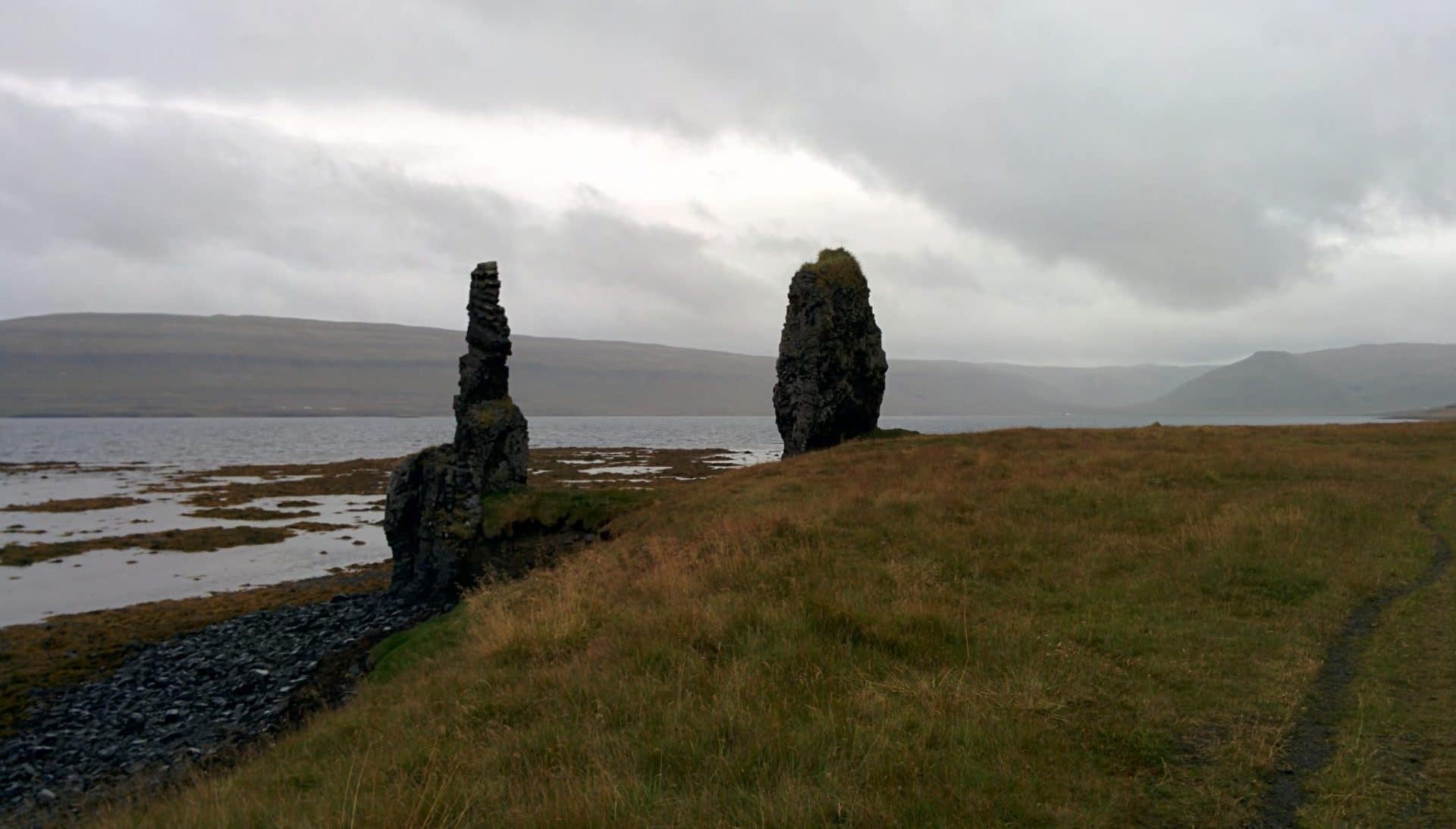
I will also make a small hook to see the two petrified trolls on this side of the fjord.
Tonight I will land at Kolufoss Falls. It is raining so I take my meal in the rain but I will make the night in the car.
Day 6 : Geocaching and "lost road"
Already 1700km … not bad. Today I do not have a big program, my main goal is to make a lost geocache at the end of a road in Skagafjord.
The principle of Geocaching is simple: people (anyone) will hide small boxes in interesting places and simply inform their GPS coordinates on the site. The goal is not so much to find the box as it is to discover something, a place, a bit of history. Almost all the stops I make in Iceland have been motivated by a geocache so far.
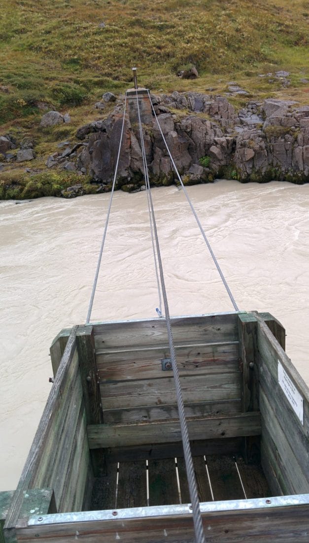
The beginning of the road for the geocache is rather good and it goes well. By cons quickly I find myself on a small road, stony and not wide at all. Impossible to turn around … I walk almost at a pace. I sometimes have to get out of the car to remove the stones on the road … I admit that at one point I wonder a little what I do there. After 2 hours (not easy) I finally arrive in the small abandoned farm. From there you have to descend towards the river and then cross by a kind of wooden crate suspended by three cables over the raging river … Not reassuring but it goes well. The geocache is finally there!
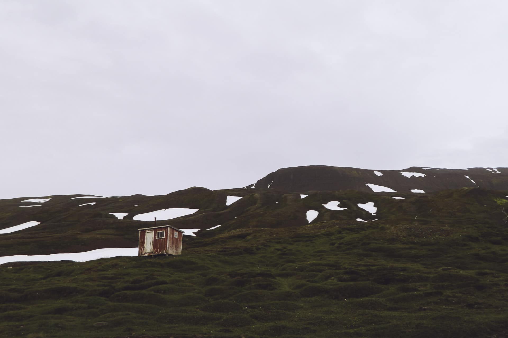
For the rest of the day I will go back on Route 1, which will take me a long time from the geocache, and then take on Route 76 in the direction of Siglufjorður, a pretty little village with colorful houses. Today there is a tunnel connecting this city to Olafsfjorður but I prefer to use the old mountain road (802).
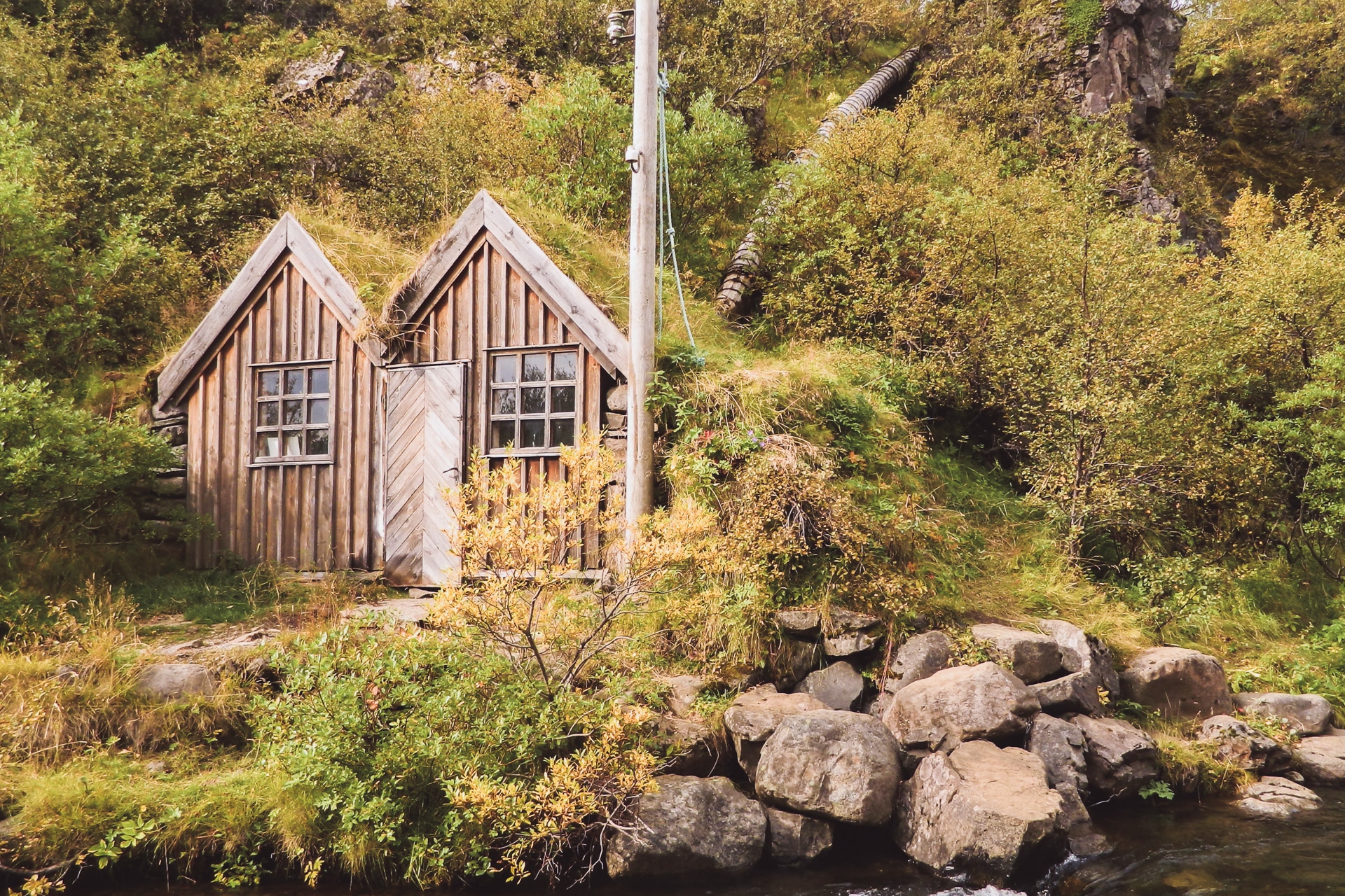
I will stop for the night at the level of the tiny shelter. The place is beautiful even under the clouds. I will calmly enjoy the late evening admiring the scenery and reading.
Day 7 : Akureyri
Not very busy day in perspective. I am about halfway through my journey and I need a good shower, a good meal and a bit of rest. Heading to Akureyri, the second biggest Icelandic settlement with 17,000 inhabitants.
Before that I have to join Route 1 but as it is still early I decide to go back my steps and go up for a ride to the small lake of Hraunsvatn. To do this, you have to park at a small farm not far from Route 1. You then attack the climbing route by a cattle barrier (which must be closed of course).
The climb is nice especially since it is sunny, on the other hand there is a strong wind especially at the level of the lake.
The site is beautiful, nestled between small peaks. The lake is known for salmonid fishing. I make a little geocache and I go down.
I then take the road to Akureyri. I spend the night at the “Akureyri BackpackersYouth hostel” in the small street of Hafnarstraeti. The hostel is nice and well kept. In the afternoon I take a walk around town but there was nothing very exciting to see (I did not explore very far). In the evening I will enjoy to be in town to eat a good meal, warm and cooked!
It feels good to see a little people and chat (especially with a guy from Quebec and a German from my room) but I also look forward to going back to nature and loneliness, one quickly needs it…
Day 8 : Myvatn and Krafla
Despite some snoring the night will not have been so bad. In the morning I have lunch with Pascal, the guy from Quebec. I then take the road towards the west and Myvatn which is a rather dense region in volcanic activity.
On the way I stop at Godafoss, historical place because here, according to legend, the pagan icons were thrown to the waves when Iceland decided to be Christianized. I then bypass the Myvatn by the south, it is a large lake to the east of which one already sees some interesting structures. Myvatn means “Lake of Flies”, in fact in summer the lake is covered with clouds of flies that can be a real pain in the a**. There are much less in September but these are annoying because attracted by CO2 produced by mouth, nostrils and eyes.
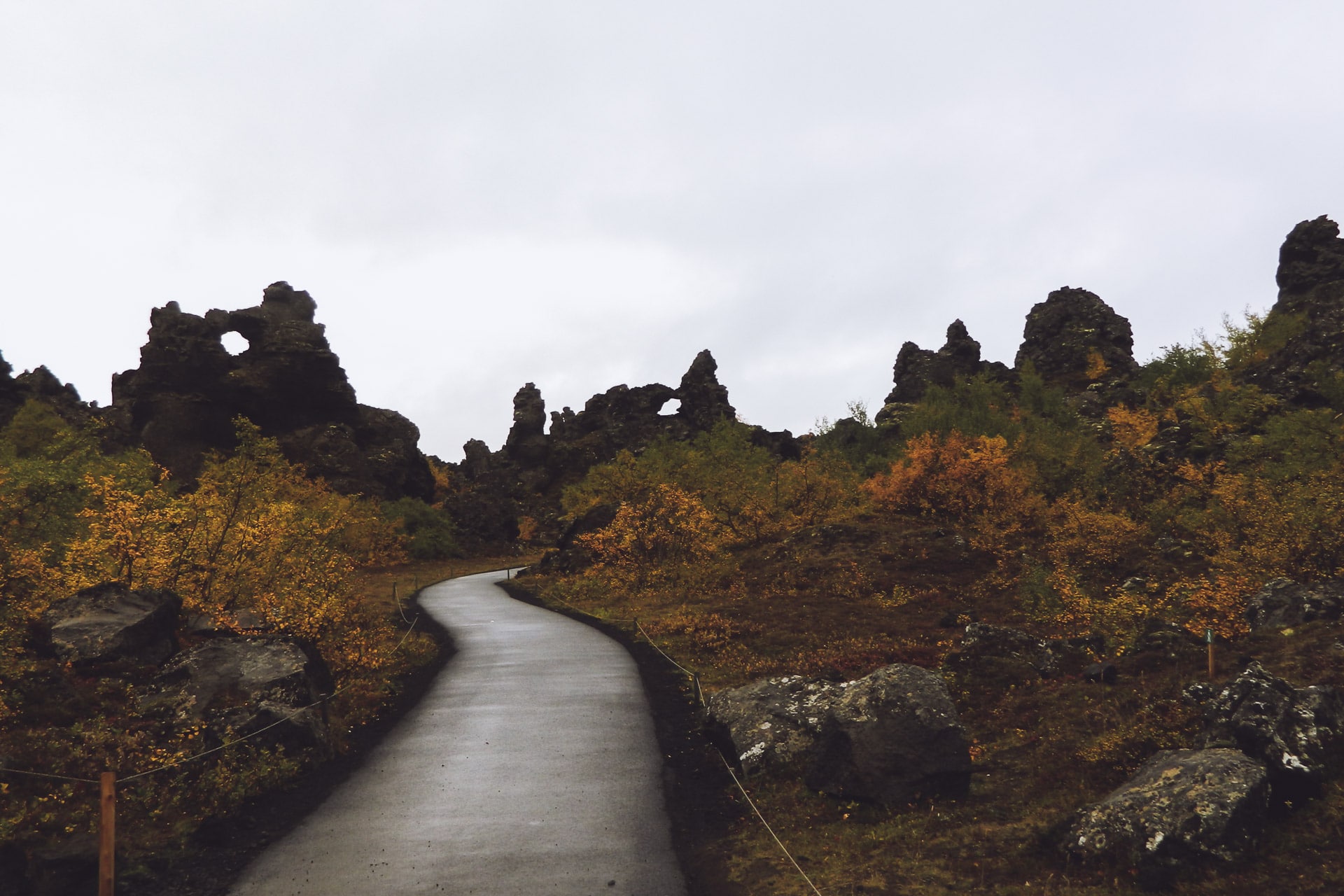
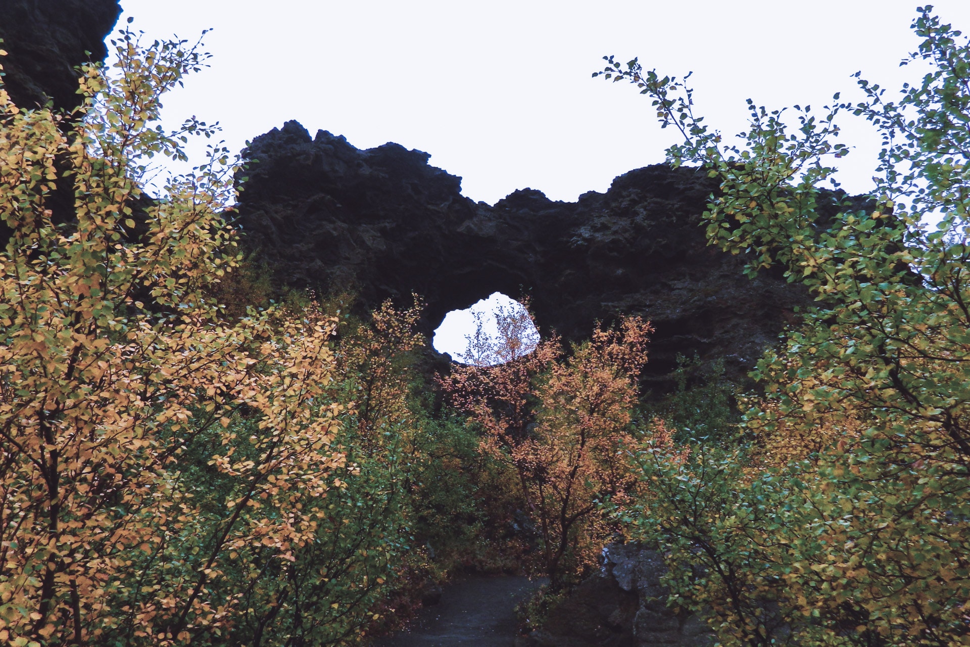
I begin my visits around Myvatn by Dimmuborgir. This amazing place is a set of basaltic structures with extravagant forms and forming a true labyrinth. I visit with Stefie, the German backpacker of the previous day that I met in the parking lot.
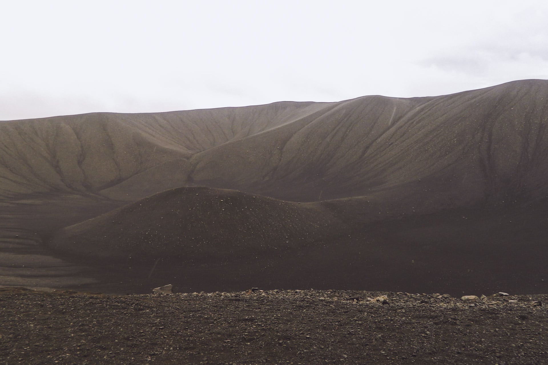
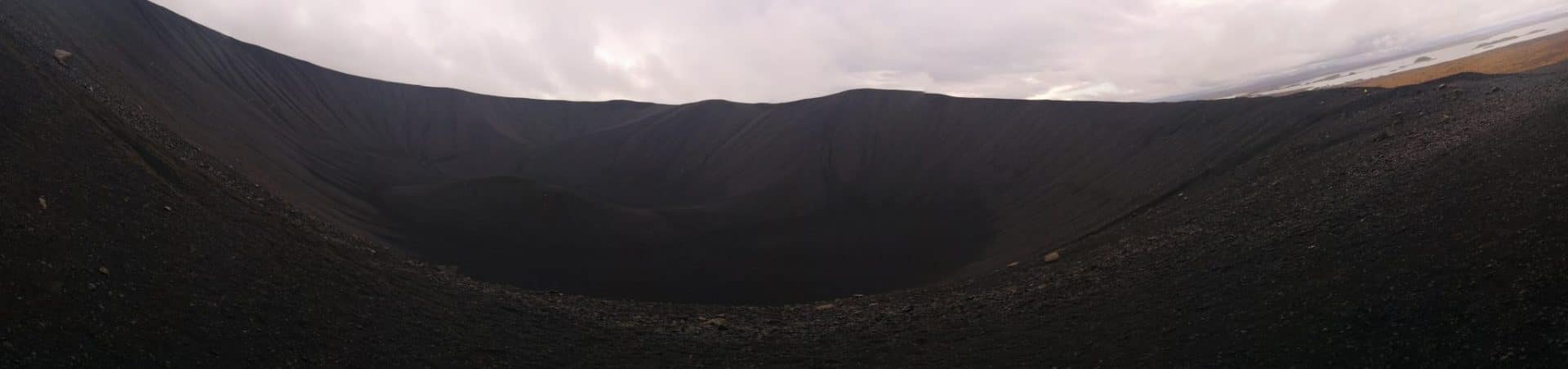
We then continue towards Hverfell, an immense cone of ashes and peebbles of obviously volcanic origin. It is gray at the end of the morning, so it gives the whole impression of Mordor or Lunar landscape. The view from the top is beautiful and the whole is impressive.
For the descent we make this full slope, it is more fun and faster.
We then walk to a geothermal cave, Grjotgja. The cave is nestled in a steaming crack.
On returning from the cave, Stefie continues the road on his side. On my side I head for the Krafla. The sun is finally back and it changes everything!
I roll the windows wide open, the music to the max! The landscapes change it is more and more beautiful.
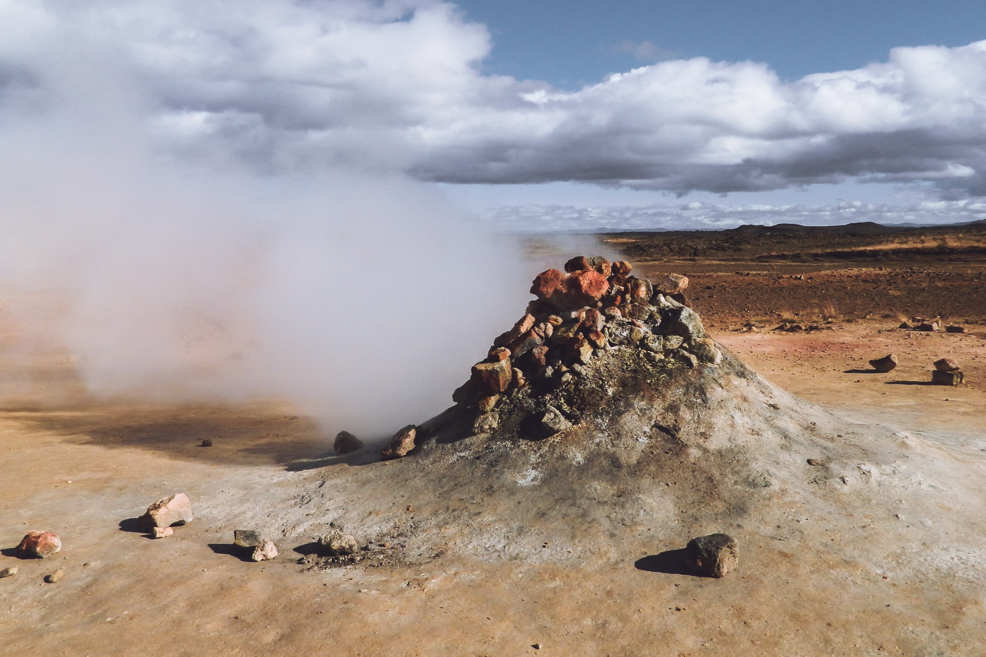
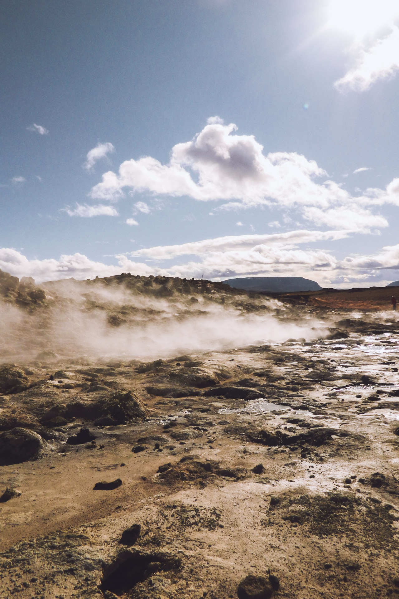
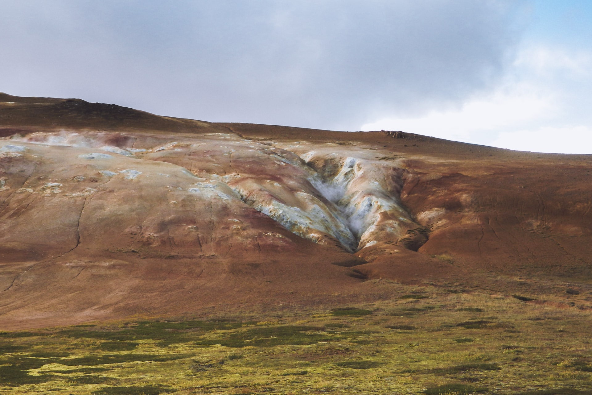
After a big hill, I stop at Hverir which is a large area with rich volcanic activity: fumaroles, boiling baths and a good smell of sulfur. It’s very beautiful, the colors are crazy.
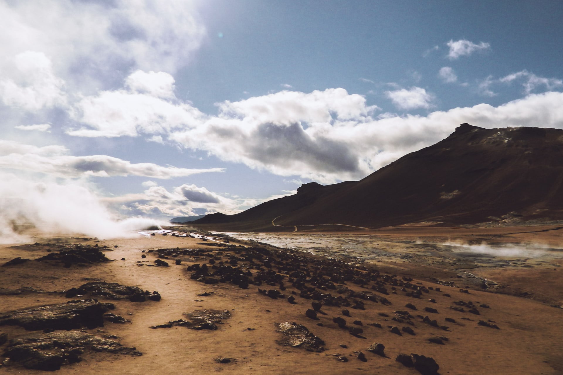
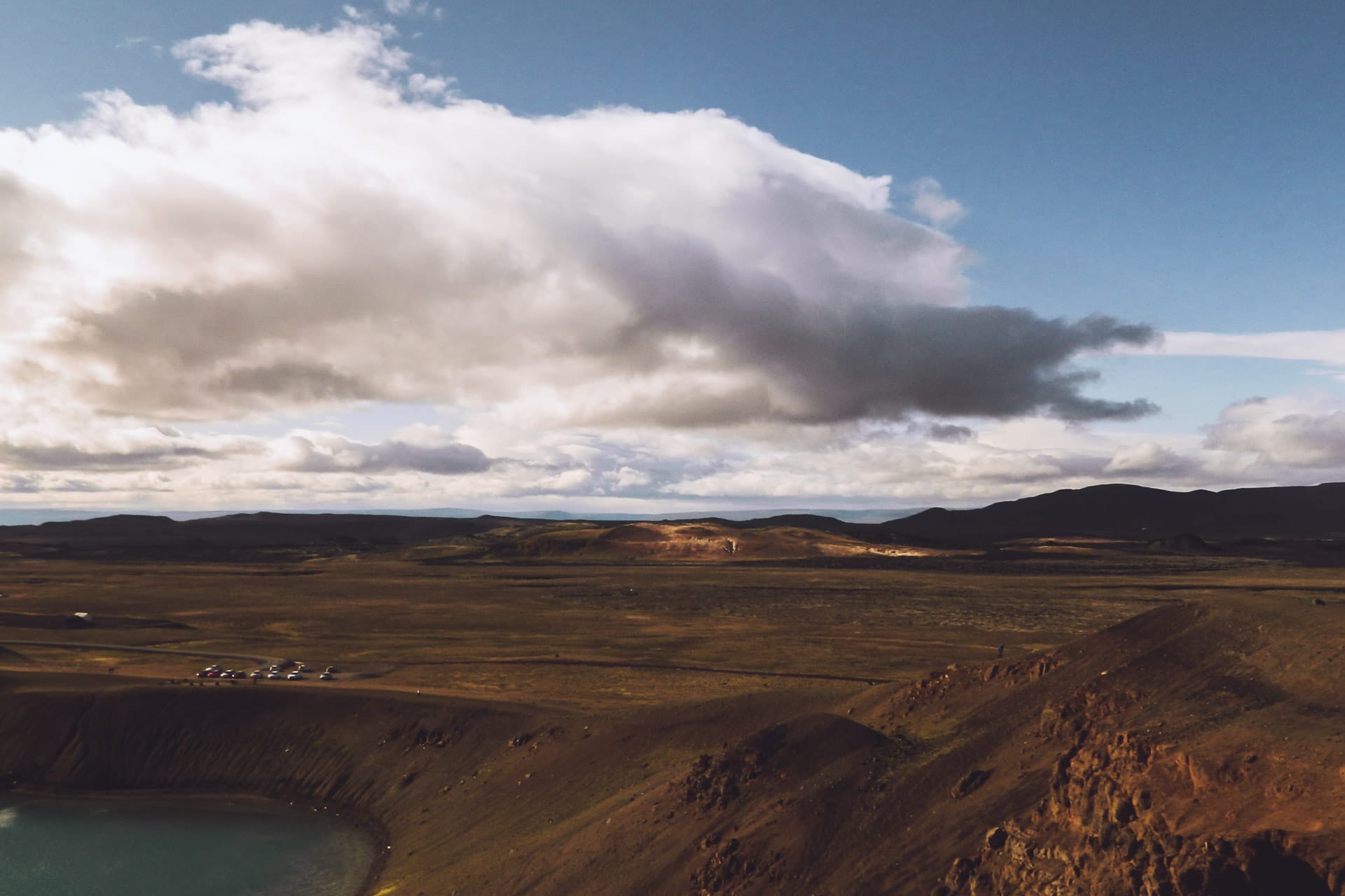
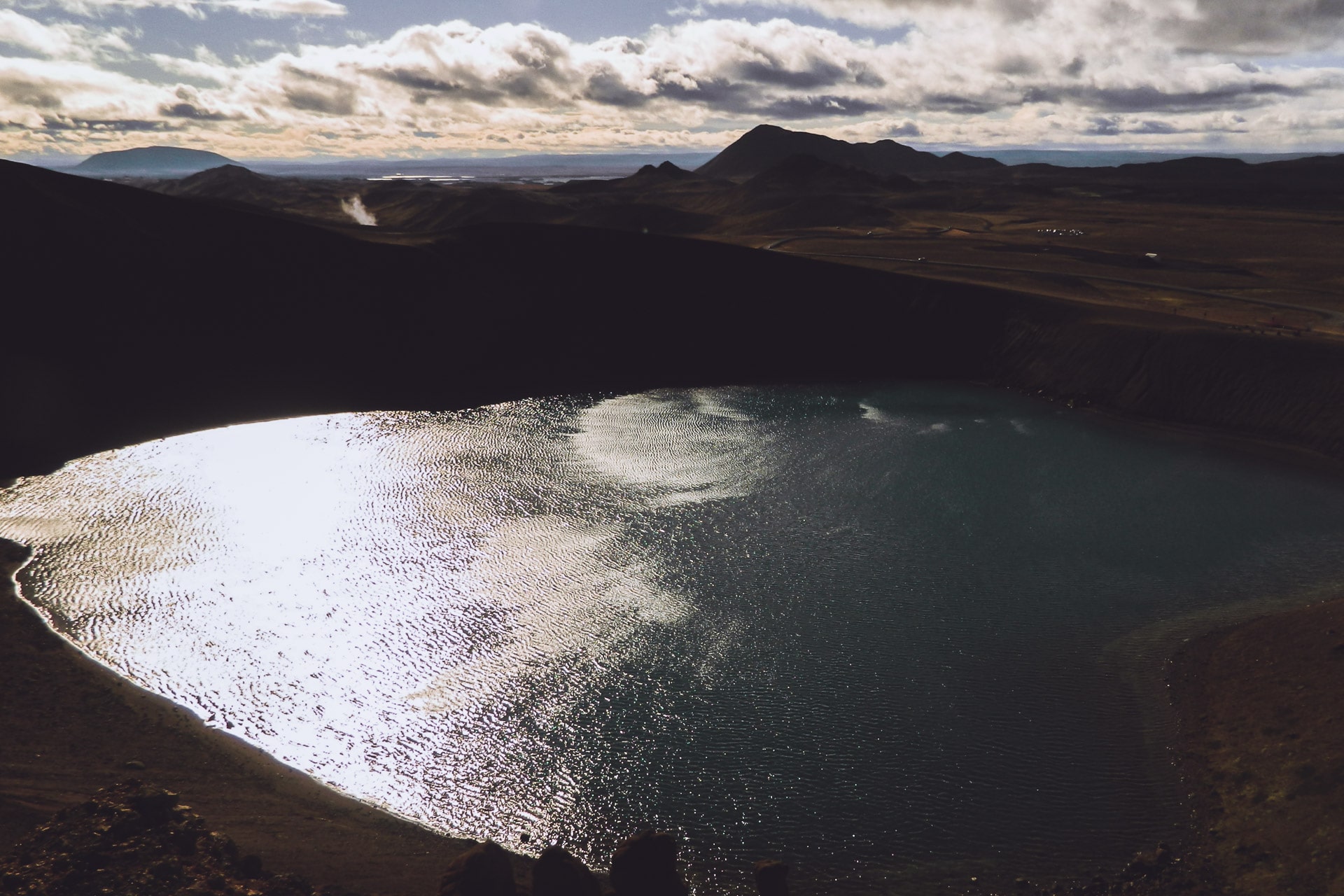
I continue the road a few kilometers before turning on the left towards Krafla, a volcano of 818m of altitude know to have a rich activity its last eruption dates from 1984. The place is very windy today, it adds to the majesty of nature here with the crater and its lake of unrealistic blue waters. It’s beautiful.
I then walk through a lava filed that is just a few years old. Life slowly resumes in the middle of the black rocks. There are not many people, it’s beautiful, all this invites to stroll.
Then back on the road 1. Direction to the east in absolutely wonderful landscapes! You can see dozens of kilometers around. There is nobody, it’s fine, I press a little (too much) on the gas pedal; the sensation of freedom is absolute! I feel very happy and lucky at this time…
After the swiftly swallowed kilometers, I turn left onto Route 864 which will take me to Detifoss. But for the time being I’m going to find a little place for the night because it is getting late and I do not move fast on this small gravel road.
I will not be far from the road but as usual there is nobody to bother me … In the distance I see the Krafla despite its distance of about 40km. Superb camping place. This certainly has been the best day of the trip. So many beautiful things to see …
Day 9 : Detifoss, Seydisfjordur and Snaefell
What a silence this night … It gives an impression almost disturbing sometimes because the mind is quick to invent noises …
I am back on the road quickly because it is cool this morning, so I will have breakfast further. I arrived at Detifoss after 40min of road a bit difficult because very rippled and therefore uncomfortable.
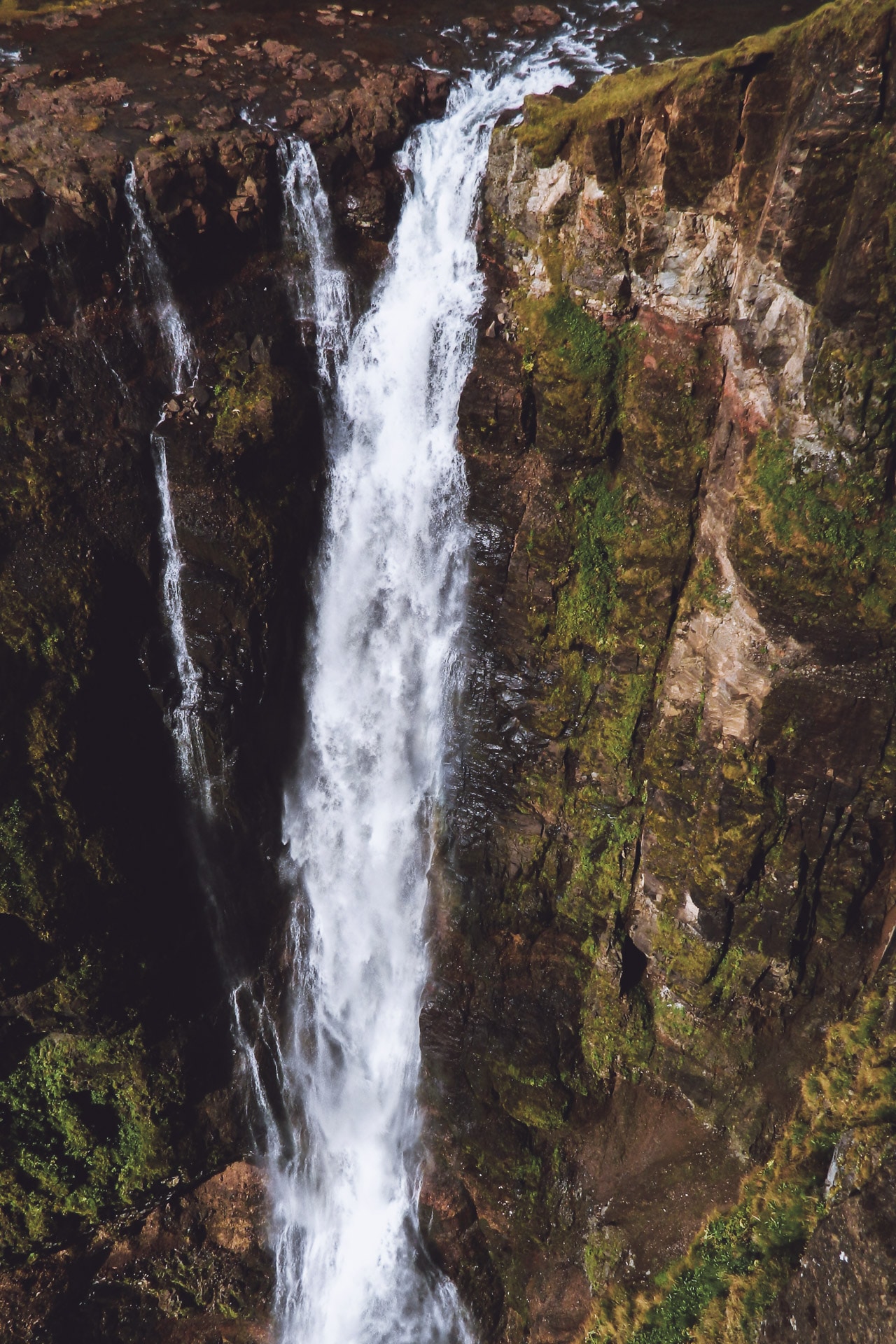
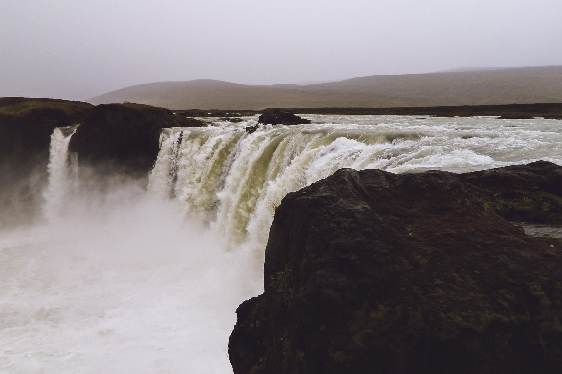
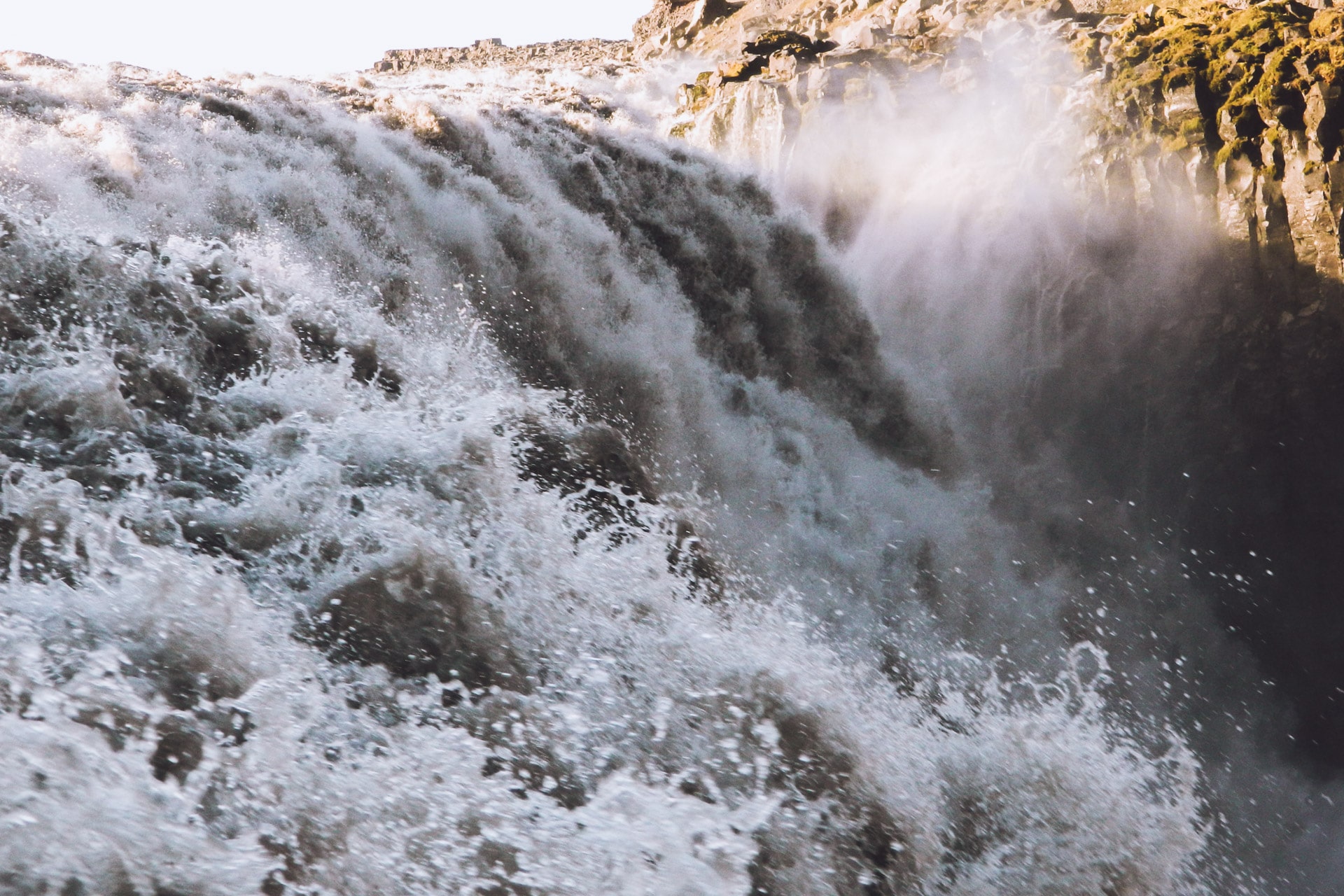
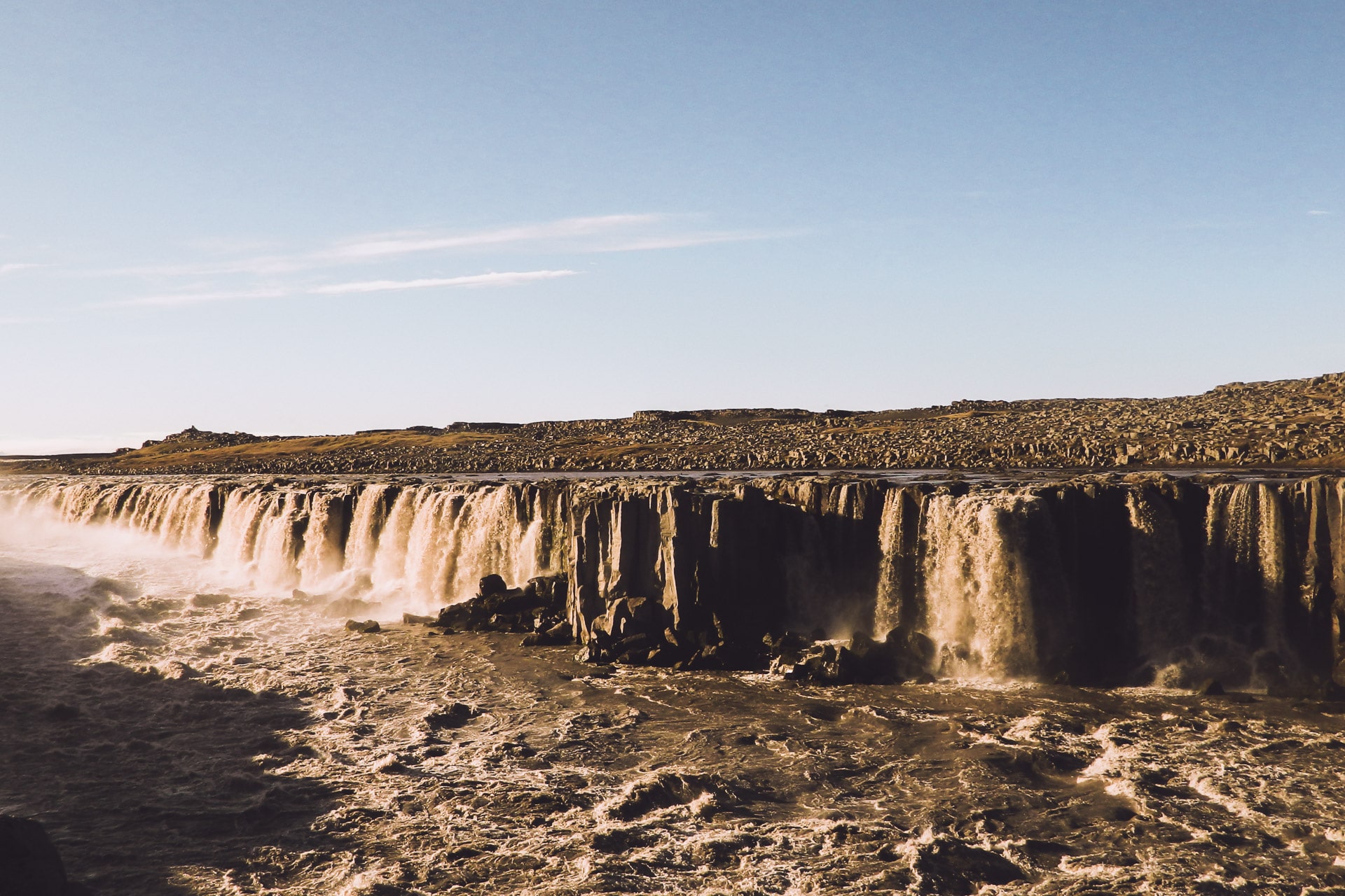
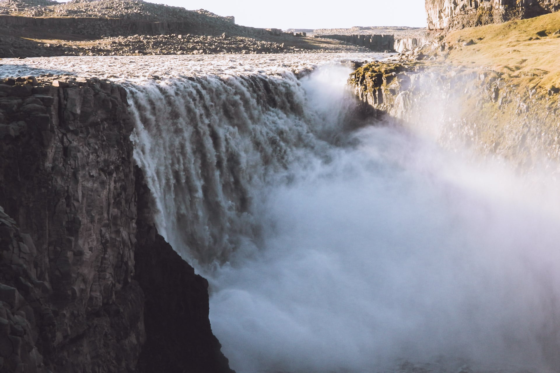
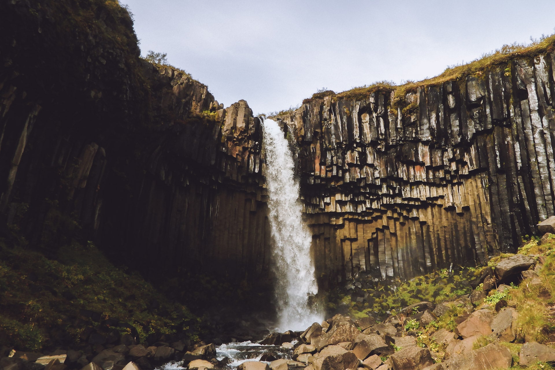
I go down to the waterfall, it’s stunning! Detifoss is the waterfall of Europe which has the biggest flow with 200 000 liters per second for a fall of 44m … It is the most impressive waterfall that I have been given to see. What is good in Iceland is that there is little barrier, so here we can advance until we have feet in the water at the edge of the fall … impressive …
The intro scene of the movie Prometheus was shot at Detifoss.
I then walk up the Jökulsá river to Fjöllum towards the Selfoss waterfall upstream. Also impressive by its width.
After returning to Detifoss, I enjoy a bit the show and do a geocache in the area, I then go back to the parking lot to have a coffee and breakfast.
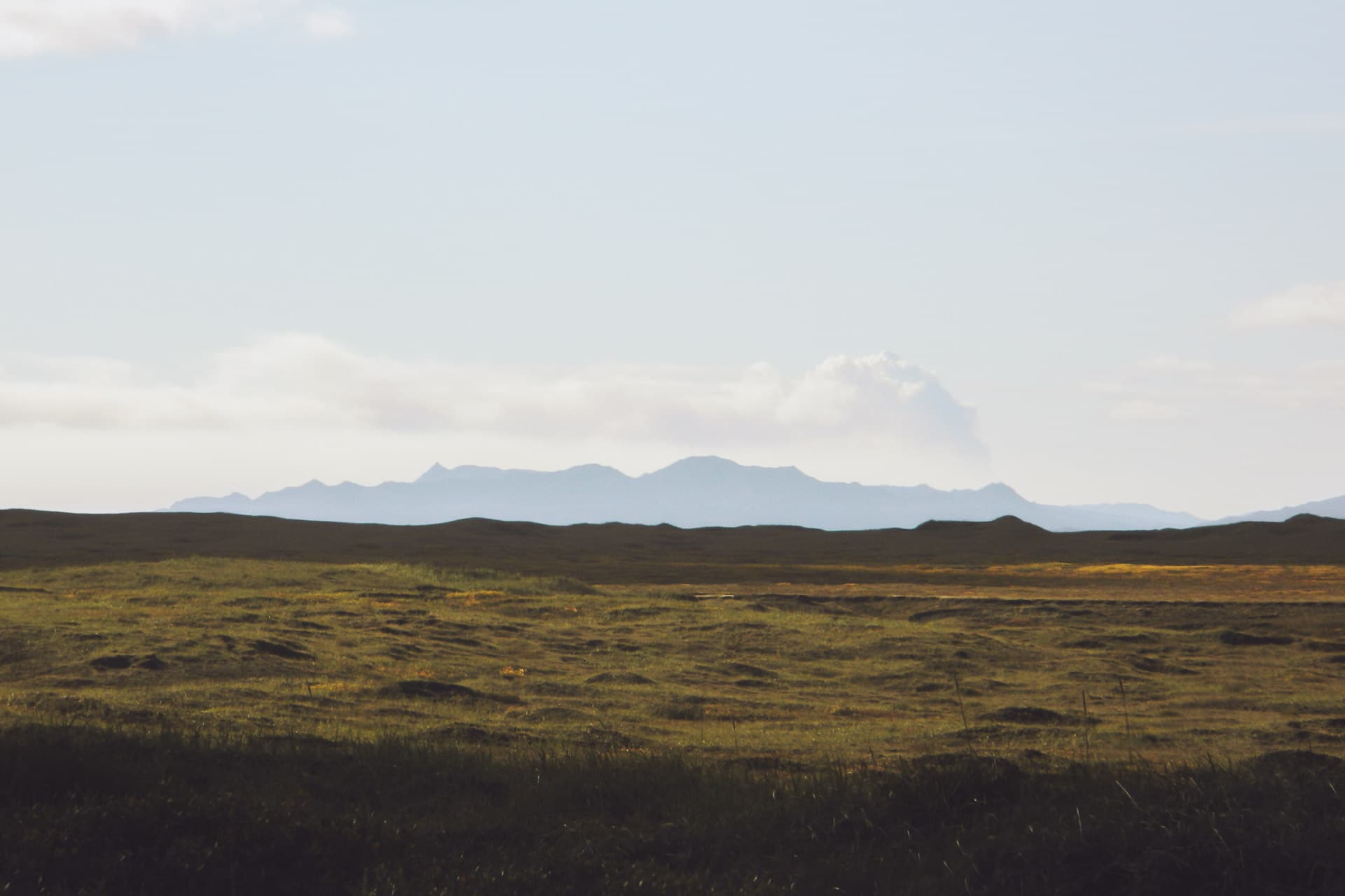
Then back to road 1. The sun is shining, the sky is blue and the road still wavy. The ground is black ash, which gives a moon face to the landscape. In the distance a cloud draws my eyes, looking carefully it is the plume of smoke of the eruption of Bárðarbunga which was going on when I was there. Despite the distance one can see it.
I run full east then. The landscapes, still amazing, pass too quickly. I arrive at Egilsstaðir but the city is very disappointing and I only stop for shopping and gas.
I then go on road 93 which leads me to Seydisfjordur. The descent is particularly interesting and fun by car. The small village is nestled at the bottom of a fjord, it’s nice. I stop at the little hostel / restaurant for a drink in the sun.
A scene from the movie Walter Mitty was shot at this hotel (when there is the eruption after the longboard descent)
Half turn then and I resume direction of the 1 but not for very long because I obliged towards the 931 in the idea to climb on the plateau of Snaefell. The view is beautiful on the height coming from Egilsstaðir but we see a kind of grayish fog that is due to the eruption of the Bárðarbunga.
The climb on the plateau, by road 910, is impressive. Above, total change of atmosphere: we find ourselves in a kind of tundra as far as the eye can see. In the distance the Snaefell, highest point of Iceland with 1833m, and the Vatnajökull also.
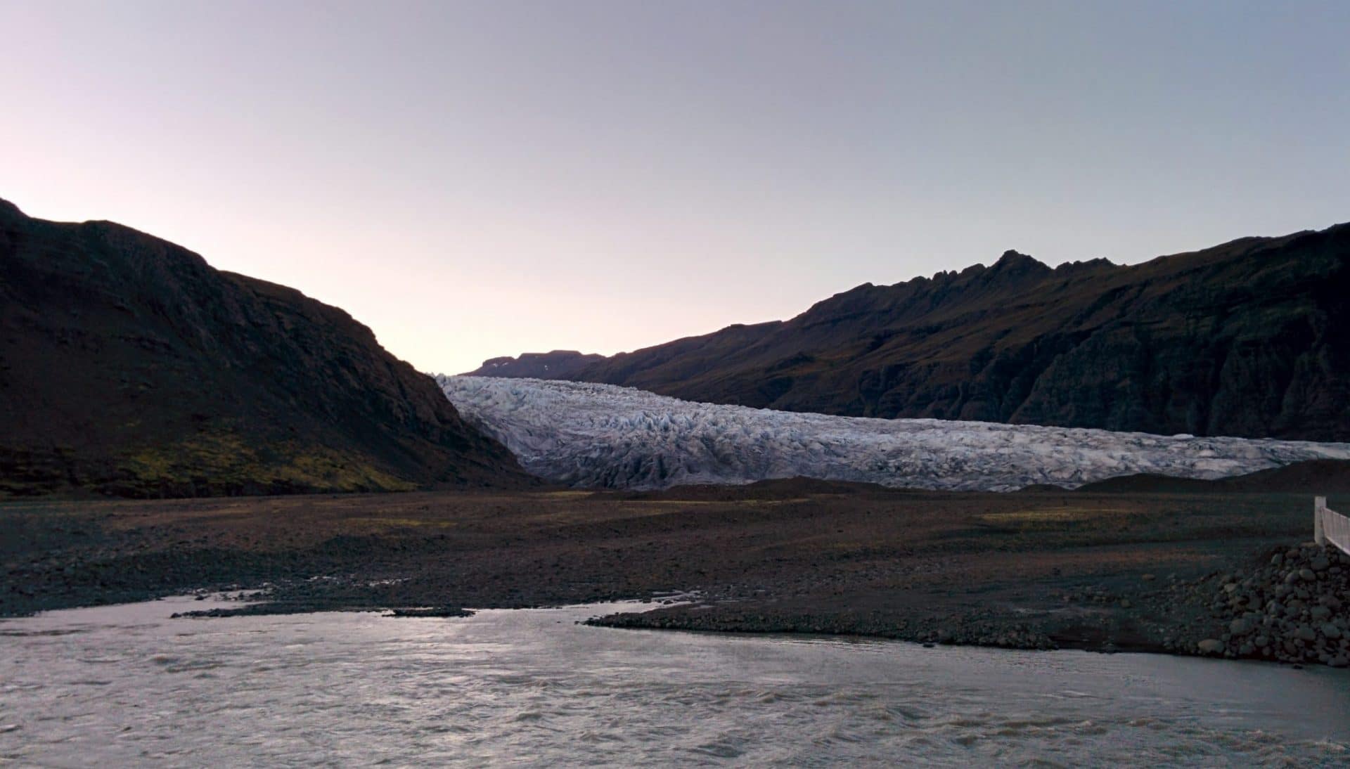
The Vatnajökull is a gigantic glacier that covers 8% of Iceland, almost the surface of Corsica in comparison. It can reach 1000m thick, it contains several volcanoes within it, including some in activity.
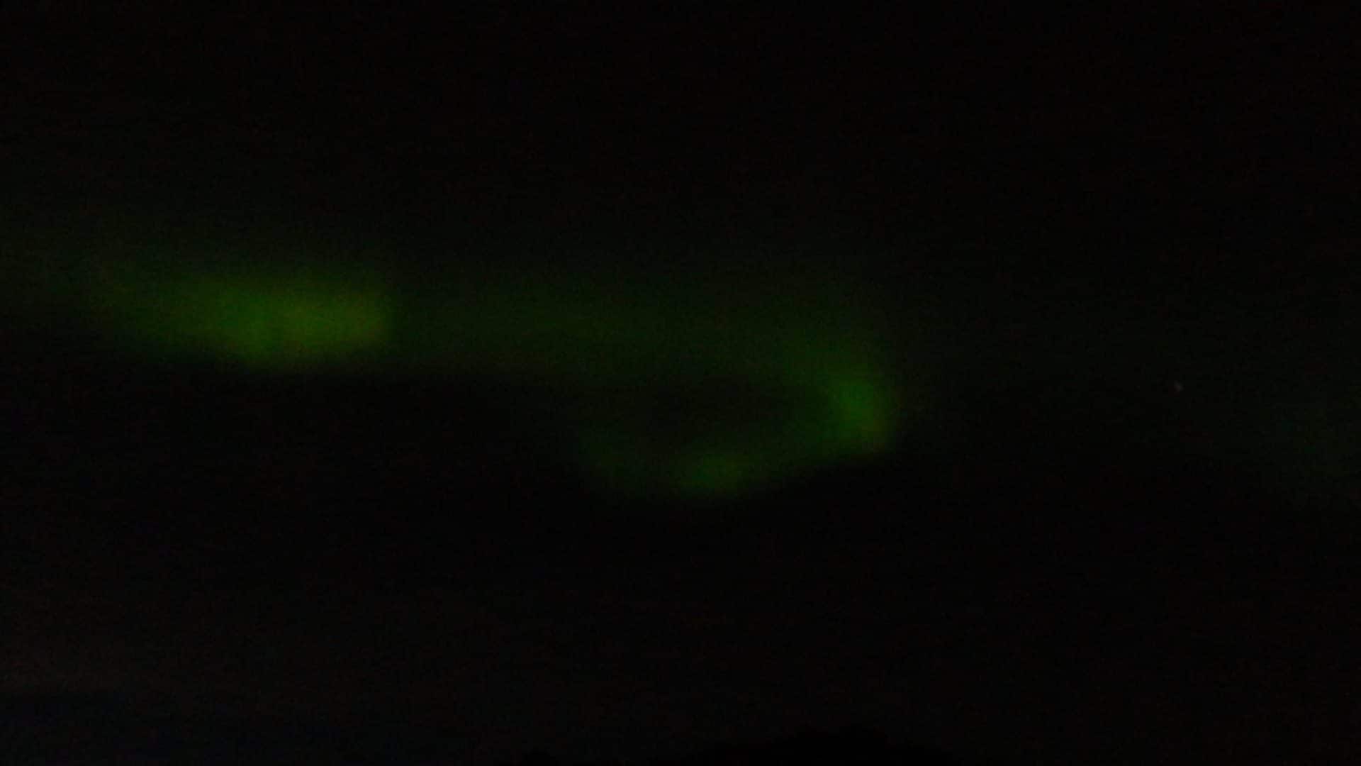
For the evening I find myself a beautiful place with a great view to set the tent. The glacier, not far away, is cooling the air and there is a lot of wind. There are normally a lot of reindeers in this area but I have not seen them yet … maybe tomorrow. In the night, I go out to see if there is no aurora (as almost every night), no aurora but in the distance I see clouds all red, despite the night, due to the direction of them, I think it was the reflection of the light emitted by the lava of the eruption of the volcano on the clouds. The impression was singular.
Day 10 : South East
Cold night! But it was Ok. Light program of today.
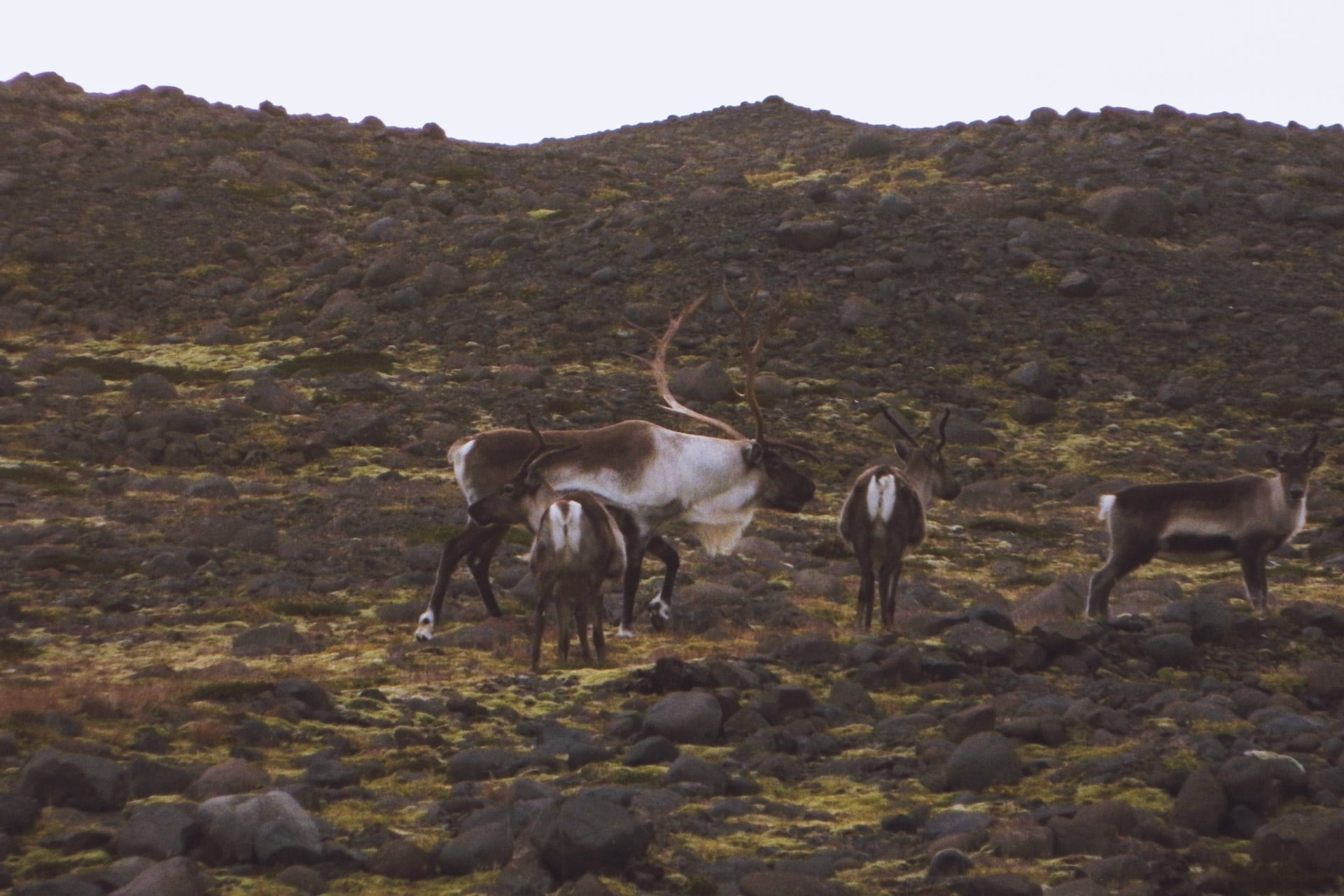
So I take my time in the morning, first I go to see the hydroelectric dam not far from where I camped. Half turn then, on the way I do not drive fast to try to see reindeers but they are not here….
At the descent I witness a nice phenomenon : there is so much wind that a waterfall usually hung on the wall climbs towards the sky … not trivial ….
I then drive south. Rather than following only Route 1, I take the 939 which passes through the mountain and is much nicer.
The descent towards the coast is beautiful. The weather is nice even if it’s a bit cloudy on the shore, so it creates very nice light effects.
After a meal break in the village of Djupivogur, I continue on route 1 towards Hofn. I pass quickly without taking too much time.
Time flies and it is already time to find a place to sleep (I mainly drove today). Task arduous tonight because few places seem nice enough.
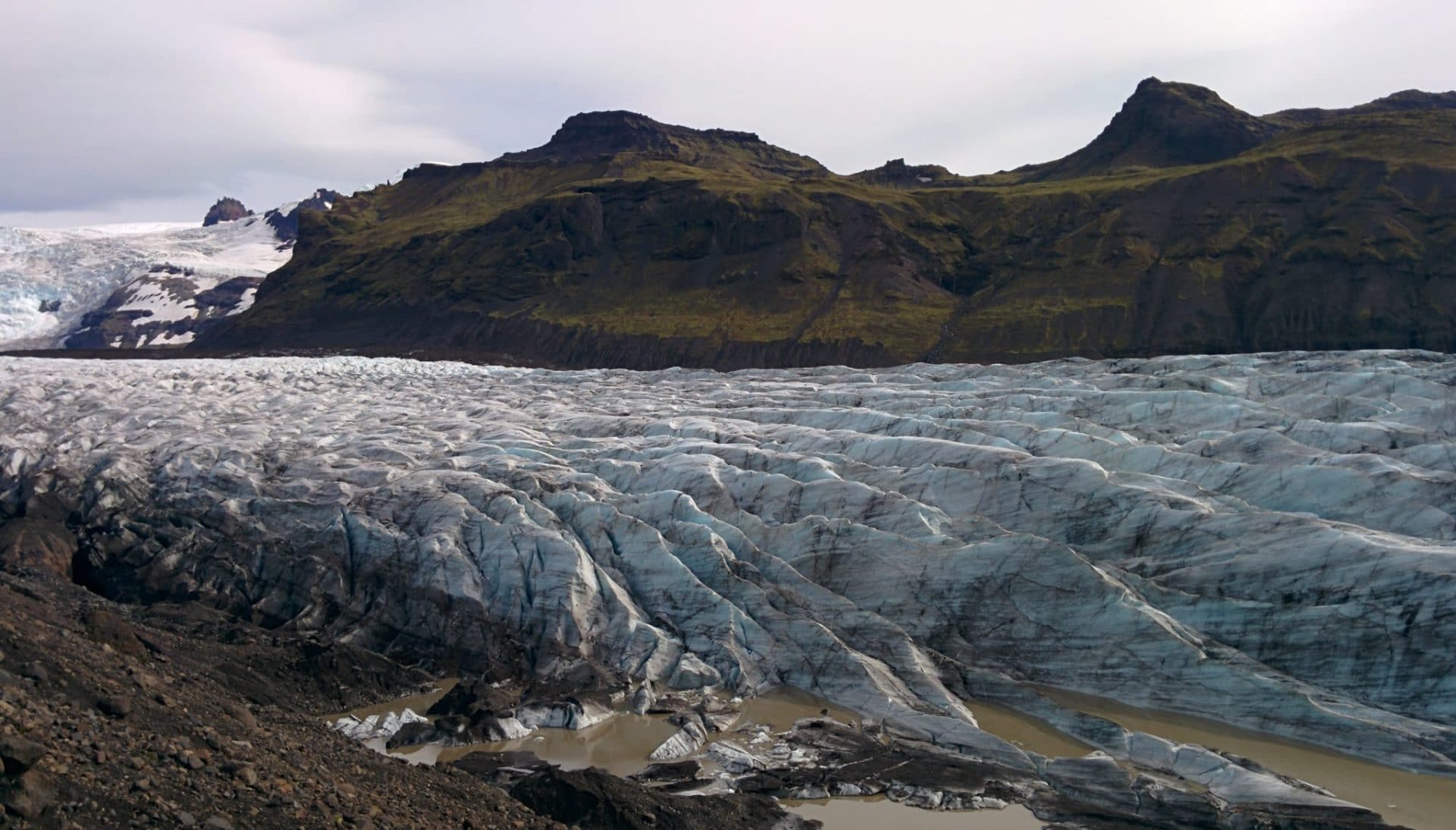
After a long search I headed for the Flaajokull. The glacier is a part of the Vatnajokull. Unfortunately, the glacier recedes due to its melting …
In the evening after having booked I take a look outside and there Ô miracle an AURORA !! It is quite covered and the aurora is not very strong but that is beautiful! I try the picture below but the rendering is not crazy … it will have been a beautiful gift anyway.
Day 11 : Jokulsarlon, Skatafell and Sandar
Today’s busy day will begin with the well-known Jokulsarlon.
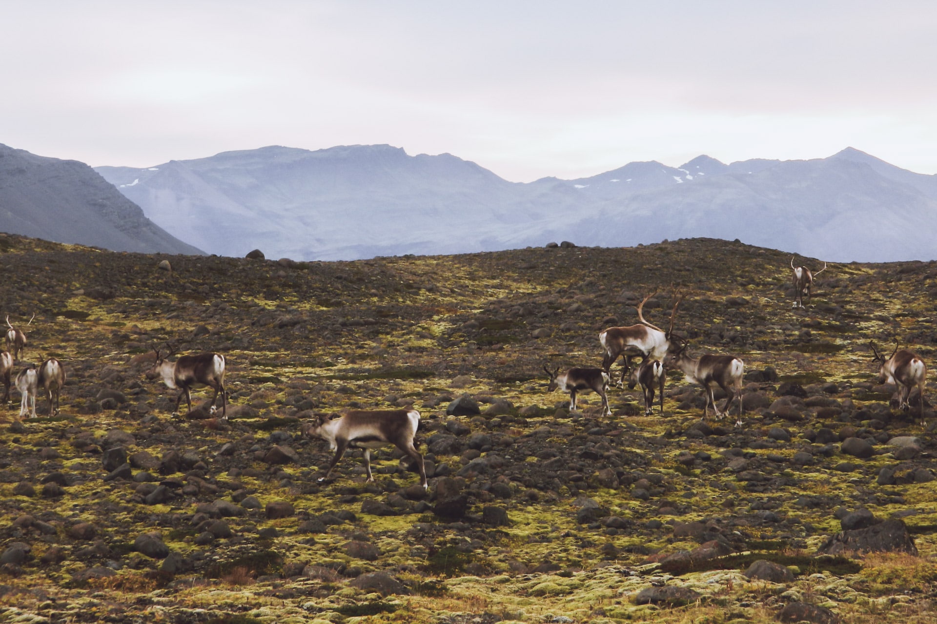
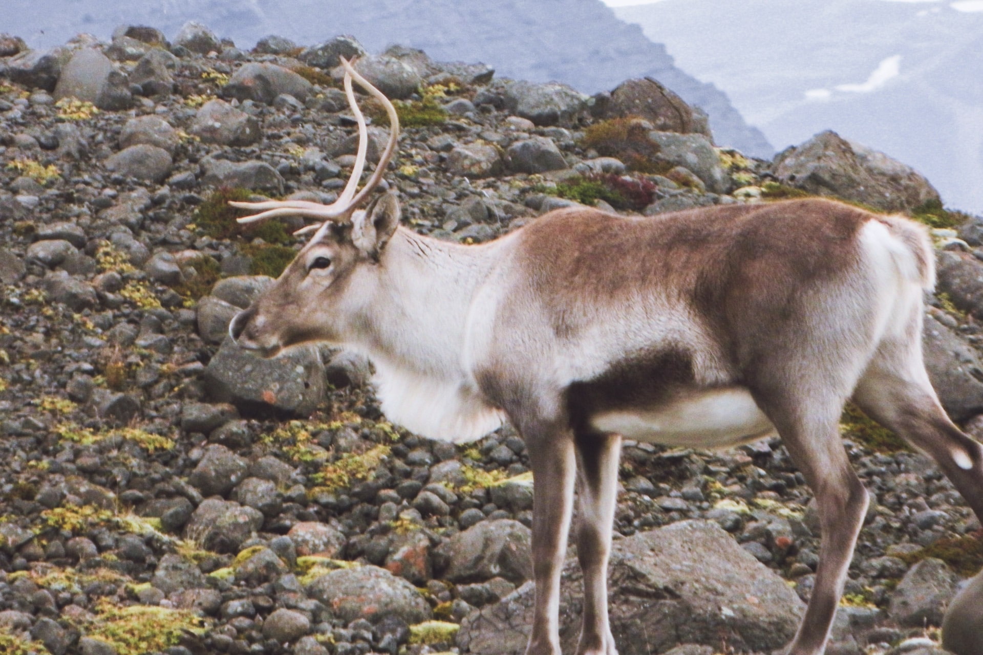
On the road that leads me to Route 1, I have the wonderful surprise of falling on a herd of reindeer. There must be about twenty animals and a superb male with impressive antlers. I enjoy a little while watching them grazing.
The road to Jokulsarlon is short. I arrive on site where there are already a few people.
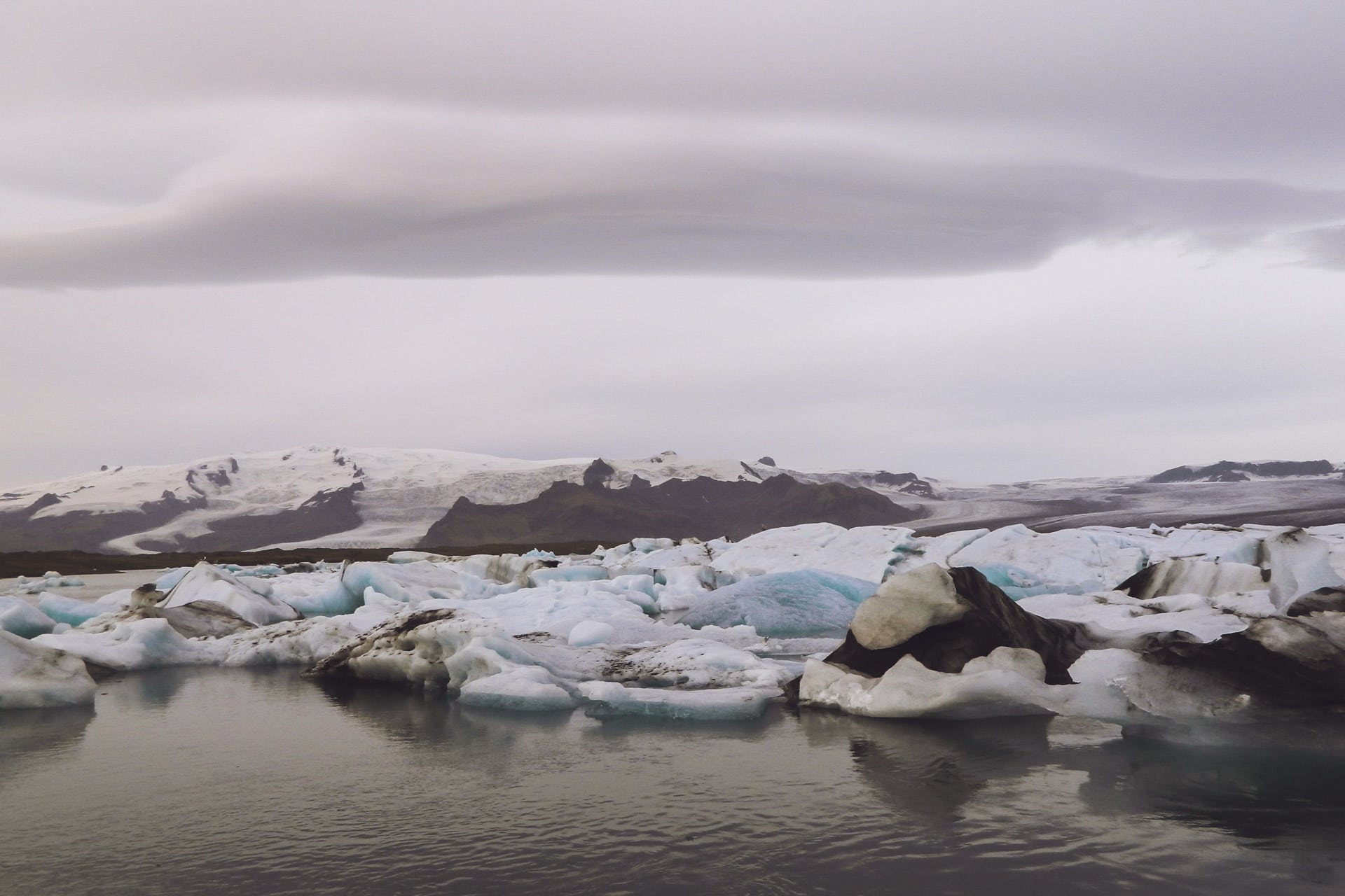
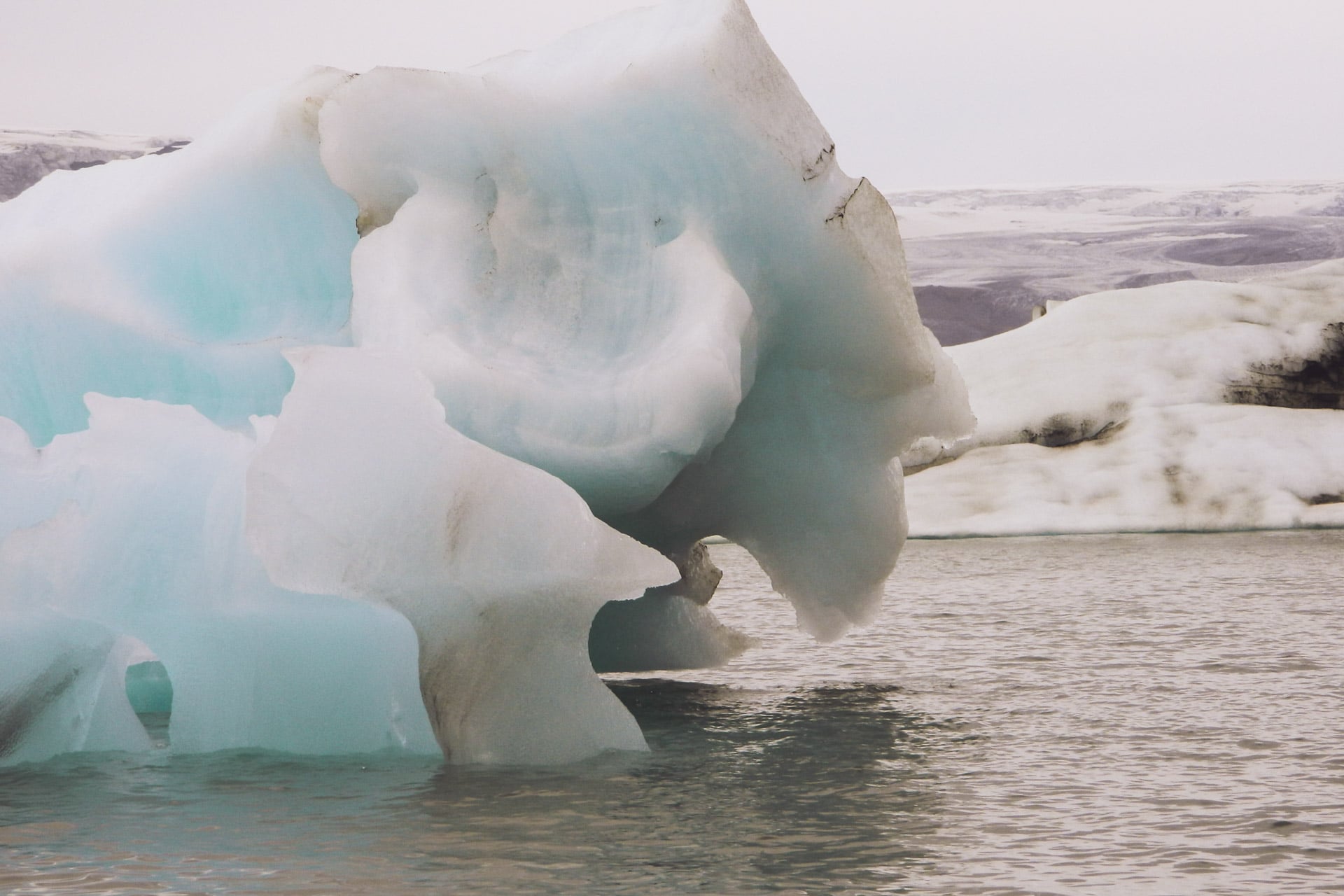
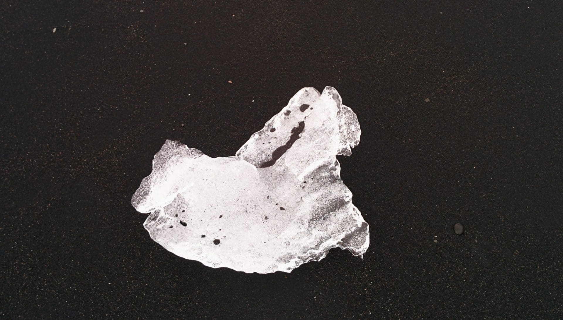
The place is beautiful, the huge glacier flows into a large lake where it melts and then flows into the sea. As the glacier breaks as it arrives in the lake it is filled with blue and gray icebergs. It is very beautiful. To top it all, seals live here and let themselves be approached. On the black sand beach, the icebergs run aground, giving striking contrasts.
This place has been filming many films including Lara Croft and James Bond Tomorrow Never dies.
After Jokulsarlon, I take the road again and stop at a glacier to make a geocache.
A scene of Batman begins was filmed near this glacier.
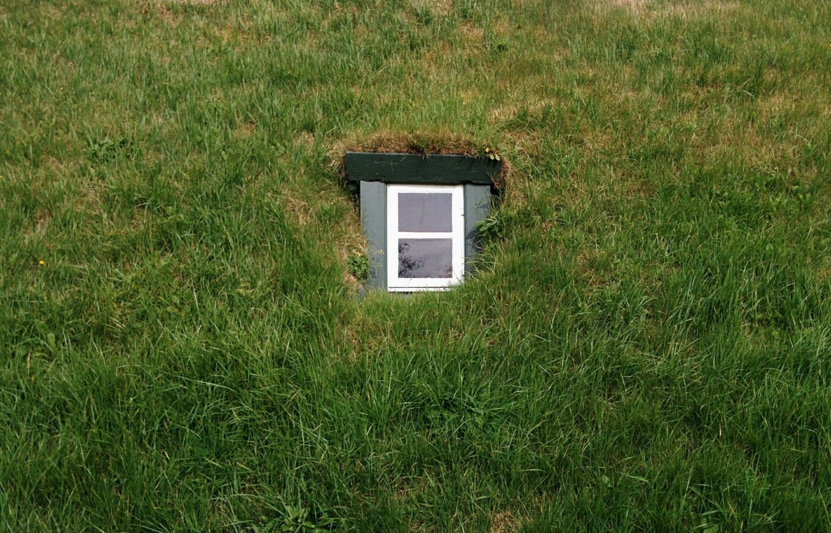
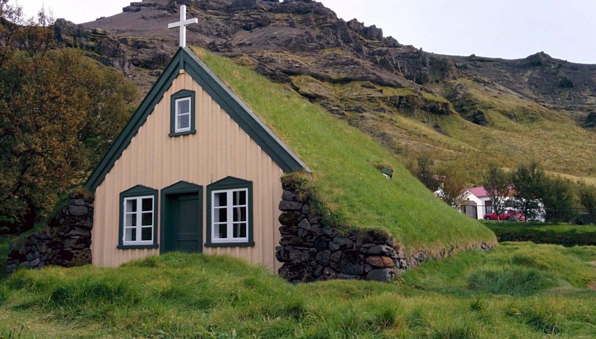
I then continue to another hidden geocache next to a beautiful church with a roof of vegetal.
Direction Skaftafell. Skaftafell is a national park offering plenty of hike possibilities and activity. With hindsight I should have spent a whole day there instead of few hours.
I decide to carry out the small hike that leads to the Svartifoss waterfall. There are trees, which is relatively rare in Iceland. The path is nice and easy. The superb cascade: it is a horseshoe cliff made up of basaltic organs. It is very beautiful.
I should have stayed a bit longer in the Skaftafell but I continued my route to the Sandar.
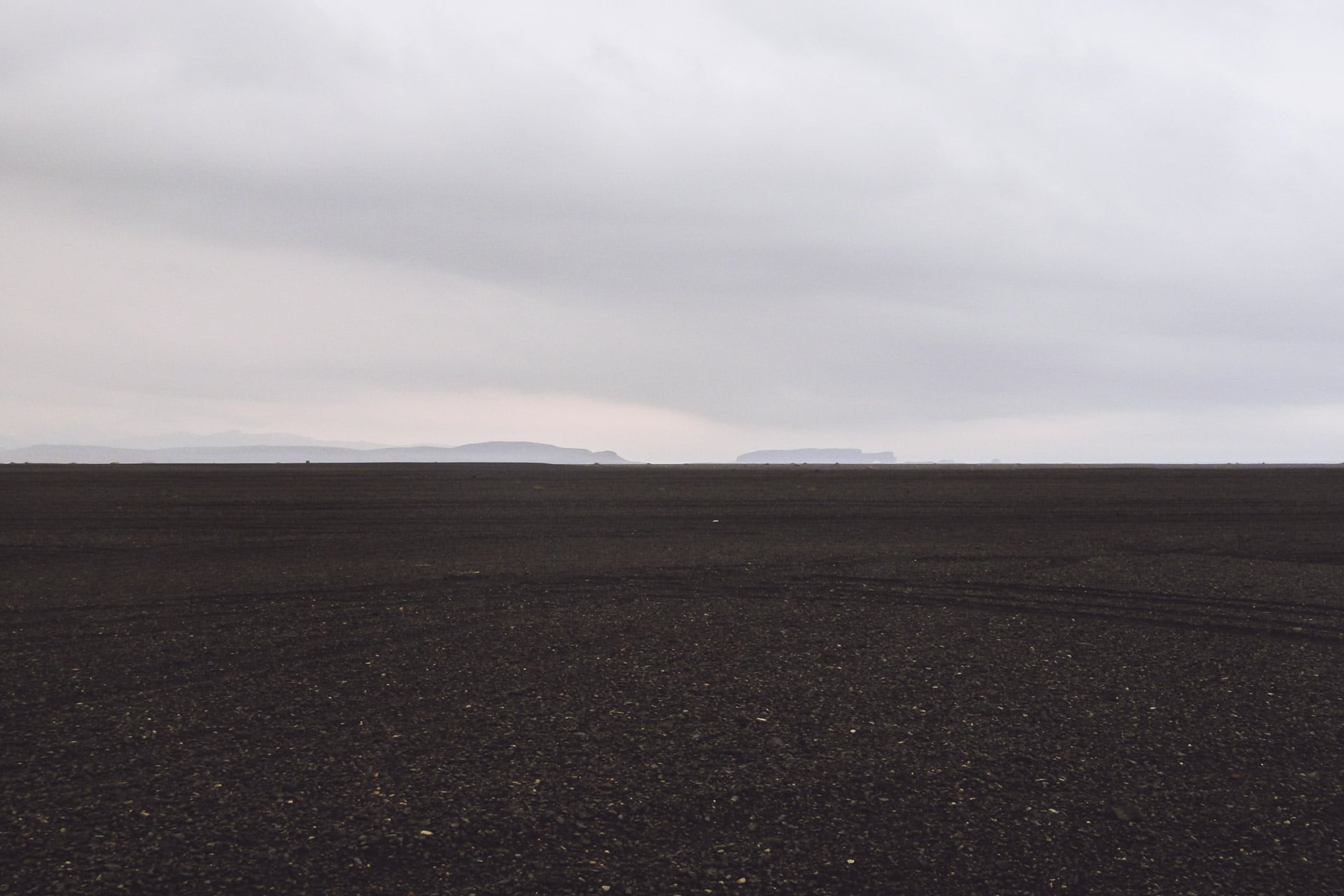
The Sandar, those are huge expanses of black sand that are created during eruptions. The volcanoes melt the ice, especially the Vatnajokull, creating enormous mudslides loaded with rocks and devastating everything in its path.
So the Sandar is a little depressing … Black sand as far as the eye can see and under the gray sky it does not make things more cheerful …
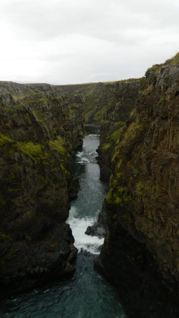
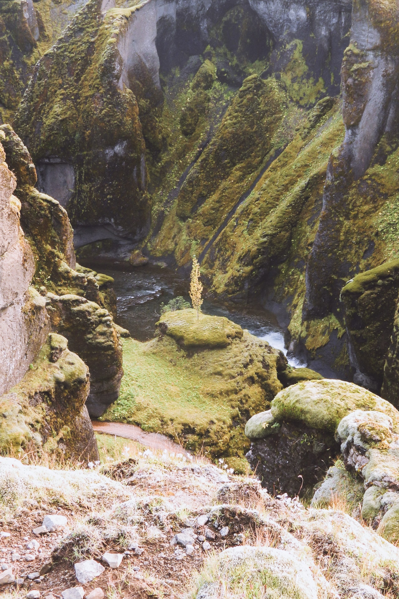
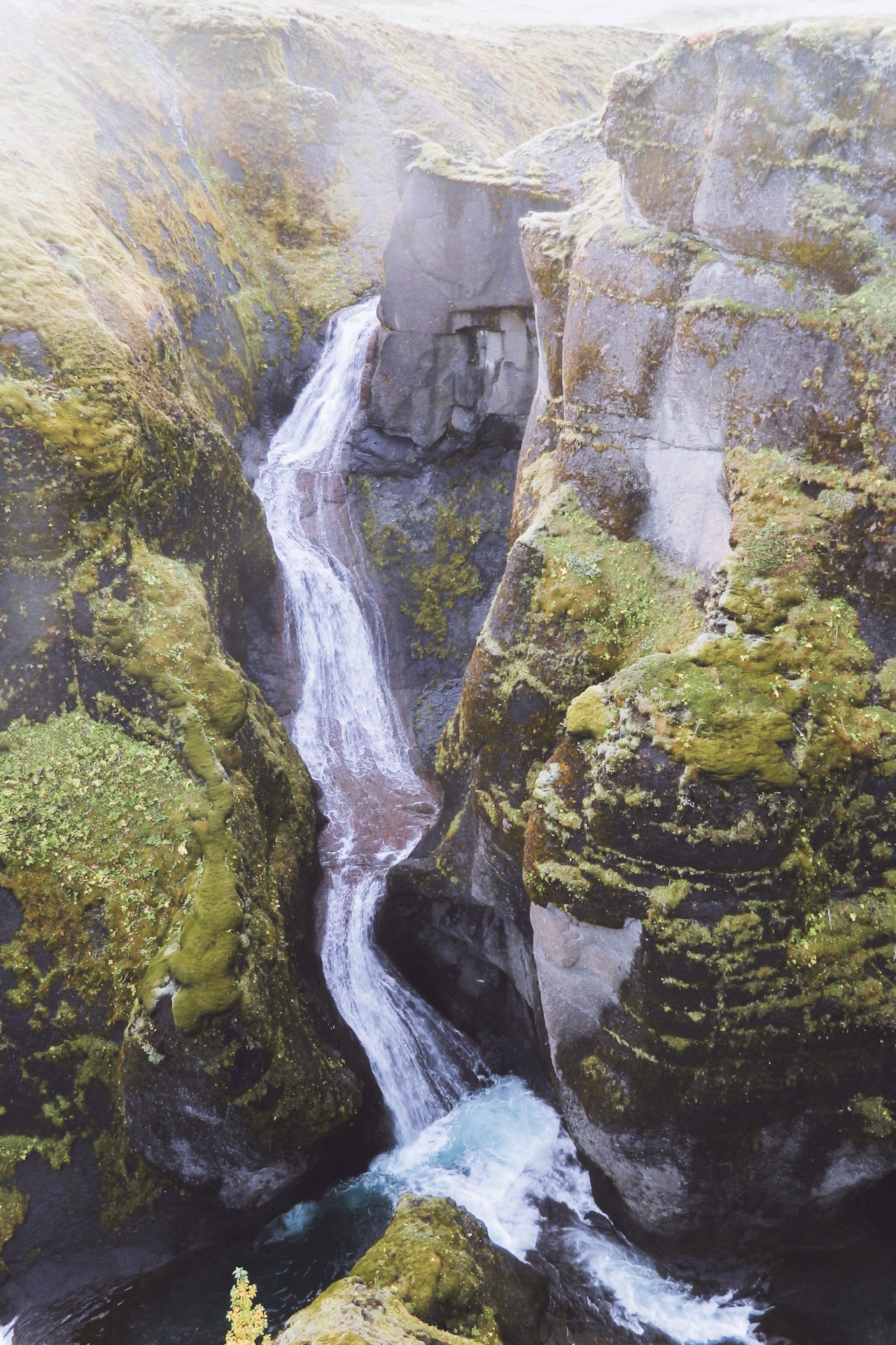
For the night I head towards Fjaðargljufur. It is a 2km canyon, the walls are vertical with the river at the bottom. The greens are impressive, with the black sandur at the bottom it’s beautiful.
The view for the night is good, more than a few days in Iceland, I have to profit.
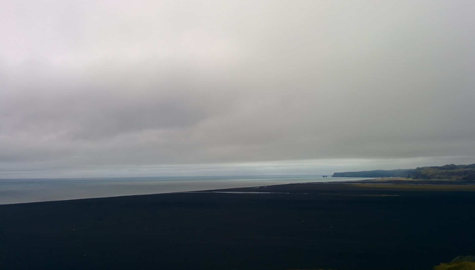
Day 12 : Hjorleifjskofði, DC-3 et waterfalls
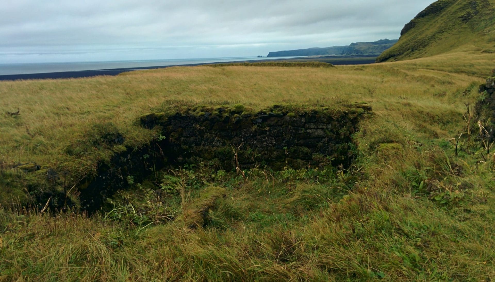
A long day ahead. It begins with the visit of the Hjorleifskofði. This place was advised by a friend, Julien, who went there in February. This place is historical and is one of the first places of settlement of Iceland and a Viking tomb is at the top. The place is a little magical, it looks like a lost island in the middle of a sea of black sand. In the past it was an island but the level of the sea fell thus linking the “hill” to Iceland.
The ascent of the 220m of the hill, alone, in the rain has something mystical. No one comes here because it is not known. Up the view from the tomb is sublime especially in bad weather, I think. A little further down are the ruins of Arnarson’s farm. I also find the trace of the passage of my buddy on the logbook of the geocache of the summit. I’m glad I came here.
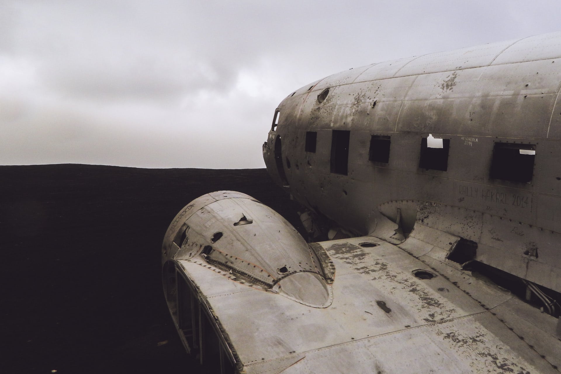
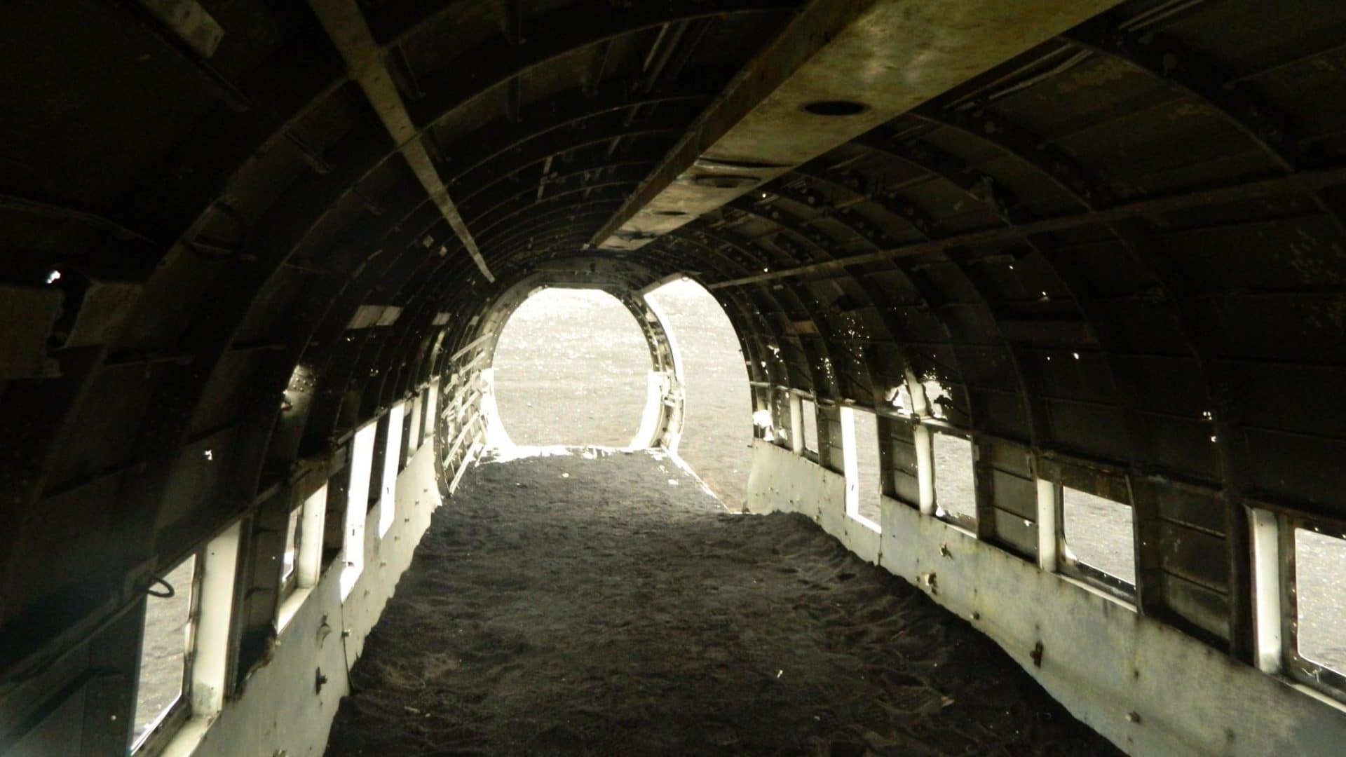
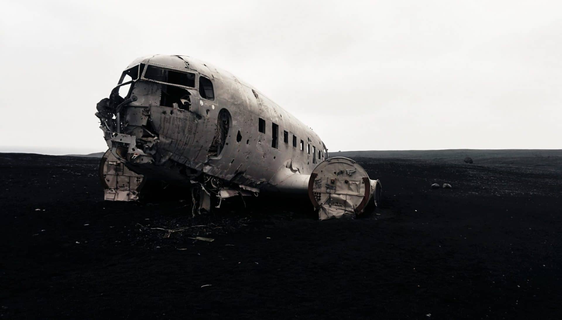
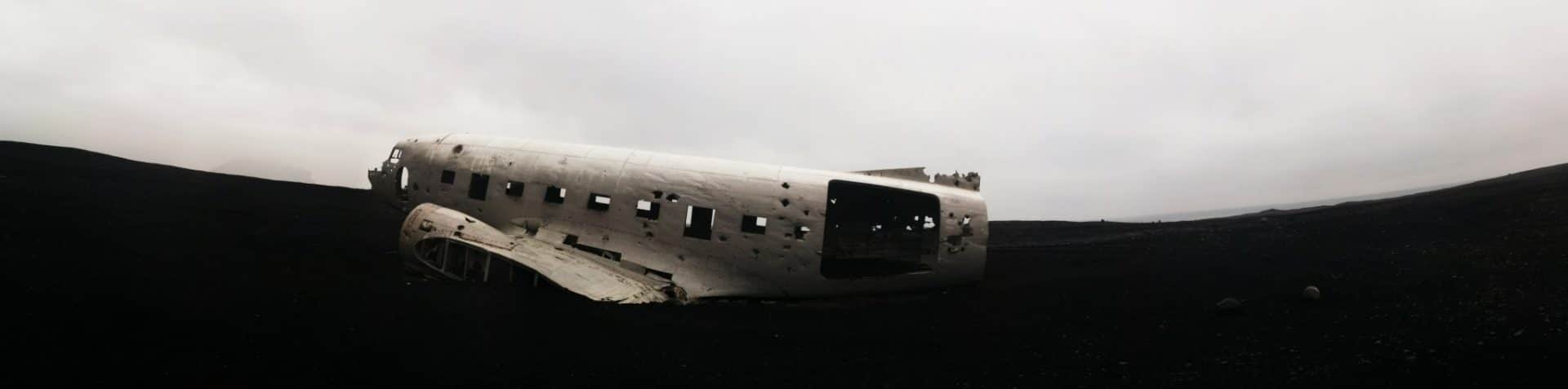
My next step is the wreckage of an old DC-3 who crashed here after the war. To get there you have to find the beginning of the road that I will walk because the car would not pass I think.
Rendering on the spot I attack the ride of 3,5km. I go well, in the immensity of the Sandur, and in the distance I begin to see the plane.
Except that … except that the more I get closer I think there is a problem: a good big river with a large flow cuts me the way for the plane … I decide to go lower down in order to ” Try to see if there is a passage. But no, no passage. Rather than taking risks to cross I turn back. Looking closer I realize my mistake and I resume the car to push 400m further and finally take the good entry for the plane … I attack the 4km again. The plane is approaching again but for good this time.
It’s a bit surreal to see it like that. It does not remain all the pieces but the plane is in good condition.
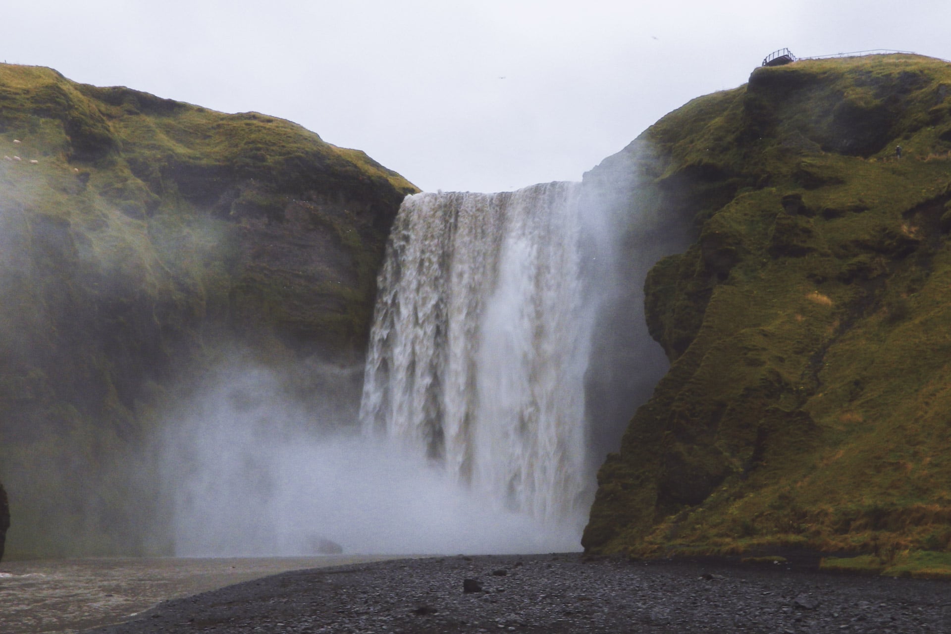
Another 4km back to the car and I drive in direction the beautiful waterfall Skogafoss which is also the beginning of the hike of the Landmannalaugar.
The Landmannalaugar trek is the hike to do if you go to Iceland, the beauty of the scenery is breathtaking.
The waterfall is impressive, a real wall of water of 60m.
The road continues and the series of stunning waterfalls also with Seljalamdsfoss which has the particularity of not being hung on the cliff. We can even go behind it’s very beautiful.
I’ll finish the day by joining Gullfoss for the night. I arrived relatively late because the day was very long …
This is the end of the journey soon …
Day 13 : Back to Reykjavik
Back in Reykjavik in the early afternoon. The circle is complete. 3500km at 57km/h on average.
I take a bed in the “Reykjavik Backpacker” street Laugavegur (which I find better than the Kex). Here I meet Pascal, the guy from Quebec I met in Akureyri. As I have quite a long time I take the opportunity to visit the city. It’s very nice, Reykjavik has the perfect Scandinavian style. The day passes quietly in the sun.
The next day I visit, I take the time, I drink cafes in Reykjavik Roaster (which make excellent coffee).
At the end of the day, I meet Pascal with whom we take drinks at Dylon and with whom we try the “Rotten Shark”, shark kept underground for several weeks. It’s horrible it stinks urine, inedible … The evening continues at the bar of the Youth hostel with French guys, American and other people; I like those cosmopolitan moments.
11pm, I take the road for the last time towards the airport, I return the car then begins a long wait because my plane is late at night.
This is the return … bye bye Iceland and see you soon!
Conclusions
What an absolutely fantastic country! I used a lot of words like “Superb”, “Magnificent” or “Wonderful” but that’s because it is! Iceland really offers landscapes apart. We find the “codes” of the Nordic landscapes as we can see in Norway but the volcanism really adds a plus.
14 days to go around I made it a bit quick with hindsight. I will have had to be spending more time in places between Hofn and Reykjavik, in the golden triangle too but I do not regret the choices I made. The fjords of the North West for example took me almost three days but it was worth it. Taking a 4wd would also have been more fun, already to go faster on the gravel roads and also to explore the center but once again between the budget and the timing it was necessary to make choices.
In any case I loved this trip, doing it alone gave it a different appearance but very nice too. Iceland is not very big but you can spend a life exploring, I think! What is certain is that I have to go back, whether it is in the North West in the Hornstrandir or in the center crossing, … ideas are not lacking …
To conclude: if you hesitate to go to Iceland, stop! Go ahead you will not be disappointed!
GR54, Trekking in the Ecrins NP
10days
trekking
176km
walked
12000m
D+
14passes
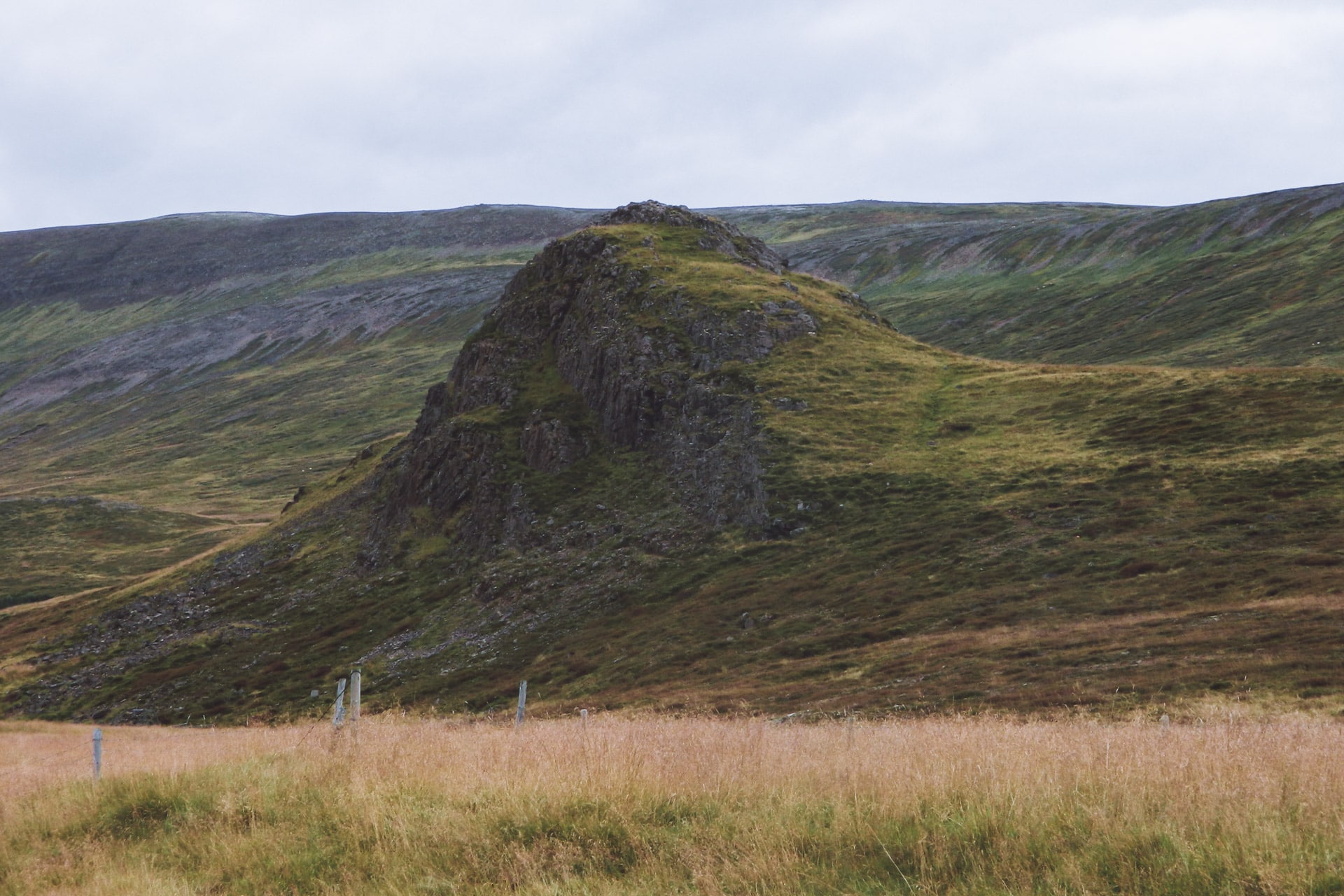
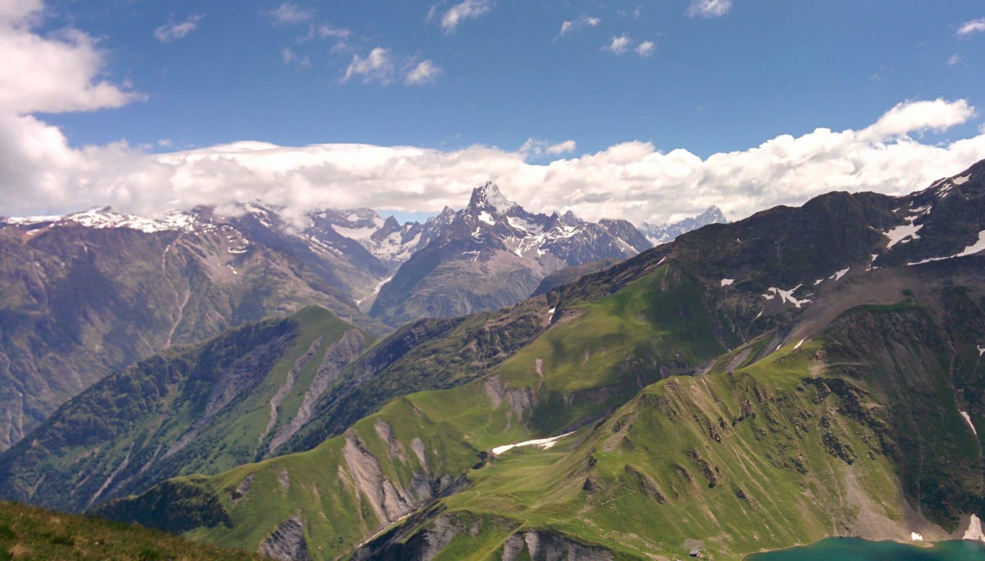
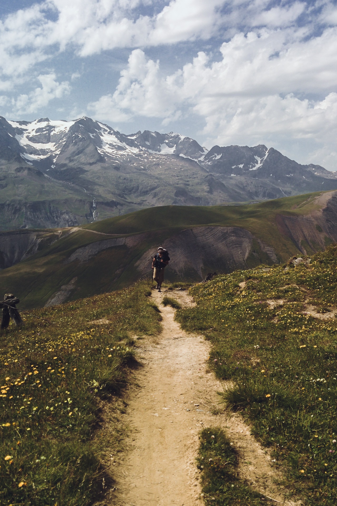
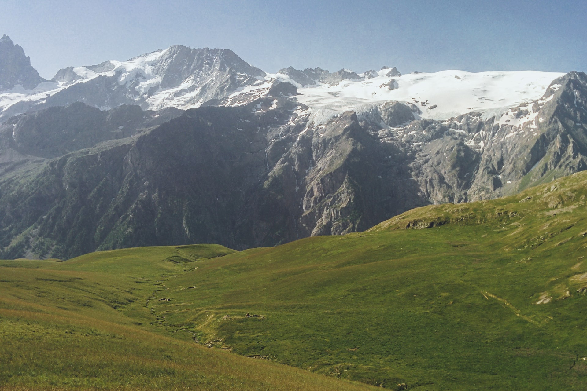
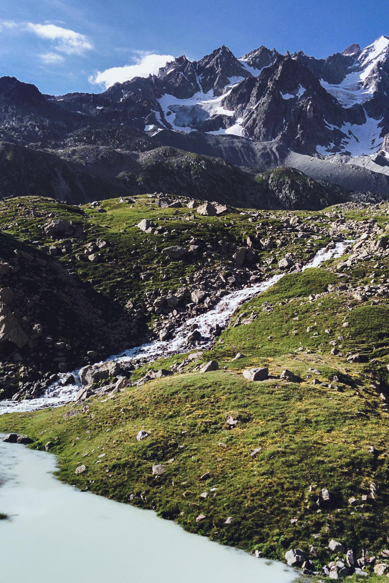
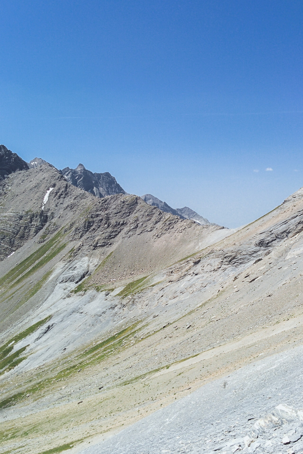
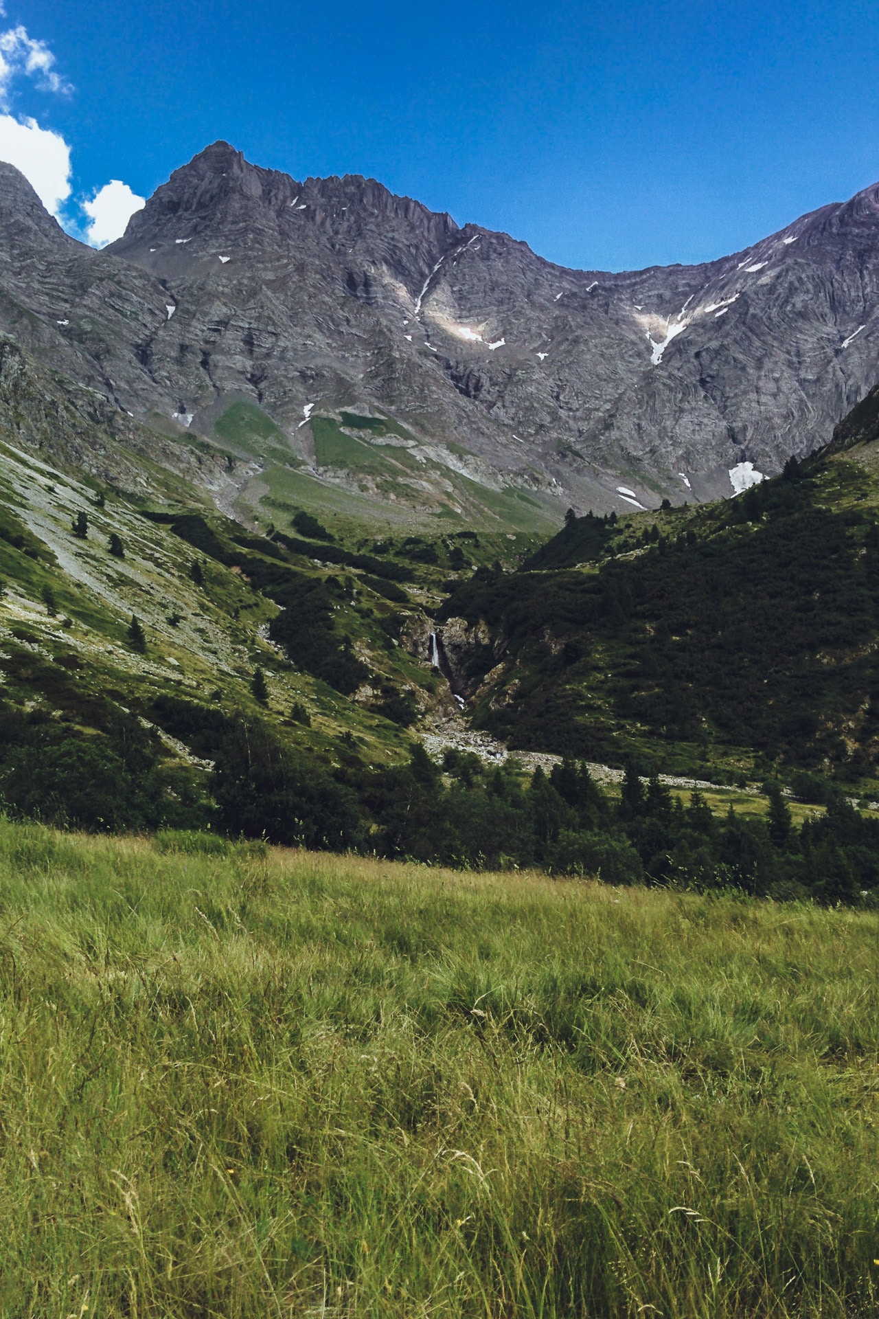
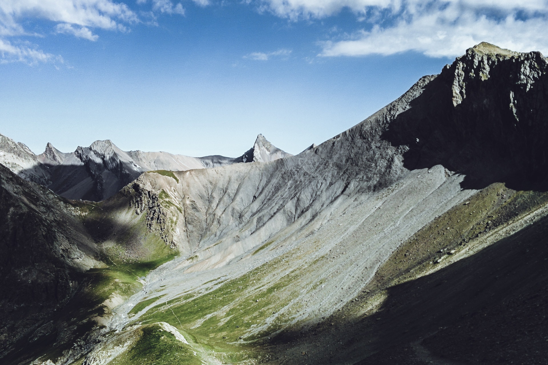
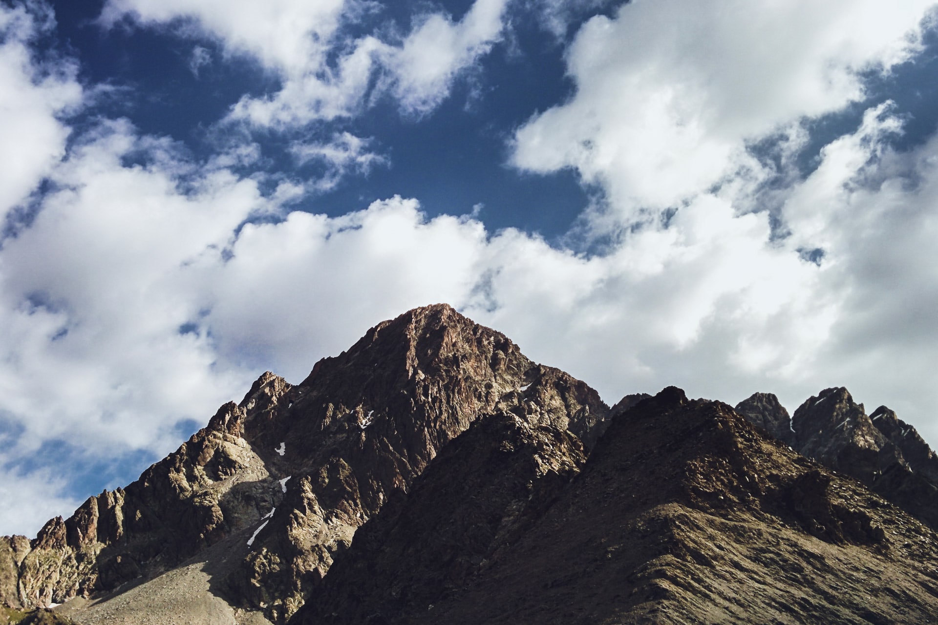
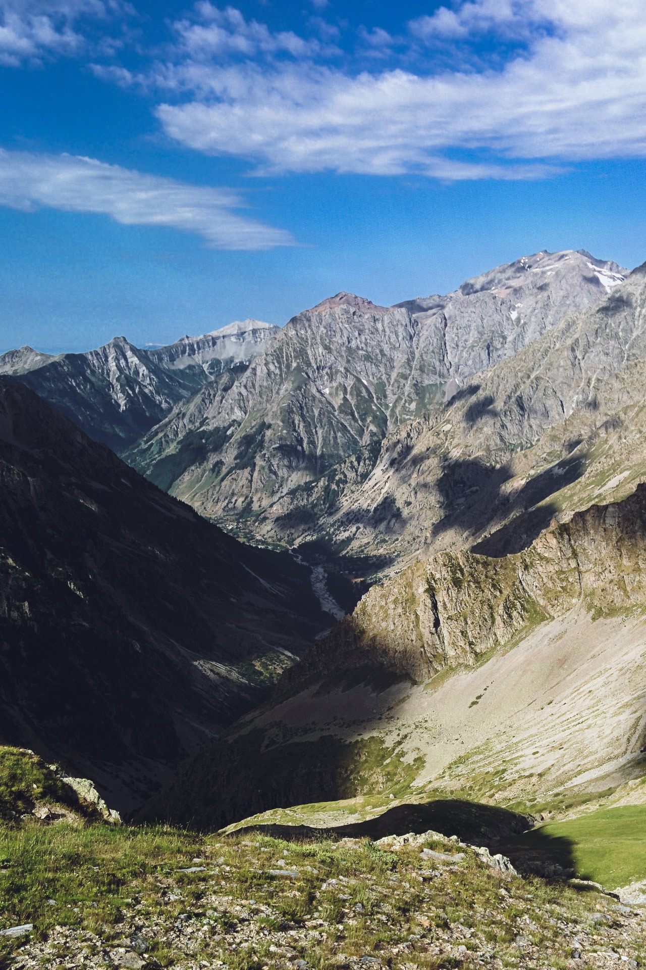
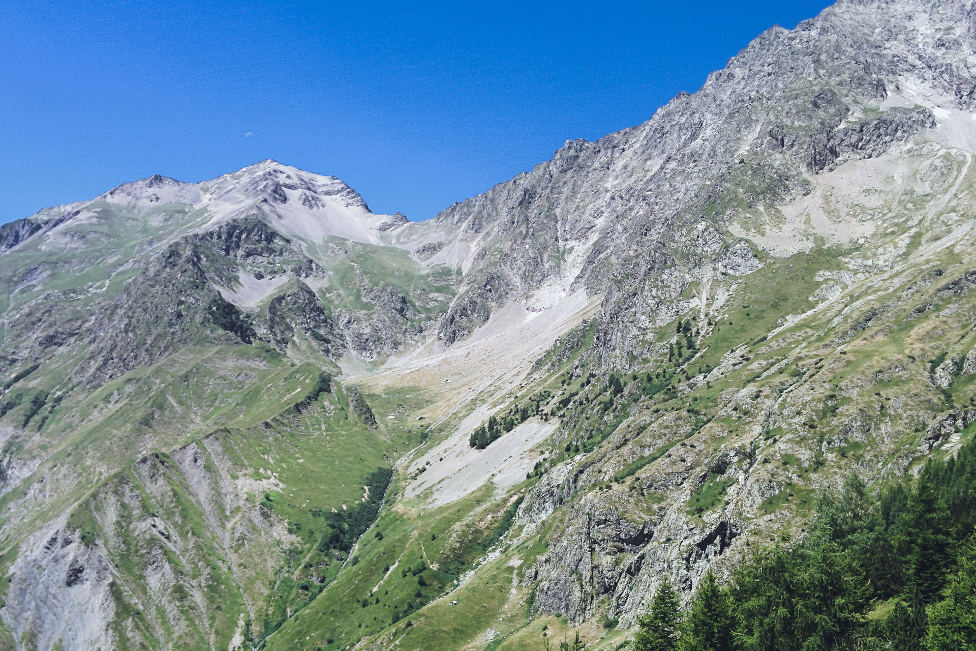
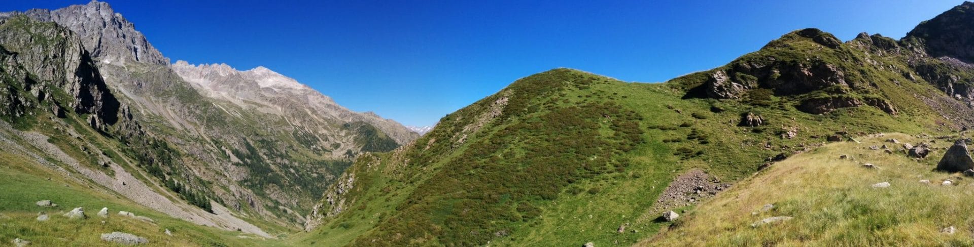
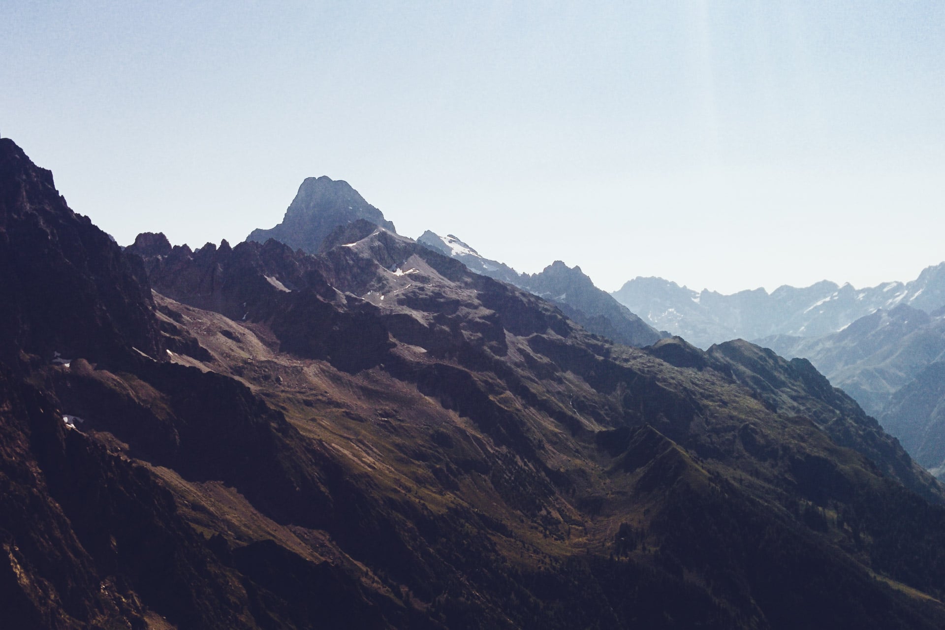
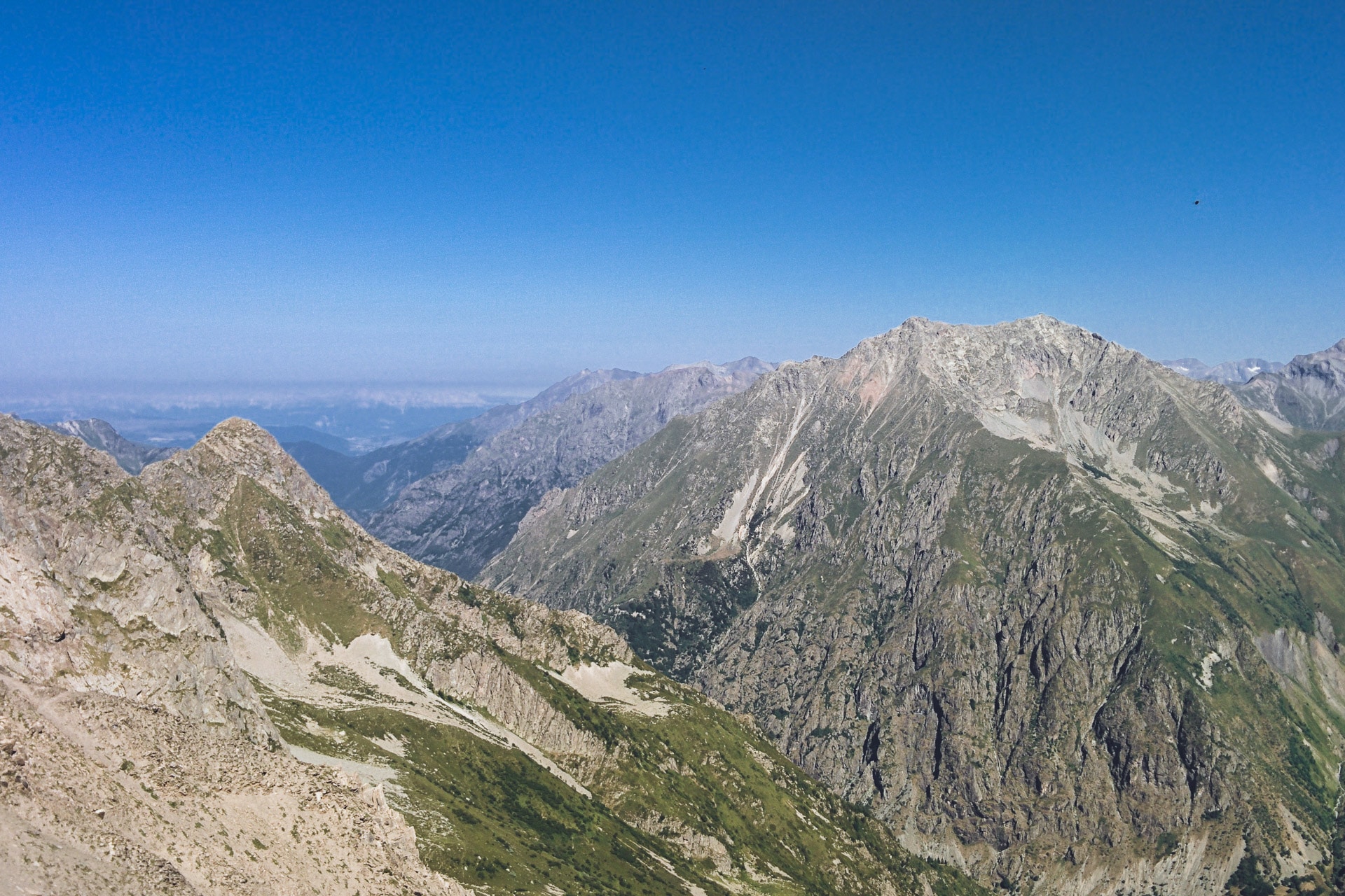
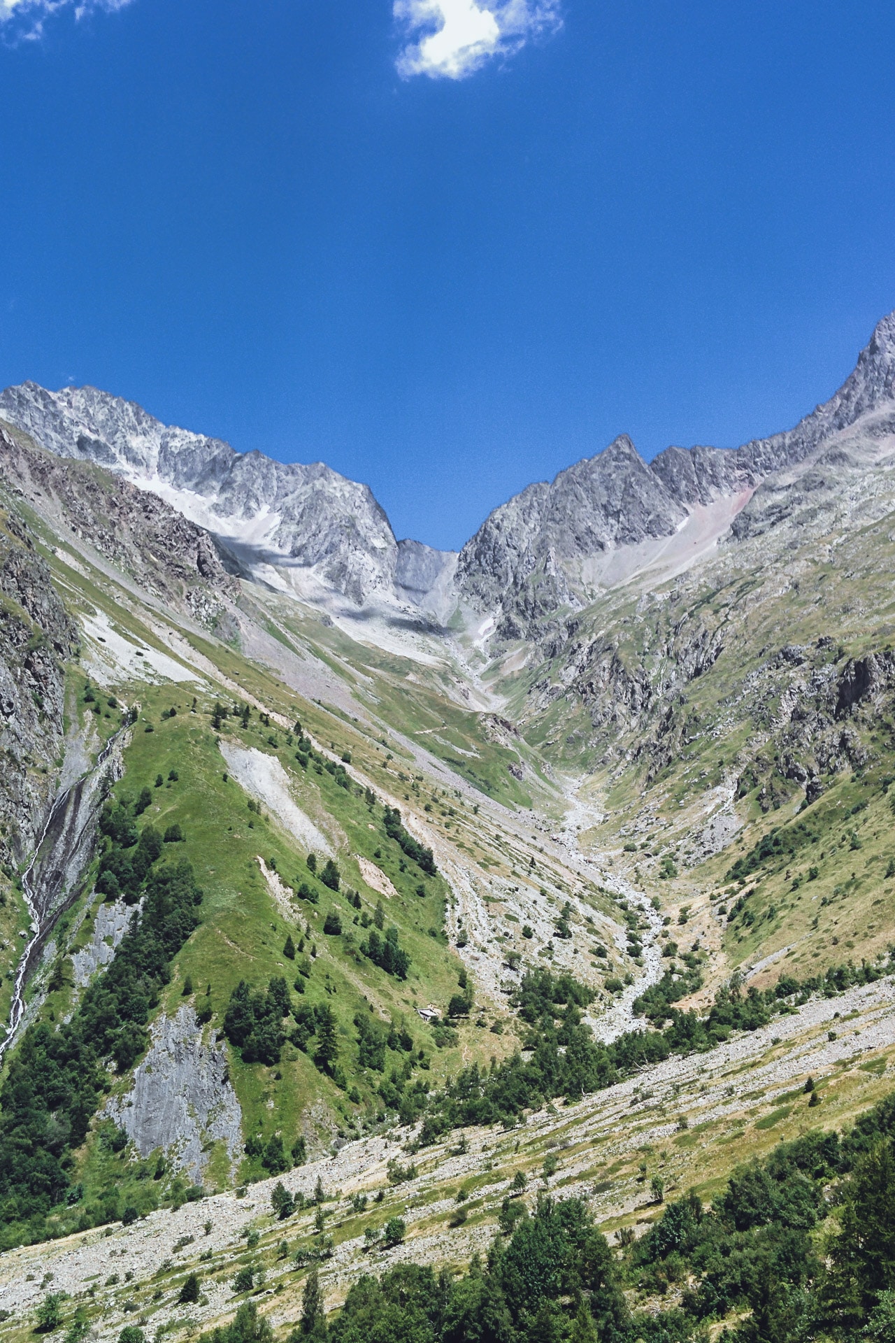
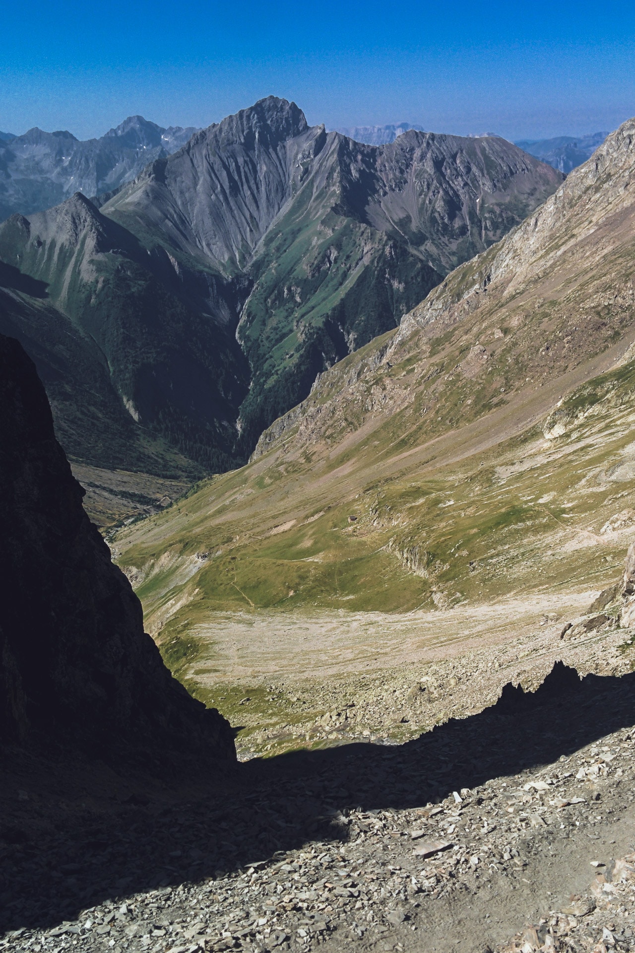
This is not the best-known GR but the GR54 has nothing to envy to the GR20 or the Tour du Mont Blanc. Technically, on the one hand, the numbers speak for themselves: a little less than 180km and about 13000m of elevation gain, 14 passes and an average altitude of 1800m. But from a scenic point of view either, the GR54 does not have to blush: we cross one of the most beautiful massif of the Alps, we go through all the mountain stages, we cross Chamois, Marmots and Vultures, .. and cherry on the cake, the path is much less crowded than other GR such as those mentioned above. In other words, the Tour de l’Oisans and Ecrins is beautiful and wild and hiking was a pleasure for 10 days.
The GR54 et the Ecrins National Park
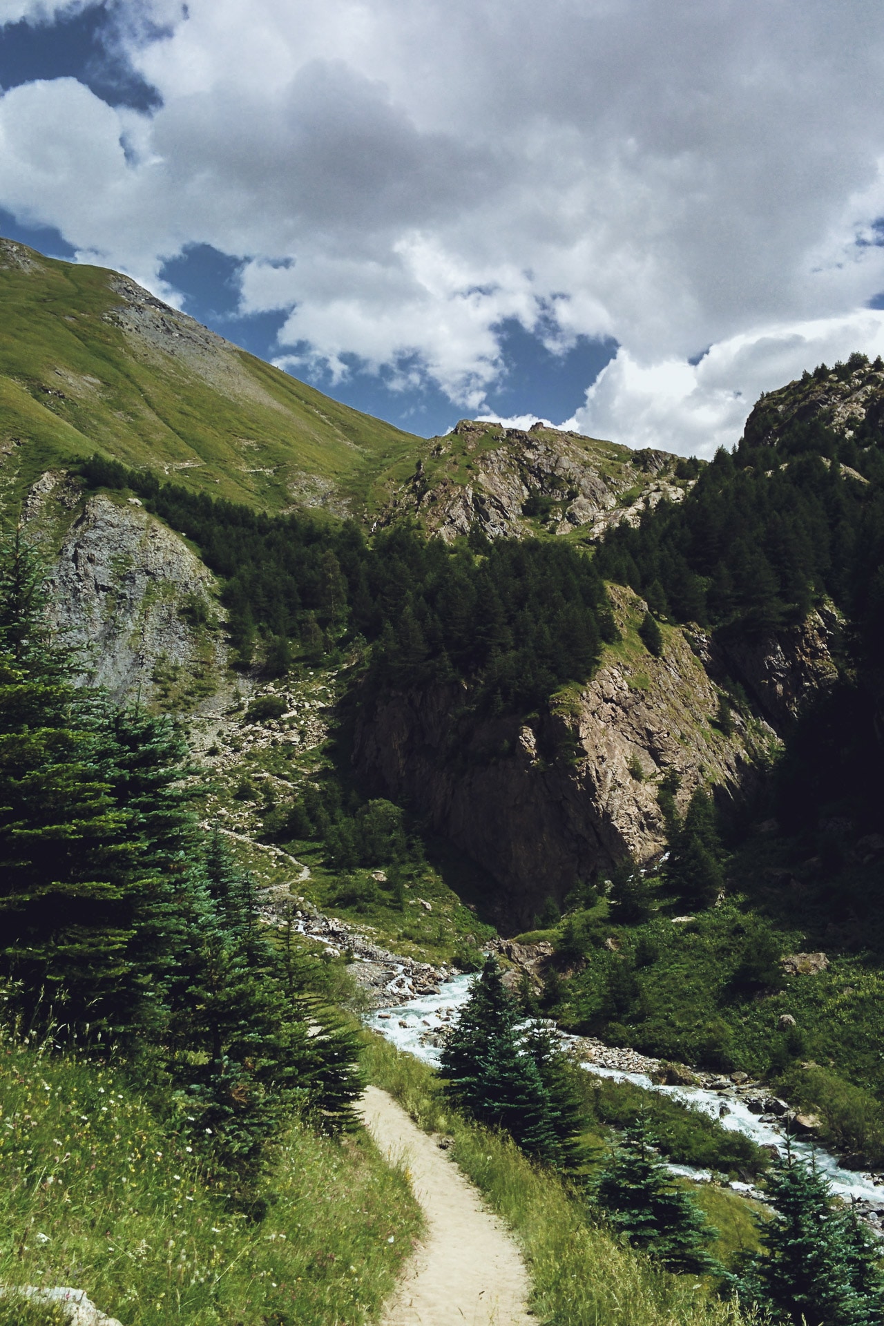
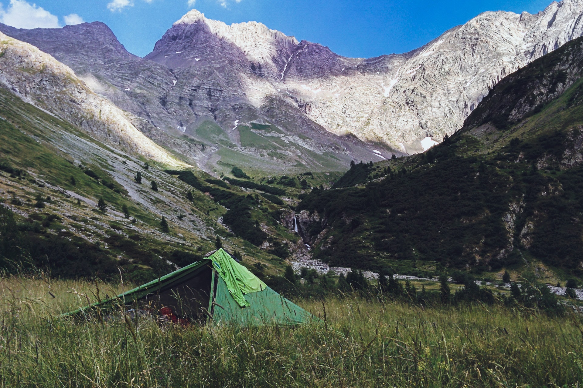
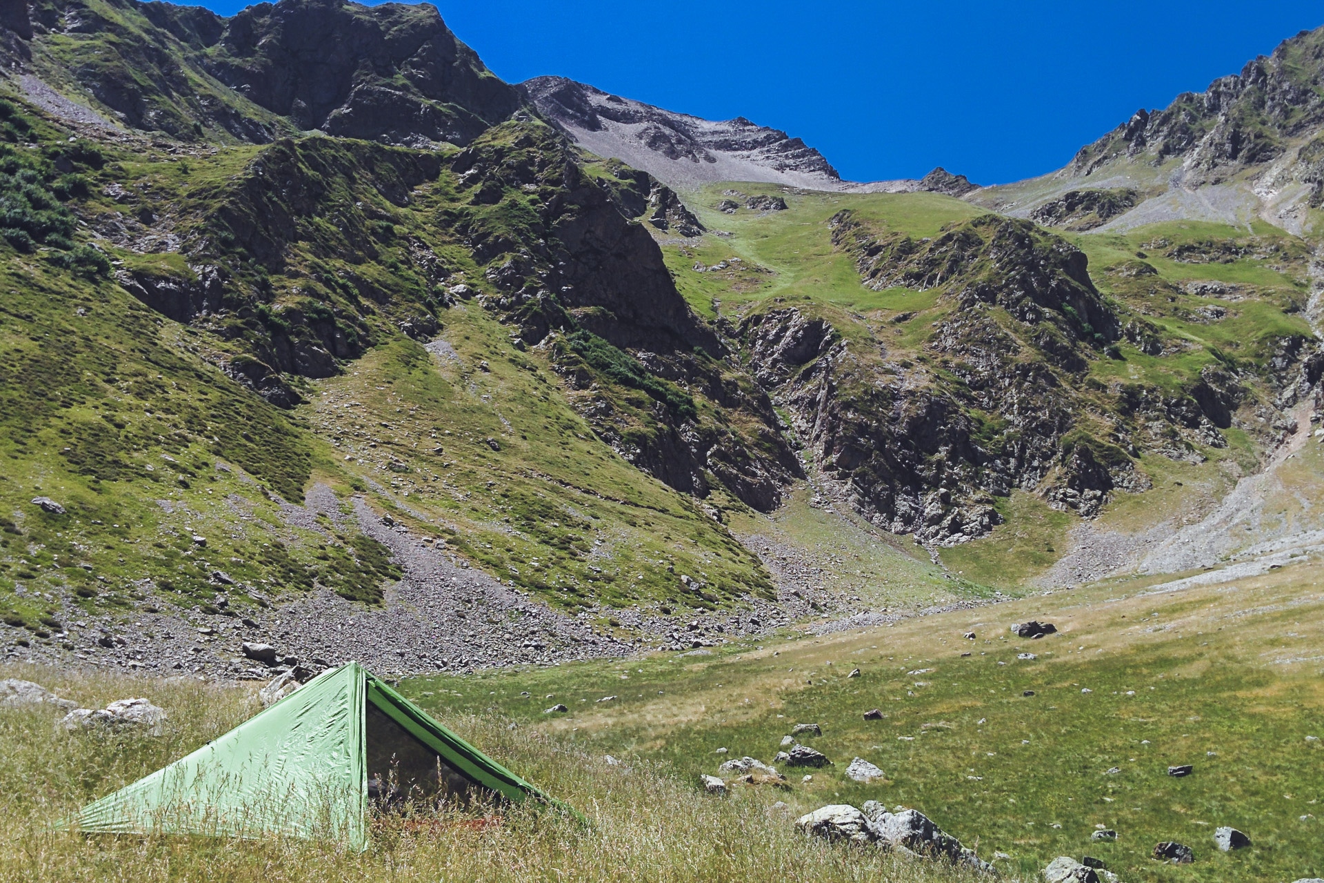
The Tour of Oisans and Ecrins is a loop that travels through these beautiful mountains in the heart of the Isere department. The diversity of landscapes, their beauty and wildness (especially for the southern part) make this GR one of the most beautiful. All days of walking are punctuated by the passage of at least one pass, by mountain lakes or majestic valleys. In terms of difficulties, the GR54 is not simple but remains accessible to the greatest number because it is quite possible to make each night in a shelter and therefore to travel light. For my part I chose the bivouac all along because this format offers the greatest freedom possible. Crossing villages or towns at least every other day also means you do not have to eat too much food or change menus.
We travel the GR54 largely in the Ecrins National Park. This area of protection of nature and mountain traditions is to be respected as a jewel. Fire is obviously prohibited as well as camping over several nights. However the bivouac is allowed between 8pm and 8am. The best way to know the rules to follow is to go to the park site what I recommend before departure: http://www.ecrins-parcnational.fr/
Day 1 : from Paris to the Ecrins
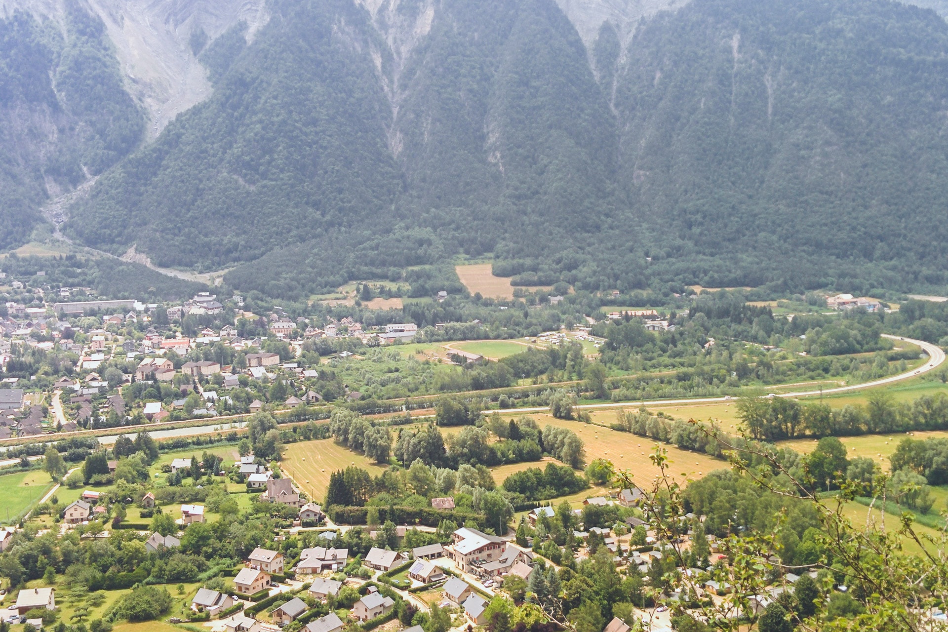
We are early July, it’s the day of departure! Finally ! As always before going on a hike (and on vacation …) the wait was long. But here we are ! I met with Quentin who should have accompanied me on all the GR54 but as we will see it will not be possible for him unfortunately. To make it to the Ecrins nothing easier: a little TGV to Grenoble and a little bus to Bourg d’Oisans where we will start the GR54.
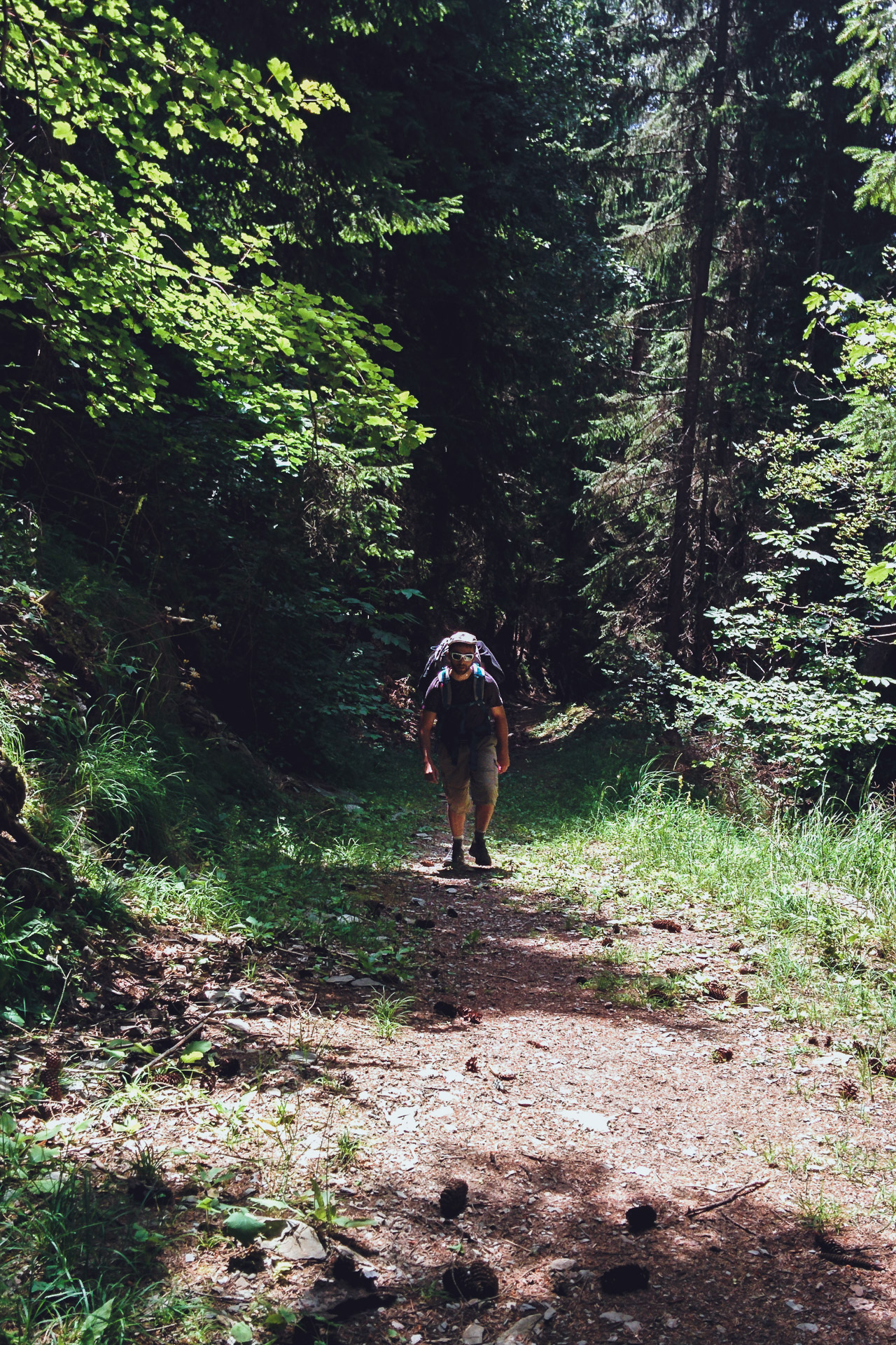
It only took us a morning to go from the city to the mountains. On site we complete our food supply with a little charge for the next days and noon. The “beginning” of the GR54 is easy to find, it is located behind the campsite Cascade and starts directly with a small climb in the rocks (be careful in case of rain it can be slippery I think). It is super sunny, even hot, and the weather forecast is good for the next few days …
We will stop on the heights of Bourg d’Oisans to nibble our lunch.
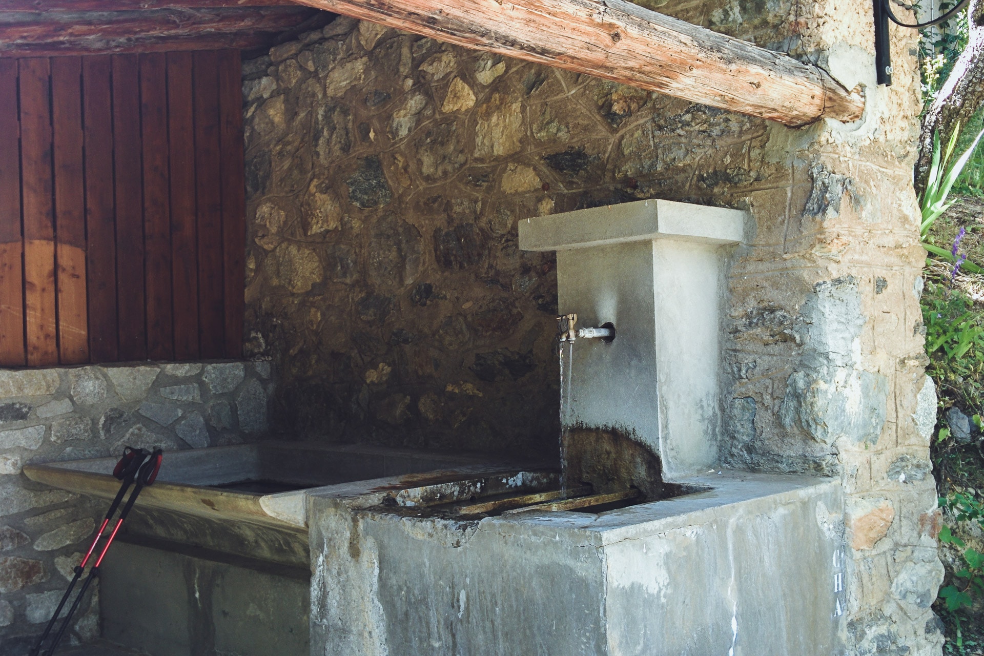
The path continues to climb then to finally arrive in the pretty hamlet of La Ville which we stop 2min enjoy the public fountain! The GR54 then continues alternating paths and tarred passages while passing through small typical mountain villages. Once again we take advantage of the fountains that we find in almost every one of them. It is very very hot and the flies are numerous and very annoying!
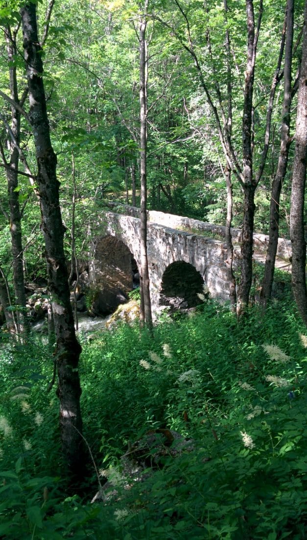
The path goes down once the village of Rosay pass. We reach the torrent of Sarenne at the level of a beautiful Roman stone bridge. We are now under cover of the forest so it is better but there are always so many flies it is tiring. We had planned to sleep in this area but the topology does not allow us to do so and the flies push us to move forward, moreover it is still early then so much to save time.
So we run along the torrent on a lot of distance, a little cool drink break at a refreshment bar and we continue.
We will find our location for the night a little further, a large expanse of fairly flat grass and not too far from the Sarenne. Flies are a little less present. It’s time to take our little evening meal after a long first day (between the ride and the walk) and we’ll go to bed early.
Day 2 : from The Sarenne Pass to the Highland of Emparis
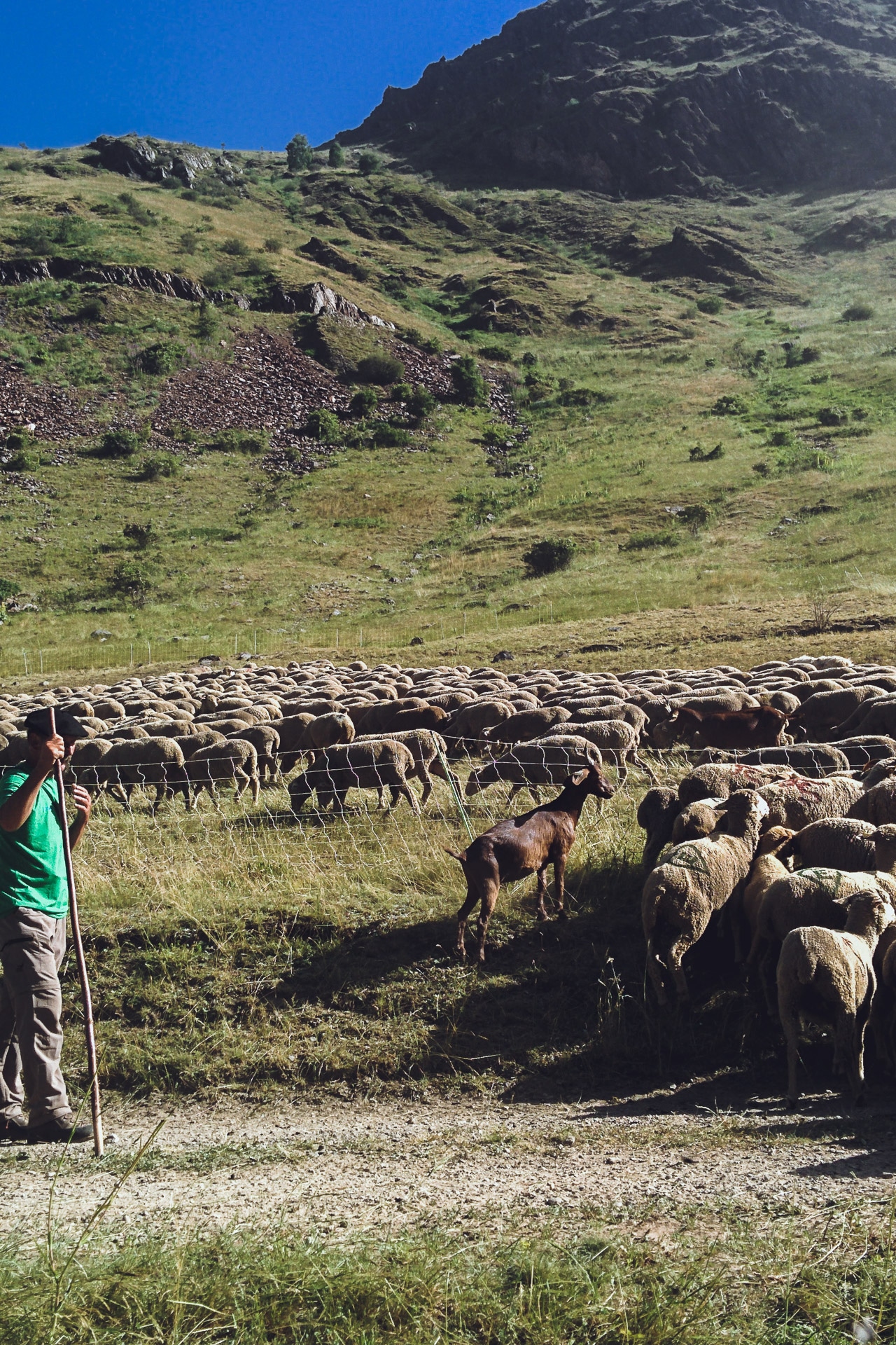
The second day begins gloriously invaded by flies. We therefore quickly leave the bivouac towards the Col de Sarenne (1999m). On the way we meet a shepherd who drives his sheep in a inclosure. Continuing to advance two “patous” come out of nowhere and come to me, one in front of the other behind. Fortunately the shepherd calms them …
“Patous” are shepherd dogs raised from a very young age in the flock. They think they are “sheep” and will do everything to protect them. So be careful when approaching an unguarded flock because the dog can be aggressive unfortunately. Hikers’ attacks are recorded every year.
The climb to the pass does not really charm because it follows a road. There are many cyclists. We take a break at the shelter to have a drink.
We then begin the descent to Clavans-Les-Bas. It’s already very hot and Quentin is starting to have his feet bad because of his shoes. He has big blisters on each foot and it hurts with every step … It’s not a good sign.
We take our lunch break at the beginning of the road that goes up to Besse. It gets hotter and the flies are a sore. Once in Besse we attack a climb of 700m vertical drop. Normally it would go well but there with the overwhelming temperature it’s really hard! Quentin has more and more pain in his feet …
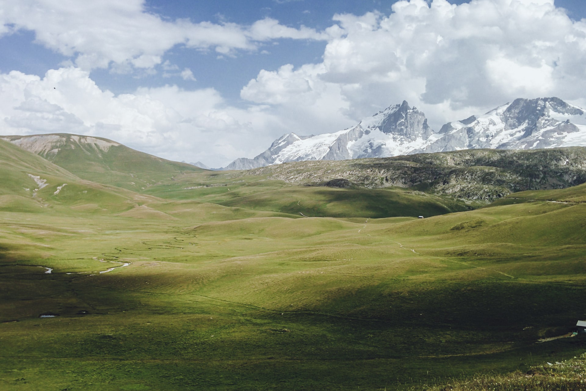
On the other hand once at the top of the show is sublime: in front of us spreads the Plateau of Emparis, immense green meadow which is not without reminding the Great American Plains in a certain way, except that no bisons here but marmots.
I motivate Quentin to go a little further to bivouac next to a water point. His feet really hurt it worries me for the next day …
Our location for the night is very beautiful. It is slightly overhanging so we saw all over the plateau. Right next to the camp, the “Rif du Coin” allows us to cool off and wash our belongings …
The evening ends with a well-deserved freeze-dried fondue and an army of flies to wish us good night …
Day 3 : from the Plateau d'Emparis to the Lake of the Star (Lac de l'Etoile)
The day begins with bad news: Quentin decides to stop the GR given the state of his feet and the pain he feels at each step … He will go down to La Grave and continue hitchhiking until at a train station. I will continue without him.
We are once again hunted by flies this morning. The climb to Col du Souchet (2365m) does not present difficulties and is quickly done. From the top, the massif of the Meije is revealed, beautiful and impressive.
The descent to the Grave is pretty especially thanks to the Meije (3983m) in the opposite side of the valley. The GR54 also passes through some pretty village like Chazelet or Les Terrasses. La Grave is also pretty but more animated already.
After the lunch break, Quentin stays there and I continue, sad moment … I wish he could continue but according to the state of his feet is better for him. I will continue alone but it does not matter it will give another dimension to the GR.
Let’s go to Villar-d’Arêne and further Pont d’Arsine. The path is flat and easy by cons it is a stifling heat … I stop almost every hour to drink 1L of water … I’m soaked …
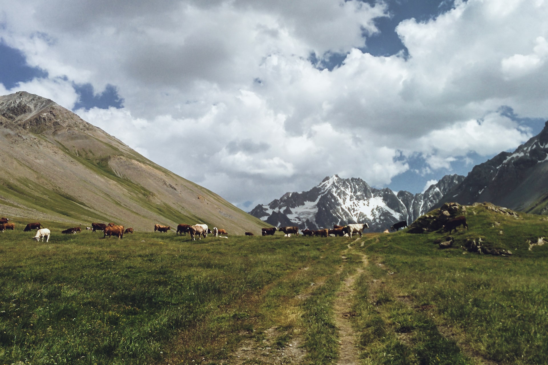
But I cover ground and I quickly find myself climbing the path that leads to the Refuge de l’Alpe de Villar-d’Arene. I am greeted by a herd of cows.
To finish this long day, during which I did a lot of kilometers I’m looking for a corner for my bivouac evening (after taking a small beer at the shelter …).
My choice will be on the Lac de l’Etoile because it is a little hidden from the path and especially because the location is superb! A hell of a day that ends and especially a hot day! I will have drunk almost 7L!
Day 4 : from Lac de l'Etoile to Vallouise
I survived my first night alone … The most disturbing in the mountains at night is the silence that reigns not the noise around.
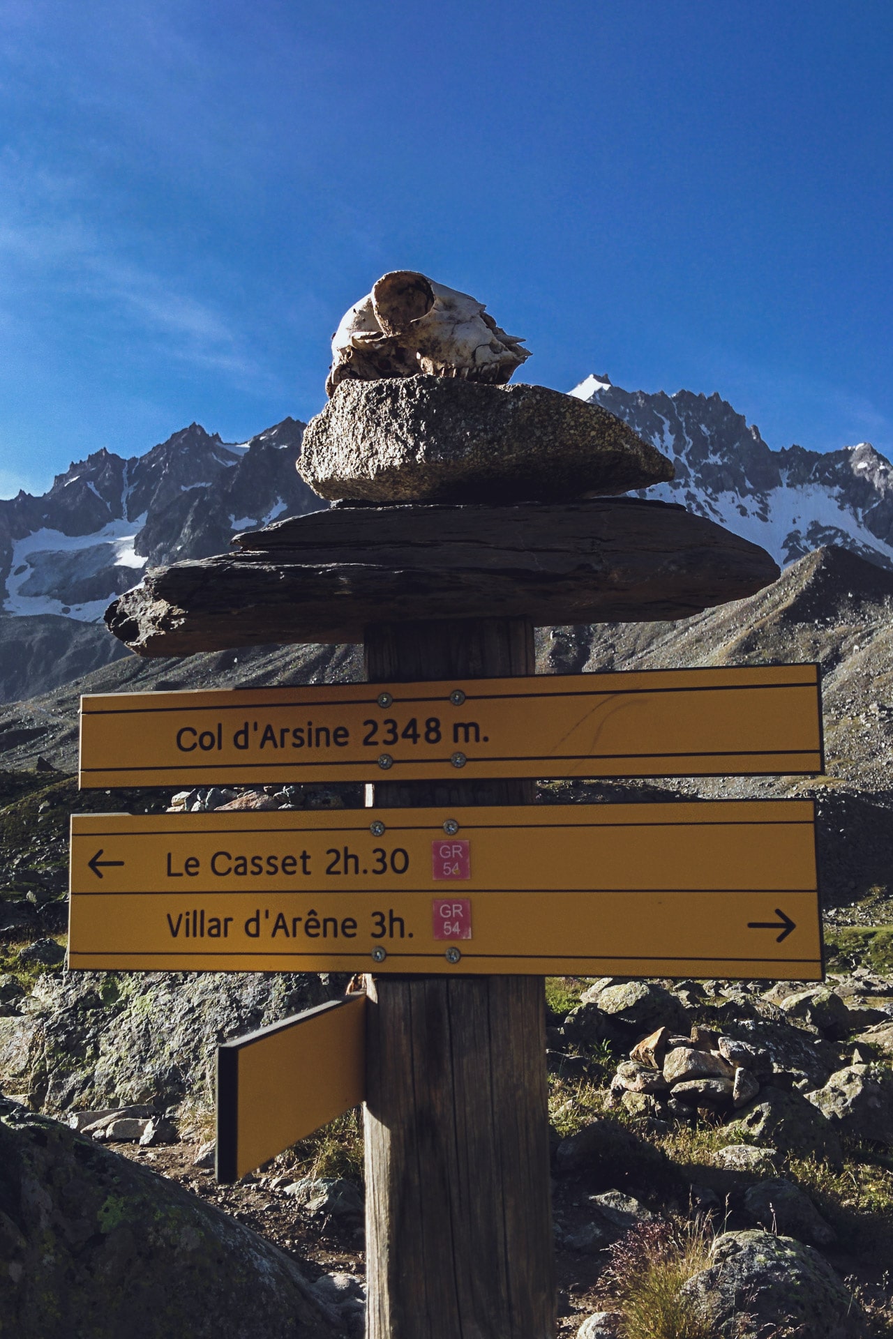
I fold my bag after a quick breakfast and I leave towards the pass of Arsine (2348m). At the pass there are a lot of marmots but the photos are not good….
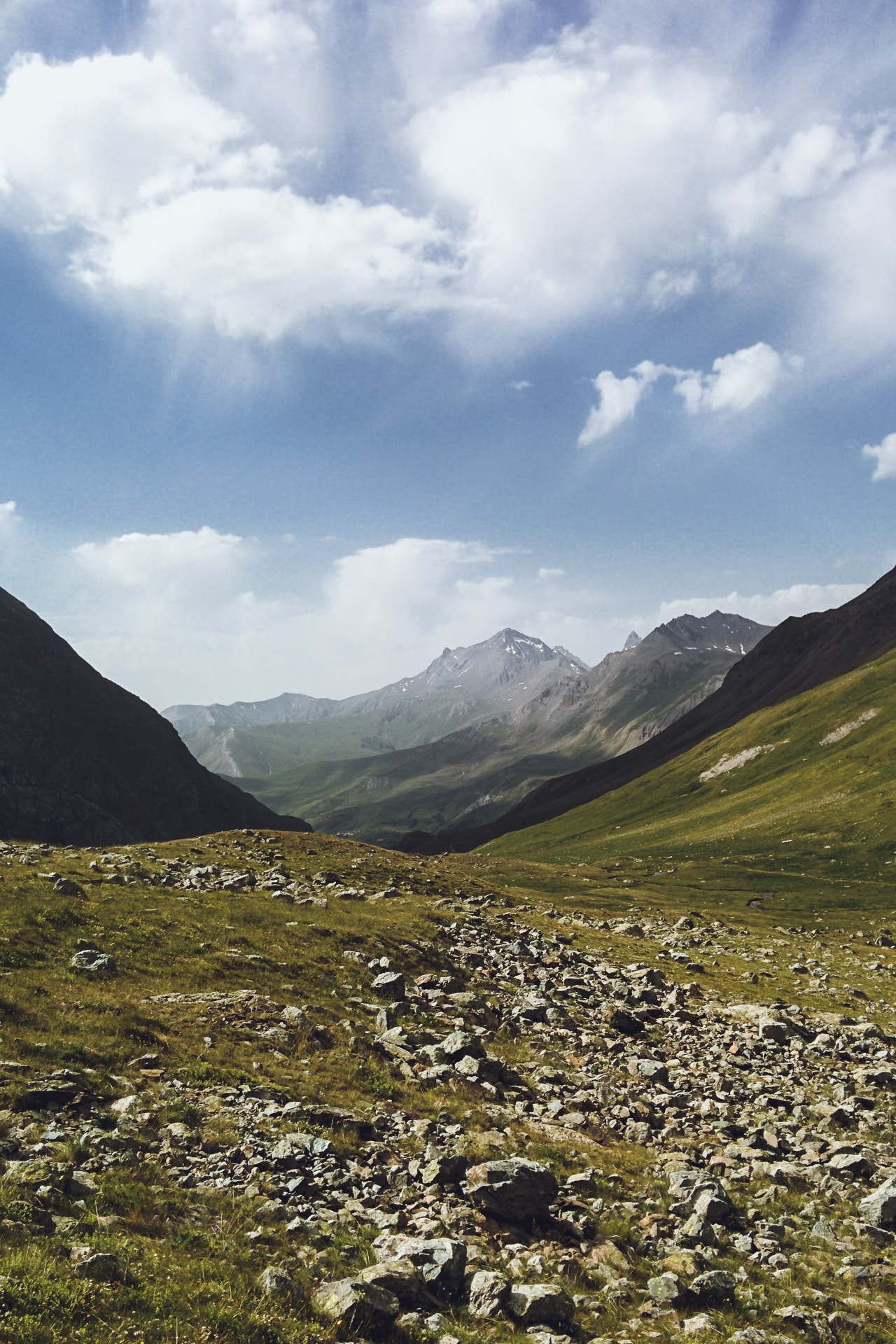
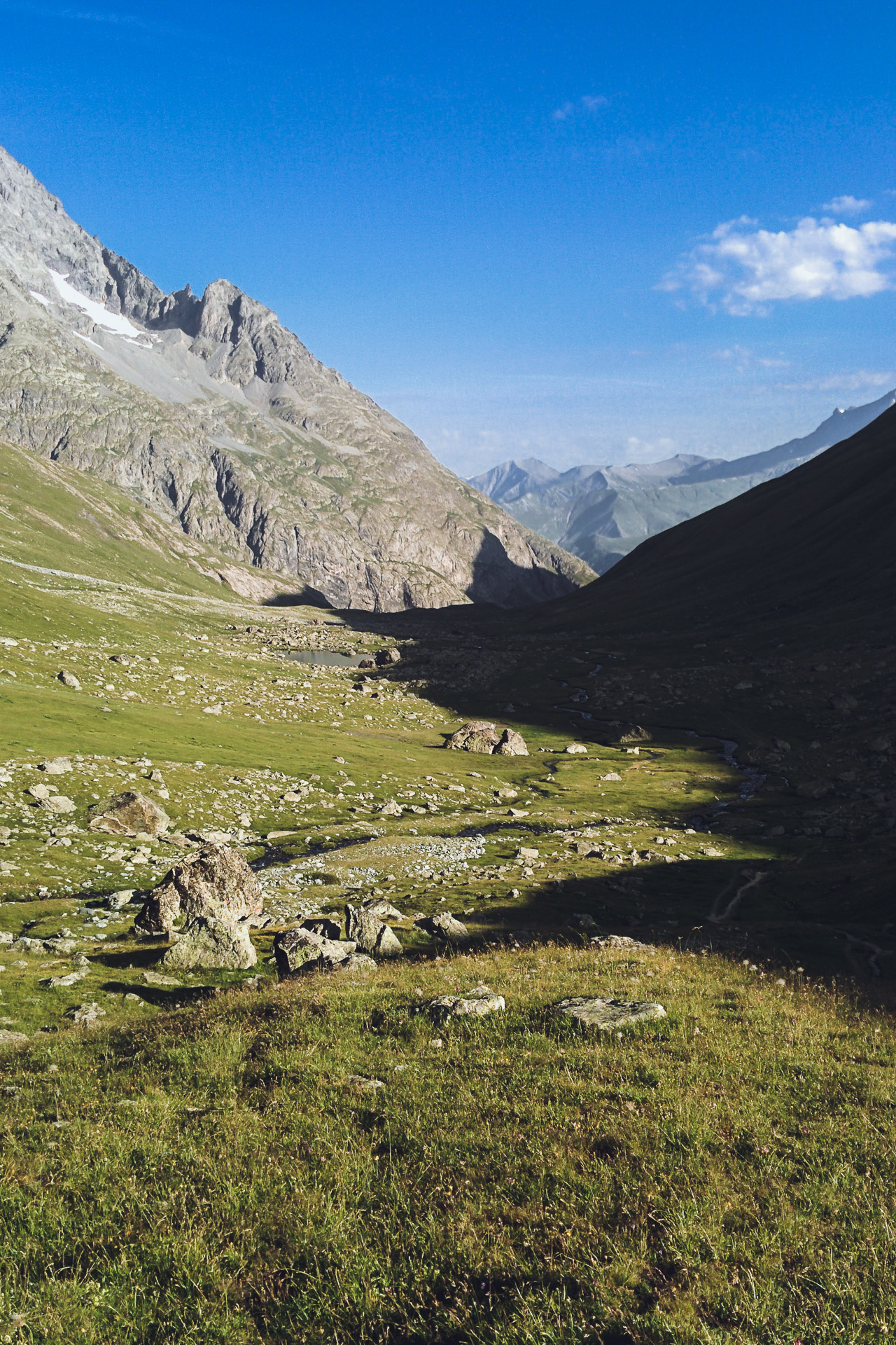
I then begin the descent. I follow the stream of Petit Tabuc which is growing while the altitude decreasing. The mineral setting gives way to coniferous forests. It is a beautiful landscape, it is still cool enough to enjoy and as the days before I do not meet anyone …
The path then continues to Le Casset and Le Monêtier-les-Bains. I start to meet hikers who go up to the pass. The trail begins to “civilize”, there are cyclists and more and more people. Everything has a less charm now …
After a break in Monêtier, I start the climb to the Col de l’Eychauda (2425m). The beginning of the ascent is great in the shade under the cover of the forest. I meet some deer who also seek the freshness of the undergrowth. The climb is done following the Torrent de la Selle, it’s nice.
By cons, around 2177m, we land on a chairlift area and installation of winter sports … it breaks the whole atmosphere. The path is stony and dusty, everything is “controlled”, artificial. This is the way to the pass, which has a retention lake for artificial snow.
I continue in the Ravine of Neyzets, fortunately the view is nicer here.
The 600m descent to Chambrian hurts your knees especially if you count the 800m of D- after the Arsine pass … To top it off I’m entitled to a bleeding nose abundant probably due to heat, altitude and dehydration.
I decide to continue to Vallouise for tonight to spend a night at the camping to have a good shower. The problem is that Vallouise is not very close and the road to go is only tar.
So I’m going to do a little bit of hitch-hiking to save my little knees … A Dutch couple will take me after a few minutes and, lucky enough, they are staying at the campsite where I wanted to go!
They deposit me in front of the reception, great. After settling my tent I have a real shower, the first since the start! Then I spend a little time with “Vinz” another hiker who is doing the GR54. It is a former bar manager in Paris who has dropped everything and who is doing hikes since. We discuss all this around a little well deserved pastis after this long day again very hot.
Day 5 : from Vallouise to the Refuge du Prè de la Chaumette.
I slept less well this night than previous … Obviously in a campsite it is noisier in the evening than at 2300m altitude ..
Today’s agenda : passage of the Col de l’Aulp Martin, culminating point of the GR54 with its 2761m. This gives a difference in altitude of 1100 from the parking of Entre les Aygues followed by a descent of 900m. A sporty day but after four full days I’m starting to get fit.
As I just said I will start the day at Entre les Aygues because it is only tar since Vallouise. So I can get hitchhiking for these 8km.
The beginning of the path is very beautiful. We walk in the valley with the beautiful Torrent de la Selle next. After a few kilometers we arrive at the Jas Lacroix Hut where the shepherd is resting and where I recharge with water. The site is charming.
The GR54 changes quickly after the hut. The environment becomes more and more mineral. The 700m of D + above the cabin are not easy especially in this heat.
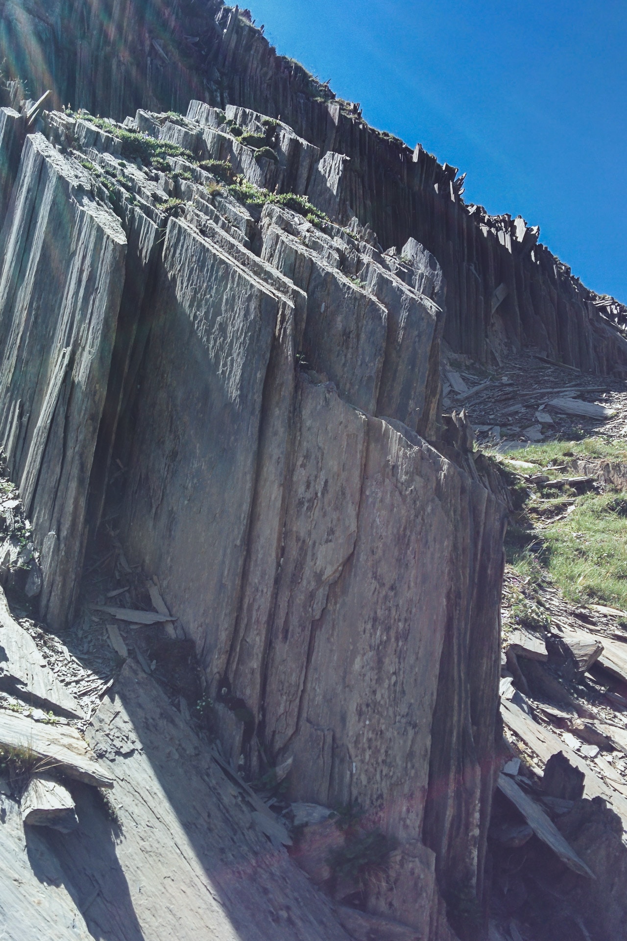
The end of the climb is carried out in a 100% mineral environment. I think the rock is Gneiss, those are kind of very friable stacked slates. You have to be a little careful if there are people above. I also think that in case of rain the path must be quite slippery, so be careful.
In any case I finally arrive at the top, very nice view. I meet a couple who makes the GR54 with whom we chatter a little.
The path then crosses to the Pas de la Cavale (2735m). Then you have to start the descent to the Refuge. The view is beautiful. There are many sheep that hide behind rocks so as not to suffer too much from the heat.
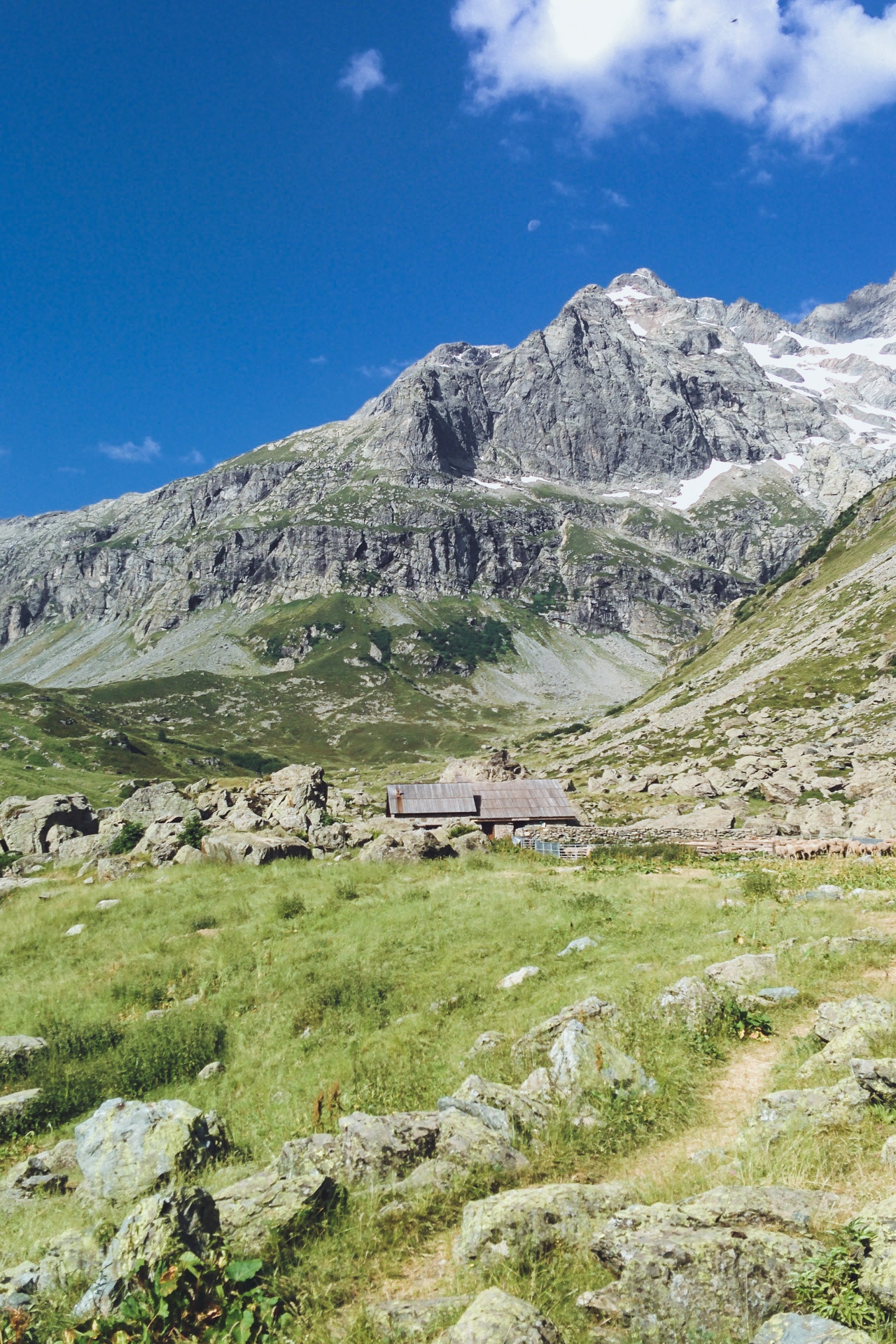
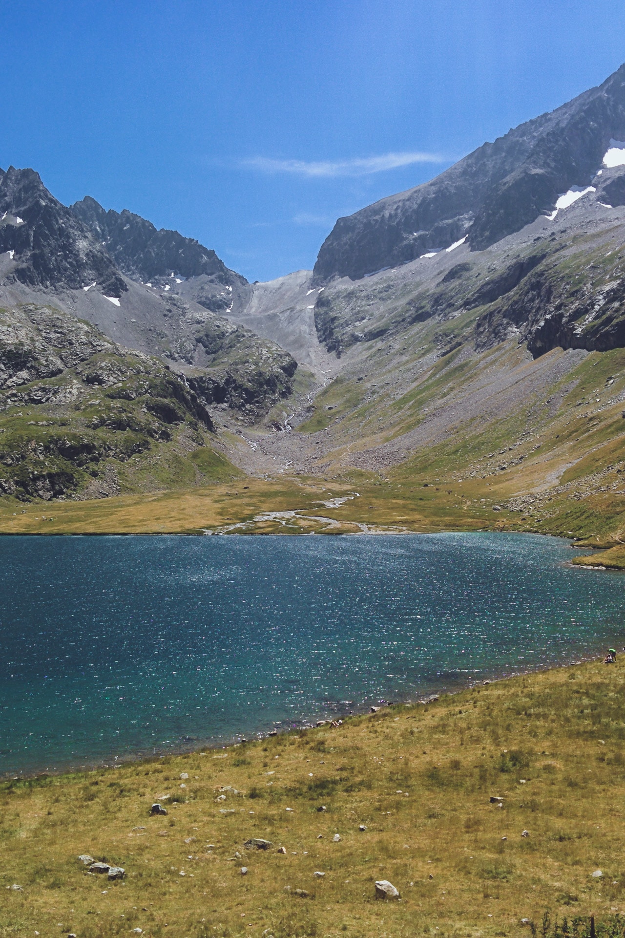
I quickly loose altitude and I am relatively early at the Refuge of the Pré de la Chaumette (1790m). As I have time, I eat a good omelette, a piece of pie and a beer, great luxury! I spend a good part of the afternoon talking with the guardian. It’s always interesting to talk to the guardians of refuge, they have lots of things to teach us.
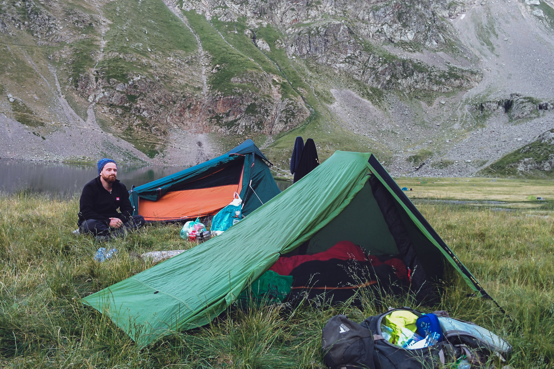
Later in the afternoon, the couple from earlier also arrives at the shelter. We will then look for a place to bivouac. The bivouac is allowed next to the shelter but in a specific area, just ask the guard to indicate it to you in case of doubt. Unfortunately the terrain is not very flat and especially very grassy (tall grass) it is not the most practical. In the evening Vinz finally arrives with his huge backpack which must be filled to more than 20kg.
End of the day always with flies and a good night sleep …
Day 6 : from Pré de la Chaumette to the Chapelle-en-Valgaudémar
One again a long day in perspective: three passes to do and quite a few miles to the village!
I begin early but the couple of the day is already gone! The beginning of the path is done quickly without difficulty. Despite the drop, I’m gaining altitude quickly. In the climb I catch up with the couple who is enjoying.
After the pass, a steep descent starts and it is made of this rock very slippery, so be careful especially if it rains!
A bit of flat and then the Col de Gouiran (2597m) that goes easily.
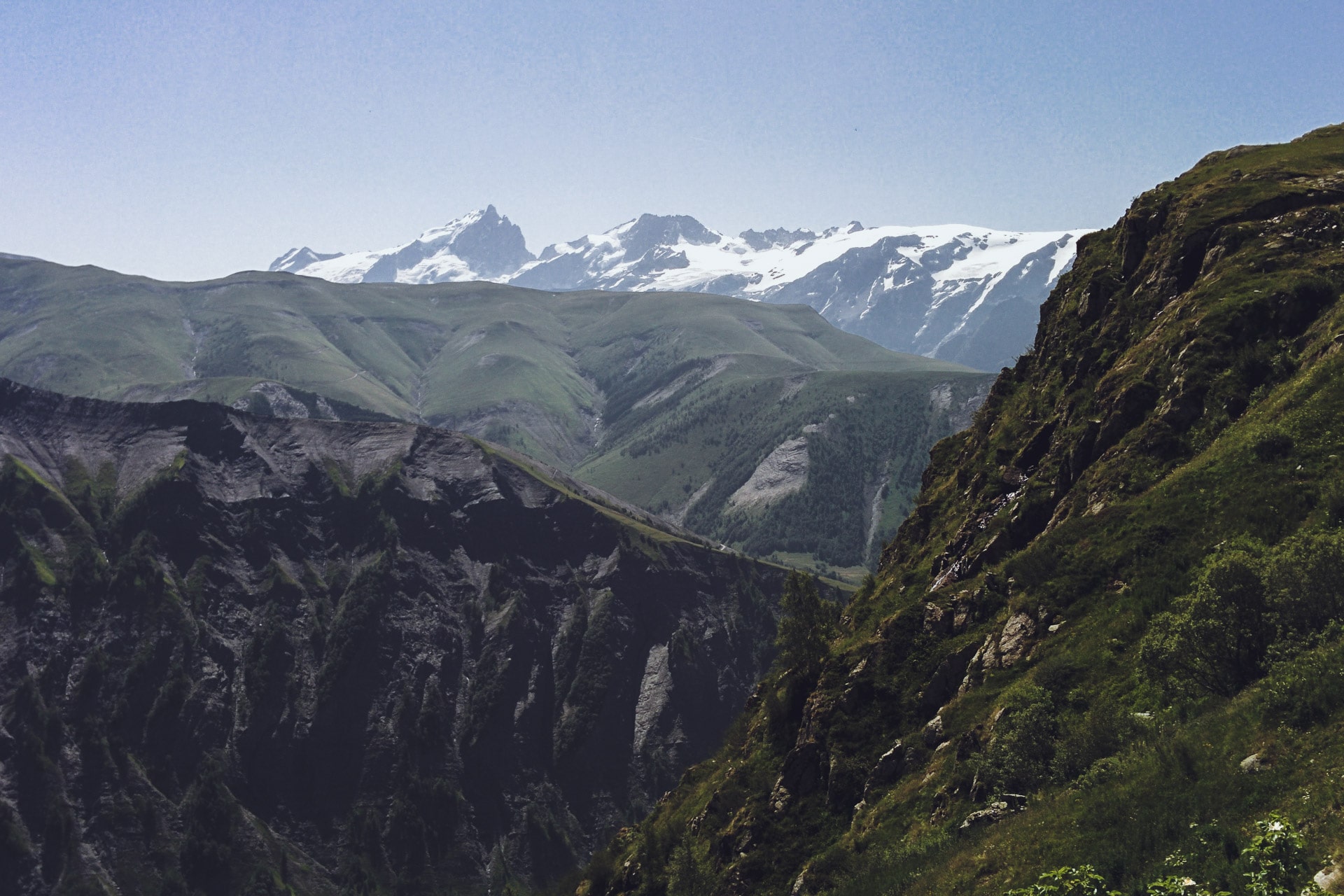
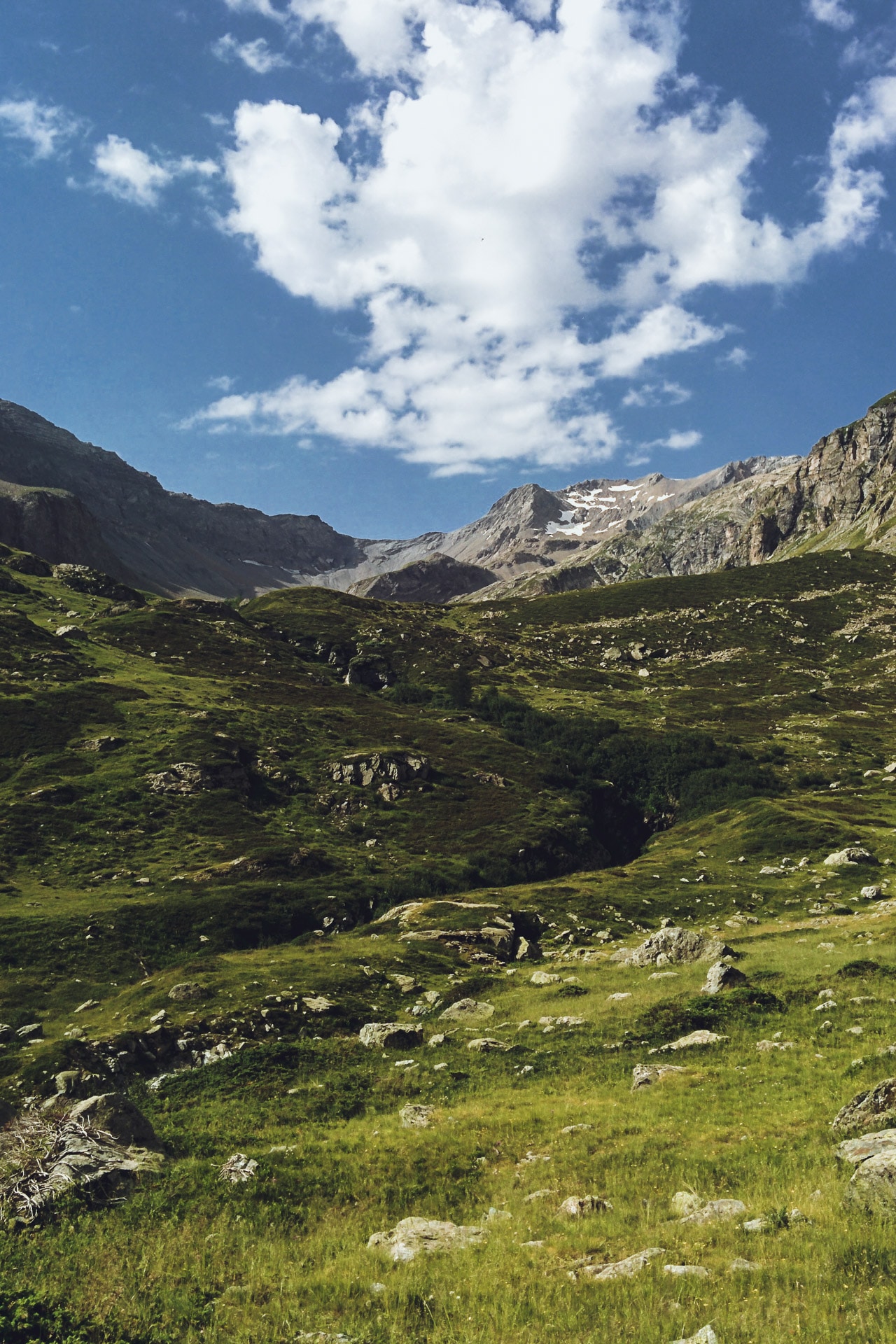
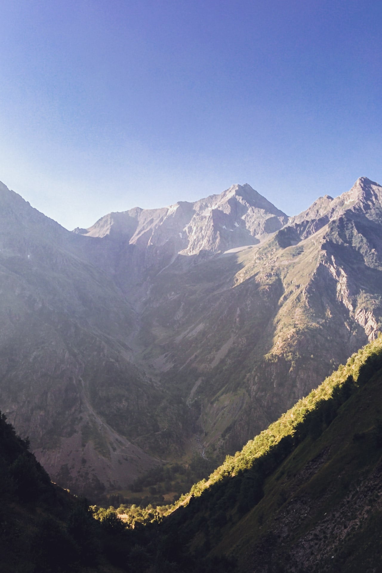
The physiognomy of the terrain has changed a lot in recent days, we are in the southern part of the GR54 which is much more “mountain” in terms of “minerality” and atmosphere. All this part will be my favorite until the Muzelle.
Once the Pass of Gouiran done, one follows the “Vallon Plat” until the Col de Vallonpierre (2607m). Unfortunately too much taken by the way to go I forgot to make photos here but it is one of the most beautiful scenery of the Ecrins that I have seen (you will have to go by yourself…). The view on the west face of Sirac (3441m) is striking and impressive!
The descent to the refuge of Vallonpierre (2271m) allows you to enjoy the show. The site of the refuge itself is beautiful with the lake and the surrounding rocky chaos, again I zap the photos (…).
I have an “omelette break” at the refuge before continuing my journey.
I think there is a very beautiful hike to do on 2 days starting from the bottom of the valley and then connecting the refuge of Vallonpierre followed by the one Chabournéou
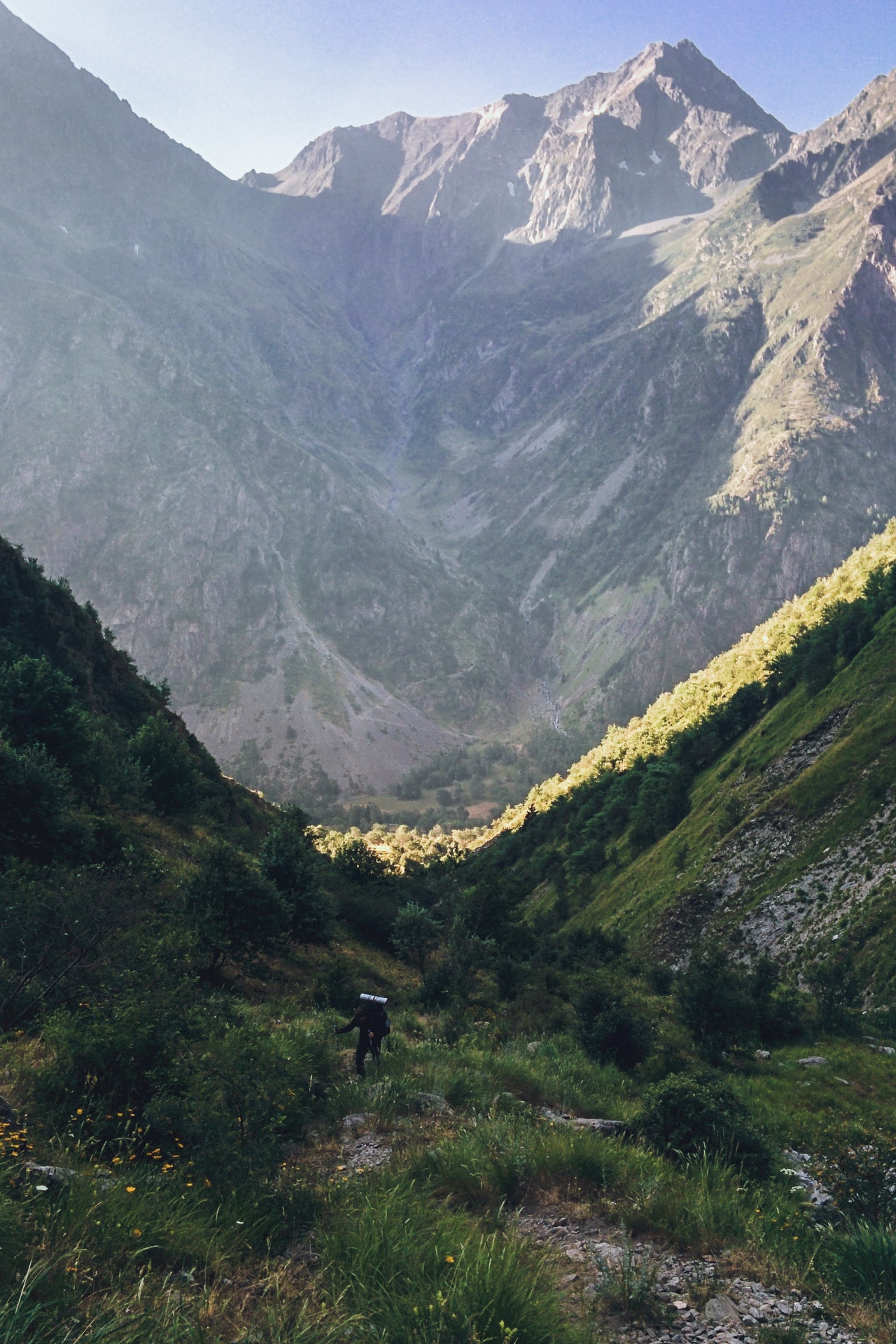
Then follows the very long descent to the Chapel Valgaudémar, 1100m below. On my side it goes well until Refuge du Clot but then the long kilometers of flat break my knees. In addition to that it is always hot … The end of the road is along the fields is less fun. I am always surprised to see how in a few hours we go from the high mountains to the valley. The advantage of walking is to live the transition smoothly.
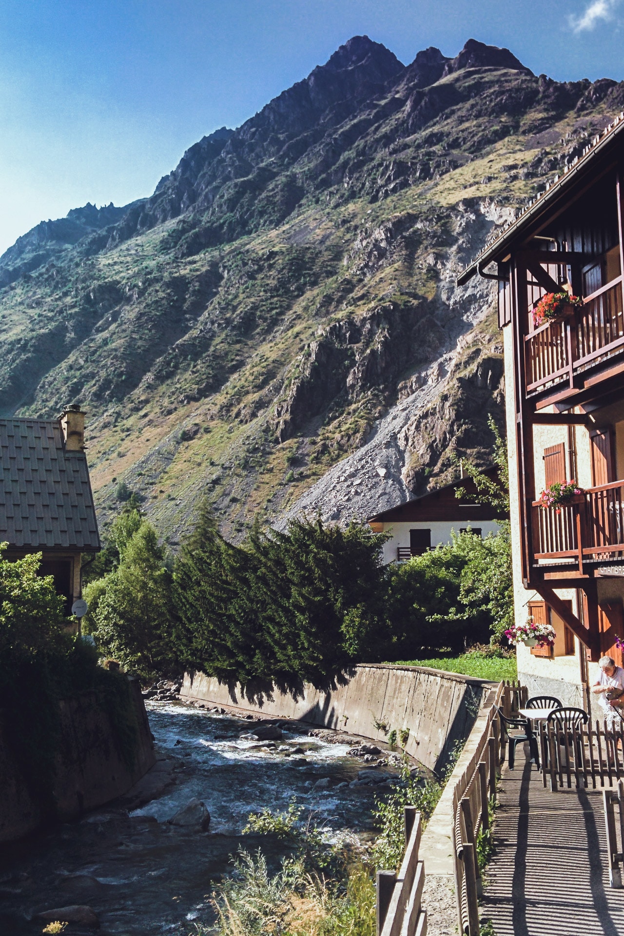
Finally arrived at the Chapelle en Valgaudémar, I take a place at the municipal campsite which is very good in terms of quality / price ratio. Once settle, let’s go to the shower that will be sooo good! I take advantage of the late afternoon to redo shopping and go for a walk in the village which is very pretty.
At the end of the day I meet Vinz who also stays at the campsite for the night by coincidence. So we have a little beer together to finish the evening.
Day 7 : From the Chapelle en Valgaudémar to the Col de la Vaurze.
Tomorrow, my friend Ben must join me in the village of Desert-en-Valjouffrey, the concern is that it is not far at all. So I will have to do a short way today and tomorrow.
For the moment, I’m packing up and I’m going to Villar-Loubière. The path is laid out and is not interesting. Villar is a typical and charming mountain village. It is from here that the real climb begins with the first stage of the Refuge des Souffles (1968m). I take my time but the 900m of D + are done well and in a beautiful setting.
The location of the refuge is very nice, slightly wooded. I take the time to eat one end and rest as it is still early.
After this long break I take the road to the pass. After talking with the guardian I decided to sleep in the Perinon Ravine around 2050m. The only “worry” is that there is no water in the corner so I refuel at the refuge, I carry 4L for tonight and tomorrow morning. It may seem like a lot but considering the heat it is limited …
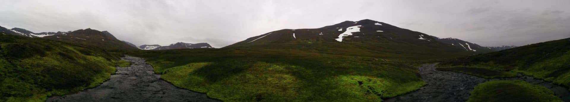
The path is pretty to the bivouac. It turns in the valley floor at a nearly constant altitude.
So I arrive quickly at my location for the night. I settle on the small hill south of the ravine. It’s a nice site, again there is nobody. On the other hand flies and horseflies have not forgotten to be there … No wonder since a flock of sheep graze in the corner. I hope there is no patou …
It is early so I have all my afternoon but not much to do. I turn around. I tried the nap in the tent but the sun is at the zenith and it is too hot …
The afternoon thus passes, slowly. In the early evening I visited by the herd of sheep that literally goes on my bivouac. So I play the shepherd so that they do not damage my tent and praying that there is no patou. I am impressed by the number of sheep injured, sometimes badly …
So ends the evening. Quietly … I feel good.
Day 8 : from the Col de Vaurze to the Désert en Valjouffrey
A short day in perspective: I pass the pass, I go down to the Desert and I’m waiting for Benjamin …
I start “late” by taking my time.
The climb to the pass is nice and not too difficult. From above the view is very beautiful, we can see the Desert in Valjouffrey far below, 1200m lower.
After a few minutes enjoying the view, I attack the long descent. In itself there is nothing really complicated but the many stones make the way a little dangerous. Shortly after arriving at the Desert, I witnessed a hoist in this way. I will learn later that it was a lady who took in the thigh a rock launched at full speed: report a fractured femur … The rock must have been “released” by a sheep upstream. All this to say be careful in this long descent. During mine I saw an impressive number of sheep with broken legs.
Still, here I am arrived at the small village. It has an air of end of the world, I like it. It is very typical. I do not have many news from Benjamin, I do not really know what time he will be there because there have been changes of trains and unfortunately the network is not good here.
In the meantime I settle at the bar “Les Ecrins” to have a drink and recharge the phone.
Time passes and still no news … I decided to go for a ride to find the evening bivouac. There is not much like a nice location and close to the village. However, I spot a corner north of the village towards Côte Belle.
I go back to the bar and I finally manage to catch a few network that allows me to receive an update from Benjamin: there was a big problem with the trains and he is not sure to find a bus to come here today in the Desert … Ouch … Anyway I have nothing to do but waiting for him. So I stay at the bar and finally I spend a lot of time talking with the manager who is of Corsican origin.
It is finally in the early evening that Benjamin arrives, carried from Entraigues to the Desert in the bucket of a van …
For the end of the evening we land at the corner I spotted, we eat quickly harassed by mosquitoes and hop to sleep.
Day 9 : from the Désert-en-Valjouffrey to Valsenestre
It is slightly wet this morning at the bottom of the valley, so we take off quickly from the camp. The first step of the day is to climb Côte Belle (2290m). The path begins gently sloping but quickly it stiffens. For my part it’s not bad as it’s been nine days that I walk but Ben struggles a little since it’s his first day and that his bag weighs heavily! But we go on. Anyway it’s useless to hurry we have the whole day ahead.
The “summit” will still be quickly reached and we give ourselves a good little break up. We meet a mother and her daughter that we’ll meet again in the Muzelle and two friends with whom we will spend the late afternoon.
The view from the top is nice; to the north we can see the Muzelle Pass, which is impressive from here.
We then go down to Valsenestre. At the top of this section we find some interesting rock formations that could be reminiscent of sculptures.
The rest of the descent is done in the scrub. It’s long and rather monotonous after a while … Not to mention the heat still present.
Arrived in the bottom of the valley we head to the village but we will stop before near the river to bathe a bit and wash our stuff.
It is still relatively early. So we kill time as we can at a picnic table. First of all, we are joined by the Cote Belle friends (a guy and a girl). We end the evening quietly with them.
For the bivouac no choice. There is a mandatory space and we will respect the rule. By cons there is not even a water point or any development whatsoever.
Tomorrow last day of real walk and last pass to pass …
Day 10 : from Valsenestre to the Lake of La Muzelle
We leave early to climb to the pass in the fresh morning. We reach the GR54 where we had left it, a little higher. 1100m to climb with a final that is deemed a bit dangerous.
The beginning slowly climbs up to the level of the Ramu Hut (about 2100m on the GR). After, it gets steeper and the laces are linked to the top. It is slippery rock but it feels comfortable. Viewed from below the pass is impressive. We ride each at his own pace. I’ll get to the top first followed by Ben a few minutes later.
The view of Col de la Muzelle (2613m) is fantastic ! Front extends the lake nestled between the cliffs and overlooked the Roche de la Muzelle (3465m).
The descent to Lake Muzelle (2099m) is good even if you have to be careful with your ankles because there are many pebbles.
Arrived at the bottom we go directly to the refuge to savor a well deserved beer once again! It is early so we are also eating and we enjoy the moment. We meet again the mother and daughter of Côte Belle and the two of the day before.
We will join a place for the bivouac not too late because unlike the previous time I came here there are a lot of people since the lake is easily accessible from the valley. ..
But you will find some nice places around with a beautiful view of the lake. Last bivouac, last night in the mountains …
Last day : descent and going back home
That’s the last day. Tonight we’ll be in Paris …
We fold everything one last time and we start the descent along the Creek Piss. It is a pretty way well in the shade and embellished by the tumultuous waves of the torrent. We cross a lot of people who spend the day at the lake.
Once at the bottom, we quickly reach Bourg d’Oisans by hitchhiking to avoid a long, flat part and manage to catch an earlier train.
The loop is complete and the GR54 finished!
Pouf! Here we are back in Paris in a few hours while this morning we were still at 2000m in a superb setting. End of this adventure, prepare the next ….
Conclusions
It’s not going to be very original but I loved this GR. As I said in the preamble it has nothing to envy the GR20 or the Tour du Mont Blanc I think. On the contrary, the fact that there are few people still improves the experience.
The Ecrins are definitely one of the most beautiful mountains in the Alps, I really advise you to go discover it. Many of the GR54 stages can be done on a day (round trip) it’s worth it!
In addition to landscapes there are Chamois, Ibex, birds of prey and of course Marmots.
Like all GR, the GR54 is perfectly marked so no worries of mapping. We cross every day a refuge so you can do it without tent.
Walking alone was also interesting but it was a shame that Quentin had to stop so early…
Anyway this hike was amazing and I strongly suggest you to do it !
Quelques infos utiles :
- Pour la préparation du GR54, je vous conseille l'excellent TopoGuide de la FFRandonnée : Topo Guide
- Toujours utiles le numéro du PGHM des Hautes-Alpes : 04 92 22 22 22
- Site du Parc National des Ecrins : http://www.ecrins-parcnational.fr/